
MELROSE
The Bronx
Geographic Setting
Bounded by Prospect Avenue to the east, East 149th Street to the south, Morris Avenue to the west, Park Avenue to the northwest, and East 163rd Street to the north, Melrose sits at the very heart of the South Bronx—an historic and deeply emblematic neighborhood whose story encompasses nearly every phase of the borough’s urban evolution: from rural estate to immigrant enclave, from decline to reinvention.
Lying just north of the Bronx Terminal Market and Yankee Stadium, Melrose is defined by its central position within the borough’s civic and transit grid. Third Avenue and Melrose Avenue serve as its main commercial arteries, while East 161st Street functions as the neighborhood’s civic axis, lined with courthouses, schools, and small businesses. The Melrose Metro-North station and multiple 2, 4, and 5 subway lines provide exceptional connectivity. Architecturally, the neighborhood reveals a tapestry of eras: 19th-century brownstones and neo-Renaissance apartment houses stand beside modern affordable housing developments and community gardens that occupy once-vacant lots.
Despite decades of transformation, Melrose remains unmistakably the South Bronx’s beating heart—a place where the energy of renewal meets the gravity of history, and where every block reflects both struggle and rebirth.
Etymology
The name “Melrose” originates from the Melrose estate, established in the early 19th century by the Morris family, whose ancestral holdings—Morrisania—once covered much of the South Bronx. The estate was named after Melrose Abbey in Scotland, a nod to the Morris family’s European heritage. When the estate lands were subdivided for development in the mid-19th century, the name “Melrose” was applied to the new village that arose around Third Avenue and East 160th Street.
The name, suggesting gentility and refinement, contrasted with the industrial vigor that would soon characterize the area. Yet it endured, linking the modern neighborhood to its origins in the pastoral ambitions of early Bronx gentry.
The Neighborhood
Origins through the 19th Century
In the early 1800s, the land that became Melrose was a landscape of rolling hills, farms, and country estates. The Morris family, prominent landowners and patriots of the Revolutionary era, oversaw the gradual subdivision of their holdings as New York City expanded northward. The construction of the New York and Harlem Railroad (1841)—which ran along what is now Park Avenue—spurred the area’s urbanization, transforming farmland into a transit-linked suburb of the city.
By the 1850s, Melrose had developed into a small commuter village centered around the Melrose Station, attracting middle-class families who sought proximity to Manhattan while retaining a sense of rural tranquility. Following the annexation of the western Bronx to New York City in 1874, the area urbanized rapidly. Rowhouses, tenements, and industrial lofts rose along Third Avenue and East 149th Street, accommodating an influx of immigrants—initially German and Irish, later Jewish, Italian, and Eastern European.
By the close of the 19th century, Melrose had fully transitioned from estate land to urban neighborhood, its grid filled with dense housing, bustling markets, and industrial workshops. Its central location made it a transportation hub and a gateway to the borough’s emerging downtown.
Early 20th Century: Working-Class Strength and Cultural Identity
During the first half of the 20th century, Melrose flourished as a working- and lower-middle-class neighborhood. The Third Avenue Elevated Line brought workers directly into Manhattan, while factories, breweries, and warehouses provided local employment. Immigrant families built stable lives in the neighborhood’s prewar tenements and small apartment houses, many with ground-floor bakeries, butcher shops, and tailor stores.
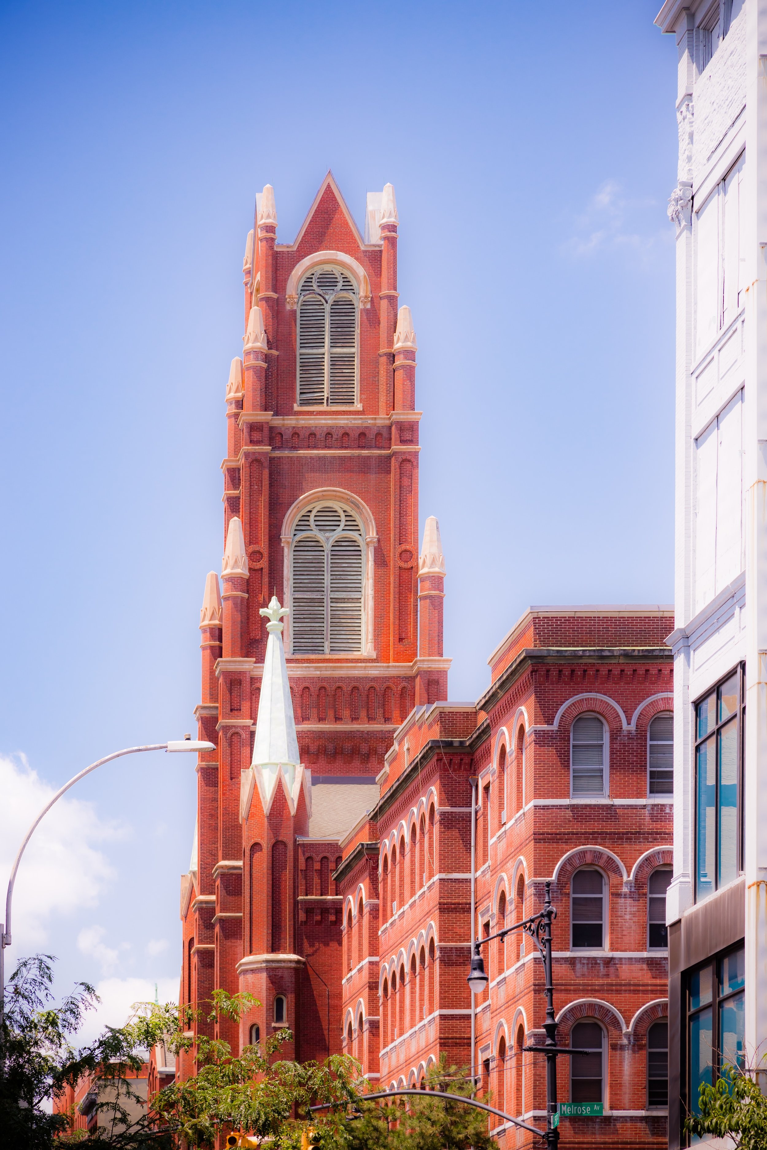
Third Avenue became one of the South Bronx’s great commercial boulevards—lined with department stores, theaters, and restaurants. St. Ann’s Avenue and Melrose Avenue anchored parish and community life, with institutions such as Immaculate Conception Church (founded 1887), Public School 29, and the Morrisania Hospital fostering a sense of permanence. The area’s Jewish and Italian residents formed the backbone of small business ownership, while vibrant street life, streetcars, and civic pride gave Melrose its metropolitan energy.
The Great Depression tested this stability, but Melrose’s dense housing and strong social networks helped sustain it through the economic downturn. In the postwar period, African-American and Puerto Rican families began moving into the neighborhood, enriching its cultural landscape and laying the groundwork for the South Bronx’s emergence as a cradle of Latino identity and creativity.
Melrose Video Coming Soon
Mid–Late 20th Century: Fire, Flight, and the Will to Rebuild
By the 1950s–1970s, the forces of deindustrialization, disinvestment, and white flight began eroding Melrose’s stability. The dismantling of the Third Avenue El (1955) removed a vital transit link and commercial anchor, while redlining and predatory lending accelerated housing decay. The construction of the Major Deegan and Bruckner Expressways diverted traffic and fractured neighborhoods.
The 1970s brought devastation. Arson, abandonment, and neglect consumed block after block, and Melrose became one of the epicenters of the Bronx’s infamous burning years. Thousands of residents were displaced, and entire swaths of the neighborhood were reduced to rubble. Yet even amid this crisis, local organizations emerged to resist total collapse.
Grassroots groups such as Nos Quedamos (“We Stay”), Mid-Bronx Desperadoes, and the Immaculate Conception Housing Development Fund worked to reclaim abandoned buildings and lots. The community’s mantra—“We are staying”—became the rallying cry for urban self-determination. Churches, block associations, and tenant organizers turned vacant land into gardens and cooperatives, keeping the neighborhood alive through sheer persistence.
By the late 1980s, city agencies and nonprofit developers began partnering with these groups to rebuild Melrose’s housing stock, creating some of the earliest large-scale affordable housing projects of New York’s urban renewal era.
21st Century: A Model of Bronx Renaissance
In the 21st century, Melrose stands as one of New York’s most visible examples of community-led transformation. Once synonymous with abandonment, it has become a showcase for sustainable, affordable urban development. Projects such as Melrose Commons, initiated in the 1990s through the Nos Quedamos coalition, introduced mixed-income housing, new schools, green spaces, and retail corridors while maintaining affordability for long-term residents.
Today, Melrose is home to some of the city’s most advanced examples of environmentally conscious architecture, including Via Verde, a LEED-certified housing complex featuring rooftop gardens and solar panels. Along Third Avenue, new businesses—cafés, supermarkets, cultural centers—reflect a renewed vibrancy. Yet the neighborhood’s social fabric remains deeply rooted in its Latino and African-American heritage, with Puerto Rican, Dominican, and West African cultures shaping its music, cuisine, and street festivals.
Institutions like The Bronx Documentary Center, Immaculate Conception Church, and the Melrose Library have become community anchors, bridging generations. Meanwhile, ongoing preservation efforts protect historic streetscapes such as East 160th Street and Melrose Avenue, where restored brownstones stand beside murals celebrating the Bronx’s resilience.
Melrose Photo Gallery
Spirit and Legacy
The spirit of Melrose is one of rebirth through resistance. It is the story of a community that refused to vanish when the city wrote it off—a neighborhood that turned ashes into architecture, and despair into determination.
New York City
Use this custom Google map to explore where every neighborhood in all five boroughs of New York City is located.
The Five Boroughs
One of New York City’s unique qualities is its organization in to 5 boroughs: Manhattan, Brooklyn, Queens, The Bronx, and Staten Island. These boroughs are part pragmatic administrative districts, and part vestiges of the region’s past. Each borough is an entire county in New York State - in fact, Brooklyn is, officially, Kings County, while Staten Island is, officially Richmond County. But that’s not the whole story …
Initially, New York City was located on the southern tip of Manhattan (now the Financial District) that was once the Dutch colony of New Amsterdam. Across the East River, another city was rising: Brooklyn. In time, the city planners realized that unification between the rapidly rising cities would create commercial and industrial opportunities - through streamlined administration of the region.
So powerful was the pull of unification between New York and Brooklyn that three more counties were pulled into the unification: The Bronx, Queens, and Staten Island. And on January 1, 1898, the City of New York unified two cities and three counties into one Greater City of New York - containing the five boroughs we know today.
But because each borough developed differently and distinctly until unification, their neighborhoods likewise uniquely developed. Today, there are nearly 390 neighborhoods, each with their own histories, cultures, cuisines, and personalities - and each with residents who are fiercely proud of their corner of The Big Apple.


