MIDWOOD
Brooklyn
Geographic Setting
Bounded by McDonald Avenue to the west, Nostrand Avenue to the east, Kings Highway and Avenue P forming its southeastern and southern edges, Foster Avenue sweeping northwest to Coney Island Avenue, and the Long Island Rail Road (Bay Ridge Branch) to the north, Midwood occupies the geographic heart of Brooklyn. True to its name—derived from the Old Dutch Midwout, meaning “middle woods”—the neighborhood lies midway between Prospect Park and Jamaica Bay, between the bustle of the city and the quiet of the borough’s southern reaches.
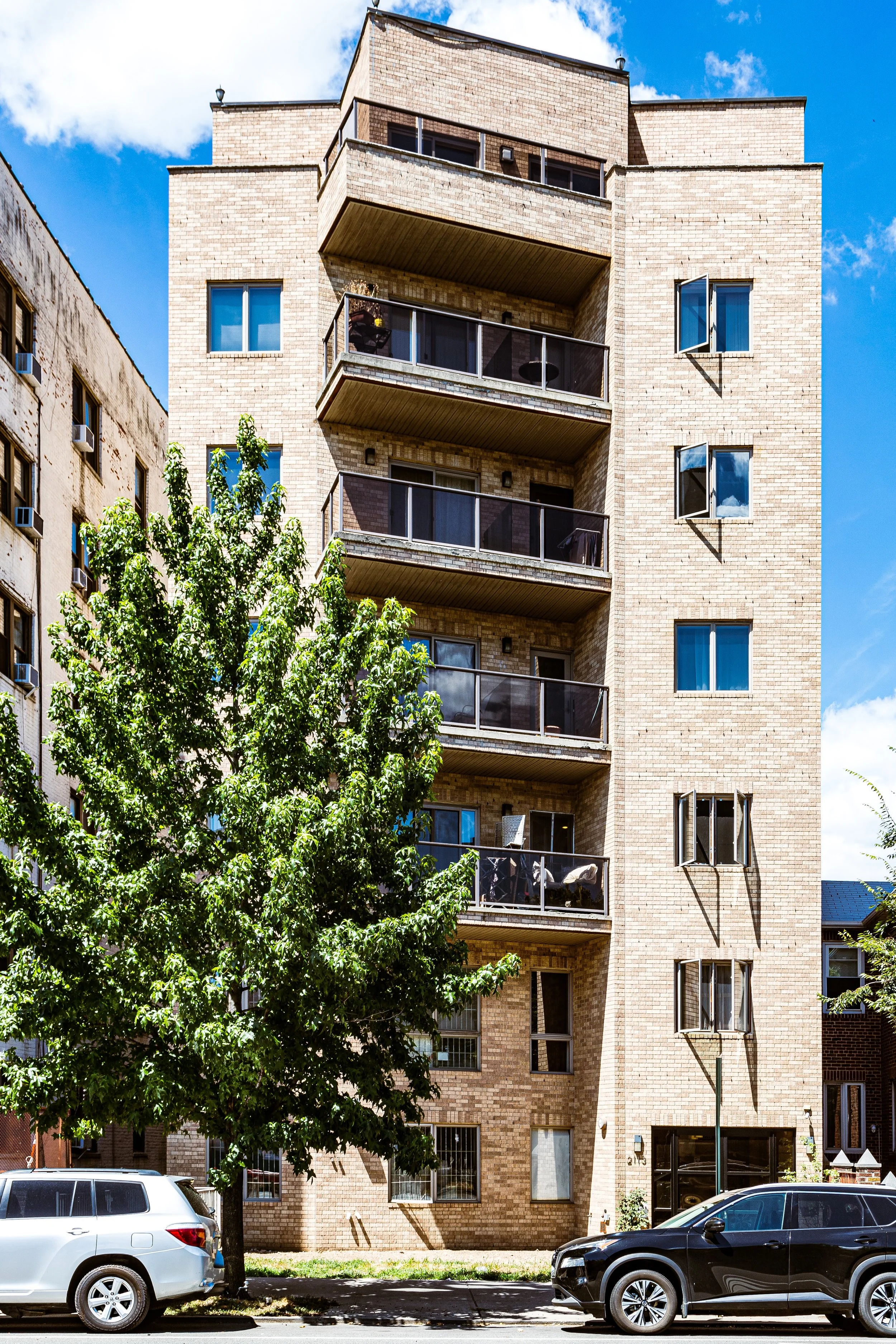
Today, Midwood is a broad, tree-lined expanse of detached homes, brick rowhouses, and low apartment buildings, its residential calm punctuated by vibrant commercial corridors along Avenue J, Coney Island Avenue, Kings Highway, and Nostrand Avenue. Subway lines trace its borders: the B/Q line along East 16th Street, the F line along McDonald Avenue. Though fully urban, Midwood retains the rhythm of a self-contained town—a landscape of leafy streets, modest architecture, and bustling corner life that has sustained generations of Brooklynites.
Etymology and Origins
Midwood’s name reaches back to the 17th century, when Dutch settlers founded the town of Flatbush (Vlacke Bos) amid a vast forest known as the Midwout—the “middle woods” that stretched between the original colonial settlements of Gravesend and Flatlands to the south and Breuckelen to the north. These dense oak and chestnut groves were cleared gradually for farmland, leaving the area’s flat, fertile terrain that would later define it.
For nearly two centuries, the district remained agricultural. The Canarsee Lenape were the first inhabitants, and Dutch families—the Vanderveers, Schencks, Voorheeses, and Kouwenhovens—established homesteads and crop fields across the plain. By the early 19th century, Midwood was a patchwork of farms, orchards, and small hamlets connected by dusty lanes like the Old Flatbush Road and Kings Highway, one of Brooklyn’s oldest thoroughfares.
The Neighborhood
19th Century: From Farmland to City Grid
The transformation of Midwood began after the Consolidation of Greater New York (1898), though its foundations were laid earlier. The Brooklyn, Flatbush & Coney Island Railroad (1878)—today’s Brighton Line—cut diagonally through the woods, bringing excursion trains to the seaside and opening new possibilities for suburban development. In 1894, trolley lines extended along Coney Island Avenue, linking the area to downtown Brooklyn.
Developers recognized the potential of this flat, central plateau. By the 1890s–1910s, the old farms were subdivided into city lots, and the rectilinear street grid replaced hedgerows and meadows. Streets such as Avenue J, Avenue M, and East 17th through East 22nd Streets filled with single-family houses, many in Victorian, Colonial Revival, and Neo-Renaissance styles. Advertisements promised “country air in the heart of the city,” appealing to families seeking the new suburban ideal.
By 1910, Midwood had evolved from rural farmland into a comfortable residential suburb within the city limits—home to middle-class professionals, shopkeepers, and immigrants from Eastern Europe and Italy.
Early–Mid 20th Century: A Garden Neighborhood Matures
The 1920s–1940s were Midwood’s golden age of growth. The completion of the BMT Brighton Line (B/Q trains) and the IND Culver Line (F train) made the neighborhood one of Brooklyn’s most accessible, while its generous lot sizes allowed for a mix of single- and two-family homes, as well as small apartment houses.
Avenue J emerged as Midwood’s commercial spine, lined with delicatessens, kosher bakeries, and small department stores. Around it, a distinct Jewish middle-class community flourished. Synagogues, yeshivas, and social clubs—such as the East Midwood Jewish Center (est. 1924) and Young Israel of Flatbush (1921)—became cornerstones of local identity.
Schools such as Midwood High School (opened 1940) and Brooklyn College (opened 1930) reinforced the neighborhood’s intellectual and civic life. The college’s Georgian campus, designed by Randolph Evans, was deliberately placed at the neighborhood’s northern edge to anchor the district and provide higher education to Brooklyn’s working and middle classes.
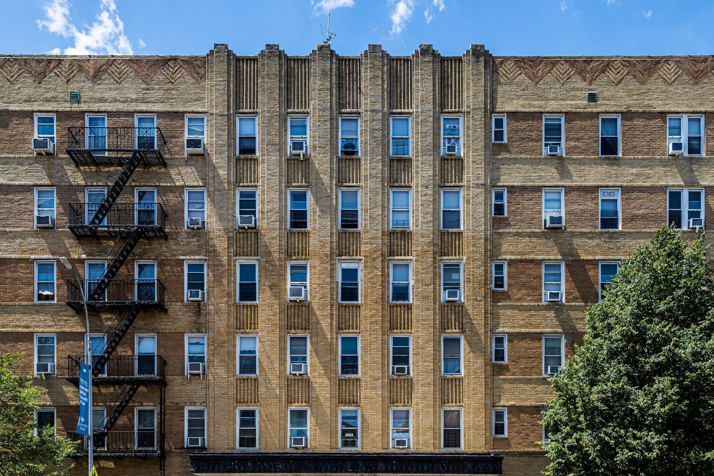
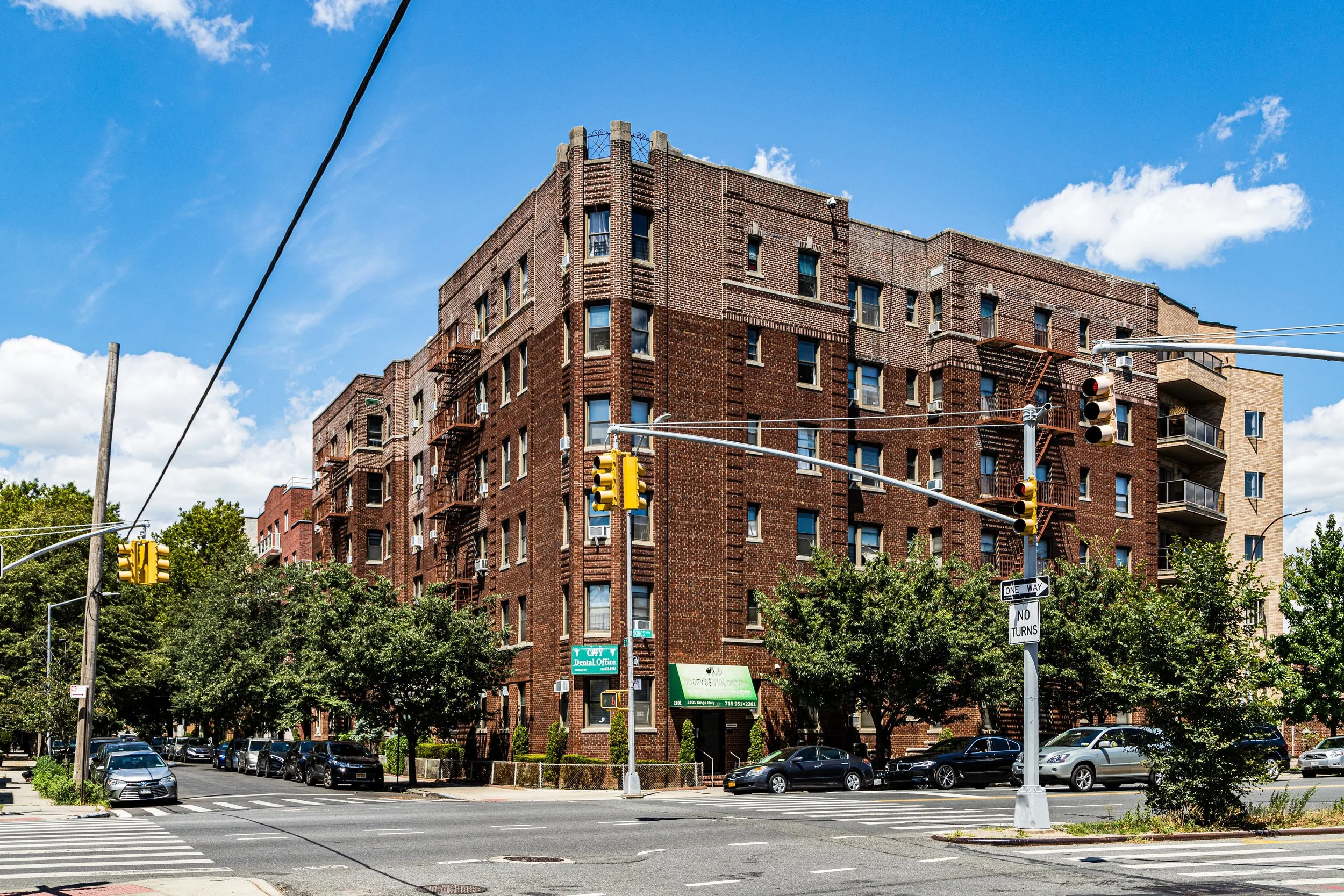
The housing stock from this period remains one of Midwood’s hallmarks: detached brick houses with bay windows and stoops, semi-detached Tudors, and elegant six-story apartment buildings on Ocean Avenue and Kings Highway. The canopy of London plane trees planted during this era still shades its streets.
Midwood Photographic Video
Postwar Years: Stability and Community Strength
After World War II, Midwood maintained its position as one of Brooklyn’s most desirable neighborhoods. Its population remained largely Jewish and Italian, with growing Irish and Eastern European elements. Many returning veterans purchased homes here under the G.I. Bill, drawn by stability, good schools, and proximity to Brooklyn College.
While other parts of the city saw flight and decline, Midwood’s homeownership base and tight-knit institutions ensured continuity. The Avenue J shopping district, with its butcher shops, movie houses, and luncheonettes, remained a hub of daily life. The Kent Theatre, opened in 1938, survived well into the late 20th century as a beloved local landmark.
The 1960s–1980s brought demographic evolution but not upheaval. Families from nearby neighborhoods such as Brownsville and East New York relocated here, while new arrivals from the Soviet Union, the Middle East, and South Asia added to the area’s diversity. The Syrian Jewish community, which had flourished in Bensonhurst and Gravesend, expanded into southern Midwood, establishing schools and synagogues along Ocean Parkway and Avenue P.
Late 20th–21st Century: Diversity and Renewal
By the 1990s–2000s, Midwood stood at the crossroads of tradition and transformation. It remained predominantly residential, but its population had become one of the most ethnically and religiously diverse in Brooklyn—Orthodox and Sephardic Jews, Pakistani, Bangladeshi, and Uzbek Muslims, and Caribbean and Russian immigrants living side by side on blocks that preserved their early 20th-century character.
Despite demographic change, Midwood’s rhythm has remained constant. Children walk to neighborhood yeshivas or public schools; shoppers crowd Avenue J’s kosher bakeries, falafel stands, and halal restaurants; and subway commuters stream toward the city each morning. The mixture of synagogues, mosques, and churches within a few square miles testifies to the district’s pluralism.
Urban pressures have brought selective redevelopment—larger houses replacing bungalows, small apartment complexes rising near major avenues—but zoning and community advocacy have preserved much of Midwood’s human scale. The Midwood Development Corporation, founded in the 1970s, continues to promote balanced growth, while Brooklyn College’s campus remains a cultural and intellectual anchor.
Midwood Photo Gallery
Architecture and Landscape
Midwood’s architecture is emblematic of early 20th-century Brooklyn domestic design. The neighborhood offers a continuum of housing types: freestanding Victorian homes on East 19th Street, limestone rowhouses along Ocean Avenue, red-brick two-families on East 13th through 16th Streets, and six-story prewar apartment houses on Kings Highway and Avenue I. The result is a cohesive, low-rise landscape—dense enough for city life, yet green and quiet enough to suggest suburbia.
Tree canopies arch over side streets, and small front gardens soften the line between house and sidewalk. The grid is punctuated by small plazas, playgrounds, and schoolyards, with Edward R. Murrow High School (1974) and Midwood High School serving as civic landmarks. The presence of Brooklyn College’s campus quadrangle, with its Georgian brick façades and clock tower, lends the area a sense of academic serenity rare in the city.
Spirit and Legacy
Midwood’s legacy is one of continuity through diversity—a neighborhood that has changed faces and languages without losing its essential calm and cohesion. It is, in many ways, the archetypal Brooklyn neighborhood: solidly residential, ethnically plural, architecturally coherent, and culturally vibrant.
Here, one hears the layered rhythms of Brooklyn itself: the call to prayer from a mosque on Coney Island Avenue mingling with Hebrew songs from a yeshiva courtyard; the scent of shawarma and challah drifting down Avenue J; the chatter of students along Campus Road near Brooklyn College.

New York City
Use this custom Google map to explore where every neighborhood in all five boroughs of New York City is located.
The Five Boroughs
One of New York City’s unique qualities is its organization in to 5 boroughs: Manhattan, Brooklyn, Queens, The Bronx, and Staten Island. These boroughs are part pragmatic administrative districts, and part vestiges of the region’s past. Each borough is an entire county in New York State - in fact, Brooklyn is, officially, Kings County, while Staten Island is, officially Richmond County. But that’s not the whole story …
Initially, New York City was located on the southern tip of Manhattan (now the Financial District) that was once the Dutch colony of New Amsterdam. Across the East River, another city was rising: Brooklyn. In time, the city planners realized that unification between the rapidly rising cities would create commercial and industrial opportunities - through streamlined administration of the region.
So powerful was the pull of unification between New York and Brooklyn that three more counties were pulled into the unification: The Bronx, Queens, and Staten Island. And on January 1, 1898, the City of New York unified two cities and three counties into one Greater City of New York - containing the five boroughs we know today.
But because each borough developed differently and distinctly until unification, their neighborhoods likewise uniquely developed. Today, there are nearly 390 neighborhoods, each with their own histories, cultures, cuisines, and personalities - and each with residents who are fiercely proud of their corner of The Big Apple.


