PARKVILLE
Brooklyn
Geographic Setting
Bounded by McDonald Avenue to the west, Coney Island Avenue to the east, 18th Avenue to the north, and Foster Avenue to the south, Parkville is a compact, quietly distinctive enclave in the heart of south-central Brooklyn. Wedged between Kensington, Midwood, and Bensonhurst, it occupies a subtle ridge where the borough’s urban grid transitions from the brownstones and prewar apartments of the north to the detached homes and tree-lined calm of the south. Its geography gives Parkville the dual personality that defines so much of Brooklyn: city in its infrastructure, suburb in its rhythm.
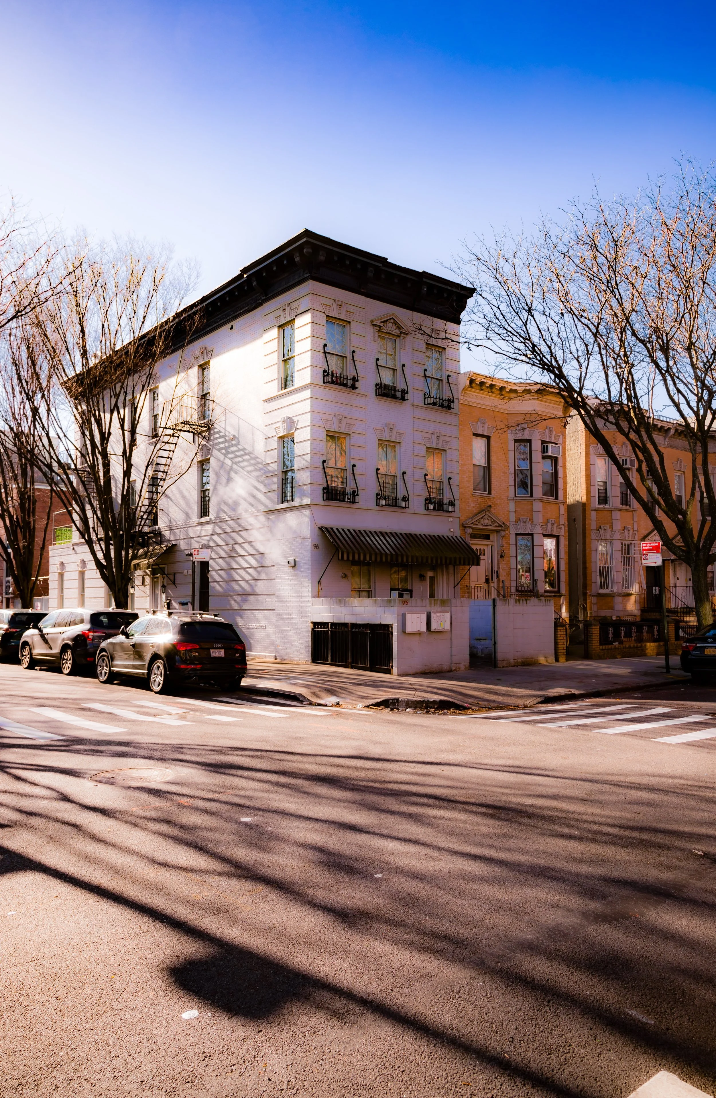
The neighborhood’s main axis, McDonald Avenue, carries the elevated F train, whose rhythmic rumble provides both soundscape and landmark. To the east, Coney Island Avenue serves as a lively commercial spine—lined with grocers, bakeries, halal markets, and kosher delis that reflect the district’s layered immigrant heritage. In between, side streets like East 2nd through East 8th Streets and Avenue I through Avenue J host rows of two-family brick houses, small apartment buildings, and prewar homes with stoops and small gardens. Parkville’s modest size belies a rich social texture—a crossroads of cultures, generations, and architectural styles that quietly encapsulates the story of Brooklyn’s evolution.
Etymology and Origins
The name Parkville first appeared in the 1850s, when early developers, inspired by the success of nearby Greenwood and Flatbush, began to market this section of rural Flatlands as an emerging suburban retreat. The term combined “park”—an aspirational nod to pastoral living—with “ville,” evoking the fashionable suburban settlements of the era.
Before its subdivision, the land formed part of the Town of Flatbush, originally settled by the Dutch in the mid-1600s. The area was characterized by gently rolling farmland dotted with woodlots and streams feeding into the Gowanus marshes. Families like the Vanderveers and Voorheeses owned farms here for generations, supplying produce to Flatbush and Gravesend markets. The opening of the Coney Island Plank Road (modern Coney Island Avenue) in the early 19th century provided a direct route from downtown Brooklyn to the seaside resorts, making the area newly accessible to investors and commuters alike.
By the 1870s, as the city’s growth pushed southward, the Parkville name was firmly in use—appearing on real estate maps and promotional brochures touting “country homes within reach of the city.”
The Neighborhood
19th Century: From Farmland to Streetcar Suburb
Parkville’s true transformation began in the 1870s–1880s, when the Brooklyn, Flatbush and Coney Island Railroad (precursor to today’s B and Q lines) and later the Culver Line (now the F train) extended southward. These rail lines paralleled McDonald Avenue and Flatbush Avenue, linking the district to both downtown Brooklyn and Coney Island. The once-quiet farmland rapidly subdivided into building lots, and modest frame and brick homes began to appear.
Real estate promoters marketed Parkville as a “commuter suburb”, emphasizing clean air, low taxes, and modern infrastructure. Advertisements in the Brooklyn Eagle from the 1890s boasted of “broad avenues, electric lights, and pure artesian wells.” The Parkville Improvement Company, one of several speculative ventures, laid out streets and built small clusters of Victorian cottages, some of which still survive along East 8th and East 7th Streets.
By 1900, the area was fully integrated into Brooklyn’s street grid, its name applied not only to the residential tract but also to the Parkville Railroad Station, located near what is now McDonald Avenue and Avenue I. The Parkville Reformed Church, established in 1890, served as the neighborhood’s spiritual and social hub, hosting bazaars, civic meetings, and youth clubs that knit together a growing middle-class community.
Early–Mid 20th Century: Growth, Immigration, and Continuity
The early 20th century brought densification and diversification. The opening of the Culver Elevated Line (1919) spurred the construction of brick two-family houses, low-rise apartment buildings, and corner stores along McDonald Avenue. The neighborhood attracted Italian, Jewish, and Irish families seeking affordable homes near transit but away from the industrial districts.
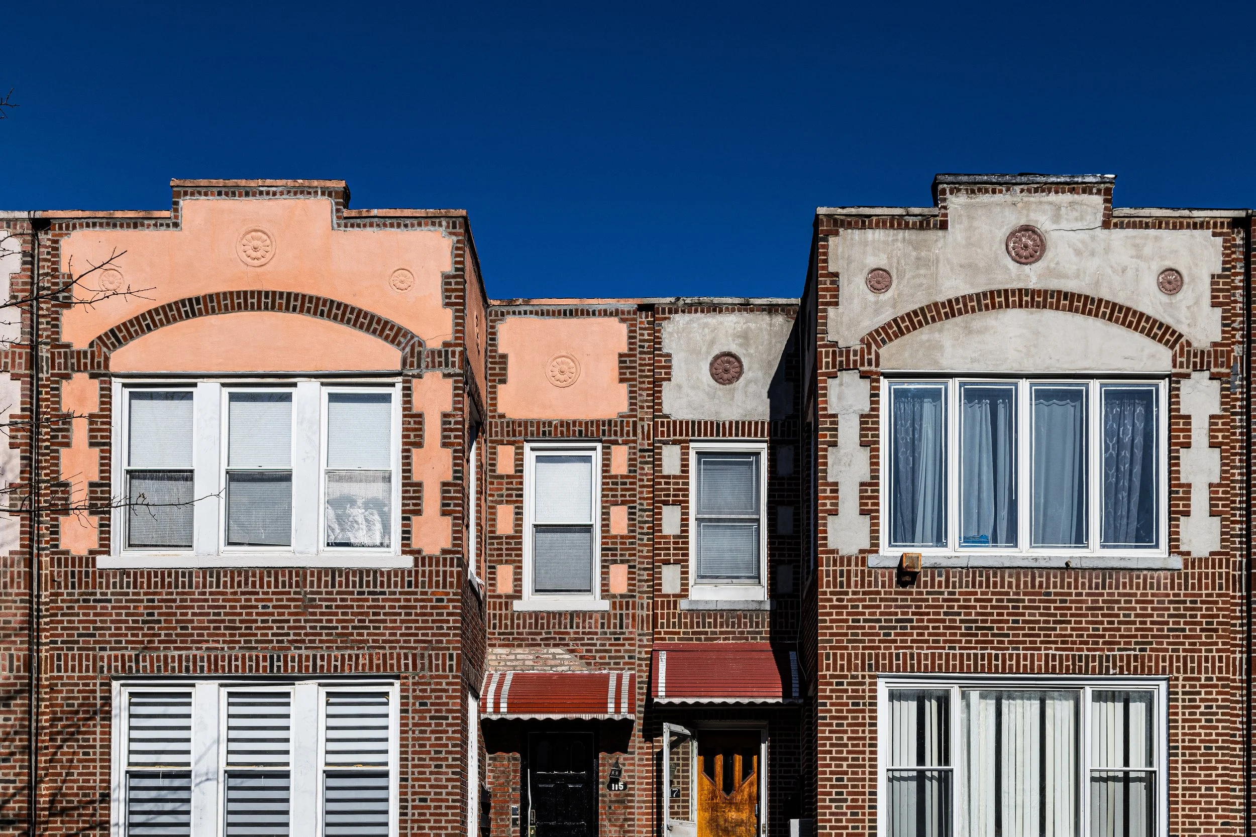
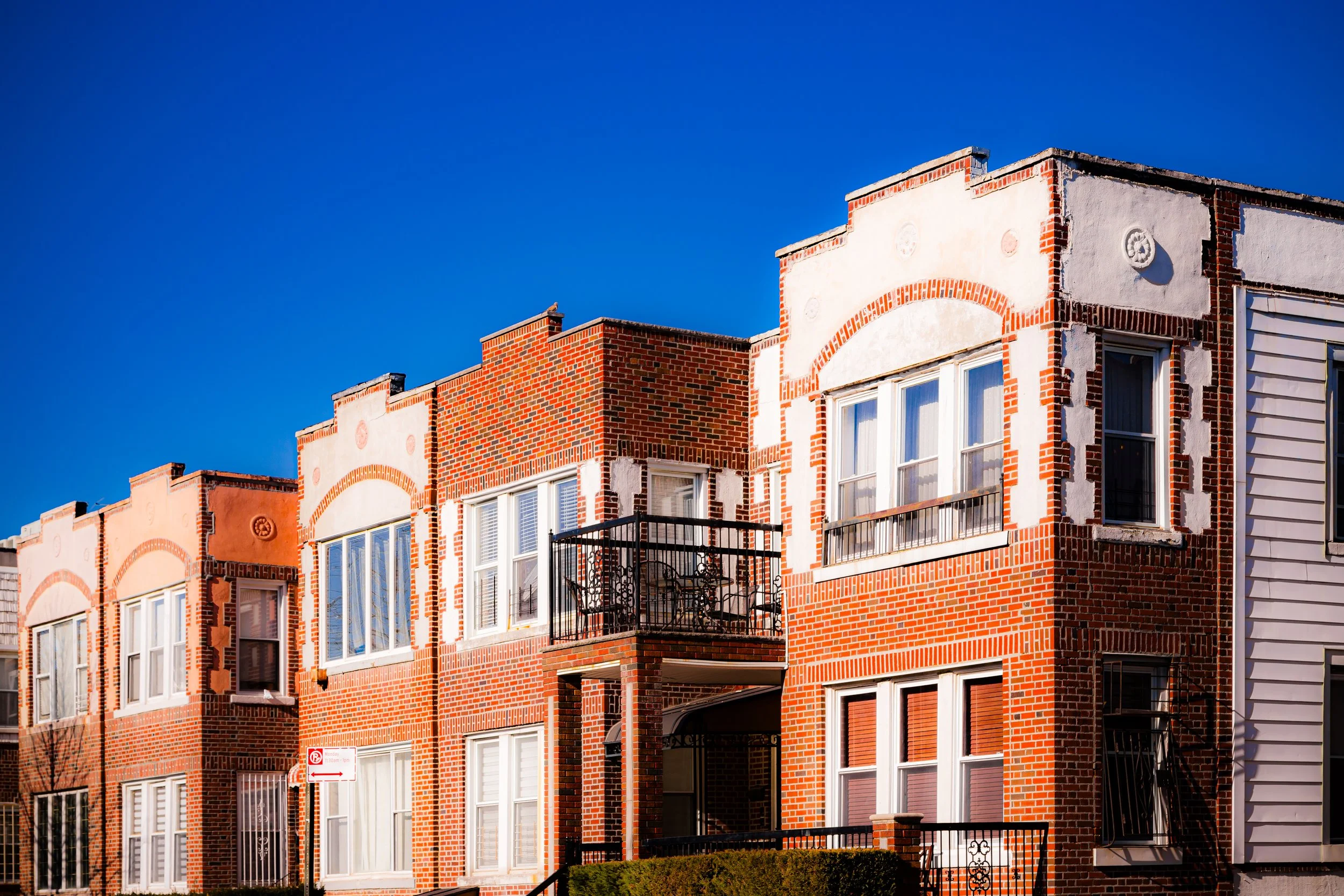
During the 1920s–1940s, Parkville developed its enduring character: tree-lined streets, corner groceries, and synagogues interspersed with small churches. Its housing stock—solidly built two- and three-story brick residences with stoops, bay windows, and iron fences—embodied the aspirations of Brooklyn’s upwardly mobile working class. The nearby Gravesend High School (now John Dewey) and parochial institutions like Saint Rose of Lima Church (1903) anchored community life.
Through the 1950s–1960s, Parkville remained stable, its residents working in manufacturing, education, and small business. As neighboring areas changed, Parkville retained a reputation for safety, cohesion, and quiet pride in homeownership. Children played under the elevated trains on McDonald Avenue, and families shopped along Avenue J and Coney Island Avenue, where bakeries, hardware stores, and luncheonettes reflected the neighborhood’s mosaic of cultures.
Parkville Photographic Video
Late 20th Century: Change and Resilience
The 1970s–1980s brought significant demographic shifts as older Italian and Jewish families moved outward to Staten Island or Long Island, replaced by new waves of Caribbean, Pakistani, Bangladeshi, and Russian immigrants. Despite these transitions, the neighborhood’s physical fabric remained remarkably consistent—few demolitions, little speculative construction, and a continued pattern of small-scale ownership.
Community institutions adapted accordingly: former synagogues became mosques or community centers; halal butchers shared blocks with kosher grocers. This coexistence—sometimes tense, often harmonious—produced the cultural layering that defines modern Parkville. Civic groups like the Parkville Neighborhood Association and local PTAs worked to maintain public safety, advocate for school improvements, and beautify McDonald Avenue.
By the late 1990s, Parkville’s modest, stable housing market and proximity to the F and Q trains began attracting new homeowners and artists priced out of Park Slope and Kensington, adding another layer to the neighborhood’s evolving identity.
21st Century: Diversity and Neighborhood Strength
In the 21st century, Parkville has matured into one of Brooklyn’s most quietly diverse and self-contained neighborhoods. The population reflects nearly every wave of immigration that has touched the borough: South Asian, Caribbean, Russian, Jewish, Arab, and Chinese families live side by side in tidy brick homes that retain their early 20th-century character. On Coney Island Avenue, Urdu signs mingle with Hebrew lettering and Italian pizzerias; the air carries the aromas of fresh naan, burekas, and espresso.
The elevated F line still defines the western border, its steel shadows part of the neighborhood’s identity as surely as its tree canopies. On summer evenings, the sidewalks fill with families chatting across stoops, while children ride bicycles down East 8th Street. The nearby Gravesend Bay waterfront and Prospect Park offer green relief within easy reach, though many residents still think of their own quiet blocks as refuge enough.
Community life revolves around small businesses, mosques, synagogues, and schools such as P.S. 179 and P.S. 134, where the diversity of Parkville is visible in every classroom. The area remains relatively affordable by Brooklyn standards, prized for its access to transit, walkability, and enduring sense of neighborhood scale.
Parkville Photo Gallery
Spirit and Legacy
The spirit of Parkville lies in its continuity amid change. Born as a 19th-century commuter suburb, it has weathered a century and a half of Brooklyn’s transformations without losing its essential modesty and human scale. Its blocks of sturdy brick homes and quiet streets testify to the durable promise of middle-class New York: a place to build a life, raise a family, and belong.
New York City
Use this custom Google map to explore where every neighborhood in all five boroughs of New York City is located.
The Five Boroughs
One of New York City’s unique qualities is its organization in to 5 boroughs: Manhattan, Brooklyn, Queens, The Bronx, and Staten Island. These boroughs are part pragmatic administrative districts, and part vestiges of the region’s past. Each borough is an entire county in New York State - in fact, Brooklyn is, officially, Kings County, while Staten Island is, officially Richmond County. But that’s not the whole story …
Initially, New York City was located on the southern tip of Manhattan (now the Financial District) that was once the Dutch colony of New Amsterdam. Across the East River, another city was rising: Brooklyn. In time, the city planners realized that unification between the rapidly rising cities would create commercial and industrial opportunities - through streamlined administration of the region.
So powerful was the pull of unification between New York and Brooklyn that three more counties were pulled into the unification: The Bronx, Queens, and Staten Island. And on January 1, 1898, the City of New York unified two cities and three counties into one Greater City of New York - containing the five boroughs we know today.
But because each borough developed differently and distinctly until unification, their neighborhoods likewise uniquely developed. Today, there are nearly 390 neighborhoods, each with their own histories, cultures, cuisines, and personalities - and each with residents who are fiercely proud of their corner of The Big Apple.


