STARRETT CITY / SPRING CREEK
Brooklyn
Geographic Setting
Stretching across a vast expanse of southeast Brooklyn near Jamaica Bay, Starrett City — rebranded as Spring Creek Towers in the early 2000s — is a self-contained residential community unlike any other in the borough. It is bordered by Louisiana Avenue and Pennsylvania Avenue to the west, Flatlands Avenue to the north, Jamaica Bay and the Spring Creek marshlands to the south, and Erskine Street to the east. Rising from land once occupied by tidal wetlands and landfill, the development stands as one of the most ambitious urban housing projects of the 20th century — a planned city within a city, designed to offer modern living, open space, and affordability amid the complexities of postindustrial Brooklyn.
Etymology and Origins
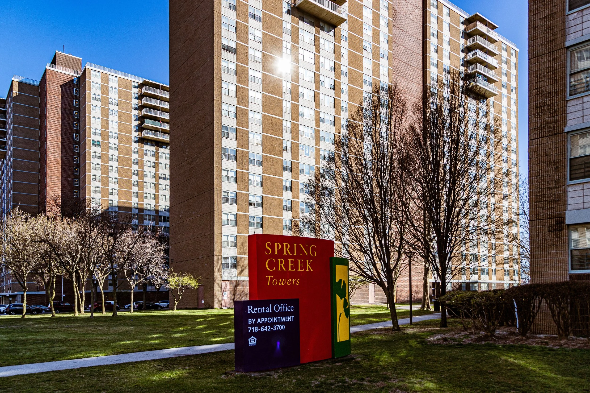
The name Starrett City honors the Starrett Corporation, the powerful New York development firm responsible for constructing the complex in the 1970s. The Starrett name had already been immortalized by landmarks such as the Empire State Building (built by Starrett Brothers & Eken) and Starrett-Lehigh Building in Manhattan. Here, on Brooklyn’s eastern fringe, the company applied its engineering and management expertise to a new social experiment: middle-income housing on a monumental scale.
Its official modern name, Spring Creek Towers, restores reference to the natural geography — the freshwater creek and marshes that once flowed through this corner of Brooklyn, sustaining wildlife and filtering into Jamaica Bay. Beneath the concrete and towers, the memory of that landscape still stirs.
The Neighborhood
Early History: Marshland and Industry
Before urbanization, this area was part of the Town of Flatlands, its southern edge a vast salt marsh dotted with creeks and tidal inlets. Indigenous Lenape people fished and hunted here, while Dutch settlers in the 17th century used the lowlands for grazing. The 19th and early 20th centuries brought industrial uses — oil storage, waste disposal, and manufacturing — that left the land degraded and largely uninhabited.
By the 1960s, as New York grappled with housing shortages and urban decay, planners looked toward these underutilized tracts as a canvas for renewal. The Mitchell–Lama Housing Program, established in 1955, provided state financing for middle-income developments, and the Starrett Corporation saw opportunity in the wide-open expanse of the Spring Creek basin.
1960s–1970s: Vision and Construction
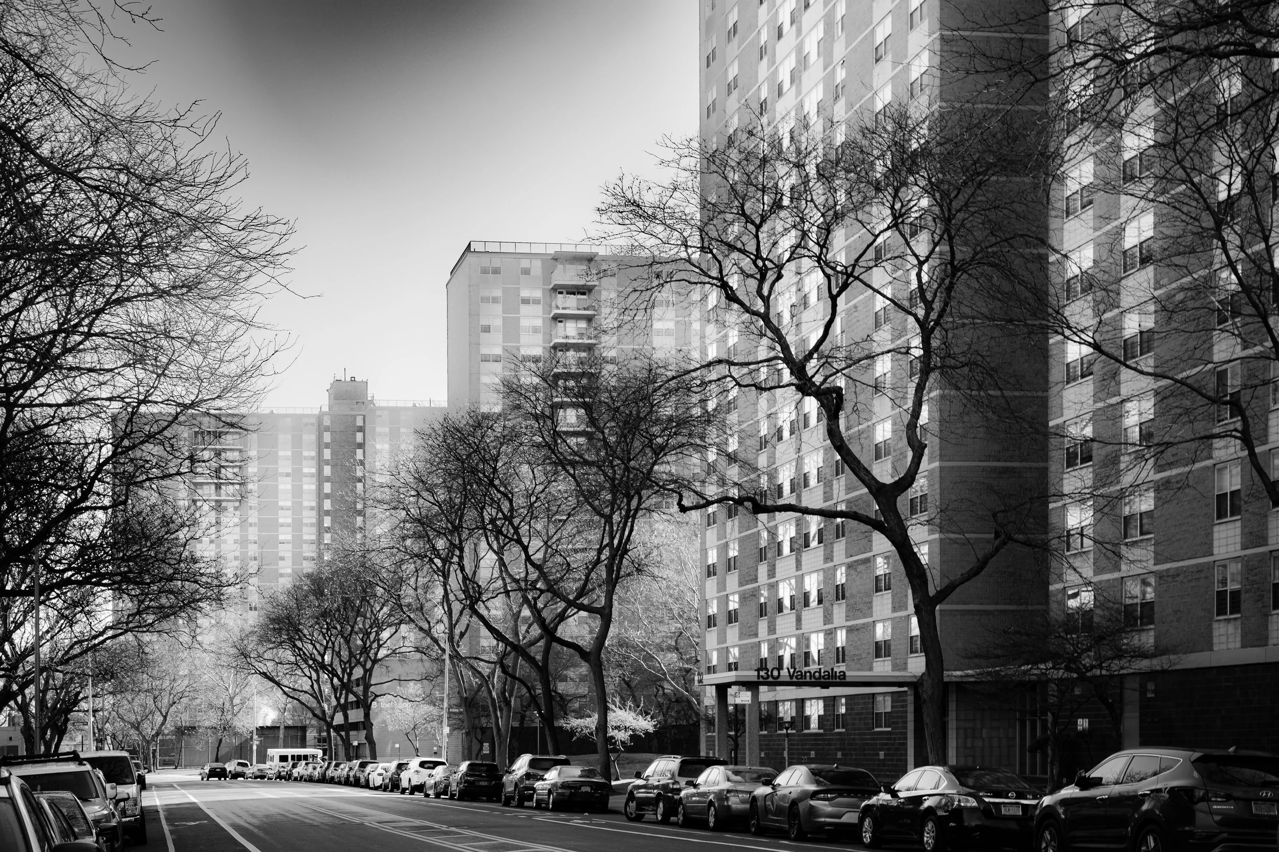
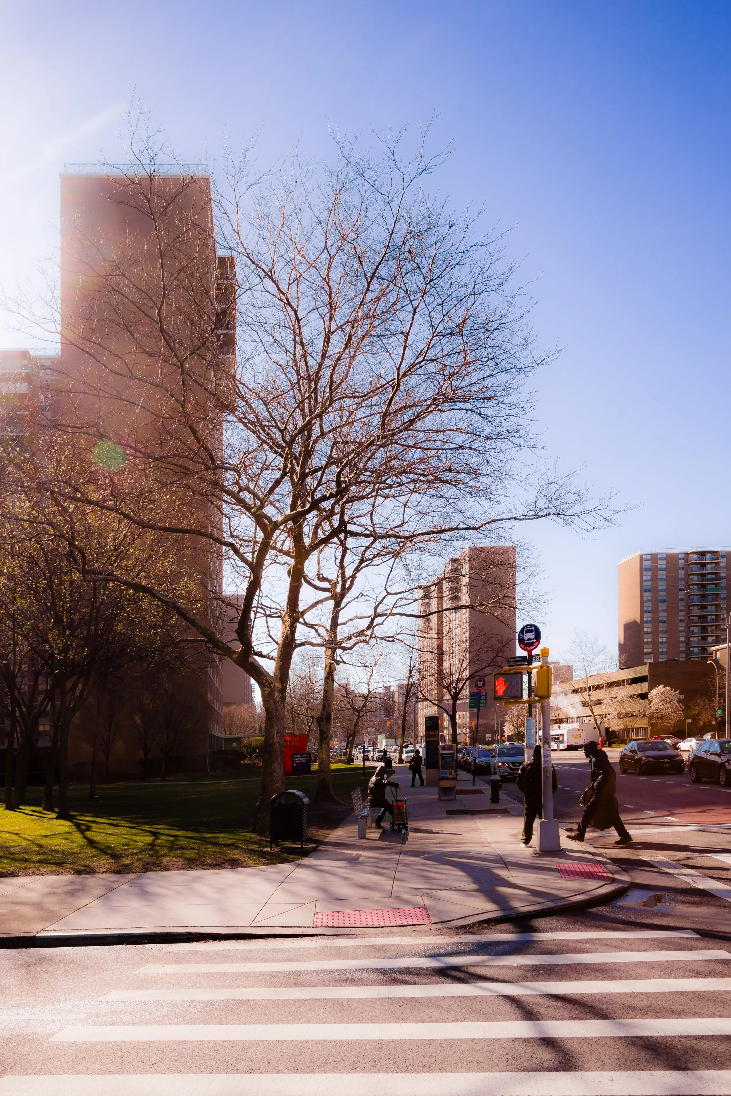
Conceived as an antidote to urban blight, Starrett City was designed to house 20,000 residents in a modern, park-like environment. Construction began in 1972 and continued through 1974, producing 46 towers — each between 11 and 20 stories high — spread across 153 landscaped acres. The design emphasized air, light, and community: vast courtyards, playgrounds, athletic fields, and pedestrian pathways replaced the crowded tenement streets of old Brooklyn.
The complex was equipped with amenities unheard of in most urban housing: a power plant that generated its own electricity, a shopping center, schools, a sports club, and even a private security force. At its opening, Starrett City was hailed as a model of “metropolitan modernism” — a vertical suburb for working families priced out of Manhattan and central Brooklyn.
Yet from the start, it also embodied the era’s social contradictions. The development’s initial management imposed strict racial quotas under the guise of maintaining “balance,” leading to federal lawsuits in the 1970s and 1980s. The eventual Starrett City Fair Housing settlement (1988) dismantled these discriminatory practices, setting a precedent for housing equity nationwide.
Starrett City / Spring Creek Photographic Video
1980s–1990s: A City Within a City
By the late 1980s, Starrett City had matured into a functioning urban ecosystem — self-sufficient, diverse, and distinctly communal. Its population included African-American, Caribbean, Jewish, Latino, and Eastern European families, reflecting the broad spectrum of New York’s middle class. Residents referred to it affectionately as “the Towers,” emphasizing both its physical and social elevation above the turmoil that afflicted other neighborhoods during the same era.
Life in Starrett City revolved around its public spaces: children played baseball on manicured fields; seniors gathered in the Spring Creek Community Center; and Sunday mornings brought a quiet hum across the lawns as families headed to local churches or synagogues. The Gateway Drive Shopping Center — now expanded as Gateway Center Mall — anchored the eastern edge, linking the development to broader patterns of urban commerce.
Through the fiscal crisis, crime waves, and demographic shifts of the late 20th century, Starrett City remained relatively stable — a triumph of scale, management, and resident investment.
21st Century: Renewal, Rebranding, and Environmental Awareness
In the 2000s, as ownership changed hands and the name “Spring Creek Towers” gained official status, the community entered a period of modernization. The buildings underwent façade renovations, energy systems were upgraded, and recreational amenities expanded. The Starrett City Power Plant, one of the nation’s largest private cogeneration facilities, continued to provide independent electricity and heating — an emblem of self-sufficiency in an era of urban dependence.
The surrounding area also transformed. The Gateway Center Mall, opened in 2002 and expanded in 2014, brought retail employment and accessibility to an area once isolated. New parks and environmental restoration projects — including the Spring Creek Park Preserve — reconnected residents with the natural landscape that had been buried beneath landfill and concrete.
Today, Spring Creek Towers remains one of the largest and most successful examples of mixed-income housing in the United States. Its nearly 6,000 apartments continue to provide affordable, well-maintained homes in a city increasingly defined by housing scarcity.
Starrett City / Spring Creek Photo Gallery
Architecture and Atmosphere
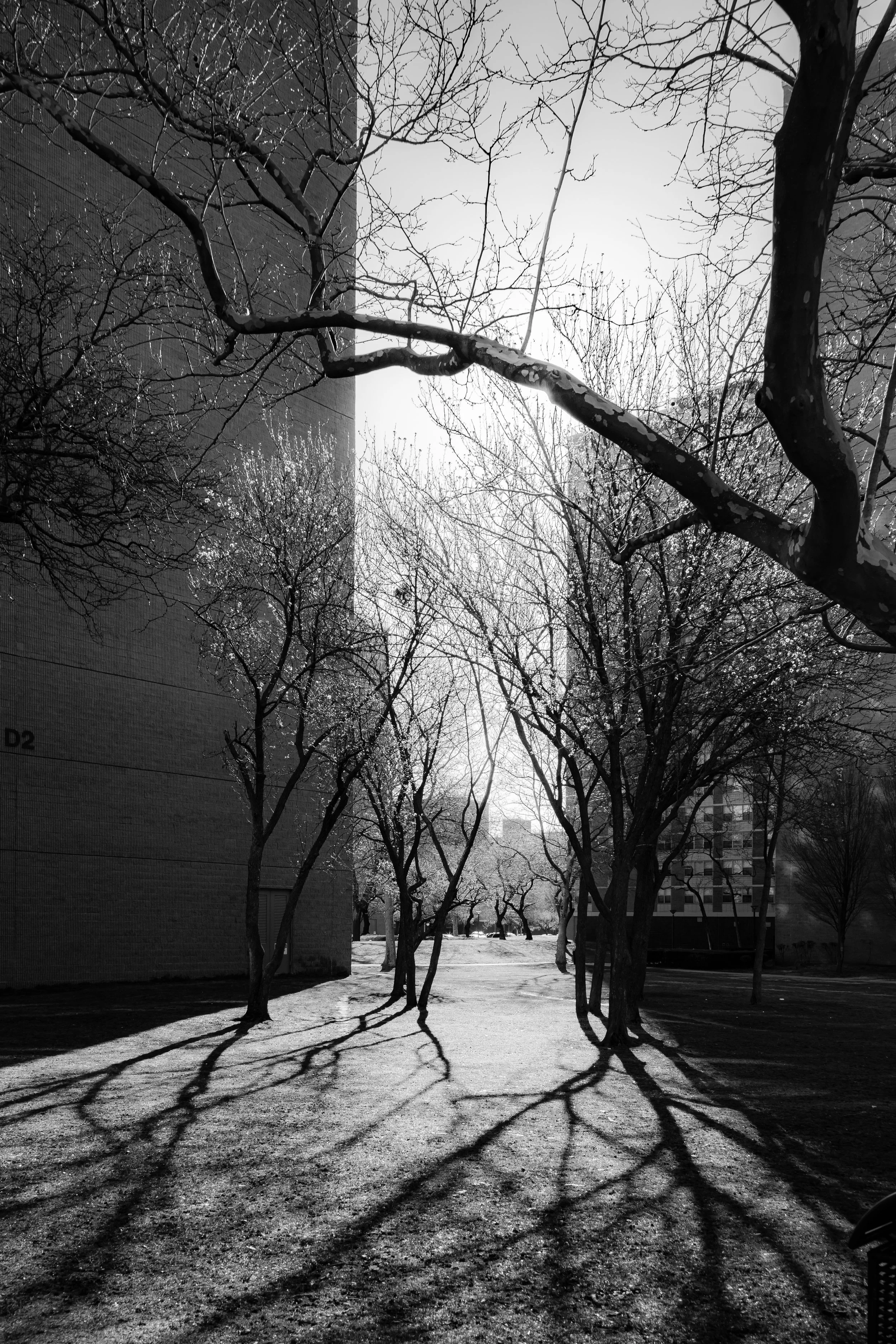
Architecturally, Starrett City exemplifies the modernist principles of the late 20th century: tower-in-the-park planning, open sightlines, and geometric uniformity. Yet within that repetition lies a surprising sense of intimacy. The towers — beige, brown, and gray — rise from lawns and tree groves punctuated by playgrounds and basketball courts. Between buildings, walkways curve toward schools, gardens, and benches where residents gather beneath shade trees.
From above, the layout resembles a modernist tapestry: rectangular towers arranged with mathematical precision against the organic curve of Jamaica Bay. From within, however, it feels neighborly — families greet one another in elevators, and children ride bicycles along traffic-free paths. The soundscape is a mix of laughter, birdsong, and the distant hum of Belt Parkway traffic.
Spirit and Legacy
Starrett City’s legacy is both architectural and social. It represents the high point of New York’s mid-century dream of planned equality — a belief that design, if humane and inclusive, could produce dignity and opportunity. Its residents have weathered storms both literal and political, from lawsuits to hurricanes, and continue to embody the cooperative spirit that defined its founding.
New York City
Use this custom Google map to explore where every neighborhood in all five boroughs of New York City is located.
The Five Boroughs
One of New York City’s unique qualities is its organization in to 5 boroughs: Manhattan, Brooklyn, Queens, The Bronx, and Staten Island. These boroughs are part pragmatic administrative districts, and part vestiges of the region’s past. Each borough is an entire county in New York State - in fact, Brooklyn is, officially, Kings County, while Staten Island is, officially Richmond County. But that’s not the whole story …
Initially, New York City was located on the southern tip of Manhattan (now the Financial District) that was once the Dutch colony of New Amsterdam. Across the East River, another city was rising: Brooklyn. In time, the city planners realized that unification between the rapidly rising cities would create commercial and industrial opportunities - through streamlined administration of the region.
So powerful was the pull of unification between New York and Brooklyn that three more counties were pulled into the unification: The Bronx, Queens, and Staten Island. And on January 1, 1898, the City of New York unified two cities and three counties into one Greater City of New York - containing the five boroughs we know today.
But because each borough developed differently and distinctly until unification, their neighborhoods likewise uniquely developed. Today, there are nearly 390 neighborhoods, each with their own histories, cultures, cuisines, and personalities - and each with residents who are fiercely proud of their corner of The Big Apple.


