
NEW BRIGHTON
Staten Island
Geographic Setting
Bounded by Jersey Street to the east, Brighton Avenue to the south, Lafayette Avenue to the west, and the Kill Van Kull to the north, New Brighton occupies a commanding stretch of Staten Island’s North Shore, overlooking the deep tidal waters that separate the island from Bayonne, New Jersey. The neighborhood lies west of St. George and east of West Brighton, forming part of the historic coastal ribbon that once anchored Staten Island’s 19th-century prominence as both a harbor suburb and cultural retreat.
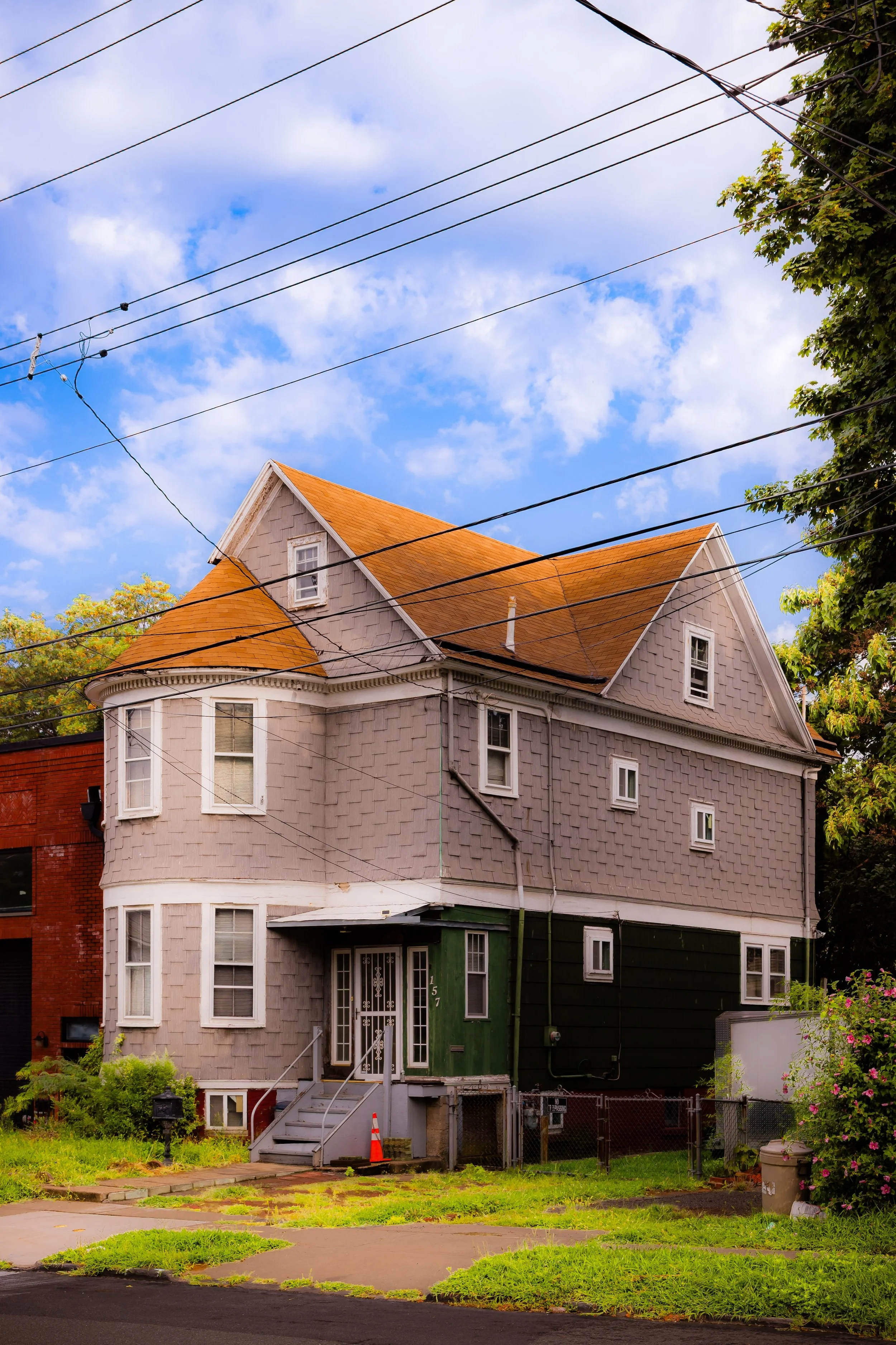
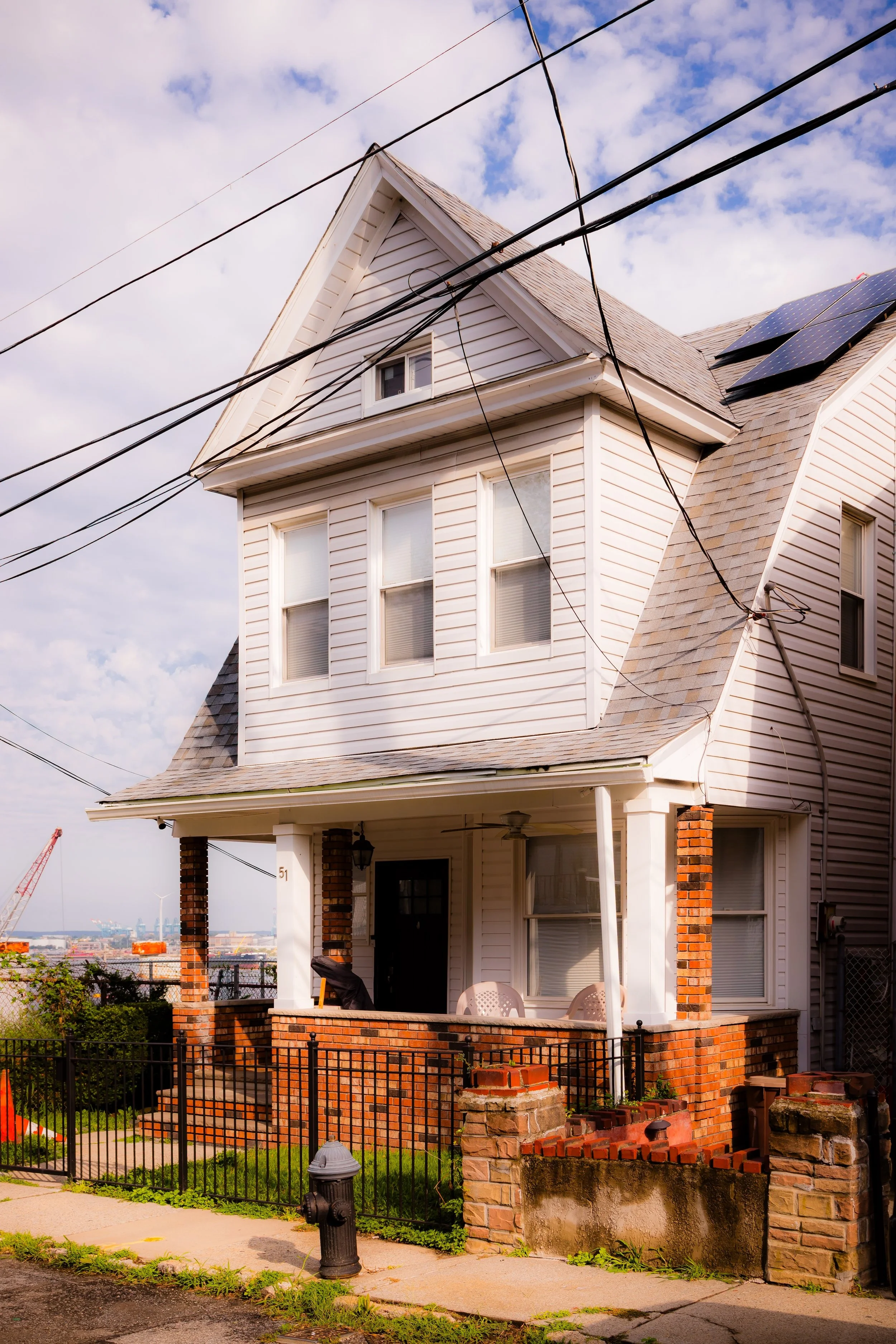
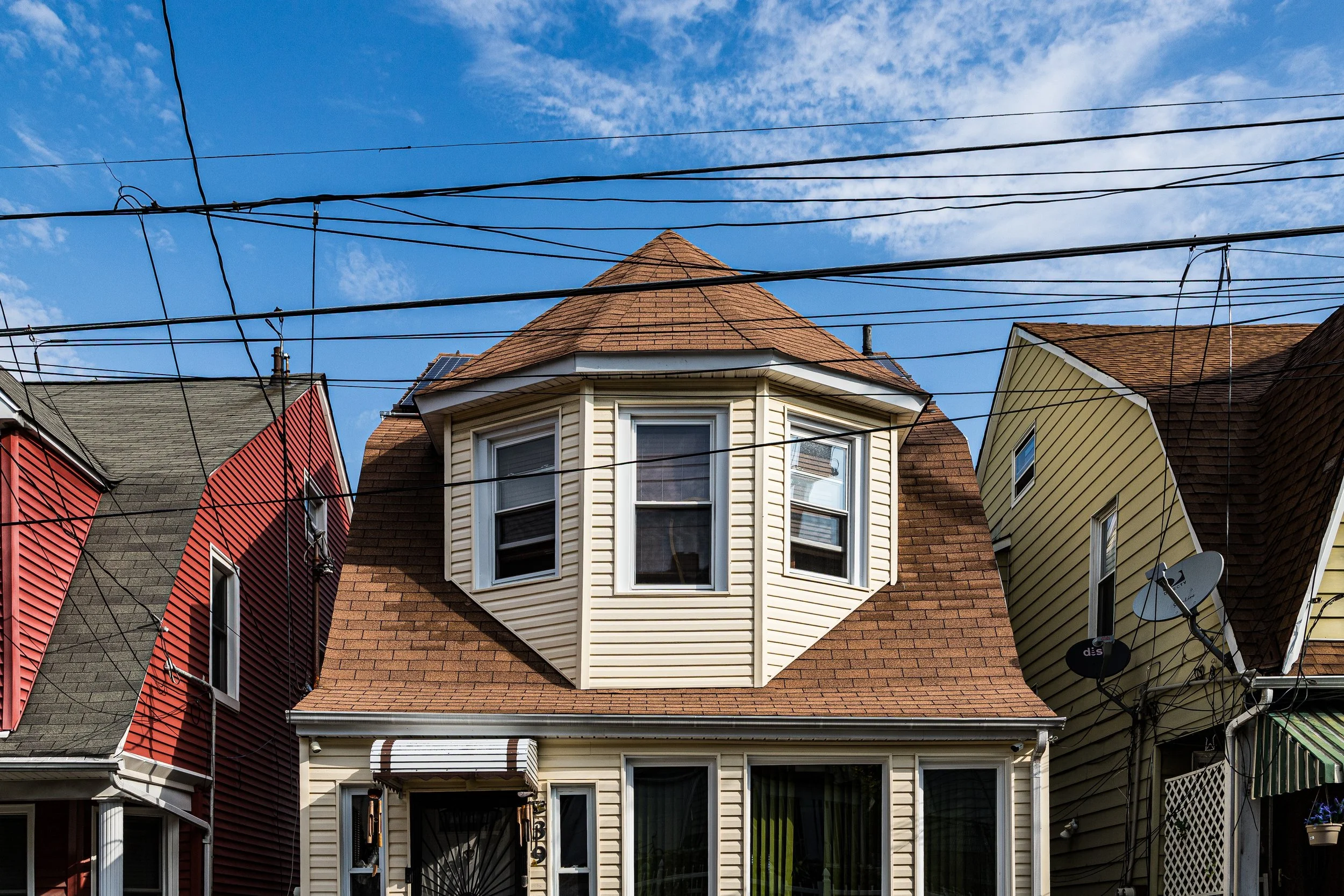
New Brighton’s geography is characterized by contrast. Along Richmond Terrace, the land hugs the waterfront in a mix of old wharves, converted warehouses, and historic churches, while inland, steep slopes rise toward Brighton Avenue and York Terrace, where tree-lined streets are dotted with 19th-century villas, Italianate houses, and brick row homes. From its heights, residents enjoy panoramic views of the Kill Van Kull, its ship traffic, and the Manhattan skyline beyond. The neighborhood’s proximity to the Staten Island Ferry and its walkable, varied topography make it one of the borough’s most distinctive and historically layered communities.
Etymology
The name New Brighton was chosen in the early 1830s by a group of wealthy New York merchants and financiers who sought to create a planned seaside community modeled after Brighton, England—the fashionable resort on the English Channel. The name reflected both aspiration and geography: a vision of refinement, leisure, and modernity transplanted to the wooded shores of Staten Island.
The investors formed the New Brighton Association in 1836, purchasing hundreds of acres along the Kill Van Kull to build a self-contained resort village of elegant villas, gardens, and promenades. Although the grandest ambitions of this “American Brighton” never fully materialized, the name endured, symbolizing both the neighborhood’s origins in genteel idealism and its enduring connection to the water.
The Neighborhood
Origins through the 19th Century
Before its transformation into a planned suburb, the area that became New Brighton was part of the Town of Castleton, a region of farms, orchards, and small docks clustered along the Kill Van Kull. Its natural harbor made it a key point for maritime trade, and by the early 1800s, the shoreline was dotted with boat landings and lumberyards. The region’s wooded hills and cooling sea breezes drew attention from Manhattan’s elite, who sought summer refuges away from the crowded city.
The founding of the New Brighton Association in the 1830s marked one of Staten Island’s earliest experiments in suburban planning. Landscape architect John Notman, who later designed Philadelphia’s Laurel Hill Cemetery, was commissioned to lay out the community. Curving streets, grand estates, and ornamental gardens rose along the hillside, with homes designed in Greek Revival and Gothic styles. The waterfront featured a ferry landing, hotel, and promenade for visitors arriving by boat. Among the early residents were prominent figures such as Commodore Cornelius Vanderbilt, who maintained a nearby estate, and Daniel D. Tompkins, the former governor and U.S. Vice President, whose influence helped elevate Staten Island’s reputation as a retreat for the well-to-do.
By the mid-19th century, New Brighton had become one of Staten Island’s most prestigious residential enclaves, home to judges, ship captains, and industrialists. Yet its elegance coexisted with industry: along the waterfront, shipyards, ironworks, and warehouses supplied the harbor economy. This duality—refined living above, hard labor below—would define the neighborhood’s social geography for generations.
Early 20th Century: Urbanization and Cultural Growth
The turn of the 20th century brought significant change to New Brighton. The consolidation of Staten Island into Greater New York City in 1898 linked the neighborhood more closely to Manhattan, transforming it from a semi-rural retreat into an urban borough neighborhood. The elegant estates of the 19th century gave way to subdivided lots, apartment houses, and denser row homes. Immigrant families—Irish, Italian, Polish, and later Caribbean—settled in the area, drawn by proximity to the ferry and employment in the shipyards, warehouses, and docks.
Despite urbanization, New Brighton retained cultural vitality. Churches such as St. Peter’s Roman Catholic Church (1839) and Christ Church (1849) stood as architectural anchors, while civic institutions like the Staten Island Museum and Staten Island Academy maintained the neighborhood’s intellectual lineage. Victory Boulevard and Jersey Street evolved into small commercial corridors lined with bakeries, groceries, and corner taverns that served the growing population.
During this period, the area also developed a distinct working-class identity. The docks along the Kill Van Kull bustled with longshoremen and sailors, and the smell of tar, salt, and coal defined the air. Yet just a few blocks inland, tree-shaded avenues preserved glimpses of the neighborhood’s genteel past—creating the layered urban landscape that defines New Brighton to this day.
New Brighton Video Coming Soon
Mid–Late 20th Century: Decline, Activism, and Preservation
The post-World War II decades brought challenges common to many waterfront neighborhoods. As shipping modernized and containerization shifted port activity across the harbor to New Jersey, New Brighton’s waterfront industries declined. Many piers fell into disuse, and unemployment rose. Urban renewal programs in the 1950s and 1960s introduced public housing projects, including the West Brighton and Markham Gardens Houses, reshaping the area’s demographics and physical landscape.
Despite economic hardship, local activism flourished. Community organizations and churches provided essential services, while preservationists fought to save the neighborhood’s historic architecture. In the 1970s, a renewed appreciation for Staten Island’s North Shore heritage inspired the restoration of several 19th-century homes and churches. Grassroots cultural initiatives took root, reflecting the borough’s growing artistic identity. The nearby Snug Harbor Cultural Center, created in the late 1970s from the former Sailors’ Snug Harbor complex, became a beacon for arts and education, extending its influence into the fabric of New Brighton.
By the 1980s, a spirit of reclamation had begun. Artists and young families were drawn to the neighborhood’s affordable historic housing and harbor views. Local leaders championed investment in infrastructure and parks, laying the groundwork for the slow but steady revitalization that would define the late 20th century.
21st Century: Historic Harbor, Diverse Community
In the 21st century, New Brighton stands as one of Staten Island’s most historically rich and culturally diverse neighborhoods. Along Richmond Terrace, Victorian homes and repurposed industrial buildings coexist with modest new housing and community gardens. The Kill Van Kull waterfront, once dominated by heavy industry, is gradually being reclaimed for recreation and conservation, with greenway projects linking New Brighton to St. George and West Brighton.
Demographically, the neighborhood reflects Staten Island’s evolving mosaic—longtime Italian-American and Irish families living alongside immigrants from West Africa, the Caribbean, and Latin America. This diversity infuses local schools, businesses, and community centers with vibrancy and resilience. The New Brighton Local Development Corporation and neighborhood associations continue to advocate for historic preservation, economic opportunity, and environmental protection.
Architecturally, the neighborhood remains a living museum of Staten Island’s past: Gothic Revival churches, Italianate villas, 1920s row houses, and mid-century apartment buildings narrate its evolution in brick and timber. The New Brighton Historic District, designated in 1967, protects a cluster of early houses and gardens that recall its 19th-century origins. The nearby cultural institutions of Snug Harbor and Staten Island Museum ensure that the area remains a center of art, learning, and community life.
New Brighton Photo Gallery
Spirit and Legacy
The spirit of New Brighton lies in its endurance and its depth. It has weathered transformation after transformation—aristocratic enclave, working-class harbor town, and multicultural urban village—yet has never lost its sense of place. Its streets tell the story of Staten Island itself: a meeting of water and land, privilege and perseverance, memory and change.
The neighborhood’s legacy is one of continuity amid reinvention. The same harbor that once carried merchant ships now reflects sunsets over restored piers; the same hills that hosted Victorian villas now shelter families from around the world. In its layered architecture and resilient community, New Brighton embodies the complex beauty of the North Shore.
New York City
Use this custom Google map to explore where every neighborhood in all five boroughs of New York City is located.
The Five Boroughs
One of New York City’s unique qualities is its organization in to 5 boroughs: Manhattan, Brooklyn, Queens, The Bronx, and Staten Island. These boroughs are part pragmatic administrative districts, and part vestiges of the region’s past. Each borough is an entire county in New York State - in fact, Brooklyn is, officially, Kings County, while Staten Island is, officially Richmond County. But that’s not the whole story …
Initially, New York City was located on the southern tip of Manhattan (now the Financial District) that was once the Dutch colony of New Amsterdam. Across the East River, another city was rising: Brooklyn. In time, the city planners realized that unification between the rapidly rising cities would create commercial and industrial opportunities - through streamlined administration of the region.
So powerful was the pull of unification between New York and Brooklyn that three more counties were pulled into the unification: The Bronx, Queens, and Staten Island. And on January 1, 1898, the City of New York unified two cities and three counties into one Greater City of New York - containing the five boroughs we know today.
But because each borough developed differently and distinctly until unification, their neighborhoods likewise uniquely developed. Today, there are nearly 390 neighborhoods, each with their own histories, cultures, cuisines, and personalities - and each with residents who are fiercely proud of their corner of The Big Apple.


