BELLEROSE MANOR
Queens
Part of an ongoing project to walk and photograph every neighborhood in New York City, this page explores Bellerose Manor through history, fieldwork, and photography.

Map
Geographic Setting
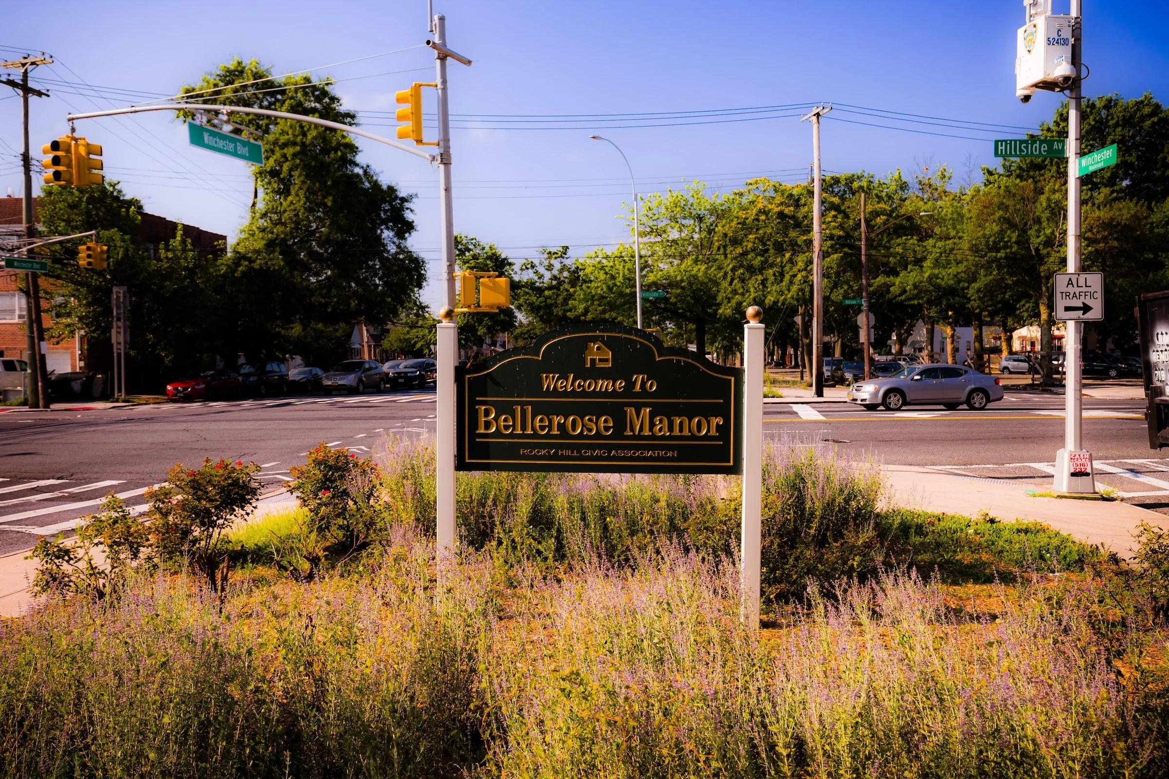
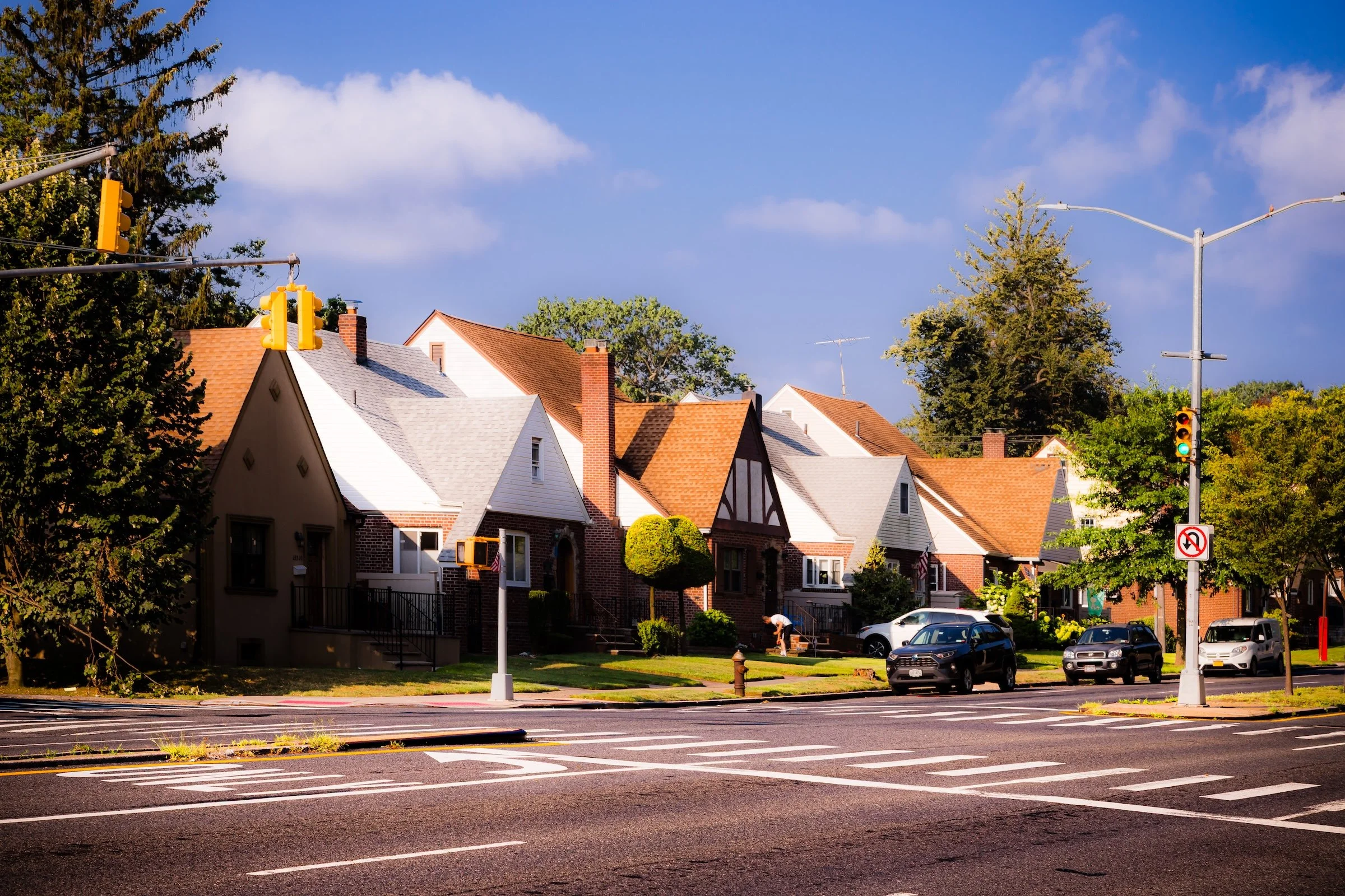
Bounded by Braddock Avenue to the south, the Grand Central Parkway to the northwest, Union Turnpike to the north, and 236th Street and 235th Court to the east, Bellerose Manor occupies a small but distinct enclave in eastern Queens—a leafy residential triangle nestled between Bellerose, Queens Village, and Glen Oaks. Its setting, just north of the Cross Island Parkway and adjacent to the Queens County Farm Museum, places it at the meeting point of suburb and city, where the built landscape softens into parkland and open fields.
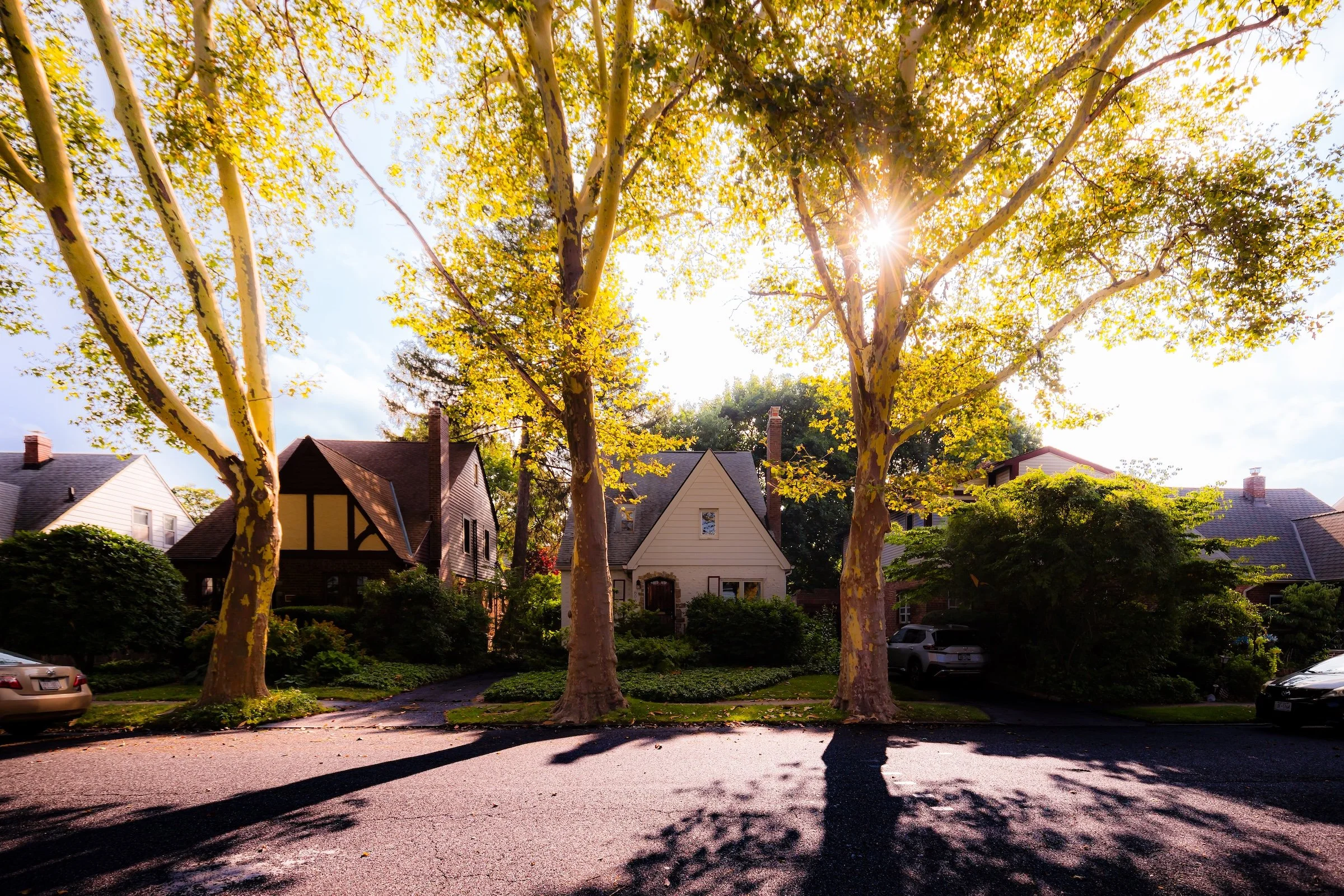
Though geographically modest, Bellerose Manor is one of Queens’ most picturesque neighborhoods. Broad, tree-lined streets wind gently between single-family Tudor, Colonial, and Cape-style homes—many dating from the 1930s through the 1950s. The neighborhood’s terrain rises slightly toward the north, giving a sense of openness and elevation above the surrounding roadways. The Union Turnpike corridor provides easy access to both the Grand Central Parkway and Cunningham Park, while Braddock Avenue forms its lively southern edge, linking the community westward toward Queens Village and eastward to Floral Park and New Hyde Park. Within this quiet pocket of homes and gardens, the atmosphere remains serenely residential: no high-rises, minimal commercial intrusion, and a civic culture rooted in stability and care.
Identity
Etymology and Origins
The name “Bellerose Manor” emerged in the 1920s as a real estate distinction—marking the northern section of greater Bellerose within the expanding city grid of Queens. Developers adopted the term “Manor” to evoke prestige and suburban refinement, a nod to the English-inspired naming conventions popular in early 20th-century real estate marketing. While the broader Bellerose area straddled the New York City–Nassau County line, the “Manor” designation referred specifically to the Queens side north of Braddock Avenue, where larger lots and curving streets distinguished it from the denser tracts to the south.
Before its subdivision, the land formed part of the agricultural hinterland of Hempstead Plains—open fields, woodlots, and small family farms extending west from modern-day Glen Oaks. Early colonial records show ownership by Dutch and English settlers in the 17th and 18th centuries, with the land worked for hay and vegetables well into the 19th century. When Queens became part of Greater New York in 1898, these tracts lay poised for transformation, offering a blank canvas for the suburban experiments of the coming century.
Neighborhood Identity
Bellerose Manor is one of eastern Queens’ most self-contained residential enclaves, a small and carefully maintained pocket of detached homes, shaded streets, and minimal commercial intrusion tucked between Bellerose, Queens Village, and Glen Oaks. Defined for decades by homeownership, civic vigilance, and a deeply rooted preference for low-rise domestic life, it carries the feel of a planned suburban refuge within the city rather than a neighborhood shaped by storefronts or transit bustle.
What distinguishes Bellerose Manor is not scale but consistency. Its streets, setbacks, lawns, and houses work together to create an environment of unusual calm and visual order, reinforced by the neighborhood’s long resistance to overdevelopment and its enduring culture of upkeep. The result is a place whose identity rests in stability, privacy, and the quiet dignity of a residential landscape built to feel settled.
Visual Identity
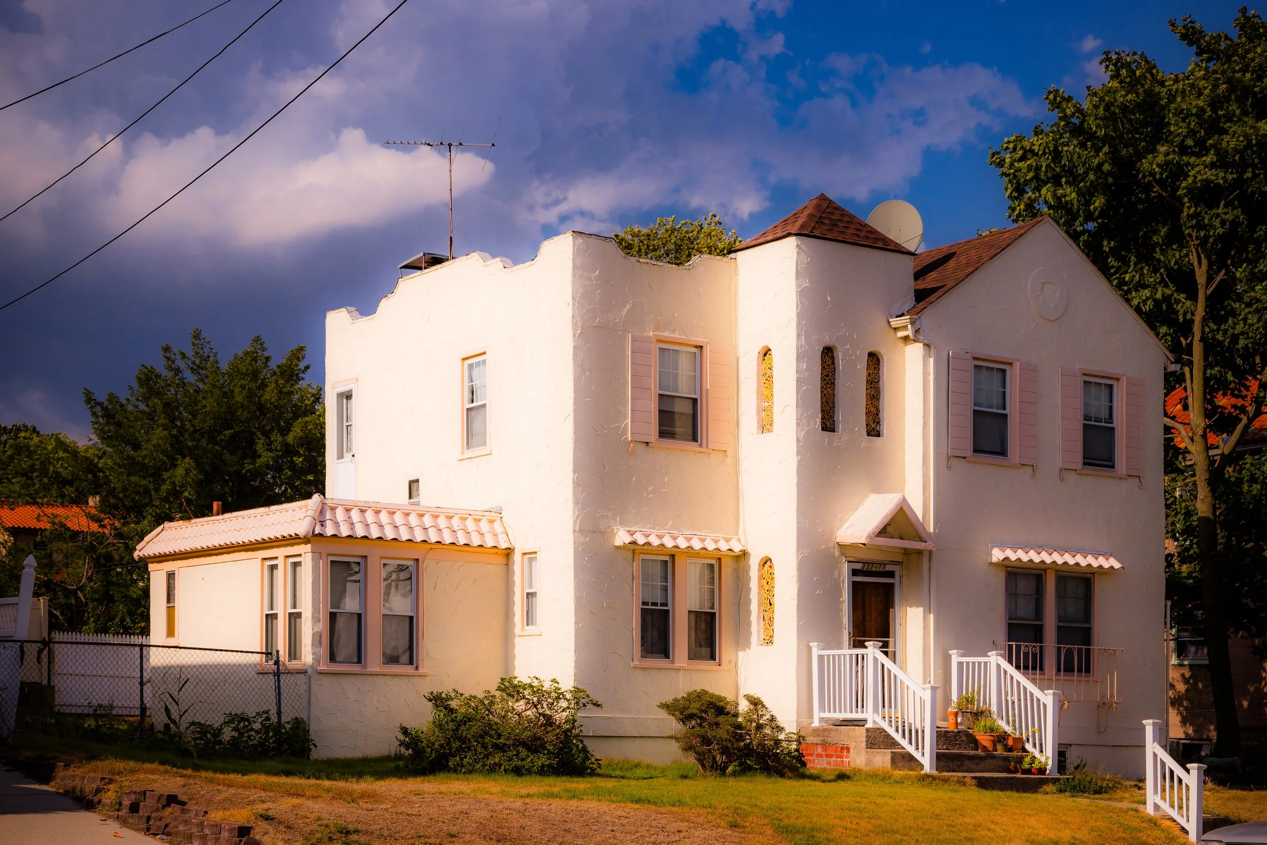
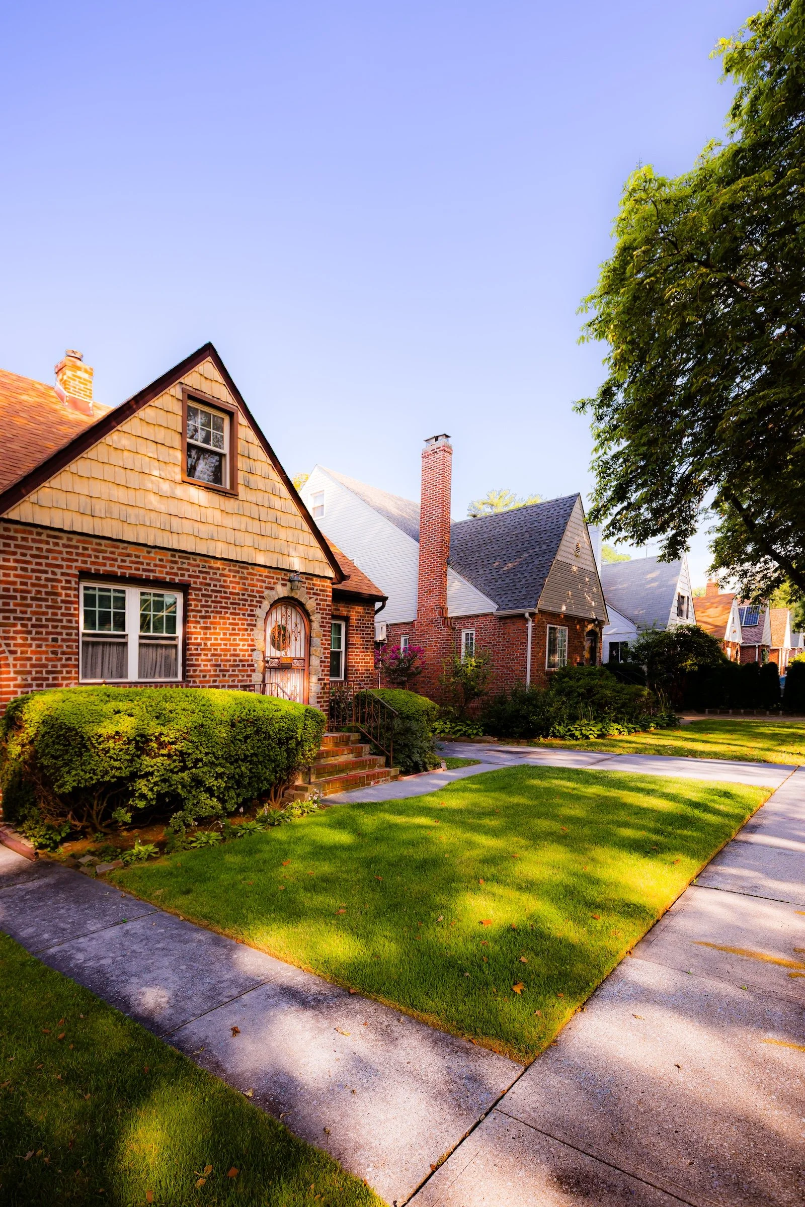
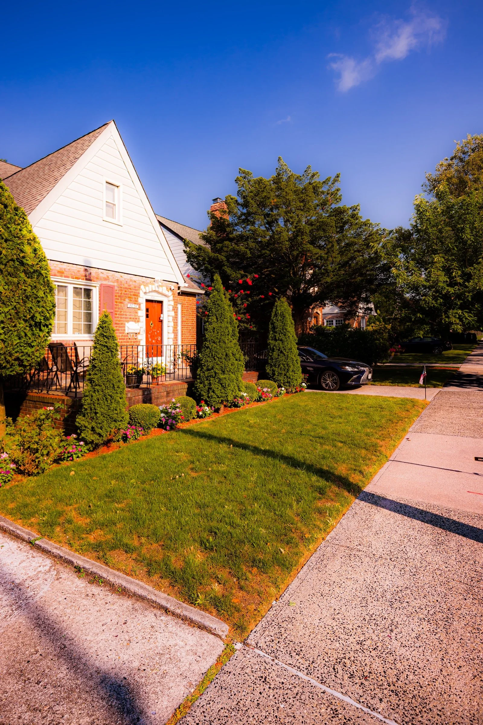
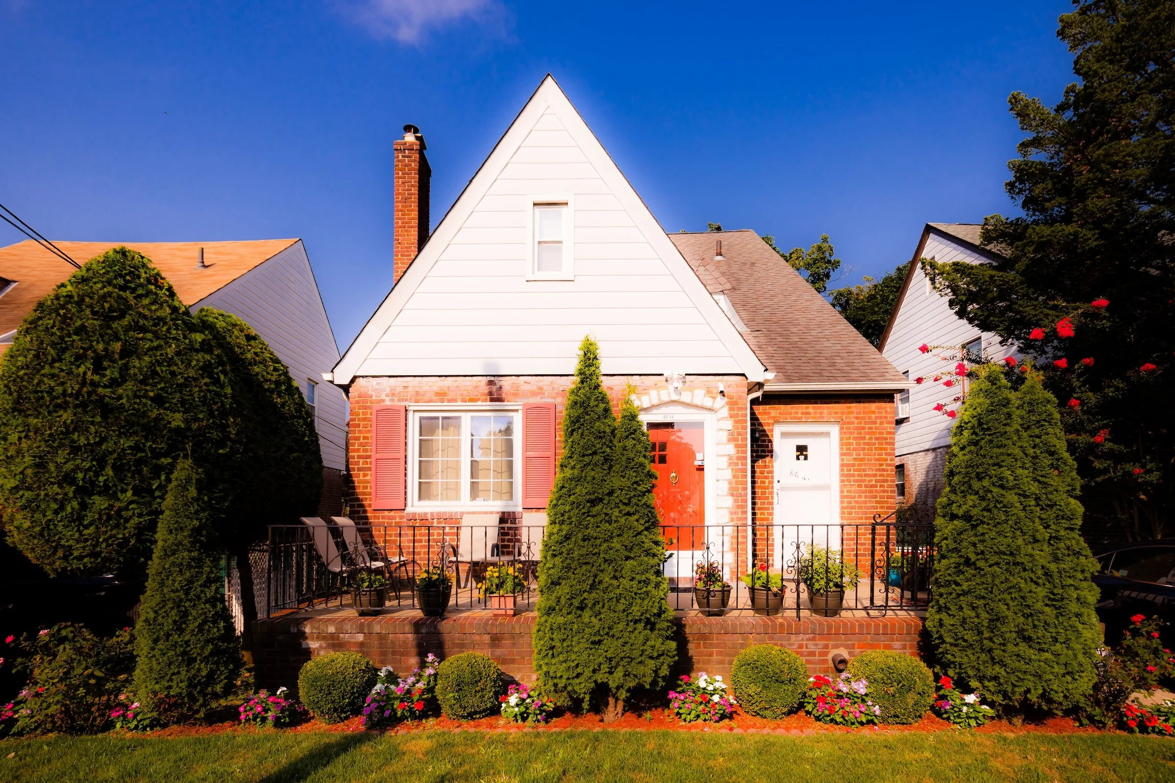
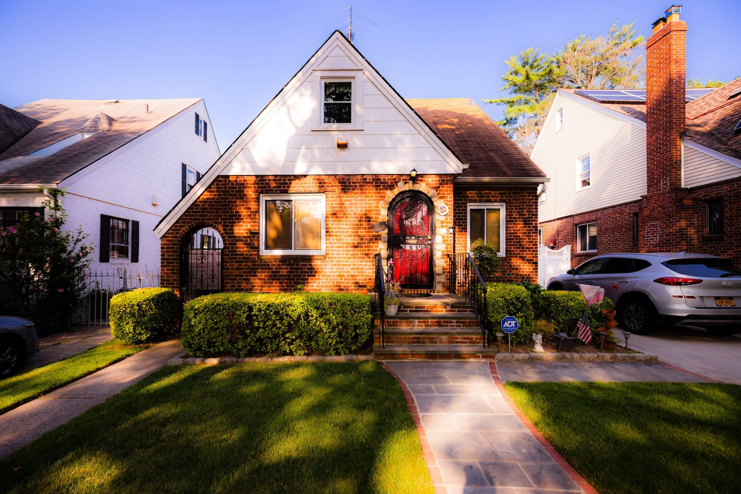
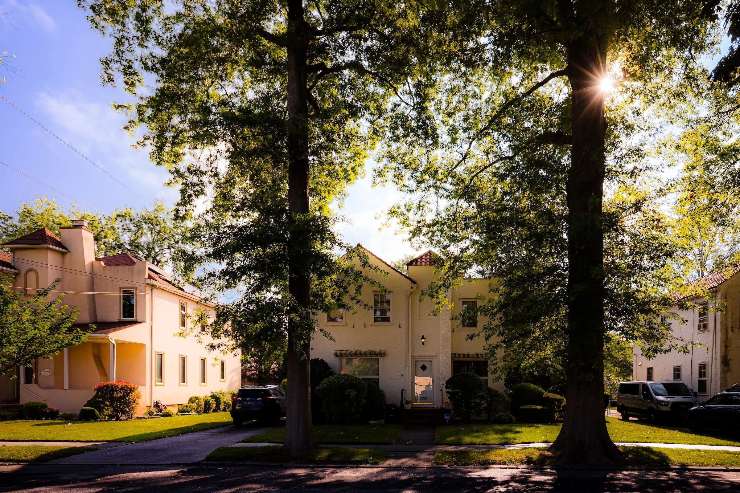
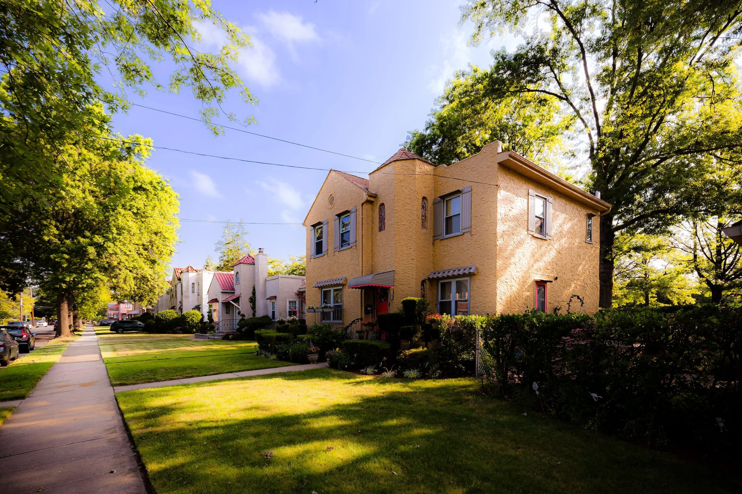
Bellerose Manor’s visual identity emerges through sunlight, masonry, and repetition. The contact sheet makes clear that this is a neighborhood of peaked roofs, stucco walls, red brick, clipped hedges, and wide residential setbacks, where detached houses sit in a steady rhythm beneath mature trees and a broad, open sky. The blocks feel composed rather than crowded, and their character comes less from any single landmark than from the cumulative effect of well-kept homes, front gardens, and generous light.
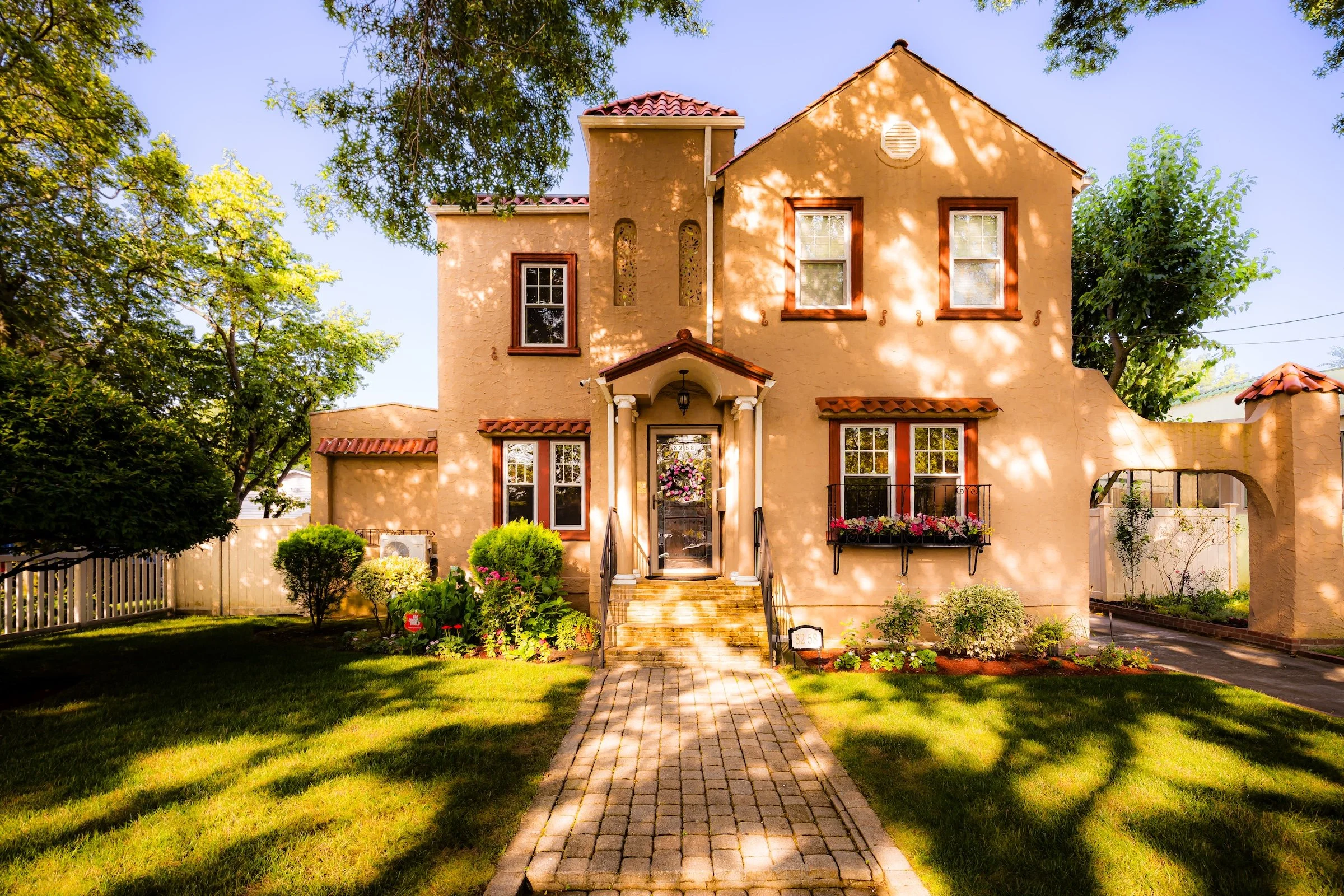
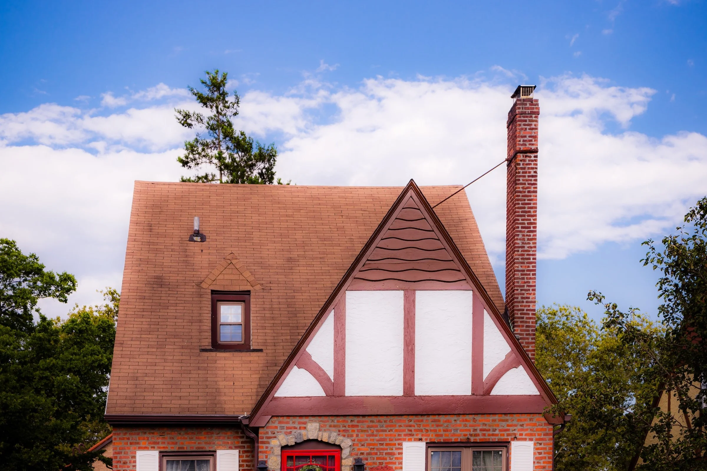
What gives the neighborhood its distinctive look is the warmth of its Mediterranean and Spanish Colonial inflection within the larger domestic language of eastern Queens. Ochre stucco, terracotta tones, arched entries, textured walls, and sun-washed façades lend parts of Bellerose Manor a softness and glow that stand apart from the borough’s more familiar brick-and-slate palette. In dappled morning and late-afternoon light, that architectural warmth becomes even more pronounced, with tree shadows, bright sidewalks, and sturdy masonry creating a streetscape that feels both bucolic and quietly refined. This visual identity aligns closely with the page’s emphasis on Tudor, Colonial, and Cape-style homes, but your photographs reveal an added layer of Mediterranean warmth and filtered-light atmosphere that gives the neighborhood a particularly memorable presence.
History
Early 20th Century: The Making of a Suburban Enclave
The development of Bellerose Manor began in earnest during the 1920s, spurred by new roadways and expanding commuter infrastructure. The extension of Union Turnpike and the creation of the Grand Central Parkway in the 1930s connected eastern Queens directly to Manhattan and Long Island, making the area an ideal site for middle- and upper-middle-class housing. Builders marketed Bellerose Manor as “the suburb within the city,” offering detached homes, manicured lawns, and the promise of quiet domestic life within commuting reach of New York’s business districts.
Architecturally, the neighborhood reflected the styles of its era: English Tudor Revival, Colonial, and Dutch Gambrel homes predominated, often with slate roofs, decorative brickwork, and arched doorways. Streets like 86th Avenue, 237th Street, and 88th Road were laid out with uniform setbacks and sidewalks, creating the orderly, garden-like aesthetic still visible today. Promotional brochures from the period boasted of “broad drives, healthful air, and proximity to Long Island’s green spaces.” Indeed, its adjacency to the Queens County Farm, the oldest continuously cultivated farmland in New York, lent Bellerose Manor an enduring sense of rural calm at the edge of urbanity.
Mid–20th Century: Stability and Community Life
By the 1940s and 1950s, Bellerose Manor had fully matured into a close-knit residential community. The neighborhood’s schools, houses of worship, and civic groups anchored a population composed largely of civil servants, teachers, and professionals who prized homeownership and local pride. Postwar prosperity saw modest expansions—brick homes replacing earlier wood-frame houses, and small additions made to accommodate growing families—but the essential character remained consistent.
The nearby Cunningham Park and Alley Pond Park, both accessible via the Grand Central Parkway, became integral to neighborhood life, providing green space for recreation and picnics. Civic activism flourished: the Bellerose Manor Civic Association, founded mid-century, advocated for zoning protections, infrastructure upkeep, and beautification projects. Residents successfully resisted attempts to increase density, ensuring that single-family zoning remained intact—a victory that preserved the neighborhood’s low-rise skyline amid the broader urbanization of Queens.
Religious and cultural institutions reinforced this sense of stability. St. Gregory the Great Roman Catholic Church, along with nearby synagogues and Protestant congregations, served as both spiritual and social centers. Block parties, PTA meetings, and seasonal parades helped sustain a sense of belonging that defined life here.
Late 20th Century: Continuity Through Transition
During the 1970s–1990s, Bellerose Manor weathered the demographic shifts that reshaped much of Queens while maintaining its essential identity. Many second-generation families remained, while newcomers—particularly from South Asian, Caribbean, and Greek backgrounds—added new cultural layers to the community’s tapestry. Despite economic fluctuations and the city’s fiscal crises, the neighborhood’s strong homeownership base and active civic associations preserved property values and quality of life.
The manicured front lawns, tree-lined blocks, and quiet evenings that once symbolized the “American suburban dream” continued to define Bellerose Manor’s reality. Its location—buffered by the Grand Central Parkway to the north and Braddock Avenue to the south—provided a sense of enclosure and protection. The community’s relative lack of commercial activity reinforced its purely residential atmosphere, while nearby corridors such as Union Turnpike and Hillside Avenue provided access to shopping, dining, and transit without disrupting the neighborhood’s peace.

21st Century: Preservation and Pride
In the 2000s and 2010s, Bellerose Manor entered the new century much as it had entered the previous one: peaceful, prosperous, and quietly self-sufficient. While Queens became increasingly cosmopolitan, Bellerose Manor remained one of its most stable enclaves, prized for its architectural charm, green streets, and strong civic identity. Many of its original homes have been carefully renovated, retaining their period details even as interiors were modernized. The neighborhood’s diversity has deepened, with Indian, Filipino, and Chinese-American families joining older residents to create a genuinely multicultural, multigenerational community bound by shared respect for its residential tradition.
The Bellerose Manor Civic Association continues to play an active role in local affairs—organizing beautification drives, tree-planting initiatives, and community watch programs. Residents remain vigilant against overdevelopment, viewing their neighborhood’s character as a rare and precious inheritance. Despite its proximity to major roadways and commercial corridors, Bellerose Manor endures as a quiet oasis within the city’s restless motion.
Spirit and Legacy
Bellerose Manor’s spirit lies in constancy: a neighborhood conceived as a suburban refuge and still readably shaped by that ambition nearly a century later. Its legacy is visible not only in its early twentieth-century development and carefully protected residential form, but in the everyday stewardship that has preserved its lawns, trees, setbacks, and low-rise skyline across generations. The page’s history repeatedly returns to that theme of continuity, from its original marketing as “the suburb within the city” to later civic efforts to resist density and maintain neighborhood character.
What gives that legacy emotional force is the way it remains tangible at street level. Bellerose Manor does not announce itself loudly; it reveals itself through shade, texture, order, and the quiet assurance of houses meant to endure. In that sense, its lasting character is not merely architectural but atmospheric: a sense of calm, care, and residential pride that still shapes the experience of walking through it. That is also what makes the neighborhood so rewarding photographically. Its beauty is not dramatic in the monumental sense, but cumulative, emerging through dappled light, warm façades, deep greenery, and the subtle persistence of a domestic landscape still holding together remarkably well.
If you want, I can also draft a matching Through The Lens revision for Bellerose Manor so the photography section speaks in the same voice as these three sections.

Photography
Bellerose Manor is a subsection of Bellerose. But don’t let that fool you. Bellerose Manor has a personality all its own - filled with sprawling manors on sun-filled and sun dappled streets.
Photographer's Insight:
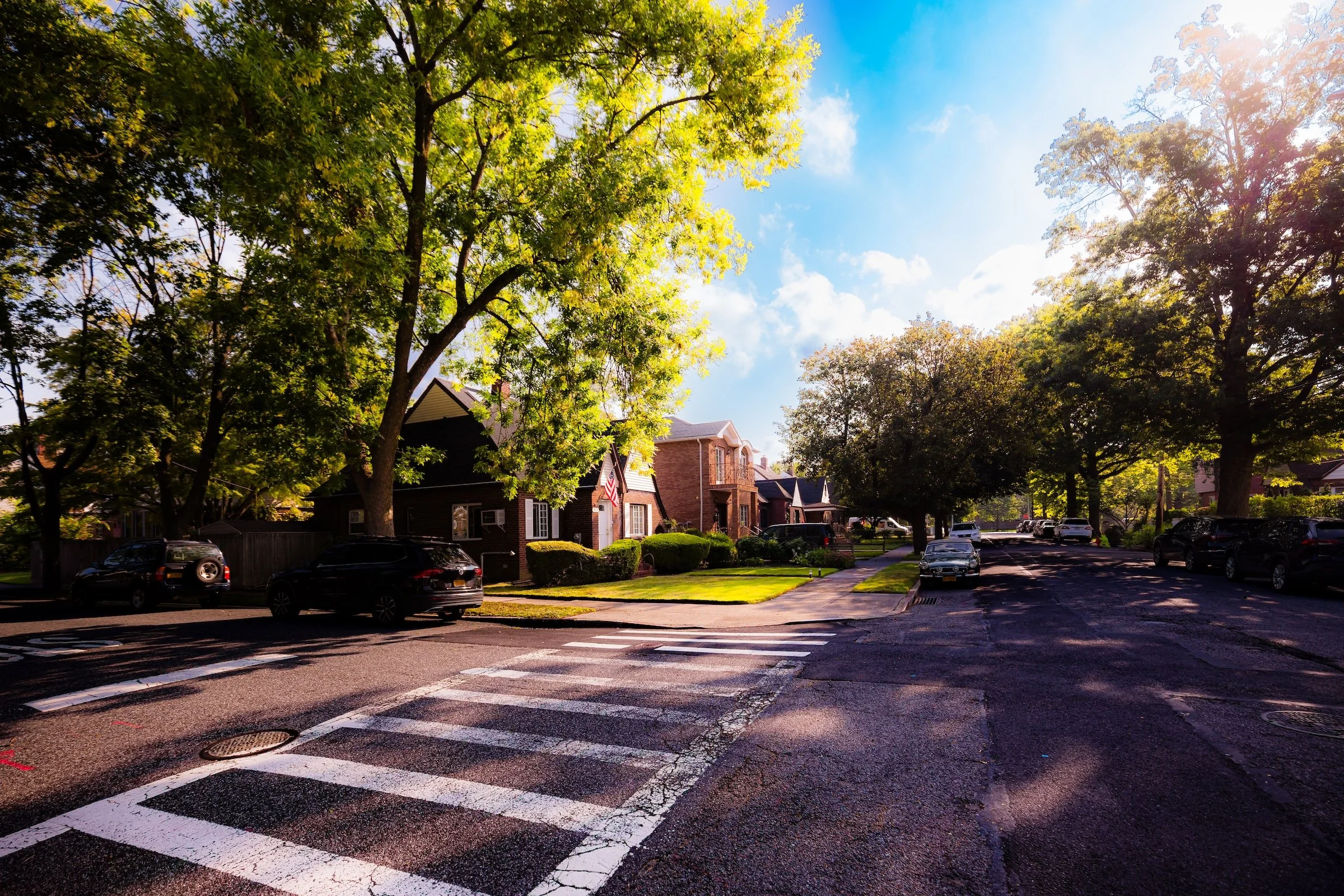
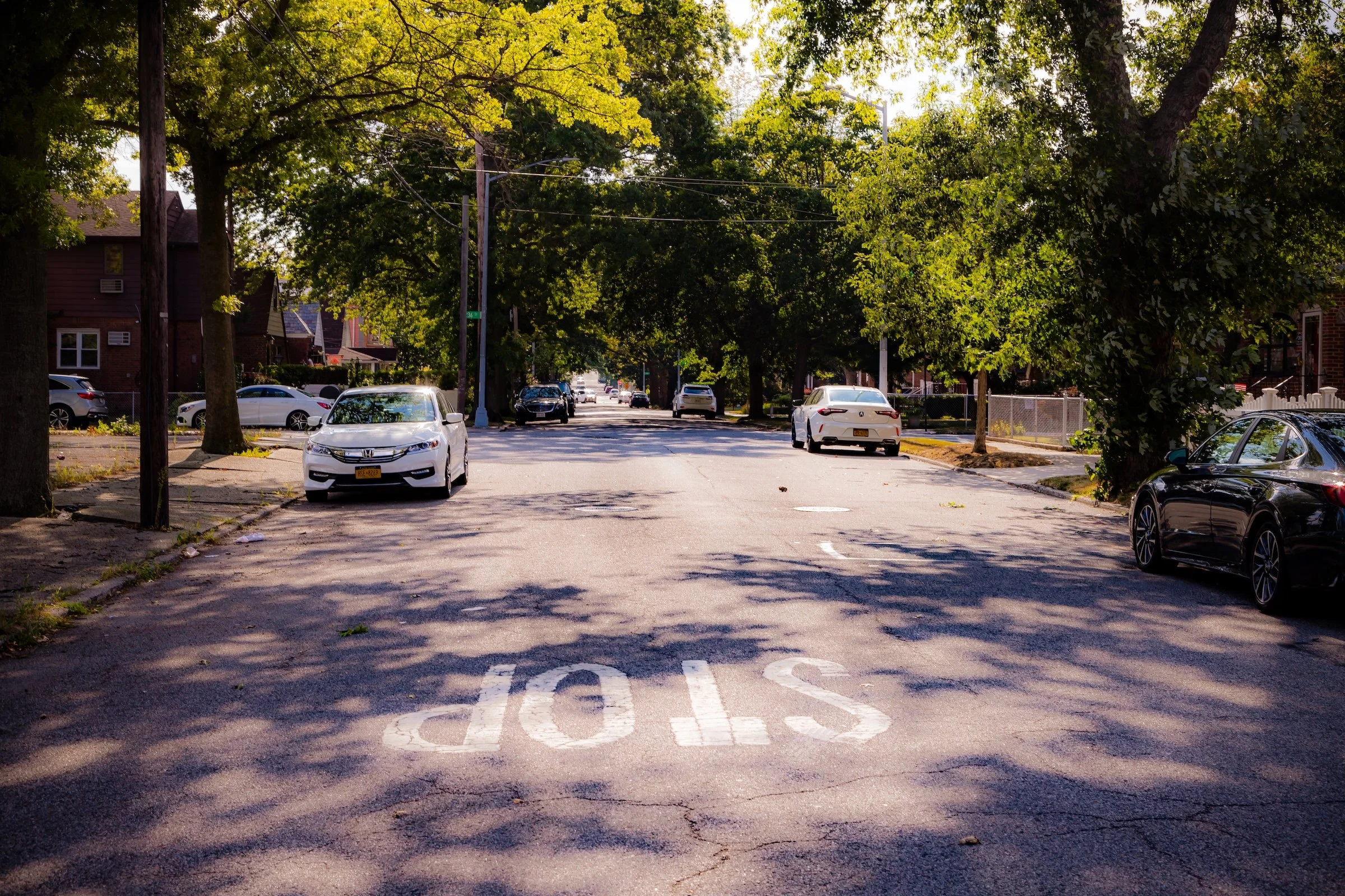
Crosswalk Cadence - Street photography in which crosswalk markings create rhythm, structure, and movement across the frame.
Painting With Light - A way of seeing in which natural sunlight turns ordinary scenes luminous, atmospheric, and almost painterly.
Sun Dapples - Photographs shaped by scattered patches of sunlight and shade, where filtered light creates a shifting, mottled pattern across the scene.
Sungleams - Direct-light photographs in which the sun enters the frame and reshapes it through rays, flare, halos, or glare.
The Wraparound - Compositions in which a curving or enclosing element, such as a corner, porch, façade, or street edge, draws the eye around the frame and deepens the sense of space.
Of course, these are just the beginning - and hardly the only ways to see Bellaire. I encourage you to experiment and find your own personal Photographic Lexicon.

Through The Lens
If you visit Bellerose Manor, these ideas can help inspire your own photography.
Bellerose Manor Video Coming Soon
Bellerose Manor Photo Gallery
Bellerose Manor Field Notes
-
Field Note: August 5, 2023 | 08:30 AM
Conditions: 82°F | Humidity: 48%
The excursion concluded at the daily low for humidity, resulting in a remarkably "crisp" finish to the archive. The late-afternoon light raked across the sturdy masonry of Bellerose Manor, perfectly capturing the moment the intense summer day began its slow transition toward evening.
Bellerose Manor revealed itself as a bucolic hidden gem, shimmering under a heavy canopy of dappled sunlight. I was particularly struck by the "Spanish Colonial" character of the neighborhood; the way the morning light hits the textured ochre stucco and red terracotta tiles (see photo “Dappled At 82-58”) creates a warmth that feels distinct from the surrounding Queens boroughs.
Other neighborhoods visited:
Dappled At 80-26 - Click To Purchase Print
Sunburst At 82-26 235 - Click To Purchase Print
Morning On 235th Street - Click To Purchase Print

Dappled At 82-58 - Click To Purchase Print
Use this custom Google map to explore where every neighborhood in all five boroughs of New York City is located.
The Five Boroughs
One of New York City’s unique qualities is its organization in to 5 boroughs: Manhattan, Brooklyn, Queens, The Bronx, and Staten Island. These boroughs are part pragmatic administrative districts, and part vestiges of the region’s past. Each borough is an entire county in New York State - in fact, Brooklyn is, officially, Kings County, while Staten Island is, officially Richmond County. But that’s not the whole story …
Initially, New York City was located on the southern tip of Manhattan (now the Financial District) that was once the Dutch colony of New Amsterdam. Across the East River, another city was rising: Brooklyn. In time, the city planners realized that unification between the rapidly rising cities would create commercial and industrial opportunities - through streamlined administration of the region.
So powerful was the pull of unification between New York and Brooklyn that three more counties were pulled into the unification: The Bronx, Queens, and Staten Island. And on January 1, 1898, the City of New York unified two cities and three counties into one Greater City of New York - containing the five boroughs we know today.
But because each borough developed differently and distinctly until unification, their neighborhoods likewise uniquely developed. Today, there are nearly 390 neighborhoods, each with their own histories, cultures, cuisines, and personalities - and each with residents who are fiercely proud of their corner of The Big Apple.


