TURTLE BAY
Manhattan
Geographic Setting
Bounded by East 42nd Street to the south and East 53rd Street to the north, and extending from Third Avenue eastward to the East River—excluding the elevated enclave of Tudor City—Turtle Bay forms a tranquil residential and diplomatic quarter nestled within the heart of Midtown East. Despite its proximity to the city’s commercial core, the neighborhood maintains a distinctly intimate and leafy character: narrow streets lined with brownstones, pocket parks, and mid-century apartment houses that descend toward the river.
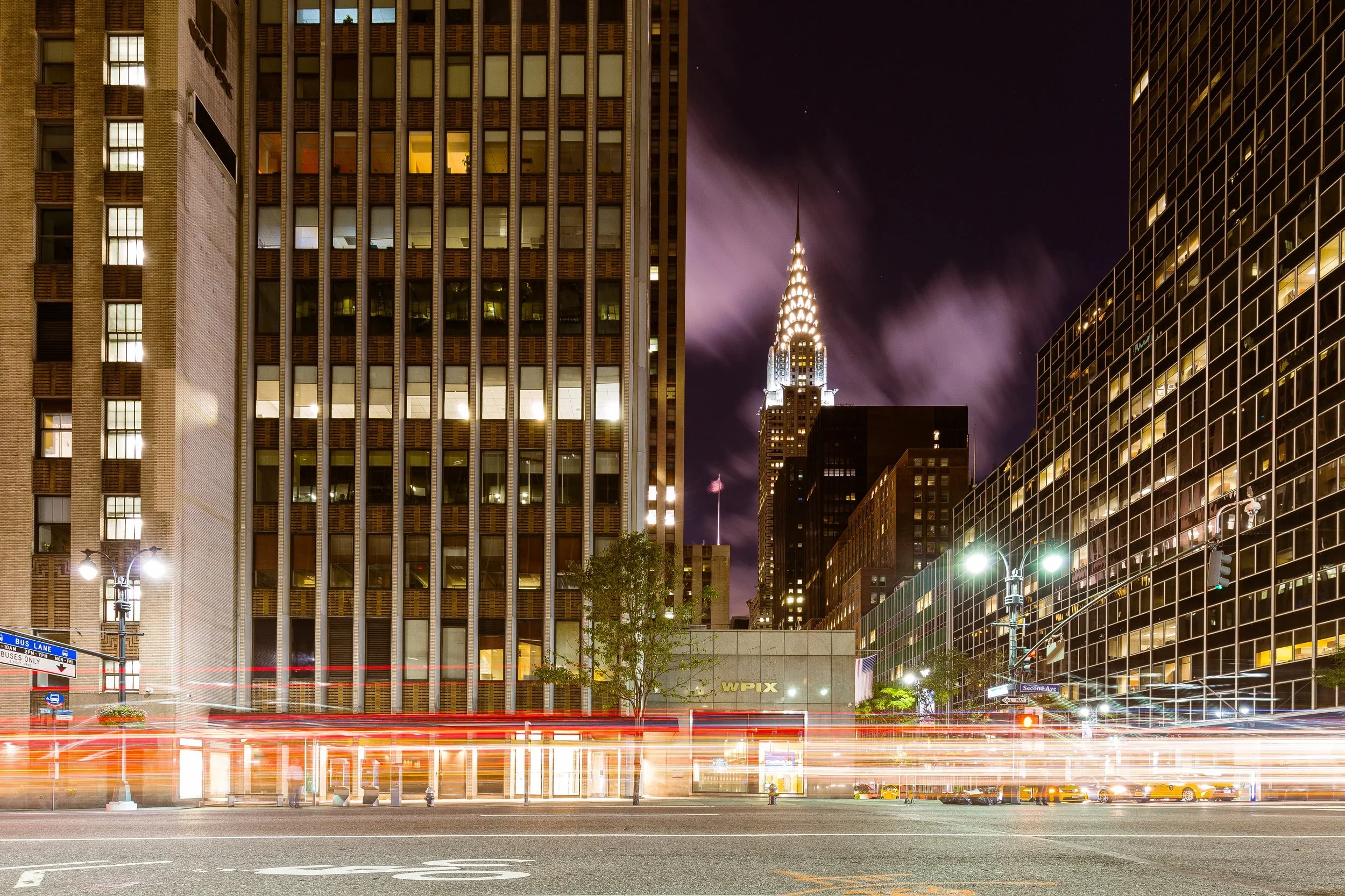
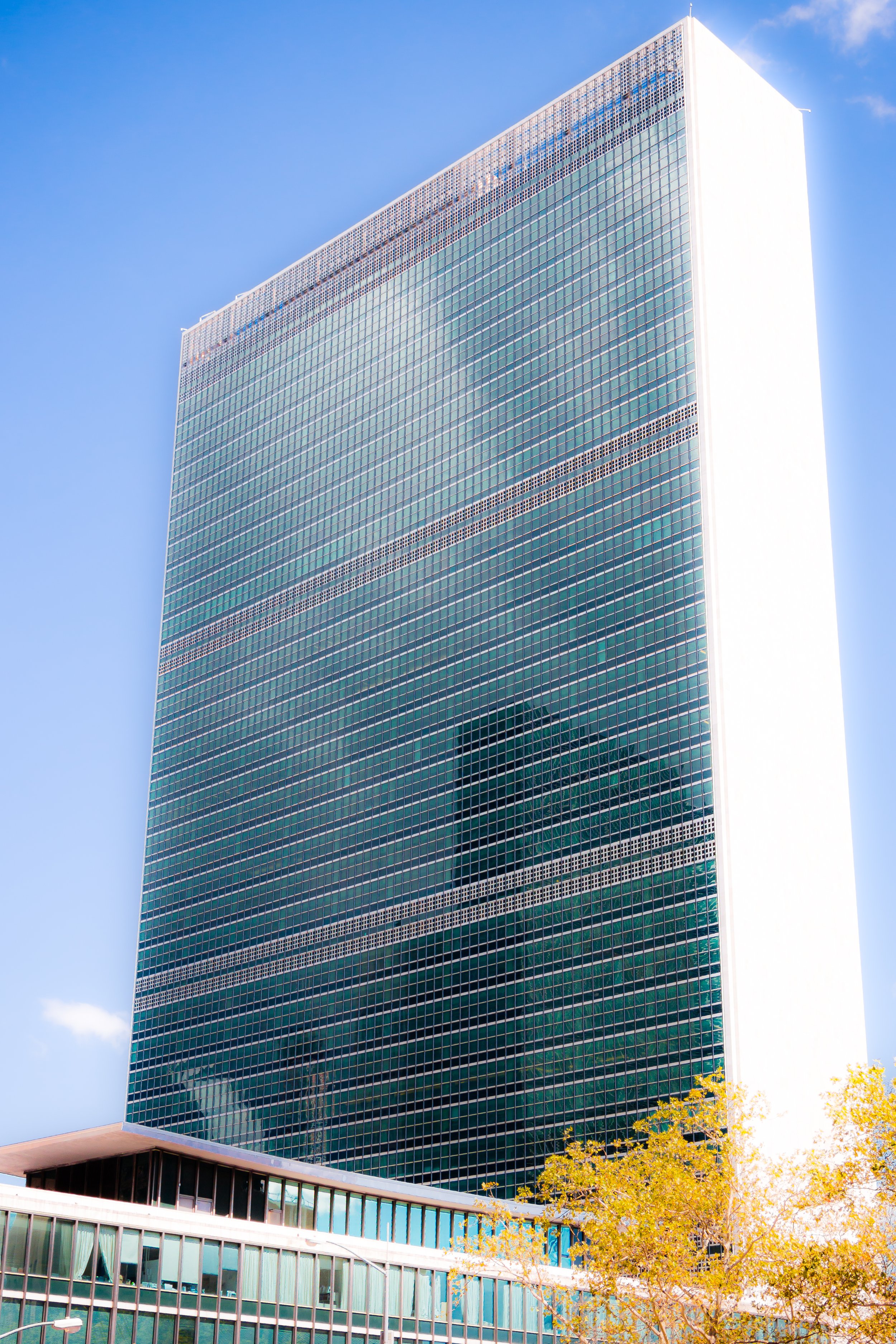
Anchored by the United Nations Headquarters along First Avenue, Turtle Bay is both globally symbolic and locally serene. The neighborhood’s topography slopes gently eastward toward the waterfront, where the East River Esplanade, Dag Hammarskjöld Plaza, and Peter Detmold Park provide public access to river breezes and skyline views. To the west, Second and Third Avenues frame a corridor of restaurants, small shops, and long-established residential buildings. Between them, Beekman Place, Mitchell Place, and East 48th–49th Streets embody the district’s dual spirit—urbane yet cloistered, cosmopolitan yet deeply neighborhood in scale.
Etymology and Origins
The name “Turtle Bay” is among Manhattan’s oldest surviving toponyms. It originates from the 17th century, when Dutch settlers recorded the sheltered cove along this stretch of the East River as Deutal Bay or Turtle Hooke, possibly a corruption of the Dutch word deutal (bent blade) or a reference to the area’s natural shape. By the 18th century, English colonists had adopted the name “Turtle Bay,” likely inspired by the turtles that once populated its calm inlet.
In 1639, the Dutch East India Company granted the land to Hendrick de Forest, making Turtle Bay one of the earliest settled waterfront tracts north of New Amsterdam. The bay’s natural harbor provided a mooring for small ships and a landing site for timber and farm goods. Over time, the name came to refer not only to the cove itself but to the surrounding farmland and, later, the urban neighborhood that supplanted it.
The Neighborhood
18th–19th Centuries: Farms, Industry, and Urban Growth
During the colonial and early national periods, Turtle Bay remained rural, dotted with farms, orchards, and country estates. The most famous of these belonged to Robert Murray, whose vast estate, Inclenberg, extended westward toward what is now Murray Hill. The bay itself figured briefly in Revolutionary War history: in September 1776, British troops landed nearby as part of their advance into Manhattan following the Battle of Kips Bay.
By the early 19th century, the waterfront’s isolation made it an ideal site for shipbuilding, breweries, slaughterhouses, and ropewalks. The Manhattan Gas Works and East River docks transformed the shoreline into a dense industrial zone, while inland streets filled with working-class housing and boardinghouses for dock laborers. The construction of the New York and Harlem Railroad (1837) and the grid extension northward brought infrastructure, but little gentility; by the mid-1800s, Turtle Bay was known for its noise, soot, and squalor.
Nevertheless, remnants of its early architecture endured. Modest brick rowhouses—some built in the 1850s for tradesmen—still stand on East 48th through 51st Streets, their scale and craftsmanship hinting at the area’s pre-industrial origins.
Early 20th Century: Decline and Renewal
By the early 1900s, Turtle Bay’s waterfront had grown heavily industrial, and its residential blocks suffered neglect. Coal yards, breweries, and abattoirs lined the East River, while tenement overcrowding typified the inland streets. Yet even amid this decay, visionaries saw potential. In 1918, Charlotte Hunnewell Sorchan, a pioneering preservationist and civic reformer, founded the Turtle Bay Association and began rehabilitating derelict rowhouses along East 48th Street. Her campaign to plant trees and restore façades inspired similar efforts throughout the area, marking one of New York’s earliest examples of organized neighborhood renewal.
By the 1920s, Turtle Bay began attracting writers, artists, and professionals seeking affordability and proximity to Midtown. Among its notable residents were E. B. White, whose essay “Here is New York” captures the city’s paradoxes from a Turtle Bay perspective, and Katherine Hepburn, whose townhouse garden became a neighborhood landmark (and whose name now graces Dag Hammarskjöld Plaza).
A decisive transformation came after World War II, when the site of the decaying slaughterhouses along First Avenue was selected for the United Nations Headquarters (completed 1952, designed by Wallace K. Harrison). The UN’s gleaming modernist complex erased the old industrial shoreline and gave Turtle Bay a new identity: international, orderly, and forward-looking.
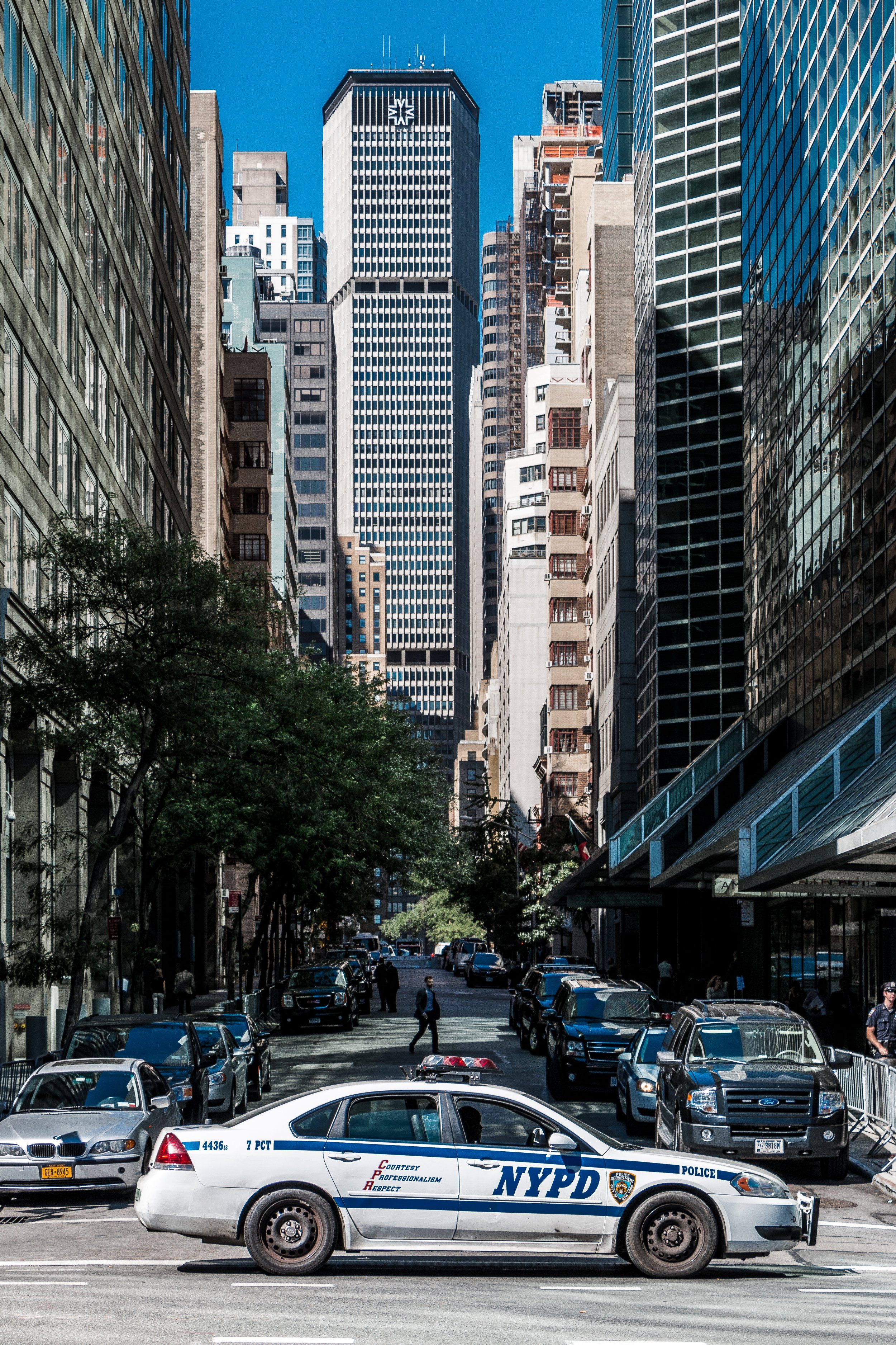
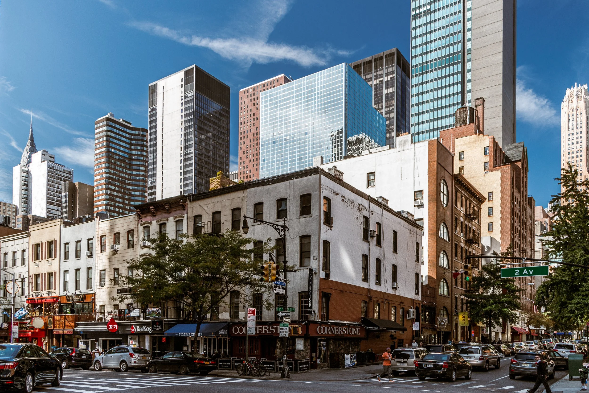
Turtle Bay Photographic Tour
Mid–Late 20th Century: Diplomacy, Modernism, and Domestic Calm
The arrival of the United Nations remade Turtle Bay both physically and symbolically. The East River’s edge, once noisy and noxious, became a landscape of plazas, gardens, and glass towers. Delegates’ missions and diplomatic residences filled nearby streets, bringing languages and flags from around the world. The Hammarskjöld Plaza and Beekman Place area—long a quiet residential enclave—became particularly associated with international life, its brick townhouses and modernist co-ops housing ambassadors and UN staff.
Simultaneously, mid-century architecture reshaped the skyline. The Turtle Bay Gardens Historic District, established in 1966, preserved a row of 20 contiguous townhouses (East 48th–49th Streets between Second and Third Avenues) that share a landscaped communal garden. Conceived in the 1920s by developer William Mathews, the project linked once-separate rear yards into a single verdant courtyard, creating a model of cooperative urban living decades ahead of its time.
Meanwhile, modern apartment towers such as The Horizon House, The Alexander Hamilton Houses, and 860 United Nations Plaza (1966, by Harrison & Abramovitz) introduced vertical luxury and river views without overwhelming the area’s charm. Through these layers of architecture—19th-century brownstone, 1920s renewal, mid-century modernism—Turtle Bay became a living chronicle of New York’s evolving ideals of urban dwelling.
21st Century: Global Identity, Local Character
Today, Turtle Bay remains one of Manhattan’s most quietly cosmopolitan neighborhoods. Diplomats, artists, journalists, and professionals coexist within its narrow grid of leafy streets and high-rise perches. The United Nations Headquarters continues to anchor the community’s identity, while Dag Hammarskjöld Plaza, redesigned in 1999, functions as both civic forecourt and public forum—hosting farmers’ markets, peace rallies, and cultural festivals that reflect the neighborhood’s international dimension.
The area’s residential character endures through its blend of architectural eras: the human-scaled brownstones of Turtle Bay Gardens, the modernist glass towers of the UN corridor, and the dignified co-ops of Beekman Place and East 51st Street. Pocket parks—Peter Detmold Park, Ralph Bunche Park, and the Greenacre Park waterfall at 51st Street—offer reprieve from the urban grid. Despite Midtown’s vertical sprawl encroaching on all sides, Turtle Bay’s rhythm remains introspective: streets shaded by plane trees, the faint toll of river barges, and pedestrians from every nation exchanging greetings in dozens of languages.
Turtle Bay Photo Gallery
Spirit and Legacy
Turtle Bay’s legacy is balance—between global diplomacy and neighborhood intimacy, between glass modernism and 19th-century charm, between the energy of Midtown and the calm of the river. It embodies New York’s capacity to reinvent itself without losing humanity. From the colonial cove where ships once anchored to the cosmopolitan plaza where the world’s nations now meet, Turtle Bay has always faced outward—to the river, to the world, to possibility.
New York City
Use this custom Google map to explore where every neighborhood in all five boroughs of New York City is located.
The Five Boroughs
One of New York City’s unique qualities is its organization in to 5 boroughs: Manhattan, Brooklyn, Queens, The Bronx, and Staten Island. These boroughs are part pragmatic administrative districts, and part vestiges of the region’s past. Each borough is an entire county in New York State - in fact, Brooklyn is, officially, Kings County, while Staten Island is, officially Richmond County. But that’s not the whole story …
Initially, New York City was located on the southern tip of Manhattan (now the Financial District) that was once the Dutch colony of New Amsterdam. Across the East River, another city was rising: Brooklyn. In time, the city planners realized that unification between the rapidly rising cities would create commercial and industrial opportunities - through streamlined administration of the region.
So powerful was the pull of unification between New York and Brooklyn that three more counties were pulled into the unification: The Bronx, Queens, and Staten Island. And on January 1, 1898, the City of New York unified two cities and three counties into one Greater City of New York - containing the five boroughs we know today.
But because each borough developed differently and distinctly until unification, their neighborhoods likewise uniquely developed. Today, there are nearly 390 neighborhoods, each with their own histories, cultures, cuisines, and personalities - and each with residents who are fiercely proud of their corner of The Big Apple.


