
CLOVE LAKES PARK
Staten Island
Geographic Setting
Clove Lakes Park occupies the deep glacial valley that stretches through Staten Island’s North Shore, bounded roughly by Victory Boulevard to the south, Forest Avenue to the north, Martling Avenue and Clove Road to the east, and Slosson Avenue and Royal Oak Road to the west. Nestled between the neighborhoods of West Brighton, Westerleigh, and Castleton Corners, the park forms a green corridor that connects Staten Island’s central highlands to its harbor-facing lowlands.
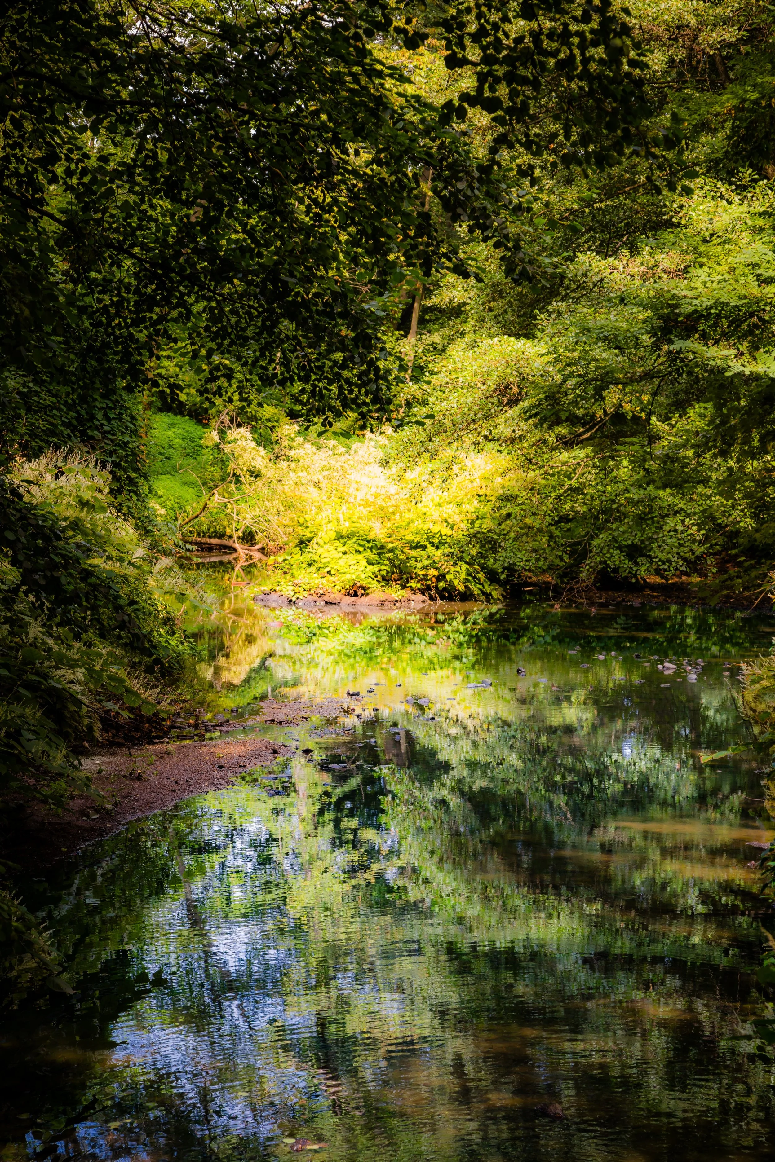
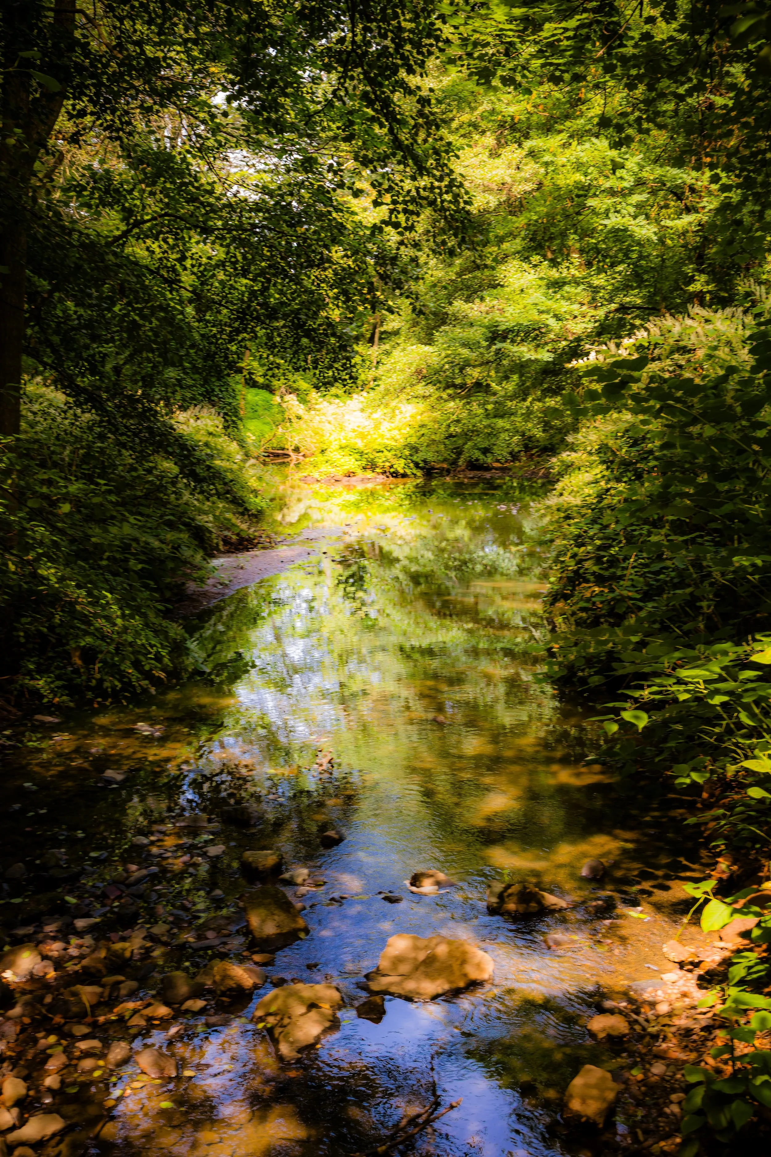
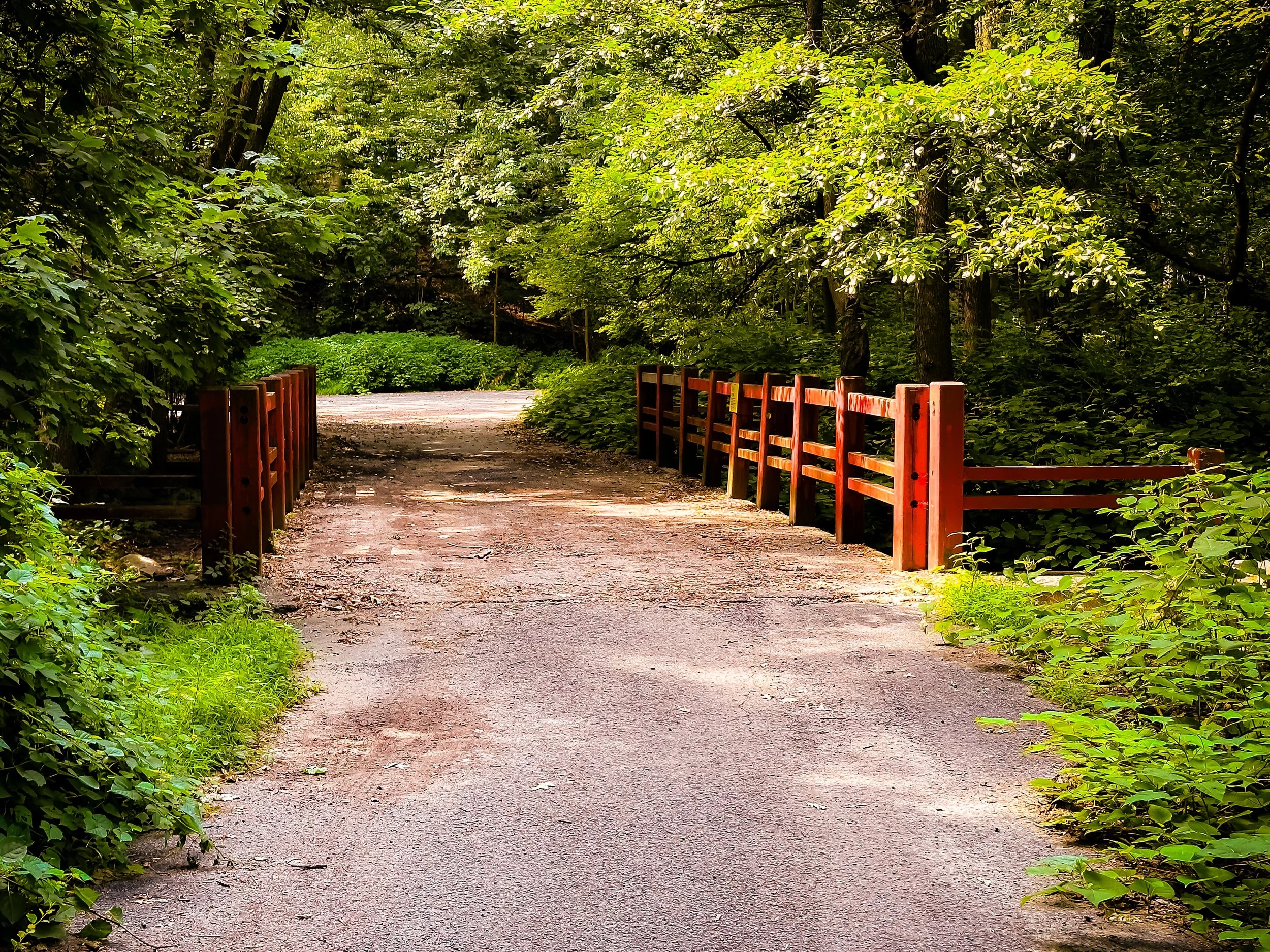
Its topography is among the most striking in New York City: steep wooded slopes, freshwater lakes, meadows, and serpentine rock outcrops carved by retreating glaciers more than 10,000 years ago. Three principal lakes—Clove Lake, Martling Lake, and Brooks Lake—are linked by a meandering stream that flows north toward the Kill Van Kull. The park’s winding drives, stone bridges, and shaded trails reveal a landscape where natural beauty and designed space blend seamlessly. In the heart of Staten Island’s urban fabric, Clove Lakes Park remains a sanctuary of forest, water, and timeless calm.
Etymology
The name Clove derives from the Dutch word “kloven,” meaning “cleft” or “valley.” Early settlers used the term to describe the deep natural ravine—the clove—that cuts between Staten Island’s central ridge and its northern slope. Over time, the stream that ran through it came to be known as the Clove Brook, and the surrounding lands collectively as the Clove Valley. When the City of New York formally acquired the property for parkland in the early 20th century, the historic name was preserved as Clove Lakes Park, honoring both the landscape’s defining geological feature and its string of tranquil lakes.
The Neighborhood
Origins through the 19th Century: From Glacial Valley to Village Green
Long before it became parkland, the valley that is now Clove Lakes Park was a landscape of glacial ponds, dense forests, and fertile meadows inhabited by the Lenape, who used its waterways for fishing and travel. After European settlement in the 17th century, the area was gradually cleared for farms and small mills. The Clove Road, established as an early colonial route, followed the natural gap through the hills, linking Richmondtown to the harbor at Tompkinsville.
By the 18th and early 19th centuries, the Clove Valley was prized for its freshwater springs and scenic beauty. Wealthy Staten Island families built country estates on the surrounding slopes, taking advantage of the cool breezes and shaded woods. The area’s combination of woodland and water gave it an almost pastoral character within reach of New York Harbor.
During the mid-1800s, small industries—sawmills, icehouses, and breweries—operated along the Clove Brook. Ice harvested from the ponds supplied local residents before refrigeration, and the brook’s flow powered water wheels for gristmills. At the same time, the surrounding hills attracted picnickers and naturalists. The “Clove Lakes” became a favored retreat for weekend visitors arriving by carriage or trolley, their appeal heightened by the nearby cricket grounds and villas of West New Brighton.
Early 20th Century: A Park for the People
The formal creation of Clove Lakes Park was part of the great wave of urban park development that transformed New York City in the early 1900s. Following Staten Island’s consolidation into the city in 1898, civic leaders recognized the need to preserve its natural landscapes amid growing suburbanization. In 1921, under the leadership of Parks Commissioner Charles B. Stover, the city began acquiring parcels of the Clove Valley to form a public park.
The design that followed sought to enhance, rather than erase, the valley’s natural contours. Paths and drives were laid to trace the water’s edge, stone bridges and rustic railings emphasized its romantic scenery, and open lawns invited both recreation and repose. The Clove Lakes Park Boathouse (constructed in the 1930s) became an architectural centerpiece, its fieldstone walls and red-tiled roof harmonizing with the wooded backdrop.
During the 1930s, Robert Moses’s ambitious citywide park program brought further improvements: new playgrounds, athletic fields, and ice-skating facilities, along with the Martling Avenue entrance, which formalized access from the east. The park quickly became Staten Island’s premier recreation destination, attracting both locals and visitors drawn to its boating, skating, and picnicking opportunities.
Yet Clove Lakes retained a serenity distinct from the grand formality of Manhattan’s parks. Its charm lay in its intimacy—the feeling of stepping into a natural hollow far removed from the surrounding city.
Clove Lakes Park Video Coming Soon
Mid–Late 20th Century: Community Anchor and Urban Refuge
Through the mid-20th century, Clove Lakes Park remained central to the civic life of Staten Island’s North Shore. Families gathered for Fourth of July picnics, school field days, and ice-skating on the frozen lakes in winter. The park’s meadows hosted community baseball games and neighborhood fairs, while its shaded trails offered solitude within sight of city streets.
The postwar suburban boom of the 1950s and 1960s brought both challenges and improvements. The construction of the Staten Island Expressway (1964) cut across nearby slopes, altering parts of the park’s hydrology and fragmenting its northern approach. Yet residents, through groups such as the Friends of Clove Lakes Park, rallied to preserve and restore the landscape. Tree plantings, erosion control, and wildlife management programs ensured that the park’s ecosystems endured.
In the 1970s, the park gained renewed cultural importance as Staten Island’s demographics shifted and urban green spaces became essential to community identity. The Clove Lakes Park Zoo, though small, delighted generations of children, while the park’s ballfields and picnic areas served families from across the borough. Even during periods of limited city funding, local volunteers maintained trails and organized cleanups, reaffirming the park’s role as both ecological sanctuary and civic commons.
21st Century: Restoration, Ecology, and Enduring Beauty
In the 21st century, Clove Lakes Park stands as one of Staten Island’s crown jewels—a living mosaic of natural and human history. Recent restoration projects have focused on shoreline stabilization, wetland rehabilitation, and the replanting of native species to support biodiversity. Willowbrook Lake’s ecological restoration within the nearby Greenbelt complements Clove Lakes’ role as part of a broader network of connected habitats spanning the island’s interior.
The park today is home to an impressive array of flora and fauna: towering tulip poplars, red oaks, and sweetgums—some over 300 years old—alongside herons, wood ducks, snapping turtles, and foxes. Its network of trails links to Silver Lake Park and the Greenbelt, making it both a neighborhood retreat and a gateway to Staten Island’s larger ecological landscape.
The boathouse and café, restored and reopened for public use, continue to anchor recreation around Clove Lake, where rowboats and pedal boats glide beneath the stone arch bridges in summer. Athletic fields and playgrounds bustle with activity, while joggers and cyclists loop around Martling Avenue’s outer ring. The park’s blend of tranquility and vitality mirrors the borough itself—urban and pastoral, historic and evolving.
Events such as outdoor concerts, charity runs, and cultural festivals keep Clove Lakes central to the island’s communal rhythm. At the same time, preservationists and environmental educators use the park as a classroom, teaching the next generation about conservation, geology, and local history. Few places in New York combine such deep natural beauty with such an active civic spirit.
Clove Lakes Park Photo Gallery
Spirit and Legacy
The spirit of Clove Lakes Park lies in its capacity for renewal. Carved by glaciers, shaped by human hands, and sustained by generations of Staten Islanders, it is both a geological relic and a living refuge. Its lakes mirror the sky; its ancient trees whisper the continuity of centuries. Within its valleys, children learn to skate, couples stroll beneath willows, and communities gather in the shared language of open space.
Its legacy is one of endurance: from colonial pasture to urban parkland, from icehouses to boathouse, from isolation to inclusion. Clove Lakes Park remains the green heart of Staten Island’s North Shore—at once landscape and memory, sanctuary and stage.
New York City
Use this custom Google map to explore where every neighborhood in all five boroughs of New York City is located.
The Five Boroughs
One of New York City’s unique qualities is its organization in to 5 boroughs: Manhattan, Brooklyn, Queens, The Bronx, and Staten Island. These boroughs are part pragmatic administrative districts, and part vestiges of the region’s past. Each borough is an entire county in New York State - in fact, Brooklyn is, officially, Kings County, while Staten Island is, officially Richmond County. But that’s not the whole story …
Initially, New York City was located on the southern tip of Manhattan (now the Financial District) that was once the Dutch colony of New Amsterdam. Across the East River, another city was rising: Brooklyn. In time, the city planners realized that unification between the rapidly rising cities would create commercial and industrial opportunities - through streamlined administration of the region.
So powerful was the pull of unification between New York and Brooklyn that three more counties were pulled into the unification: The Bronx, Queens, and Staten Island. And on January 1, 1898, the City of New York unified two cities and three counties into one Greater City of New York - containing the five boroughs we know today.
But because each borough developed differently and distinctly until unification, their neighborhoods likewise uniquely developed. Today, there are nearly 390 neighborhoods, each with their own histories, cultures, cuisines, and personalities - and each with residents who are fiercely proud of their corner of The Big Apple.


