
KISSENA PARK
Queens
Geographic Setting
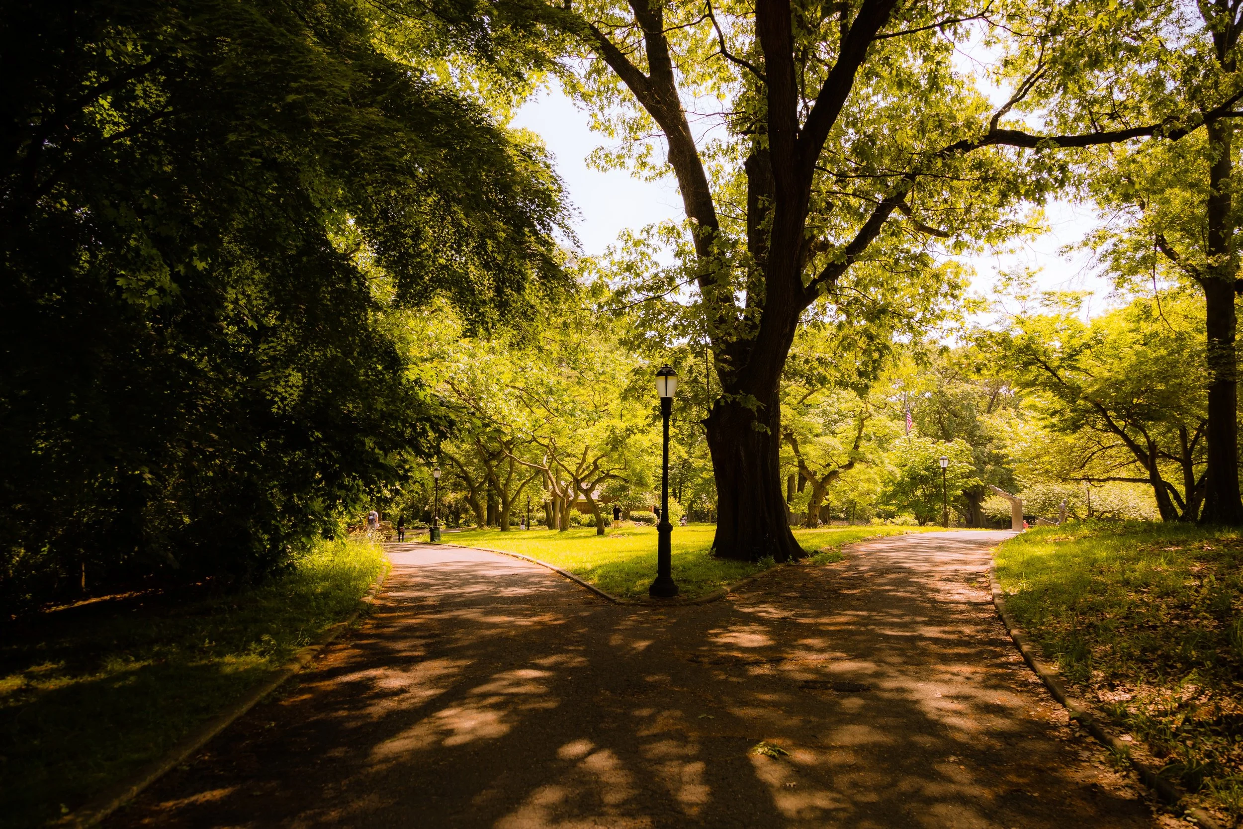
Stretching across more than 230 acres of central Queens, Kissena Park forms the green heart of the borough’s eastern park system. It is bounded by Main Street and Kissena Boulevard on the east, Booth Memorial Avenue to the north, 164th Street to the west, and Jewel Avenue to the south. The park occupies a natural depression carved by retreating glaciers, with low, wooded hills surrounding a central freshwater lake—Kissena Lake—fed by underground springs and stormwater runoff.
The park’s landscape shifts from manicured recreation fields on the western edge to wilder woodlands and wetlands toward the north and east. Biking and walking trails connect to Kissena Corridor Park, which extends westward toward Flushing Meadows–Corona Park, and to the south toward Kew Gardens Hills. The Kissena Velodrome and multiple playgrounds make it both a neighborhood amenity and a citywide destination. Kissena Park is thus not merely a local green space—it is the ecological and historical core of northeastern Queens.
Etymology and Origins
The name “Kissena” is believed to come from a word used by the Lenape people, meaning “it is cold” or “cold water,” in reference to the natural springs that once surfaced in the area. The park’s history, however, begins with the visionary 19th-century horticulturist Samuel Parsons Jr., who in 1870 established the Kissena Nurseries on this very site. Parsons’ family—among New York’s most prominent landscape designers—supplied trees and shrubs for Central Park, Prospect Park, and public gardens throughout the United States.
Parsons named his nursery “Kissena” for the clarity of its water and the healthfulness of its air. He introduced hundreds of exotic species to New York’s ecosystem—Japanese maples, magnolias, and ginkgo trees among them—and transformed this section of Queens into an arboretum of international reputation. When the nursery closed in the early 1900s, the city purchased the land to preserve it as public parkland, thereby ensuring the continuity of Parsons’ environmental legacy.
The Neighborhood
Early 20th Century: From Nursery to Public Park
In 1906, New York City acquired roughly 234 acres from the Parsons estate to create Kissena Park, formally opening it in 1908 as part of the emerging Queens park system. Early planners, guided by Charles Downing Lay, sought to retain the naturalistic spirit of the former nursery. The park’s design emphasized winding carriage drives, open lawns, and groves of mature trees—many remnants of Parsons’ plantings—surrounding the glacial lake at its center.
Throughout the 1910s and 1920s, Kissena Park became a beloved destination for strolling, picnicking, and ice skating. The Kissena Lake boathouse, built in 1912, served visitors for decades, while landscaped trails and scenic bridges invited quiet reflection. The park’s diverse vegetation earned it the nickname “The Jewel of Queens,” a living laboratory of horticultural experimentation within the growing city.
Mid-20th Century: Recreation and Renewal
The postwar era transformed Kissena Park into a major recreational complex under Parks Commissioner Robert Moses. During the 1930s–1950s, ball fields, tennis courts, and playgrounds were added, complementing the park’s pastoral core. In 1963, as part of World’s Fair improvements across Queens, the Kissena Velodrome was constructed—a 400-meter banked bicycle racing track that quickly became a focal point for local and national cycling events. Though damaged by hurricanes in the 1960s, it was later rebuilt and remains one of the few outdoor velodromes in the United States.
The creation of Kissena Corridor Park in the 1960s connected Kissena to Flushing Meadows–Corona Park, forming a continuous greenway through the borough’s center. This linkage fulfilled early 20th-century planners’ vision of an interconnected park system stretching from Jamaica to Flushing Bay. Meanwhile, naturalists and civic groups began restoring overgrown woodlands and preserving remnants of the original Parsons nursery—particularly its rare trees, some of which still stand near 164th Street.
Kissena Park Photographic Video
Late 20th–21st Century: Ecology, Heritage, and Community
In the late 20th century, Kissena Park evolved into both a recreational hub and an ecological preserve. Urban development around it heightened appreciation for its natural habitats, which include meadows, forest groves, and wetland ecosystems supporting more than 150 bird species. The NYC Parks Department and community volunteers initiated restoration programs—clearing invasive species, replanting native trees, and rehabilitating Kissena Lake’s shoreline.
The park’s historic connection to horticulture has reemerged through educational initiatives and interpretive signage that honor Samuel Parsons Jr. and the park’s botanical roots. Annual tree plantings and cycling events, organized by local civic groups and schools, reaffirm its dual legacy as a place of both recreation and stewardship. Nearby institutions—Queens College, John Bowne High School, and Kissena Corridor Community Gardens—extend the park’s environmental mission into daily civic life.
Bowery Photo Gallery
Spirit and Legacy
Kissena Park is more than open space—it is the living continuation of New York’s botanical heritage. Every grove and glade traces its lineage to a time when Queens supplied the trees that shaded Manhattan’s parks. Its lake mirrors not just the sky but the history of landscape design in America, from the naturalism of the 19th century to the ecological consciousness of the present.

New York City
Use this custom Google map to explore where every neighborhood in all five boroughs of New York City is located.
The Five Boroughs
One of New York City’s unique qualities is its organization in to 5 boroughs: Manhattan, Brooklyn, Queens, The Bronx, and Staten Island. These boroughs are part pragmatic administrative districts, and part vestiges of the region’s past. Each borough is an entire county in New York State - in fact, Brooklyn is, officially, Kings County, while Staten Island is, officially Richmond County. But that’s not the whole story …
Initially, New York City was located on the southern tip of Manhattan (now the Financial District) that was once the Dutch colony of New Amsterdam. Across the East River, another city was rising: Brooklyn. In time, the city planners realized that unification between the rapidly rising cities would create commercial and industrial opportunities - through streamlined administration of the region.
So powerful was the pull of unification between New York and Brooklyn that three more counties were pulled into the unification: The Bronx, Queens, and Staten Island. And on January 1, 1898, the City of New York unified two cities and three counties into one Greater City of New York - containing the five boroughs we know today.
But because each borough developed differently and distinctly until unification, their neighborhoods likewise uniquely developed. Today, there are nearly 390 neighborhoods, each with their own histories, cultures, cuisines, and personalities - and each with residents who are fiercely proud of their corner of The Big Apple.


