BENSONHURST
Brooklyn
Geographic Setting
Bounded by 86th Street to the south and 65th Street to the north, and extending from 14th Avenue eastward to Bay Parkway (from 86th to 77th Street) and then Avenue P to McDonald Avenue, Bensonhurst occupies the southwestern heart of Brooklyn’s vast residential plain. Situated inland from the Narrows but only minutes from the sea, it sits between Bath Beach, Dyker Heights, and Mapleton, forming a bridge between Brooklyn’s maritime edge and its central neighborhoods.
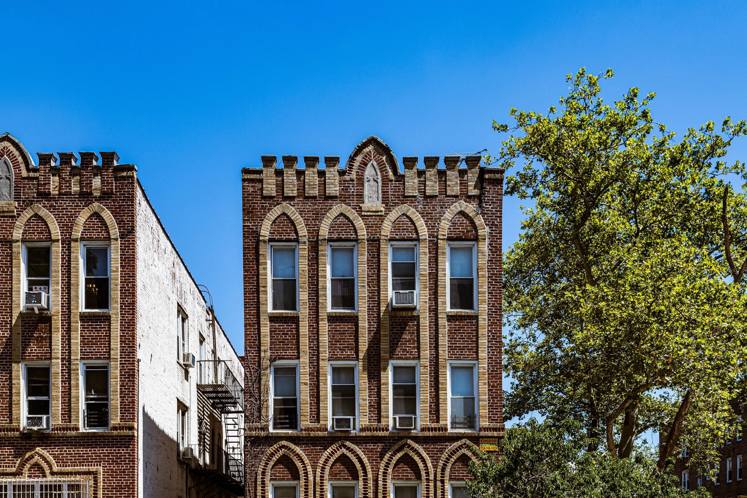
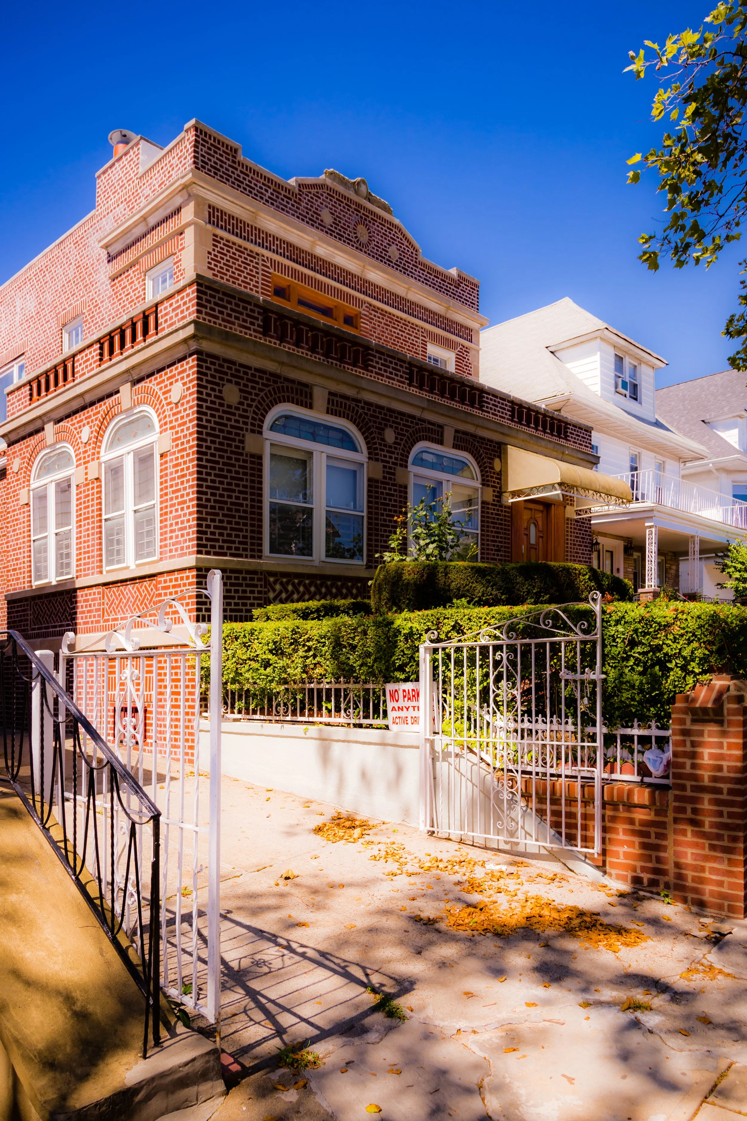
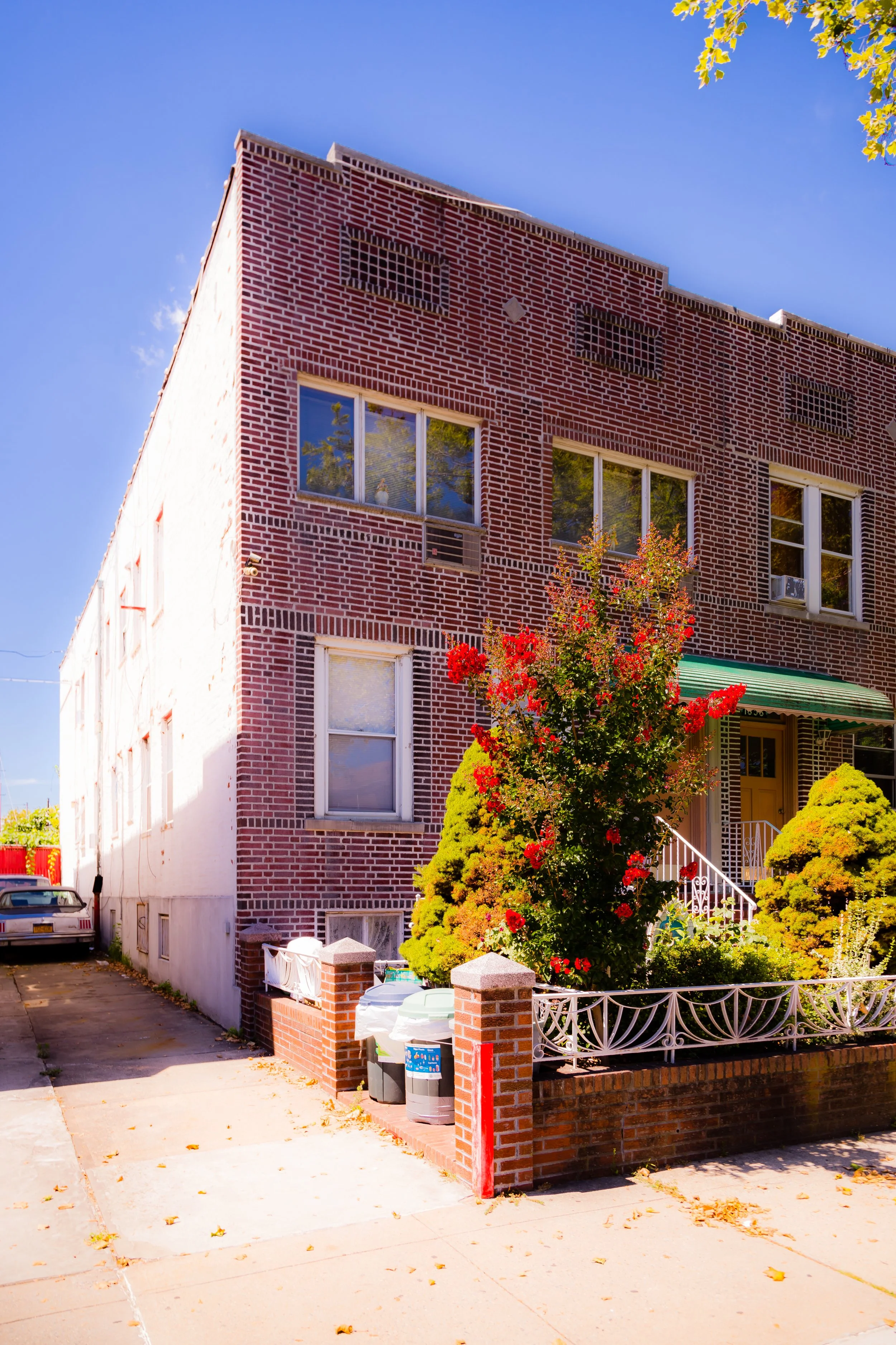
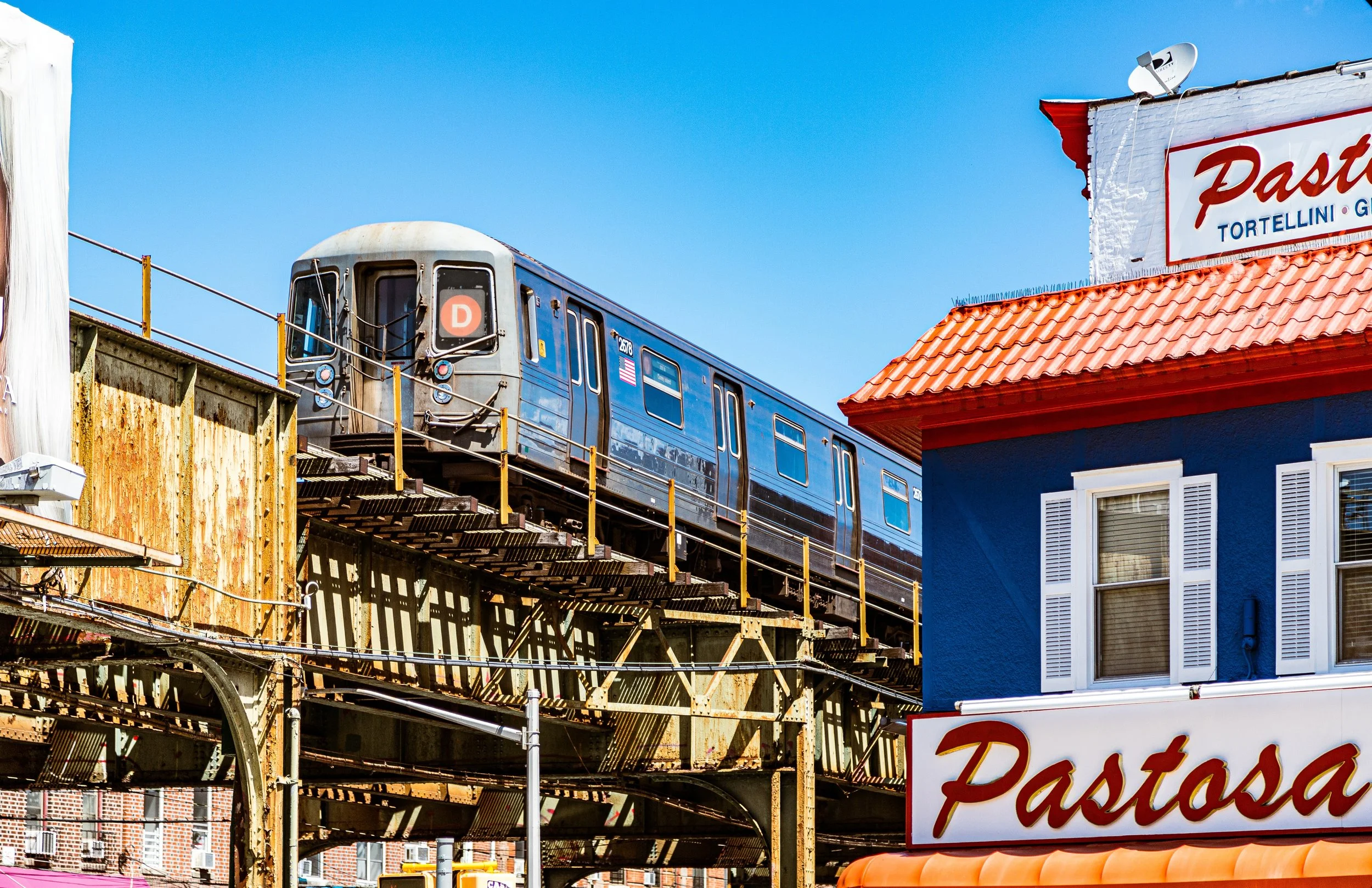
The landscape is distinctly urban-suburban: low-rise homes, attached brick rowhouses, and corner storefronts give Bensonhurst its human scale. Broad commercial corridors—18th Avenue (Cristoforo Colombo Boulevard), Bay Parkway, and 86th Street—serve as cultural arteries, lined with bakeries, greengrocers, and cafés representing generations of immigrants. Between them, quiet side streets with leafy canopies and tight-knit stoops express the neighborhood’s enduring domestic rhythm. The D train runs beneath New Utrecht Avenue, its elevated structure an ever-present reminder of the neighborhood’s working-class energy and connection to the rest of the city.
Etymology and Origins
The name “Bensonhurst” honors Egbert Benson, a prominent New York judge and statesman who acquired land here in the 18th century. His family’s holdings stretched across the southern portion of the old Town of New Utrecht, whose Dutch settlers had cultivated the area’s fertile soil since the 1600s. For much of its early history, the district remained farmland—rows of corn, potatoes, and orchards leading down to the marshes of Gravesend Bay.
The neighborhood’s modern identity took shape in the late 19th century, when Bensonhurst-by-the-Sea, a speculative suburban development, was promoted by the Bensonhurst Land and Improvement Company in the 1880s. The company envisioned a residential enclave connected by rail and designed for families escaping Manhattan’s congestion. Its tree-lined avenues and grid of “Bays” (Bay 8th through Bay 50th Streets) still bear the imprint of that planned suburban vision.
The Neighborhood
19th Century: From Farmland to Streetcar Suburb
Before Brooklyn’s consolidation with New York City in 1898, Bensonhurst was largely rural, dotted with Dutch farmhouses and country lanes. The arrival of the Brooklyn, Bath and Coney Island Railroad (1862)—later integrated into the elevated West End Line (D train)—linked the area to downtown Brooklyn and Coney Island, transforming farmland into commuter territory.
By the 1890s, developers were subdividing lots and constructing wooden frame houses, many with porches and gardens reminiscent of small-town America. Churches, schools, and small hotels followed, serving an influx of German, Irish, and Italian families who arrived as Brooklyn’s population boomed. The proximity to both Coney Island and Dyker Beach Park made Bensonhurst especially attractive to working- and middle-class families seeking fresh air and affordable homes within reach of the city.
The Bensonhurst-by-the-Sea subdivision, stretching toward 86th Street and Bath Beach, was marketed as a “model community” of tree-shaded streets and seaside views. While its resort ambitions faded, the residential fabric it created laid the foundation for the neighborhood’s enduring sense of order and calm.
Early–Mid 20th Century: The Italian Heart of Brooklyn
By the 1920s, Bensonhurst had become one of the city’s largest Italian-American communities, rivaling East Harlem’s “Little Italy.” Waves of immigrants from southern Italy and Sicily brought with them language, cuisine, and deep family traditions. They opened bakeries, butcher shops, and groceries along 18th Avenue and Bay Parkway, establishing a cultural infrastructure that shaped neighborhood life for generations.
Brick rowhouses and two-family homes replaced many older wooden structures during this era, while apartment buildings clustered along 86th Street and New Utrecht Avenue. Parishes such as St. Athanasius (founded 1916) and St. Dominic (1920s) became focal points of faith and community, their feast days marked by processions, music, and fireworks that drew crowds from across Brooklyn.
The neighborhood’s compact blocks fostered an intense sense of belonging. Stoops were extensions of the living room; shopkeepers knew every family by name. Movies like Saturday Night Fever (1977), though stylized, captured this close-knit and sometimes insular world—a community defined by loyalty, labor, and local pride.
Through the Great Depression and World War II, Bensonhurst remained largely stable. Many residents found employment in nearby docks, factories, or the Brooklyn Army Terminal, while neighborhood institutions—from social clubs to candy stores—provided a sense of continuity through turbulent decades.
Neighborhood Video Coming Soon
Late 20th Century: Continuity Amid Change
After 1960, Bensonhurst began to diversify once again. Jewish families from Borough Park, as well as Chinese, Russian, and Middle Eastern immigrants, joined the longstanding Italian core. The construction of the Verrazzano-Narrows Bridge (1964) and the modernization of the Belt Parkway shifted traffic patterns but reinforced the neighborhood’s accessibility.
While other parts of Brooklyn experienced disinvestment, Bensonhurst maintained a strong middle-class base. The 1980s–1990s saw both moments of tension and resilience, as demographic transitions brought new cultures into old spaces. Yet the neighborhood’s defining traits—orderly streets, good schools, and accessible transit—ensured continuity. Festivals such as the Festa di Santa Rosalia along 18th Avenue persisted as living symbols of its Italian heritage, even as new traditions emerged from incoming communities.
21st Century: A Multicultural Stronghold
Today, Bensonhurst is one of Brooklyn’s most diverse and cohesive neighborhoods—a tapestry of old and new Brooklyn intertwined. Its population includes Chinese, Italian, Russian, Arab, and Latino residents living side by side, their cultures reflected in the languages on shop signs and the aromas wafting from kitchens along 86th Street.
Dim sum restaurants, halal markets, and classic pizzerias coexist within blocks of each other. Generations of homeowners still maintain the same rowhouses their grandparents bought, even as newcomers renovate interiors and add modern touches. 18th Avenue, officially co-named Cristoforo Colombo Boulevard, remains the neighborhood’s symbolic heart, bustling with bakeries, clothing shops, and cafés that blend the familiar and the evolving.
Community life remains strong, centered on local parishes, schools, and civic organizations. The sense of continuity—families, stoops, block associations, corner delis—anchors Bensonhurst against the rapid changes sweeping much of the city. The soundscape of multiple languages, the mix of old storefront neon and new LED signs, and the scent of espresso mingling with scallion pancakes all testify to a neighborhood both grounded and global.
Bensonhurst Photo Gallery
Spirit and Legacy
Bensonhurst’s legacy is one of enduring neighborhood identity amid constant change. It has absorbed wave after wave of newcomers—Dutch farmers, Italian immigrants, Jewish merchants, Chinese restaurateurs—yet maintained a core ethos of family, stability, and small-scale urban life. Its streets are not showy, but they possess something more lasting: a collective pride that turns ordinary blocks into community landmarks.
New York City
Use this custom Google map to explore where every neighborhood in all five boroughs of New York City is located.
The Five Boroughs
One of New York City’s unique qualities is its organization in to 5 boroughs: Manhattan, Brooklyn, Queens, The Bronx, and Staten Island. These boroughs are part pragmatic administrative districts, and part vestiges of the region’s past. Each borough is an entire county in New York State - in fact, Brooklyn is, officially, Kings County, while Staten Island is, officially Richmond County. But that’s not the whole story …
Initially, New York City was located on the southern tip of Manhattan (now the Financial District) that was once the Dutch colony of New Amsterdam. Across the East River, another city was rising: Brooklyn. In time, the city planners realized that unification between the rapidly rising cities would create commercial and industrial opportunities - through streamlined administration of the region.
So powerful was the pull of unification between New York and Brooklyn that three more counties were pulled into the unification: The Bronx, Queens, and Staten Island. And on January 1, 1898, the City of New York unified two cities and three counties into one Greater City of New York - containing the five boroughs we know today.
But because each borough developed differently and distinctly until unification, their neighborhoods likewise uniquely developed. Today, there are nearly 390 neighborhoods, each with their own histories, cultures, cuisines, and personalities - and each with residents who are fiercely proud of their corner of The Big Apple.


