MEADOWMERE
Queens
Geographic Setting
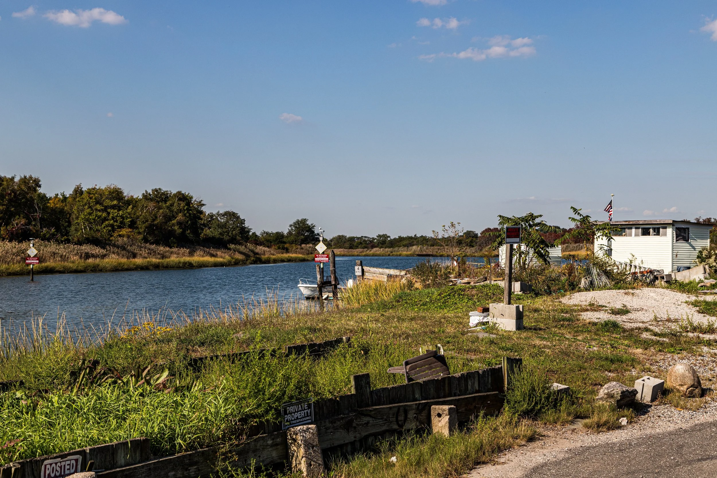
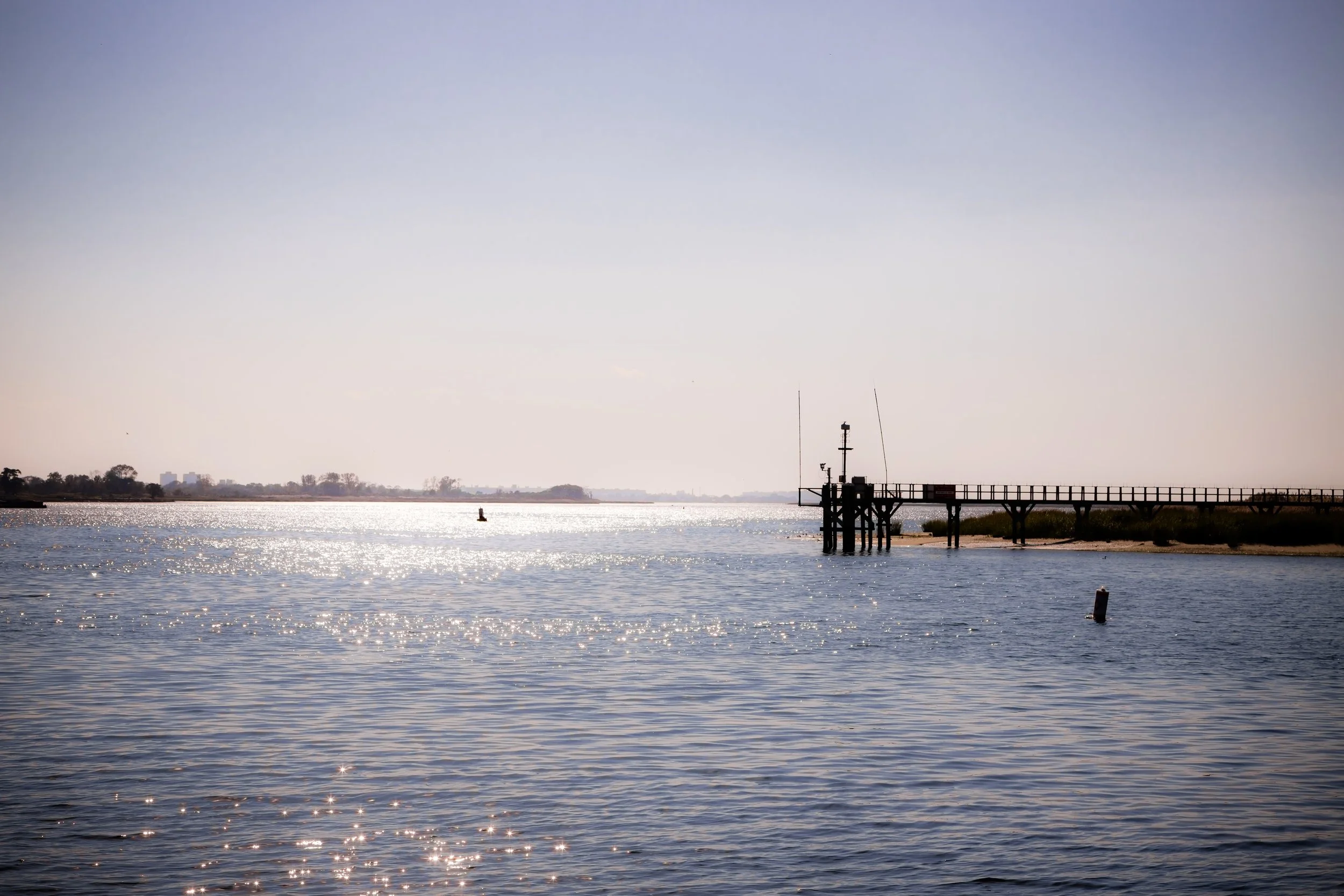
Tucked into the southeasternmost corner of Queens, Meadowmere is one of the smallest and most geographically isolated neighborhoods in New York City—a quiet cluster of houses set amid the marshlands of Hook Creek near the Nassau County line. It lies between Rockaway Boulevard to the north, Hook Creek Boulevard and Nassau County (Meadowmere Park, Long Island) to the east, and the tidal inlets of Jamaica Bay to the south and west.
The area is bisected by Hook Creek, a narrow tidal channel spanned by the Hook Creek Footbridge, the only pedestrian bridge connecting New York City directly to Nassau County. The surrounding landscape—salt grasses, creeks, and wetlands—gives Meadowmere a coastal village atmosphere more akin to the South Shore of Long Island than to the city it belongs to. Modest frame houses line Meadowmere Park Road, Sutton Park Drive, and Bayswater Boulevard, their porches facing quiet waters where egrets and herons feed at low tide. Though only minutes from the bustle of Green Acres Mall and Kennedy Airport, Meadowmere feels worlds away—an enclave at the literal edge of the metropolis.
Etymology and Origins
The name “Meadowmere” emerged in the early 20th century, combining “meadow,” for the salt-grass wetlands that dominate the area, and “mere,” an old English term for a lake or body of water. Long before European settlement, these marshes were part of the traditional lands of the Rockaway and Massapequa peoples, who fished and gathered shellfish along Jamaica Bay. By the 18th and 19th centuries, the area formed part of the Hook Creek Meadows, used by colonial farmers for grazing and haying.
The land remained undeveloped well into the 20th century, owned largely by estates and private investors who considered it unsuitable for large-scale agriculture or construction due to its low elevation and frequent flooding. The construction of Rockaway Boulevard and the dredging of Hook Creek in the early 1900s provided access and drainage, setting the stage for limited residential development.
The Neighborhood
Early 20th Century: A Remote Coastal Hamlet
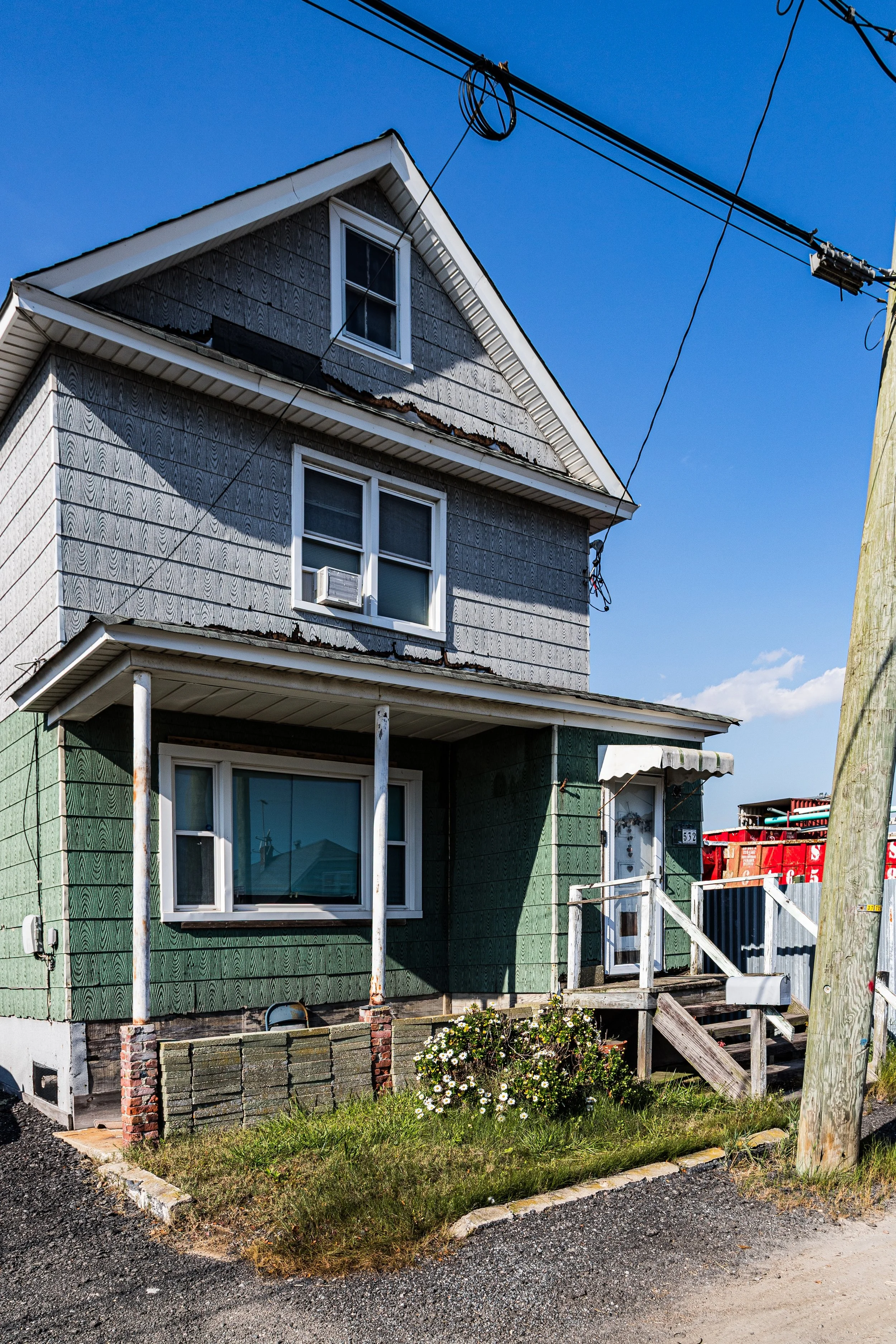
Meadowmere’s development began in earnest during the 1920s and 1930s, when small parcels were sold for summer cottages and fishing shacks. Families from Brooklyn and Jamaica purchased lots along the creek, drawn by the promise of affordable waterfront property. Houses were built on pilings or raised foundations, often from salvaged materials, and reached by unpaved roads that turned to mud after storms. Electricity and city water arrived late, and even into the 1950s, residents relied on septic systems and cisterns.
Despite these challenges, the community developed a strong sense of independence and self-reliance. The Meadowmere Civic Association (later merged with Meadowmere Park Association across the county line) organized social events, cleanup drives, and neighborhood watches. The footbridge over Hook Creek—constructed in wood in the 1930s and later rebuilt in steel—became both a literal and symbolic link between two worlds: New York City and suburban Long Island.
Mid-20th Century: Isolation and Resilience
Through the mid-century decades, Meadowmere remained a hidden enclave of working-class homeowners and retirees. Many residents worked at JFK International Airport, located only a few miles to the west, or in nearby Rosedale and Valley Stream. The area’s isolation—bounded by wetlands and lacking direct road connections to the rest of Queens—fostered a tight-knit community where neighbors depended on one another during storms and floods.
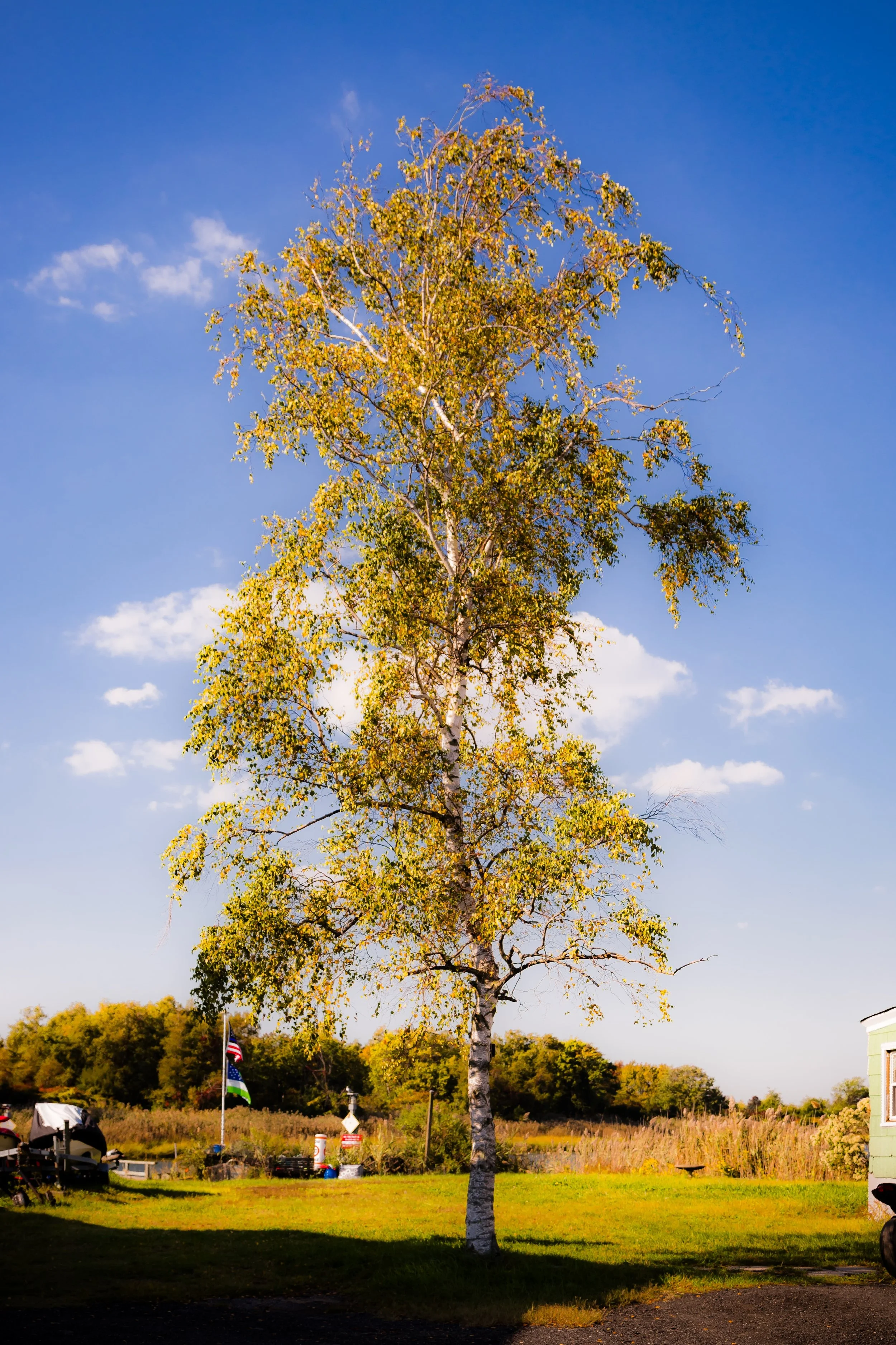
Houses remained small, most single-story wood-frame cottages painted in bright coastal colors. Gardens bloomed in raised beds, and the narrow lanes gave the neighborhood a distinctly rural feel. Local lore recounts neighborhood gatherings and clam bakes along the creek, as well as the occasional sight of egrets nesting on telephone poles. Yet flooding was constant; Hurricanes Donna (1960) and Gloria (1985) inundated streets, and even moderate tides could turn lanes into canals.
Meadowmere Video Coming Soon
Late 20th Century: Endurance at the Edge
By the 1980s and 1990s, Meadowmere’s seclusion had become both its charm and its challenge. Its residents—predominantly middle- and working-class families—continued to maintain their homes despite increasing environmental vulnerability. Proposals for buyouts or relocation were repeatedly debated, but most residents resisted, citing deep roots and community identity.
The neighborhood’s unusual geography attracted attention from urban planners and journalists, who dubbed it “New York’s forgotten coastal village.” Infrastructure improvements came slowly: partial sewer installations, elevated power lines, and stormwater management projects sought to mitigate chronic flooding. Yet the sense of autonomy persisted. Meadowmere became known for its neighborly vigilance, informal volunteer fire patrols, and shared determination to remain a living community rather than a ghost of the bay.
21st Century: Rising Tides, Steadfast Spirit
The 21st century has brought both renewal and reckoning. Hurricane Sandy (2012) devastated Meadowmere, flooding nearly every home and severing access to the mainland for days. In the storm’s aftermath, residents rebuilt—some elevating homes several feet above previous flood levels, others relocating temporarily but returning as soon as possible. Community solidarity deepened through hardship; cleanup efforts, mutual aid, and FEMA grants slowly restored the neighborhood.
Today, Meadowmere stands as one of the most unusual inhabited places in New York City—technically part of Queens but separated from it by wetlands and accessible mainly via Nassau County’s road grid. Environmental restoration projects along Hook Creek aim to protect both the community and the fragile estuary, while long-term discussions continue about managed retreat versus resilient adaptation. Despite its small size—fewer than 100 homes—Meadowmere’s identity is unshakable: a maritime hamlet defying the tides.
Meadowmere Photo Gallery
Spirit and Legacy
Meadowmere is the city’s quiet frontier—a reminder that New York’s borders include not just towers and asphalt but salt marsh and tidewater. Its resilience, tested by storms and isolation, embodies the stubborn endurance of coastal life. The same forces that threaten its future—the sea, the weather, the shifting shoreline—also define its beauty.
New York City
Use this custom Google map to explore where every neighborhood in all five boroughs of New York City is located.
The Five Boroughs
One of New York City’s unique qualities is its organization in to 5 boroughs: Manhattan, Brooklyn, Queens, The Bronx, and Staten Island. These boroughs are part pragmatic administrative districts, and part vestiges of the region’s past. Each borough is an entire county in New York State - in fact, Brooklyn is, officially, Kings County, while Staten Island is, officially Richmond County. But that’s not the whole story …
Initially, New York City was located on the southern tip of Manhattan (now the Financial District) that was once the Dutch colony of New Amsterdam. Across the East River, another city was rising: Brooklyn. In time, the city planners realized that unification between the rapidly rising cities would create commercial and industrial opportunities - through streamlined administration of the region.
So powerful was the pull of unification between New York and Brooklyn that three more counties were pulled into the unification: The Bronx, Queens, and Staten Island. And on January 1, 1898, the City of New York unified two cities and three counties into one Greater City of New York - containing the five boroughs we know today.
But because each borough developed differently and distinctly until unification, their neighborhoods likewise uniquely developed. Today, there are nearly 390 neighborhoods, each with their own histories, cultures, cuisines, and personalities - and each with residents who are fiercely proud of their corner of The Big Apple.


