HARDING PARK
The Bronx
Geographic Setting
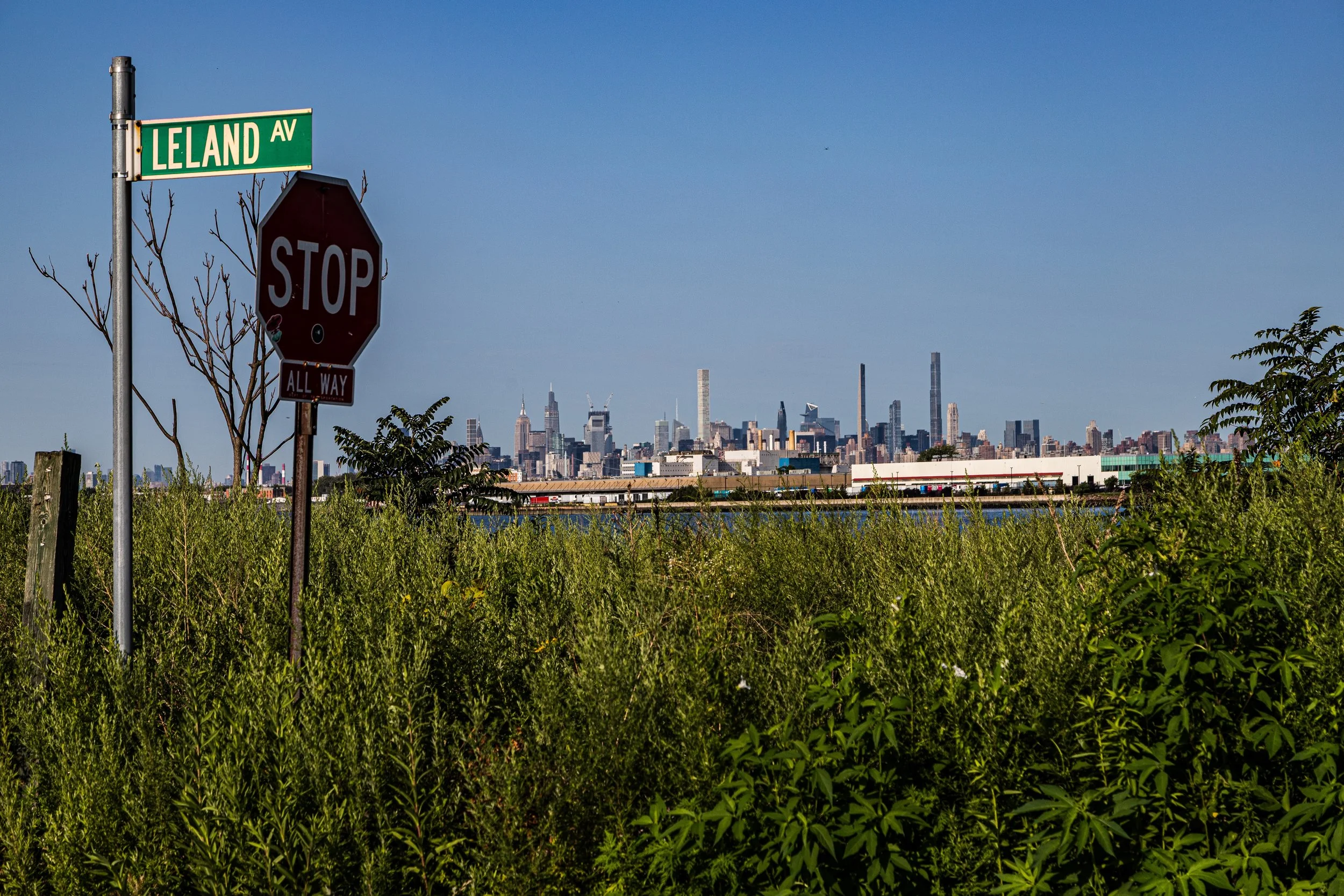
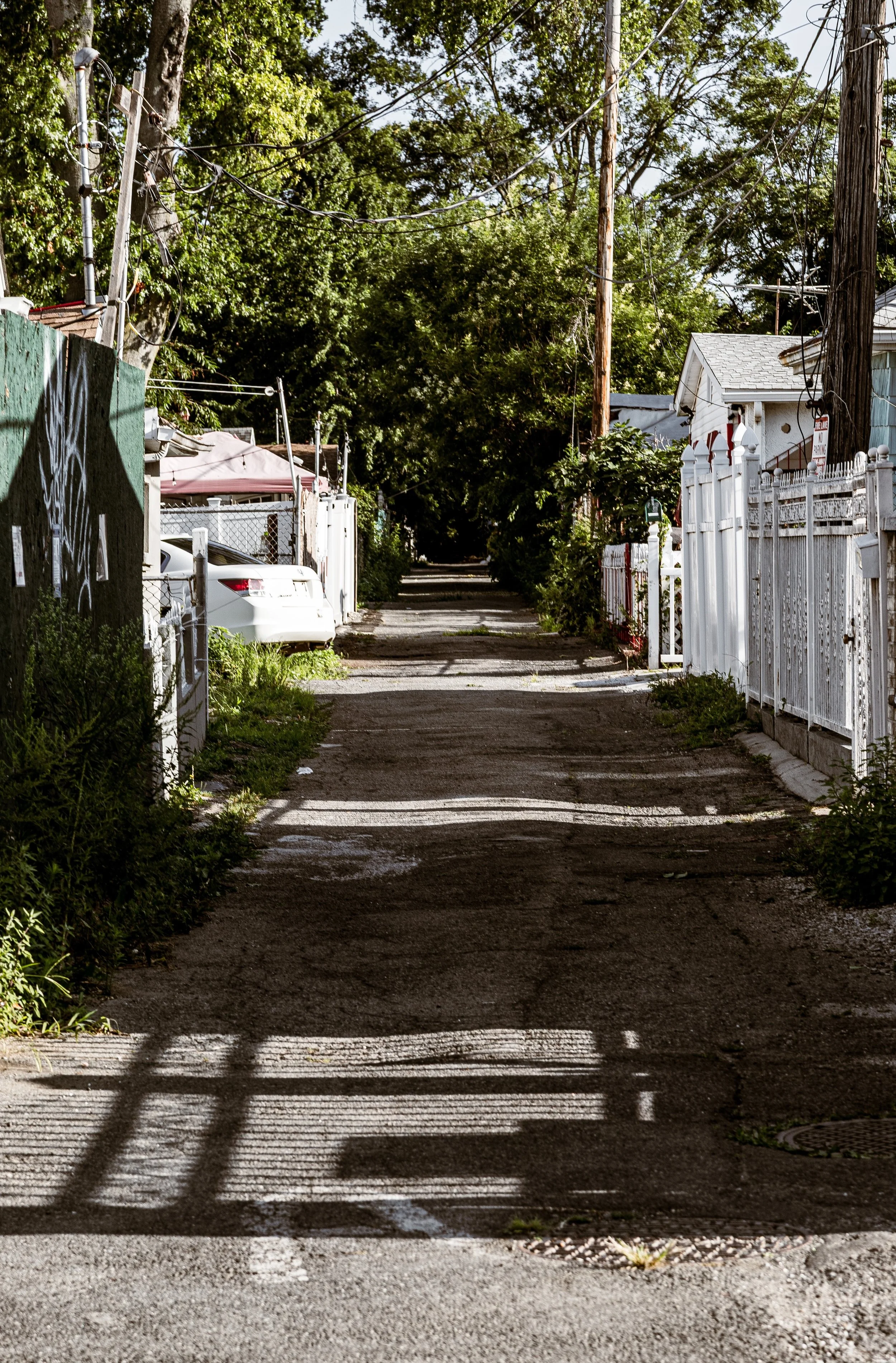
Bounded by O’Brien Avenue to the north, Bolton Avenue to the east, and the Bronx River curving around its southern and western edges, Harding Park occupies a quiet, peninsular pocket of the Soundview section of the Bronx. Surrounded on three sides by water, the neighborhood forms a small, low-lying enclave that feels almost separate from the rest of the city—an intimate settlement of modest homes, narrow lanes, and sweeping river views that evoke a bygone maritime era. The community is reached primarily via Lafayette Avenue, which leads south toward the peninsula’s narrow entrance before giving way to Croes Avenue and Underhill Avenue, winding through small residential streets such as Harding Park Lane, Havemeyer Avenue, and Gildersleeve Avenue.
The neighborhood sits directly opposite Soundview Park, across the tidal estuary of the Bronx River, with the skyline of Hunts Point visible across the water. Its geography—marshy, salt-edged, and wind-swept—has shaped every aspect of its identity. Wooden docks, backyard boats, and waterfront gardens line the riverbank, where herons, gulls, and ospreys share space with kayakers and fishermen. Harding Park’s isolation gives it a distinctive sense of community, while its proximity to Sheridan Boulevard and the Bruckner Expressway keeps it connected to the broader Bronx and Manhattan beyond.
Etymology
Harding Park takes its name from President Warren G. Harding, the 29th President of the United States, whose brief tenure (1921–1923) coincided with the period when the area’s early bungalows were first constructed. Originally conceived as a summer retreat, the settlement was christened “Harding Park” by its developers in the 1920s, part of a national trend of naming new residential tracts after political leaders to evoke patriotism and modernity.
Locally, the name also came to represent aspiration—a promise of peaceful, modest living along the water’s edge for working-class New Yorkers seeking an escape from the crowded tenements of the city. Over time, “Harding Park” ceased to refer to a development company and instead came to signify the enduring waterfront community itself.
The Neighborhood
Origins through the 19th Century
Before its transformation into a residential enclave, the land now known as Harding Park was part of the marshy tidal flats that fringed the Bronx River Estuary. In the 18th and early 19th centuries, this area belonged to the vast estates of West Farms, later annexed to New York City in 1895. It remained undeveloped for decades, used mainly for grazing and oyster harvesting, its muddy banks and salt meadows considered unsuitable for dense settlement.
By the late 19th century, nearby Soundview and Clason Point were beginning to attract visitors as recreational destinations, with ferries carrying families from Manhattan to beaches and amusement piers along the East River. The future Harding Park site remained quiet but strategically located—a small rise above the wetlands that could accommodate cottages and docks once landfilling began.
The shift from wilderness to neighborhood came in the 1920s, as urban workers sought affordable leisure properties. The area’s isolation and waterfront access made it ideal for small seasonal homes, and by the mid-1920s, modest wooden bungalows dotted the peninsula—many built by hand from salvaged materials and designed for weekend use.
Early 20th Century: From Summer Colony to Year-Round Community
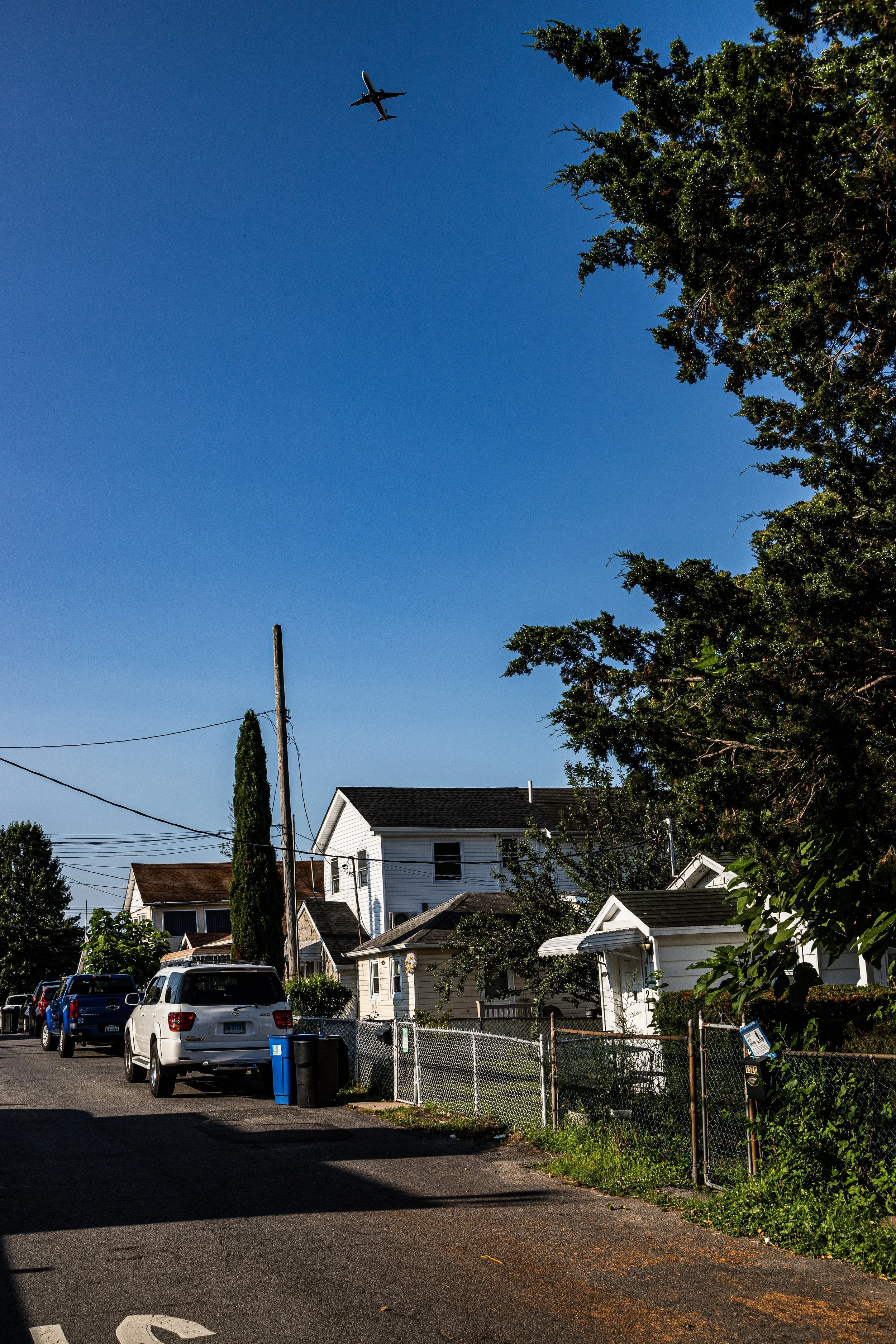
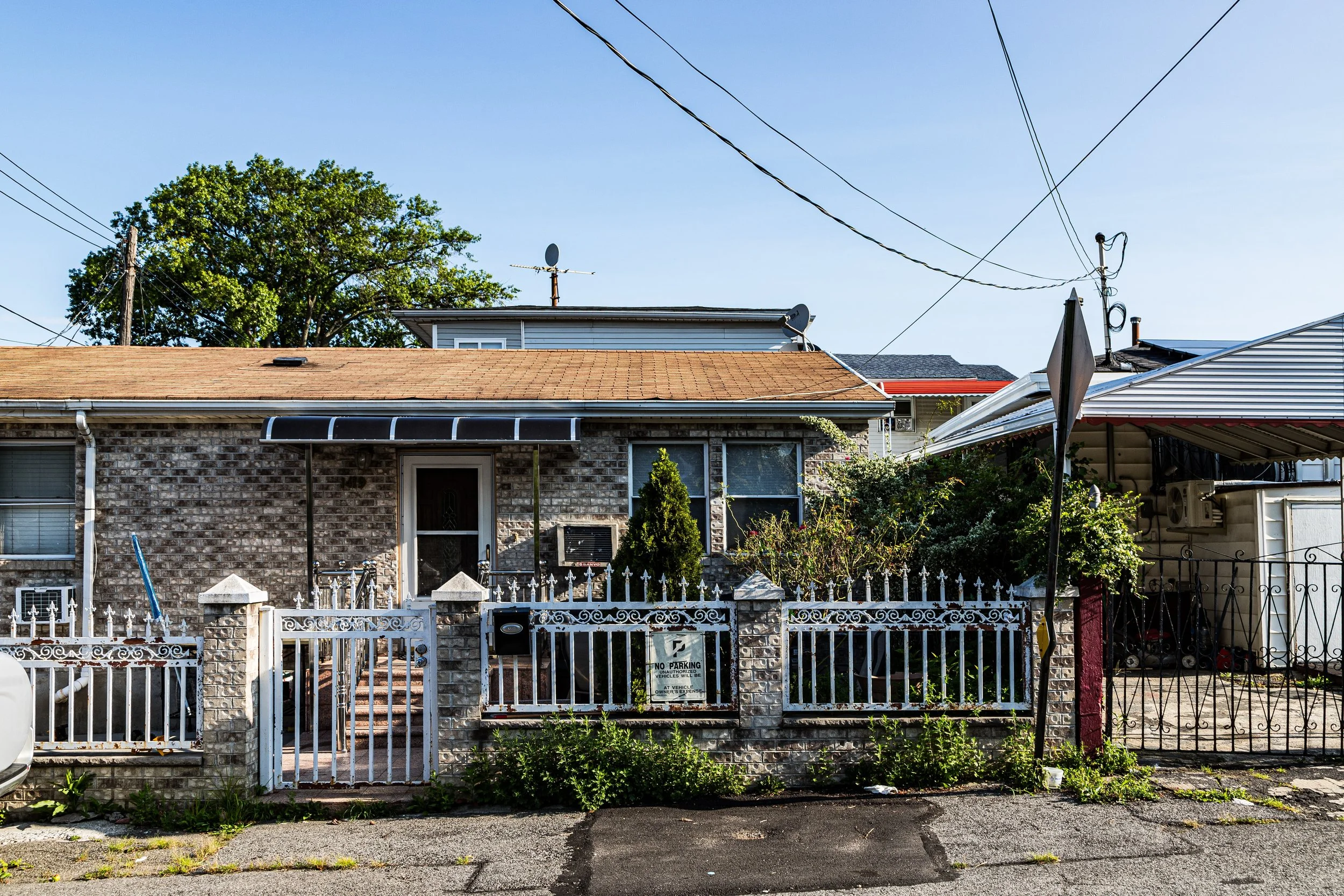
During the 1920s and 1930s, Harding Park developed as a bungalow colony—a self-built settlement of carpenters, dockworkers, and tradesmen who pooled resources to construct simple cottages along the riverbank. Initially accessible only by dirt road and plank bridges, the area offered affordable leisure and independence at a time when formal suburban living remained out of reach for most working-class families.
By the 1940s, many of the original summer residents—largely Irish, Italian, and Jewish New Yorkers—had converted their bungalows into year-round homes. The community, though lacking in city infrastructure such as paved roads and sewer lines, was close-knit and self-governing. Residents established informal associations to manage repairs, organize events, and represent the enclave to the city. Children played along the docks, neighbors shared gardens, and boats were as common a sight as cars.
Harding Park’s seclusion, however, came at a cost. The city’s reluctance to invest in infrastructure for what was viewed as “temporary” housing left residents dependent on private wells and septic systems. Still, the sense of autonomy—born from its geography and self-reliant ethos—became a defining trait of the neighborhood’s identity.
Harding Park Video Coming Soon
Mid–Late 20th Century: The People’s Park and Urban Survival
The 1950s–1970s were years of transformation and struggle. As the South Bronx experienced waves of disinvestment, Harding Park’s remoteness shielded it from much of the urban decline that struck inland neighborhoods. Yet its unregulated status left it vulnerable to city redevelopment plans. In 1959, New York City moved to condemn Harding Park’s land for public use, intending to redevelop it as parkland. Residents—led by a coalition of homeowners and tenants—fought back.
Their organizing culminated in the formation of the Harding Park Homeowners Association (HPHA), which launched a prolonged legal battle against eviction. In a remarkable act of self-determination, the residents negotiated with the city for collective ownership. In 1982, after decades of activism, they succeeded in purchasing the land collectively for $1,000,000, transforming Harding Park into one of the city’s first resident-owned cooperatives. This victory earned it the nickname “The People’s Park”, symbolizing grassroots triumph over bureaucracy and neglect.
During the 1980s and 1990s, residents worked tirelessly to rehabilitate aging homes, install sewers and utilities, and secure official recognition from city agencies. Despite modest means, the cooperative’s perseverance restored the neighborhood’s livability while preserving its independent character.
21st Century: Preservation, Renewal, and Waterfront Revival
In the 21st century, Harding Park stands as one of the Bronx’s most unique communities—a waterfront enclave of detached cottages and bungalows, many still dating from the 1920s. While the broader South Bronx has undergone waves of redevelopment, Harding Park has maintained its intimate, small-town atmosphere. Recent infrastructure improvements, including street paving, drainage, and shoreline stabilization, have enhanced quality of life without erasing the neighborhood’s rustic charm.
Environmental awareness has become central to Harding Park’s identity. Situated at the confluence of the Bronx River and Pugsley Creek, the area is part of the city’s expanding Bluebelt and Bronx River Greenway systems. Residents collaborate with organizations such as the Bronx River Alliance and NYC Parks to protect wetlands, manage stormwater, and maintain biodiversity. These initiatives have reconnected Harding Park to the river that shaped it, transforming its once-neglected waterfront into a space for kayaking, fishing, and birdwatching.
Culturally, the neighborhood remains diverse—its population now a mix of Latino, Caribbean, and long-established Italian-American families—bound by a strong cooperative tradition. Its quiet streets, water views, and communal spirit continue to attract those seeking a sense of refuge within the city.
Harding Park Photo Gallery
Spirit and Legacy
The spirit of Harding Park lies in its duality: at once humble and heroic, both secluded and deeply civic. Built by working hands on borrowed land, it survived through self-organization and collective will, standing as proof that community can flourish even at the city’s forgotten edges.
New York City
Use this custom Google map to explore where every neighborhood in all five boroughs of New York City is located.
The Five Boroughs
One of New York City’s unique qualities is its organization in to 5 boroughs: Manhattan, Brooklyn, Queens, The Bronx, and Staten Island. These boroughs are part pragmatic administrative districts, and part vestiges of the region’s past. Each borough is an entire county in New York State - in fact, Brooklyn is, officially, Kings County, while Staten Island is, officially Richmond County. But that’s not the whole story …
Initially, New York City was located on the southern tip of Manhattan (now the Financial District) that was once the Dutch colony of New Amsterdam. Across the East River, another city was rising: Brooklyn. In time, the city planners realized that unification between the rapidly rising cities would create commercial and industrial opportunities - through streamlined administration of the region.
So powerful was the pull of unification between New York and Brooklyn that three more counties were pulled into the unification: The Bronx, Queens, and Staten Island. And on January 1, 1898, the City of New York unified two cities and three counties into one Greater City of New York - containing the five boroughs we know today.
But because each borough developed differently and distinctly until unification, their neighborhoods likewise uniquely developed. Today, there are nearly 390 neighborhoods, each with their own histories, cultures, cuisines, and personalities - and each with residents who are fiercely proud of their corner of The Big Apple.


