
HIGHLAND PARK
Brooklyn
Geographic Setting
Commanding one of the highest natural ridges in New York City, Highland Park crowns the border between Brooklyn and Queens, rising above the neighborhoods of Cypress Hills, East New York, and Ridgewood. It spans roughly from Jamaica Avenue and Crescent Street in the north to Highland Boulevard and Jackie Robinson Parkway in the south, and from Force Tube Avenue on the west to Cleveland Street and the Cemetery Belt on the east. Straddling the borough line, it is both neighborhood and park — a green highland that unites landscape, history, and community across generations.
Etymology and Origins
The name “Highland Park” derives directly from its topography. This ridge, a remnant of the terminal moraine left by retreating glaciers some 20,000 years ago, rises sharply above the coastal plain of southern Brooklyn, offering sweeping views of Manhattan, Jamaica Bay, and the Rockaways. The term highland first appeared in city documents in the 1890s, when plans for a public park were drawn to preserve the scenic hilltop then threatened by quarrying and development.
Long before city planners, the Canarsee Lenape used this elevated ground as a lookout and hunting range. In colonial times, it fell within the Dutch town of New Lots, where 18th- and early 19th-century farmers cultivated fields at the base of the ridge while leaving the rocky upper slopes wooded. Its strategic height later gave the area significance during the American Revolution, when British forces used the ridge for surveillance after the Battle of Long Island in 1776.
The Neighborhood
19th Century: The Birth of a Park
By the mid-19th century, Brooklyn’s population was booming, and civic leaders began envisioning a network of parks to serve the growing city. While Prospect Park became the crown jewel, Highland Park emerged as its eastern counterpart — smaller, wilder, and more topographically dramatic.
In 1856, the Ridgewood Reservoir was constructed atop the ridge to supply water to the City of Brooklyn. Its three vast basins, built of stone and earthen embankments, were connected to the Jamaica Water Supply system. The reservoir’s location made it both practical and picturesque; even as it served the city’s infrastructure, the surrounding landscape remained a natural retreat.
By the 1890s, as the reservoir’s role diminished, city officials formally designated the surrounding 100 acres as public parkland. The Brooklyn Parks Department developed carriage drives, promenades, and picnic groves, blending the reservoir’s engineered grandeur with the romantic landscape ideals of the period. In 1905, the name “Highland Park” became official.
Early 20th Century: A Civic Hilltop
During the early 1900s, Highland Park blossomed as a recreational destination. Families from East New York and Cypress Hills climbed its hills for weekend outings, drawn by its breezes and panoramic views. The park featured ornamental gardens, ball fields, and Highland Boulevard, a scenic roadway designed for carriage rides and early automobiles.
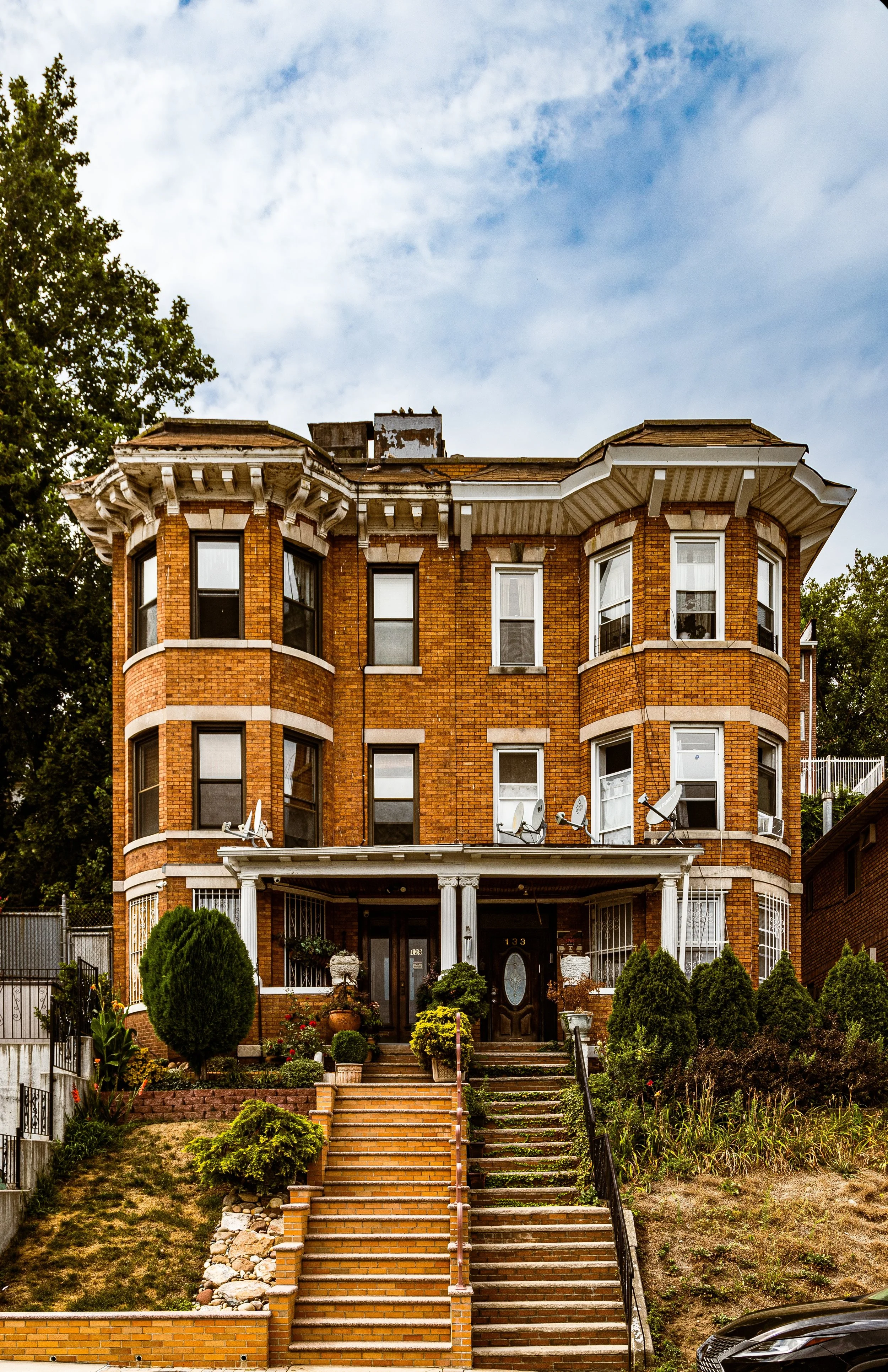
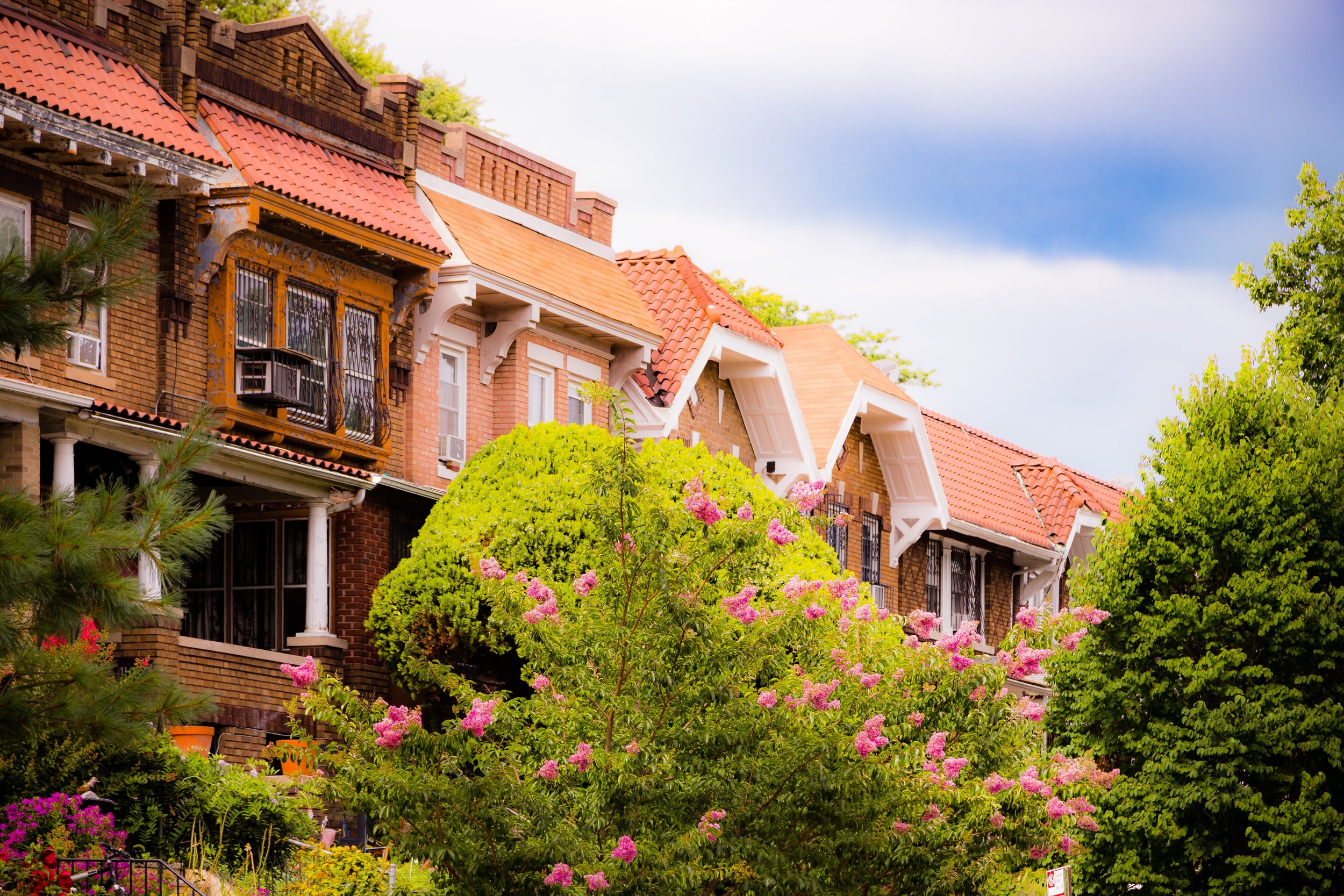
Surrounding the park, residential development followed swiftly. Streets such as Etna Street, Barbey Street, and Elton Street filled with rows of brick and limestone townhouses, their stoops facing the tree-shaded hill. Immigrant families — German, Irish, Italian, and later Jewish — formed the backbone of these new blocks. Churches and synagogues anchored the growing community, including St. Malachy’s Church (1909) and Hebrew Educational Society of East New York.
By the 1930s, the park had become a center of civic life. Baseball and handball courts were installed, playgrounds built, and terraces added overlooking the Ridgewood Reservoir. From the ridge, one could see the Manhattan skyline rising to the west — a symbol of both proximity and distance from the metropolis below.
Highland Park Photographic Video
Mid-20th Century: Decline and Survival
The postwar years brought challenges familiar to many Brooklyn neighborhoods. Industrial decline in nearby East New York and disinvestment in park maintenance left Highland Park weathered but unbowed. As the city’s population shifted, new waves of residents — particularly Puerto Rican, Dominican, and later Caribbean-American families — made the area home.
During the 1960s and 1970s, the park suffered from neglect and vandalism, yet remained a vital green space for local youth. The adjoining Ridgewood Reservoir, decommissioned in 1959, became overgrown — a forgotten landscape of reeds and willows rising within the old stone basins. Ironically, this neglect would preserve it. As the city’s infrastructure moved on, nature reclaimed the site, creating one of New York’s most unexpected urban wildernesses.
21st Century: Restoration and Renewal
In the 2000s, Highland Park and the Ridgewood Reservoir entered a renaissance. Community activists, environmental groups, and the New York City Parks Department united to restore the park’s historic landscapes and recognize its ecological importance. The reservoir was designated a protected wetland and a historic site, its wooden boardwalks and observation platforms inviting visitors to explore what has become one of the city’s premier bird habitats.
Highland Park itself underwent extensive renovation. Ball fields were rebuilt, walking paths resurfaced, and native plantings reintroduced. The park’s summit, crowned by the Highland Park War Memorial and its flagpole, once again serves as a gathering point for local celebrations and commemorations.
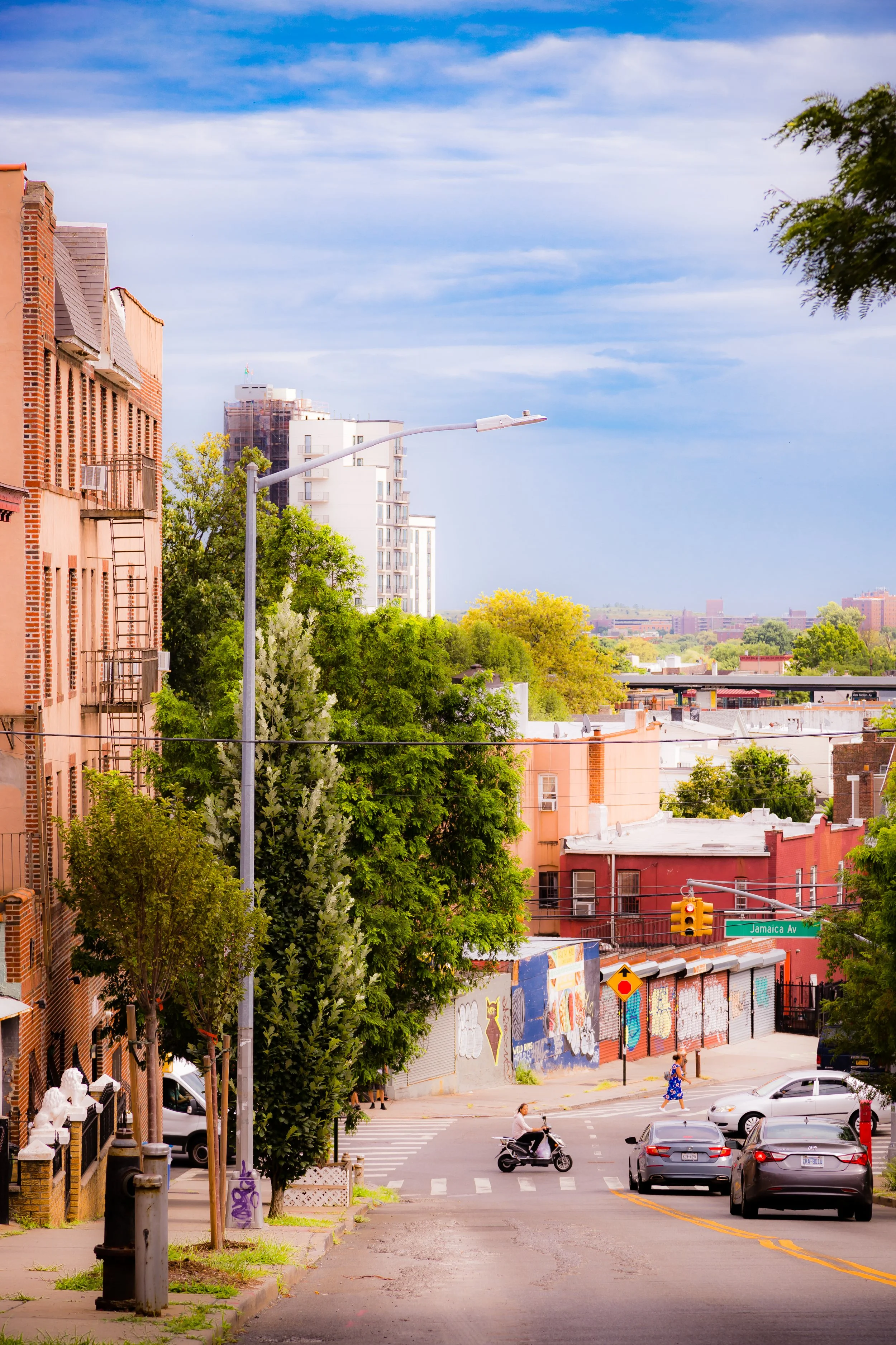
Today, the surrounding neighborhood retains its strong community fabric. New immigrants from the Caribbean, Latin America, and South Asia share streets with families whose roots stretch back generations. The cultural mix is mirrored in the park’s rhythms — Sunday barbecues, soccer matches, and festivals filling its lawns with color and music.
Highland Park Photo Gallery
Architecture and Atmosphere
Architecturally, Highland Park is framed by its own natural monumentality. The reservoir’s massive stone embankments, built in the 1850s, evoke the civic grandeur of the era’s infrastructure, while the park’s curving drives and terraces recall the romantic vision of the 19th-century landscape movement. Surrounding streets feature early-20th-century rowhouses, many with bay windows and decorative lintels, their modest elegance echoing the craftsmanship of a bygone Brooklyn.
The park’s atmosphere shifts with the hours: morning mist over the reservoir, the golden light of afternoon over its meadows, and at twilight, the distant shimmer of Manhattan’s skyline beyond the treetops. It is at once urban and pastoral, elevated yet grounded in the daily life of its neighbors.
Spirit and Legacy
Highland Park endures as both refuge and remembrance — a landscape of resilience shaped by nature, history, and community. From Lenape hunters to 19th-century engineers, from immigrant families to today’s multigenerational residents, all have left their mark on this high ground.
New York City
Use this custom Google map to explore where every neighborhood in all five boroughs of New York City is located.
The Five Boroughs
One of New York City’s unique qualities is its organization in to 5 boroughs: Manhattan, Brooklyn, Queens, The Bronx, and Staten Island. These boroughs are part pragmatic administrative districts, and part vestiges of the region’s past. Each borough is an entire county in New York State - in fact, Brooklyn is, officially, Kings County, while Staten Island is, officially Richmond County. But that’s not the whole story …
Initially, New York City was located on the southern tip of Manhattan (now the Financial District) that was once the Dutch colony of New Amsterdam. Across the East River, another city was rising: Brooklyn. In time, the city planners realized that unification between the rapidly rising cities would create commercial and industrial opportunities - through streamlined administration of the region.
So powerful was the pull of unification between New York and Brooklyn that three more counties were pulled into the unification: The Bronx, Queens, and Staten Island. And on January 1, 1898, the City of New York unified two cities and three counties into one Greater City of New York - containing the five boroughs we know today.
But because each borough developed differently and distinctly until unification, their neighborhoods likewise uniquely developed. Today, there are nearly 390 neighborhoods, each with their own histories, cultures, cuisines, and personalities - and each with residents who are fiercely proud of their corner of The Big Apple.


