JAMAICA HILLS
Queens
Geographic Setting
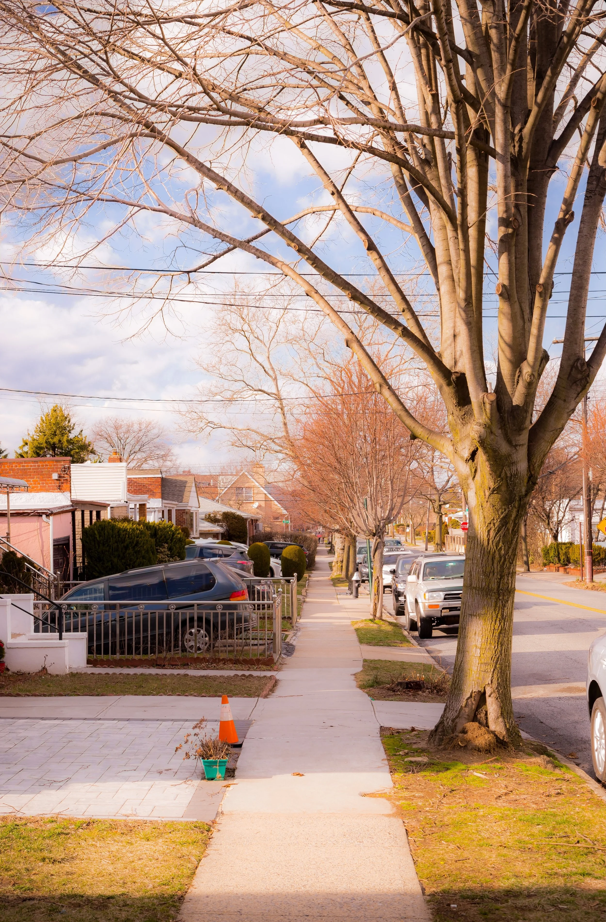
Bounded by Hillside Avenue to the south, Parsons Boulevard to the west, Union Turnpike to the north, and 170th Street and Homelawn Street to the east, Jamaica Hills occupies a gently elevated swath of central Queens—an upland neighborhood that forms a quiet, residential transition between the bustle of downtown Jamaica and the parklands of Flushing and Kew Gardens Hills. Its tree-lined streets, curving roads, and tidy homes reflect the suburban aspirations of early 20th-century Queens: close to the city’s core yet defined by calm, space, and greenery.
Set atop the same ridge that gives nearby Hillcrest and Holliswood their topographical distinction, Jamaica Hills offers subtle elevation and scenic views that long appealed to families seeking a “high ground” refuge within New York City. The neighborhood’s principal arteries—Parsons Boulevard, Hillside Avenue, Homelawn Street, and Union Turnpike—form a perimeter around an interior network of leafy residential streets such as Marlborough Road, Gothic Drive, and Edgerton Boulevard, which wind gently across the hillside. The F train at 169th Street Station and bus routes along Hillside Avenue link residents to Jamaica Center and Midtown Manhattan, while nearby institutions such as St. John’s University and King Park provide cultural and recreational anchors.
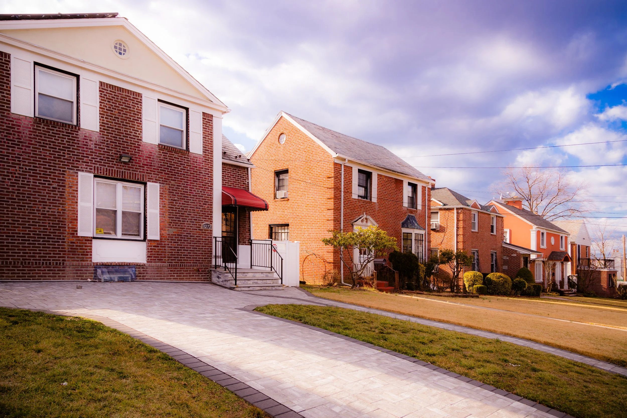
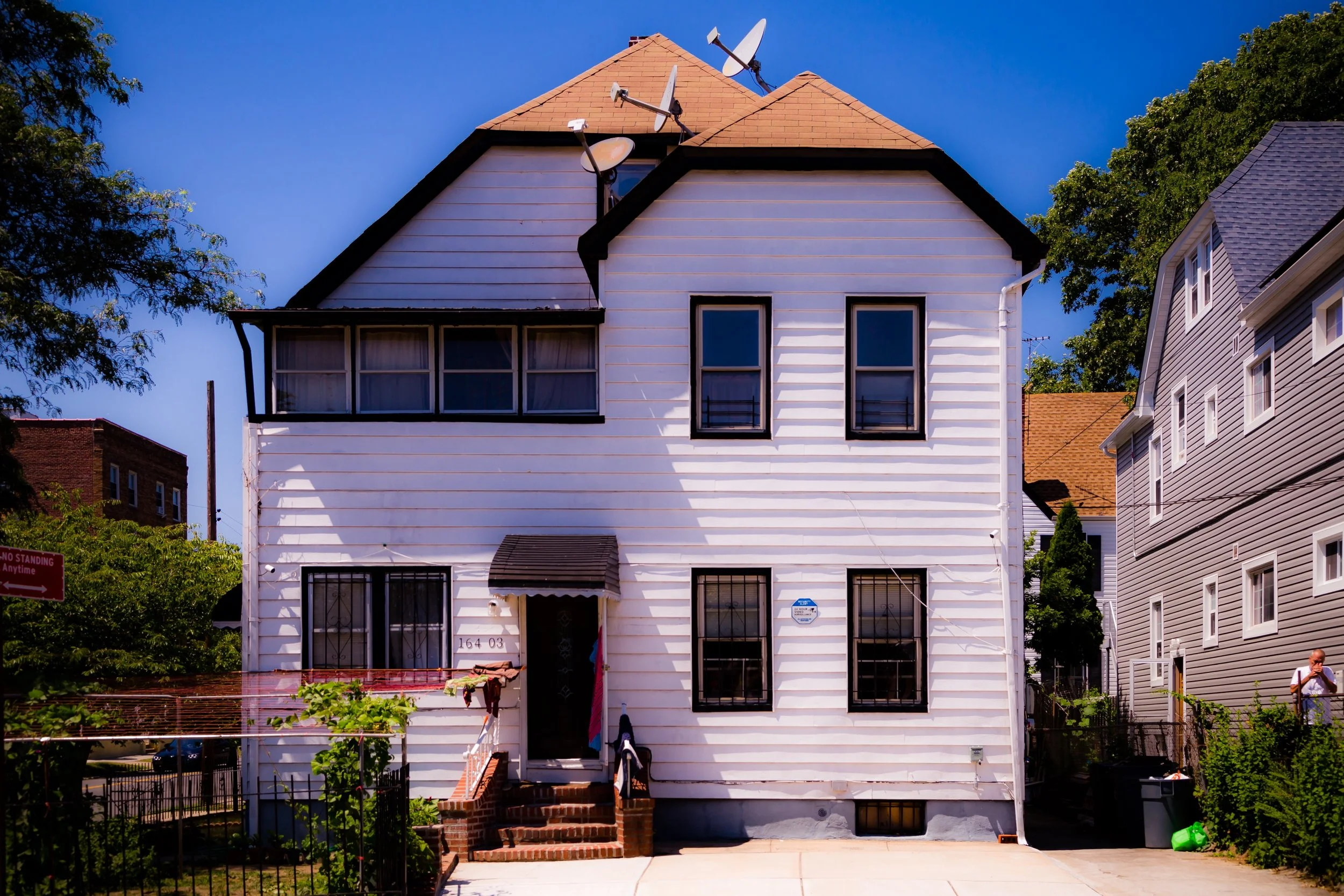
Architecturally, Jamaica Hills retains a remarkably consistent character: rows of brick Tudors, Colonials, and Cape Cod–style homes, interspersed with modest apartment houses from the 1930s–1950s. Gardens, stone retaining walls, and mature oaks lend the area a settled, verdant feel—an atmosphere that sets it apart from the denser commercial zones immediately to its south and west.
Etymology and Origins
The name “Jamaica Hills” emerged in the early 20th century as part of a wave of suburban development that swept eastern Queens following the consolidation of Greater New York in 1898. The “Hills” descriptor refers both to the neighborhood’s gentle topography and to its association with the older Town of Jamaica, whose historic center lay just to the south. Before residential construction began, this area was largely farmland and wooded estate land belonging to families whose holdings stretched between Jamaica and Flushing.
By the 1910s, with the expansion of electric trolley lines and the completion of the Hillside Avenue corridor, developers began subdividing the land into housing tracts marketed toward middle-class professionals seeking suburban tranquility. Early promotional maps and real estate advertisements touted the area as “Jamaica Hills – The High Point of Queens,” emphasizing elevation, clean air, and modern infrastructure. Unlike the dense grid of downtown Jamaica, Jamaica Hills was deliberately designed with curved streets, larger lots, and restrictive covenants that limited building heights and preserved uniform setbacks—principles influenced by the Garden City movement then popular in urban planning.
The Neighborhood
Early 20th Century: A Planned Suburban Enclave
Between the 1920s and 1940s, Jamaica Hills developed into one of Queens’ most desirable middle-class suburbs. The neighborhood’s houses—built primarily by small local developers—featured brick or stucco exteriors, slate roofs, and landscaped front yards. Architectural diversity within an overall harmony became a hallmark: Tudor Revival homes stood beside Colonial Revivals, Dutch Colonials, and English cottages, giving each block its own subtle rhythm.
The construction of the IND Subway’s Queens Boulevard Line, completed in 1937 with the 169th Street Station, transformed accessibility and spurred a second wave of development. Commuters could now reach Manhattan in under 40 minutes while enjoying the tranquility of hillside living. Churches such as St. Nicholas of Tolentine Roman Catholic Church and The Free Synagogue of Flushing established congregations nearby, reflecting the area’s early cultural mix of Jewish, Irish, and Italian families.
During these decades, Jamaica Hills was also shaped by proximity to major institutions. St. John’s University, whose campus moved to nearby Hillcrest in 1955, introduced an academic presence that influenced local culture, housing, and commerce. At the same time, the nearby Jamaica Hospital and the emerging medical corridor along Queens Boulevard attracted professionals who settled in the area.
Mid-20th Century: Stability and Community Character
From the 1950s through the 1970s, Jamaica Hills maintained its reputation as a stable, family-oriented neighborhood amid the shifting demographics of Queens. Its detached homes and well-kept lawns symbolized the borough’s middle-class ideal—urban in location but suburban in lifestyle. The area’s zoning (largely R2 and R3) protected it from high-density construction, ensuring that apartment buildings remained clustered near Hillside Avenue while the interior retained its quiet residential scale.
Civic engagement became a defining feature. The Jamaica Hills Civic Association—founded mid-century and still active today—advocated for traffic control, park improvements, and school quality. Local schools such as P.S. 131 Abigail Adams and Thomas A. Edison Career and Technical High School anchored community life. Meanwhile, residents formed block associations and garden clubs that maintained the neighborhood’s aesthetics and fostered close social ties.
As Queens diversified in the postwar decades, Jamaica Hills evolved demographically, welcoming Caribbean-American, South Asian, and Eastern European families who joined long-established Jewish and Italian homeowners. The result was a community that reflected the borough’s global character while retaining its sense of continuity and civility.
Jamaica Hills Photographic Video

Late 20th–21st Century: Diversity, Preservation, and Renewal
By the late 20th century, Jamaica Hills had become one of the most ethnically and religiously diverse residential enclaves in Queens. Along Hillside Avenue, new houses of worship appeared—mosques, Hindu temples, and Caribbean Pentecostal churches—reflecting the arrival of Bangladeshi, Indian, and Indo-Caribbean families. Yet the neighborhood’s architectural and civic fabric remained remarkably intact.
The Jamaica Hills Civic Association and Community Board 8 have continued to guard against overdevelopment, maintaining single-family zoning and opposing high-rise encroachment from downtown Jamaica. Streetscape beautification projects and the city’s Greenstreets initiative have added trees and improved public space, particularly along Hillside Avenue.
Cultural diversity has enriched the neighborhood’s commercial life. Along the borders, one finds South Asian groceries, West Indian bakeries, kosher cafés, and Middle Eastern markets, each serving a distinct yet overlapping community. Despite its proximity to dense commercial centers, Jamaica Hills remains defined by tranquility—front porches, backyard gardens, and the steady rhythm of neighborhood routines.
The 21st century has brought modest modernization rather than radical change: renovations to older homes, energy-efficient retrofits, and community events such as block fairs and cultural celebrations. The area’s proximity to Cunningham Park and Captain Tilly Park reinforces its connection to green space, while its schools continue to draw families seeking educational opportunity.
Jamaica Hills Photo Gallery
Spirit and Legacy
Jamaica Hills embodies the ideal of Queens as a borough of balance—a place where urban access meets suburban serenity, and where diversity coexists with deep-rooted neighborhood pride. Its hilly terrain, tree-lined streets, and architectural harmony make it a living remnant of early 20th-century suburban planning, while its residents—drawn from every corner of the globe—have given it renewed vitality and purpose.
At dusk, as the last rays of light fall across the rooftops along Gothic Drive and the call to prayer mingles with church bells on Hillside Avenue, Jamaica Hills reveals its true character: a hillside sanctuary within the metropolis—steadfast, cultured, and quietly enduring, where New York’s past and present find their most graceful meeting ground.
New York City
Use this custom Google map to explore where every neighborhood in all five boroughs of New York City is located.
The Five Boroughs
One of New York City’s unique qualities is its organization in to 5 boroughs: Manhattan, Brooklyn, Queens, The Bronx, and Staten Island. These boroughs are part pragmatic administrative districts, and part vestiges of the region’s past. Each borough is an entire county in New York State - in fact, Brooklyn is, officially, Kings County, while Staten Island is, officially Richmond County. But that’s not the whole story …
Initially, New York City was located on the southern tip of Manhattan (now the Financial District) that was once the Dutch colony of New Amsterdam. Across the East River, another city was rising: Brooklyn. In time, the city planners realized that unification between the rapidly rising cities would create commercial and industrial opportunities - through streamlined administration of the region.
So powerful was the pull of unification between New York and Brooklyn that three more counties were pulled into the unification: The Bronx, Queens, and Staten Island. And on January 1, 1898, the City of New York unified two cities and three counties into one Greater City of New York - containing the five boroughs we know today.
But because each borough developed differently and distinctly until unification, their neighborhoods likewise uniquely developed. Today, there are nearly 390 neighborhoods, each with their own histories, cultures, cuisines, and personalities - and each with residents who are fiercely proud of their corner of The Big Apple.


