
WEST CHELSEA
Manhattan
Geographic Setting
Bounded by West 14th Street to the south and West 30th Street to the north, and stretching from Tenth Avenue westward to the Hudson River, West Chelsea occupies one of Manhattan’s most striking urban landscapes—an arc of transformation where the city’s industrial waterfront has evolved into a global center for art, architecture, and adaptive reuse. The neighborhood’s topography is horizontal and expansive, defined by the steel spine of the High Line—the elevated freight railway turned park—that cuts northward through warehouses and galleries, binding together old and new Manhattan.
To the west, the Hudson River Park unfurls as a linear greenway of piers and promenades, reclaiming space once dominated by shipping terminals. To the east, Tenth and Eleventh Avenues form a corridor of converted factories, modern condominiums, and cultural landmarks. From the cobblestones of West 14th Street to the glass towers of Hudson Yards, West Chelsea today stands as a living museum of the city’s industrial past and creative future—its architecture a continuous dialogue between iron, brick, and sky.
Etymology and Origins
The name “Chelsea” traces to the Chelsea Estate, established in the mid-18th century by Captain Thomas Clarke, a retired British officer who named his property after London’s riverside district of the same name. Clarke’s estate originally stretched from approximately Eighth Avenue to the Hudson River and from 14th to 24th Streets, encompassing what is now both Chelsea and its western industrial subdistrict. As New York expanded northward, Clarke’s descendants subdivided the land, giving rise to the city’s first planned residential development west of Broadway.
The “West” prefix gained currency in the late 20th century, as the neighborhood’s industrial waterfront emerged from decline and redefined itself as distinct from the older, brownstone-lined streets east of Tenth Avenue. In this transformation, “West Chelsea” became synonymous with art, design, and modern urban renewal—an identity rooted in its geography but reinvented by its creative energy.
The Neighborhood
19th Century: The Industrial Waterfront
Through most of the 19th century, West Chelsea served as a crucial node in Manhattan’s maritime economy. The neighborhood’s proximity to the Hudson River piers made it a center for shipping, warehousing, and manufacturing. Lumberyards, breweries, and ironworks clustered along Eleventh and Twelfth Avenues, while the Baltimore & Ohio Railroad and New York Central’s freight lines delivered goods directly to the docks.
Residential life concentrated east of Tenth Avenue, where modest rowhouses and tenements housed workers employed in the nearby factories and docks. By the 1850s, institutions such as the General Theological Seminary (founded 1817) and Holy Apostles Church (1848) added ecclesiastical grandeur to an otherwise utilitarian setting. The Seminary’s Gothic Revival quadrangle, still standing between 20th and 21st Streets, remains the neighborhood’s oldest and most serene architectural ensemble—a reminder that even in its industrial age, West Chelsea nurtured both labor and contemplation.
By the late 1800s, the Hudson River Railroad Freight Depot and the Gansevoort and Chelsea Piers had turned the waterfront into one of the busiest shipping corridors in the nation, serving transatlantic lines and produce markets that fed the city’s expanding population.
Early–Mid 20th Century: Industry, Railways, and the High Line
The first half of the 20th century saw West Chelsea reach its industrial zenith. The opening of the Chelsea Piers (1910)—a monumental complex of steel-and-masonry terminals designed by Warren & Wetmore—modernized the city’s shipping industry. Ocean liners such as the Lusitania and Titanic’s sister ships docked here, making the neighborhood a front door to the world.
In 1934, the High Line elevated freight railway was constructed by the New York Central Railroad, running directly through buildings to deliver meat, produce, and dairy to factories and cold-storage warehouses. This innovation reduced street congestion and symbolized the area’s integration of technology and industry. Warehouses along Tenth Avenue, such as the Nabisco Biscuit Company complex (built 1913–1914)—later reborn as the Chelsea Market—formed the backbone of this industrial ecosystem.
Despite the glamour of the piers, daily life remained gritty. The neighborhood’s streets echoed with truck engines, longshoremen’s shouts, and the smell of tar and flour. Yet its density and proximity to Midtown made it resilient through the Depression and both World Wars.
After the 1950s, containerization and the decline of maritime shipping rendered the piers obsolete. The High Line fell silent in 1980, its tracks overgrown with weeds—a steel relic awaiting rediscovery.
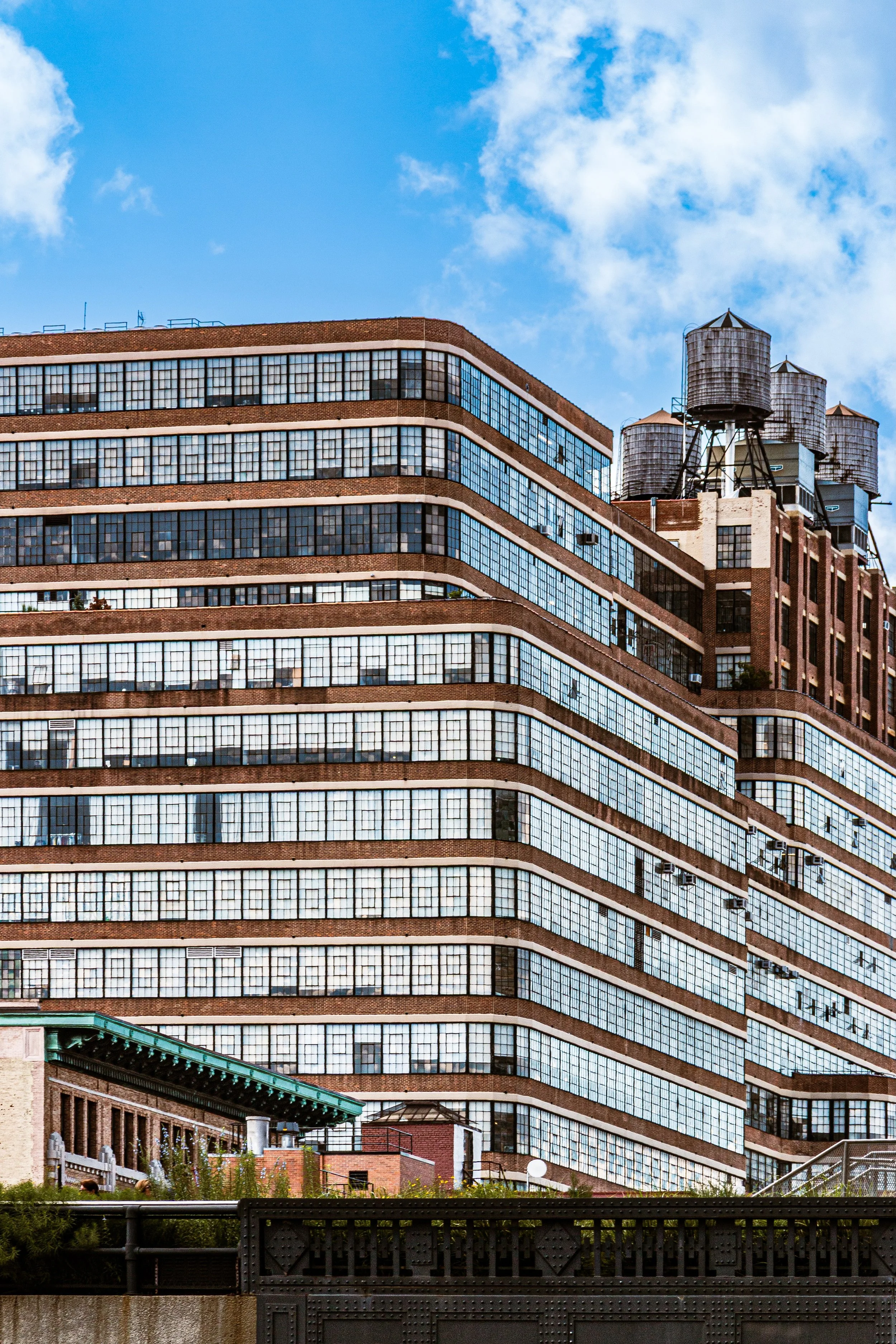
West Chelsea Photographic Tour
Late 20th Century: Art, Ruin, and Reinvention
In the 1970s–1990s, as industry receded, artists and entrepreneurs began to reclaim the district’s vast, light-filled spaces. The area’s large warehouses, cheap rents, and isolation proved ideal for galleries displaced from SoHo. By the 1990s, West Chelsea had become the epicenter of New York’s contemporary art scene: pioneers such as Gagosian, David Zwirner, and Paula Cooper established flagship galleries along West 22nd–26th Streets, transforming once-derelict loading docks into white-cube sanctuaries of modern art.
Urban planning caught up with creative energy. The Chelsea Historic District (1977) and the Special West Chelsea District (2005) established zoning that preserved the area’s industrial scale while encouraging cultural and residential use. The most transformative project, however, was the High Line Park, conceived by community activists Joshua David and Robert Hammond in the late 1990s. Their vision to convert the abandoned railway into a linear public park took shape between 2006 and 2014, creating a green thread that reconnected the neighborhood vertically and spiritually.
The Chelsea Piers Sports & Entertainment Complex (opened 1995) meanwhile revived the waterfront, replacing cargo sheds with recreation facilities that reintroduced New Yorkers to the river.
21st Century: Architecture, Art, and Adaptive Beauty
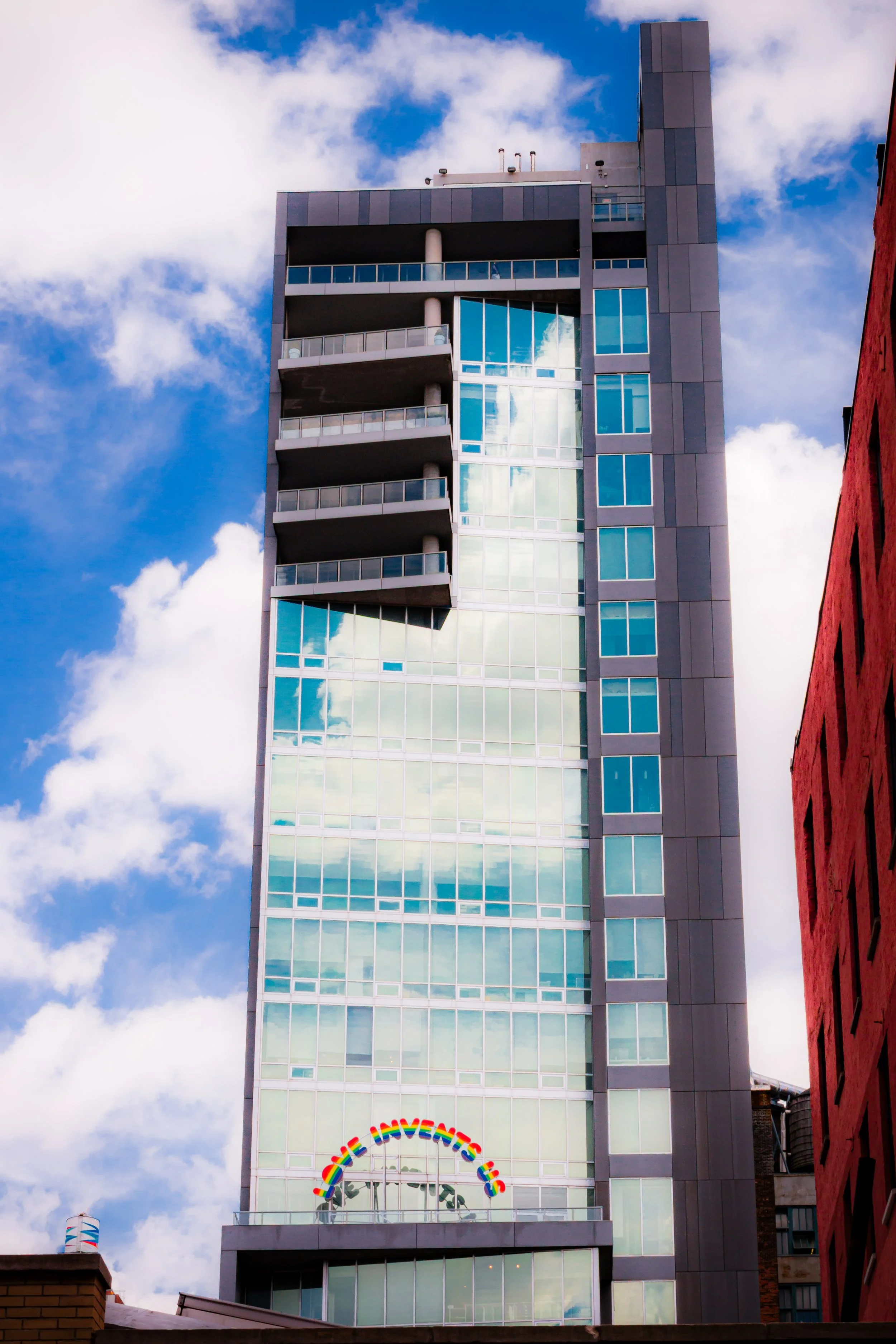
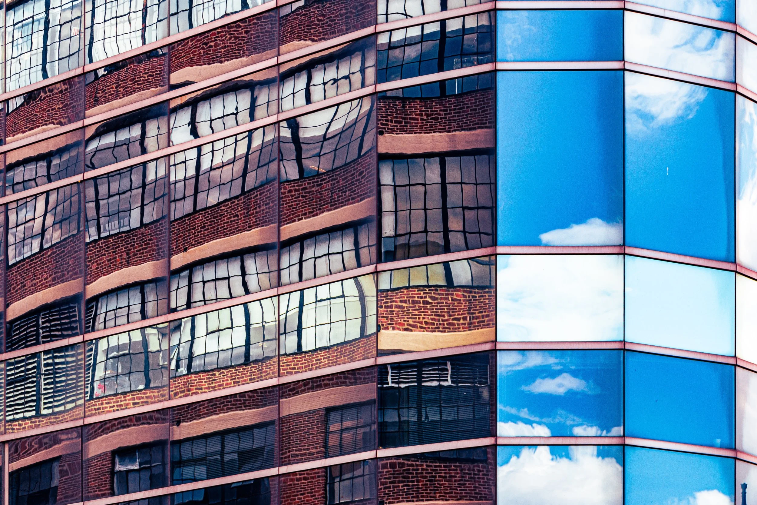
In the new millennium, West Chelsea stands as a global showcase of adaptive reuse and architectural experimentation. The High Line’s success catalyzed new residential and cultural development—most notably the Whitney Museum of American Art (designed by Renzo Piano, opened 2015) at Gansevoort Street, which anchors the district’s southern edge. Along Eleventh Avenue, starchitect-designed towers by Zaha Hadid, Jean Nouvel, and Frank Gehry rise beside the preserved brick facades of warehouses, creating a skyline that embodies New York’s dialogue between heritage and innovation.
The Hudson River Park now unites West Chelsea’s piers with landscaped walkways, bike paths, and playgrounds, transforming the former industrial fringe into one of the city’s most scenic waterfronts. Yet despite gentrification, traces of the old working district remain: the cobblestones of West 22nd Street, the meatpacking remnants along Little West 12th, and the enduring smell of sea air from the piers.
West Chelsea’s art galleries continue to define global trends, while the neighborhood’s mix of residents—artists, professionals, and families—sustain its creative pulse. The interplay of steel, glass, and greenery has become its signature aesthetic: a neighborhood perpetually in conversation with its past, its skyline, and its sense of possibility.
West Chelsea Photo Gallery
Spirit and Legacy
West Chelsea’s legacy is transformation through vision—a neighborhood that has turned industrial function into urban poetry. Its warehouses became cathedrals of art; its railway became a park; its waterfront, once scarred by commerce, now opens serenely to the river. The district stands as proof that the city’s ruins can bloom anew without erasing their memory.
New York City
Use this custom Google map to explore where every neighborhood in all five boroughs of New York City is located.
The Five Boroughs
One of New York City’s unique qualities is its organization in to 5 boroughs: Manhattan, Brooklyn, Queens, The Bronx, and Staten Island. These boroughs are part pragmatic administrative districts, and part vestiges of the region’s past. Each borough is an entire county in New York State - in fact, Brooklyn is, officially, Kings County, while Staten Island is, officially Richmond County. But that’s not the whole story …
Initially, New York City was located on the southern tip of Manhattan (now the Financial District) that was once the Dutch colony of New Amsterdam. Across the East River, another city was rising: Brooklyn. In time, the city planners realized that unification between the rapidly rising cities would create commercial and industrial opportunities - through streamlined administration of the region.
So powerful was the pull of unification between New York and Brooklyn that three more counties were pulled into the unification: The Bronx, Queens, and Staten Island. And on January 1, 1898, the City of New York unified two cities and three counties into one Greater City of New York - containing the five boroughs we know today.
But because each borough developed differently and distinctly until unification, their neighborhoods likewise uniquely developed. Today, there are nearly 390 neighborhoods, each with their own histories, cultures, cuisines, and personalities - and each with residents who are fiercely proud of their corner of The Big Apple.


