BATTERY PARK CITY
Manhattan
Geographic Setting
Built on land once reclaimed from the Hudson River, Battery Park City occupies the southwestern edge of Manhattan — a master-planned community that seems at once ancient in its monumental calm and futuristic in its design. It is bounded by the Hudson River to the west, the West Side Highway (West Street) to the east, Chambers Street to the north, and Battery Place to the south, forming a 92-acre enclave where river light, greenery, and architecture intersect. From the air, it appears as a sculpted peninsula of parks and towers extending gracefully into the harbor, facing Ellis Island, Liberty Island, and the open sea beyond.
Etymology and Origins
The name Battery Park City derives from the adjacent Battery Park, itself named for the artillery batteries once positioned there to defend New York Harbor. Yet unlike nearly every other Manhattan neighborhood, Battery Park City did not exist in any physical form before the 1970s. It is one of New York’s few entirely man-made neighborhoods — conceived not through the accidents of history, but through deliberate reclamation, engineering, and urban idealism.
The site’s origins lie in the World Trade Center excavation of the late 1960s. Millions of cubic yards of earth and rock removed from that project were used to fill 23 acres of the Hudson River, expanding Manhattan’s shoreline westward. This fill, combined with sand dredged from the harbor, formed the foundation for what would become Battery Park City — a new urban district literally built atop the bedrock of New York’s own ambitions.
The Neighborhood
Concept and Construction: A New Urban Frontier
In 1968, the Battery Park City Authority (BPCA) was established by the State of New York to guide the project’s development. The goal was visionary: to create a mixed-use, planned community that would balance residential, commercial, and recreational life — a “city within a city” at the edge of the financial district.
The initial Hugh Stubbins and Wallace Harrison master plan envisioned glass towers rising above landscaped esplanades, but it wasn’t until the 1979 Cooper Eckstut master plan that the neighborhood’s current design language took shape. Eckstut’s approach was grounded in New Urbanism before the term existed: human-scale streets, varied façades, contextual brickwork, and a network of parks linking the waterfront to the city grid.
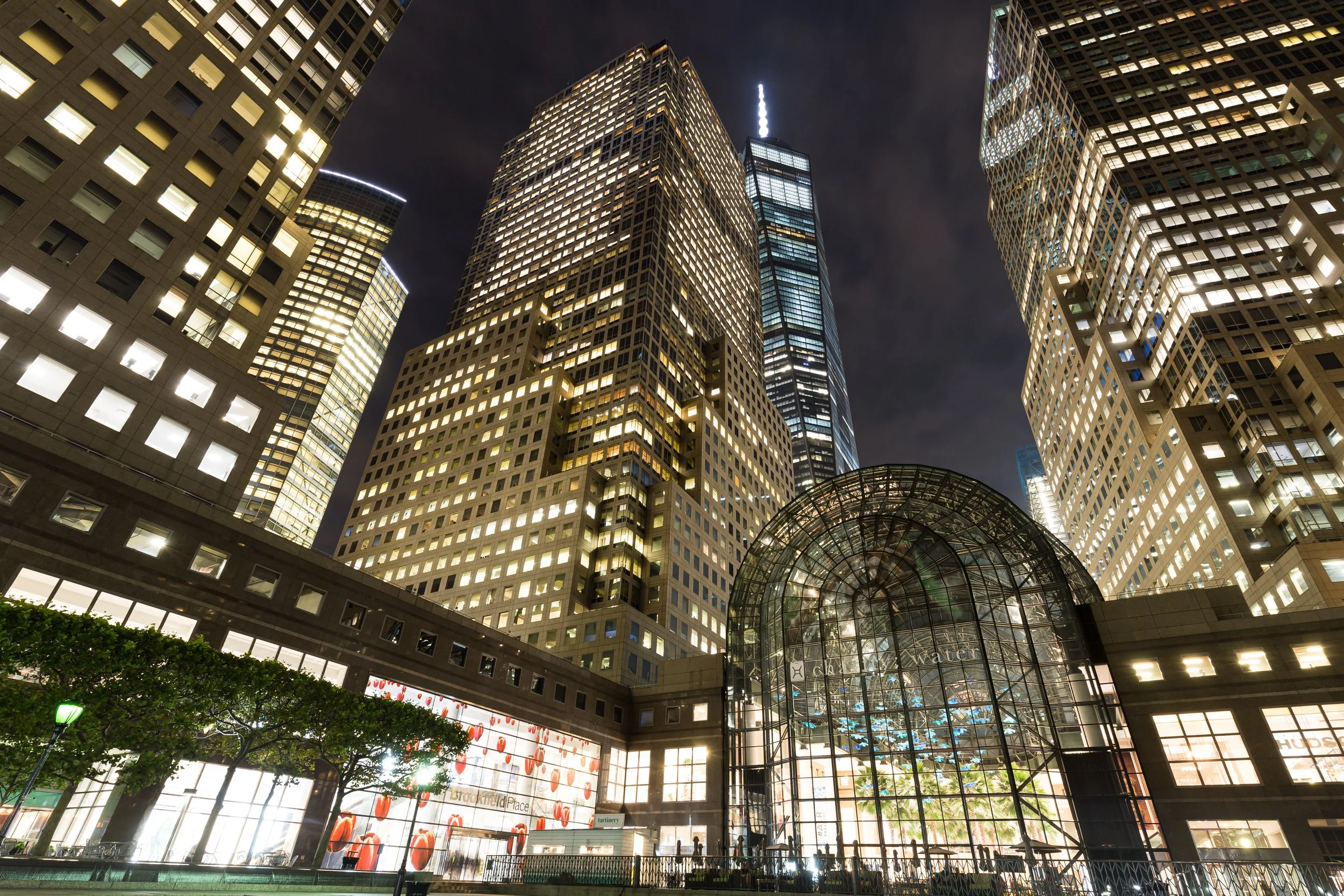
Construction began in earnest in the early 1980s. The Gateway Plaza apartment complex (completed 1983) became the neighborhood’s first residential anchor, followed by the World Financial Center — now Brookfield Place — whose glass atrium and palm-lined Winter Garden brought architectural drama and public space to the shoreline.
Late 20th Century: The Dream Realized
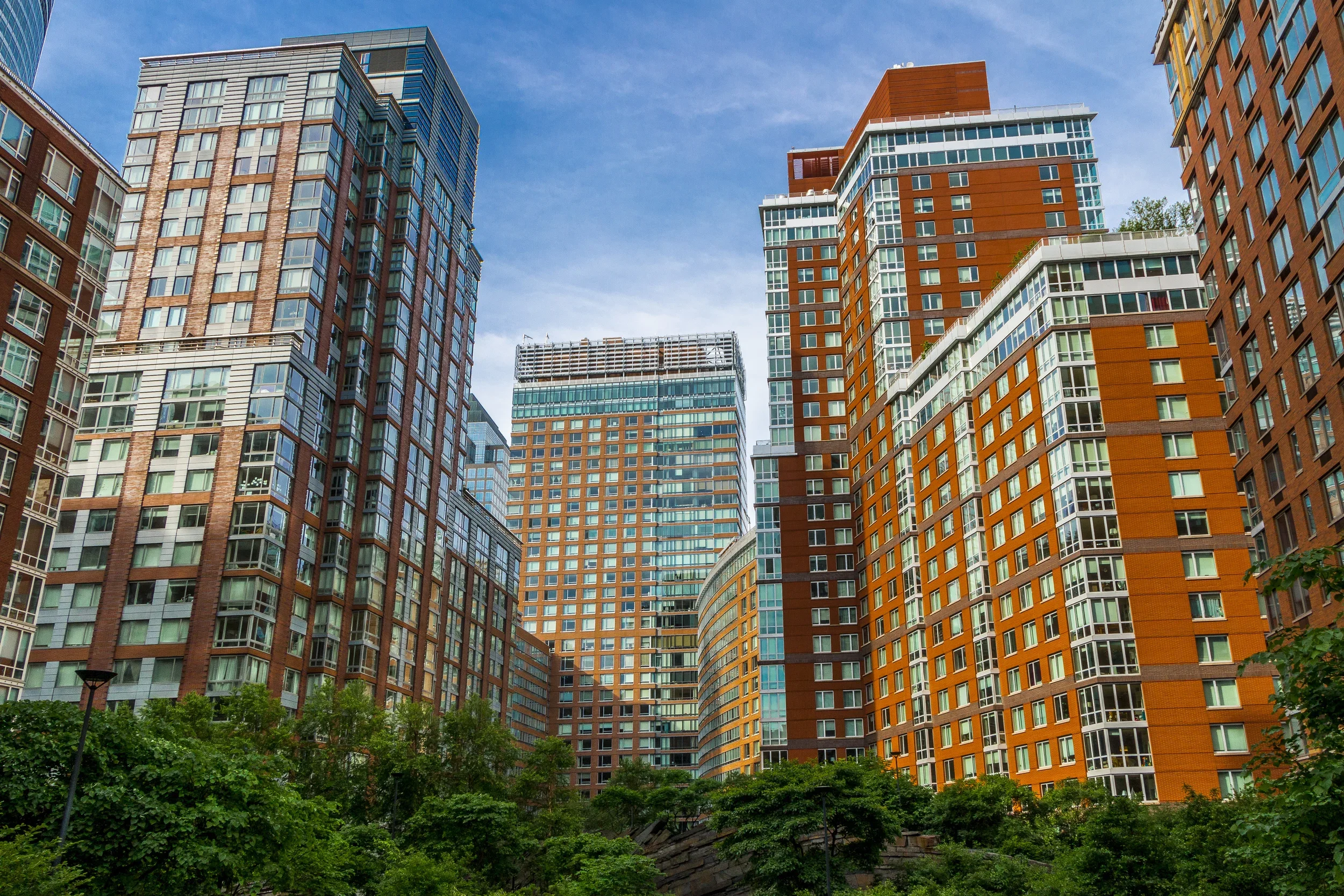
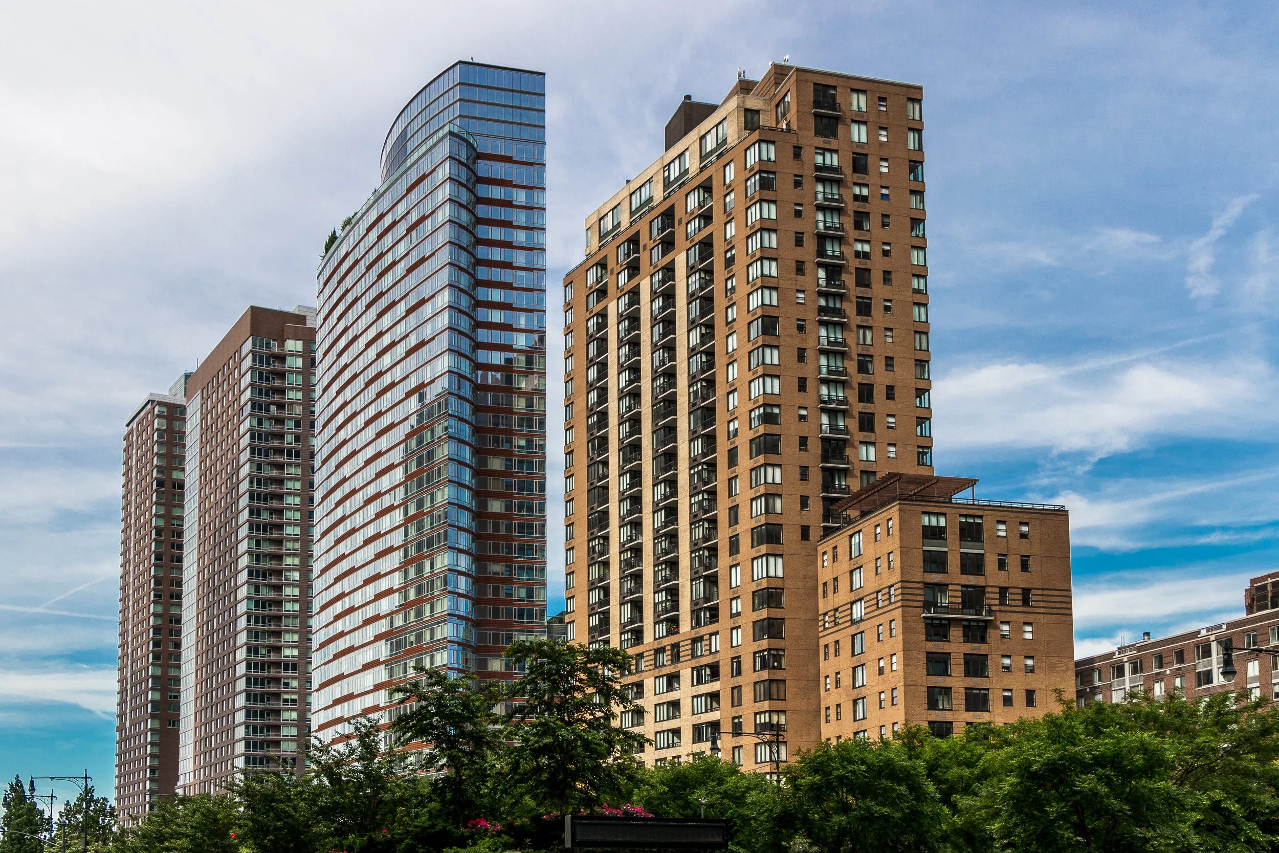
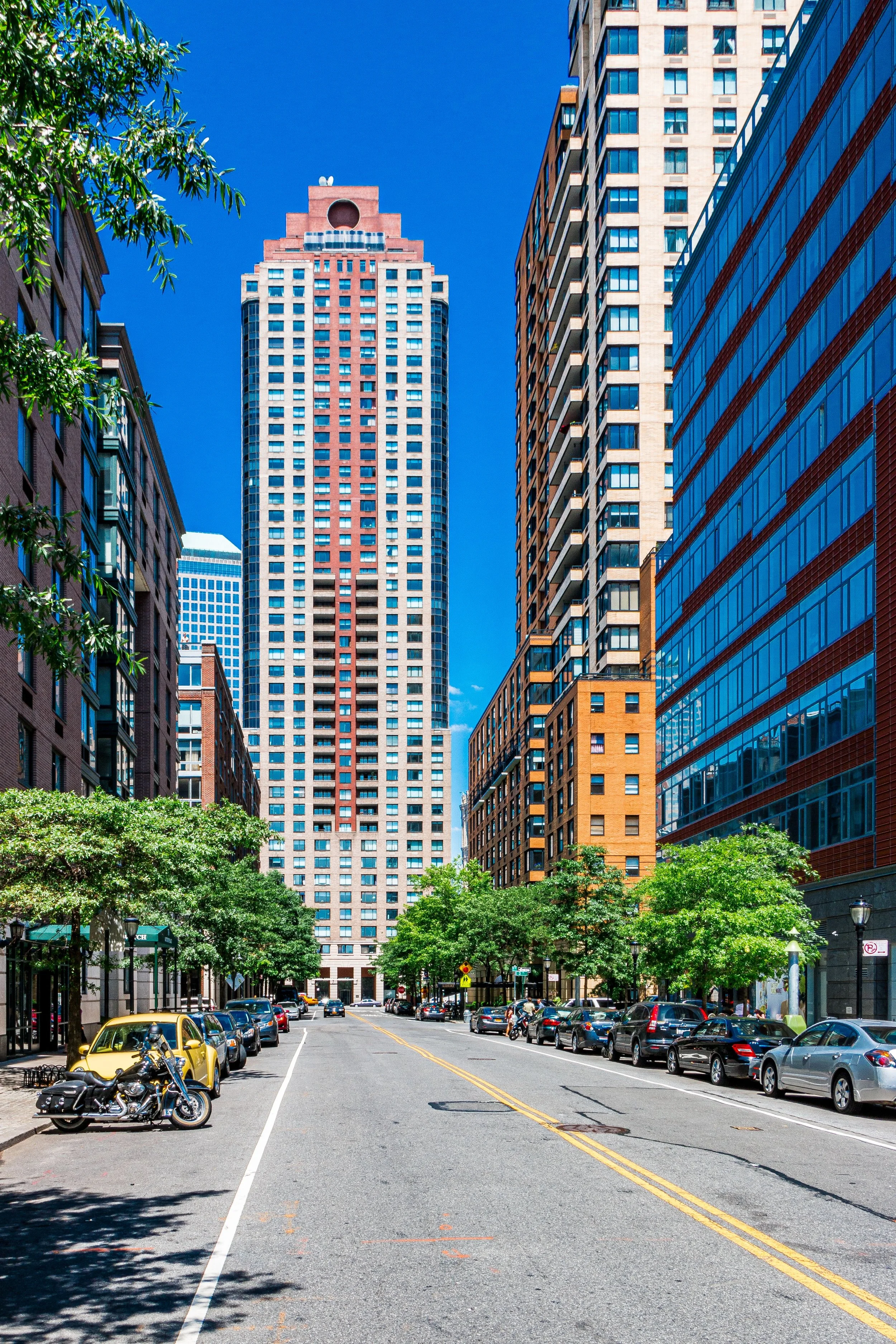
By the late 1980s and early 1990s, Battery Park City had matured into a self-sufficient community. Residential buildings such as Liberty Court, Liberty Terrace, and Hudson View West rose along the esplanade, offering panoramic views of the river and harbor. Schools, playgrounds, and plazas filled the grid, while the Esplanade — a 1.2-mile waterfront walkway lined with gardens, public art, and benches — became one of the most beloved promenades in New York.
The neighborhood’s design emphasized balance and environmental sensitivity. Roughly one-third of its total acreage was reserved for open space, a radical proposition in Manhattan. Landscaped parks such as Robert F. Wagner Jr. Park, Rockefeller Park, and South Cove provided a sequence of waterfront experiences — from formal lawns to tidal wetlands — that reconnected the city to the Hudson in ways unseen since the 19th century.
By the 1990s, Battery Park City was known as a model of modern urbanism: orderly, peaceful, and meticulously maintained. Yet its quiet success also stood in contrast to the volatile energy of nearby downtown, a tension that would take on profound meaning in the decade ahead.
Battery Park City Photograph Video
September 11, 2001: Shock and Renewal
The terrorist attacks of September 11, 2001 profoundly altered Battery Park City’s trajectory. Situated directly adjacent to the World Trade Center, the neighborhood suffered extensive damage from debris and dust, and residents were forced to evacuate. For months afterward, the streets lay silent under gray ash.
Yet the recovery was swift and determined. Residents returned by early 2002, and reconstruction efforts focused not only on repair but on resilience. The Winter Garden Atrium, shattered by falling debris, was rebuilt as a symbol of renewal. New parks, memorials, and schools rose from the tragedy, reinforcing Battery Park City’s role as both refuge and rebirth.
The Irish Hunger Memorial, dedicated in 2002, embodied this dual spirit: a sculpted landscape of Irish stone and native flora, commemorating past suffering while framing the Hudson’s horizon — the eternal link between homeland and new world.
21st Century: Sustainability and Serenity
In the decades since, Battery Park City has come to represent a model of sustainable urban living. The Solaire (2003), the first green residential high-rise in the United States, set new standards for energy efficiency, water recycling, and air quality. Subsequent buildings — including The Verdesian, The Visionaire, and Tribeca Green — extended that ethos, establishing Battery Park City as the city’s most environmentally advanced district.
Today, the neighborhood is home to roughly 16,000 residents, a mix of professionals, families, and retirees who enjoy an atmosphere more akin to a European riverfront town than to Lower Manhattan’s bustling core. Cafés, schools, and playgrounds create a rhythm of daily life that feels remarkably calm — a rare tranquility amid the city’s velocity.
Battery Park City Photo Gallery
Architecture and Atmosphere
Architecturally, Battery Park City embodies a dialogue between modernity and memory. The postmodern brick and limestone façades of the 1980s and 1990s harmonize with Lower Manhattan’s historic masonry, while glass towers at the northern edge echo the new skyline of Hudson Yards and the rebuilt World Trade Center.
Yet the defining feature is landscape. The waterfront parks are living architecture — sculpted with stone, willow, and light. Walk from South Cove’s tidal reeds to Rockefeller Park’s lawns and you traverse a living museum of landscape design: works by Hanna/Olin, Clinton Hewitt, and Mary Miss, all unified by the shimmer of the river.
The atmosphere shifts through the day — morning joggers tracing the esplanade; sailboats gliding past the marina; the evening sun igniting the glass façades in gold. At night, the city lights flicker against the dark water, and the Statue of Liberty glows across the harbor — a constant presence, viewed here from a new edge of the world.
Spirit and Legacy
Battery Park City’s legacy is both literal and symbolic. Built from the earth of the Trade Center, it embodies New York’s capacity to reshape itself — to turn debris and displacement into creation. It is a neighborhood born not of chance but of intent: a deliberate act of city-building that reconciles architecture, ecology, and humanity.
New York City
Use this custom Google map to explore where every neighborhood in all five boroughs of New York City is located.
The Five Boroughs
One of New York City’s unique qualities is its organization in to 5 boroughs: Manhattan, Brooklyn, Queens, The Bronx, and Staten Island. These boroughs are part pragmatic administrative districts, and part vestiges of the region’s past. Each borough is an entire county in New York State - in fact, Brooklyn is, officially, Kings County, while Staten Island is, officially Richmond County. But that’s not the whole story …
Initially, New York City was located on the southern tip of Manhattan (now the Financial District) that was once the Dutch colony of New Amsterdam. Across the East River, another city was rising: Brooklyn. In time, the city planners realized that unification between the rapidly rising cities would create commercial and industrial opportunities - through streamlined administration of the region.
So powerful was the pull of unification between New York and Brooklyn that three more counties were pulled into the unification: The Bronx, Queens, and Staten Island. And on January 1, 1898, the City of New York unified two cities and three counties into one Greater City of New York - containing the five boroughs we know today.
But because each borough developed differently and distinctly until unification, their neighborhoods likewise uniquely developed. Today, there are nearly 390 neighborhoods, each with their own histories, cultures, cuisines, and personalities - and each with residents who are fiercely proud of their corner of The Big Apple.


