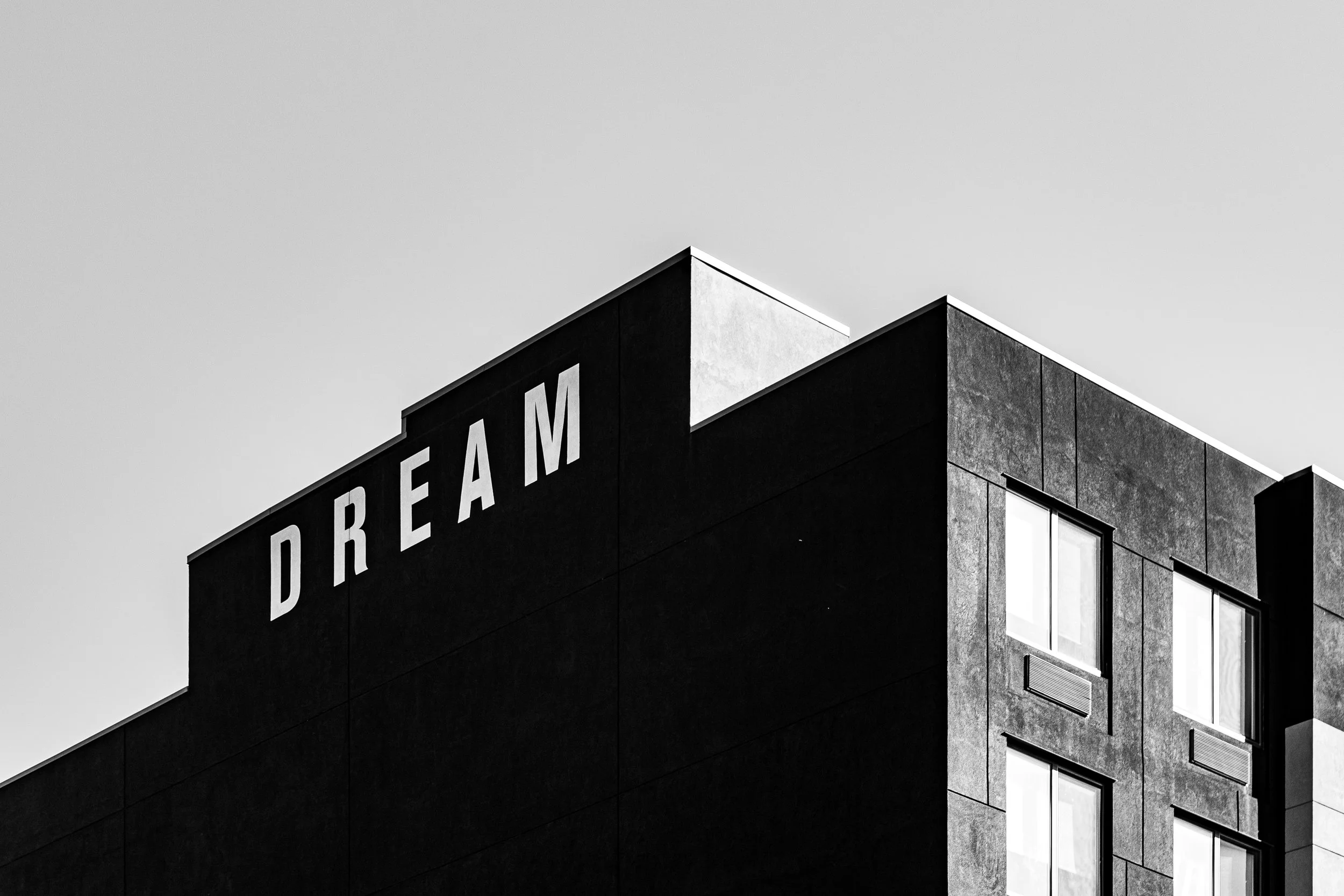
FARRAGUT
Brooklyn
Geographic Setting
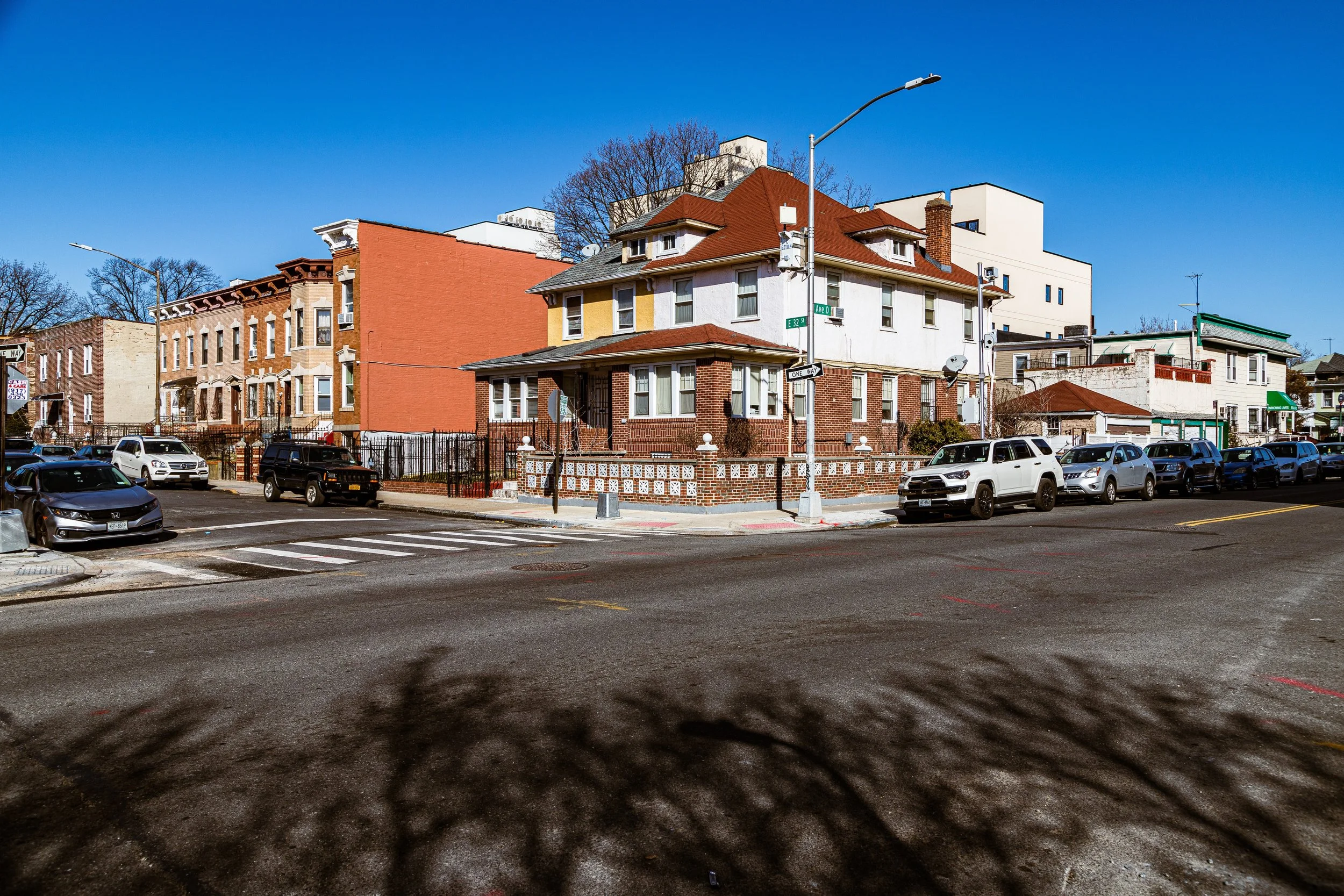
Bounded by Nostrand Avenue, Flatbush Avenue, and Rogers Avenue to the west, Clarendon Road to the north, Utica Avenue to the east, and the Long Island Rail Road Bay Ridge Branch to the south, Farragut forms a distinct southern extension of East Flatbush—a broad, residential plateau that stretches toward the heart of Brooklyn. Compact yet deeply rooted, Farragut sits at the junction of multiple Brooklyn identities: the historical Flatbush Village to its northwest, the solidly residential Remsen Village to its east, and the broad commercial avenues that define the borough’s urban middle ground.
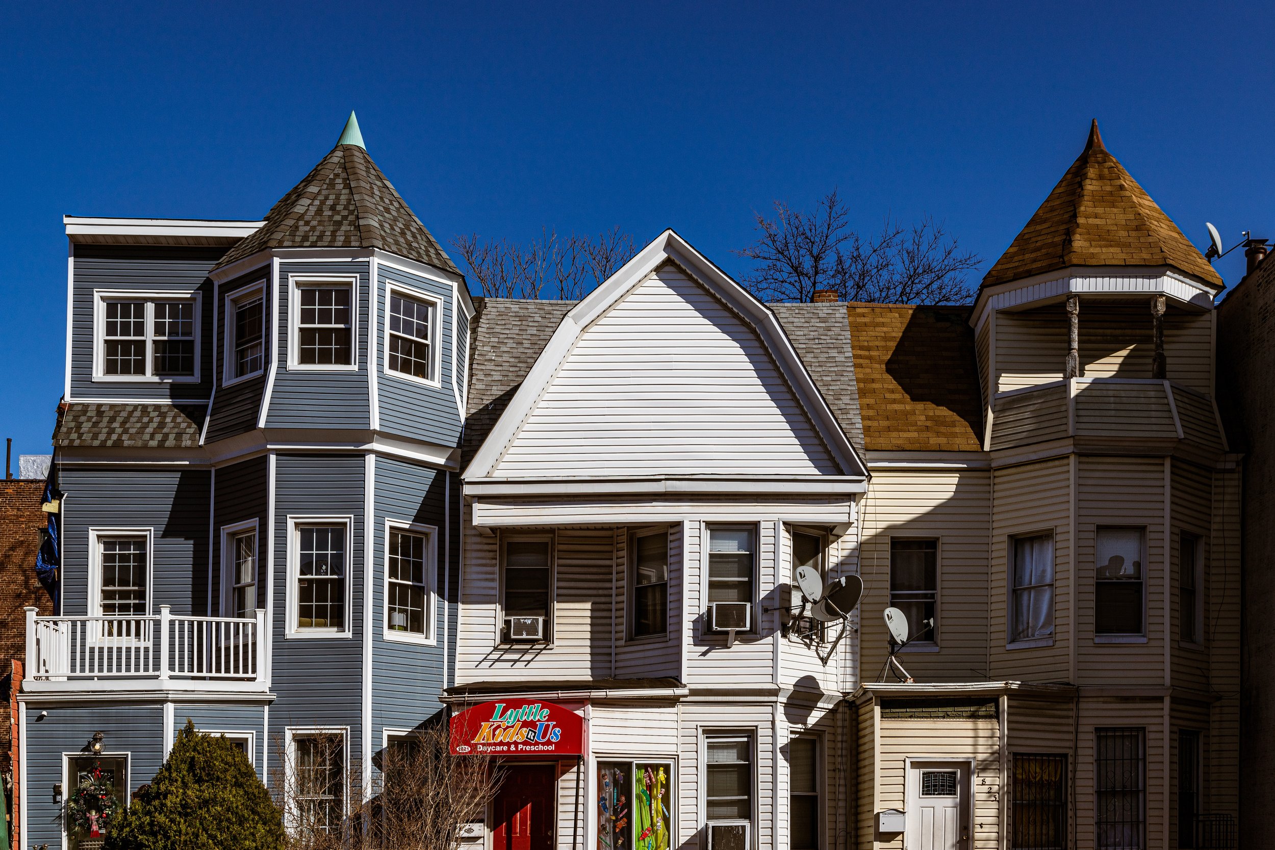
Topographically, Farragut occupies level terrain along the old Flatbush Plain, where 19th-century farmland gave way to early 20th-century grid housing. Its streets—Avenues D, E, and Foster among them—are lined with two- and three-story brick rowhouses, semi-detached homes, and modest prewar apartment buildings. The neighborhood’s architecture speaks of Brooklyn’s interwar boom: ornamental lintels, small gardens, and stoops where neighbors still greet one another at dusk. Commercial corridors along Nostrand Avenue, Flatbush Avenue, and Utica Avenue frame its residential heart, while the rail embankment to the south provides both a geographic and psychological border—beyond which lies Flatlands and East Flatbush Junction.
Though often absorbed into broader references to East Flatbush, Farragut maintains its own local character: stable, community-oriented, and shaped by a century of migration and persistence.
Etymology and Origins
Farragut takes its name from Admiral David Glasgow Farragut (1801–1870), the celebrated Union naval commander of the American Civil War, whose cry “Damn the torpedoes, full speed ahead!” at the Battle of Mobile Bay became a national legend. His name was affixed to local developments and schools in the early 20th century, part of a wave of patriotic naming that accompanied Brooklyn’s urban expansion.
Prior to urbanization, the land that now forms Farragut was part of Flatbush’s southern farming tracts, worked for generations by Dutch-descended families such as the Lefferts, Vanderveer, and Martense clans. By the mid-19th century, these farms supplied vegetables, hay, and dairy to Brooklyn’s growing markets via Flatbush and Nostrand Avenues—ancient colonial roads that still define the district’s western edge.
The Neighborhood
19th Century: From Farmland to Framework
In the 1800s, this section of Flatbush remained a quiet agricultural landscape dotted with farmhouses, orchards, and the occasional windmill. The extension of Flatbush Avenue as a major arterial road and the growth of trolley service north toward Downtown Brooklyn began to transform the area’s destiny. The Flatbush and Coney Island Railway (1878), later electrified and absorbed into the BMT subway system, provided new access, making the southern reaches of Flatbush ripe for residential development.
By the 1890s, small speculative developers were purchasing farmland south of Clarendon Road, laying out a street grid that would later define Farragut’s limits. Early housing took the form of wood-frame cottages and two-family homes, catering to civil servants, clerks, and skilled laborers. The area’s relative elevation and distance from industrial centers made it desirable for families seeking fresh air and quiet within reach of the city’s core.
Early–Mid 20th Century: A Working- and Middle-Class Enclave
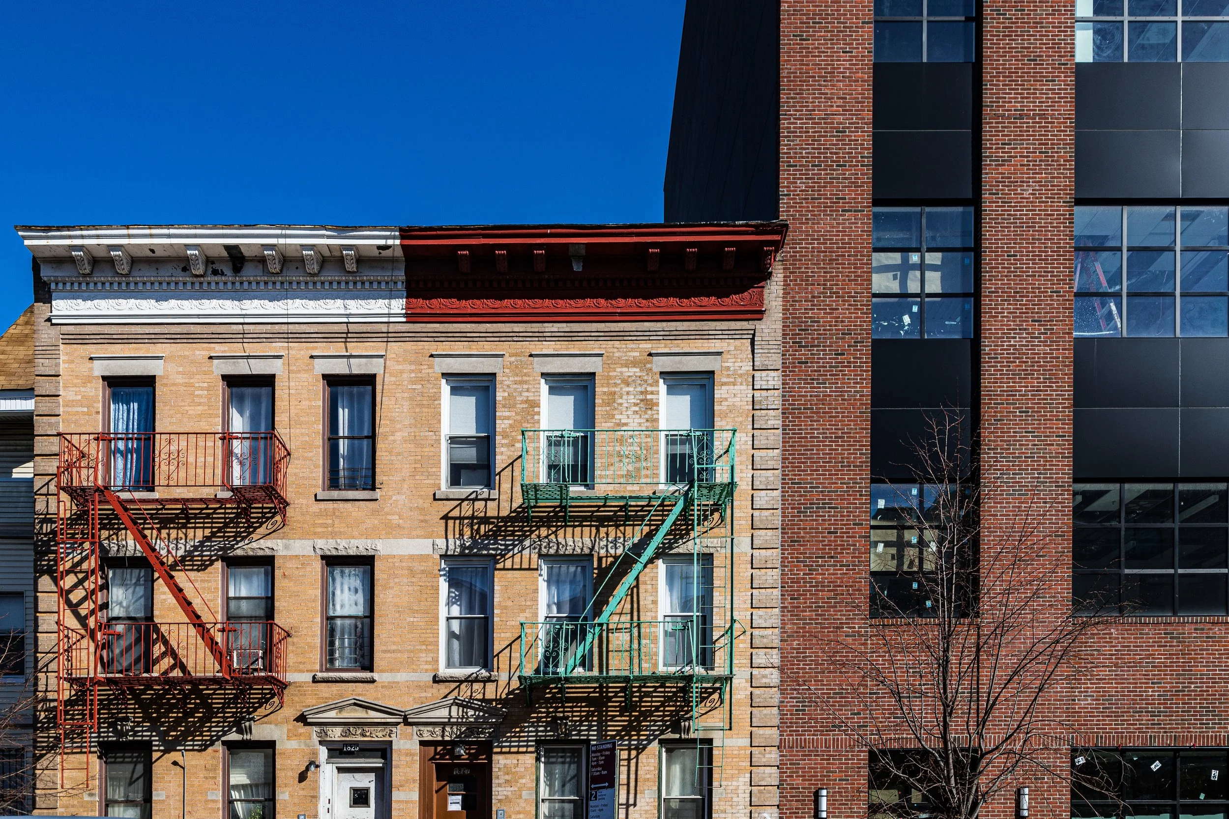
The early 20th century marked Farragut’s true emergence. Following Brooklyn’s consolidation into Greater New York (1898), the city extended utilities, paved roads, and public transit deep into Flatbush. The construction of the Flatbush Avenue Junction (1906)—where the IRT Nostrand and Flatbush lines converged—turned the area into a transportation hub. Developers quickly filled the empty fields between Clarendon Road and the railroad tracks with rows of brick and limestone homes, blending Colonial Revival and Art Deco motifs.
By the 1920s–1940s, Farragut had become a thriving, predominantly Jewish and Italian neighborhood, part of Brooklyn’s expanding middle class. Residents shopped at corner bakeries and delis along Nostrand Avenue, attended services at nearby synagogues such as Temple Ahavath Sholom, and sent their children to well-regarded public schools. The opening of the Farragut Houses—not to be confused with the later NYCHA complex in Downtown Brooklyn—reflected the area’s aspirational identity: modest homes with gardens, tidy stoops, and a sense of upward mobility.
During these decades, the surrounding commercial strips flourished. Flatbush Avenue was lined with furniture stores, pharmacies, and movie theaters, while Utica Avenue anchored local industry and retail. Churches such as Holy Cross Roman Catholic Church on Church Avenue and Holy Innocents served as community anchors for successive waves of immigrant families.
Farragut Video Coming Soon
Late 20th Century: Change and Continuity
The postwar years brought gradual change. As second-generation Jewish and Italian families moved to Long Island and Queens, Caribbean and African American families—many from Jamaica, Trinidad, Haiti, and Barbados—began settling in Farragut during the 1960s–1970s, drawn by its solid housing and established infrastructure. This demographic shift mirrored broader transformations across East Flatbush, turning the area into one of the largest and most culturally vibrant Caribbean communities in the United States.
Despite the city’s fiscal crises and rising crime rates during the 1970s and 1980s, Farragut retained much of its stability. Homeownership rates remained high; neighborhood associations, block clubs, and church groups maintained order and social cohesion. The East Flatbush Civic League and local community boards advocated for improvements to parks, schools, and safety, while storefront churches and small businesses adapted to serve the new Caribbean and African American populations.
By the 1990s, Farragut’s streets bore witness to a hybrid identity: jerk chicken stands beside kosher bakeries, reggae spilling from open windows near brownstone stoops. The Utica Avenue corridor remained the neighborhood’s economic lifeline—dense, noisy, and alive with the commerce of everyday life.
21st Century: A Neighborhood of Heritage and Renewal
In the 21st century, Farragut continues to embody the layered complexity of central Brooklyn. Its demographics remain predominantly Caribbean and African American, with growing representation from Latin American and West African families. Many homes are still owner-occupied, passed down through generations, their facades lovingly maintained. On Sundays, the air fills with the sounds of church choirs, while weekday life hums along Utica and Flatbush Avenues with markets, restaurants, and hair salons reflecting global influences.
Urban revitalization has brought both opportunity and pressure. Rising property values in nearby Prospect Lefferts Gardens and Flatbush Junction have led to renewed interest in Farragut’s housing stock. New condominium conversions and small apartment developments have begun to appear along major avenues, though the core residential blocks remain largely unchanged in scale and texture. Schools such as PS 198 and Tilden Educational Campus serve a diverse student population, and nearby institutions like Brooklyn College continue to attract young professionals and families.
The city’s investment in the Flatbush Caton Market and the broader Caribbean Cultural District to the northwest underscores the importance of preserving the area’s cultural identity even as development advances.
Farragut Photo Gallery
Spirit and Legacy
Farragut’s legacy is one of quiet endurance and community pride. Unlike flashier Brooklyn neighborhoods, it has changed not through spectacle but through steadfastness—sustained by generations who have cared for its homes, attended its schools, and enlivened its avenues with music and food. It is a neighborhood of porches and pride, of homeowners who mow their own lawns, of block parties and backyards alive with the smell of barbecues and the pulse of reggae basslines on summer evenings.
New York City
Use this custom Google map to explore where every neighborhood in all five boroughs of New York City is located.
The Five Boroughs
One of New York City’s unique qualities is its organization in to 5 boroughs: Manhattan, Brooklyn, Queens, The Bronx, and Staten Island. These boroughs are part pragmatic administrative districts, and part vestiges of the region’s past. Each borough is an entire county in New York State - in fact, Brooklyn is, officially, Kings County, while Staten Island is, officially Richmond County. But that’s not the whole story …
Initially, New York City was located on the southern tip of Manhattan (now the Financial District) that was once the Dutch colony of New Amsterdam. Across the East River, another city was rising: Brooklyn. In time, the city planners realized that unification between the rapidly rising cities would create commercial and industrial opportunities - through streamlined administration of the region.
So powerful was the pull of unification between New York and Brooklyn that three more counties were pulled into the unification: The Bronx, Queens, and Staten Island. And on January 1, 1898, the City of New York unified two cities and three counties into one Greater City of New York - containing the five boroughs we know today.
But because each borough developed differently and distinctly until unification, their neighborhoods likewise uniquely developed. Today, there are nearly 390 neighborhoods, each with their own histories, cultures, cuisines, and personalities - and each with residents who are fiercely proud of their corner of The Big Apple.


