STAPLETON
Staten Island
Geographic Setting
Bounded by Vanderbilt Avenue to the southeast, Van Duzer Street to the west, Clinton Street to the north, and the Narrows to the east, Stapleton unfolds along Staten Island’s northeastern waterfront as one of the borough’s oldest and most historically layered neighborhoods. Nestled between Tompkinsville to the north and Clifton to the south, it slopes gently from the high ridges of Van Duzer Street toward the harbor, where old piers, warehouses, and the Staten Island waterfront’s maritime heritage meet the urban renaissance of the 21st century.
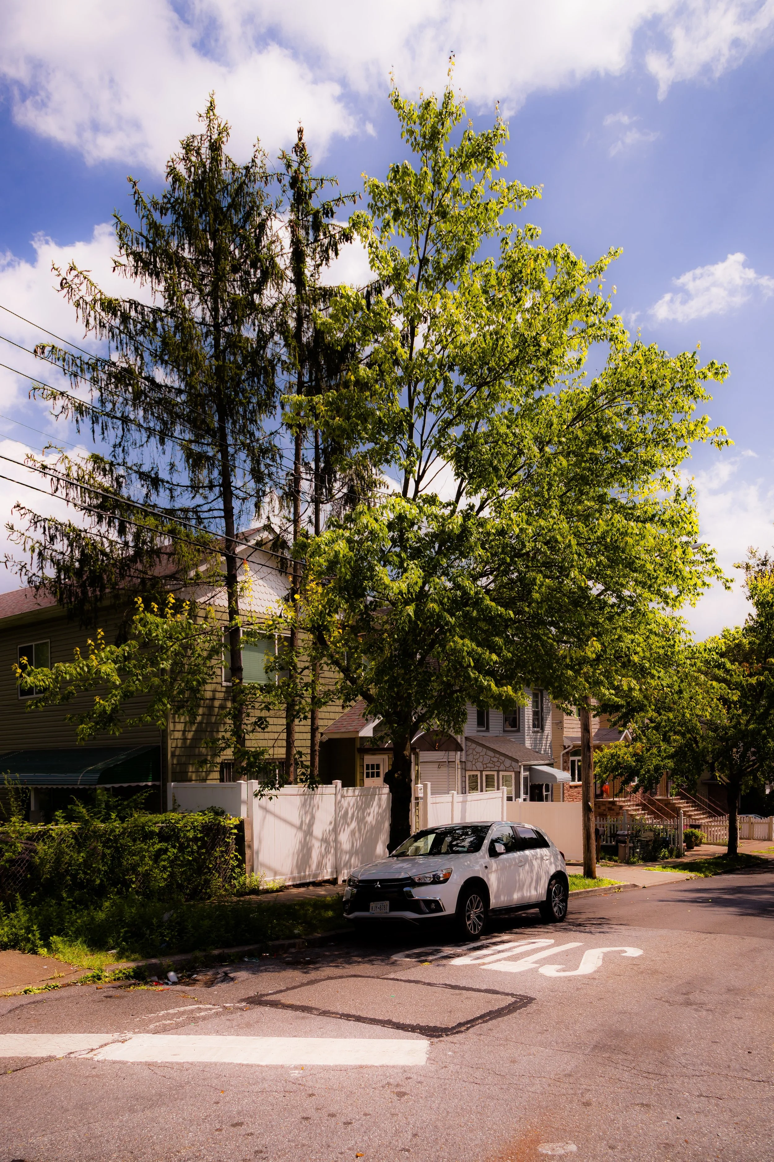
Stapleton’s setting has always defined its character. The elevated western streets offer panoramic views of the harbor and Manhattan skyline, while the low-lying shore once thrived with shipyards, breweries, and waterfront trade. Today, the neighborhood is a vibrant mosaic—historic brick rowhouses and industrial lofts coexist with new waterfront developments and tree-lined residential streets. The rhythm of the ferry horns and the salt air off the Narrows remain as constant as they were two centuries ago.
Etymology
Stapleton takes its name from William J. Staples, a local developer who, together with Minthorne Tompkins (son of former New York Governor Daniel D. Tompkins), founded the village in 1836. The two entrepreneurs envisioned a planned harbor community to rival Manhattan’s bustling piers, combining industry, commerce, and genteel residence. They named the settlement “Stapleton” in honor of Staples himself, whose financial backing and vision helped launch one of Staten Island’s earliest organized urban centers.
The name soon became synonymous with enterprise and opportunity. By the late 19th century, “Stapleton” evoked not just a place but a way of life—maritime, industrious, and self-reliant. Though the industries have come and gone, the neighborhood retains the spirit of its founders: a belief in growth shaped by the sea.
The Neighborhood
Origins through the 19th Century
Stapleton’s history is inseparable from the harbor that borders it. In the early 1800s, before its formal founding, the area was known for its shipyards, farms, and ferry slips. The deep natural harbor and proximity to Manhattan made it an ideal site for maritime enterprise. When Minthorne Tompkins and William Staples laid out their vision in 1836, they built not just streets and docks, but a new identity for Staten Island’s eastern shore.
By the mid-19th century, Stapleton had become the island’s first true urban center. A bustling waterfront grew along Front Street and Bay Street, where steamships docked to load cargo and commuters boarded ferries bound for Manhattan. Breweries, foundries, and warehouses rose near the water’s edge, while the inland streets filled with elegant homes for merchants, captains, and professionals. The opening of the Staten Island Railway (1860) further cemented Stapleton’s role as the borough’s commercial hub.
The Bechtel Brewery and later the Piel Brothers Brewery made Stapleton a brewing powerhouse, exporting beer throughout the city and employing hundreds of residents. The Staten Island Savings Bank (1864) and the grand Edgewater Village Hall (1866) reflected civic confidence and prosperity. Immigrant labor—particularly from Germany, Ireland, and later Italy—fueled the neighborhood’s growth, and their influence shaped its architecture, cuisine, and community institutions. Churches, schools, and fraternal halls flourished, binding together a population proud of its industry and independence.
Early 20th Century: Industry, Immigration, and Community Life
In the early 20th century, Stapleton thrived as one of Staten Island’s busiest neighborhoods. Its waterfront buzzed with commerce—ship repair yards, warehouses, and docks lined the Narrows, while factories produced everything from paints to paper. The U.S. Lighthouse Depot, established on the Stapleton waterfront in the late 19th century, became the central supply base for lighthouses along the Atlantic coast, cementing the neighborhood’s maritime importance.
The streets west of Bay Street filled with dense rows of brick townhouses and small apartment buildings. Along Targee Street and Van Duzer Street, working-class families built close-knit communities, supported by neighborhood churches like Immaculate Conception and Trinity Lutheran. Immigrants from Italy, Germany, and Eastern Europe brought their languages, trades, and traditions, while African American families from the South joined the labor force, adding to the cultural fabric.
Social life revolved around local businesses, taverns, and community halls. The Staten Island Advance, founded nearby in 1886, reported daily on the comings and goings of Stapleton’s merchants, schools, and political life. Bay Street, then as now, served as the neighborhood’s main artery—a lively corridor of shops, trolleys, and human energy connecting St. George to Clifton and beyond.
Stapleton Video Coming Soon
Mid–Late 20th Century: Decline and Survival
The mid-20th century brought upheaval as Staten Island’s industrial base waned. Shipping and manufacturing moved to larger, mechanized ports in New Jersey, and the Stapleton waterfront fell quiet. The once-bustling breweries and shipyards closed by the 1960s, leaving behind empty warehouses and brownfields. Economic hardship and suburban migration drained much of the neighborhood’s commercial vitality, while the construction of the Verrazzano-Narrows Bridge (1964) shifted development southward.
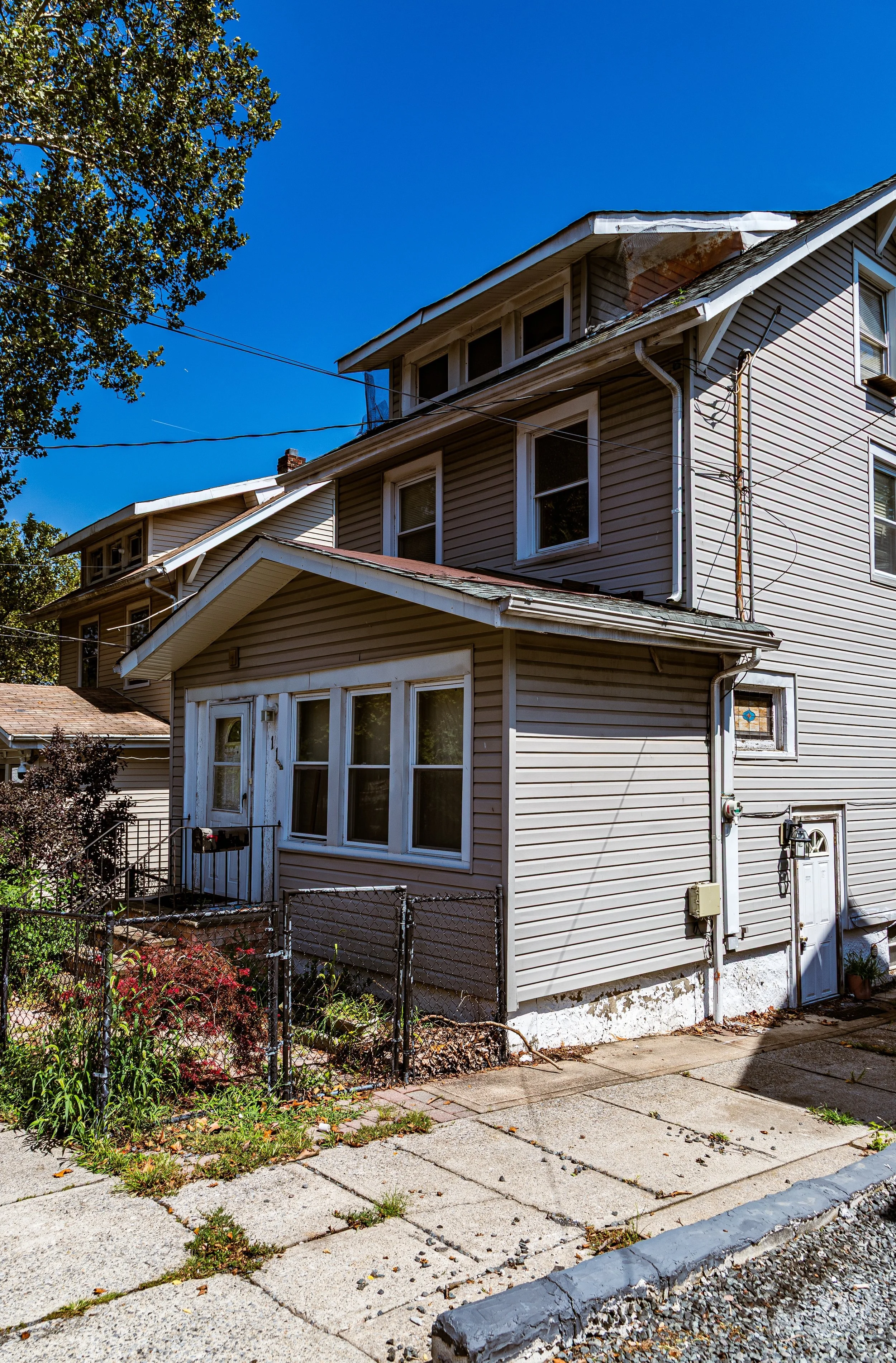
Yet Stapleton’s sense of community endured. Its diverse population remained anchored by long-established families and an influx of new immigrants—Puerto Rican, Dominican, and later, West African and South Asian—who filled its historic housing stock and revitalized its street life. While Bay Street struggled with disinvestment, churches, local businesses, and social organizations provided continuity. The neighborhood’s architecture—solid brick facades, carved cornices, and Victorian rowhouses—stood as reminders of a proud urban past.
In the 1980s and 1990s, artists and preservationists began to rediscover Stapleton’s potential. Affordable rents and spacious old buildings attracted creatives, small galleries, and craftspeople, particularly along Van Duzer Street, which evolved into a quiet corridor of art studios and cafés. Community activism also took root, leading to historic district designations and early waterfront cleanup efforts that foreshadowed the area’s rebirth.
21st Century: Revival on the Waterfront
In the 21st century, Stapleton has emerged as one of Staten Island’s most dynamic and transitional neighborhoods—at once historic, diverse, and forward-looking. The redevelopment of the Stapleton Homeport, a former U.S. Naval base that closed in 1994, has transformed the shoreline into a new residential and commercial destination. The Urby Staten Island complex, completed in 2017, introduced modern apartments, restaurants, and public green spaces along the water, reconnecting Stapleton to its harborfront for the first time in generations.
The Bay Street Corridor revitalization plan—extending through Stapleton, Tompkinsville, and St. George—has brought new infrastructure, affordable housing, and business support, while preserving the neighborhood’s architectural and cultural heritage. Bay Street Landing, a conversion of historic warehouses into lofts and co-ops, exemplifies the adaptive reuse that defines modern Stapleton: old brick bones reimagined for a new era.
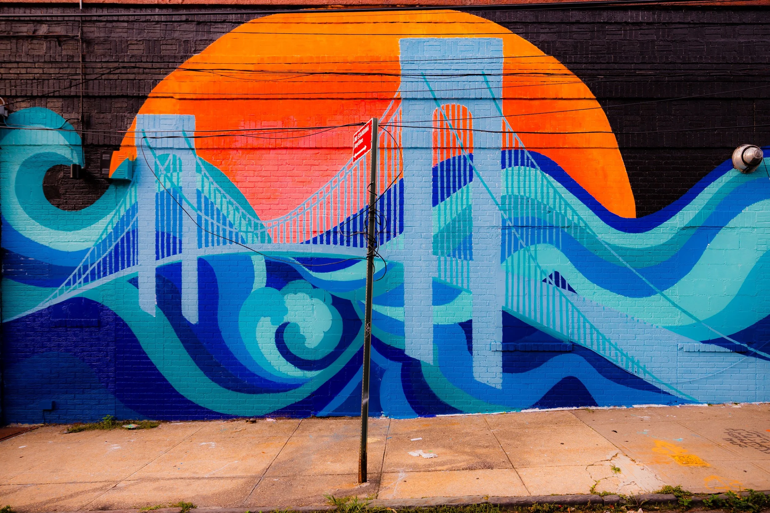
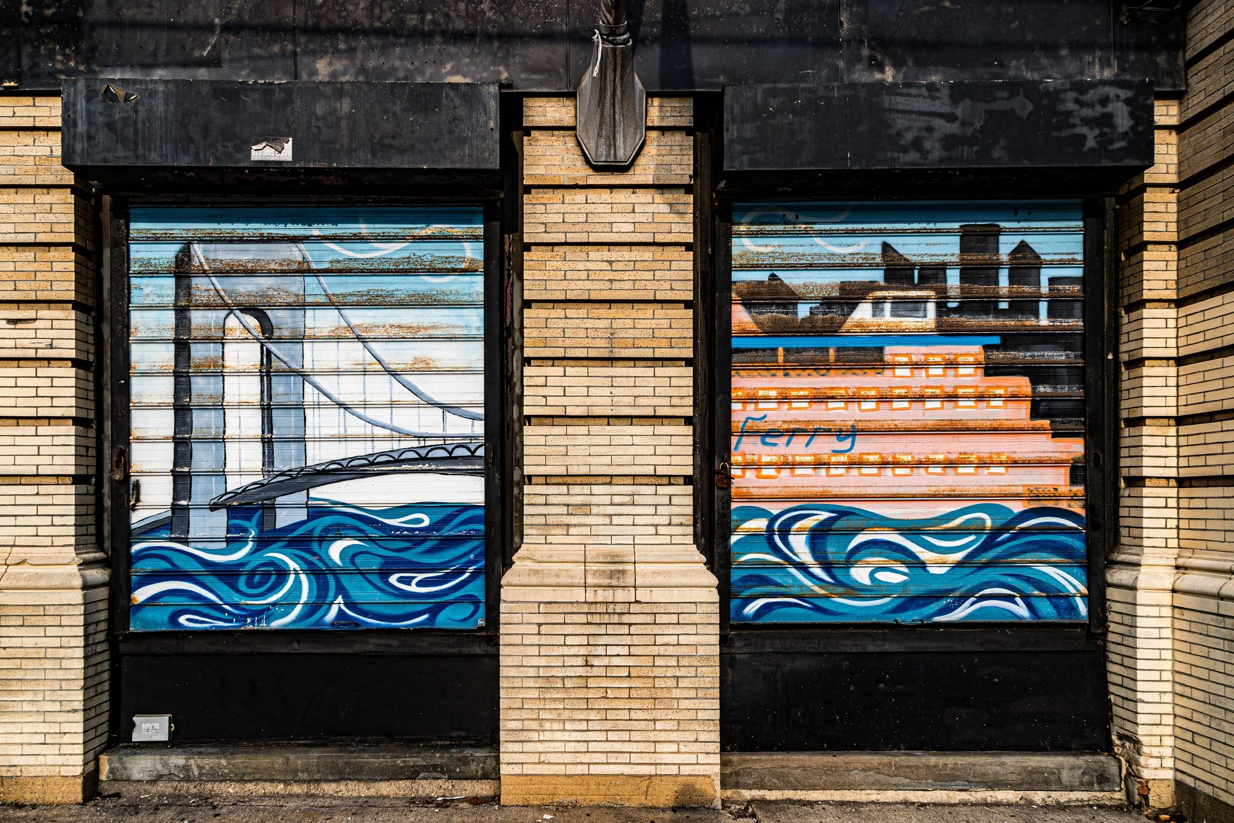
Culturally, the neighborhood continues to thrive. The Staten Island Makerspace, located in a converted warehouse, provides resources for artists and innovators. Street murals, community gardens, and pop-up markets have infused color and life into formerly industrial spaces. The National Lighthouse Museum, just north in St. George, draws visitors along the shared waterfront. Meanwhile, Stapleton’s small businesses—cafés, restaurants, and family-owned shops—reflect the borough’s growing diversity and creative energy.
The neighborhood’s evolution remains ongoing: a careful balancing act between renewal and preservation, gentrification and authenticity. Through it all, Stapleton has retained the maritime soul that has defined it since 1836—a community built by and beside the sea.
Stapleton Photo Gallery
Spirit and Legacy
The spirit of Stapleton is that of endurance and reinvention. From shipbuilders and brewers to artists and entrepreneurs, each generation has shaped the neighborhood to meet its moment without erasing its past. Its narrow streets and weathered facades speak to centuries of labor, migration, and resilience—a living record of Staten Island’s urban and industrial heart.
Its legacy lies in continuity: the same harbor winds that once filled sails now ruffle café awnings; the same docks that launched ships now host festivals, farmers’ markets, and evening strollers. Stapleton remains a place where history is not static but active, where the hum of the city mingles with the sound of waves against the pier.
New York City
Use this custom Google map to explore where every neighborhood in all five boroughs of New York City is located.
The Five Boroughs
One of New York City’s unique qualities is its organization in to 5 boroughs: Manhattan, Brooklyn, Queens, The Bronx, and Staten Island. These boroughs are part pragmatic administrative districts, and part vestiges of the region’s past. Each borough is an entire county in New York State - in fact, Brooklyn is, officially, Kings County, while Staten Island is, officially Richmond County. But that’s not the whole story …
Initially, New York City was located on the southern tip of Manhattan (now the Financial District) that was once the Dutch colony of New Amsterdam. Across the East River, another city was rising: Brooklyn. In time, the city planners realized that unification between the rapidly rising cities would create commercial and industrial opportunities - through streamlined administration of the region.
So powerful was the pull of unification between New York and Brooklyn that three more counties were pulled into the unification: The Bronx, Queens, and Staten Island. And on January 1, 1898, the City of New York unified two cities and three counties into one Greater City of New York - containing the five boroughs we know today.
But because each borough developed differently and distinctly until unification, their neighborhoods likewise uniquely developed. Today, there are nearly 390 neighborhoods, each with their own histories, cultures, cuisines, and personalities - and each with residents who are fiercely proud of their corner of The Big Apple.


