COLUMBIA STREET WATERFRONT DISTRICT
Brooklyn
Geographic Setting
Bounded by the Gowanus Expressway to the south and Atlantic Avenue to the north, and lying west of the Brooklyn–Queens Expressway (BQE) to the New York Harbor, the Columbia Street Waterfront District occupies a slim, maritime strip of southwest Brooklyn—an isolated yet vibrant community perched between the roaring expressways and the quiet brilliance of the harbor. Though modest in scale, it holds immense character: a neighborhood reborn from mid-20th-century urban disruption, where cobblestone streets, red-brick warehouses, and modern townhouses coexist beside sweeping views of the Statue of Liberty, Governor’s Island, and the Lower Manhattan skyline.
Cut off from the rest of Brownstone Brooklyn by the trench of the BQE and hemmed in by industrial waterfront, Columbia Street feels like a village rediscovered. Its main thoroughfare, Columbia Street, runs parallel to the harbor, lined with low-rise rowhouses, cafés, and small businesses that recall the area’s 19th-century port-town spirit. To the west, remnants of the old Atlantic Basin and Pier 9 still hint at the neighborhood’s maritime origins, while green spaces such as the Waterfront Garden and the Columbia Street Esplanade restore a human scale to land long dominated by docks and freight.
Etymology and Origins
The Columbia Street Waterfront District takes its name from its principal artery—Columbia Street—laid out in the 1830s as part of South Brooklyn’s expansion toward the harbor. The “Waterfront District” designation is a later addition, coined in the 1980s to distinguish this area from its better-known inland neighbors, Carroll Gardens and Cobble Hill, after the construction of the Brooklyn–Queens Expressway physically severed it from both.
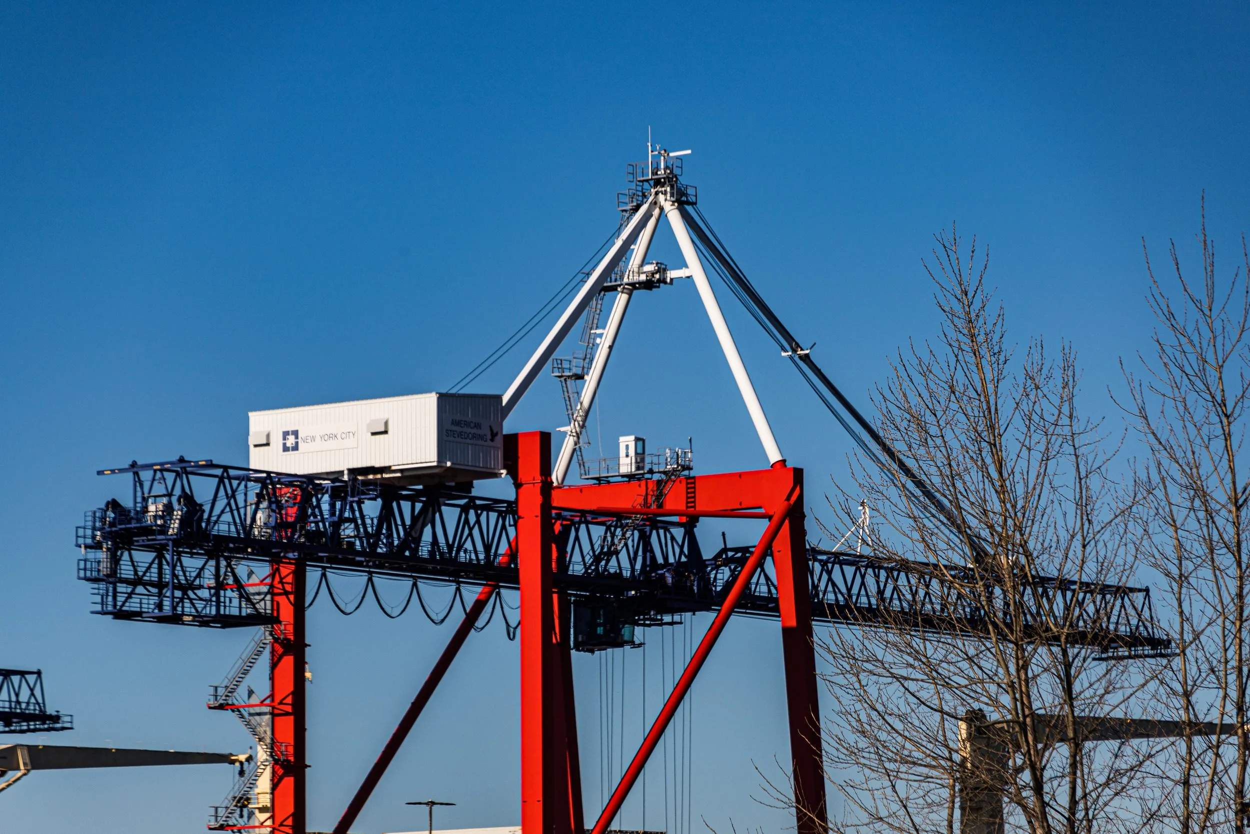
Before the expressway’s arrival, this area formed the western edge of old South Brooklyn, its life centered on the Atlantic Dock Company’s vast 19th-century complex of piers and warehouses. It was here that goods from around the world—grain from the Midwest, sugar from the Caribbean, coffee from South America—were unloaded and stored, feeding the city’s markets and fueling its growth. The waterfront also gave rise to generations of longshoremen and dockworkers, many of them Irish, Italian, and later Puerto Rican immigrants who built homes just east of the docks along Columbia, Hicks, and Union Streets.
The Neighborhood
19th Century: The Portside Village of South Brooklyn
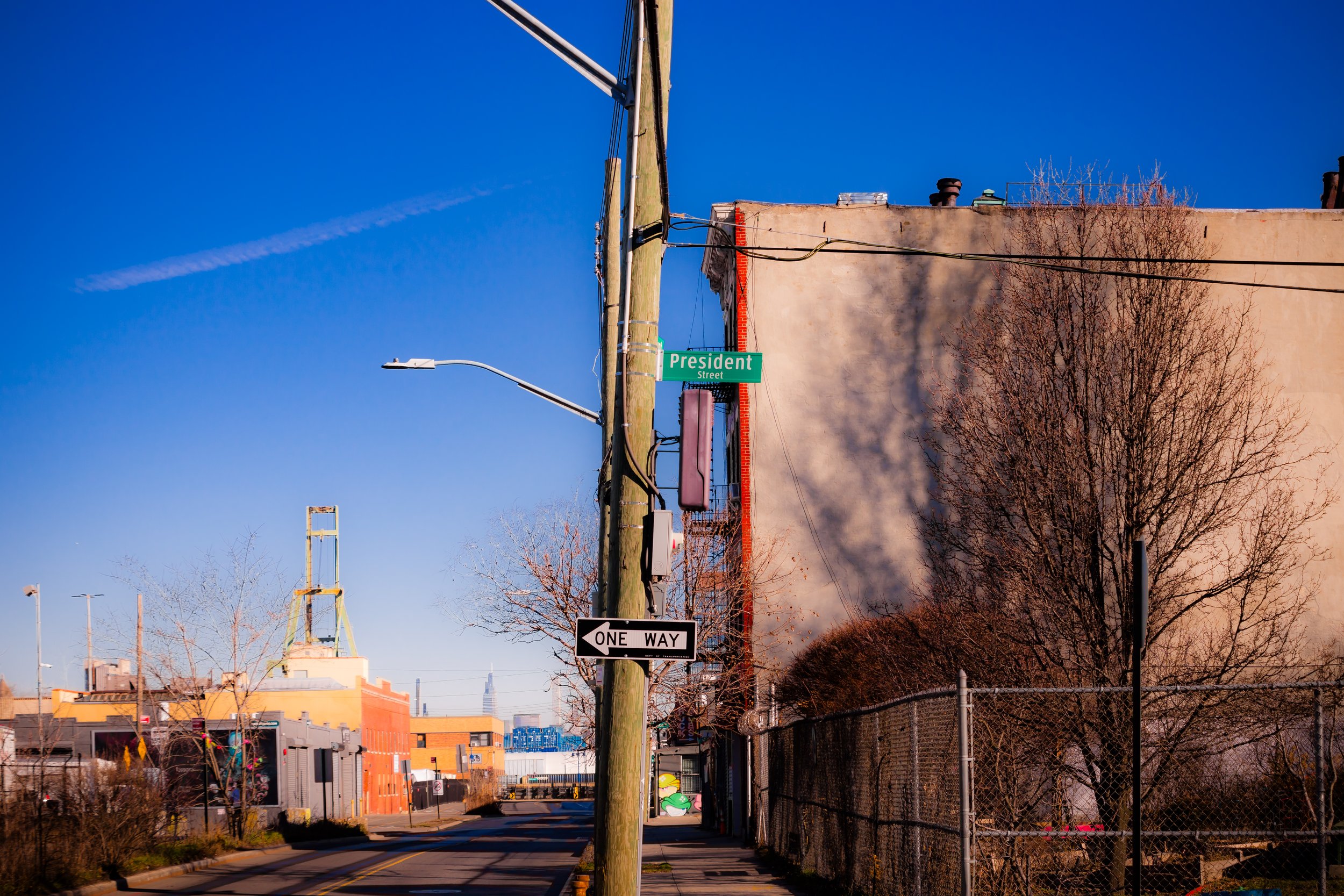
During the mid–19th century, the district now known as Columbia Street was a bustling, if gritty, extension of the Brooklyn waterfront. The completion of the Atlantic Basin (1841) transformed the area into one of the busiest cargo ports in the world, lined with warehouses, shipyards, and tenements for the laborers who worked the docks. Streets like President, Summit, and Sackett echoed with the sounds of horse carts, ship horns, and the creak of timber.
Italian and Irish immigrants formed the core of the community. They lived in narrow rowhouses and walked daily to the piers, where they loaded and unloaded ships bound for distant ports. Churches such as Sacred Hearts–St. Stephen (founded 1882) on Summit Street became the social and spiritual anchors of the community. Despite its proximity to wealthier enclaves like Cobble Hill, this was a working-class district defined by hard labor, tight kinship, and maritime grit.
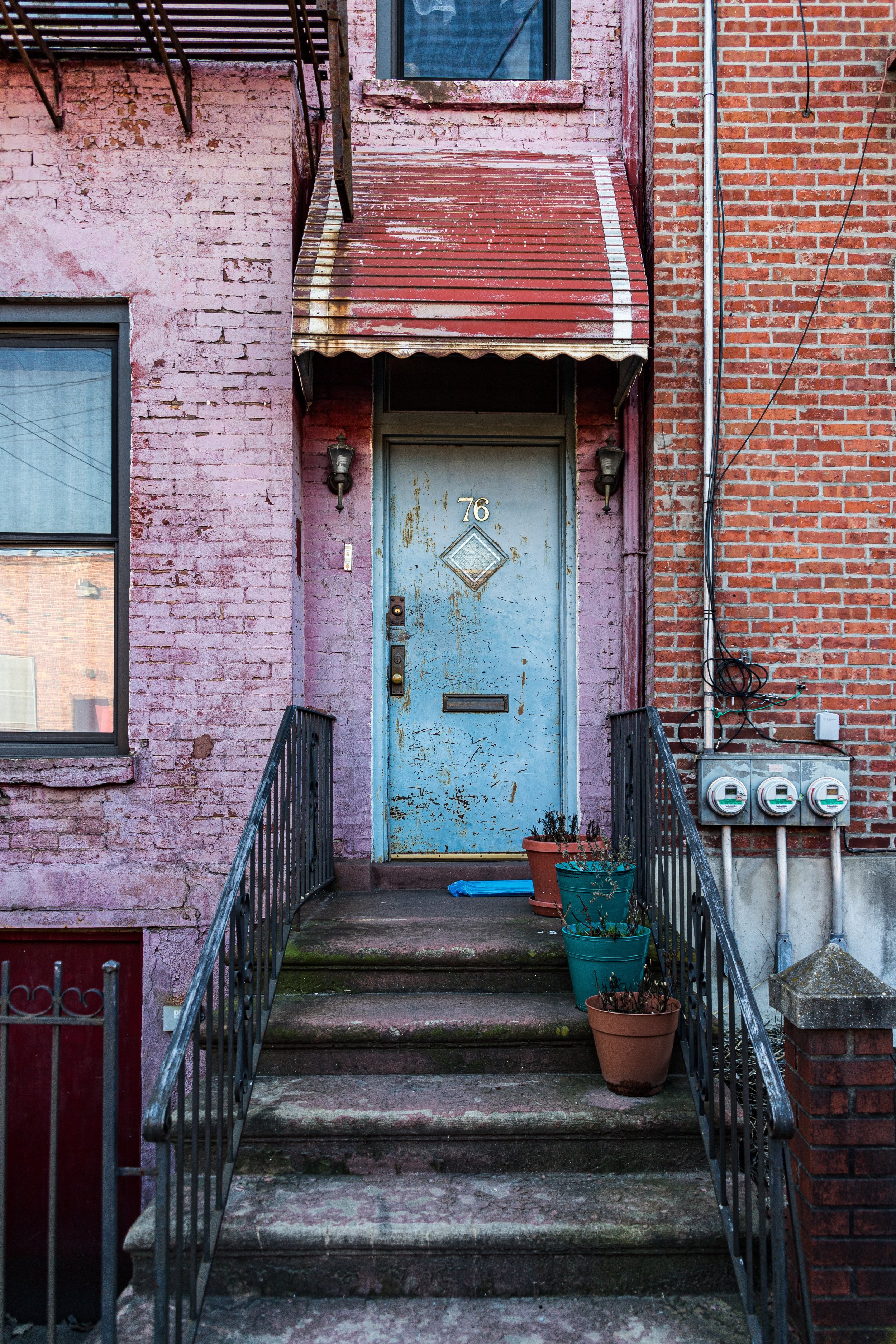
The architecture of the era reflected this duality: utilitarian brick warehouses stood beside simple but dignified Italianate rowhouses. The waterfront’s constant motion—commerce, immigration, and tides—gave the area an energy that was both worldly and intimate. By the 1890s, the Columbia Street corridor was fully built up, its storefronts offering groceries, tailors, and taverns serving the dockside workforce.
Early–Mid 20th Century: Industry, Decline, and Displacement
For much of the early 20th century, the Columbia Street waterfront remained a vital industrial zone. The Erie Basin, Atlantic Basin, and Red Hook Terminal bustled with shipping traffic, while nearby sugar refineries and warehouses provided steady employment. The Longshoremen’s unions, centered around International Longshoremen’s Association Local 1814, wielded significant influence. Columbia Street itself was a lively commercial strip, lined with bakeries, butchers, and bars that catered to dockworkers and their families.
After World War II, however, containerization and the shift of shipping to New Jersey’s larger ports devastated Brooklyn’s maritime economy. Docks fell silent, and unemployment surged. In the 1950s–1960s, urban renewal projects dealt further blows. The construction of the Brooklyn–Queens Expressway (1954) cleaved through the heart of South Brooklyn, creating a trench that separated Columbia Street from Carroll Gardens and Cobble Hill. The once-integrated community suddenly found itself cut off from schools, transit, and social networks.
A series of urban missteps followed: streets were widened, houses demolished, and new public housing complexes rose nearby. Then, in 1976, tragedy struck when a water main burst beneath Columbia Street, flooding basements and undermining foundations. Dozens of buildings were condemned, and much of the neighborhood was left vacant for nearly a decade. By the late 1970s, what had once been a thriving dockside village had become a desolate stretch of empty lots and boarded-up storefronts.
Neighborhood Video Coming Soon
Late 20th Century: Renewal and Reinvention
Recovery began slowly in the 1980s, led by determined residents, local activists, and small-scale developers. The Columbia Street Regeneration Committee—formed by local families and the South Brooklyn Local Development Corporation—secured city and state funding to rebuild the neighborhood block by block. New brick rowhouses were constructed on the footprints of those lost to collapse, designed to echo 19th-century proportions and materials. Streets were repaved, trees planted, and small businesses coaxed back to Columbia Street.
By the 1990s, the city officially recognized the area as the Columbia Street Waterfront District, a name that honored both its maritime past and its new beginnings. Artists and young families were drawn to its quiet streets and waterfront views. The neighborhood’s isolation, once a liability, became an asset—preserving its low-rise charm and close-knit atmosphere amid Brooklyn’s broader gentrification wave.
At the same time, environmental and public-space projects reclaimed the long-neglected harborfront. The Waterfront Garden (1984) and later the Columbia Street Esplanade (1998) provided green corridors overlooking the piers. Maritime remnants—bollards, rail tracks, and cobblestones—were preserved as living history, blending the aesthetic of an old port with the vitality of urban renewal.
21st Century: Between the City and the Sea
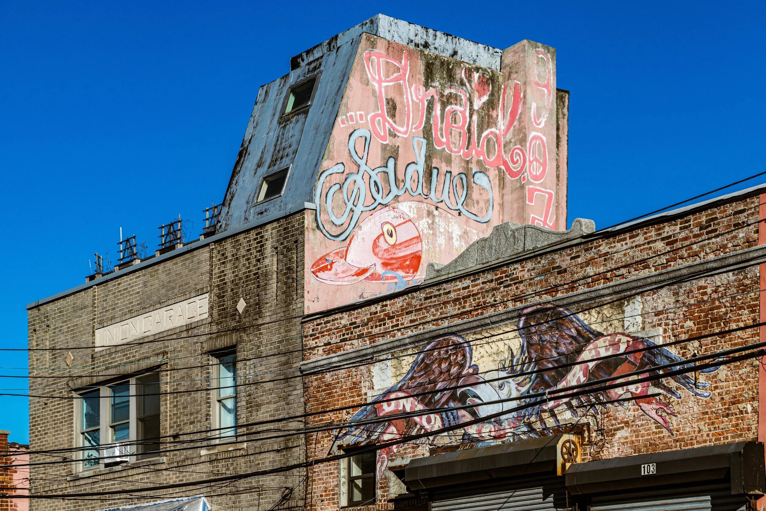
In the 21st century, the Columbia Street Waterfront District stands as one of Brooklyn’s smallest but most distinctive neighborhoods. It maintains a delicate equilibrium between tradition and innovation: historic brick warehouses converted into artist studios and restaurants, new townhouses that respect the scale of their surroundings, and an enduring sense of community fostered by its physical boundaries.
Columbia Street, now home to bakeries, cafés, bike shops, and restaurants like Alma and Lucali’s nearby cousin, hums with quiet life. The Mary A. Whalen, a decommissioned 1938 oil tanker moored at Pier 9, serves as the headquarters of PortSide NewYork, a nonprofit dedicated to reconnecting New Yorkers with their waterfront. Along the shore, Pioneer Works in adjacent Red Hook and the expanding Brooklyn Greenway knit the district back into the fabric of the city, creating a pedestrian and bicycle route that links it to the Brooklyn Bridge Park to the north and Sunset Park to the south.
Yet the neighborhood retains its sense of remove: no subway runs directly through it, and its boundaries—hemmed by expressways and docks—still define its rhythm. This semi-seclusion has preserved its intimacy, fostering a community of artists, longshoremen’s descendants, and newcomers who value both its tranquility and authenticity.
Columbia Street Waterfront District Photo Gallery
Spirit and Legacy
The Columbia Street Waterfront District’s legacy is one of rebirth at the edge of the city—a testament to how a neighborhood can lose everything and still rebuild from its own foundations. It has endured flood, neglect, and the violence of urban planning, yet reemerged with grace, rooted in the persistence of those who refused to abandon it. Its cobblestones, waterfront vistas, and low skyline evoke both Brooklyn’s industrial past and its creative future.
New York City
Use this custom Google map to explore where every neighborhood in all five boroughs of New York City is located.
The Five Boroughs
One of New York City’s unique qualities is its organization in to 5 boroughs: Manhattan, Brooklyn, Queens, The Bronx, and Staten Island. These boroughs are part pragmatic administrative districts, and part vestiges of the region’s past. Each borough is an entire county in New York State - in fact, Brooklyn is, officially, Kings County, while Staten Island is, officially Richmond County. But that’s not the whole story …
Initially, New York City was located on the southern tip of Manhattan (now the Financial District) that was once the Dutch colony of New Amsterdam. Across the East River, another city was rising: Brooklyn. In time, the city planners realized that unification between the rapidly rising cities would create commercial and industrial opportunities - through streamlined administration of the region.
So powerful was the pull of unification between New York and Brooklyn that three more counties were pulled into the unification: The Bronx, Queens, and Staten Island. And on January 1, 1898, the City of New York unified two cities and three counties into one Greater City of New York - containing the five boroughs we know today.
But because each borough developed differently and distinctly until unification, their neighborhoods likewise uniquely developed. Today, there are nearly 390 neighborhoods, each with their own histories, cultures, cuisines, and personalities - and each with residents who are fiercely proud of their corner of The Big Apple.


