ARLINGTON
Staten Island
Geographic Setting
Bounded by Harbor Road to the east, Forest Avenue and South Avenue to the southeast, Goethals Road to the south, and the Kill Van Kull to the west and north, Arlington forms Staten Island’s northwesternmost neighborhood—a place shaped equally by water, industry, and working-class resilience. It occupies a peninsula of sorts, where the Kill Van Kull, that narrow tidal strait separating Staten Island from Bayonne, New Jersey, bends in a wide curve. From its shorelines, tankers and tugboats glide toward the Goethals Bridge, whose steel span defines the neighborhood’s southern horizon.
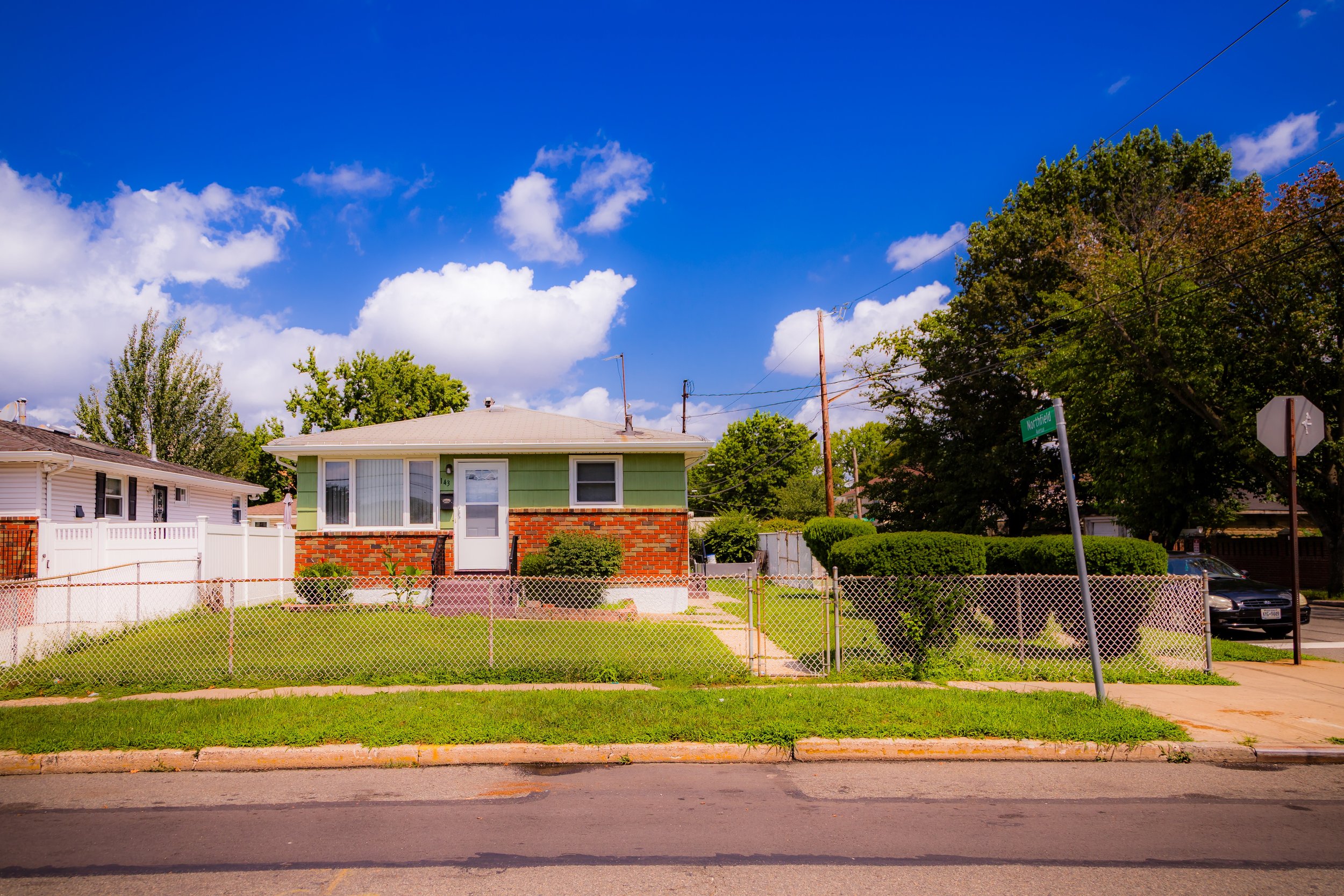
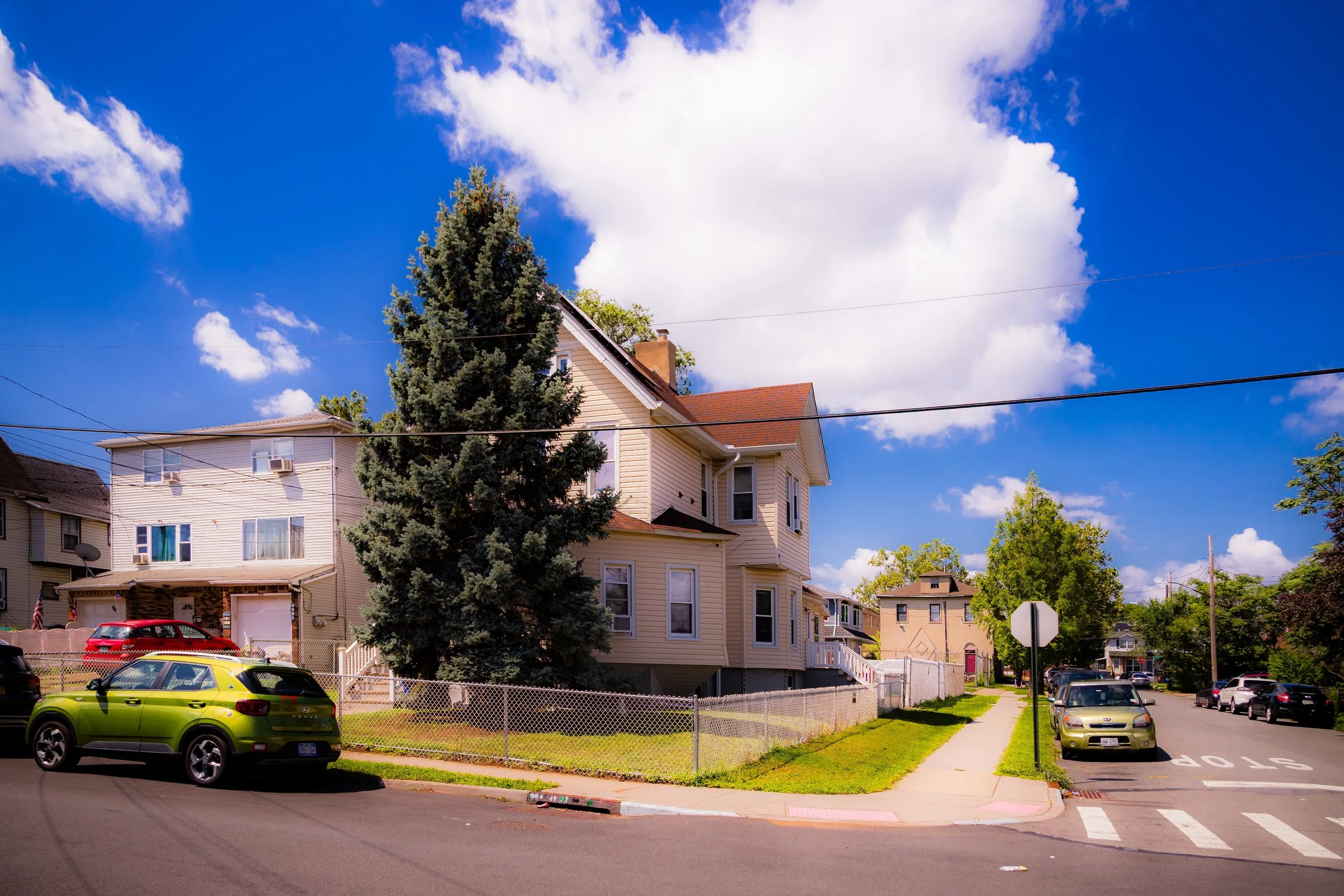
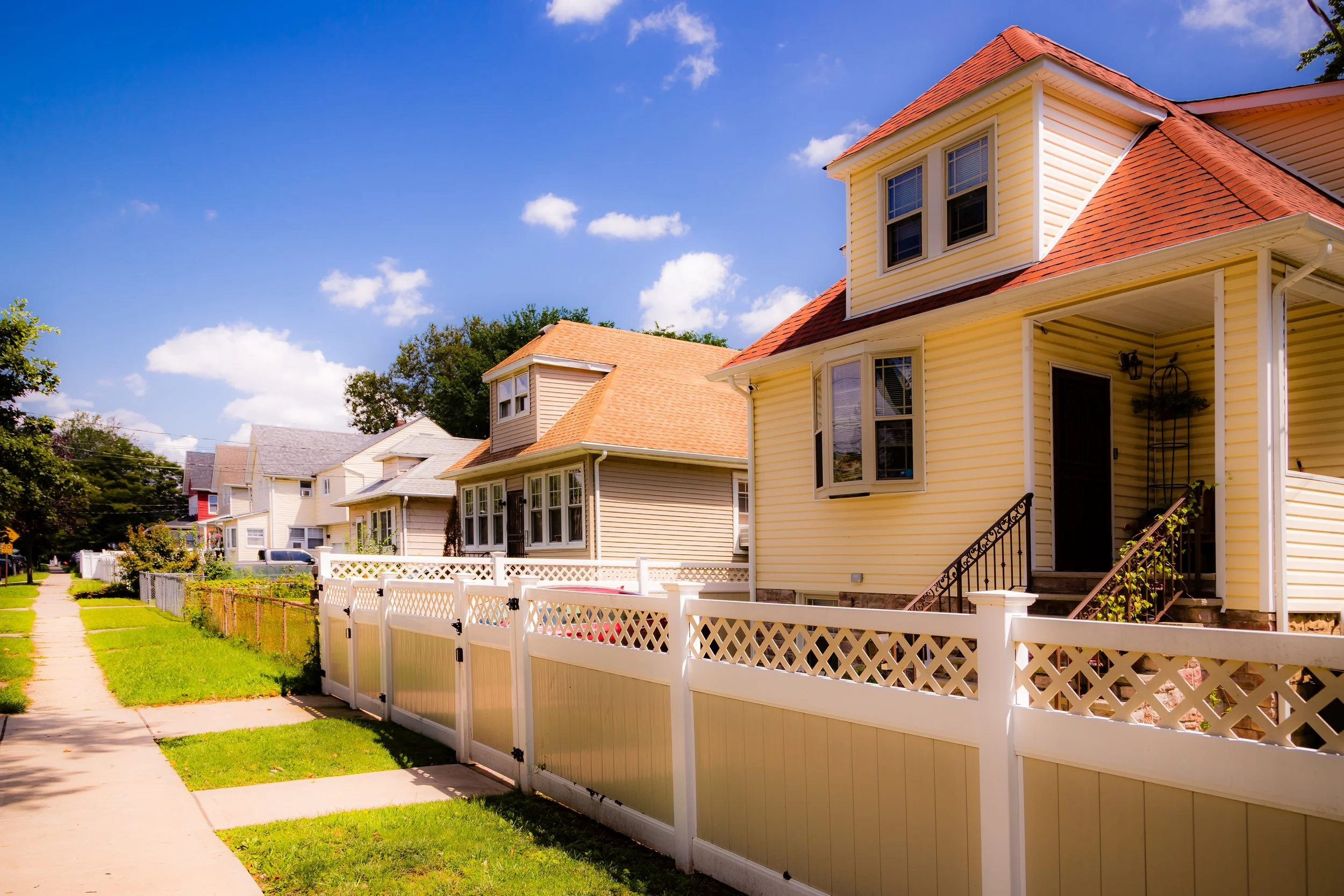
The terrain of Arlington rises gently from the waterfront’s industrial flats toward the residential blocks around Morningstar Road and Park Avenue, where rows of modest frame houses, corner delis, and church spires evoke the enduring texture of an urban village. The neighborhood sits within the larger district historically known as Mariner’s Harbor, yet it has always possessed a distinct identity—more maritime and more industrial, yet deeply communal. The Bayonne Bridge lies to the north, linking the waterfront to global commerce, while Goethals Road North and South Avenue provide its main inland connections. Arlington is both gateway and frontier: the edge of Staten Island where the sea and the city first meet.
Etymology
The name Arlington first appeared in the late 19th century, likely drawn from the same romantic and commemorative well that named Arlington, Virginia, home of the national cemetery and the former Custis-Lee estate. The choice reflected a period when Staten Island’s northern neighborhoods—like Port Ivory, Mariner’s Harbor, and West Brighton—were being subdivided by real-estate speculators eager to lend their developments genteel distinction. “Arlington” suggested dignity, elevation, and serenity—qualities that developers hoped would appeal to clerks and factory foremen seeking refuge from the crowded tenements of Manhattan and Jersey City.
The name persisted through the century because it suited the place: a community perched on a height above the Kill Van Kull, looking toward the mainland yet firmly anchored in its own identity.
The Neighborhood
Origins through the 19th Century
The area now called Arlington was originally part of the Mariner’s Harbor shoreline—an expanse of salt meadows and creeks where oyster beds flourished and small farms stretched inland. The Lenape fished and gathered shellfish here for centuries before European colonization. In the 17th and 18th centuries, Dutch and English settlers transformed the tidal flats into meadows and wharves, harvesting oysters, catching shad, and later shipping timber and produce across the Kill Van Kull.
By the mid-1800s, as Staten Island’s north shore industrialized, the area became a hub for shipyards, dry docks, and later oil storage and manufacturing. The Erastus Wiman era of Staten Island boosterism—when ferries, railways, and promotion promised to make the island “the next Brooklyn”—brought new roads and subdivisions to the northwest corner. Maps from the 1870s first mark “Arlington” as a residential extension of Mariner’s Harbor, a name used for a station stop on the Staten Island Rapid Transit Railway, established in 1886. Its presence encouraged workers from nearby ironworks and refineries to settle inland, and modest Victorian houses began to dot the grid near Park Avenue and Northfield Avenue.
Even then, Arlington’s geography bound it to labor and the sea. Its residents were ferrymen, dockworkers, blacksmiths, and carpenters—families whose lives moved to the rhythm of tide and whistle.
Early 20th Century: Industry and Community
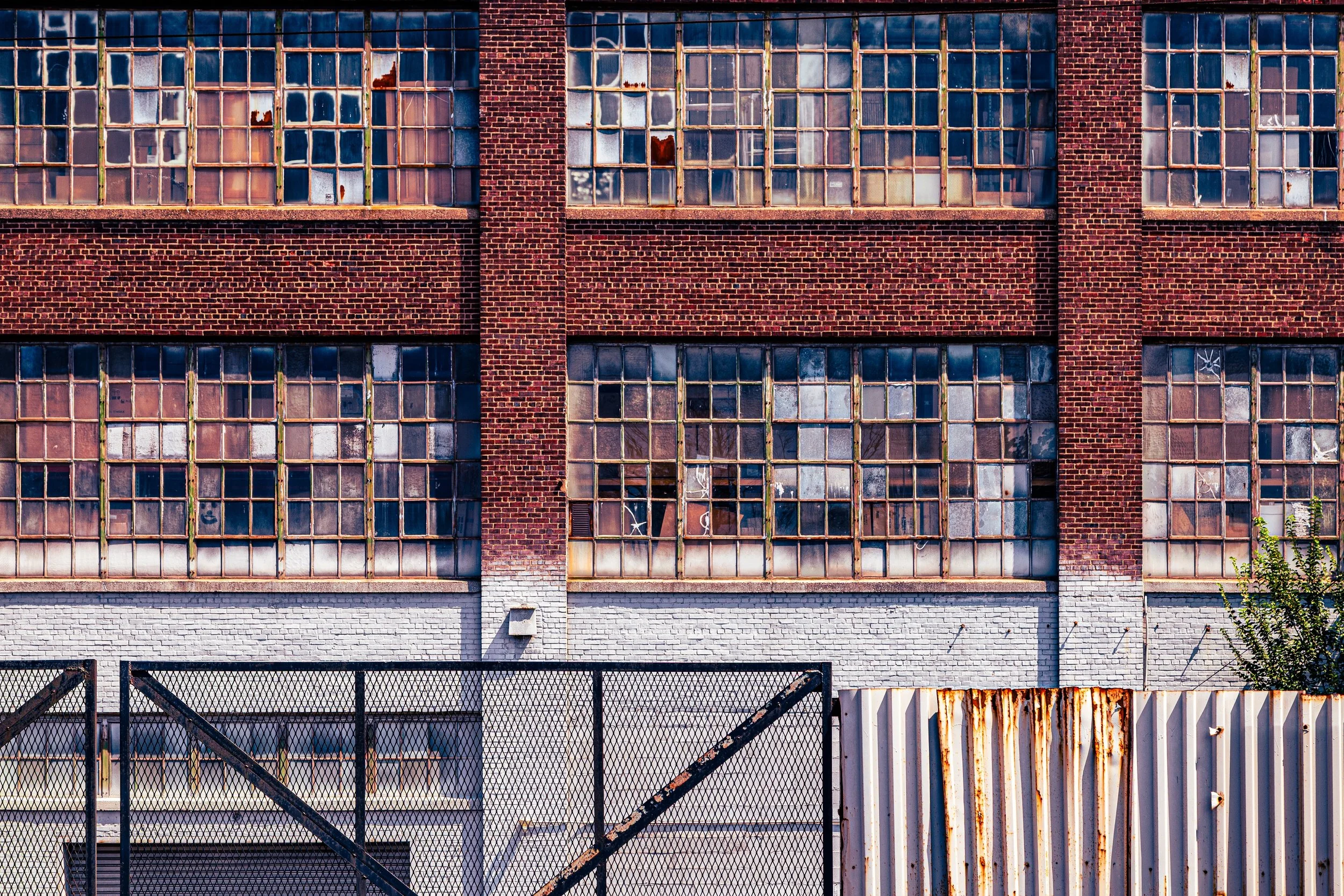
The early 1900s solidified Arlington’s identity as a working waterfront neighborhood. The Standard Oil Company built massive refining and storage facilities along the Kill Van Kull, part of a network that extended east to Port Richmond and west to Bayonne. Rail spurs carried freight directly to the docks, while narrow residential streets backed up against factories and warehouses.
Despite the industrial setting, a cohesive community emerged—immigrants from Ireland, Italy, Poland, and the American South who brought with them deep traditions of family and faith. Churches like St. Michael’s Roman Catholic Church and community halls provided the social heart. Small wooden homes filled with longshoremen, machinists, and sailors’ families defined the neighborhood’s texture. Schools such as P.S. 44 anchored local life, while mom-and-pop shops and taverns lined South Avenue.
By the 1930s and 1940s, as the Great Depression and war years reshaped industry, Arlington remained industrious but close-knit. Boys played stickball in the streets while ship horns sounded across the water. The smell of oil and salt air was constant; so was the sense of self-reliance. Arlington was never glamorous, but it was proud—a community that endured the city’s shifts without surrendering its rooted character.
Arlington Video Coming Soon
Mid–Late 20th Century: Decline and Resilience
The postwar decades brought both transformation and challenge. The Goethals Bridge (1928) had already connected Staten Island to New Jersey, but the completion of the Staten Island Expressway (1964) and containerization of shipping shifted commerce away from the older waterfronts. Many of the docks along the Kill Van Kull fell silent, and industries began to close or consolidate.
Arlington’s population changed accordingly. As blue-collar jobs declined, out-migration followed, and vacant lots appeared where factories once stood. Yet amid decline, the community persisted. Public housing developments such as Mariner’s Harbor Houses (1953) and Arlington Terrace Apartments (1958) sought to stabilize the area, offering affordable housing to working families and veterans. Civic associations and local churches provided a sense of continuity even as economic hardship deepened.
By the 1970s, portions of Arlington were characterized by urban neglect—abandoned warehouses, polluted waterways, and infrastructure in need of repair. But residents continued to invest in their neighborhood, advocating for cleanup and renewal. The North Shore Waterfront Conservancy and environmental groups later took up this mantle, recognizing the ecological and historical significance of the Kill Van Kull shoreline. Their work laid the groundwork for restoration efforts that would follow in the next century.
21st Century: Renewal on the Waterfront
In the 21st century, Arlington has emerged as one of Staten Island’s most quietly resilient communities. The Goethals Bridge replacement project (completed 2018) transformed the skyline and brought new infrastructure, while the nearby Matrix Global Logistics Park—a massive modern distribution hub—has reactivated the western shore with thousands of new jobs. Although technically south of Arlington proper, its presence has reconnected the community to the rhythms of commerce that once defined it.
New housing developments, rehabilitated homes, and improved transportation links have slowly reversed decades of decline. The Arlington Rail Yard, refurbished for freight service, now plays a strategic role in New York’s supply chain. Environmental cleanup of the Kill Van Kull’s edge and the creation of pocket parks have restored views of the water long lost to industry.
Still, the neighborhood remains true to its working-class spirit. Longtime residents mingle with newcomers drawn by affordability and proximity to Staten Island’s industrial corridor. Small churches, community centers, and local festivals maintain cultural continuity, while younger generations push for investment in schools and public transit. Arlington is not a suburb or a showcase—it is, rather, a living neighborhood of perseverance, defined by the strength of those who stayed.
Arlington Photo Gallery
Spirit and Legacy
Arlington’s legacy is written in labor and endurance. It is a place that has seen ships launched, factories shuttered, bridges raised, and communities reborn—all within the span of a century. Though smaller and less celebrated than many Staten Island neighborhoods, its contribution to the island’s working waterfront is profound. Every pier, every rowhouse, every church steeple speaks to a history of grit and dignity.
For those who live here, the sound of foghorns and the shimmer of the Kill Van Kull at dusk are reminders of belonging—to a neighborhood forged by tides and toil, where the past is never far below the surface. Arlington endures not because it was spared the city’s hardships, but because it met them with quiet strength.
New York City
Use this custom Google map to explore where every neighborhood in all five boroughs of New York City is located.
The Five Boroughs
One of New York City’s unique qualities is its organization in to 5 boroughs: Manhattan, Brooklyn, Queens, The Bronx, and Staten Island. These boroughs are part pragmatic administrative districts, and part vestiges of the region’s past. Each borough is an entire county in New York State - in fact, Brooklyn is, officially, Kings County, while Staten Island is, officially Richmond County. But that’s not the whole story …
Initially, New York City was located on the southern tip of Manhattan (now the Financial District) that was once the Dutch colony of New Amsterdam. Across the East River, another city was rising: Brooklyn. In time, the city planners realized that unification between the rapidly rising cities would create commercial and industrial opportunities - through streamlined administration of the region.
So powerful was the pull of unification between New York and Brooklyn that three more counties were pulled into the unification: The Bronx, Queens, and Staten Island. And on January 1, 1898, the City of New York unified two cities and three counties into one Greater City of New York - containing the five boroughs we know today.
But because each borough developed differently and distinctly until unification, their neighborhoods likewise uniquely developed. Today, there are nearly 390 neighborhoods, each with their own histories, cultures, cuisines, and personalities - and each with residents who are fiercely proud of their corner of The Big Apple.


