UNION SQUARE
Manhattan
Geographic Setting
Bounded by East 14th Street to the south and East 18th Street to the north, and stretching from Fifth Avenue eastward to Irving Place, Union Square lies at the confluence of downtown and Midtown Manhattan—a crossroads where commerce, culture, and civic life have converged for nearly two centuries. The neighborhood takes its name from the great oval plaza at its center, formed by the “union” of Broadway and the Bowery Road (now Fourth Avenue) when the Commissioners’ Plan of 1811 imposed Manhattan’s grid. This accidental geometry produced one of the city’s most significant public spaces, around which an enduring district of shops, theaters, residences, and institutions evolved.
Today, Union Square is both an urban commons and a neighborhood—anchored by its historic park, its bustling Greenmarket, and its surrounding blocks of late-19th- and early-20th-century architecture. Along its perimeter rise landmarks such as the Decker Building, Consolidated Edison Building, and Lincoln Building, while to the east, Irving Place and Gramercy lend a quieter, residential cadence. Beneath it all runs the city’s busiest transit hub, a literal union of subway lines mirroring the social convergence above.
Etymology and Origins
The name “Union Square” does not commemorate the American Union, as later myth suggested, but rather the union of Manhattan’s two great thoroughfares—Broadway and Fourth Avenue (formerly the Bowery Road)—at this precise juncture. The space first appeared on city maps in 1815, envisioned as an open plaza to relieve the dense grid. The city formally established Union Place in 1832, then redesigned it as Union Square Park in 1839 under the direction of Samuel Ruggles, a developer and civic reformer who sought to create an elegant northern counterpart to Washington Square.
Ruggles planted elms, laid gravel paths, and encircled the square with iron fencing and dignified townhouses. From the outset, Union Square served dual purposes: a genteel promenade for the wealthy and a democratic meeting ground for the city’s growing population. Its name thus proved prophetic—Union Square became a literal and symbolic point of convergence.
The Neighborhood
19th Century: From Promenade to Public Forum
By the 1850s, Union Square was the epicenter of fashionable New York. Grand hotels such as the Everett House and Clarendon rose along its perimeter, while luxury retailers and publishers filled Broadway and Fourth Avenue. The square’s central lawns hosted band concerts and parades; gaslights and horse-drawn carriages circled its drives in an atmosphere of Victorian elegance.
However, the square’s destiny as a civic space soon eclipsed its role as a social one. The Civil War transformed Union Square into the nation’s rallying ground: on April 20, 1861, tens of thousands gathered for the Great Union Meeting to support President Lincoln and the Union cause, giving the park patriotic resonance its name had never intended. Subsequent decades saw further politicization—labor rallies, suffrage parades, and socialist demonstrations cemented Union Square’s reputation as the city’s agora. The first Labor Day parade, held on September 5, 1882, marched north along Broadway to Union Square, marking the park as the birthplace of the American labor movement.
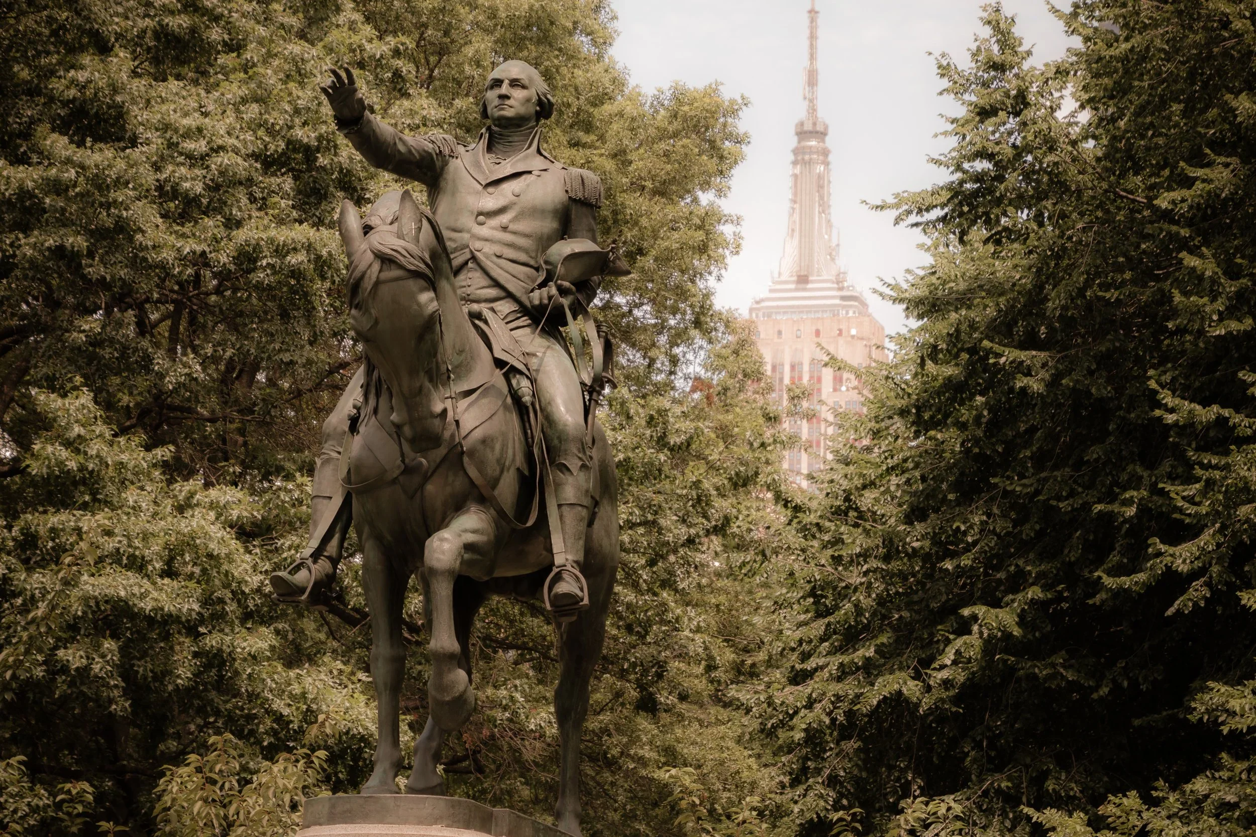
Architectural grandeur accompanied this civic energy. The George Washington statue by Henry Kirke Brown (1856) graced the south plaza; later monuments to Lincoln (1870) and Lafayette (1876) embodied the square’s evolving symbolism—freedom, democracy, and alliance.
Early 20th Century: Commerce, Activism, and Artistry
By the early 1900s, Union Square had shifted from residential enclave to bustling commercial district. Department stores, publishing houses, and union offices clustered along Broadway and 14th Street. The construction of the Fourth Avenue subway (1904) and IRT station at 14th Street–Union Square reinforced the area’s centrality.
Union Square became known as “the city’s soapbox,” where speakers of every persuasion addressed crowds on socialism, workers’ rights, and international causes. Labor leaders like Eugene V. Debs and Emma Goldman drew audiences beneath the park’s elms, while police surveillance and crackdowns made it a barometer of New York’s political climate.
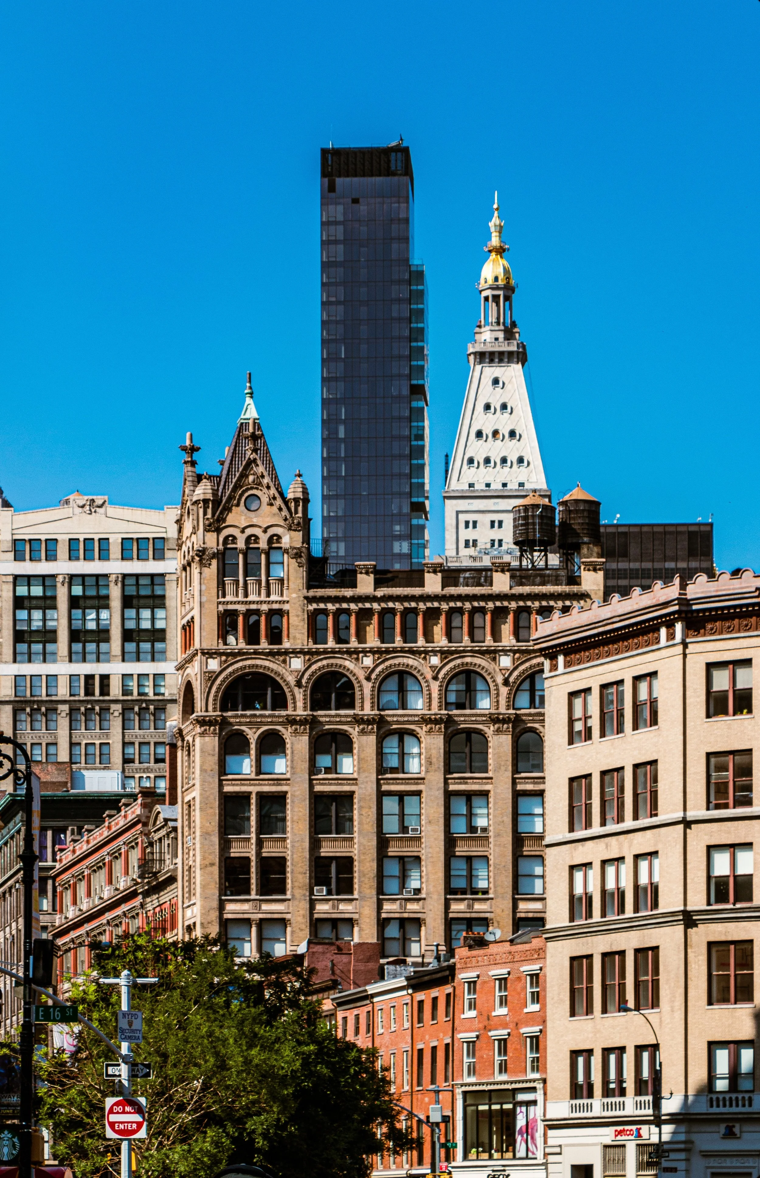
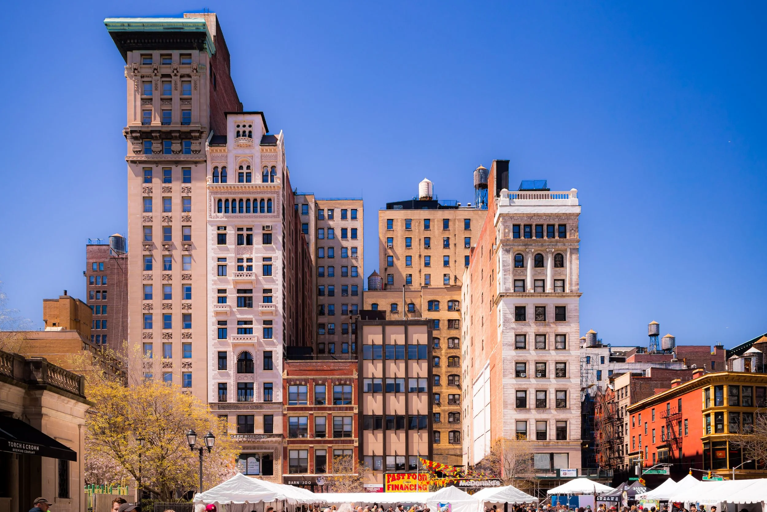
At the same time, the neighborhood’s architectural fabric matured. Loft buildings with cast-iron and terra-cotta façades replaced earlier rowhouses, serving garment and printing trades. Artists’ studios occupied upper floors, including the Decker Building (1883) at 33 Union Square West, later home to Andy Warhol’s Factory in the 1960s. By mid-century, the area reflected both the city’s industrial pulse and its artistic imagination.
Manhattan Neighborhoods Photographic Tour
Mid–Late 20th Century: Decline and Reawakening
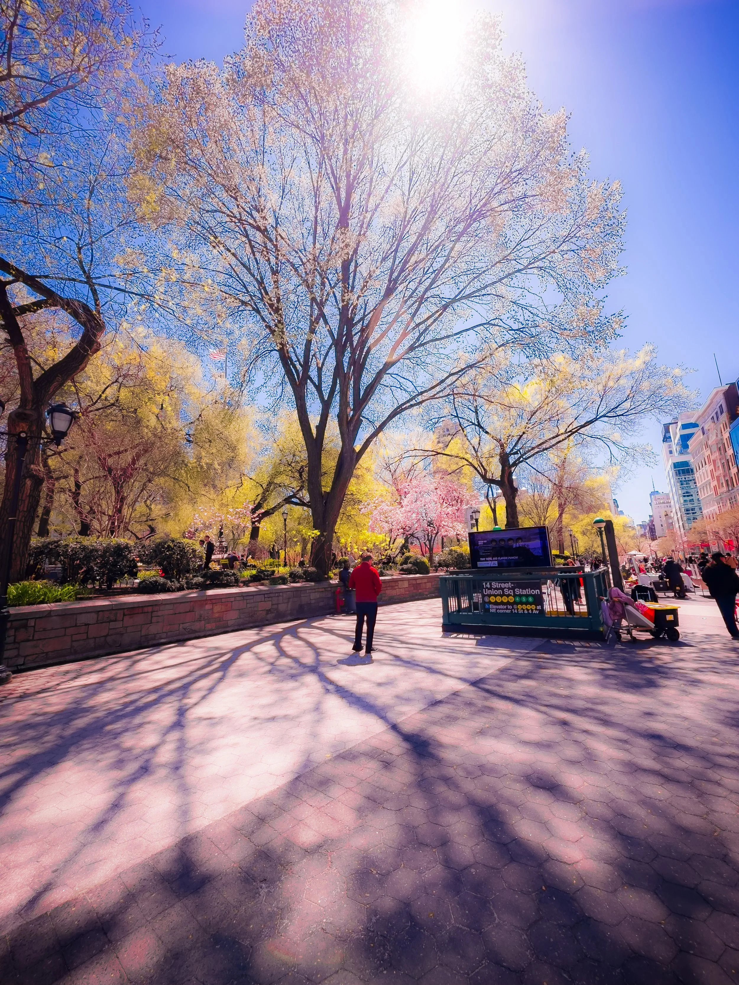
Like much of Lower Manhattan, Union Square declined in the postwar decades. The departure of department stores to Midtown and suburban malls left vacancies along 14th Street; crime and neglect shadowed the park. Yet grassroots renewal began in the 1970s with the creation of the Union Square Greenmarket (1976) by Barry Benepe and Bob Lewis, who envisioned connecting upstate farmers with urban consumers. The Greenmarket redefined the park’s identity—restoring it as a place of gathering, sustainability, and civic health.
Urban revitalization accelerated in the 1980s and 1990s. Landscape architect Paul Friedberg redesigned Union Square Park (1985–1987), balancing historic restoration with modern amenities. The area attracted bookstores, cafés, and cultural institutions; The New School, Parsons School of Design, and New York University expanded their presence nearby, infusing the neighborhood with students and artists. By the turn of the 21st century, Union Square had reclaimed its historic role as both marketplace and meeting ground.
21st Century: Public Life and Plural Identity
Today, Union Square embodies the essence of New York’s public life—part park, part plaza, part protest ground. The Greenmarket, held four days a week, remains the city’s premier farmers’ market and a model of urban sustainability. Seasonal fairs, art installations, and vigils fill the park’s terraces, while the square continues to serve as the city’s democratic pulse—hosting climate marches, political rallies, and memorial gatherings.
The surrounding neighborhood, meanwhile, has evolved into a blend of commerce and residence. Renovated lofts, tech offices, and mixed-use buildings coexist with historic structures like the Lincoln Building (now One Union Square East) and the Consolidated Edison clock tower. The side streets east of Park Avenue—particularly along Irving Place—retain a 19th-century intimacy: brick rowhouses, old taverns like Pete’s Tavern (est. 1864), and quiet shade trees recall the area’s residential roots even as new energy hums a block away.
Union Square’s urban ecosystem—students, activists, commuters, and families—mirrors the diversity of the city itself. It remains one of the few places where all New Yorkers, regardless of class or calling, cross paths daily.
Union Square Photo Gallery
Spirit and Legacy
Union Square’s legacy is that of the public square as moral compass—a space that has reflected and shaped the conscience of New York for two centuries. From abolitionist speeches to labor parades, from antiwar protests to environmental markets, it has hosted every movement that tested and reaffirmed the city’s ideals of freedom and equality. Its physical design—a union of avenues—has become a metaphor for civic unity.
New York City
Use this custom Google map to explore where every neighborhood in all five boroughs of New York City is located.
The Five Boroughs
One of New York City’s unique qualities is its organization in to 5 boroughs: Manhattan, Brooklyn, Queens, The Bronx, and Staten Island. These boroughs are part pragmatic administrative districts, and part vestiges of the region’s past. Each borough is an entire county in New York State - in fact, Brooklyn is, officially, Kings County, while Staten Island is, officially Richmond County. But that’s not the whole story …
Initially, New York City was located on the southern tip of Manhattan (now the Financial District) that was once the Dutch colony of New Amsterdam. Across the East River, another city was rising: Brooklyn. In time, the city planners realized that unification between the rapidly rising cities would create commercial and industrial opportunities - through streamlined administration of the region.
So powerful was the pull of unification between New York and Brooklyn that three more counties were pulled into the unification: The Bronx, Queens, and Staten Island. And on January 1, 1898, the City of New York unified two cities and three counties into one Greater City of New York - containing the five boroughs we know today.
But because each borough developed differently and distinctly until unification, their neighborhoods likewise uniquely developed. Today, there are nearly 390 neighborhoods, each with their own histories, cultures, cuisines, and personalities - and each with residents who are fiercely proud of their corner of The Big Apple.


