
FLORAL PARK
Queens
Geographic Setting
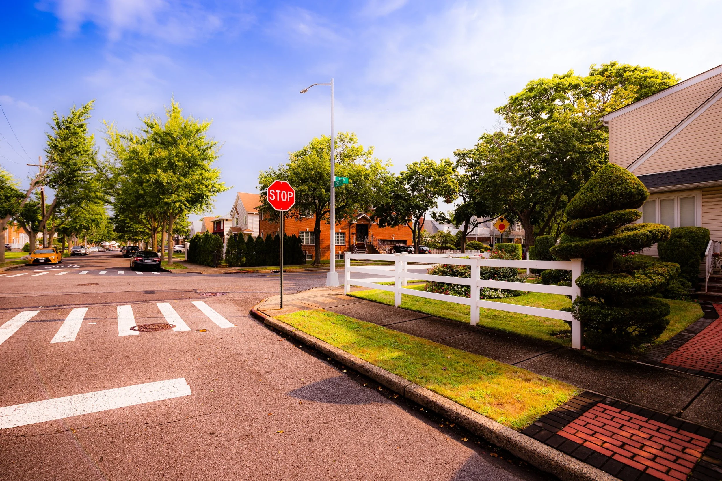
Bounded by Little Neck Parkway to the west, Union Turnpike to the north, 268th Street to the east, and the Nassau County line to the south and southwest, Floral Park marks the easternmost edge of Queens—a gateway between New York City and Long Island’s first ring of suburban towns. Nestled at the borough’s border, it is a neighborhood of tree-lined streets, gabled homes, and manicured lawns, defined by the tranquil rhythm of a small-town community yet fully connected to the city’s metropolitan pulse.
The Long Island Rail Road’s Floral Park Station and the commercial spine of Tulip Avenue form the neighborhood’s civic heart, surrounded by clusters of early-20th-century single-family homes, local churches, and small businesses. The community’s northern edge along Union Turnpike offers access to Glen Oaks, Queens Village, and Bellerose, while its southern edge blends almost seamlessly into the Village of Floral Park, which lies just across the Nassau County border. The shared name reflects both geography and history: a once-rural landscape of greenhouses and flower farms that evolved into one of the first truly suburban enclaves of Greater New York.
Etymology and Origins
The name “Floral Park” dates to the 1870s and 1880s, when the area—then part of the old Town of Hempstead—was transformed by the expansion of the Long Island Rail Road and the rise of the regional nursery trade. The land had been largely agricultural throughout the 18th and early 19th centuries, worked by Dutch and English-descended families who grew vegetables, hay, and flowers for Manhattan markets. In 1874, a businessman named John Lewis Childs, an enterprising seed merchant from Brooklyn, purchased farmland near the LIRR tracks and established a mail-order seed and bulb empire.
Childs not only grew his business into one of the nation’s largest seed distributors but also founded and named the surrounding community. “Floral Park,” inspired by his horticultural ventures, became both brand and place—a meticulously planned village with tree-shaded avenues, nurseries, and elegant Victorian homes. Streets were named for flowers and trees (Tulip, Violet, Iris, and Magnolia), and Childs himself served as the community’s first postmaster. By the 1890s, Floral Park had its own railroad depot, school, and town square, and it officially incorporated as a village in 1908, straddling the Nassau–Queens border that was later formalized when Nassau County separated from Queens in 1899.
The Neighborhood
Early 20th Century: Suburban Foundations and Growth
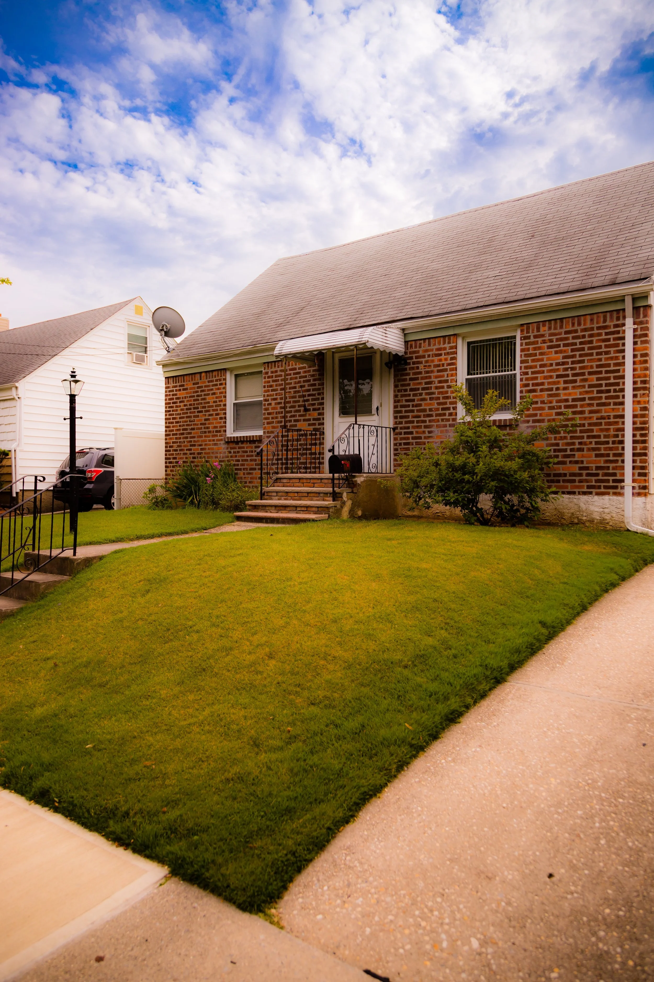
The early decades of the 20th century saw Floral Park flourish as a model suburb. The Queens side, while smaller in area, mirrored the residential charm and architectural character of its Nassau counterpart. The neighborhood attracted middle-class families—teachers, civil servants, and shopkeepers—who sought the safety and greenery of suburbia while retaining proximity to city jobs. The Long Island Rail Road, with direct service to Penn Station after 1910, made daily commuting practical, while Jericho Turnpike and Union Turnpike connected the community by road to Queens and Manhattan.
Houses built during this period reflected popular suburban styles: Colonial Revival, Tudor, and Cape Cod, many with porches, dormers, and bay windows that echoed the Arts & Crafts movement’s emphasis on craftsmanship. The neighborhood’s tight grid of streets and deep sense of order reflected early 20th-century ideals of planned suburban living. Churches such as Our Lady of Victory Roman Catholic Church and schools like P.S. 133Q became enduring community anchors.
By the 1930s, Floral Park was firmly established as one of the easternmost residential strongholds of Queens. While other parts of the borough urbanized rapidly, Floral Park retained its low-density, garden-suburb identity, buffered by its position at the city’s edge and by the strong civic traditions it shared with its Nassau neighbors.
Mid–Late 20th Century: Community Continuity and Suburban Stability
The postwar years reinforced Floral Park’s character as a stable, middle-class enclave. Returning veterans and young families moved into the area in the late 1940s and 1950s, drawn by modest home prices, good schools, and the promise of suburban quiet within the city’s borders. The expansion of Union Turnpike and the Grand Central Parkway increased accessibility while preserving the neighborhood’s green, residential core.
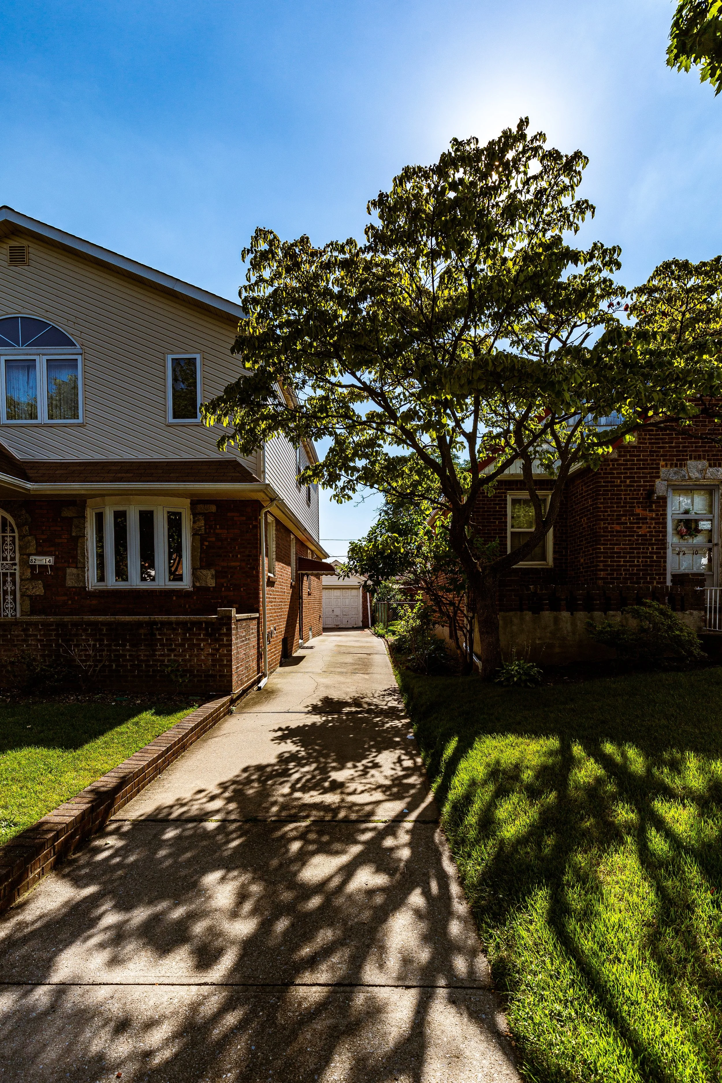
Unlike many neighborhoods in central and western Queens, Floral Park saw little large-scale redevelopment during this period. Zoning protections, community advocacy, and its distance from major industrial centers ensured that the area retained its primarily single-family housing stock. Civic organizations such as the Floral Park Civic Association and the Floral Park–Bellerose Little League reflected the neighborhood’s family-oriented spirit. Residents took pride in maintaining well-kept gardens, tree-lined blocks, and the small-town feel of Tulip Avenue, where independent shops and cafés served as social gathering points.
Culturally, Floral Park remained predominantly Irish-, Italian-, and German-American through much of the 20th century, with parochial schools and parish life playing central roles. Over time, it welcomed growing numbers of Jewish and later South Asian families, mirroring the gradual diversification of eastern Queens while maintaining a cohesive community identity.
Floral Park Video Coming Soon
Late 20th–21st Century: Preservation and New Diversity
By the 1980s and 1990s, Floral Park had become a portrait of quiet continuity amid the city’s transformation. Its proximity to Glen Oaks Village, Bellerose, and Queens Village allowed for overlapping social and commercial networks, while its strong civic associations helped preserve its suburban scale against development pressures. The area’s border with Nassau County remained practically invisible—a testament to how seamlessly the two communities have grown together since their 19th-century roots.
The 21st century brought renewed diversity, as South Asian, Caribbean, and East Asian families joined long-established residents, enriching the cultural life of the neighborhood without disrupting its architectural or civic character. Schools, parks, and community institutions adapted naturally to this evolution, with festivals and cultural events reflecting the mosaic of modern Queens.
Despite its location within New York City, Floral Park continues to evoke the sensibility of a village: front porches adorned with seasonal flowers, block parties in summer, and a rhythm of daily life more reminiscent of Long Island than of the metropolis to the west. Its Floral Park Memorial High School, shared with neighboring Bellerose, remains a hub of community pride, while the LIRR continues to connect residents to Manhattan in under 40 minutes—a journey that still defines the dream of living “in the suburbs but of the city.”
Floral Park Photo Gallery
Spirit and Legacy
Floral Park’s spirit lies in its balance of history, greenery, and community. Born from the vision of a seed merchant, it remains a place where gardens, families, and architecture harmonize—a living testament to New York’s suburban ideal at its most human scale. Its streets, still named for flowers, recall its horticultural origins, while its well-kept homes and civic vitality reflect generations of care and continuity.
New York City
Use this custom Google map to explore where every neighborhood in all five boroughs of New York City is located.
The Five Boroughs
One of New York City’s unique qualities is its organization in to 5 boroughs: Manhattan, Brooklyn, Queens, The Bronx, and Staten Island. These boroughs are part pragmatic administrative districts, and part vestiges of the region’s past. Each borough is an entire county in New York State - in fact, Brooklyn is, officially, Kings County, while Staten Island is, officially Richmond County. But that’s not the whole story …
Initially, New York City was located on the southern tip of Manhattan (now the Financial District) that was once the Dutch colony of New Amsterdam. Across the East River, another city was rising: Brooklyn. In time, the city planners realized that unification between the rapidly rising cities would create commercial and industrial opportunities - through streamlined administration of the region.
So powerful was the pull of unification between New York and Brooklyn that three more counties were pulled into the unification: The Bronx, Queens, and Staten Island. And on January 1, 1898, the City of New York unified two cities and three counties into one Greater City of New York - containing the five boroughs we know today.
But because each borough developed differently and distinctly until unification, their neighborhoods likewise uniquely developed. Today, there are nearly 390 neighborhoods, each with their own histories, cultures, cuisines, and personalities - and each with residents who are fiercely proud of their corner of The Big Apple.


