SOUNDVIEW
The Bronx
Geographic Setting
Bounded by Westchester Avenue to the north, White Plains Road to the east, Lacombe Avenue to the south, Soundview Park to the southeast, and the Bronx River to the west, Soundview occupies a broad, low-lying tract of the southeastern Bronx where the city’s urban grid meets the tidal waters of the East River estuary. Its geography is defined by the curve of the Bronx River, which frames its western edge, and by Soundview Park, a sprawling green expanse of wetlands, meadows, and ballfields that gives the neighborhood both its name and its lungs.
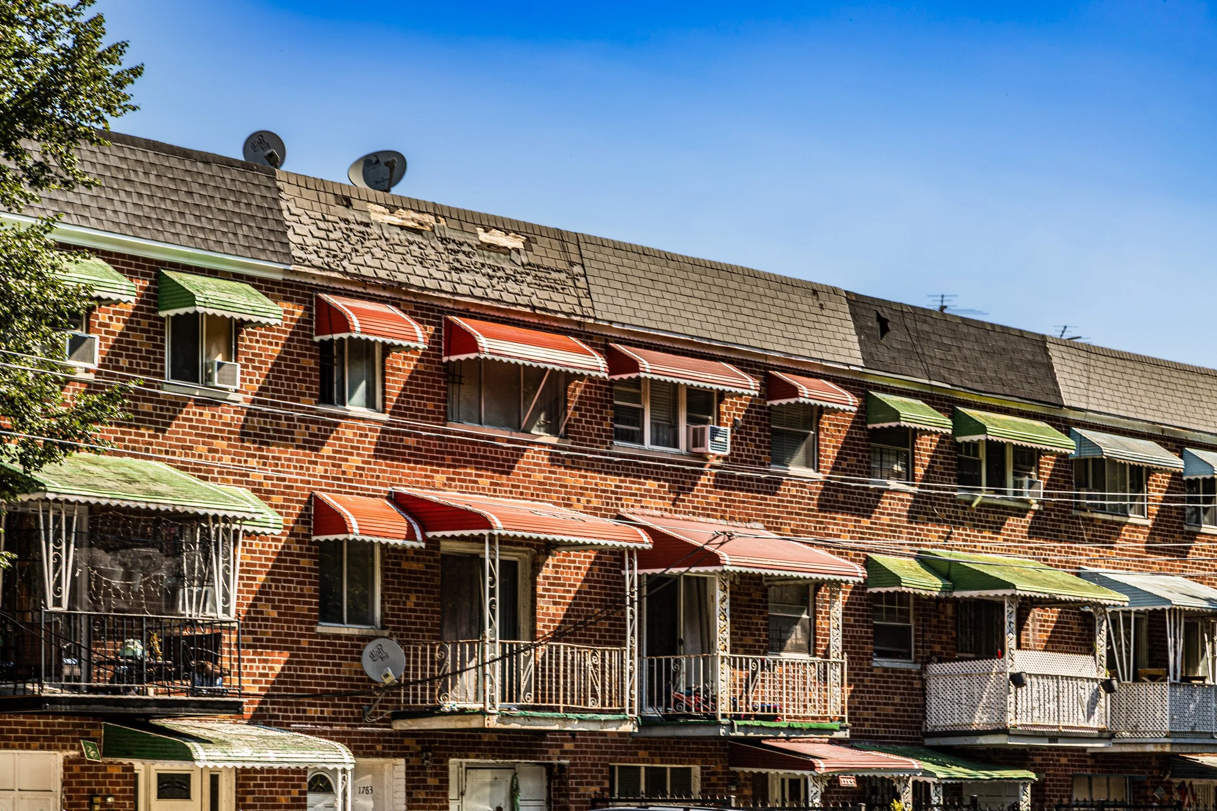
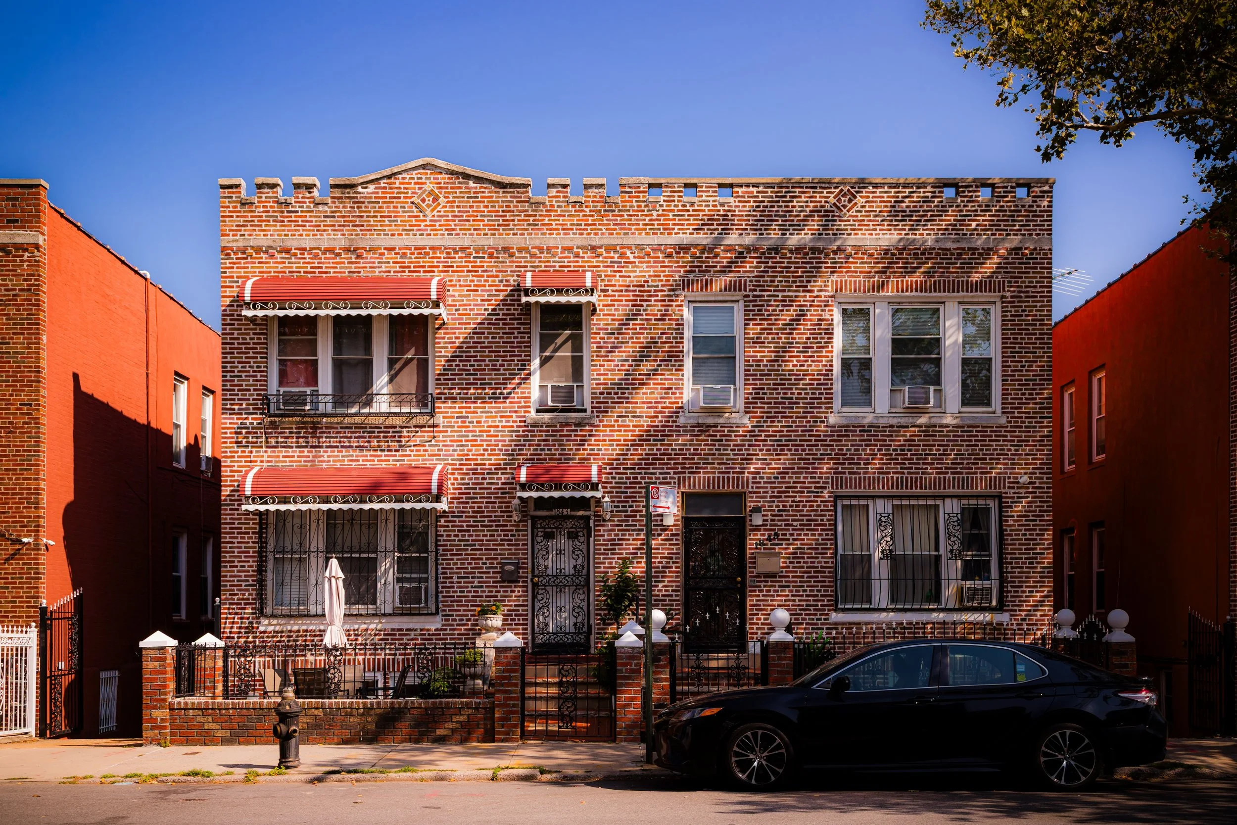
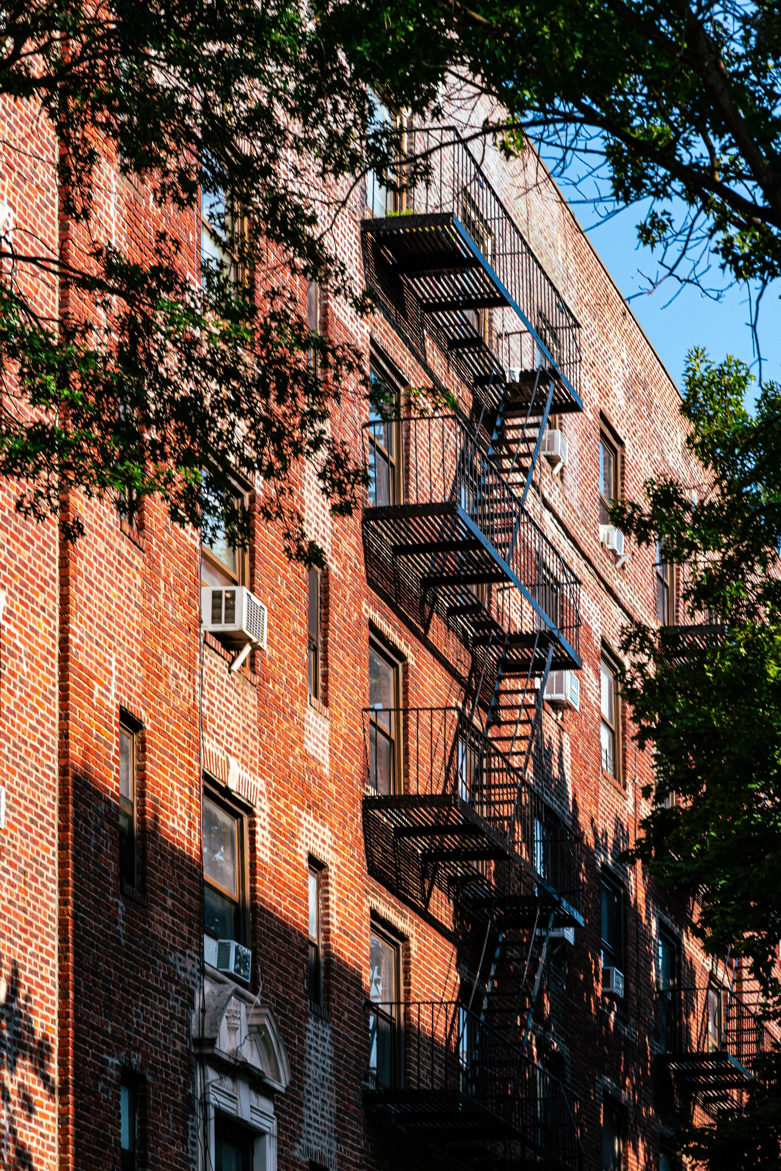
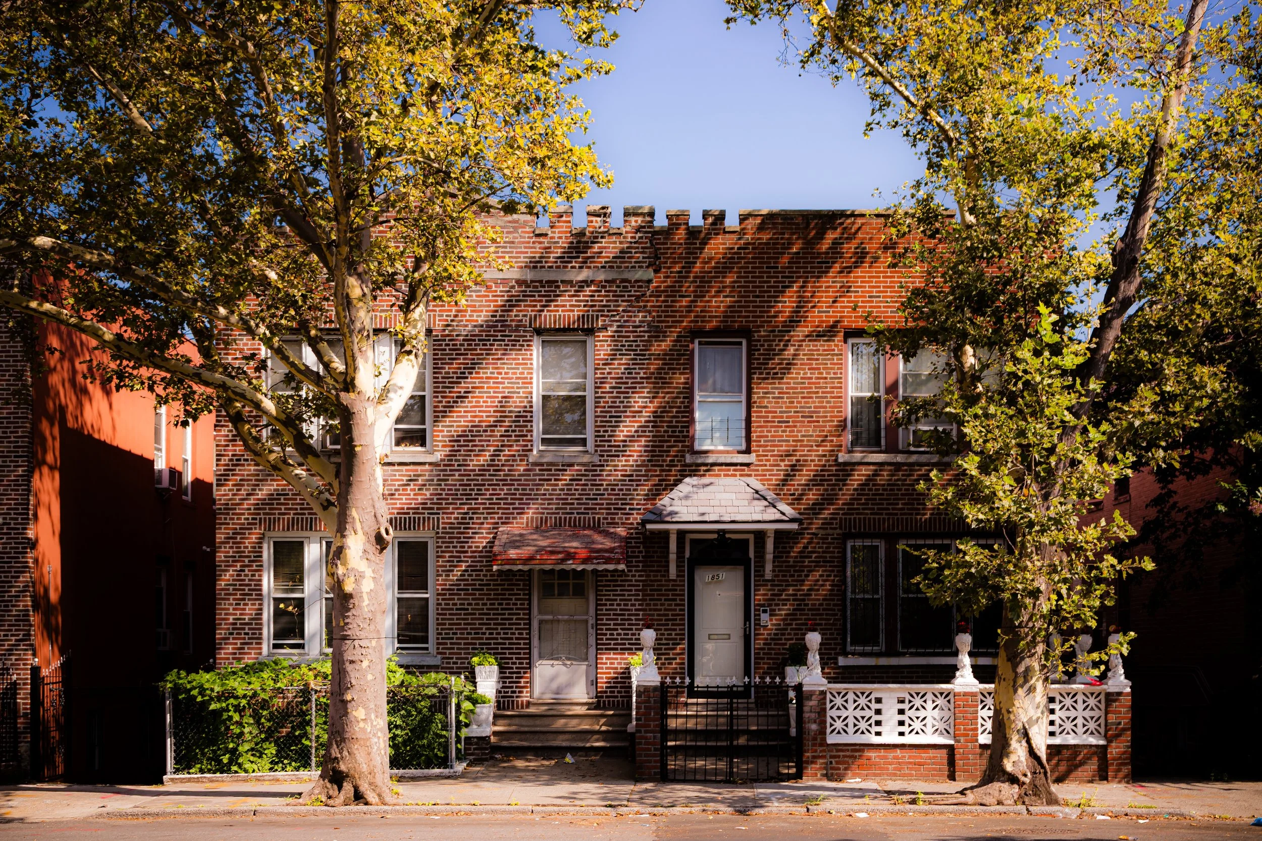
Within these borders, Soundview is a place of contrasts—gritty and green, densely populated yet dotted with open space. Residential life unfolds along Watson Avenue, Lacombe Avenue, and Story Avenue, where clusters of mid-20th-century apartment towers, red-brick rowhouses, and detached single-family homes reflect decades of layered development. Major arteries such as White Plains Road, Metcalf Avenue, and Soundview Avenue knit the community together, while Westchester Avenue—lined with shops, restaurants, and transit connections—forms its busy northern boundary.
Though often associated with its large public housing complexes, Soundview is far more multifaceted: it is a community where high-rises overlook tree-shaded side streets, and where the edge of the Bronx River opens into one of the borough’s most vital ecological and recreational corridors.
Etymology
The name “Soundview” first appeared in the early 20th century, when developers and city planners sought to brand the area along the lower Bronx River as a waterfront district with views toward the Long Island Sound. The term was both aspirational and geographical—the neighborhood’s southeastern edge indeed faces the waters that merge into the Sound, but the name also signaled a vision of renewal and access to nature.
The designation gained permanence with the creation of Soundview Park in the 1930s, which formalized the area’s identity around its riverine and maritime setting. In a borough of neighborhoods named for manors, avenues, and immigrant origins, “Soundview” stood out for its landscape-centered poetry: a view of the Sound, and a promise of open air at the city’s edge.
The Neighborhood
Origins through the 19th Century
Before its urbanization, the land that would become Soundview was part of the Sound View and Clason Point tracts, originally belonging to the Clason family, early Scottish settlers who purchased large portions of the Bronx shoreline in the late 17th century. For much of the 18th and 19th centuries, the area remained a patchwork of farms, salt meadows, and oyster-rich marshland. The Bronx River, then a working waterway, supported gristmills and small docks that shipped agricultural products toward the Harlem River and beyond.
The coming of the New York, Westchester & Boston Railway (1912) and the extension of Westchester Avenue began to draw urban development eastward, but this coastal stretch remained semi-rural well into the early 20th century. The construction of the Bronx River Parkway (begun in 1907) and the Bruckner Boulevard corridor redefined the area’s boundaries, setting the stage for industrial expansion and, eventually, large-scale housing.
By the early 1900s, as city planners sought to transform the lower Bronx River’s neglected marshlands into recreational space, the term “Sound View” began appearing in maps and park plans—an early sign of the area’s shifting destiny from rural fringe to urban waterfront.
Early 20th Century: Urbanization and the Birth of Soundview Park
The transformation of Soundview began in earnest during the 1930s, under the direction of Robert Moses and the city’s ambitious public works agenda. The marshlands along the Bronx River were filled and graded to create Soundview Park, envisioned as the “gateway park” of the southeastern Bronx. The park’s design echoed the era’s optimism: broad athletic fields, promenades, and waterfront vistas intended to serve the growing working-class population settling nearby.
Residential construction accelerated after World War II, as the city sought to accommodate returning veterans and low- to middle-income families. Single- and two-family homes filled streets north of Lacombe Avenue, while modest apartment buildings arose along Watson Avenue and Soundview Avenue. Churches, schools, and small businesses soon followed, shaping a community that combined stability with accessibility.
In the 1950s, the city launched a major wave of public housing construction, led by the New York City Housing Authority (NYCHA). Developments such as Bronx River Houses (1951), Soundview Houses (1954), and Clason Point Gardens (1941) defined the new skyline—modernist brick towers surrounded by green courtyards, intended as symbols of progress and equality. For many families, particularly Puerto Rican and African-American New Yorkers, these developments offered a foothold into stable urban life amid the postwar housing shortage.
Soundview Video Coming Soon
Mid–Late 20th Century: Turbulence and Transformation
The promise of postwar modernism gave way to the challenges of urban change. By the 1960s and 1970s, Soundview—like much of the Bronx—faced economic disinvestment, rising unemployment, and the consequences of redlining and segregation. The large-scale housing complexes, once celebrated as architectural achievements, suffered from underfunding and poor maintenance. Fires, crime, and infrastructure decay took their toll, and the Bronx River itself—once the area’s lifeblood—became choked with industrial waste and neglect.
Yet Soundview never lost its core of resilience. Local churches, block associations, and tenants’ councils organized to maintain safety and civic life. The Bronx River Houses Tenant Association became a model for resident leadership, while community organizations such as The Point CDC and Youth Ministries for Peace and Justice (founded nearby) began advocating for environmental justice and youth empowerment in the 1980s and 1990s.
Even at the height of the Bronx’s decline, Soundview retained an active commercial corridor along Westchester Avenue and White Plains Road, sustained by small businesses serving the area’s largely Puerto Rican and African-American population. The enduring presence of Soundview Park—even in its undermaintained state—remained a crucial outlet for recreation and a symbol of potential renewal.
21st Century: Revitalization, Diversity, and Environmental Renewal
The 21st century has ushered in a renaissance for Soundview, driven by both grassroots activism and city investment. The Bronx River Restoration Project, launched in the late 1990s, transformed the once-polluted waterway into an ecological corridor, complete with walking paths, salt marsh restoration, and recreational spaces that link Soundview Park to the greater Bronx River Greenway. The park’s $150 million renovation, completed in phases through the 2010s, has introduced new playgrounds, amphitheaters, soccer fields, and a waterfront esplanade that reconnects the community to its shoreline for the first time in generations.
Residential renewal has accompanied this environmental revival. While the area’s NYCHA developments remain central to its landscape, new affordable housing complexes and rehabilitated private homes have diversified the housing stock. Immigrant populations—from the Dominican Republic, West Africa, Bangladesh, and Central America—have joined long-standing Puerto Rican families, making Soundview one of the Bronx’s most culturally vibrant neighborhoods.
Public transit improvements, including enhanced Bx27 and Bx5 bus service and the Soundview NYC Ferry stop (opened 2018), have strengthened connections to Manhattan and the outer boroughs, giving Soundview a renewed sense of accessibility and economic opportunity.
Soundview Photo Gallery
Spirit and Legacy
The spirit of Soundview lies in its balance of endurance and evolution—a community that has weathered disinvestment, rediscovered its river, and reimagined its relationship to the city around it. Its people—working-class families, immigrants, and lifelong Bronxites—embody a deep pride in neighborhood and history. The hum of Westchester Avenue, the laughter of children in Soundview Park, and the sight of kayakers gliding along the Bronx River together tell the story of a neighborhood reborn.
New York City
Use this custom Google map to explore where every neighborhood in all five boroughs of New York City is located.
The Five Boroughs
One of New York City’s unique qualities is its organization in to 5 boroughs: Manhattan, Brooklyn, Queens, The Bronx, and Staten Island. These boroughs are part pragmatic administrative districts, and part vestiges of the region’s past. Each borough is an entire county in New York State - in fact, Brooklyn is, officially, Kings County, while Staten Island is, officially Richmond County. But that’s not the whole story …
Initially, New York City was located on the southern tip of Manhattan (now the Financial District) that was once the Dutch colony of New Amsterdam. Across the East River, another city was rising: Brooklyn. In time, the city planners realized that unification between the rapidly rising cities would create commercial and industrial opportunities - through streamlined administration of the region.
So powerful was the pull of unification between New York and Brooklyn that three more counties were pulled into the unification: The Bronx, Queens, and Staten Island. And on January 1, 1898, the City of New York unified two cities and three counties into one Greater City of New York - containing the five boroughs we know today.
But because each borough developed differently and distinctly until unification, their neighborhoods likewise uniquely developed. Today, there are nearly 390 neighborhoods, each with their own histories, cultures, cuisines, and personalities - and each with residents who are fiercely proud of their corner of The Big Apple.


