HAMILTON BEACH
Queens
Geographic Setting
Bounded by 160th Avenue to the north, 104th Street to the east, Jamaica Bay to the south, and Hawtree Creek to the west, Hamilton Beach is a small, low-lying waterfront neighborhood tucked within southern Queens—an intimate, semi-isolated enclave that seems to float between land and sea. Part of the broader Howard Beach area, it sits along the northern edge of Jamaica Bay, separated from the mainland by marshland and tidal inlets and connected by 104th Street and the Hamilton Beach Bridge to the rest of the city.
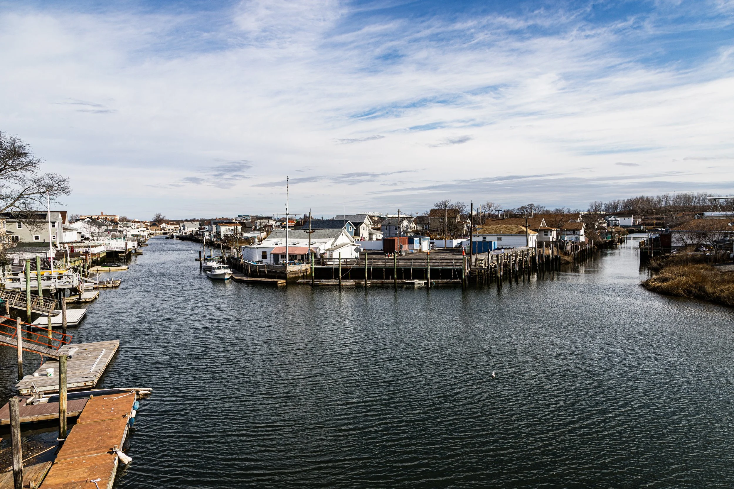
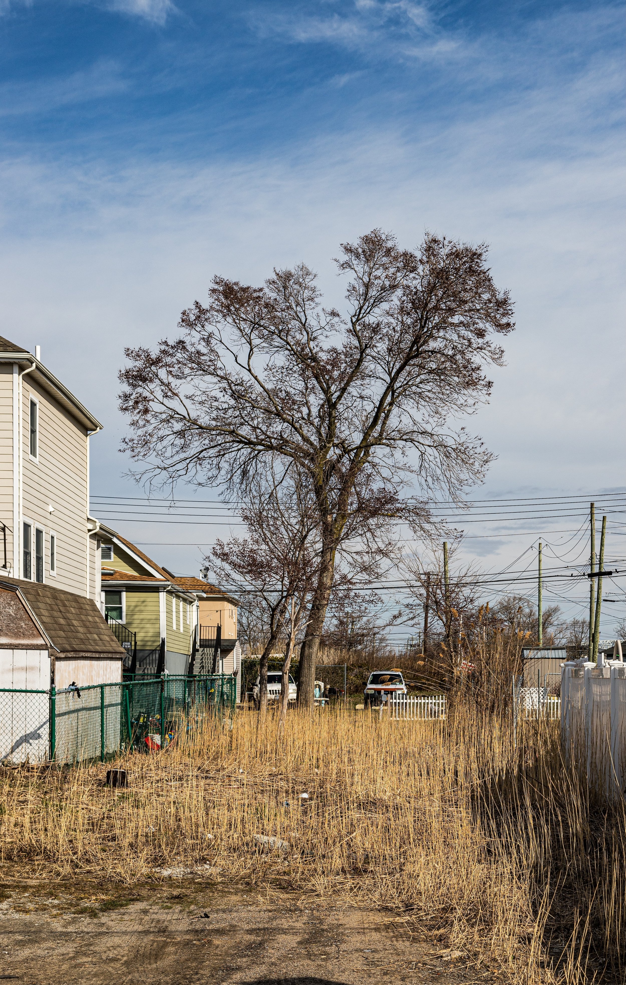
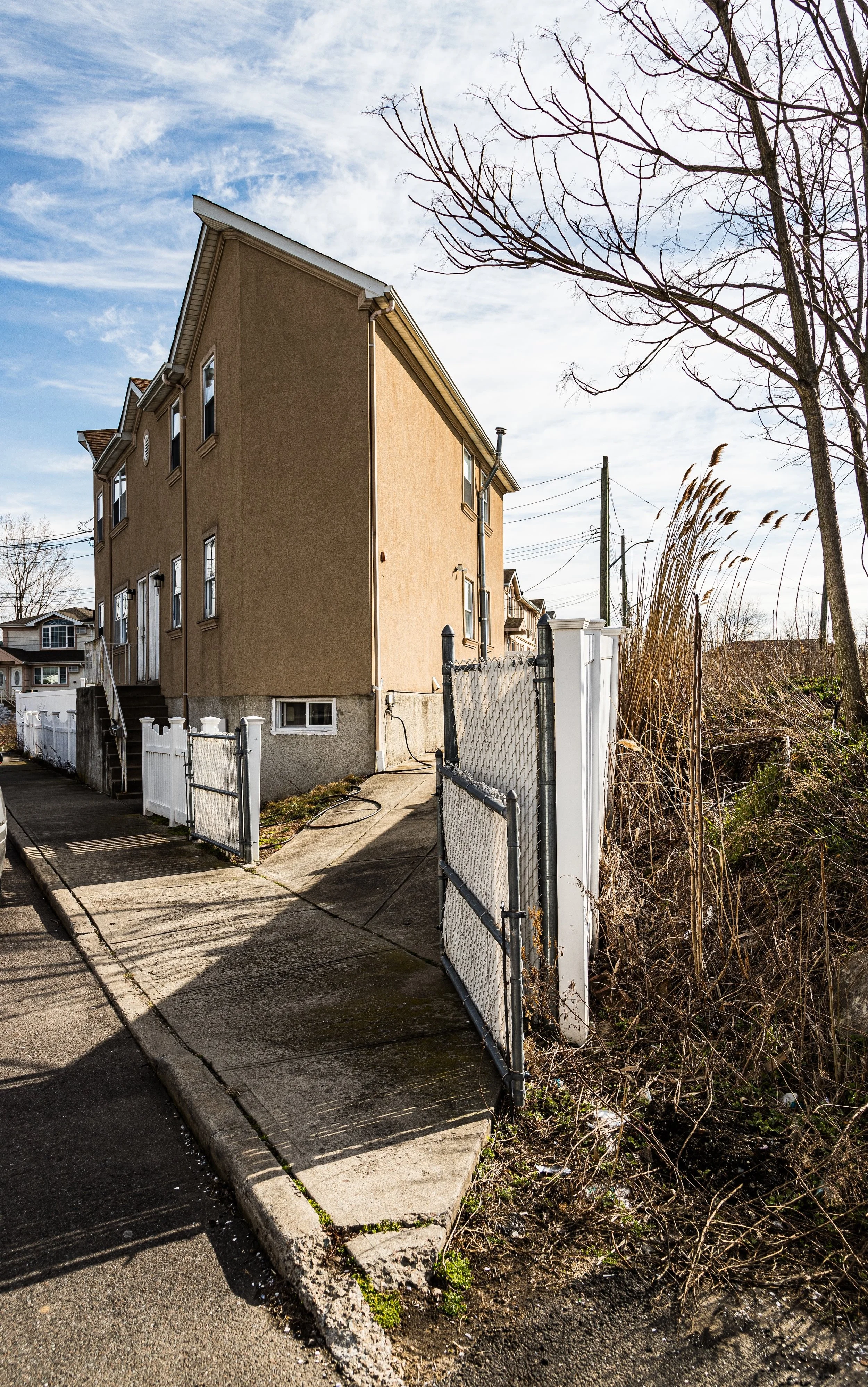
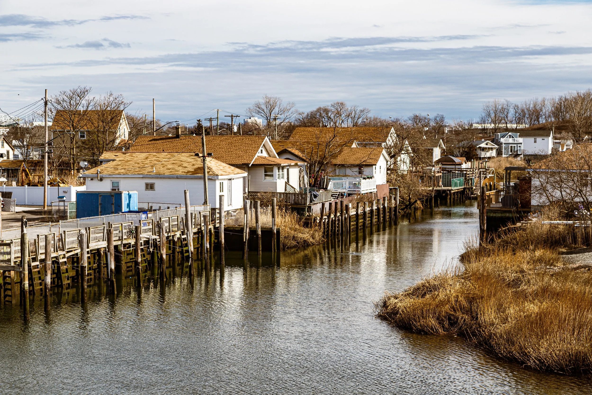
The neighborhood occupies a narrow peninsula of reclaimed marshland, laced with creeks, docks, and tidal flats. Its streets—Davenport Court, Russell Street, and Stanton Road—are short, low-lying lanes lined with bungalows, small two-story homes, and boat slips that open directly onto the bay. The A train passes nearby, elevated above the wetlands, its Howard Beach–JFK Airport Station serving as the closest transit link. To the south stretch the shimmering waters and islands of Jamaica Bay, part of the Gateway National Recreation Area, while to the north lie the suburban blocks of Howard Beach proper. Though technically within city limits, Hamilton Beach retains the atmosphere of a weathered fishing village—a place defined by its waterlines, tides, and unpretentious endurance.
Etymology and Origins
The name “Hamilton Beach” dates to the early 20th century and was inspired by the coastal resorts and planned seaside communities that once dotted Jamaica Bay’s rim. It likely honored Robert G. Hamilton, a local land developer active in the area’s early 1900s transformation from wetlands into waterfront property. During this period, Jamaica Bay’s shoreline—then a patchwork of creeks, islands, and meadows—was being reshaped by dredging and landfill as New York City sought to convert the region into usable real estate for shipping, recreation, and suburban expansion.
In its earliest incarnation, Hamilton Beach was envisioned as a modest resort community, part of a wave of speculative development that followed the success of Rockaway Beach and Broad Channel. The area’s accessible shoreline and proximity to the Long Island Rail Road (via the old Rockaway Beach Branch) made it attractive to city residents seeking summer cottages by the bay. Developers built simple wooden bungalows and piers for fishing and boating, promoting Hamilton Beach as “a quiet retreat for the working man.”
The Neighborhood
Early 20th Century: Bungalows, Boats, and Bay Breezes
By the 1910s and 1920s, Hamilton Beach had taken shape as a small but vibrant seaside colony. Rows of wooden cottages—many on stilts—lined the edge of the bay, and the community’s rhythm revolved around the tides. Residents fished, crabbed, and swam in the creeks and channels that wound through the marshes. The Hamilton Beach Station on the Rockaway Beach Branch provided direct rail service to Brooklyn and Manhattan, bringing both seasonal visitors and year-round residents who prized the area’s salt-air solitude.
Though intended as a resort, Hamilton Beach gradually evolved into a working-class residential community. Dockworkers, clerks, and tradesmen—many employed at nearby Idlewild Airport (later John F. Kennedy International Airport) or along the industrial corridors of Ozone Park—settled permanently. The neighborhood’s irregular grid, wooden bulkheads, and informal docks reflected its organic growth. Unlike the planned suburbs developing elsewhere in Queens, Hamilton Beach remained proudly makeshift—homes built and rebuilt over time, adapted to the shifting shoreline.
Mid-20th Century: Between Land and Sea
The mid-20th century brought both progress and peril. In 1950, the opening of Idlewild Airport to the east permanently altered the surrounding landscape. Noise and pollution increased, while parts of neighboring wetlands were filled for airport infrastructure. The closure of the Rockaway Beach rail line in 1962 further isolated Hamilton Beach, leaving it accessible only by road via 104th Street and the narrow bridge over Hawtree Creek.
Yet the community’s resilience persisted. Residents relied on local civic groups and volunteer fire services, maintaining a spirit of independence that became the neighborhood’s hallmark. Flooding, always a concern, was met with improvisation—homes raised on pilings, bulkheads rebuilt after storms, and sandbags deployed during high tides. By the 1970s, Hamilton Beach was one of the few remaining corners of Queens where small boats still moored beside backyards, and neighbors shared tools to patch docks or clear storm debris.
While the rest of Howard Beach expanded with suburban-style development, Hamilton Beach stayed small, unpretentious, and deeply local. Its population hovered around just a few hundred residents, most of whom knew each other by name. The neighborhood’s only significant institutions—a few local businesses, a civic association, and P.S. 146 (Howard Beach School) nearby—anchored a way of life built on familiarity and persistence.
Hamilton Beach Video Coming Soon
Late 20th–21st Century: Storms, Rebuilding, and Continuity
In the late 20th century, Hamilton Beach’s isolation became both its charm and its challenge. The encroaching waters of Jamaica Bay, combined with sea-level rise and more frequent storms, made flooding an unavoidable part of daily life. Hurricanes Donna (1960), Gloria (1985), and especially Sandy (2012) left indelible marks. During Sandy, nearly every home in the neighborhood was inundated, and floodwaters rose several feet above street level. Despite the destruction, residents rallied to rebuild—raising houses on stilts, replacing bulkheads, and working with city and federal agencies to improve drainage and resiliency infrastructure.
Today, Hamilton Beach remains one of New York City’s most flood-prone neighborhoods, yet its community identity endures. Many homes have been elevated, and shoreline restoration projects along Hawtree Basin and Jamaica Bay aim to protect the area from future storms. The surrounding wetlands, now part of the Gateway National Recreation Area, have regained ecological vitality, drawing egrets, herons, and ospreys back to the bay. Civic pride remains palpable through groups like the Hamilton Beach Civic Association, which advocates for environmental restoration, emergency preparedness, and preservation of the neighborhood’s maritime heritage.
Hamilton Beach Photo Gallery
Spirit and Legacy
Hamilton Beach’s spirit is one of endurance—the quiet, stubborn determination of a community that refuses to surrender to the tides. Though its footprint is small and its challenges immense, it represents a vanishing New York: the working waterfront neighborhood where boats, tides, and people coexist on intimate terms.
At dusk, when the tide laps against pilings and the last plane from JFK arcs overhead, Hamilton Beach feels suspended between two worlds—urban and coastal, permanent and transient. Its narrow lanes, salt-stained docks, and resilient families tell a story written in the rhythm of the bay itself: one of adaptation, loyalty, and an enduring love for life at the water’s edge.
New York City
Use this custom Google map to explore where every neighborhood in all five boroughs of New York City is located.
The Five Boroughs
One of New York City’s unique qualities is its organization in to 5 boroughs: Manhattan, Brooklyn, Queens, The Bronx, and Staten Island. These boroughs are part pragmatic administrative districts, and part vestiges of the region’s past. Each borough is an entire county in New York State - in fact, Brooklyn is, officially, Kings County, while Staten Island is, officially Richmond County. But that’s not the whole story …
Initially, New York City was located on the southern tip of Manhattan (now the Financial District) that was once the Dutch colony of New Amsterdam. Across the East River, another city was rising: Brooklyn. In time, the city planners realized that unification between the rapidly rising cities would create commercial and industrial opportunities - through streamlined administration of the region.
So powerful was the pull of unification between New York and Brooklyn that three more counties were pulled into the unification: The Bronx, Queens, and Staten Island. And on January 1, 1898, the City of New York unified two cities and three counties into one Greater City of New York - containing the five boroughs we know today.
But because each borough developed differently and distinctly until unification, their neighborhoods likewise uniquely developed. Today, there are nearly 390 neighborhoods, each with their own histories, cultures, cuisines, and personalities - and each with residents who are fiercely proud of their corner of The Big Apple.


