GOWANUS
Brooklyn
Geographic Setting
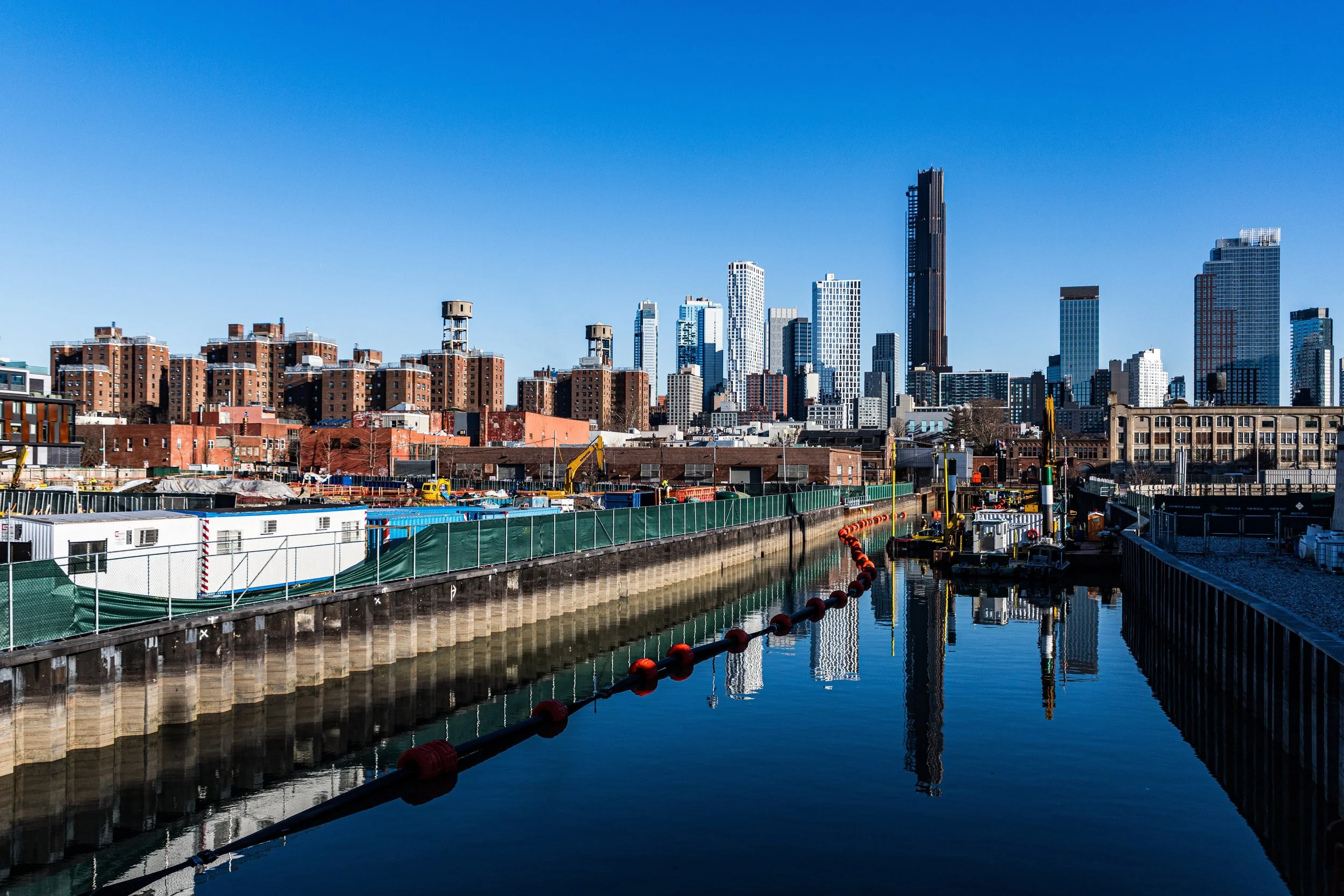
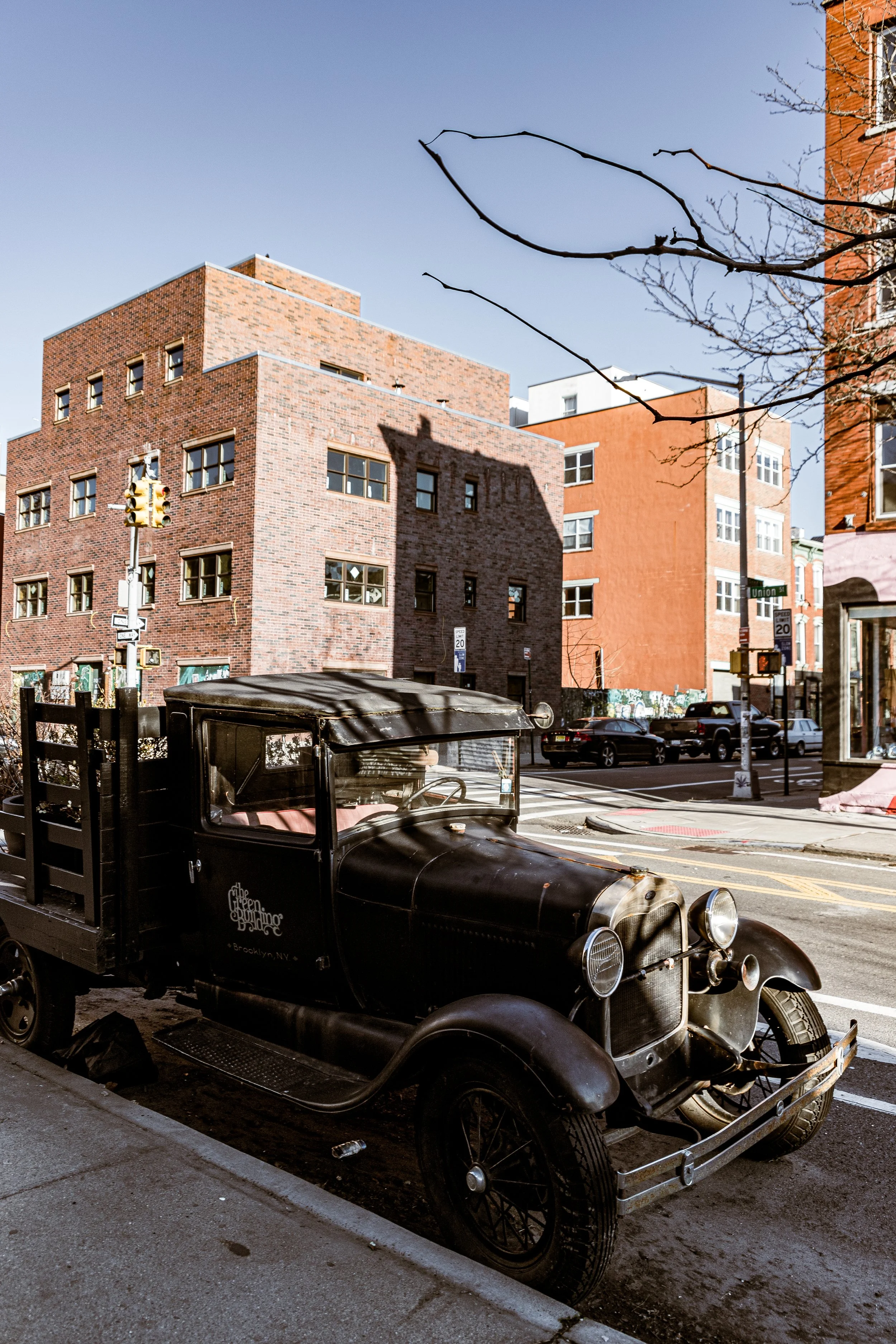
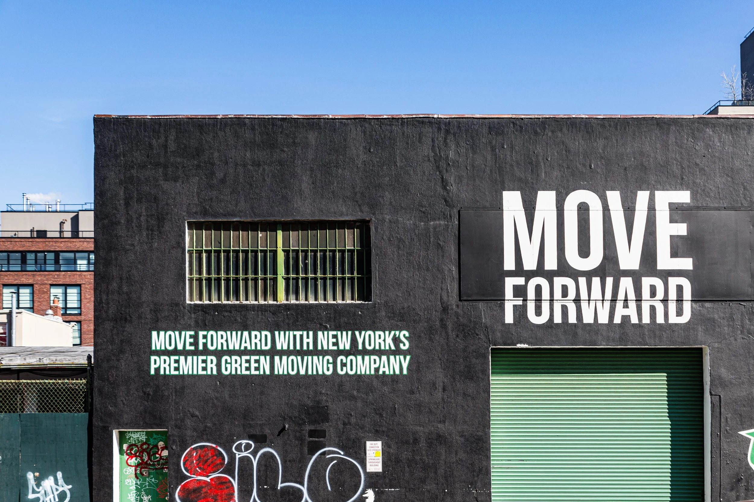
Centered on the Gowanus Canal and bounded by Baltic Street to the north, the Brooklyn-Queens Expressway (BQE) to the south, Fourth Avenue to the east, and Smith Street and Hoyt Street to the west, Gowanus occupies a long, low-lying swath of central Brooklyn—an industrial valley wedged between the historic neighborhoods of Boerum Hill, Carroll Gardens, and Park Slope. Its landscape, defined by the sinuous black-green canal that bears its name, is one of striking contrasts: 19th-century brick factories beside glass condominiums, working auto shops beside cafés, and graffiti-tagged warehouses beside restored lofts and wetlands.
The Gowanus Canal, carved from a natural tidal creek in the mid-19th century, remains the neighborhood’s spine and symbol. Running roughly a mile and a half from Buttermilk Channel northward toward Degraw Street, its banks frame an uneasy coexistence of industry, art, and ecology. The low elevation of the canal basin—once salt marsh and meadow—creates both its gritty beauty and its enduring vulnerability to flooding. Overhead, the Gowanus Expressway’s concrete viaduct roars, while the smell of brine and diesel mingles with the aroma of roasting coffee, kiln-fired clay, and sawdust from the district’s workshops.
Etymology and Origins
The name Gowanus derives from Gouwane, a leader of the Canarsee Lenape, the Indigenous people who inhabited the region before European colonization. The word, often translated as “small fort” or “pasture,” reflected the area’s fertile wetlands and hunting grounds along a tidal creek that emptied into the Upper New York Bay.
In the 1630s, Dutch settlers from the colony of New Netherland began acquiring land here, establishing farms and mills that relied on the freshwater of the Gowanus Creek. The earliest known settler, Frederick Lubbertsen, built a mill at the creek’s mouth around 1645, and the surrounding area became known as the Gowanus Meadows. The fertile, marshy soil made it ideal for crops, but also prone to flooding—a feature that would shape its future for centuries.
The Neighborhood
18th–19th Century: From Battlefield to Industrial Waterway
During the American Revolution, the Battle of Long Island (August 1776) raged across these fields. The old stone Vechte-Cortelyou House, today preserved within Washington Park, served as a key defensive position for American troops under General George Washington, who famously retreated across the Gowanus marshes to Brooklyn Heights under fire—a moment that saved the Continental Army from destruction.
In the decades that followed, Gowanus remained pastoral until the dawn of industrialization. The completion of the Gowanus Canal (1869) transformed the natural creek into a navigable waterway, dredged and bulkheaded to accommodate barges and factories. Its construction—overseen by the engineer Edwin Litchfield—was a triumph of 19th-century ambition but also a harbinger of environmental peril. The canal’s tidal flow stagnated as it was sealed off from the bay, and its waters soon filled with the runoff of tanneries, gas plants, cement works, and chemical factories.
By the late 1800s, Gowanus had become one of Brooklyn’s busiest industrial corridors. Concrete plants, coal yards, rope manufacturers, and ice companies lined its banks. The Brooklyn Rapid Transit Company operated maintenance shops nearby, and rail spurs crisscrossed the district. Rowhouses for laborers rose on Nevins, Bond, and Union Streets, while the clatter of dredgers and the tang of tar defined the air.
Early–Mid 20th Century: Industry and Decline
In the early 20th century, Gowanus reached its industrial peak. The canal served as a working artery linking factories to the harbor, while bridges and warehouses knitted it into Brooklyn’s economic fabric. The neighborhood was gritty but vital—a place where machinists, longshoremen, and truckers found steady employment.
However, the very industries that sustained Gowanus poisoned it. By the 1920s, the canal was notorious for its oily sheen and acrid stench. Raw sewage and industrial waste turned its waters opaque and toxic, earning it the nickname “Lavender Lake” for the peculiar colors of chemical runoff. As shipping shifted to larger vessels unsuited for the canal, industrial decline began.
The construction of the Gowanus Expressway (1941–1964) further altered the landscape, dividing the neighborhood and casting its southern section in perpetual shadow. Deindustrialization after World War II accelerated the downturn: factories closed, rail lines rusted, and the canal became an open sewer. By the 1970s, many buildings stood abandoned, and the area’s population dwindled.
Yet amid this decay, a new chapter quietly began. Artists, drawn by low rents and cavernous spaces, began occupying old factories and warehouses. Bond Street, Union Street, and Third Avenue became home to studios, galleries, and performance spaces.
Gowanus Photographic Video
Late 20th Century: Artists, Activists, and Environmental Reckoning
By the 1980s and 1990s, Gowanus had become synonymous with both pollution and possibility. The canal—long dismissed as an industrial relic—became a cause célèbre for environmentalists. Community groups such as the Gowanus Canal Conservancy and Friends and Residents of Greater Gowanus (FROGG) began pushing for remediation and preservation of the neighborhood’s distinctive industrial architecture.
Simultaneously, the creative influx transformed Gowanus into one of Brooklyn’s most idiosyncratic cultural zones. Reclaimed factories became pottery studios, recording spaces, printshops, and art collectives. Venues like The Bell House and Littlefield established the area as a hub for live music and experimental art. The juxtaposition of decay and creativity—rusting cranes beside murals and cafés—became the neighborhood’s aesthetic signature.
21st Century: Cleanup, Development, and Transformation
In 2010, after years of study, the U.S. Environmental Protection Agency (EPA) designated the Gowanus Canal a Superfund site, citing over a century of industrial contamination by coal tar, heavy metals, and sewage. The cleanup, one of the most ambitious urban environmental restorations in America, began in earnest in the 2020s, involving dredging, sediment removal, and the installation of stormwater tanks to prevent overflow from the city’s antiquated sewers.
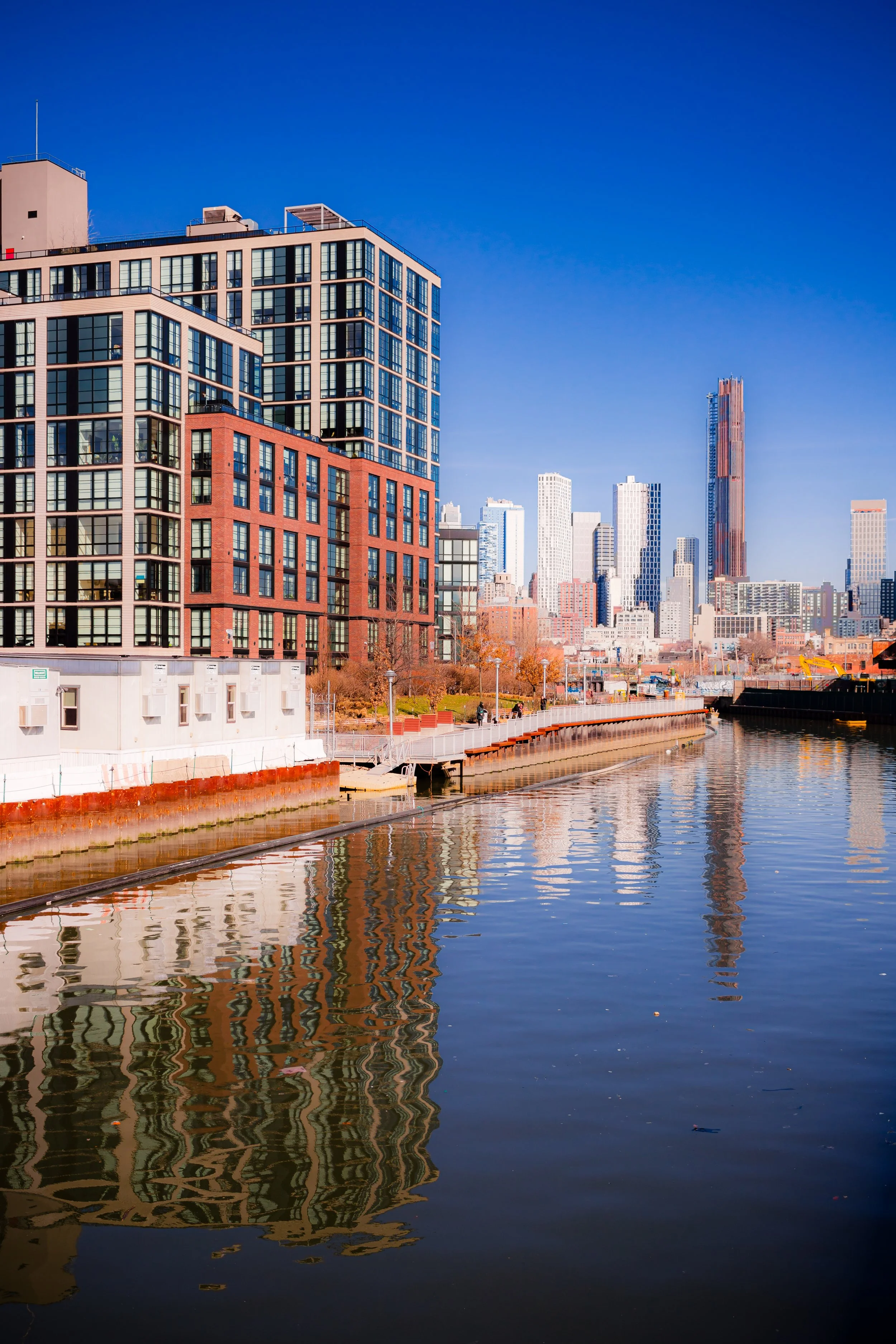
Parallel to this environmental renewal came intense urban redevelopment. The Gowanus Rezoning Plan (approved 2021) opened nearly 80 blocks to mixed-use and residential construction, promising thousands of new housing units—including affordable housing—along the canal. Gleaming residential towers now rise beside century-old warehouses, their reflections mingling in the canal’s still waters.
Yet Gowanus remains in flux, suspended between its industrial past and uncertain future. Artists and longtime residents worry about displacement, even as long-contaminated lots are reborn as parks, esplanades, and civic spaces. Projects such as the Public Place redevelopment at Smith and Fifth Streets, the creation of Gowanus Green, and the extension of waterfront access represent an ongoing negotiation between history, ecology, and growth.
Gowanus Photo Gallery
Spirit and Legacy
Gowanus’s legacy is one of transformation through resilience—a neighborhood that has continually reinvented itself while bearing the marks of its past. Its identity is inseparable from the canal: once a symbol of industrial triumph, then of environmental ruin, and now of urban rebirth. The smell of salt and silt still rises from the water at low tide, mingling with the aroma of espresso and paint; the same bridges that once carried barges now frame sunsets for photographers and walkers.
New York City
Use this custom Google map to explore where every neighborhood in all five boroughs of New York City is located.
The Five Boroughs
One of New York City’s unique qualities is its organization in to 5 boroughs: Manhattan, Brooklyn, Queens, The Bronx, and Staten Island. These boroughs are part pragmatic administrative districts, and part vestiges of the region’s past. Each borough is an entire county in New York State - in fact, Brooklyn is, officially, Kings County, while Staten Island is, officially Richmond County. But that’s not the whole story …
Initially, New York City was located on the southern tip of Manhattan (now the Financial District) that was once the Dutch colony of New Amsterdam. Across the East River, another city was rising: Brooklyn. In time, the city planners realized that unification between the rapidly rising cities would create commercial and industrial opportunities - through streamlined administration of the region.
So powerful was the pull of unification between New York and Brooklyn that three more counties were pulled into the unification: The Bronx, Queens, and Staten Island. And on January 1, 1898, the City of New York unified two cities and three counties into one Greater City of New York - containing the five boroughs we know today.
But because each borough developed differently and distinctly until unification, their neighborhoods likewise uniquely developed. Today, there are nearly 390 neighborhoods, each with their own histories, cultures, cuisines, and personalities - and each with residents who are fiercely proud of their corner of The Big Apple.


