FORT GEORGE
Manhattan
Geographic Setting
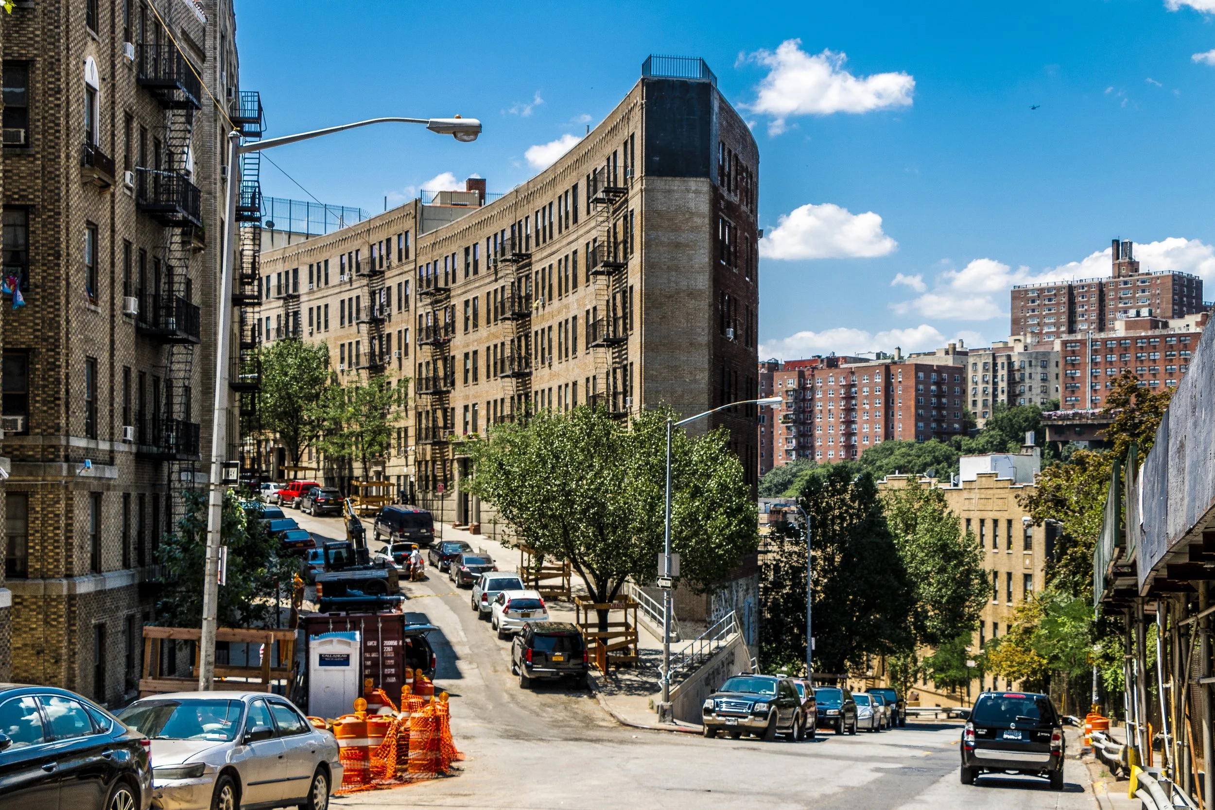
Tucked into the northern heights of Manhattan, Fort George occupies one of the borough’s most elevated and storied terrains. Centered around St. Nicholas Avenue and Amsterdam Avenue, the neighborhood stretches northward from 181st Street to Dyckman Street, between Broadway and the Harlem River. It is here that Fort George rises steeply above the Harlem River and the valley of the Dyckman Houses, framed by Highbridge Park to the east Fort Tryon Park to the west. Though officially part of Washington Heights, Fort George retains its own topographical and historical distinction — a high bluff where geography, memory, and community intersect.
Etymology and Origins
The name Fort George derives from the Revolutionary War fortification that once crowned this hilltop, built in 1776 by American forces to defend upper Manhattan against the advancing British. Originally called Fort Clinton, it was soon renamed in honor of King George III after the British captured it later that same year. Though the fort itself was short-lived — dismantled after the war — the name endured, carried through maps, real estate records, and local memory.
Before colonization, this ridge formed part of the homeland of the Weckquaesgeek branch of the Lenape people, who hunted and fished along the Harlem River’s wooded banks. The natural advantages that later made Fort George a strategic military site — its elevation, its commanding views of the river valleys — had long been recognized by the island’s original inhabitants.
The Neighborhood
18th Century: War and Wilderness
During the American Revolution, upper Manhattan was a contested frontier. In September 1776, General George Washington’s troops fortified this northern ridge as part of a defensive network that included Fort Washington to the west and Fort Tryon to the north. On November 16, 1776, British and Hessian forces overwhelmed the American garrisons, capturing thousands of troops in what became known as the Battle of Fort Washington — one of the war’s most devastating losses for the Continental Army.
Fort George’s hilltop — then cleared farmland and pasture — witnessed the smoke and cannon fire of that fateful day. Afterward, the British occupied the site, using it as an observation post. By the war’s end, the area returned to quiet, its fortifications abandoned to the encroaching forest.
19th Century: Estates, Resorts, and a View of the City
For much of the 19th century, Fort George remained sparsely developed. Wealthy New Yorkers established country estates and summer homes atop the ridge, drawn by its breezes and panoramic views. The Seaman–Drake Estate, built nearby in the 1850s, stood as a marble-columned landmark visible for miles.
The extension of the Hudson River Railroad and later the Ninth Avenue Elevated Railway in the late 1800s opened the area to recreation and tourism. In 1895, entrepreneurs built the Fort George Amusement Park at Amsterdam Avenue and 190th Street, transforming the tranquil heights into what newspapers called “Harlem’s Coney Island.” The park featured roller coasters, carousels, dance halls, and theaters — a dazzling attraction that drew tens of thousands each summer weekend.
The amusement era was short-lived. Fires in 1911 and 1914 destroyed much of the park, and the land was soon absorbed into Highbridge Park. Yet for a brief time, Fort George was a playground for the working-class city, its heights echoing with laughter and music.
Early 20th Century: Urbanization and Immigration
With the arrival of the subway — the IRT’s Broadway–Seventh Avenue line in 1904 and the IND Eighth Avenue line in the 1930s — Fort George transitioned from rural to urban. Tenements and apartment buildings rose along the steep grid, housing a growing population of Irish, German, and later Jewish immigrants.
The neighborhood’s terrain produced distinctive architecture: terraced apartments, retaining walls, and stair-street passages connecting upper and lower levels. Local institutions — churches, synagogues, and schools — anchored the hillside community. The Highbridge Water Tower, completed in 1872, became both a landmark and a symbol of the neighborhood’s lofty vantage.
By mid-century, Fort George had become a densely populated residential enclave within Washington Heights. Children played stickball on cobbled streets; families gathered on stoops overlooking the Harlem River Drive. Its proximity to both the river and the parks gave the district a rare mix of urban energy and natural beauty.
Fort George Photographic Video
Mid-20th Century: Dominican Arrival and Transformation
After World War II, demographic change reshaped the neighborhood once again. Many of the Jewish and Irish families moved to the outer boroughs or suburbs, replaced by new immigrants from Puerto Rico and later the Dominican Republic. By the 1970s, Fort George and the broader Washington Heights area had become the largest Dominican community in the United States — a cultural hub that would define northern Manhattan’s identity for decades.
The neighborhood weathered the city’s fiscal crisis and waves of disinvestment in the 1970s and 1980s, but community solidarity endured. Local churches and social organizations provided support networks for newcomers. St. Jude Church, perched atop its hill, and George Washington High School, a few blocks away, became anchors of local life.
In those decades, Fort George developed a distinct rhythm — the cadence of merengue and bachata, the scent of arroz con pollo and café drifting through open windows, and the sound of street vendors calling out in Spanish. Despite economic challenges, the neighborhood’s cultural vitality never dimmed.
Late 20th–21st Century: Renewal on the Heights
By the 1990s and early 2000s, crime rates declined and investment slowly returned. Many of the early 20th-century apartment buildings were restored, while portions of Highbridge Park underwent ecological rehabilitation. The reopening of the High Bridge pedestrian walkway in 2015 reconnected Fort George residents with the Bronx, reviving a historic link across the Harlem River.
Today, Fort George remains predominantly Dominican, though recent years have brought greater diversity, with newcomers drawn to its affordability, views, and sense of community. The neighborhood’s steep topography — its stair streets, winding slopes, and elevated vantage points — gives it a character unlike anywhere else in Manhattan.
Fort George Photo Gallery
Architecture and Atmosphere
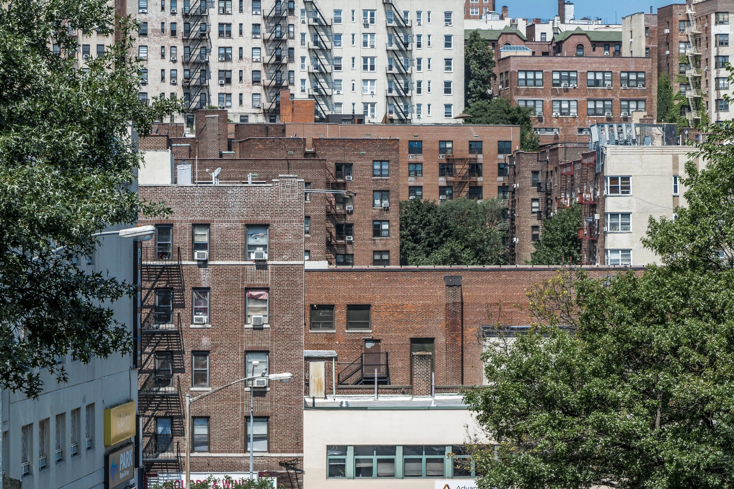
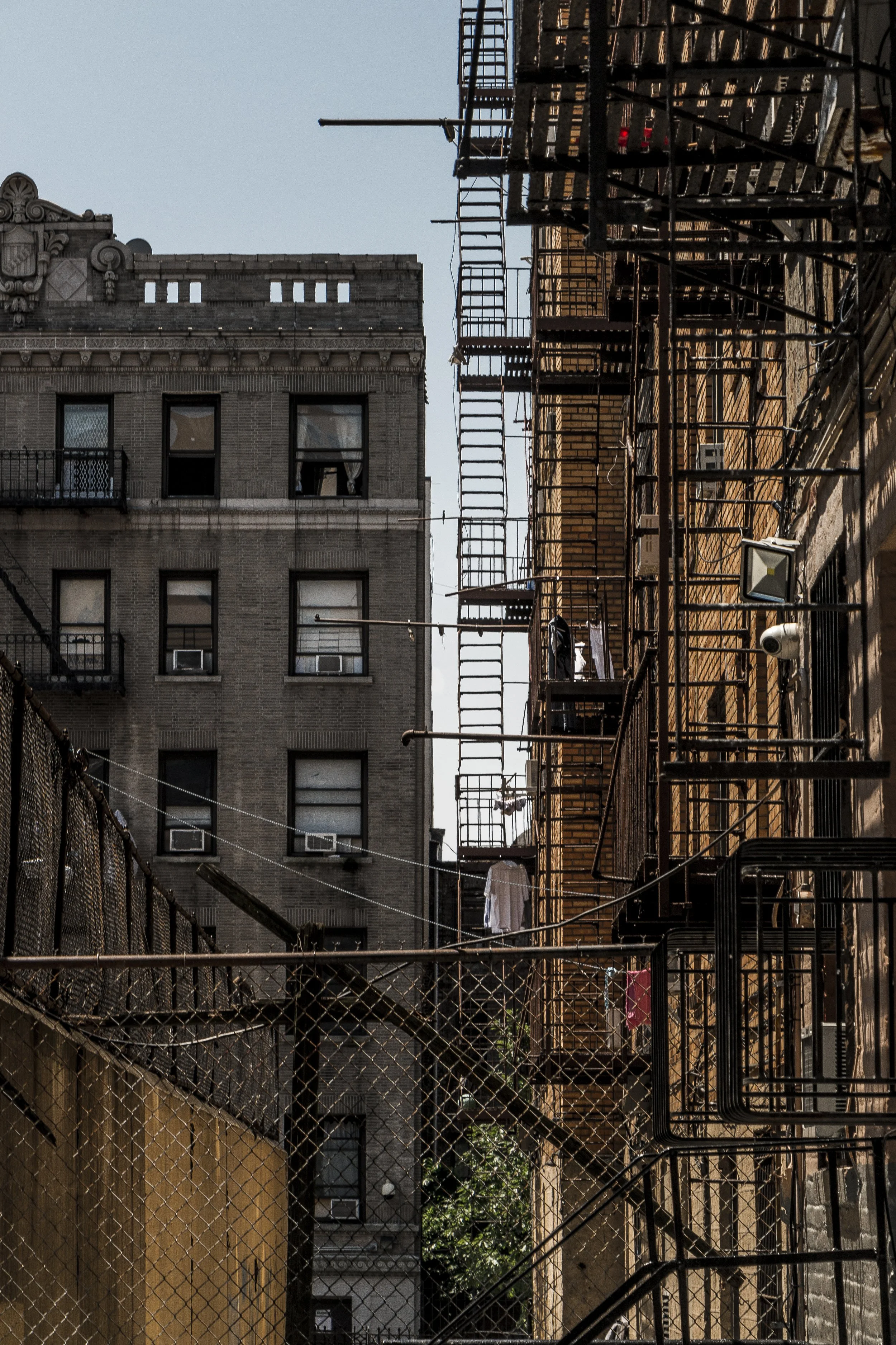
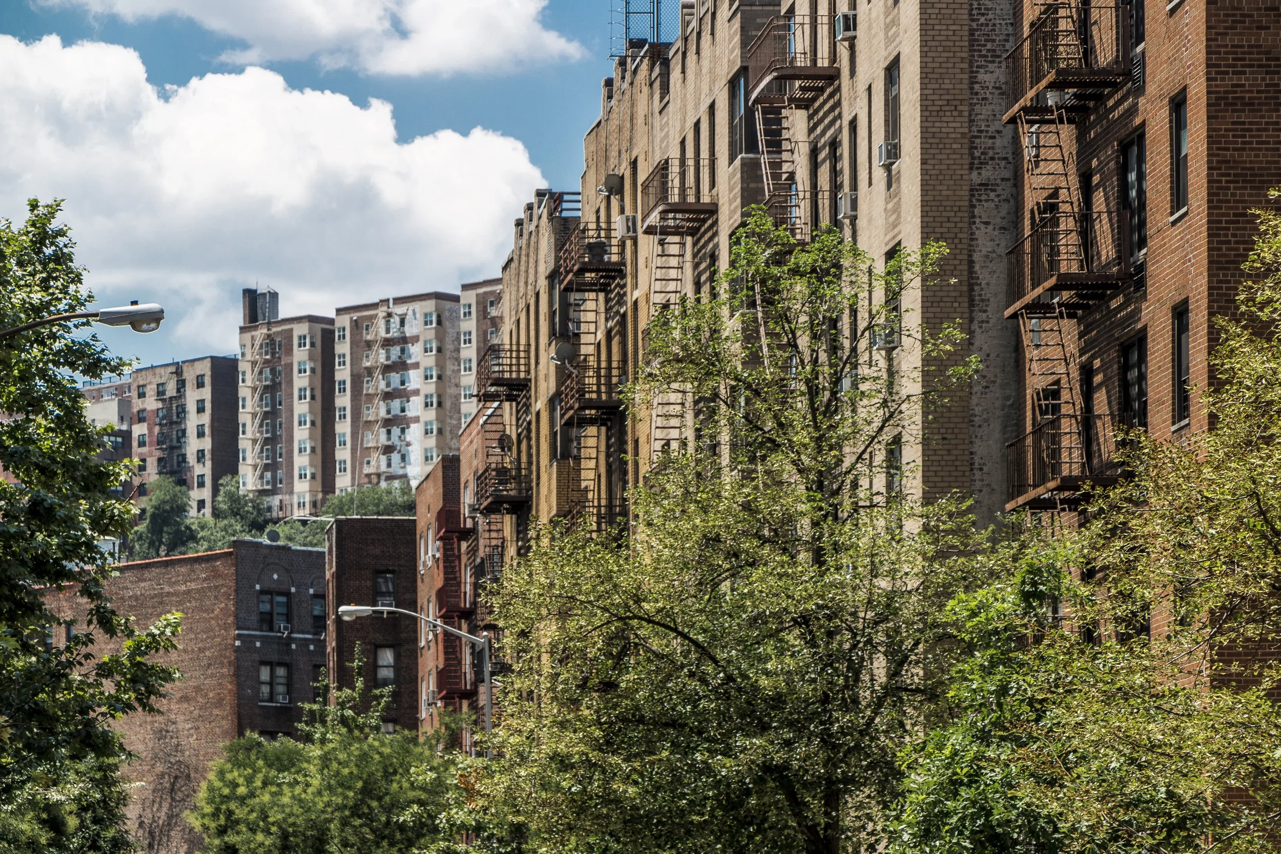
Architecturally, Fort George is defined by its relationship to the landscape. Prewar brick apartment houses cascade down the hillsides like terraces; Art Deco and Tudor Revival details punctuate façades along St. Nicholas and Wadsworth Avenues. The remnants of old retaining walls and stairways evoke the neighborhood’s layered past — from battlefield to amusement ground to immigrant stronghold.
The atmosphere is both elevated and grounded: a hillside village in the city’s sky. From the overlooks above Harlem River Drive, one can see bridges, water, and the distant towers of the Bronx, all framed by the greenery of Highbridge Park. Street life, meanwhile, remains vibrant and communal — families chatting from balconies, domino games on the sidewalks, the hum of bachata mixing with the distant roar of traffic below.
Spirit and Legacy
Fort George’s legacy is one of endurance atop the heights — a neighborhood that has seen war, wonder, and waves of change, yet remains steadfast in its humanity. From Revolutionary fort to immigrant foothold, from amusement park to urban village, it has embodied New York’s perpetual balancing act between history and reinvention.
New York City
Use this custom Google map to explore where every neighborhood in all five boroughs of New York City is located.
The Five Boroughs
One of New York City’s unique qualities is its organization in to 5 boroughs: Manhattan, Brooklyn, Queens, The Bronx, and Staten Island. These boroughs are part pragmatic administrative districts, and part vestiges of the region’s past. Each borough is an entire county in New York State - in fact, Brooklyn is, officially, Kings County, while Staten Island is, officially Richmond County. But that’s not the whole story …
Initially, New York City was located on the southern tip of Manhattan (now the Financial District) that was once the Dutch colony of New Amsterdam. Across the East River, another city was rising: Brooklyn. In time, the city planners realized that unification between the rapidly rising cities would create commercial and industrial opportunities - through streamlined administration of the region.
So powerful was the pull of unification between New York and Brooklyn that three more counties were pulled into the unification: The Bronx, Queens, and Staten Island. And on January 1, 1898, the City of New York unified two cities and three counties into one Greater City of New York - containing the five boroughs we know today.
But because each borough developed differently and distinctly until unification, their neighborhoods likewise uniquely developed. Today, there are nearly 390 neighborhoods, each with their own histories, cultures, cuisines, and personalities - and each with residents who are fiercely proud of their corner of The Big Apple.


