MT. HOPE
The Bronx
Geographic Setting
Bounded by the Cross Bronx Expressway to the south, Jerome Avenue to the west, East Burnside Avenue to the north, and Webster Avenue to the east, Mount Hope lies within the central-west Bronx, a compact but deeply storied neighborhood perched on the sloping terrain between the Harlem River valley and the elevated Grand Concourse district. Its steep streets, brick façades, and tree-lined ridges capture the physical drama of the borough’s topography and the resilience of its people.
The neighborhood’s name is literal as well as aspirational—it rises atop a ridge of land once known for its commanding views of the Harlem valley. Today, Mount Hope is defined by prewar apartment buildings, walk-ups, and postwar housing developments, interspersed with churches, schools, and small shops that anchor community life. Mount Hope Place, a short but symbolic street that crosses the neighborhood’s center, still carries the echo of the 19th-century suburb from which the district took its name. Major corridors such as Tremont Avenue, Burnside Avenue, and Jerome Avenue provide access to transit and commerce, while the Mount Hope Community Center and nearby University Woods offer crucial green and civic space in a densely built environment.
Wedged between the larger neighborhoods of Morris Heights and Fordham Heights, Mount Hope functions as both crossroads and enclave—an urban hilltown whose elevated terrain and enduring community give it a quiet, distinctive character amid the Bronx’s bustle.
Etymology
The name “Mount Hope” dates back to the mid-19th century, when the area formed part of a small rural settlement that grew around the Mount Hope Estate, a gently wooded tract named for its elevated position and its owner’s sense of optimism about the region’s potential. “Hope” was a popular term in 19th-century suburban naming conventions—connoting aspiration, tranquility, and refuge.
As development spread northward from Morrisania and the Harlem River, the name “Mount Hope” was retained for the surrounding ridge and later applied to the grid of streets laid down in the 1880s–1890s. Though the pastoral landscape has long since vanished, the name endures as a vestige of the neighborhood’s semi-rural origins and as a fitting metaphor for its residents’ persistence through cycles of change.
The Neighborhood
Origins through the 19th Century
In the 18th and early 19th centuries, the land that would become Mount Hope belonged to the Morris family estate, part of the vast holdings that included Morrisania and much of the South Bronx. The region was characterized by rocky hills, wooded slopes, and scattered farms. As Manhattan’s population expanded northward after the Civil War, the Bronx began to urbanize. Developers, encouraged by the extension of rail lines and the proximity of Fordham and Highbridge, began subdividing the hills into residential plots.
By the 1870s, advertisements promoted “Mount Hope Heights” as a quiet suburban refuge within reach of the city, boasting fresh air and commanding views. The name attracted middle-class professionals who built freestanding villas and frame houses along winding roads such as Mount Hope Place and Morris Avenue. The area’s first institutions—including churches and small schools—were established during this period, forming the nucleus of the future neighborhood.
Annexation of the western Bronx into New York City in 1874 brought paved streets, gas lamps, and trolley connections, accelerating Mount Hope’s transition from rural hamlet to urban neighborhood. By the century’s close, the hillside was filling with brick tenements and early apartment houses, signaling a permanent shift toward density and diversity.
Early 20th Century: Urban Growth and Cultural Flourishing
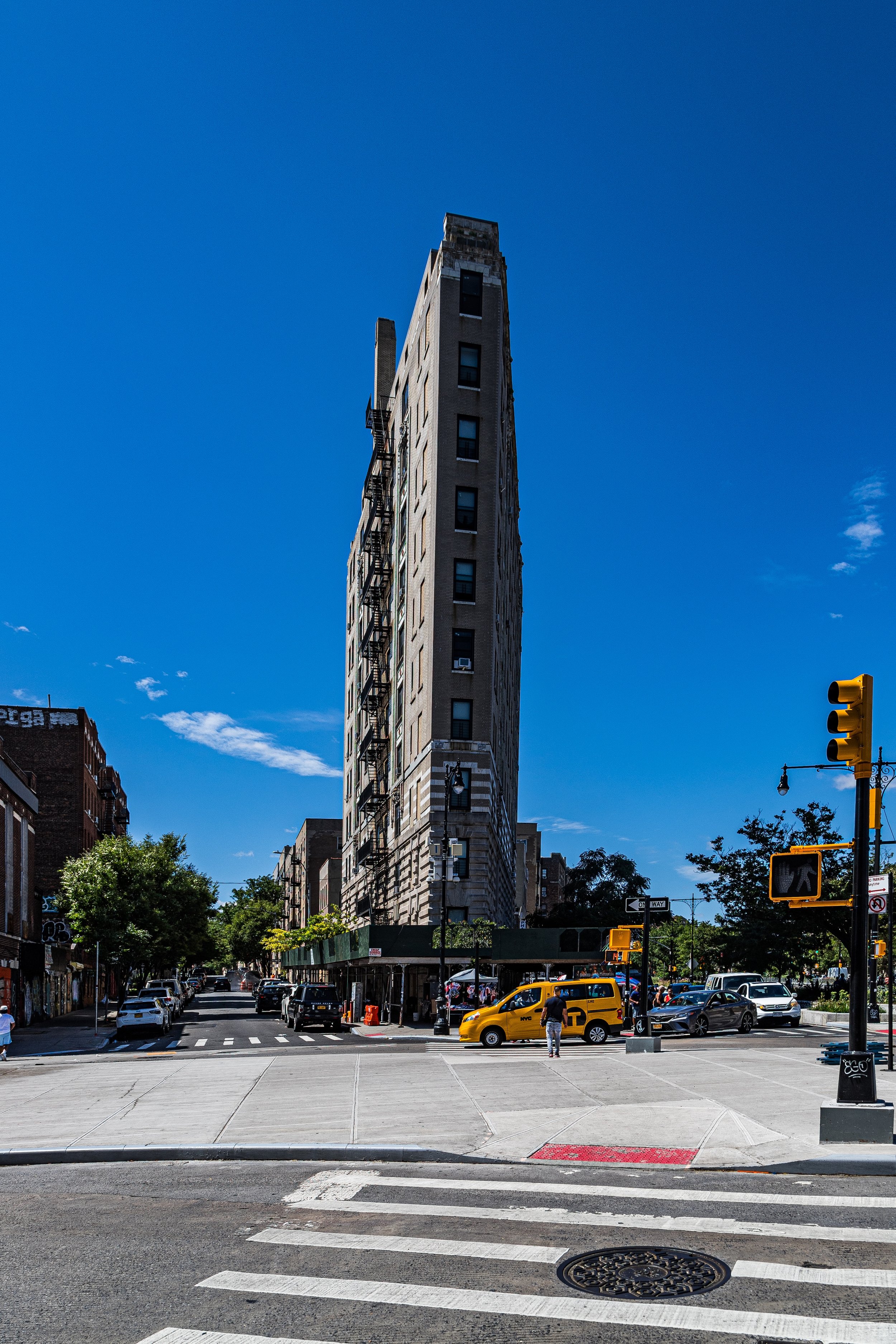
Between 1900 and 1940, Mount Hope matured into a quintessential Bronx residential district—dense, vibrant, and architecturally cohesive. The extension of the IRT Jerome Avenue Line (4 train) in 1917, running just west of the neighborhood, and the New York Central Railroad’s Harlem Line to the east provided unmatched access to employment centers in Manhattan.
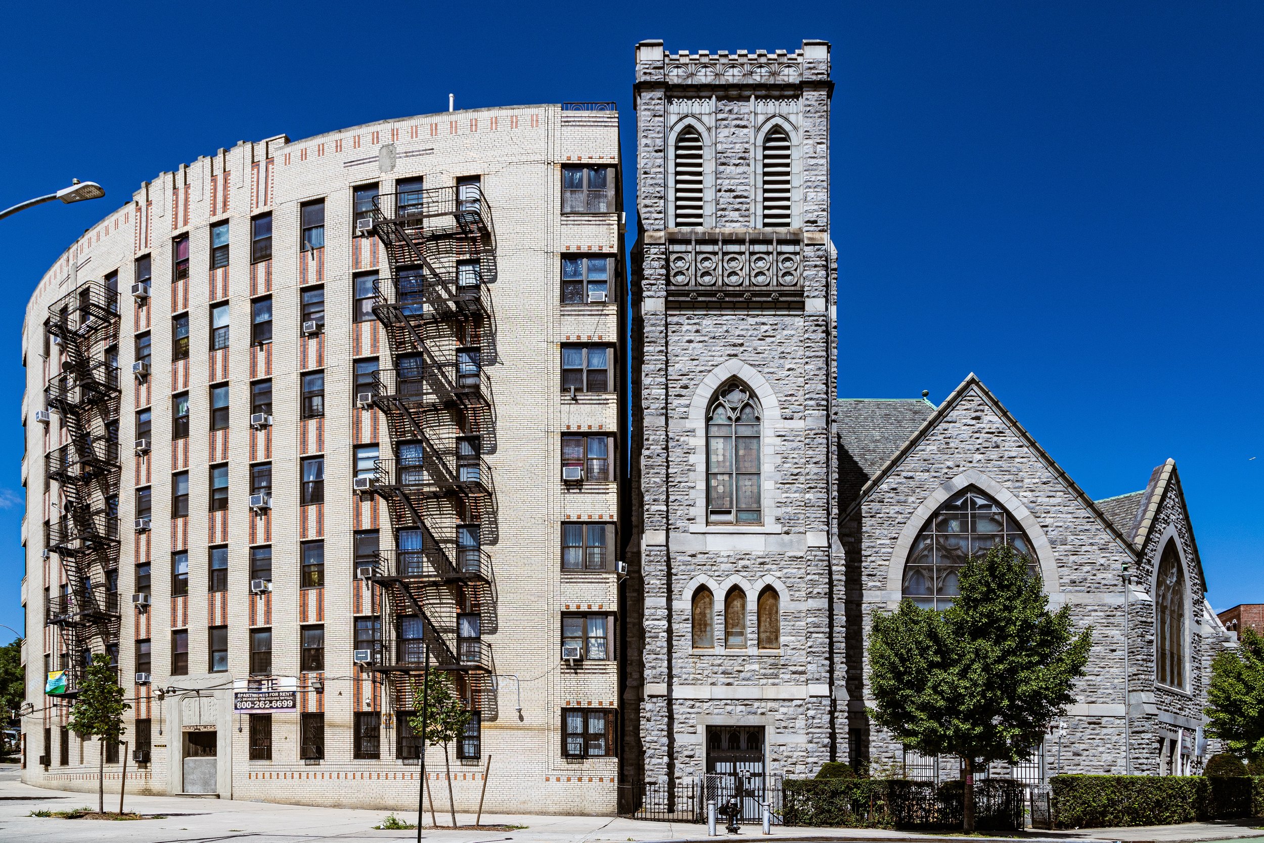
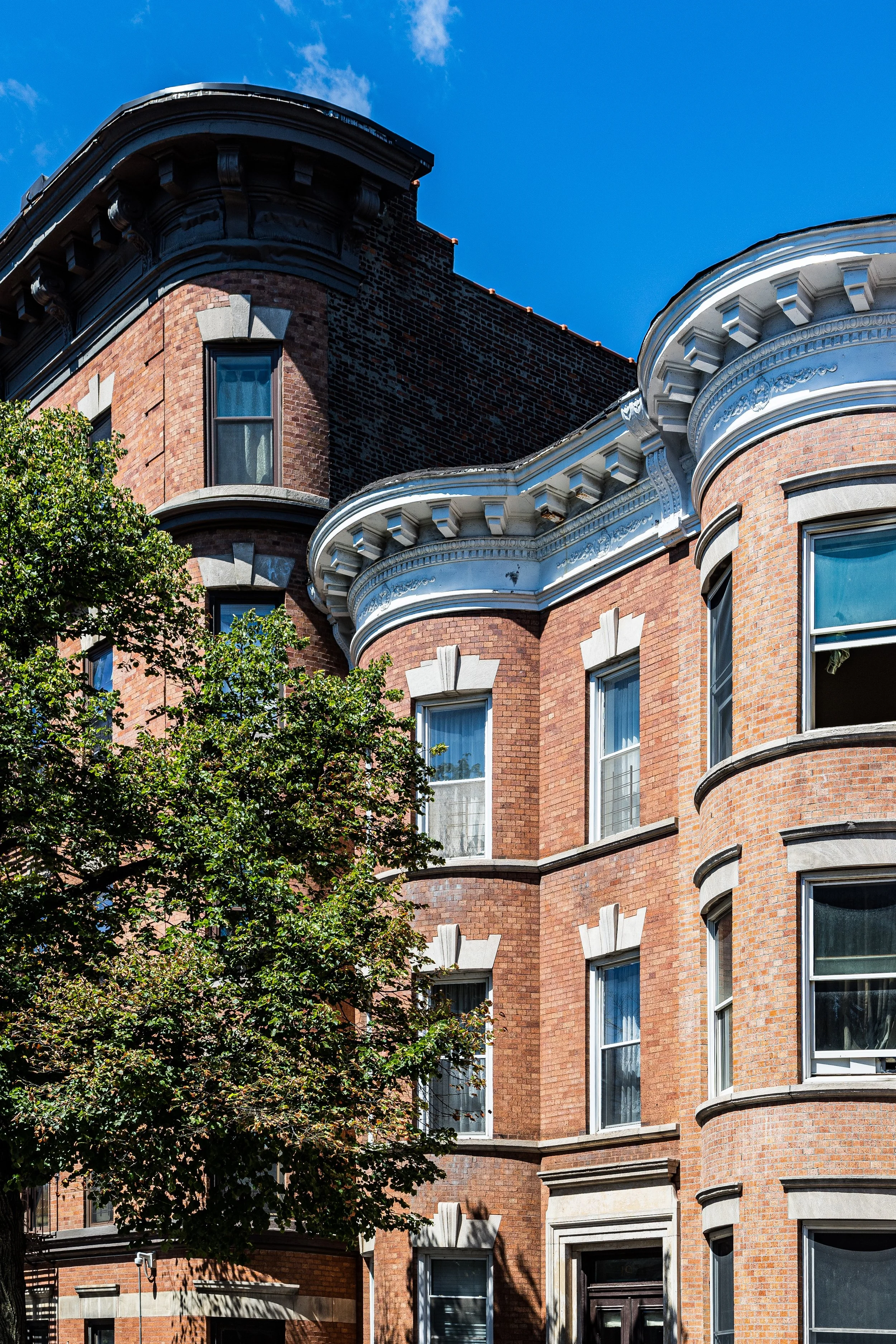
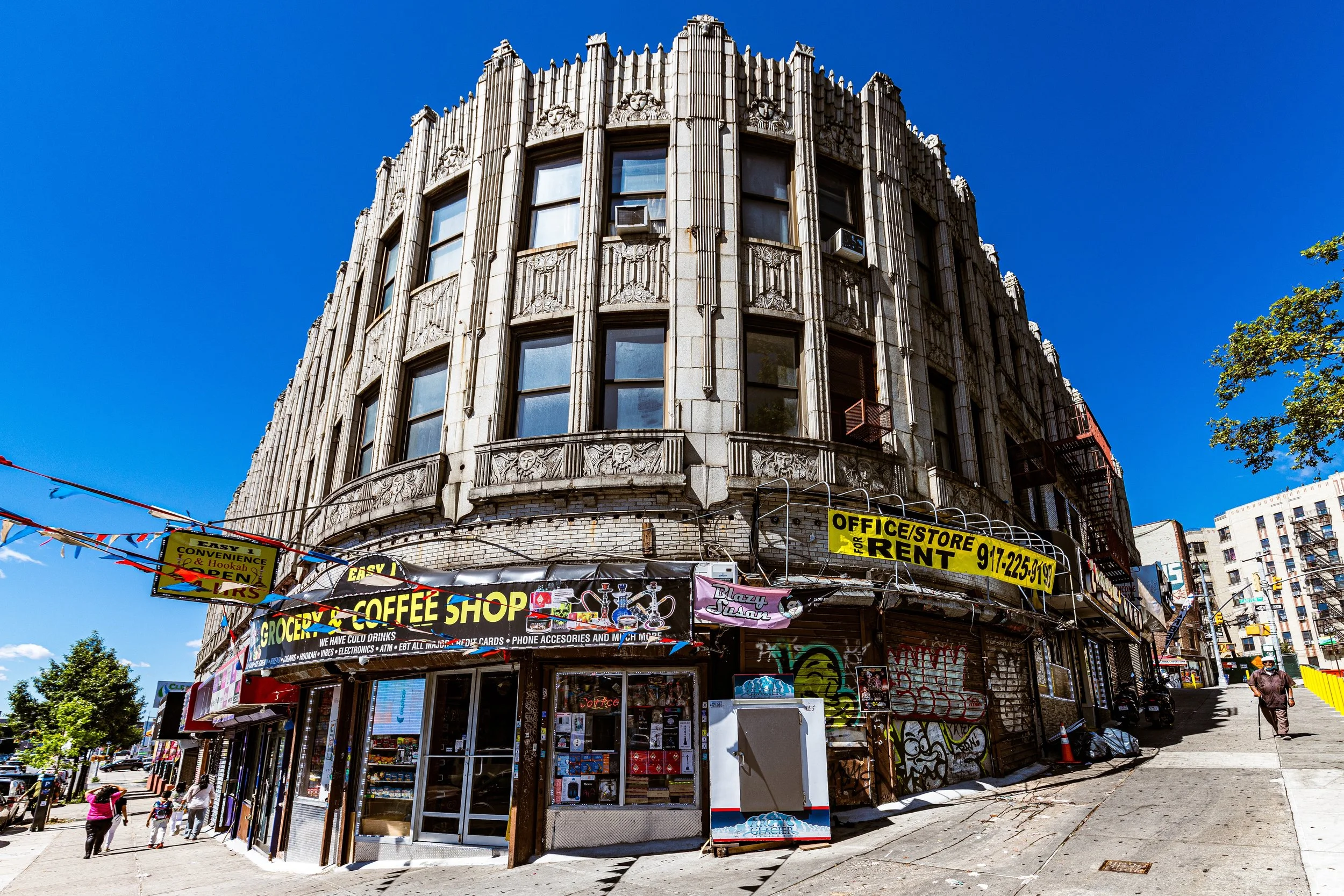
Developers erected five- and six-story apartment houses along Tremont, Burnside, and Mount Hope Place, their façades rendered in Art Deco, neo-Renaissance, and Tudor Revival styles. Ornate lobbies, courtyards, and stoops reflected the pride of working- and middle-class families—many Jewish, Irish, and Italian—who settled here during the interwar years. Corner stores, kosher delis, and bakeries animated street life, while synagogues and Catholic parishes stood as neighborhood anchors.
Mount Hope’s proximity to Bronx institutions—including the Grand Concourse, Bronx Community College, and Crotona Park—gave residents access to cultural and educational opportunities that fostered civic pride. The neighborhood was clean, self-contained, and upwardly mobile, emblematic of the Bronx’s reputation during its early 20th-century golden age.
Mt. Hope Video Coming Soon
Mid–Late 20th Century: Disinvestment and Resilience
After World War II, Mount Hope, like much of the West Bronx, underwent dramatic change. The construction of the Cross Bronx Expressway (1948–1972) cut through the southern edge of the neighborhood, displacing families and eroding the stability of once-thriving blocks. As middle-class residents left for the suburbs, new waves of Puerto Rican, African-American, and later Dominican migrants arrived, drawn by affordable rents but confronted with deteriorating housing and shrinking municipal investment.
By the 1970s, Mount Hope was engulfed in the same crisis that beset the South Bronx: arson, abandonment, and economic decline. Many prewar buildings fell into disrepair, and entire blocks were left vacant. Yet even amid the devastation, community organizing took root. Residents formed block associations, tenant unions, and advocacy groups dedicated to reclaiming their neighborhood. Faith-based institutions—especially Sacred Heart Church and neighborhood mosques—offered social services and a moral anchor in a time of instability.
Grassroots organizations such as the Mount Hope Housing Company, founded in 1986, became a model for community-led urban renewal. Partnering with the city and nonprofit developers, the organization rehabilitated abandoned tenements, created affordable housing, and reopened youth programs. These efforts marked the beginning of Mount Hope’s transformation from neglected periphery to renewed community.
21st Century: Revival, Diversity, and Community Strength
In the 21st century, Mount Hope stands as one of the Bronx’s strongest examples of neighborhood-driven renewal. The legacy of grassroots activism has yielded tangible results: new affordable housing developments, renovated prewar buildings, and a flourishing network of community centers. The Mount Hope Community Center and Mount Hope Housing Company continue to provide vital services, from after-school programs to workforce training, ensuring that revitalization benefits residents rather than displaces them.
The population remains diverse—predominantly Latino (largely Dominican, Puerto Rican, and Mexican), alongside African-American and West African families. Commercial corridors like Burnside Avenue hum with life: bodegas, Dominican bakeries, and Caribbean restaurants sit beside salons and small groceries that reflect the neighborhood’s international mix.
Although challenges persist—rising rents, aging infrastructure, and the pressures of gentrification—Mount Hope’s strong social fabric has made it a model for sustainable, inclusive recovery. The neighborhood’s proximity to major transit lines and institutions like BronxCare Health System and Bronx Community College ensures continued vitality, while its active civic associations preserve its sense of belonging and history.
Mt. Hope Photo Gallery
Spirit and Legacy
The spirit of Mount Hope is captured in its name: a persistent optimism that has carried the neighborhood through hardship into renewal. Its hilly streets, lined with buildings from every era of the Bronx’s growth, tell a story of adaptation and endurance.
New York City
Use this custom Google map to explore where every neighborhood in all five boroughs of New York City is located.
The Five Boroughs
One of New York City’s unique qualities is its organization in to 5 boroughs: Manhattan, Brooklyn, Queens, The Bronx, and Staten Island. These boroughs are part pragmatic administrative districts, and part vestiges of the region’s past. Each borough is an entire county in New York State - in fact, Brooklyn is, officially, Kings County, while Staten Island is, officially Richmond County. But that’s not the whole story …
Initially, New York City was located on the southern tip of Manhattan (now the Financial District) that was once the Dutch colony of New Amsterdam. Across the East River, another city was rising: Brooklyn. In time, the city planners realized that unification between the rapidly rising cities would create commercial and industrial opportunities - through streamlined administration of the region.
So powerful was the pull of unification between New York and Brooklyn that three more counties were pulled into the unification: The Bronx, Queens, and Staten Island. And on January 1, 1898, the City of New York unified two cities and three counties into one Greater City of New York - containing the five boroughs we know today.
But because each borough developed differently and distinctly until unification, their neighborhoods likewise uniquely developed. Today, there are nearly 390 neighborhoods, each with their own histories, cultures, cuisines, and personalities - and each with residents who are fiercely proud of their corner of The Big Apple.


