MORRIS HEIGHTS
The Bronx
Geographic Setting
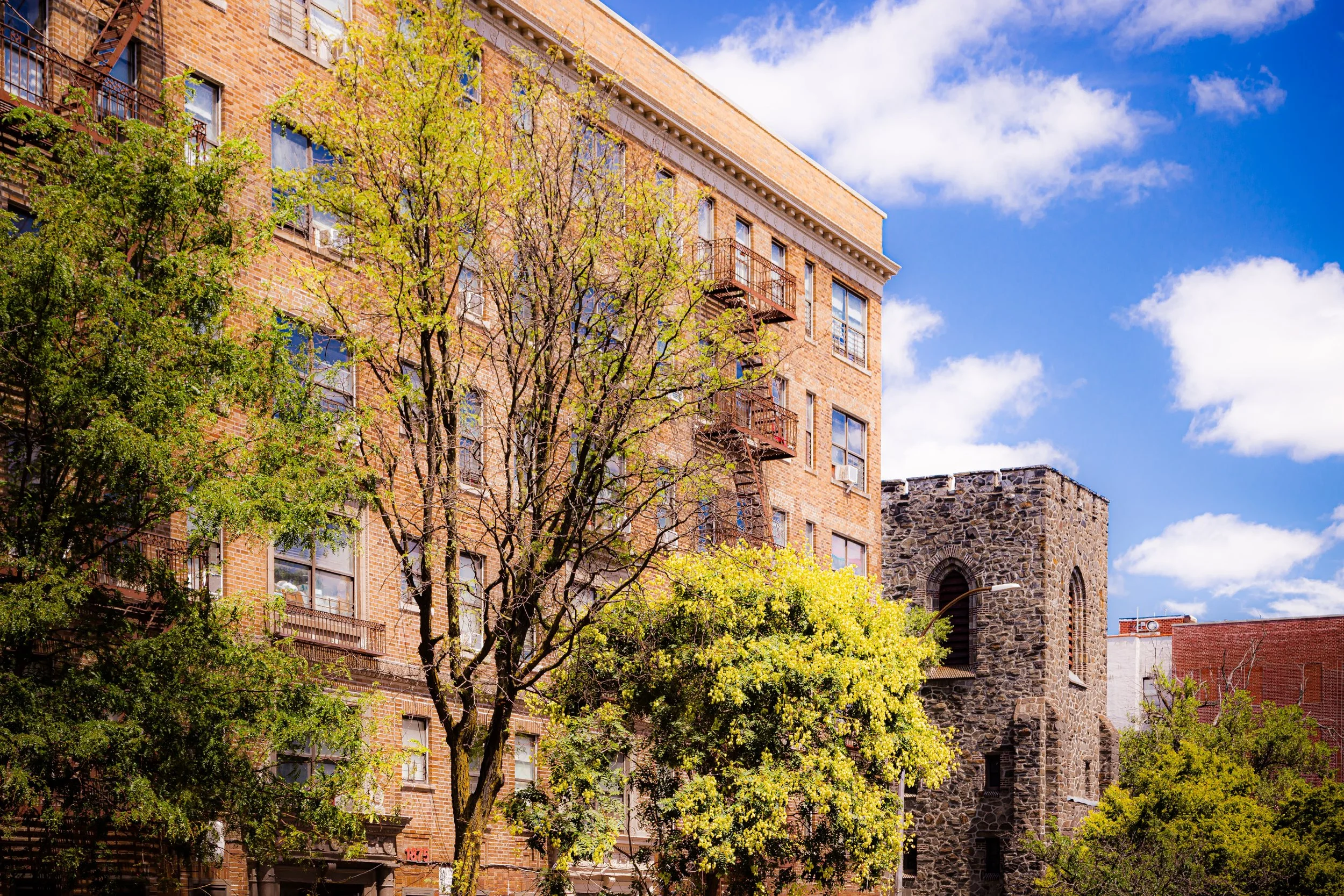
Bounded by the Harlem River to the west, West 179th Street to the north, Jerome Avenue to the east, and the Cross Bronx Expressway to the south, Morris Heights occupies a dramatic stretch of the western Bronx—its terrain a series of steep ridges and terraces that descend toward the river and frame sweeping views of the Manhattan skyline. Nestled between Highbridge to the south and University Heights to the north, the neighborhood forms part of the historic “Heights” district of the West Bronx, where elevation, infrastructure, and resilience converge.
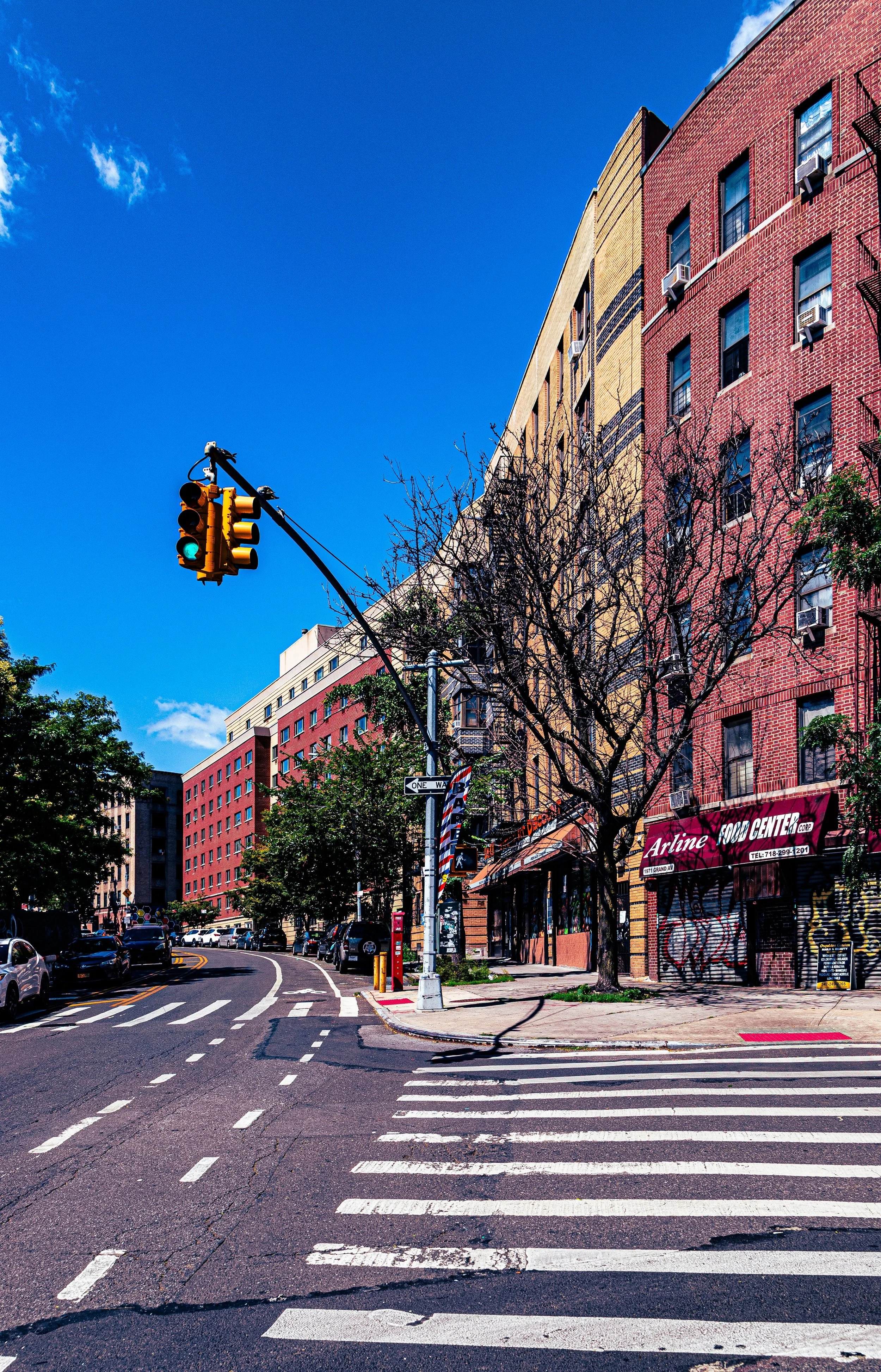
The neighborhood’s western edge is marked by the sinuous Harlem River Drive and Major Deegan Expressway, which trace the river’s bend and offer glimpses of the High Bridge and the Washington Bridge, two of New York’s oldest surviving spans. Jerome Avenue, its eastern boundary, serves as the area’s main commercial artery—lined with small shops, subway stations, and auto-repair businesses beneath the elevated 4 train. The heart of the neighborhood is residential: clusters of brick tenements, mid-century apartment houses, and public housing developments, including the Sedgwick Houses and Morris Heights Houses, interspersed with schools, community centers, and pocket parks.
Topographically complex yet compact, Morris Heights embodies the Bronx’s essential duality—its urban density framed by green slopes and open water, its physical challenges matched by the tenacity of the people who have long called it home.
Etymology
Morris Heights takes its name from the Morris family, one of the Bronx’s founding dynasties whose 17th- and 18th-century estate, Morrisania, encompassed vast portions of the South and West Bronx. The “Heights” designation refers to the neighborhood’s elevated position above the Harlem River valley—a geographic distinction that, in the 19th century, made it a desirable site for suburban villas and institutions seeking fresh air and commanding views.
Like neighboring Morrisania and Morris Park, the name preserves the legacy of the family’s influence over the borough’s early development—an aristocratic echo that contrasts with the neighborhood’s later evolution into one of the Bronx’s most vibrant working-class enclaves.
The Neighborhood
Origins through the 19th Century
In the 18th century, the area now known as Morris Heights was part of the rural Morrisania estate, a patchwork of farmland, woods, and meadows descending toward the Harlem River. The riverfront’s steep bluffs made it unsuitable for intensive agriculture but ideal for estate homes, which began appearing in the early 19th century as wealthy New Yorkers sought suburban retreats beyond Manhattan.
The arrival of the Harlem River Railroad (1840s) and the construction of the High Bridge (1848–1858)—New York City’s oldest surviving bridge—transformed the landscape, linking the Bronx to Manhattan and encouraging residential growth. By the 1870s, the area’s hills and views attracted developers who marketed “Morris Heights” as a suburban alternative to the city. Early residents included professionals and tradesmen, many commuting via the new Jerome Avenue streetcar or the New York Central Railroad’s Putnam Line.
As New York City expanded northward and the Bronx was annexed (1874), the neighborhood’s rural character gave way to a dense urban grid. Small rowhouses and apartment buildings replaced the villas, while new churches and schools anchored a growing population.
Early 20th Century: A Thriving Working-Class District
By the 1910s–1930s, Morris Heights had become a solidly working- and middle-class neighborhood defined by prewar apartment houses, corner stores, and a thriving street culture. Its population was largely Irish, Jewish, and Italian, reflecting the Bronx’s broader demographic pattern during this era of growth.
The opening of the Jerome Avenue subway line (1917) connected the neighborhood directly to Midtown Manhattan, fueling a building boom. Developers erected five- and six-story Art Deco and neo-Renaissance apartment houses along Sedgwick Avenue, University Avenue, and Harrison Avenue, many with decorative facades, courtyards, and stoops. Schools such as P.S. 11 and parish institutions like Our Lady of Angels Church provided educational and social anchors, while local movie houses and social clubs along Jerome Avenue fostered community life.
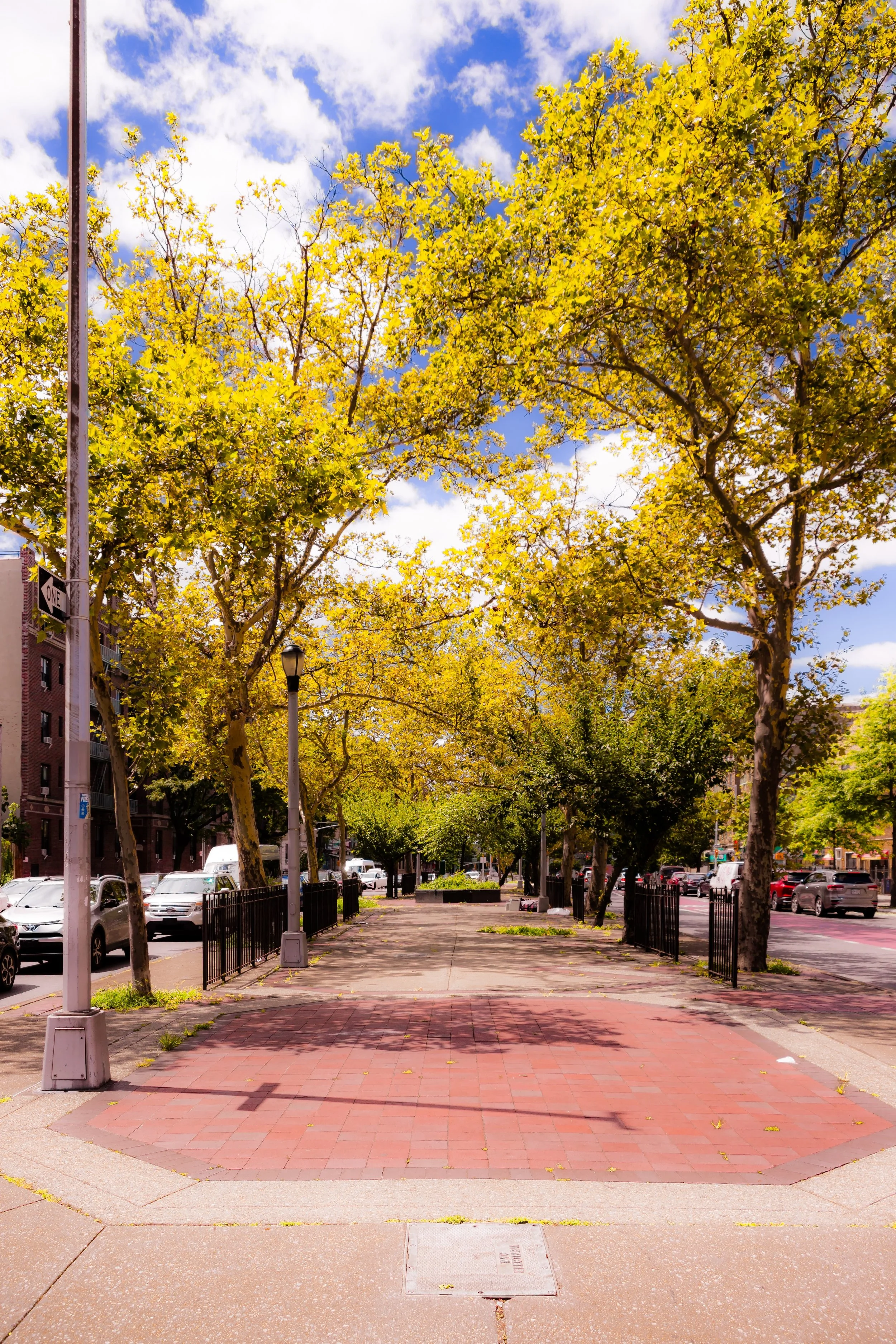
During the Great Depression and World War II, Morris Heights remained stable—a neighborhood of factory workers, shopkeepers, and teachers. The nearby High Bridge Park and Macombs Dam Park offered recreation, and the area’s elevation and open air maintained its reputation as one of the Bronx’s healthier districts.
Morris Heights Video Coming Soon
Mid–Late 20th Century: Displacement and the Fires of the South Bronx
The postwar decades, however, brought upheaval. The construction of the Cross Bronx Expressway (1948–1972) under Robert Moses carved through the heart of the Bronx just south of Morris Heights, displacing thousands of residents and severing neighborhood connections. Simultaneously, middle-class families—many of them Jewish and Italian—moved to the suburbs, replaced by waves of Puerto Rican, African-American, and Caribbean residents seeking affordable housing and opportunity.
By the 1970s, Morris Heights was at the epicenter of the South Bronx’s crisis. Redlining, arson, and neglect decimated housing stock, while the city’s fiscal collapse curtailed services. Entire blocks of apartment houses along University Avenue and 176th–179th Streets fell into disrepair or burned. The neighborhood became emblematic of urban abandonment, featured in headlines and photographs that portrayed the Bronx as a city in ruins.
Yet even in this darkest period, community organizing flourished. Residents formed tenant associations and block groups to reclaim vacant buildings. The Davidson Community Center and Community Board 5 became vital hubs for advocacy, while the Bronx Overall Economic Development Corporation (founded 1972) began channeling federal aid into rebuilding efforts. Faith-based organizations such as Our Lady of Angels Parish and St. Edmund’s Episcopal Church provided crucial social services and moral support.
21st Century: Rebuilding, Resilience, and Redefinition
In the decades since, Morris Heights has undergone one of the Bronx’s most striking transformations. Extensive urban renewal and community-led housing initiatives—beginning in the 1980s and continuing into the 2000s—have restored much of its residential fabric. Vacant lots were redeveloped into affordable apartments, schools, and parks, while older prewar buildings were renovated under city programs such as Tenants Interim Lease (TIL) and Low-Income Housing Tax Credit (LIHTC) partnerships.
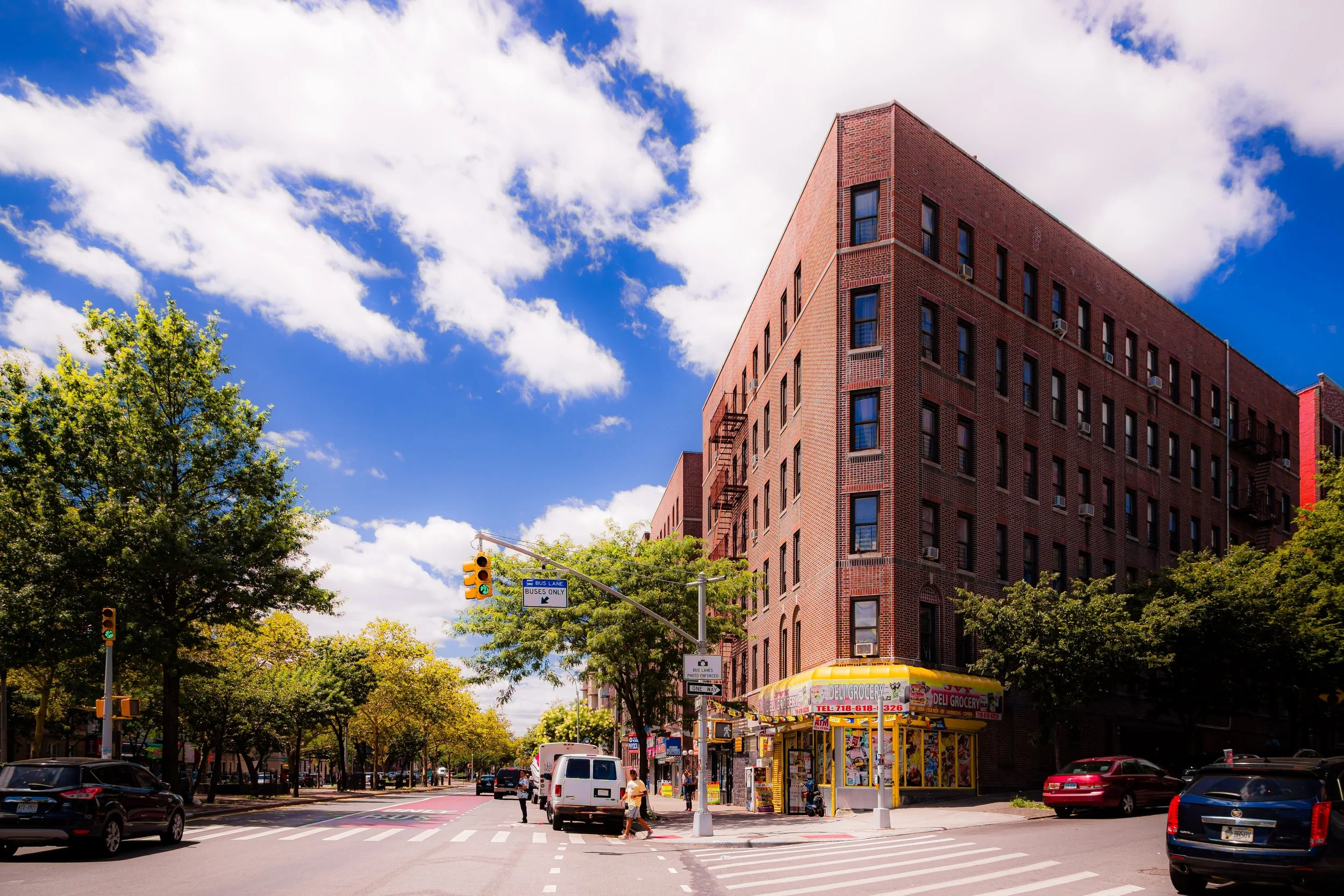
Today, Morris Heights is a predominantly Latino and African-American neighborhood, characterized by a rich cultural mix and a strong sense of place. Jerome Avenue remains a bustling corridor of auto shops, groceries, and small eateries; Sedgwick Avenue and University Avenue are lined with newly renovated apartment houses; and the Harlem River waterfront—once industrial and neglected—is gradually being reimagined through greenway initiatives that reconnect residents with the water.
The neighborhood’s civic institutions have adapted and expanded. The Davidson Community Center, SEDgwicK Houses Resident Council, and BronxWorks offer programs in youth development, job training, and family services. Public schools and charter networks have improved facilities, and the High Bridge, restored and reopened to pedestrians in 2015, has become a beloved landmark once more, linking the Bronx and Manhattan through both geography and symbolism.
Morris Heights Photo Gallery
Spirit and Legacy
The spirit of Morris Heights is defined by endurance—its residents’ ability to survive displacement, neglect, and disrepair, and to rebuild a livable, hopeful community from the ground up. The neighborhood’s very geography—a series of steep hills overlooking a river—mirrors its emotional topography: hard-won perspective earned through struggle and perseverance.
New York City
Use this custom Google map to explore where every neighborhood in all five boroughs of New York City is located.
The Five Boroughs
One of New York City’s unique qualities is its organization in to 5 boroughs: Manhattan, Brooklyn, Queens, The Bronx, and Staten Island. These boroughs are part pragmatic administrative districts, and part vestiges of the region’s past. Each borough is an entire county in New York State - in fact, Brooklyn is, officially, Kings County, while Staten Island is, officially Richmond County. But that’s not the whole story …
Initially, New York City was located on the southern tip of Manhattan (now the Financial District) that was once the Dutch colony of New Amsterdam. Across the East River, another city was rising: Brooklyn. In time, the city planners realized that unification between the rapidly rising cities would create commercial and industrial opportunities - through streamlined administration of the region.
So powerful was the pull of unification between New York and Brooklyn that three more counties were pulled into the unification: The Bronx, Queens, and Staten Island. And on January 1, 1898, the City of New York unified two cities and three counties into one Greater City of New York - containing the five boroughs we know today.
But because each borough developed differently and distinctly until unification, their neighborhoods likewise uniquely developed. Today, there are nearly 390 neighborhoods, each with their own histories, cultures, cuisines, and personalities - and each with residents who are fiercely proud of their corner of The Big Apple.


