INDIAN VILLAGE
The Bronx
Geographic Setting
Bounded by Tiffany Street, Randall Avenue, and Leggett Avenue to the west, the Bruckner Expressway to the north, the Bronx River to the east, and the East River to the south, Hunts Point occupies a distinct peninsula in the southeastern Bronx—an industrial, maritime, and residential district whose geography has shaped both its economy and its identity for over two centuries. The neighborhood juts into the meeting waters of the East and Bronx Rivers, its shoreline lined with piers, warehouses, and distribution terminals that hum with the constant movement of goods, trucks, and ships.
Despite its heavy industry, Hunts Point also contains pockets of vibrant community life and resilience. The grid of Hunts Point Avenue, Spofford Avenue, and Bryant Avenue runs through the heart of the peninsula, dividing the neighborhood between its northern residential core and its southern industrial expanse—the Hunts Point Food Distribution Center, one of the largest wholesale markets in the world. To the east, the Bronx River Greenway and Barretto Point Park offer greenery, waterfront access, and glimpses of the harbor, where the skyline of Manhattan shimmers faintly across the water. In the north, Louis Nine Boulevard and Garrison Avenue connect Hunts Point to Longwood and the rest of the South Bronx, forming a tenuous but vital link between the peninsula and the broader city.
Etymology
Hunts Point takes its name from the Hunt family, early English settlers who acquired land in the area during the 17th century. The family’s patriarch, Thomas Hunt, established a manor here around 1665, and the peninsula became known as “Hunt’s Point”—a designation that survived through the centuries even as the land passed through numerous owners and transformations.
The name’s endurance reflects both lineage and location: a “point” of land reaching into the rivers, marked by elevation and isolation, and a family whose imprint—though long vanished in stone—remains etched in the Bronx’s earliest colonial record.
The Neighborhood
Origins through the 19th Century
In the colonial and early national periods, Hunts Point was a landscape of farms, meadows, and estates, with tidal marshes along the riverbanks and orchards inland. The Hunt family’s property extended over much of the peninsula, and by the 18th century, the area became part of the larger Town of West Farms. During the American Revolution, the region saw skirmishes and troop movements, though it remained largely rural well into the 19th century.
In the 1830s–1860s, Hunts Point evolved into a haven for wealthy New Yorkers seeking country residences beyond Manhattan’s congestion. The Leggett, Spofford, and Fox families built grand estates overlooking the rivers, their mansions surrounded by gardens and pastures. Steamboats ferried visitors from Manhattan to the Hunts Point shoreline, where they enjoyed fresh air and sweeping vistas of the harbor.
The Morrisania and West Farms annexations of the late 19th century brought the area into the urban orbit of New York City. The extension of rail lines and industrial docks along the East River in the 1890s began transforming Hunts Point from pastoral retreat to working waterfront. The land’s proximity to both water and rail made it ideal for shipping, storage, and manufacturing—a shift that would define its 20th-century destiny.
Early 20th Century: Industry, Immigration, and Working-Class Growth
The early 20th century marked the definitive transition of Hunts Point from countryside to city. The construction of rowhouses, tenement blocks, and small apartment buildings north of Lafayette and Randall Avenues drew waves of immigrants—Jewish, Italian, and Irish families—who found work in the nearby factories, breweries, and warehouses. The Interborough Rapid Transit (IRT) subway reached Hunts Point Avenue in 1919, linking the peninsula to Manhattan and spurring commercial growth along the avenue.
At the same time, the waterfront filled with industry: shipyards, oil storage tanks, and food-processing plants clustered along Barry Street, Leggett Avenue, and the East River piers. Laborers built a tight-knit community around parishes like St. Athanasius Church and public institutions such as P.S. 48, creating a self-contained working-class neighborhood that embodied the Bronx’s industrial vigor.
By the 1930s, Hunts Point was densely populated yet stable, sustained by a culture of hard work, family networks, and neighborhood pride. Its residential blocks, though modest, were clean and lively, and the nearby Bronx River still flowed with traces of its natural course before being heavily industrialized.
Indian Village Video Coming Soon
Mid–Late 20th Century: Displacement and Decline
The postwar decades brought seismic change. In the 1950s and 1960s, construction of the Bruckner Expressway and other highways carved through the Bronx, isolating Hunts Point physically and economically from surrounding neighborhoods. Simultaneously, white flight and disinvestment swept through the borough. Factories closed or relocated, unemployment soared, and the neighborhood’s population—by then increasingly Puerto Rican and African-American—faced mounting poverty.
During the 1970s, Hunts Point became synonymous with the South Bronx’s decline. Fires, redlining, and abandonment ravaged blocks north of Lafayette Avenue. Yet even as much of the Bronx burned, the Hunts Point Food Distribution Center—established in 1967 on former industrial land at the peninsula’s tip—emerged as a new economic anchor. Comprising the Fulton Fish Market, the Meat Market, and the Produce Market, it grew into one of the largest wholesale food hubs in the world, supplying much of New York City’s restaurants, grocers, and bodegas.
Still, environmental burdens multiplied: diesel emissions, waste transfer stations, and truck traffic overwhelmed the community. By the 1980s, Hunts Point was both a symbol of urban hardship and a crucible of community activism. Residents and organizations such as The Point Community Development Corporation and Sustainable South Bronx (founded by Majora Carter) fought to reclaim land, reduce pollution, and restore access to the waterfront. Their advocacy planted the seeds of the neighborhood’s modern rebirth.
21st Century: Environmental Justice and Waterfront Renewal
In the 21st century, Hunts Point stands as a paradox of progress and struggle—an epicenter of both New York’s food economy and its environmental justice movement. The wholesale markets employ thousands and move billions of dollars in produce each year, but their truck-intensive operations have long impacted residents’ health and air quality. In response, community and city agencies have collaborated on initiatives to green the industrial zone, electrify truck fleets, and invest in sustainable infrastructure.
Redevelopment projects have transformed the waterfront from fenced-off industrial lots into spaces of recreation and renewal. Barretto Point Park, opened in 2006, restored public access to the East River for the first time in generations. Featuring piers, lawns, and views of the Manhattan skyline and Rikers Island, it stands as a testament to community advocacy. The Bronx River Greenway now threads through the eastern edge of Hunts Point, reconnecting the peninsula to the river’s renewed ecology and offering trails, kayak launches, and environmental education programs.
Today, Hunts Point’s residential core—anchored along Hunts Point Avenue, Spofford Avenue, and Lafayette Avenue—reflects a rich cultural mosaic of Latino, African-American, and West African families. New affordable housing, schools, and community centers coexist with historic industrial buildings converted for arts, education, and social enterprise. The Hunts Point Riverside Campus and The Point CDC host cultural festivals, youth programs, and sustainability projects that bridge generations and redefine what urban resilience looks like.
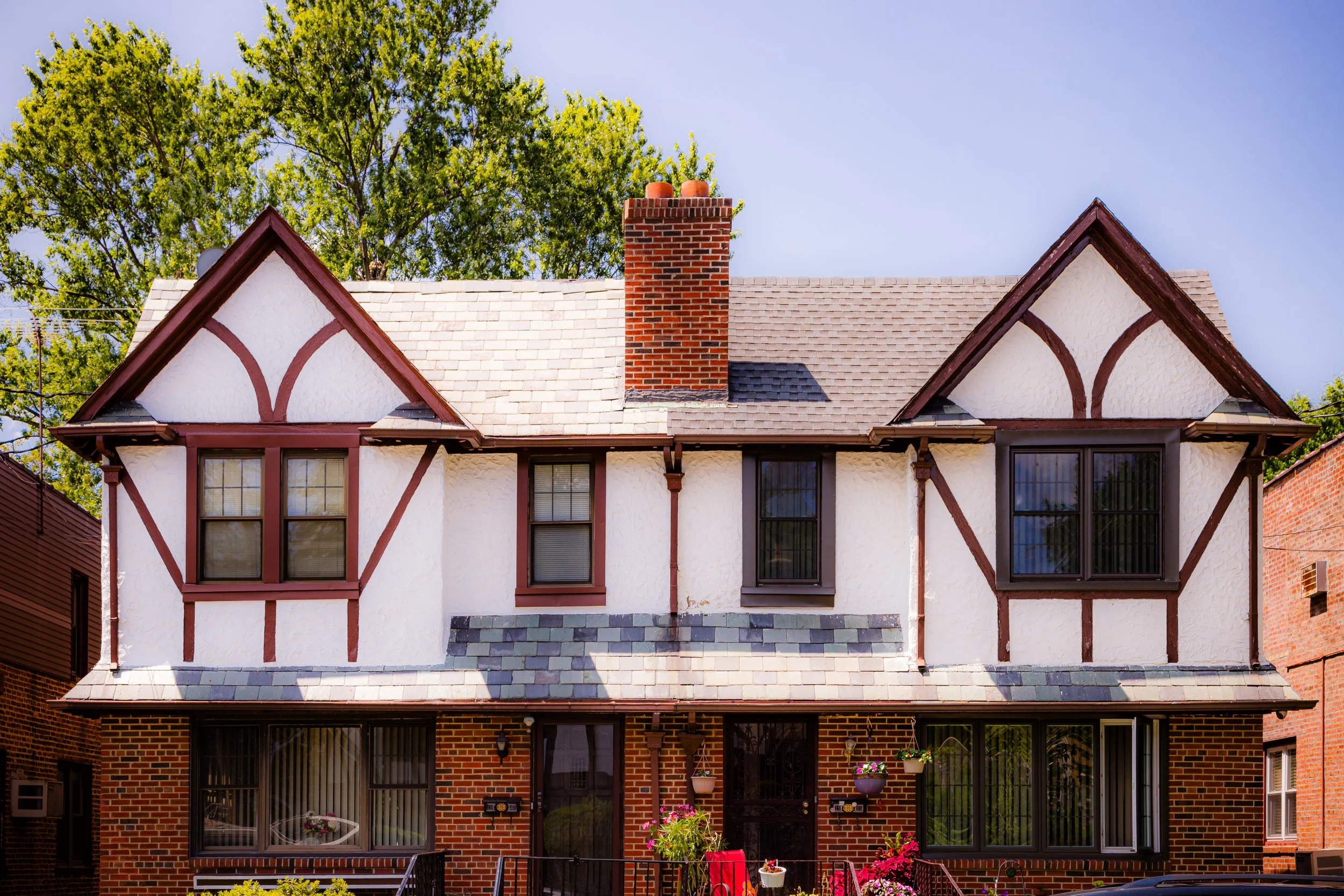
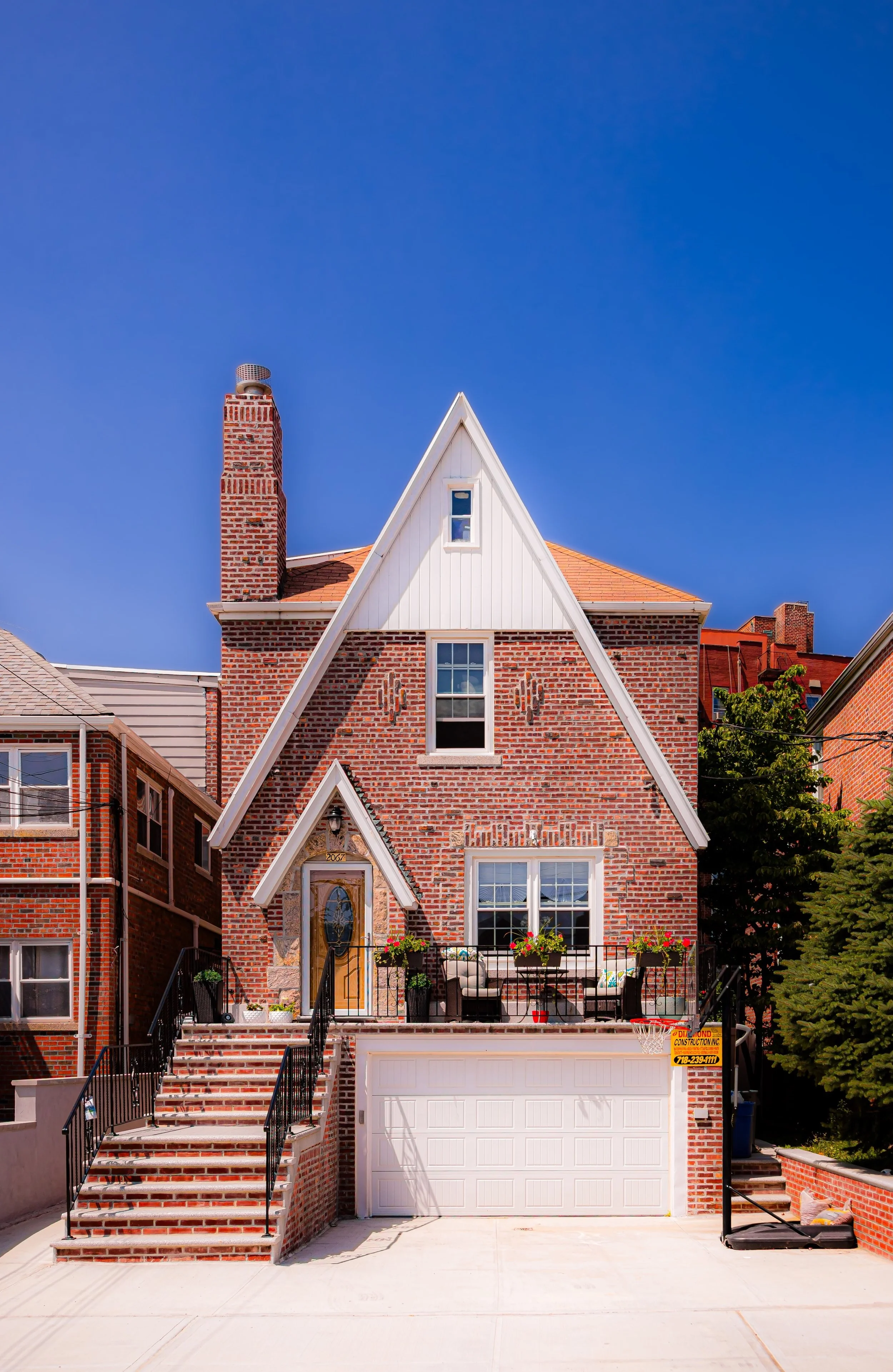
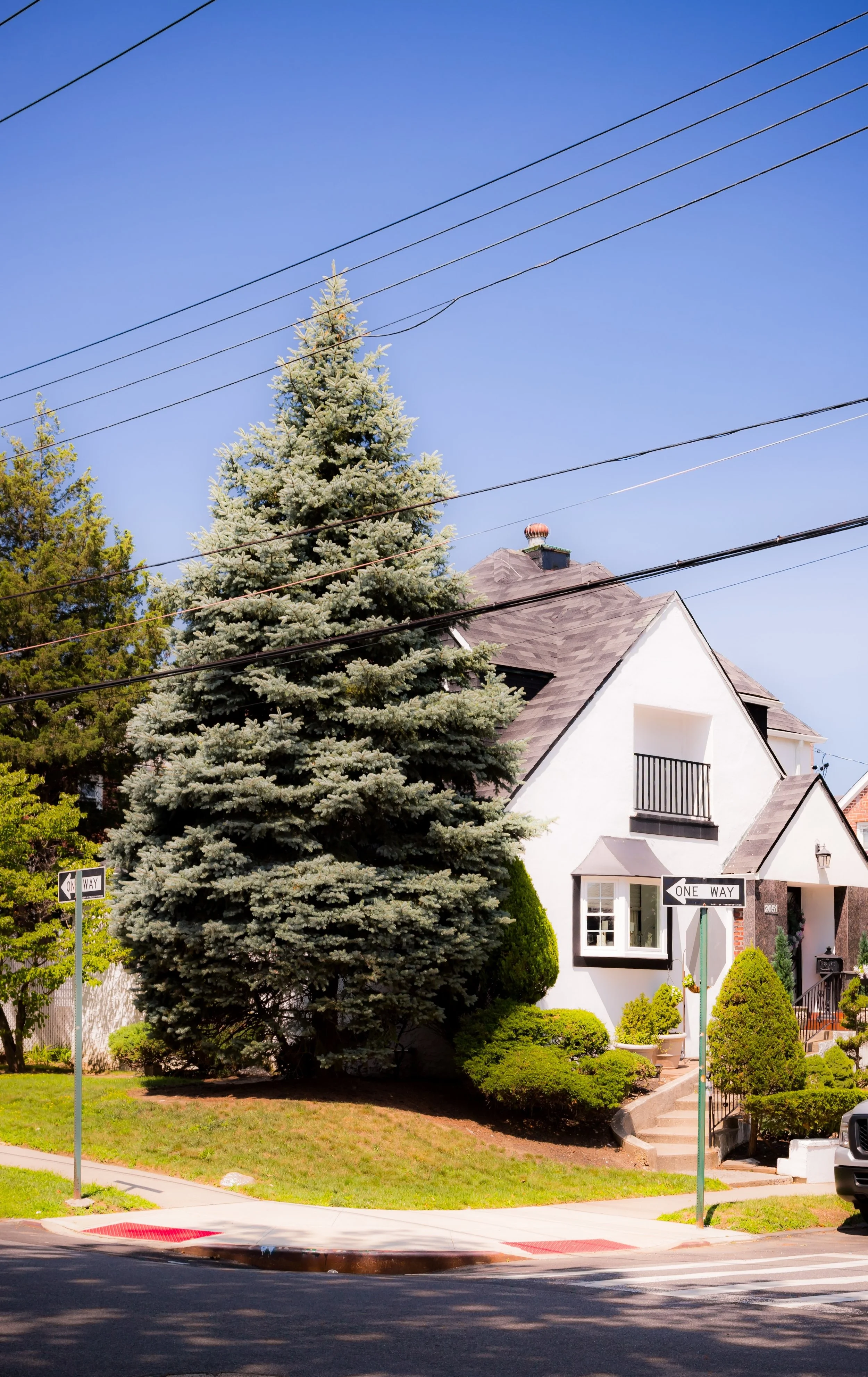
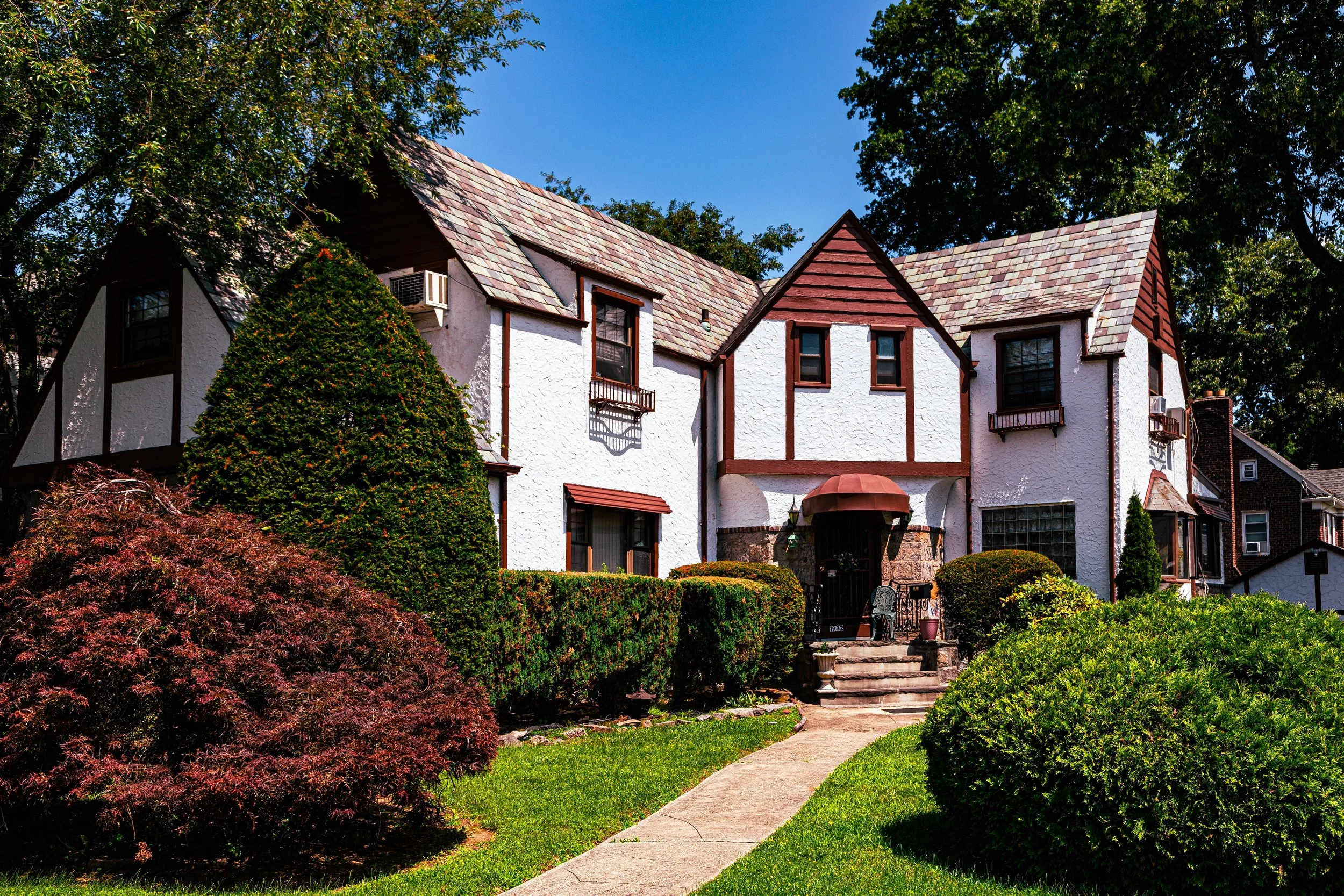
Indian Village Photo Gallery
Spirit and Legacy
The spirit of Hunts Point is one of labor, tenacity, and rebirth—a place where the Bronx’s industrial backbone meets its activist heart. Its story spans from colonial farmland to shipping hub, from near collapse to model of community-driven renewal. Few neighborhoods embody the tension between industry and ecology, hardship and hope, as vividly as Hunts Point.
New York City
Use this custom Google map to explore where every neighborhood in all five boroughs of New York City is located.
The Five Boroughs
One of New York City’s unique qualities is its organization in to 5 boroughs: Manhattan, Brooklyn, Queens, The Bronx, and Staten Island. These boroughs are part pragmatic administrative districts, and part vestiges of the region’s past. Each borough is an entire county in New York State - in fact, Brooklyn is, officially, Kings County, while Staten Island is, officially Richmond County. But that’s not the whole story …
Initially, New York City was located on the southern tip of Manhattan (now the Financial District) that was once the Dutch colony of New Amsterdam. Across the East River, another city was rising: Brooklyn. In time, the city planners realized that unification between the rapidly rising cities would create commercial and industrial opportunities - through streamlined administration of the region.
So powerful was the pull of unification between New York and Brooklyn that three more counties were pulled into the unification: The Bronx, Queens, and Staten Island. And on January 1, 1898, the City of New York unified two cities and three counties into one Greater City of New York - containing the five boroughs we know today.
But because each borough developed differently and distinctly until unification, their neighborhoods likewise uniquely developed. Today, there are nearly 390 neighborhoods, each with their own histories, cultures, cuisines, and personalities - and each with residents who are fiercely proud of their corner of The Big Apple.


