BROAD CHANNEL
Queens
Geographic Setting
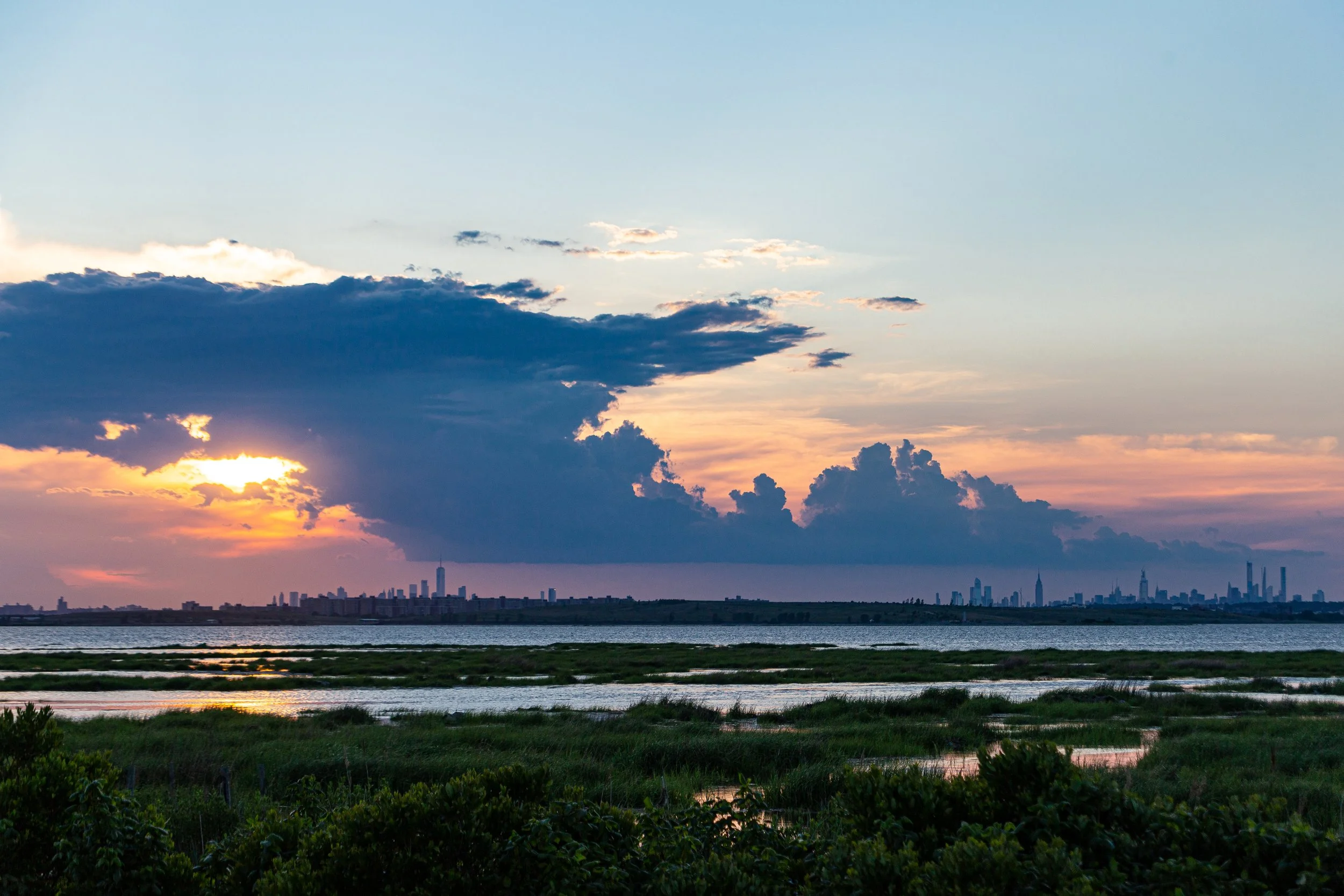
Situated in the middle of Jamaica Bay, Broad Channel is the only inhabited island within the vast tidal estuary that separates southern Queens from the Rockaway Peninsula. Bounded on all sides by the waters of the bay, the community is linked to the mainland via Cross Bay Boulevard, which runs north to Howard Beach and south across the Joseph P. Addabbo Memorial Bridge to Rockaway Beach. Its geographic isolation defines its character: a self-contained maritime village of low-rise homes, docks, and wetlands, surrounded by open sky and shifting tides.
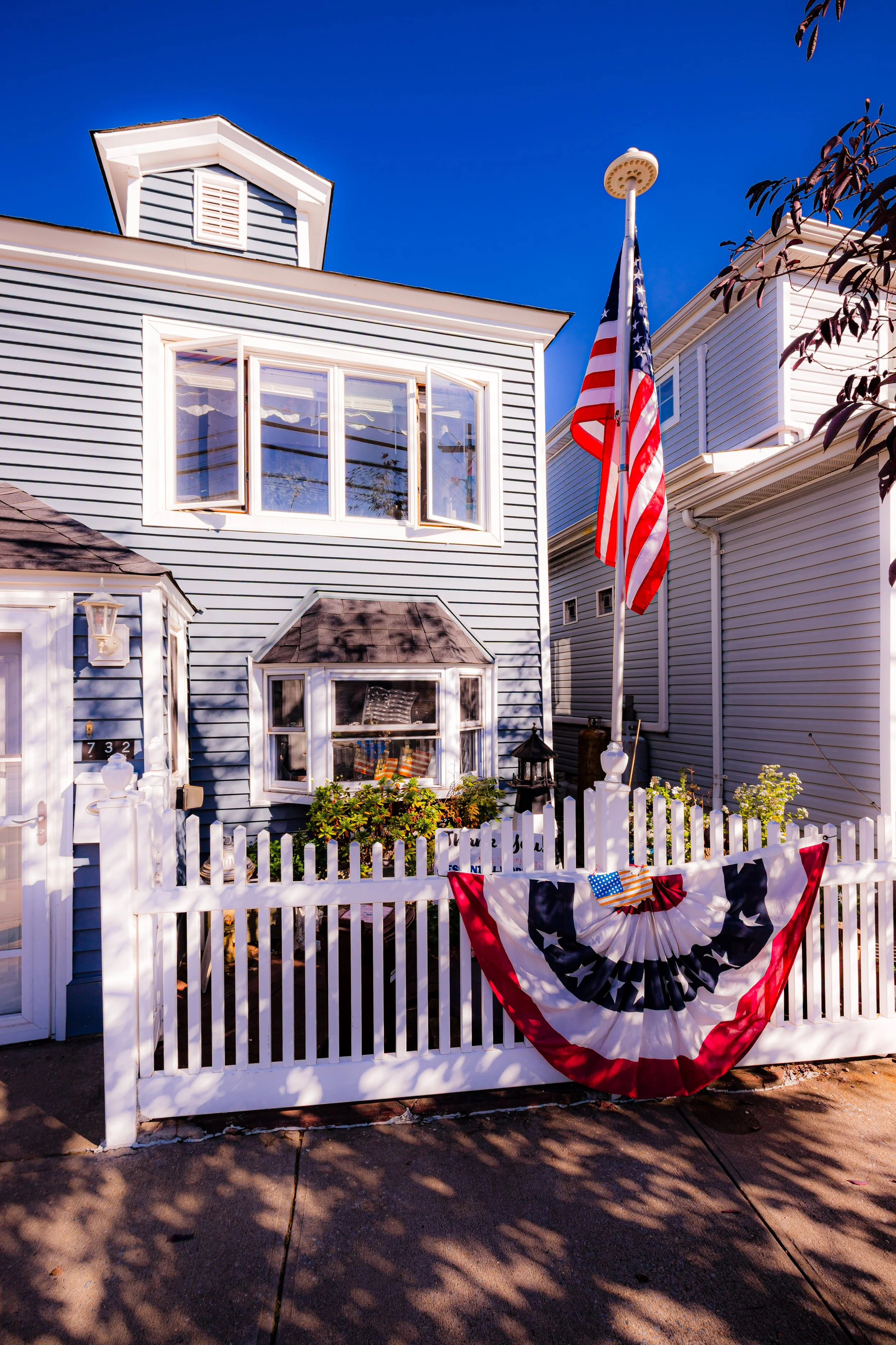
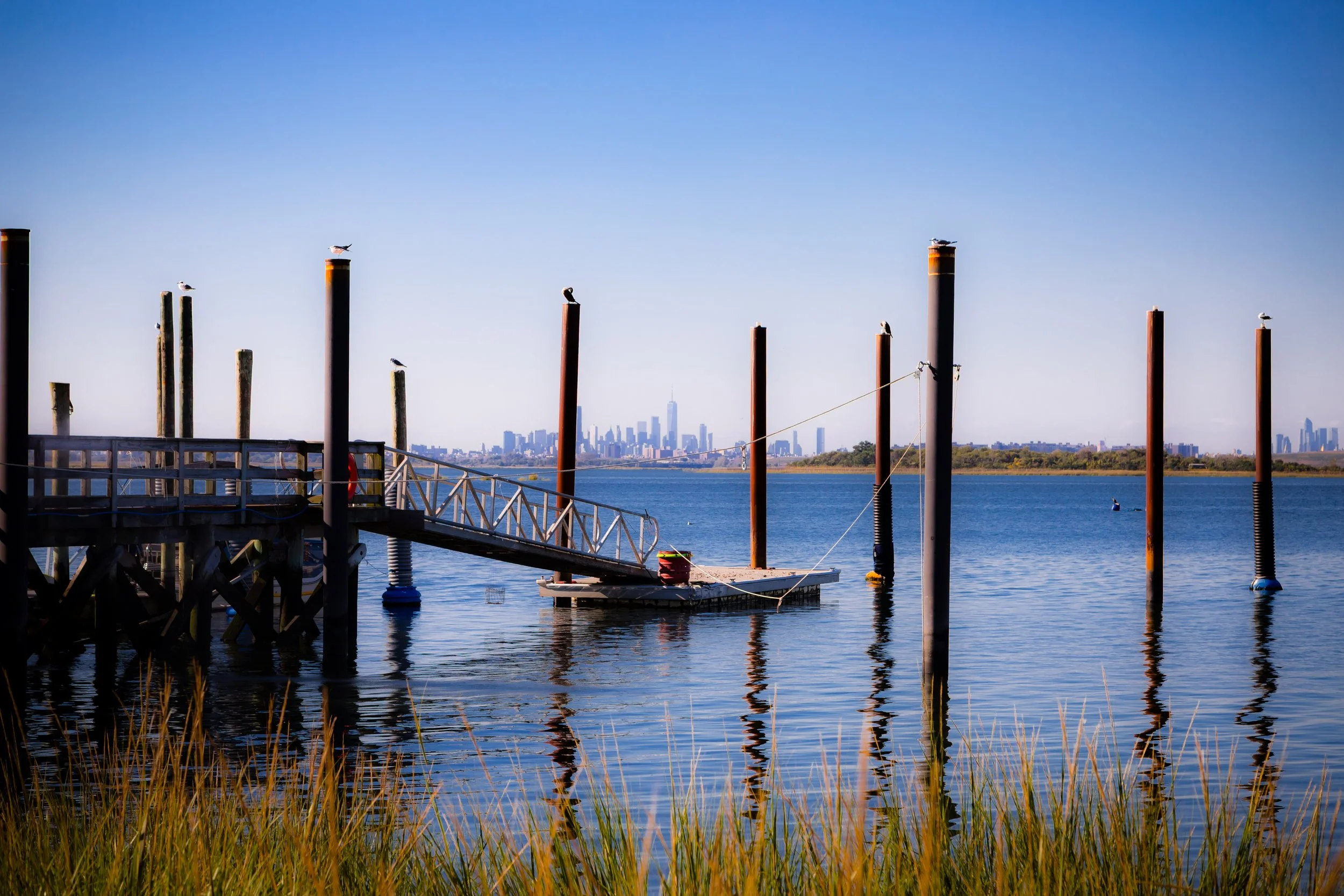
The island is long and narrow—barely a mile in length and a few blocks wide—bordered by salt marshes, mudflats, and tidal channels that host herons, egrets, and migratory birds. To the east and west stretch the protected waters of Gateway National Recreation Area’s Jamaica Bay Wildlife Refuge, making Broad Channel one of New York City’s most unique neighborhoods: an urban settlement within a federally protected ecosystem. Along Cross Bay Boulevard, modest bungalows and elevated homes face the water, interspersed with small shops, marinas, and community halls. From the island’s docks, the Manhattan skyline is visible to the north and the distant surf of the Atlantic to the south, yet the rhythms of daily life remain distinctly coastal and local.
Etymology and Origins
The name “Broad Channel” derives from the wide tidal channel that separates the island from the Rockaway Peninsula to the south. The term was first recorded in nautical charts of the early 19th century, when the area served primarily as a fishing and oyster-harvesting ground for residents of Jamaica and Canarsie. The broader bay, known to the Lenape people as part of their network of coastal hunting and fishing grounds, was later mapped and claimed by Dutch and English settlers.
In the 19th century, Jamaica Bay’s islands were little more than marshlands, but as New York’s population grew, they became valuable for recreation. By the 1880s, rail lines and ferries began carrying visitors to the Rockaways, and Broad Channel emerged as a seasonal outpost for fishermen and summer residents. Small wooden shacks and bungalows appeared on pilings above the marsh, built on land owned by the City of New York but leased to private occupants.
The Neighborhood
Early 20th Century: From Fishing Shanty to Summer Colony
At the turn of the 20th century, Broad Channel developed into a thriving summer colony. The New York, Woodhaven & Rockaway Beach Railroad, completed in the 1880s (now the A train), connected the island to Brooklyn and Manhattan, transforming the once-remote outpost into a weekend retreat. Residents constructed modest cottages and fishing docks along Cross Bay Boulevard, which itself was completed in 1925 and became the island’s main lifeline.
Life on Broad Channel revolved around the water. Residents fished for bluefish and flounder, dug clams, and moored small boats along the bay. With no sewer system or paved streets, the community remained rustic, defined by wooden boardwalks, salt breezes, and a sense of independence. By the 1930s, however, the island faced increasing scrutiny from city officials, who sought to reclaim the land for public use and remove “squatters.” Decades of legal battles ensued, as residents—technically tenants on city-owned property—fought for the right to remain.
Mid-20th Century: Permanent Settlement and Resilience
Broad Channel gradually transformed from a seasonal colony to a permanent neighborhood during the mid-20th century. After World War II, many bungalows were winterized, and year-round families replaced summer tenants. Civic institutions such as the Broad Channel Volunteer Fire Department (1905), American Legion Hall, and local churches anchored the growing community.
In 1938, the construction of the Cross Bay Veterans Memorial Bridge (later replaced in 1970 by the Addabbo Bridge) linked the island directly to the Rockaways, while Cross Bay Boulevard’s widening improved access to Howard Beach and mainland Queens. Despite modernization, Broad Channel remained physically and psychologically separate—accessible, but apart.
The 1950s and 1960s brought renewed tension as the city, under Robert Moses, sought to evict residents and repurpose the island as parkland. The formation of Gateway National Recreation Area in 1972 ultimately preserved both the community and its natural surroundings. In 1982, after years of advocacy, Broad Channel residents were finally allowed to purchase their homes from the city, ending a century of uncertainty and securing the island’s future as a legal, self-owned neighborhood.
Broad Channel Video Coming Soon
Late 20th Century: Island Life and Environmental Awareness
Through the late 20th century, Broad Channel maintained its distinctive identity—a close-knit, working- and middle-class community rooted in maritime life and civic pride. Firefighter and police families, tradespeople, and retirees formed the backbone of its population. Annual traditions such as the Broad Channel Mardi Gras Parade, dating back to the early 1900s, and the Volunteer Fire Department’s Labor Day celebrations reinforced the neighborhood’s communal spirit.
Surrounded by the Jamaica Bay Wildlife Refuge, residents developed a strong environmental consciousness. Local organizations such as the Broad Channel Civic Association and American Littoral Society partnered with the National Park Service to clean shorelines, restore wetlands, and advocate for sustainable living. The delicate balance between human settlement and natural habitat became central to the community’s self-identity.
21st Century: Storms, Rebuilding, and Renewal
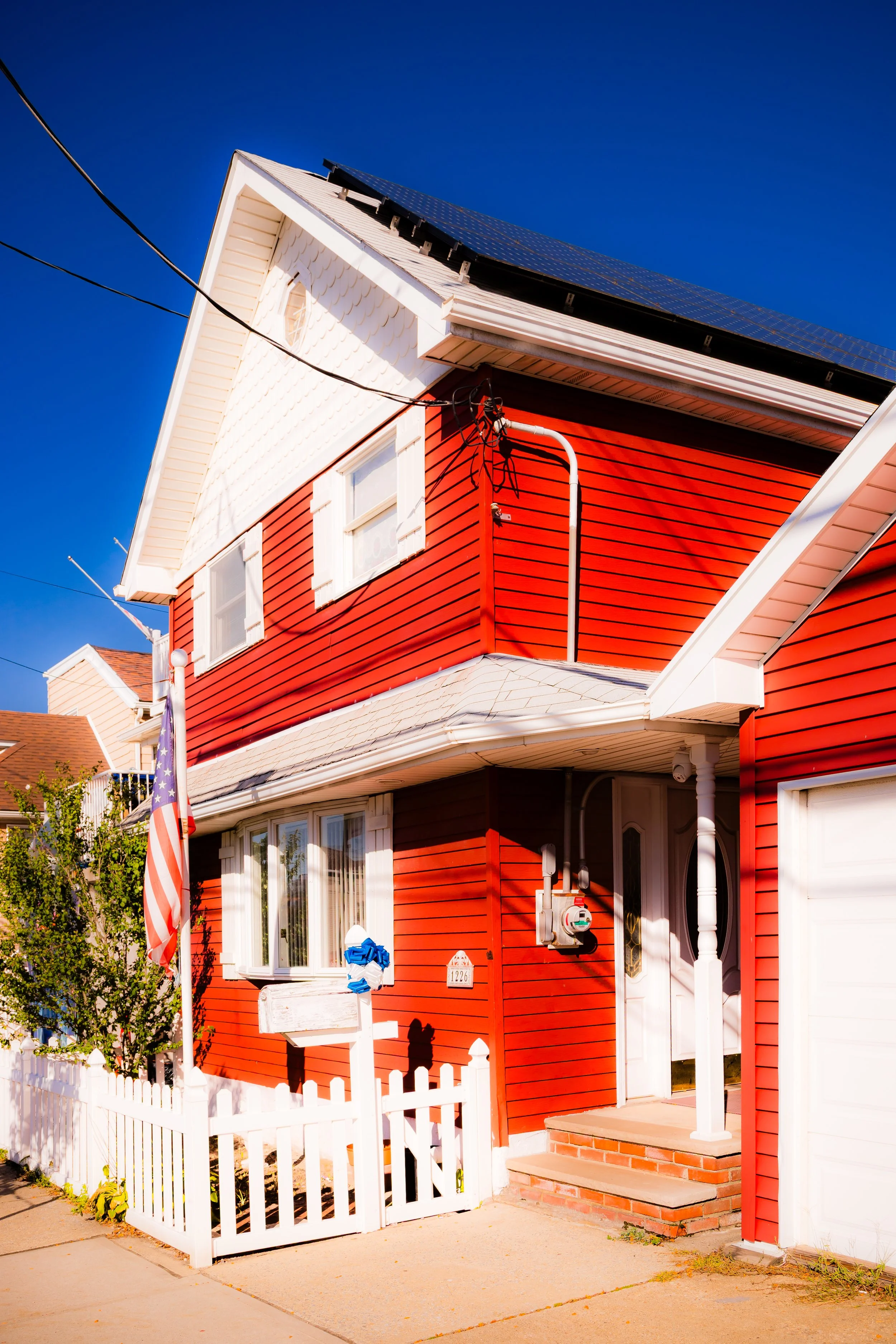
The 21st century has tested Broad Channel’s resilience like few other neighborhoods in New York. Its low elevation and exposure to tidal surges make it especially vulnerable to climate change. Hurricane Sandy (2012) inundated nearly every home on the island, destroying property and infrastructure. Yet in the storm’s aftermath, Broad Channel’s reputation for solidarity proved well-founded: neighbors rebuilt together, elevated homes, and lobbied for federal flood protection.
In the decade since, the island has emerged as a model of grassroots adaptation. Many houses have been reconstructed on stilts, stormwater systems upgraded, and shoreline restoration projects implemented in partnership with the Army Corps of Engineers and Gateway National Recreation Area. Despite rising waters, residents remain fiercely committed to their home—drawn by the views, the wildlife, and the unique quiet of an island community within the nation’s largest city.
Today, Broad Channel stands at the intersection of tradition and transition. Its narrow streets host both lifelong residents and newcomers seeking a maritime refuge within reach of Manhattan. Kayakers paddle the bay beside egrets, while fishing boats idle at docks that have served generations. Community life remains deeply participatory: potlucks at the VFW Hall, volunteer cleanups, and summer barbecues continue the rhythms that have defined the island for over a century.
Broad Channel Photo Gallery
Spirit and Legacy
Broad Channel’s spirit is inseparable from its setting—a testament to endurance at the edge of land and sea. Its people have weathered storms, eviction threats, and environmental uncertainty, all while preserving a distinct sense of independence and belonging. Few places in New York capture the tension between human persistence and natural fragility so vividly.
New York City
Use this custom Google map to explore where every neighborhood in all five boroughs of New York City is located.
The Five Boroughs
One of New York City’s unique qualities is its organization in to 5 boroughs: Manhattan, Brooklyn, Queens, The Bronx, and Staten Island. These boroughs are part pragmatic administrative districts, and part vestiges of the region’s past. Each borough is an entire county in New York State - in fact, Brooklyn is, officially, Kings County, while Staten Island is, officially Richmond County. But that’s not the whole story …
Initially, New York City was located on the southern tip of Manhattan (now the Financial District) that was once the Dutch colony of New Amsterdam. Across the East River, another city was rising: Brooklyn. In time, the city planners realized that unification between the rapidly rising cities would create commercial and industrial opportunities - through streamlined administration of the region.
So powerful was the pull of unification between New York and Brooklyn that three more counties were pulled into the unification: The Bronx, Queens, and Staten Island. And on January 1, 1898, the City of New York unified two cities and three counties into one Greater City of New York - containing the five boroughs we know today.
But because each borough developed differently and distinctly until unification, their neighborhoods likewise uniquely developed. Today, there are nearly 390 neighborhoods, each with their own histories, cultures, cuisines, and personalities - and each with residents who are fiercely proud of their corner of The Big Apple.


