SPUYTEN DUYVIL
The Bronx
Geographic Setting
Bounded by West 232nd Street to the north, Riverdale Avenue to the east, Marble Hill across Irwin and Johnson Avenues to the southeast, Spuyten Duyvil Creek to the south, and the Hudson River to the west, Spuyten Duyvil occupies one of the Bronx’s most dramatic natural landscapes—a promontory of steep hills and wooded slopes overlooking the confluence of the Harlem and Hudson Rivers. The neighborhood’s topography defines its character: cliffs, winding roads, and elevated vantage points that frame some of the most spectacular views in New York City.
Perched at the borough’s southwestern tip, Spuyten Duyvil feels both secluded and connected. Its curving streets—Palisade Avenue, Independence Avenue, Kappock Street, and Johnson Avenue—descend from the high bluffs of Riverdale toward the waterfront, where the Spuyten Duyvil Metro-North Station offers direct commuter access to Manhattan. Along the ridge, clusters of mid-20th-century co-op towers rise amid the trees, including Skyview-on-the-Hudson and The Henry Hudson House, their balconies oriented toward the river’s silvery expanse and the distant Palisades of New Jersey. Below them, the Henry Hudson Bridge arches gracefully across the water, linking the Bronx to Inwood and Manhattan, while the adjacent Spuyten Duyvil Shorefront Park preserves a fragment of the peninsula’s natural shoreline.
Though part of the larger Riverdale district, Spuyten Duyvil possesses a distinctive geography and identity—defined not by density or commerce, but by its landscape: steep, verdant, and eternally in dialogue with the water.
Etymology
The name “Spuyten Duyvil” is among the oldest and most evocative in New York. Derived from 17th-century Dutch, it has been variously translated as “Spouting Devil,” “Devil’s Whirlpool,” or “In spite of the Devil.” The phrase originally described the turbulent tidal currents at the narrow channel connecting the Harlem and Hudson Rivers—a dangerous passage notorious among Dutch sailors.
The name entered the city’s folklore through Washington Irving’sA History of New York (1809), which recounts the tale of trumpeter Anthony Van Corlaer, who, “in spite of the devil,” attempted to swim across the treacherous waters to carry news to Fort Washington—only to vanish beneath the waves. Whether myth or truth, the story immortalized the name and fixed it in the city’s imagination as a symbol of both peril and perseverance.
The Neighborhood
Origins through the 19th Century
Long before Dutch colonization, the region around Spuyten Duyvil Creek was inhabited by the Lenape people, who fished its rich estuarine waters and followed trails along the ridges now traced by Riverdale Avenue and Palisade Avenue. When the Dutch West India Company settled New Netherland in the early 1600s, the creek became a vital boundary—separating Manhattan Island from the mainland Bronx. The area was incorporated into the Philipse Manor estate in the late 17th century, encompassing much of the present-day Bronx west of the Bronx River.
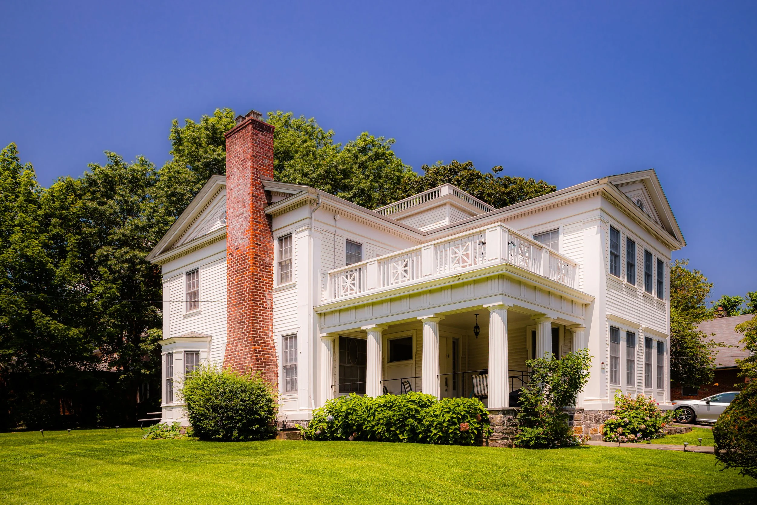
Through the 18th and early 19th centuries, Spuyten Duyvil remained rural and sparsely populated, its steep terrain unsuited to farming but prized for its views. The opening of the Hudson River Railroad in 1850 transformed the region, providing direct rail access to Manhattan and stimulating the development of grand riverfront estates. Industrial activity briefly flourished along the shoreline—most notably the Spuyten Duyvil Rolling Mill, founded in the 1840s by industrialist Joseph Delafield, whose ironworks produced cannon shot during the Civil War. The surrounding hills, however, remained the preserve of wealthy families who built country houses overlooking the Hudson.
Early 20th Century: Suburban Transformation and the Henry Hudson Bridge
By the early 20th century, Spuyten Duyvil had begun to transition from a pastoral outpost to a planned suburban neighborhood. The extension of Broadway and improvements to the Hudson Line encouraged residential growth, while the arrival of the Henry Hudson Parkway in the 1930s permanently reshaped the landscape.
The construction of the Henry Hudson Bridge (opened 1936)—a graceful steel arch designed by David B. Steinman—linked Spuyten Duyvil to Manhattan’s Inwood Hill, turning the area into a key gateway between boroughs. The bridge’s completion also spurred new housing development: modest private homes, low-rise apartment buildings, and, later, cooperative towers designed to take advantage of the views and transit access. The Spuyten Duyvil Station became a commuting lifeline, drawing professionals who sought riverfront tranquility within twenty minutes of Midtown Manhattan.
During this period, civic institutions took root: P.S. 24, St. Margaret of Cortona Church, and a branch of the New York Public Library established the civic framework of a self-sufficient, middle-class enclave.
Spuyten Duyvil Video Coming Soon
Mid–Late 20th Century: The Skyline on the Hudson
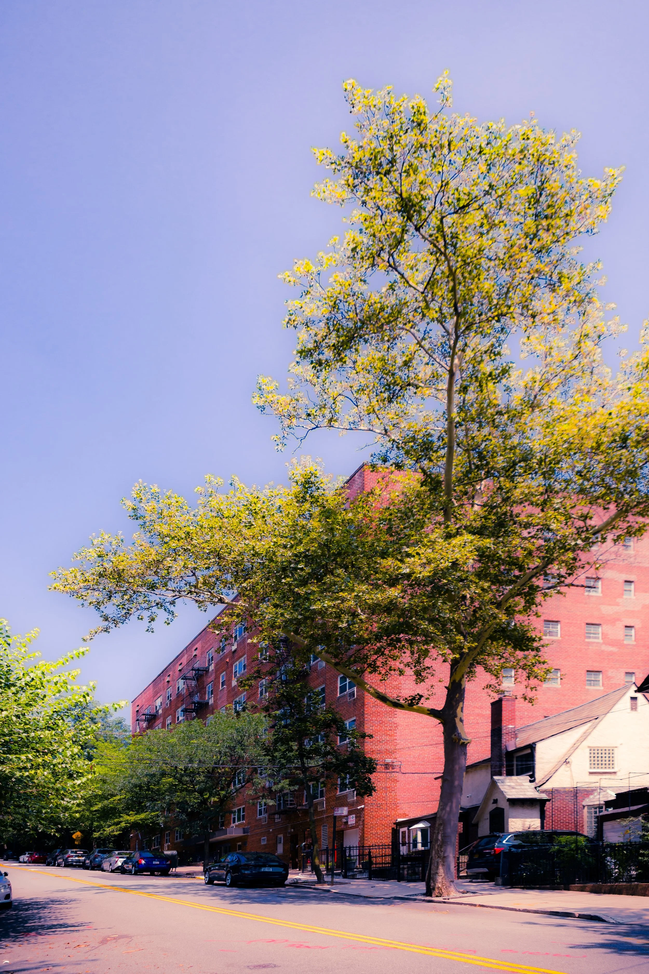
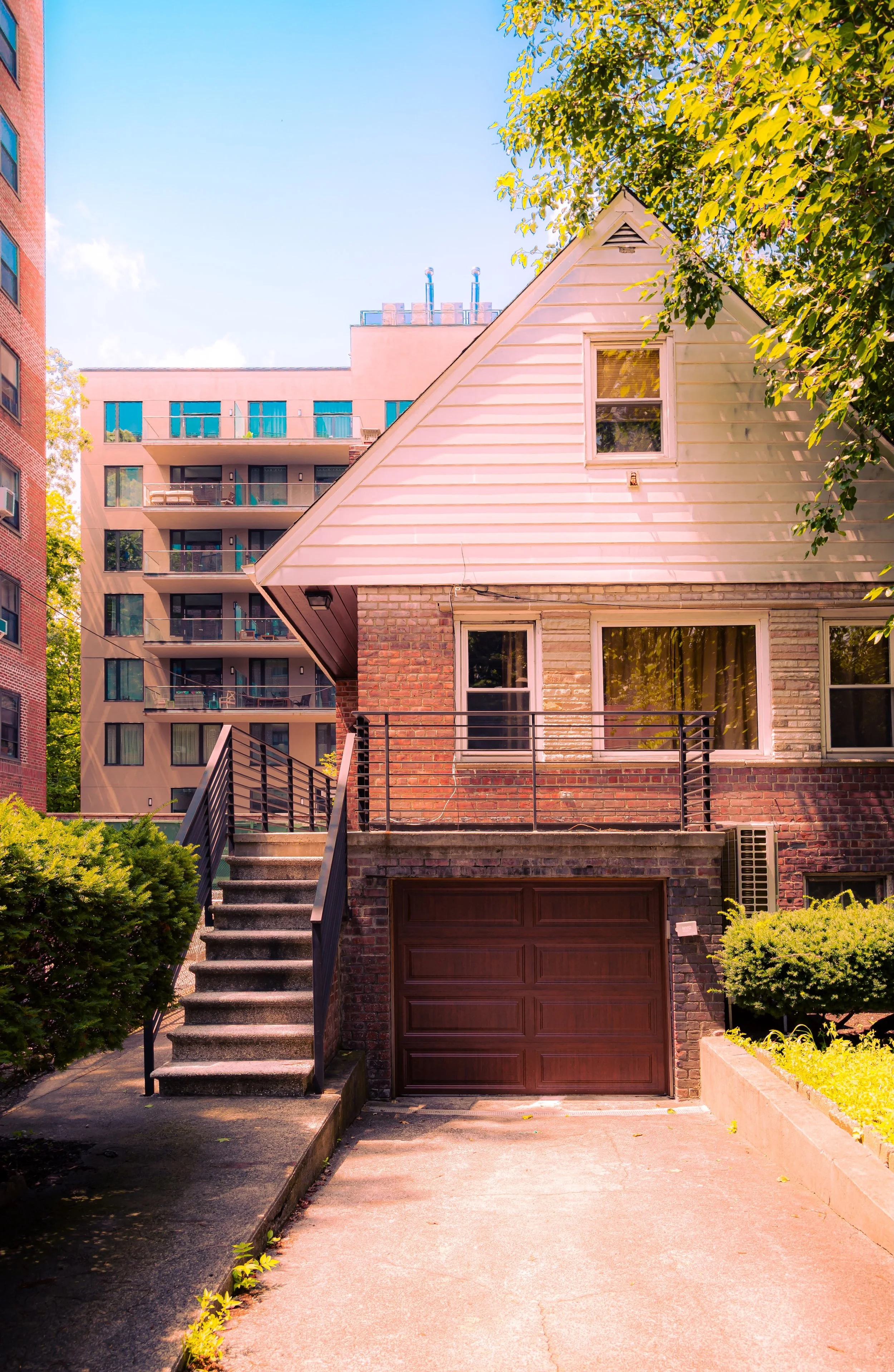
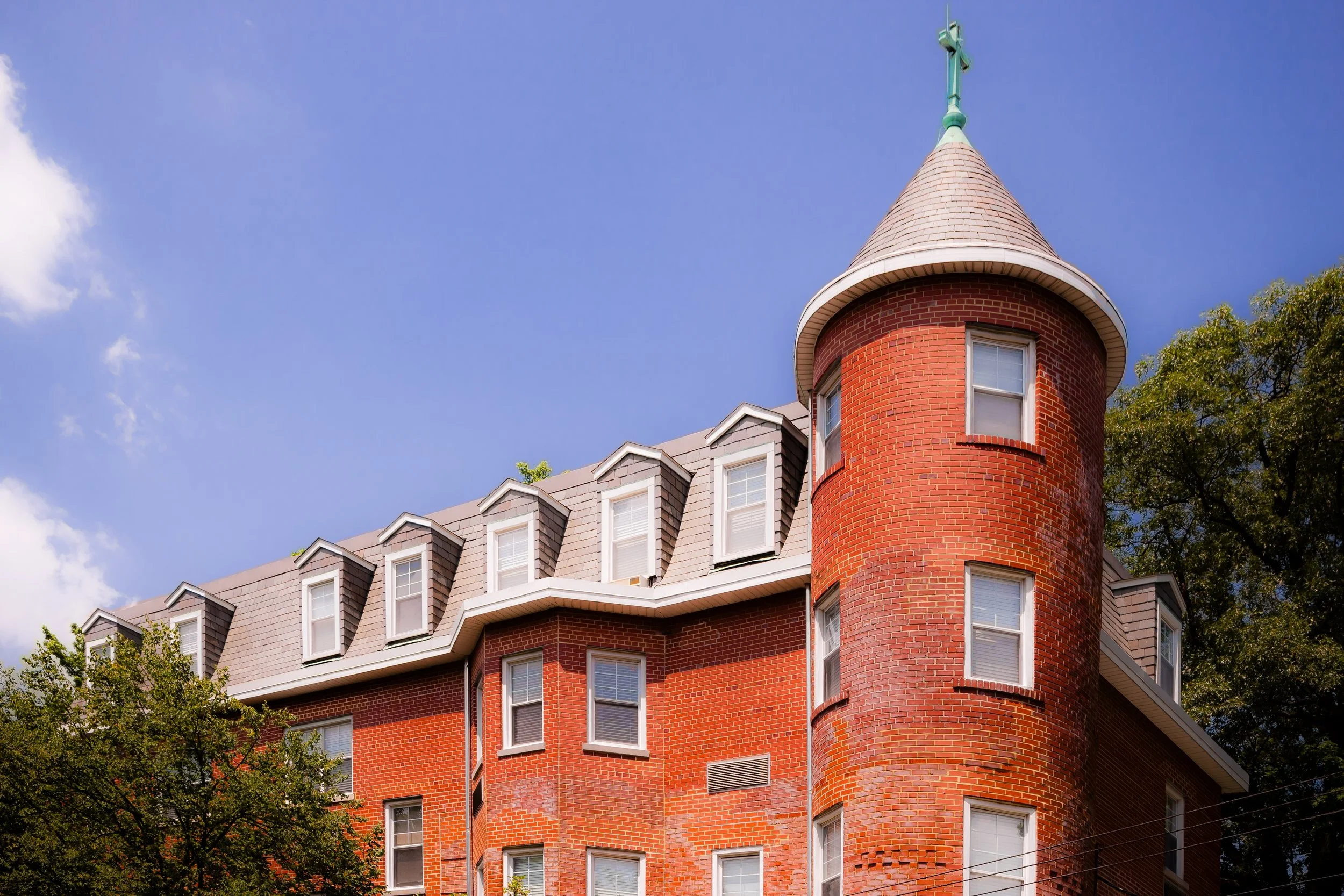
The postwar decades marked Spuyten Duyvil’s modern transformation. Between the 1950s and 1970s, developers replaced many of the early single-family homes with cooperative apartment complexes, reflecting a broader Bronx trend toward vertical living with suburban amenities. Buildings like Skyview-on-the-Hudson (built 1960s), The Henry Hudson House, and The Imperial defined the neighborhood’s mid-century skyline, offering panoramic views, swimming pools, and doorman service.
Despite its increasing density, the neighborhood retained a sense of privacy thanks to its geography—its hills and trees muffling the noise of city life. The river and the Henry Hudson Parkway served as natural and infrastructural boundaries, preserving Spuyten Duyvil’s quietude even as urban life surged elsewhere in the Bronx.
The area was not untouched by the borough’s struggles in the 1970s–1980s, yet its cooperative governance, stable homeowner base, and relative affluence helped it weather the city’s fiscal crisis largely intact. Its proximity to Riverdale and the enduring prestige of its river views continued to attract professionals, academics, and artists seeking refuge within city limits.
21st Century: Waterfront Renewal and Elevated Calm
In the 21st century, Spuyten Duyvil remains one of the Bronx’s most sought-after residential districts—a blend of modern convenience and natural beauty rarely found in New York City. The neighborhood’s co-ops and condominiums have undergone renovations, while new developments near the Metro-North station have introduced contemporary architecture without overwhelming the landscape.
Environmental and civic efforts have focused on reconnecting residents to the waterfront. The Spuyten Duyvil Shorefront Park, part of the Hudson River Greenway, now provides walking paths, lookouts, and ecological restoration along the once-industrial shoreline. Views of the Palisades, Inwood Hill Park, and the George Washington Bridge remain breathtaking constants, anchoring the neighborhood’s identity.
A sense of quiet continuity pervades the community: tree-lined streets, neighborhood associations, and an enduring respect for the land’s contours. The area’s diversity has deepened, yet its essential qualities—safety, scenery, and a rarefied calm—remain as defining as ever.
Spuyten Duyvil Photo Gallery
Spirit and Legacy
The spirit of Spuyten Duyvil is the spirit of place itself—a dialogue between rock, water, and sky that has shaped human settlement here for centuries. It is a neighborhood where myth meets geography, where the currents of two rivers converge beneath the arch of a bridge, and where city life slows into something almost pastoral.
New York City
Use this custom Google map to explore where every neighborhood in all five boroughs of New York City is located.
The Five Boroughs
One of New York City’s unique qualities is its organization in to 5 boroughs: Manhattan, Brooklyn, Queens, The Bronx, and Staten Island. These boroughs are part pragmatic administrative districts, and part vestiges of the region’s past. Each borough is an entire county in New York State - in fact, Brooklyn is, officially, Kings County, while Staten Island is, officially Richmond County. But that’s not the whole story …
Initially, New York City was located on the southern tip of Manhattan (now the Financial District) that was once the Dutch colony of New Amsterdam. Across the East River, another city was rising: Brooklyn. In time, the city planners realized that unification between the rapidly rising cities would create commercial and industrial opportunities - through streamlined administration of the region.
So powerful was the pull of unification between New York and Brooklyn that three more counties were pulled into the unification: The Bronx, Queens, and Staten Island. And on January 1, 1898, the City of New York unified two cities and three counties into one Greater City of New York - containing the five boroughs we know today.
But because each borough developed differently and distinctly until unification, their neighborhoods likewise uniquely developed. Today, there are nearly 390 neighborhoods, each with their own histories, cultures, cuisines, and personalities - and each with residents who are fiercely proud of their corner of The Big Apple.


