MOSHOLU
The Bronx
Geographic Setting
Bounded by Broadway and Van Cortlandt Park to the east, West 254th Street to the south, Riverdale Avenue to the west, and the Westchester County line to the north, Mosholu occupies a serene and wooded corner of the northwestern Bronx. It serves as a natural threshold between the city and its suburban periphery—where the urban grid dissolves into tree-lined roads, stone walls, and the forested edges of Van Cortlandt Park, one of New York’s largest and most historic green spaces.
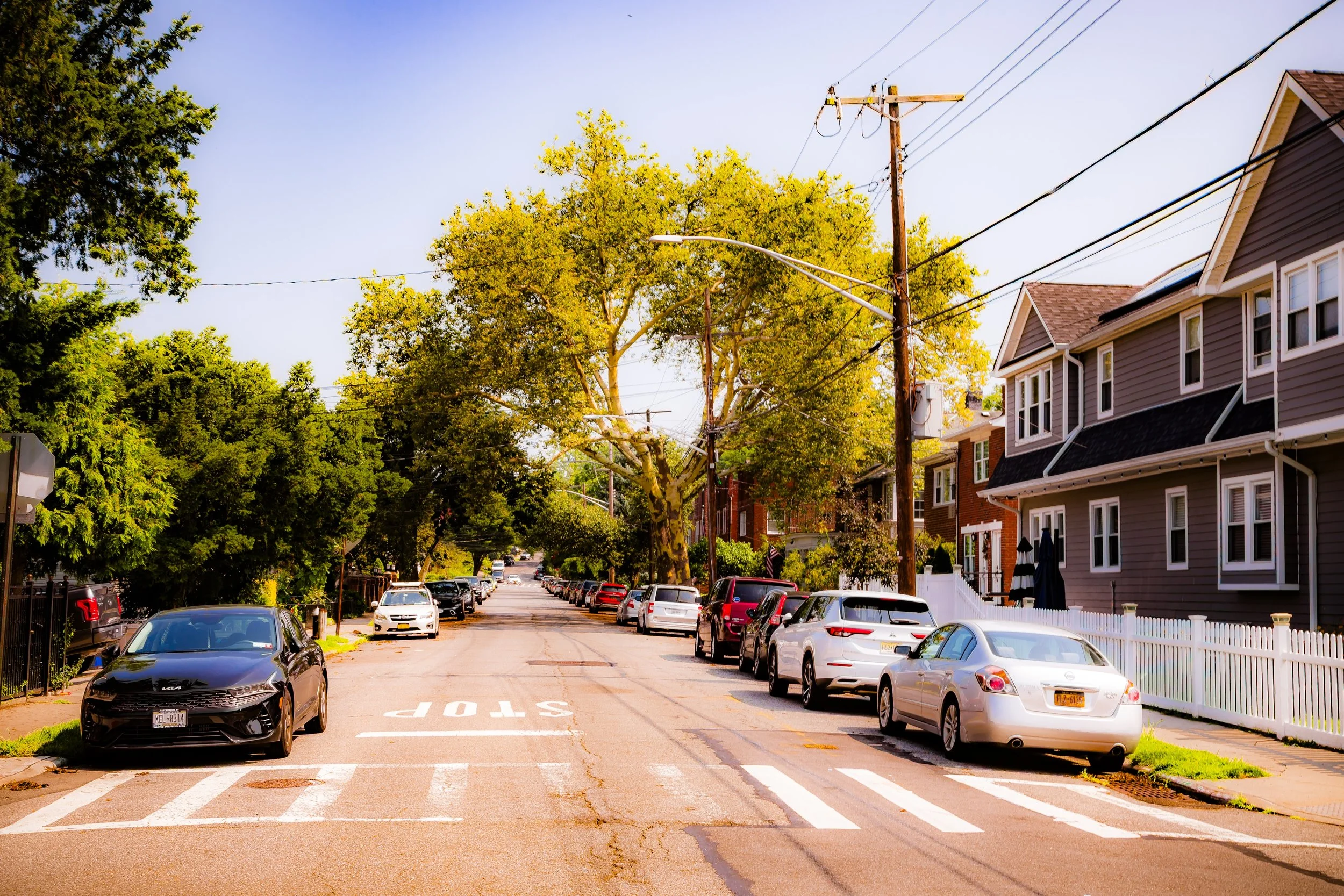
Set along the upper reaches of the Harlem River watershed, Mosholu’s geography is defined by rolling hills, quiet residential lanes, and vistas that open toward the Hudson and Bronx river valleys. Mosholu Parkway, running southeast from nearby Van Cortlandt Park toward Bronx Park, provides the neighborhood’s most prominent connection to the rest of the borough—a landscaped corridor conceived during the City Beautiful era as part of the Bronx’s grand parkway system. Within the neighborhood itself, Riverdale Avenue, Fieldston Road, and Broadway form its principal thoroughfares, while smaller streets like Mosholu Avenue, Post Road, and West 256th Street define its tranquil residential interior.
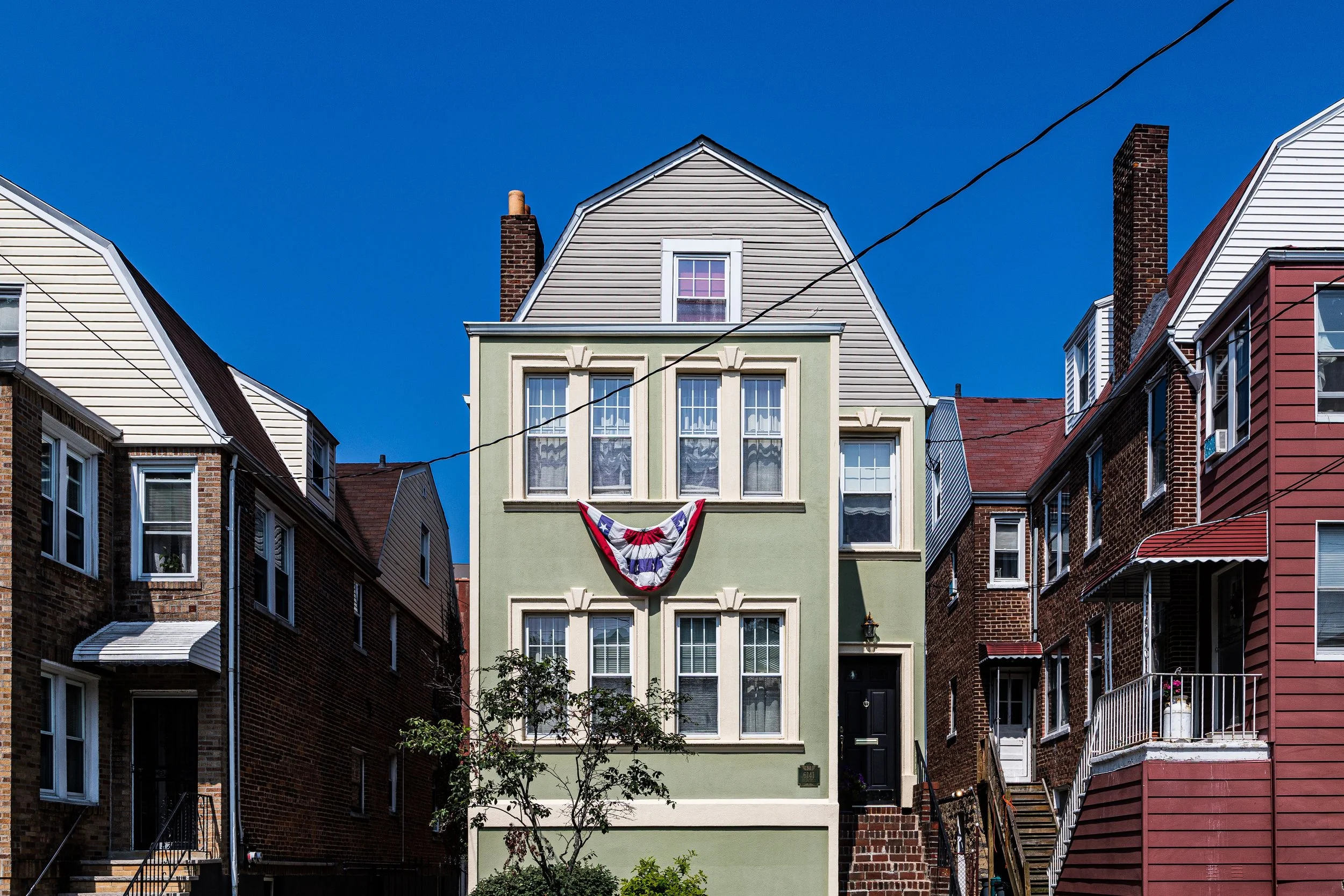
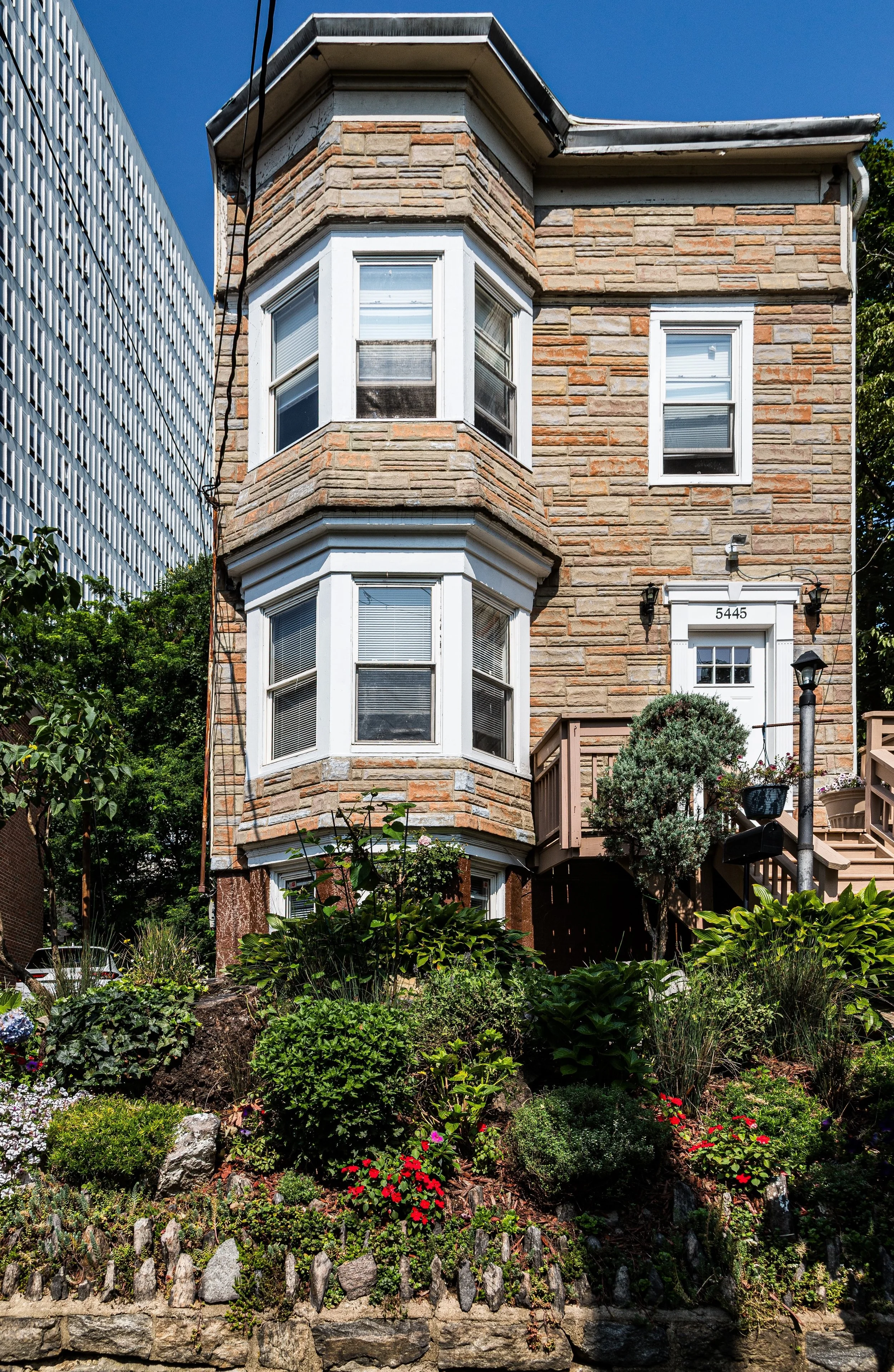
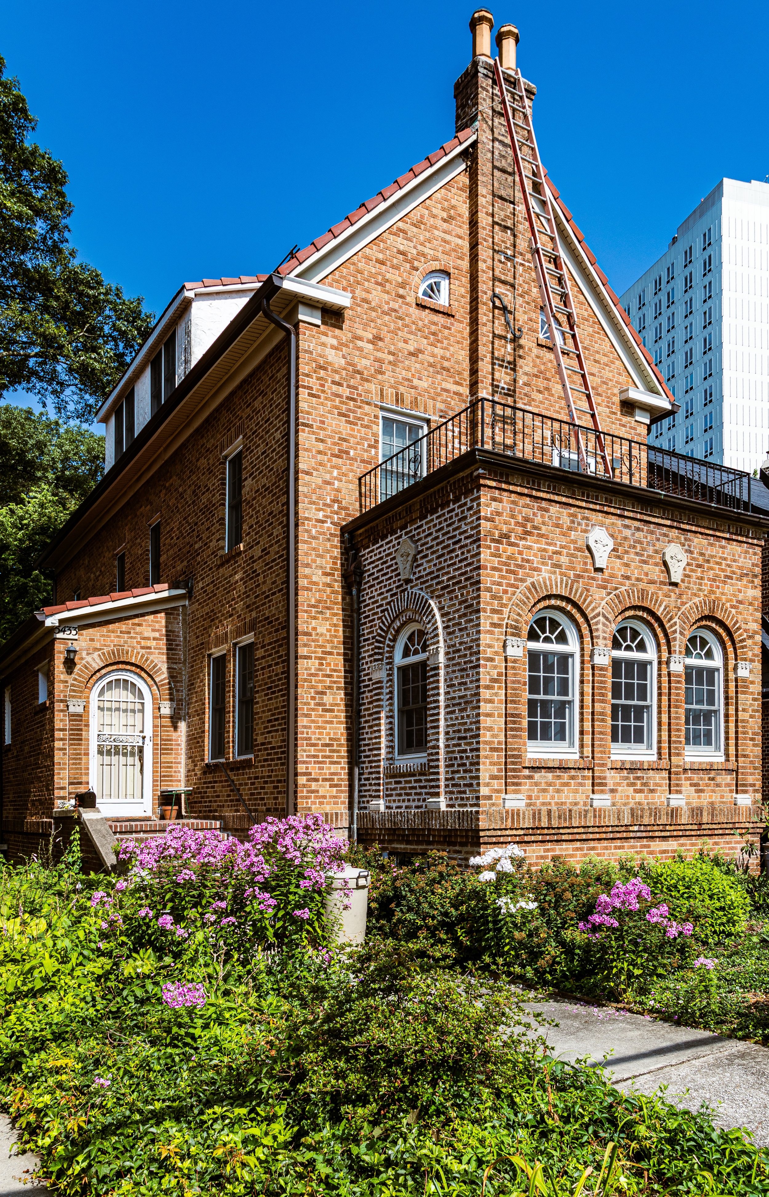
Architecturally, the area reflects a blend of early-20th-century suburban ambitions and later urban refinement: Tudor and Colonial Revival houses, prewar apartment buildings, and modest brick rowhomes coexist within a landscape marked by stone retaining walls, old-growth trees, and open sky.
Etymology
The name “Mosholu” originates from a Lenape word meaning “smooth stones” or “small stones,” a reference to the Moshulu Brook that once flowed through what is now Van Cortlandt Park. The term was preserved in the naming of Mosholu Parkway (constructed in the 1890s) and subsequently extended to nearby streets and residential areas. The word also found a second life in maritime lore—the four-masted ship Moshulu, launched in 1904, was named after this same Native American root.
In its linguistic endurance, “Mosholu” connects the modern Bronx to its precolonial landscape—a rare surviving echo of the region’s Indigenous heritage, reminding residents that the borough’s forests, hills, and waterways once bore names long predating European settlement.
The Neighborhood
Origins through the 19th Century
Before the advent of the parkway or suburban development, the land now known as Mosholu formed part of the Van Cortlandt estate, a vast colonial-era property encompassing farms, forests, and mills operated by the prominent Dutch Van Cortlandt family. The estate’s manor house, built in 1748 and still standing in Van Cortlandt Park, served as a Revolutionary War landmark and later as the nucleus of a sprawling agricultural operation that extended north to the Westchester border.
Through the 19th century, the surrounding area remained pastoral—rolling farmland interspersed with woodlots, stone fences, and carriage roads. The arrival of the New York Central Railroad’s Hudson Line in the mid-1800s brought accessibility and modest suburban growth, but much of the terrain remained undeveloped until after annexation to New York City in 1874.
The creation of Van Cortlandt Park (1888) and the Mosholu Parkway (1890s) under the vision of park designers Frederick Law Olmsted and John Mullaly redefined the area’s purpose. The parkway linked the northern and eastern park systems of the Bronx, embodying a new ideal of urban green infrastructure. The wooded lands around its upper terminus—today’s Mosholu neighborhood—soon became prized as a healthful residential retreat for the city’s middle class.
Early 20th Century: Suburban Aspirations and Growth
The early 20th century brought steady suburban-style development to Mosholu. The area’s elevation, proximity to Van Cortlandt Park, and relative isolation from industrial centers made it an appealing enclave for professionals and families seeking tranquility within city limits. Builders erected a range of single-family houses, two-family brick homes, and modest apartment houses along gently curved streets that followed the contours of the land rather than the rigid grid of the South Bronx.
Public transportation improvements—especially the expansion of Broadway’s trolley lines and the opening of the IRT Broadway–Seventh Avenue Line (1 train) in the 1910s—connected Mosholu to Manhattan, encouraging further residential growth. Small local schools and corner markets appeared, yet the area retained its village-like quietude, distinct from both the denser urbanism of Kingsbridge and the grander estates of Riverdale.
By the 1930s, Mosholu had developed a reputation for modest affluence and stability. Its tree-shaded streets, proximity to parkland, and architectural coherence made it a microcosm of Bronx suburban living—a setting where middle-class families could claim both urban convenience and natural beauty.
Mosholu Video Coming Soon
Mid–Late 20th Century: Preservation Through Change
Unlike much of the Bronx, Mosholu weathered the mid-century upheavals—urban renewal, expressway construction, and demographic change—with minimal disruption. Its physical insulation by Van Cortlandt Park and its small scale spared it from large-scale redevelopment. The community remained largely white ethnic—Irish, Italian, and Jewish—through the 1950s and 1960s, before gradually diversifying with the arrival of Caribbean, Hispanic, and African-American residents in later decades.
Throughout the 1970s Bronx crisis, Mosholu stood as a pocket of stability, buffered by high homeownership and civic engagement. Local groups such as the Mosholu Preservation Society and Friends of Van Cortlandt Park advocated for maintenance of green spaces, infrastructure, and public safety. The neighborhood’s older homes and apartment buildings required upkeep but rarely abandonment, and the area avoided the catastrophic fires and disinvestment seen farther south.
By the 1980s and 1990s, Mosholu had quietly consolidated its identity as one of the Bronx’s safest, most neighborly residential pockets—a place defined less by growth than by continuity.
21st Century: Quiet Renewal and Lasting Character
In the 21st century, Mosholu continues to embody the Bronx’s gentler side—a district defined by its greenery, small-scale architecture, and civic pride. The community’s diversity has deepened, with Irish-American, Albanian, West Indian, Hispanic, and South Asian families coexisting in the same blocks, sustaining a culture of cooperation and shared maintenance.
Many prewar homes have been lovingly restored, and new low-rise developments have respected the neighborhood’s historic scale. Van Cortlandt Park, the neighborhood’s eastern anchor, has undergone extensive restoration—its trails, meadows, and historic sites drawing both residents and visitors. Efforts to preserve the Mosholu Parkway Greenway and improve pedestrian access have reinforced the area’s identity as part of a continuous green network linking the Bronx’s great parks.
The civic spirit remains palpable: block associations organize cleanups, tree-plantings, and seasonal events; local delis and cafés serve as gathering points; and the quiet streets maintain a dignity that feels almost suburban in its rhythm, even as the rest of the Bronx continues to densify.
Mosholu Photo Gallery
Spirit and Legacy
The spirit of Mosholu lies in its balance between nature and neighborhood—a place where the legacies of Native American language, colonial estates, and 20th-century suburbia converge in a rare equilibrium. Its hills and parkways, its modest houses and enduring calm, tell a story of continuity in a borough famous for transformation.
New York City
Use this custom Google map to explore where every neighborhood in all five boroughs of New York City is located.
The Five Boroughs
One of New York City’s unique qualities is its organization in to 5 boroughs: Manhattan, Brooklyn, Queens, The Bronx, and Staten Island. These boroughs are part pragmatic administrative districts, and part vestiges of the region’s past. Each borough is an entire county in New York State - in fact, Brooklyn is, officially, Kings County, while Staten Island is, officially Richmond County. But that’s not the whole story …
Initially, New York City was located on the southern tip of Manhattan (now the Financial District) that was once the Dutch colony of New Amsterdam. Across the East River, another city was rising: Brooklyn. In time, the city planners realized that unification between the rapidly rising cities would create commercial and industrial opportunities - through streamlined administration of the region.
So powerful was the pull of unification between New York and Brooklyn that three more counties were pulled into the unification: The Bronx, Queens, and Staten Island. And on January 1, 1898, the City of New York unified two cities and three counties into one Greater City of New York - containing the five boroughs we know today.
But because each borough developed differently and distinctly until unification, their neighborhoods likewise uniquely developed. Today, there are nearly 390 neighborhoods, each with their own histories, cultures, cuisines, and personalities - and each with residents who are fiercely proud of their corner of The Big Apple.


