LIVINGSTON
Staten Island
Geographic Setting
Bounded by Kissel Avenue to the east, Henderson Avenue to the south, Bement Avenue to the west, and the Kill Van Kull to the north, Livingston occupies a graceful stretch of Staten Island’s North Shore—an area where tree-lined streets descend toward the waterfront, blending historic architecture with the maritime panorama of the Upper New York Bay. The neighborhood sits between New Brighton to the west and Snug Harbor to the east, forming part of the North Shore’s historic crescent of 19th-century estates and cultural landmarks.
The terrain slopes gently from the high ground near Henderson Avenue toward the Kill Van Kull, where narrow lanes open to glimpses of cranes and ships moving through the channel. Its blocks—Davis, Richmond Terrace, and Fillmore Streets among them—are shaded by maples and sycamores, lined with stately homes that date from Staten Island’s Gilded Age. Though bounded by busy corridors, Livingston retains an air of seclusion: a leafy enclave where time seems to pass more slowly, and where the rhythms of harbor life mingle with the quiet dignity of old Staten Island.
Etymology
The name Livingston derives from the prominent Livingston family, one of New York’s most influential dynasties during the colonial and early national periods. The family’s reach extended across the Hudson Valley and into Staten Island, where they owned land and conducted mercantile business throughout the 18th and 19th centuries. The Staten Island neighborhood was likely named in homage to this lineage during the mid-19th century, when the area’s estate culture flourished and local naming conventions favored historical or aristocratic associations.
The name also reflects the aspirational spirit of its founders: Livingston evoked refinement, culture, and permanence—a fitting title for a community that would become home to merchants, ship captains, and artists drawn to the North Shore’s scenic vistas and proximity to Manhattan.
The Neighborhood
Origins through the 19th Century
In the 18th century, the land along the Kill Van Kull that would become Livingston was part of the Town of Castleton, a largely rural district of farms and woodlots overlooking the narrow waterway separating Staten Island from Bayonne, New Jersey. The channel’s deep waters made it a vital corridor for shipping and trade, attracting early settlers who combined agriculture with maritime enterprise.
By the early 19th century, the area began to transform into a haven for affluent New Yorkers seeking country estates. The advent of ferry service between Staten Island and Manhattan in 1817 made the island newly accessible, and the North Shore’s highlands—with their views of New York Harbor and the Lower Bay—became prime locations for summer homes.
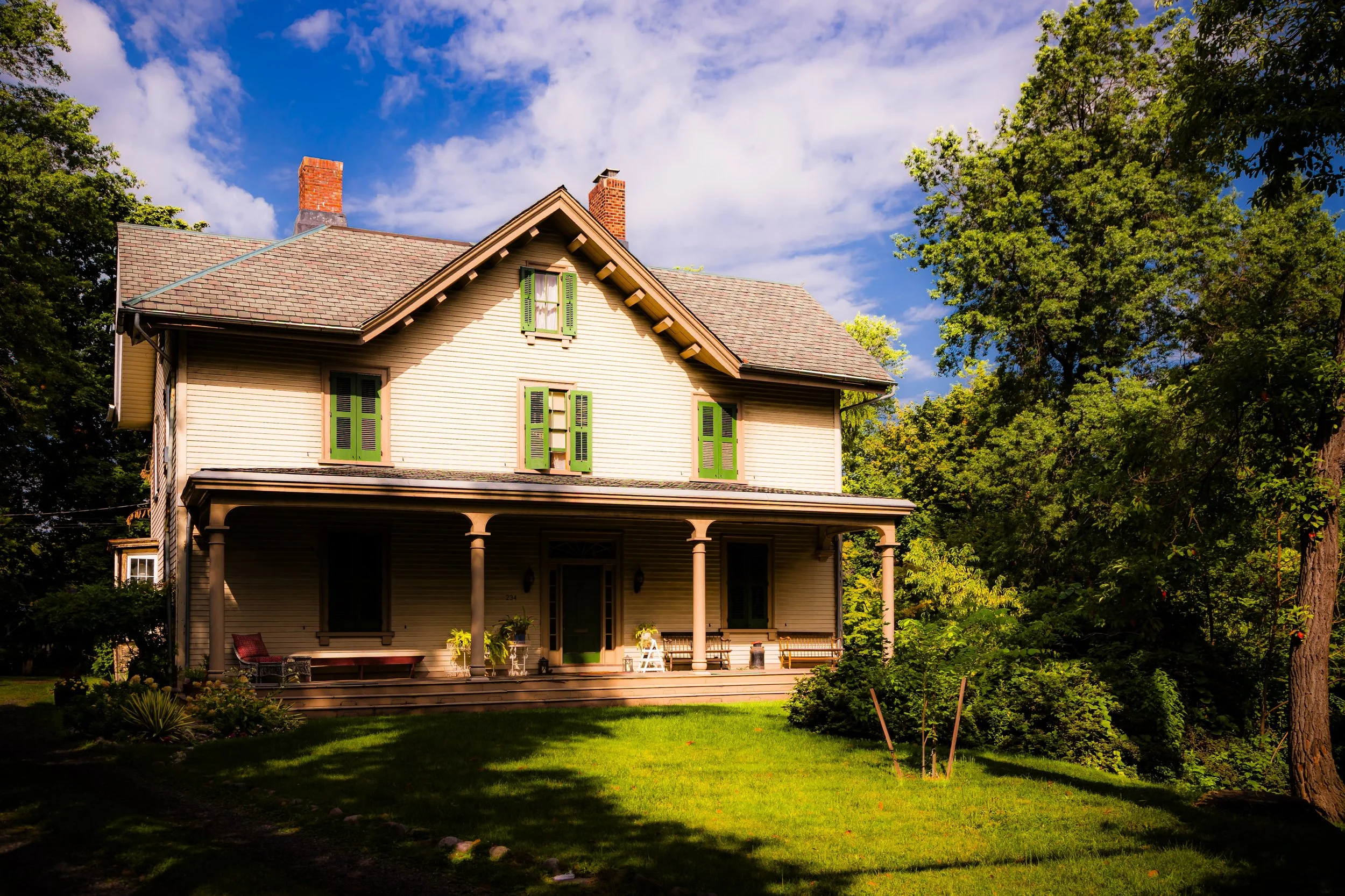
In the 1830s and 1840s, prominent families established estates along what is now Richmond Terrace, their properties stretching down to the water’s edge. Among them were merchants, industrialists, and professionals who valued the area’s beauty and isolation. The Livingston, Tompkins, and McFarlane families helped define its character as a cultivated residential enclave. The proximity of Snug Harbor—founded in 1833 as the Sailors’ Snug Harbor for retired mariners—brought further distinction, and the adjoining district gradually adopted the name Livingston. By mid-century, the area was dotted with elegant mansions surrounded by gardens, orchards, and carriage drives overlooking the Kill Van Kull.
Early 20th Century: From Estate to Neighborhood
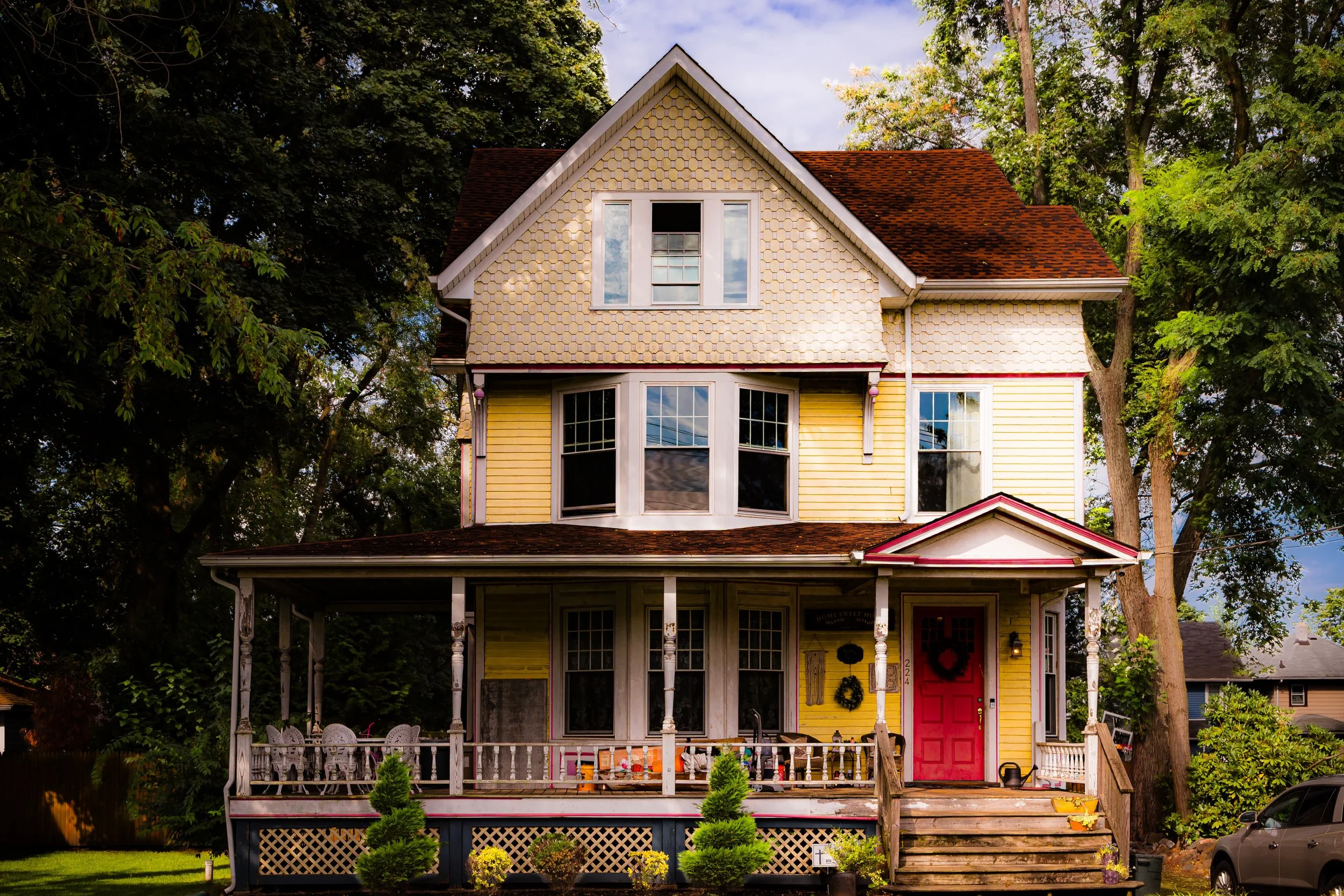
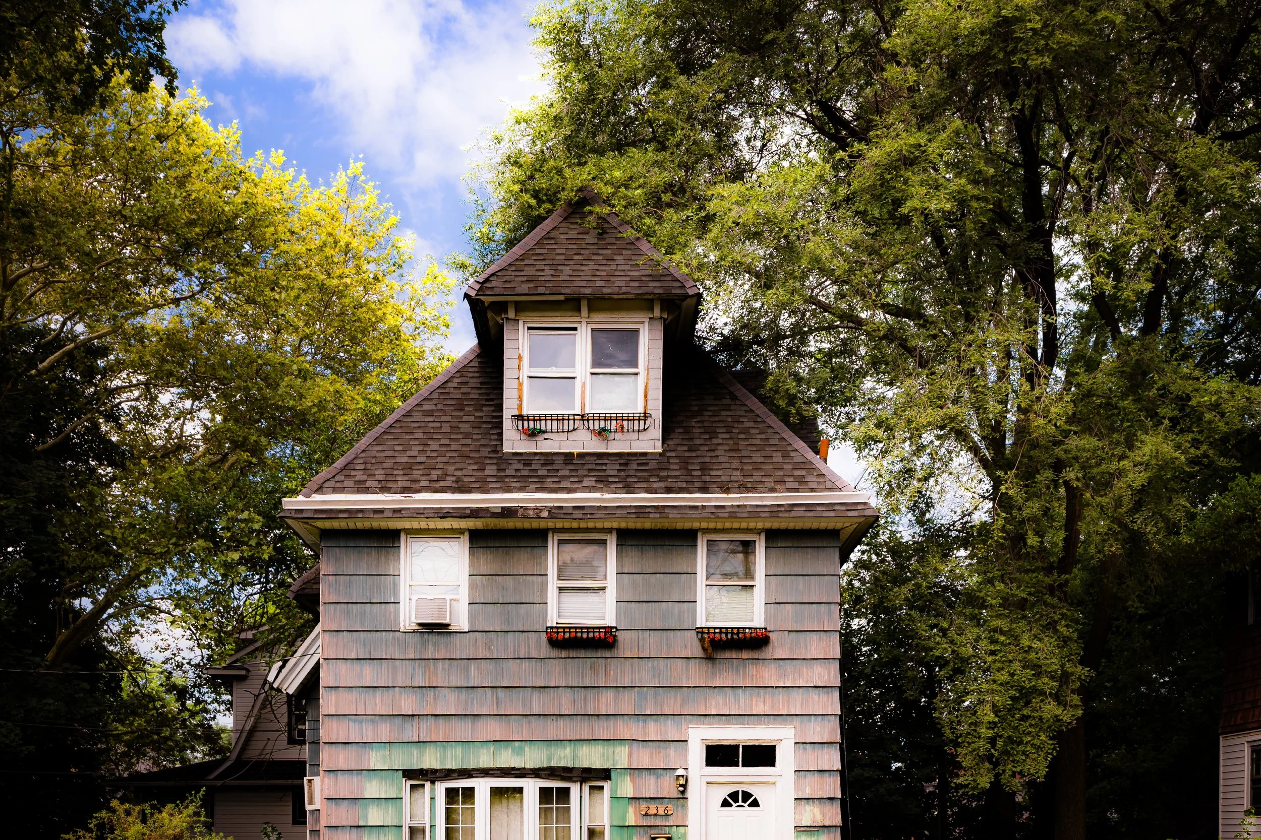
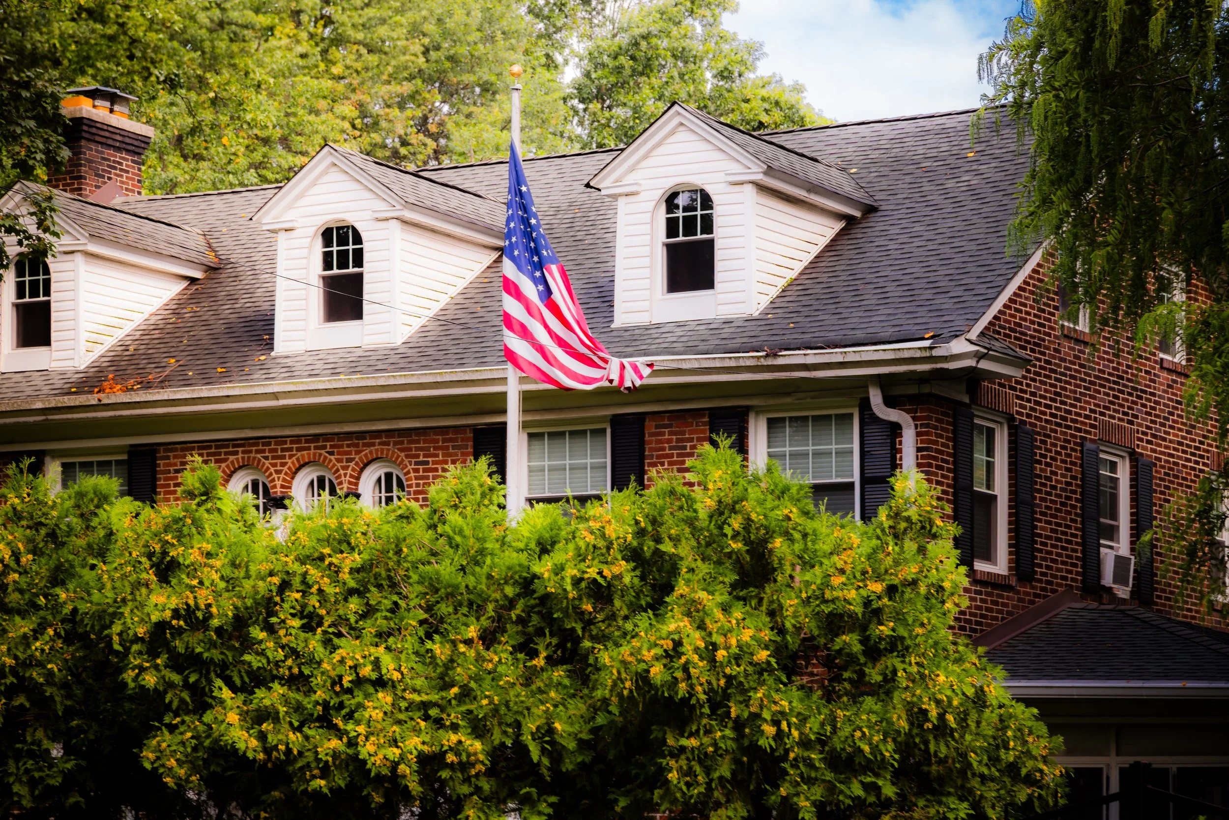
The turn of the 20th century marked a shift from the great estate era to the more structured suburban landscape seen today. The old manor lands were subdivided into smaller residential lots, but development remained tasteful and restrained. Large single-family homes in Victorian, Colonial Revival, and Arts and Crafts styles replaced the earlier estates, their porches and turrets reflecting the optimism of a new century.
The extension of Richmond Terrace and improvements to Henderson Avenue enhanced connectivity to St. George and the Staten Island Ferry, transforming Livingston into a commuter neighborhood for professionals working in Manhattan. Yet its visual and social character remained distinct: leafy, genteel, and closely tied to the harbor.
During this period, many of Staten Island’s cultural figures found inspiration here. Writers, teachers, and architects lived among the older families, drawn by the light off the Kill Van Kull and the proximity of Snug Harbor Cultural Center—then still an active retirement home for sailors, later to become one of the island’s major cultural institutions. Livingston was neither urban nor rural; it was, and remains, a cultivated retreat within the city.
Livingston Video Coming Soon
Mid–Late 20th Century: Preservation Amid Change
After World War II, Staten Island’s population grew dramatically, but Livingston managed to preserve much of its 19th- and early 20th-century charm. While new construction appeared along Henderson Avenue and the upper blocks, many of the historic houses along Richmond Terrace and its side streets survived intact. The closure and repurposing of Sailors’ Snug Harbor in the 1970s as the Snug Harbor Cultural Center and Botanical Garden added a new cultural dimension to the area. Museums, galleries, and gardens replaced dormitories and workshops, transforming the neighboring district into a center of Staten Island’s artistic life.
Residents of Livingston took pride in this evolution, advocating for historic preservation and tree protection ordinances that safeguarded the neighborhood’s leafy streetscape. Civic associations and local historians collaborated to document and maintain the area’s architectural heritage, from Greek Revival mansions to Craftsman bungalows. The mix of 19th-century estates and early 20th-century homes became a living archive of Staten Island’s northern heritage.
Even as industrial activity expanded along the opposite New Jersey shoreline, Livingston’s waterfront retained its quiet grace—a vantage point from which residents could watch cargo ships, tugboats, and ferries pass, reminders of the maritime forces that shaped the community’s beginnings.
21st Century: Historic Elegance and Cultural Vitality
Today, Livingston remains one of Staten Island’s most architecturally and culturally distinctive neighborhoods. Its proximity to Snug Harbor Cultural Center, St. Peter’s Boys High School, and Clove Lakes Park ties it to both art and education, while its residential core continues to exemplify historic suburban elegance. Many of its 19th-century homes have been lovingly restored, and the mature tree canopy that arches over its narrow streets continues to give the area its signature sense of calm.
Demographically, Livingston has grown more diverse, reflecting Staten Island’s broader evolution, but it remains primarily residential and family-oriented. Artists, teachers, and professionals value its blend of accessibility and beauty—just minutes from the St. George Ferry yet worlds removed in atmosphere.
Community involvement remains strong: block associations and preservation groups organize annual cleanups, historic home tours, and cultural events in partnership with Snug Harbor. The neighborhood’s elevated streets still offer glimpses of the Kill Van Kull, where ships glide past at dusk, their lights flickering against the water’s surface—a nightly reminder of Livingston’s enduring relationship with the harbor.
Livingston Photo Gallery
Spirit and Legacy
The spirit of Livingston resides in its continuity—a neighborhood that has evolved without losing the grace and dignity of its origins. It is a place where the past feels present in the curve of a porch railing, the sound of the water against the seawall, the silhouette of the lighthouse at dusk. Its legacy is one of refinement and resilience: born of the harbor, nurtured by artistry, and preserved through generations of care.
Livingston endures as a microcosm of Staten Island’s North Shore—historic, cultured, and quietly proud. Its tree-shaded streets and water views remind residents that they inhabit a landscape where history and horizon meet, where the city’s pulse is tempered by the stillness of the sea.
New York City
Use this custom Google map to explore where every neighborhood in all five boroughs of New York City is located.
The Five Boroughs
One of New York City’s unique qualities is its organization in to 5 boroughs: Manhattan, Brooklyn, Queens, The Bronx, and Staten Island. These boroughs are part pragmatic administrative districts, and part vestiges of the region’s past. Each borough is an entire county in New York State - in fact, Brooklyn is, officially, Kings County, while Staten Island is, officially Richmond County. But that’s not the whole story …
Initially, New York City was located on the southern tip of Manhattan (now the Financial District) that was once the Dutch colony of New Amsterdam. Across the East River, another city was rising: Brooklyn. In time, the city planners realized that unification between the rapidly rising cities would create commercial and industrial opportunities - through streamlined administration of the region.
So powerful was the pull of unification between New York and Brooklyn that three more counties were pulled into the unification: The Bronx, Queens, and Staten Island. And on January 1, 1898, the City of New York unified two cities and three counties into one Greater City of New York - containing the five boroughs we know today.
But because each borough developed differently and distinctly until unification, their neighborhoods likewise uniquely developed. Today, there are nearly 390 neighborhoods, each with their own histories, cultures, cuisines, and personalities - and each with residents who are fiercely proud of their corner of The Big Apple.


