
EAST / INDUSTRIAL WILLIAMSBURG
Brooklyn
Geographic Setting
Bounded by Flushing Avenue to the south and the Brooklyn–Queens Expressway (BQE) to the north, stretching eastward to the Queens line, and defined to the west by Bushwick Avenue and Woodpoint Road, East Williamsburg—often referred to in planning and industrial contexts as Industrial Williamsburg—occupies the transitional zone between Williamsburg, Bushwick, and Maspeth. It is a district of stark juxtapositions: 19th-century factories and warehouses reborn as art studios, the clang of delivery trucks beside the hum of espresso machines, and vacant lots giving way to glass apartments.
Though the name “East Williamsburg” has grown fashionable in real estate circles, much of the area retains its industrial DNA. The landscape is characterized by low-rise brick manufacturing buildings, corrugated-steel warehouses, rail spurs, and wide streets laid out for trucks rather than pedestrians. Major arteries—Metropolitan Avenue, Grand Street, and Johnson Avenue—run like industrial veins, carrying goods, artists, and nightlife alike through a district that remains one of Brooklyn’s last major production zones. To the north, the BQE overpass and the Kosciuszko Bridge loom over rail yards and scrapyards; to the east, the streets dissolve into the borderlands of Maspeth, Queens, where factories meet cemeteries and freight routes.
And yet, amid this landscape of brick and concrete, creative life flourishes. Converted lofts on Morgan Avenue, Meadow Street, and Ingraham Street pulse with art galleries, studios, and music venues. Breweries and bakeries share space with machine shops and metal fabricators. It is this duality—production and reinvention—that defines East Williamsburg today.
Etymology and Origins
The name East Williamsburg is a relatively modern creation, dating to 20th-century urban planning terminology, but its historical roots stretch back to Williamsburgh, the 19th-century town founded by Richard Woodhull in 1802 along the East River. As the original waterfront neighborhood grew prosperous, the lands east of Bushwick Avenue—once farms and meadows—remained largely undeveloped until industrial expansion pushed inland after the mid-1800s.
Flushing Avenue, one of Brooklyn’s oldest colonial roads, became a key route between the Brooklyn Navy Yard and the Newtown Creek, while the area north of it was transformed by breweries, chemical works, sugar refineries, and lumber yards. The coming of the Long Island Rail Road’s Montauk Branch (1860s) and later the Bushwick Branch provided direct freight links to the East River docks, turning this eastern fringe of Williamsburg into a powerhouse of light manufacturing.
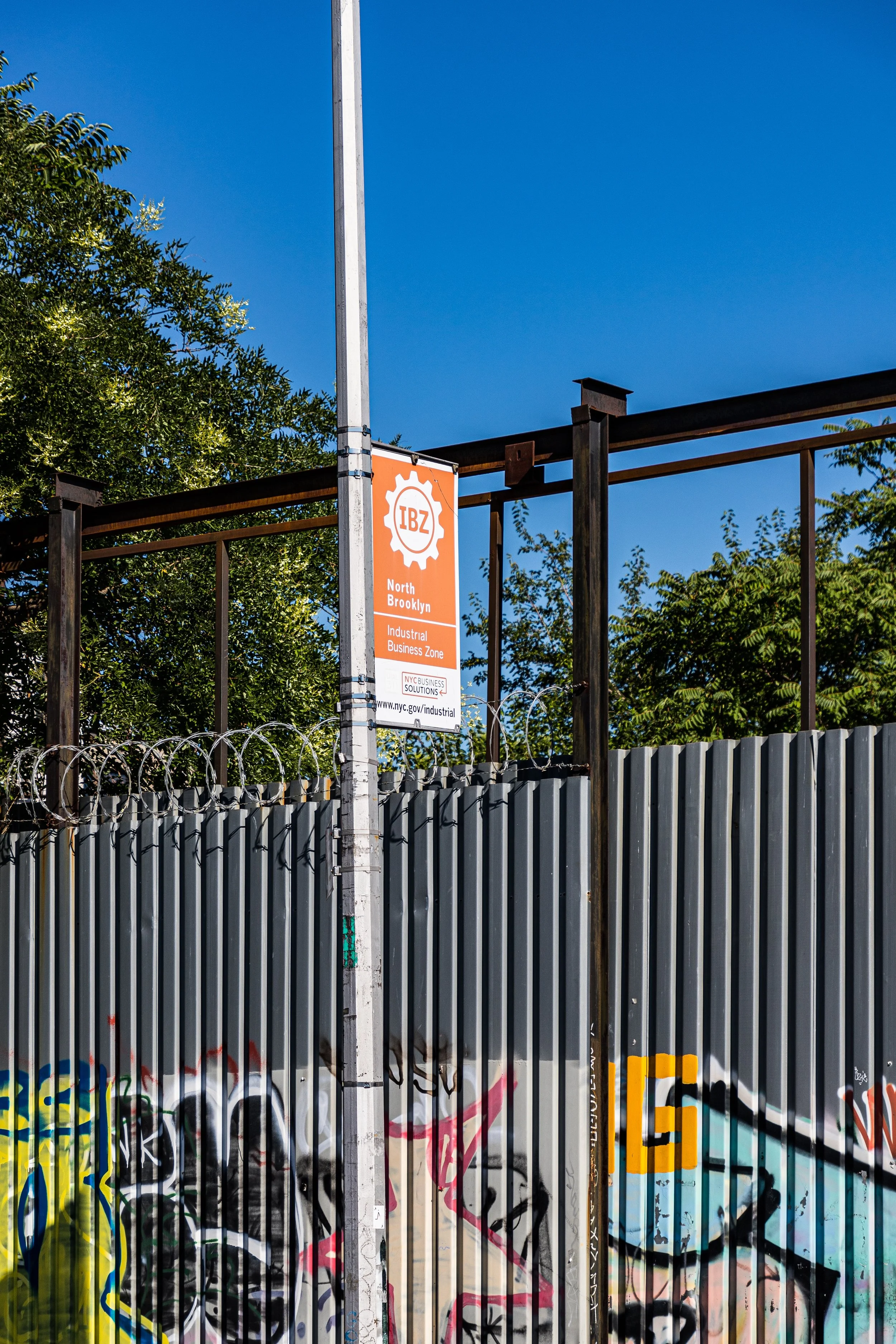
In the city’s zoning lexicon, “Industrial Williamsburg” refers to the Manufacturing (M) districts that stretch between Flushing Avenue and the BQE—an area intentionally preserved for production, repair, and warehousing well into the 21st century.
The Neighborhood
19th Century: The Rise of the Industrial Belt
During the mid- to late 1800s, this sector of Williamsburg emerged as part of Brooklyn’s broader industrial revolution. Breweries, notably the Hittleman Brewery and Rheingold’s nearby in Bushwick, found the area ideal due to its proximity to the fresh water of Ridgewood Reservoir and to the rail spurs feeding the riverfront. Along Johnson, Ten Eyck, and Boerum Streets, foundries, glassworks, and woodworking plants rose beside rows of modest worker housing built for immigrant laborers.
The district’s workers—primarily German, Polish, and Italian immigrants—lived in small tenements or rowhouses near Graham Avenue and Bushwick Avenue, walking to factories that produced everything from furniture and beer barrels to textiles and metal goods. The Grand Street elevated railway (1888) and the later Canarsie Line (L train) linked this industrial hinterland to the rest of Brooklyn, solidifying its role as a vital node in the city’s manufacturing web.
Early–Mid 20th Century: Industry at Full Strength
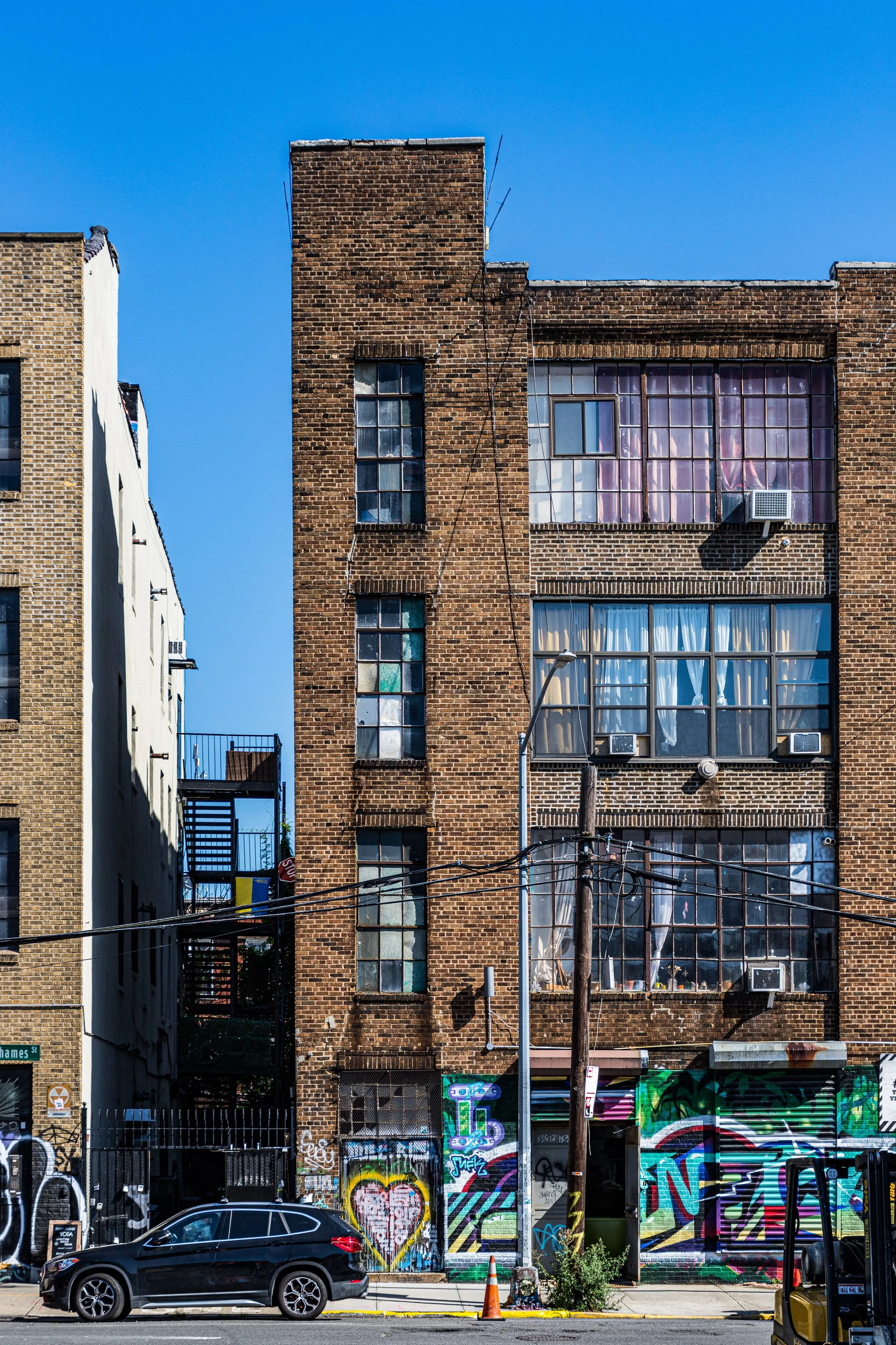
By the 1920s, East Williamsburg had matured into one of New York’s densest industrial zones. The blocks between Flushing Avenue and the BQE teemed with production: garment factories, bakeries, printing presses, and machinery shops. Many buildings from this period—heavy timber or reinforced-concrete lofts with broad windows—still define the neighborhood’s physical texture today.
During World War II, the area’s factories operated around the clock, producing equipment and materials for the war effort. Nearby, the Brooklyn Navy Yard employed tens of thousands, and East Williamsburg’s machine shops supplied parts and labor. The community that surrounded it remained solidly working class—Italian-American, Jewish, and Polish families clustered around Grand Street and Humboldt Street, attending churches such as Our Lady of Mount Carmel and St. Nicholas Roman Catholic Church.
However, after the war, the forces of urban change began to erode the neighborhood’s economic base. Containerization shifted shipping to New Jersey, and by the 1960s, factories began to close or move south. Abandoned warehouses dotted Johnson and Ten Eyck Streets, while nearby Bushwick and Williamsburg faced waves of disinvestment and decline.
East / Industrial Williamsburg Photographic Video
Late 20th Century: Abandonment and Artistic Rebirth
In the 1970s and 1980s, East Williamsburg was a district of quiet decay—its wide streets largely empty, its hulking factories shuttered. Yet its very emptiness became its salvation. The cheap, sturdy industrial spaces attracted artists priced out of Manhattan’s SoHo and Lower East Side. By the 1990s, East Williamsburg—particularly the blocks around Morgan Avenue, Meadow Street, and Bogart Street—had become an underground haven for painters, sculptors, and musicians.
Warehouses became illegal live-work lofts, and DIY performance spaces such as L Train Studios and The McKibbin Lofts defined a new countercultural geography. Long before “Bushwick” became a brand, the East Williamsburg industrial corridor nurtured the creative energy that would transform northern Brooklyn into a global symbol of artistic migration.
At the same time, small manufacturers and wholesalers—particularly in food distribution, construction, and textiles—continued to operate, forming an uneasy coexistence with the creative influx. The neighborhood’s industrial designation, preserved by the city’s zoning, ensured that the hum of commerce never entirely faded.
21st Century: Production, Innovation, and Pressures of Change
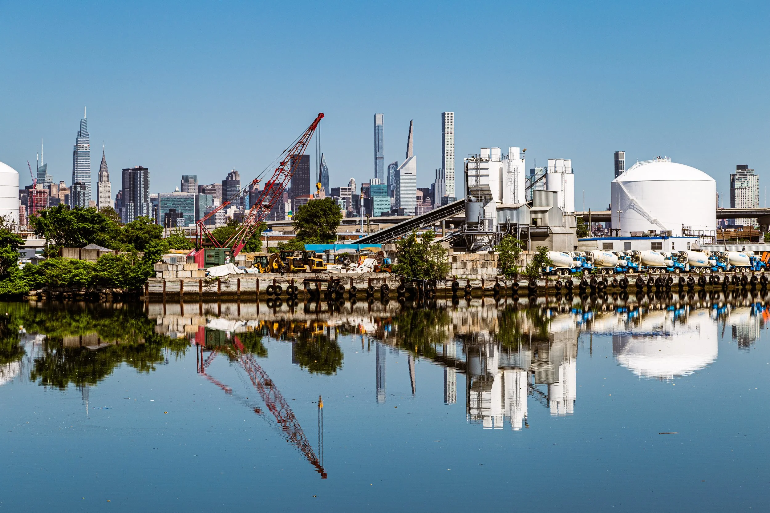
In the new century, East Williamsburg has entered a delicate balance between production and reinvention. Former factories now house craft breweries, furniture makers, design studios, and tech startups. The L train’s Morgan Avenue station, once an overlooked stop amid warehouses, now opens onto bustling streets filled with cafés, galleries, and rooftop venues. The Knockdown Center (just across the Queens line) and Brooklyn Steel on Frost Street symbolize the area’s reinvention as both cultural and industrial terrain.
Yet zoning conflicts remain. The city’s Industrial Business Zone (IBZ) designation protects portions of the district from residential development, preserving space for manufacturing and logistics firms that continue to employ thousands. Meanwhile, residential and creative conversions encroach along the edges near Bushwick Avenue and Flushing Avenue, creating tensions between the needs of artists, workers, and developers.
In recent years, sustainability and adaptive reuse have emerged as guiding principles. Projects like the East Williamsburg Industrial Park and the Newtown Creek Green Infrastructure Initiative reflect efforts to balance economic growth with environmental restoration. The air smells alternately of diesel and roasted coffee; murals bloom on warehouse walls beside company logos from another century.
East / Industrial Williamsburg Photo Gallery
Spirit and Legacy
East Williamsburg’s legacy is one of work, reinvention, and survival. It has never been a purely residential neighborhood, nor purely industrial—it has always existed in between, a landscape of labor that repeatedly redefines itself with the times. From the clatter of 19th-century breweries to the beat of 21st-century nightclubs, from the sweat of machinists to the glow of studio lights, the district remains faithful to its core purpose: production.
New York City
Use this custom Google map to explore where every neighborhood in all five boroughs of New York City is located.
The Five Boroughs
One of New York City’s unique qualities is its organization in to 5 boroughs: Manhattan, Brooklyn, Queens, The Bronx, and Staten Island. These boroughs are part pragmatic administrative districts, and part vestiges of the region’s past. Each borough is an entire county in New York State - in fact, Brooklyn is, officially, Kings County, while Staten Island is, officially Richmond County. But that’s not the whole story …
Initially, New York City was located on the southern tip of Manhattan (now the Financial District) that was once the Dutch colony of New Amsterdam. Across the East River, another city was rising: Brooklyn. In time, the city planners realized that unification between the rapidly rising cities would create commercial and industrial opportunities - through streamlined administration of the region.
So powerful was the pull of unification between New York and Brooklyn that three more counties were pulled into the unification: The Bronx, Queens, and Staten Island. And on January 1, 1898, the City of New York unified two cities and three counties into one Greater City of New York - containing the five boroughs we know today.
But because each borough developed differently and distinctly until unification, their neighborhoods likewise uniquely developed. Today, there are nearly 390 neighborhoods, each with their own histories, cultures, cuisines, and personalities - and each with residents who are fiercely proud of their corner of The Big Apple.


