ROCHDALE
Queens
Geographic Setting
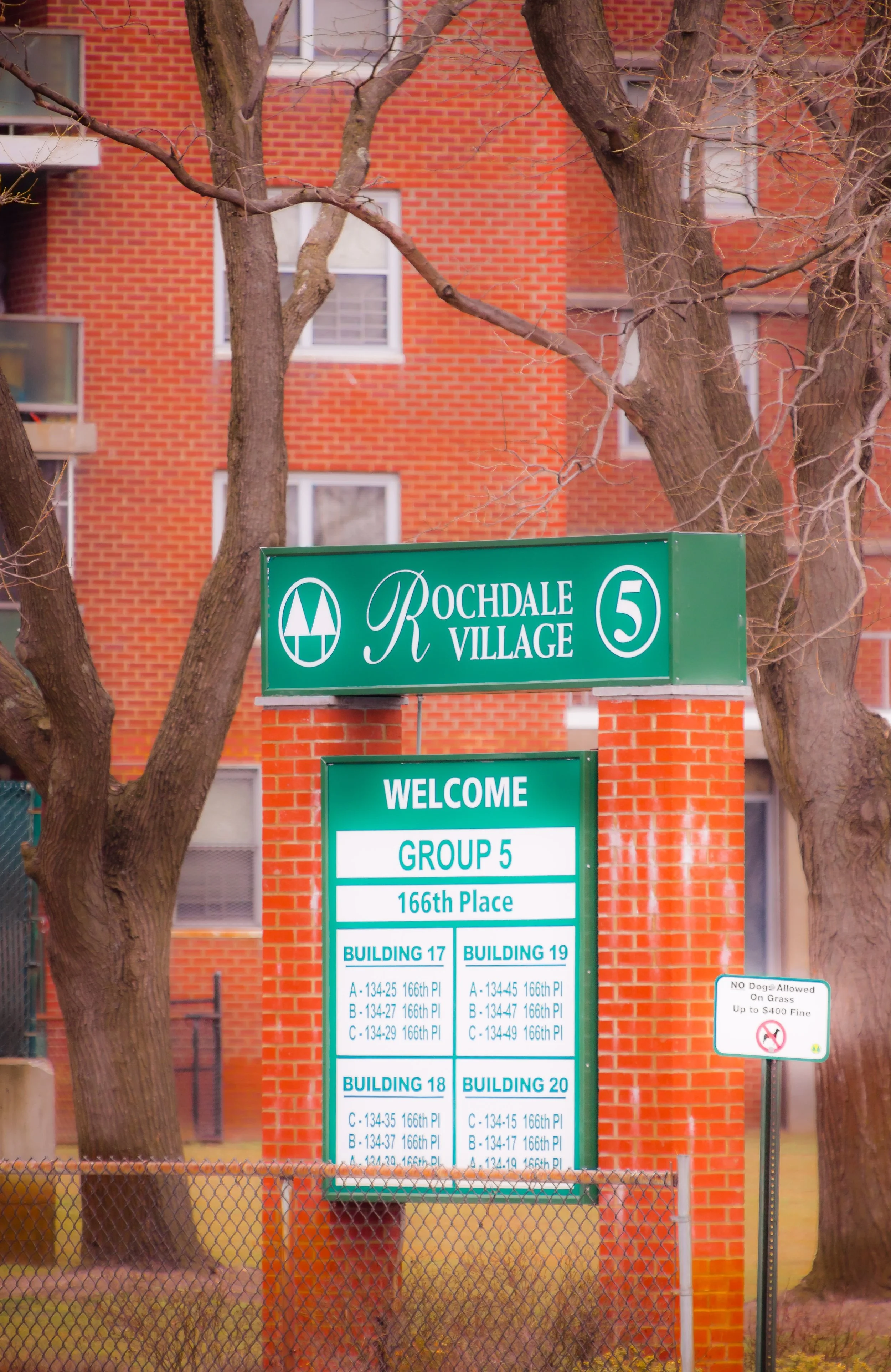
Located in southeastern Queens, Rochdale—often referred to as Rochdale Village—occupies a vast, planned expanse between Baisley Boulevard to the west, Guy R. Brewer Boulevard to the east, Bedell Street and Baisley Pond Park to the north, and North Conduit Avenue to the south. The complex sits at the heart of South Jamaica, on land once occupied by the historic Jamaica Racetrack, now replaced by one of the largest cooperative housing communities in the world. Its sweeping arrangement of 20 residential buildings—set amid lawns, courtyards, and circular drives—gives Rochdale a distinctly modernist form: a city within a city, built on egalitarian ideals of community, access, and shared space.
Surrounding Rochdale are the open green vistas of Baisley Pond Park and Roy Wilkins Park, the commercial corridors of Guy R. Brewer Boulevard and Baisley Boulevard, and the steady hum of JFK International Airport just to the south. This combination of mid-century design, parkland, and infrastructure defines Rochdale’s unique place in the urban geography of Queens—a self-contained residential landscape bordered by airfields, expressways, and neighborhoods of deep historical continuity.
Etymology and Origins
The name “Rochdale” honors the English town of Rochdale, Lancashire, birthplace of the Rochdale Pioneers, a 19th-century workers’ cooperative whose principles of shared ownership and democratic governance inspired the international cooperative movement. The name was chosen deliberately when the United Housing Foundation—under the leadership of labor organizer and housing visionary Abraham Kazan—founded Rochdale Village in the 1950s as a grand experiment in postwar cooperative living.
The site had been the Jamaica Racetrack, a historic horse-racing venue that operated from 1903 until 1959. When the racetrack closed, city officials and planners saw an opportunity to convert the vast open tract into affordable housing for middle-income families—a modern suburban enclave within the city, guided by the ideals of equity, modernism, and integration.
The Neighborhood
Mid-20th Century: The Birth of a Modern Cooperative City
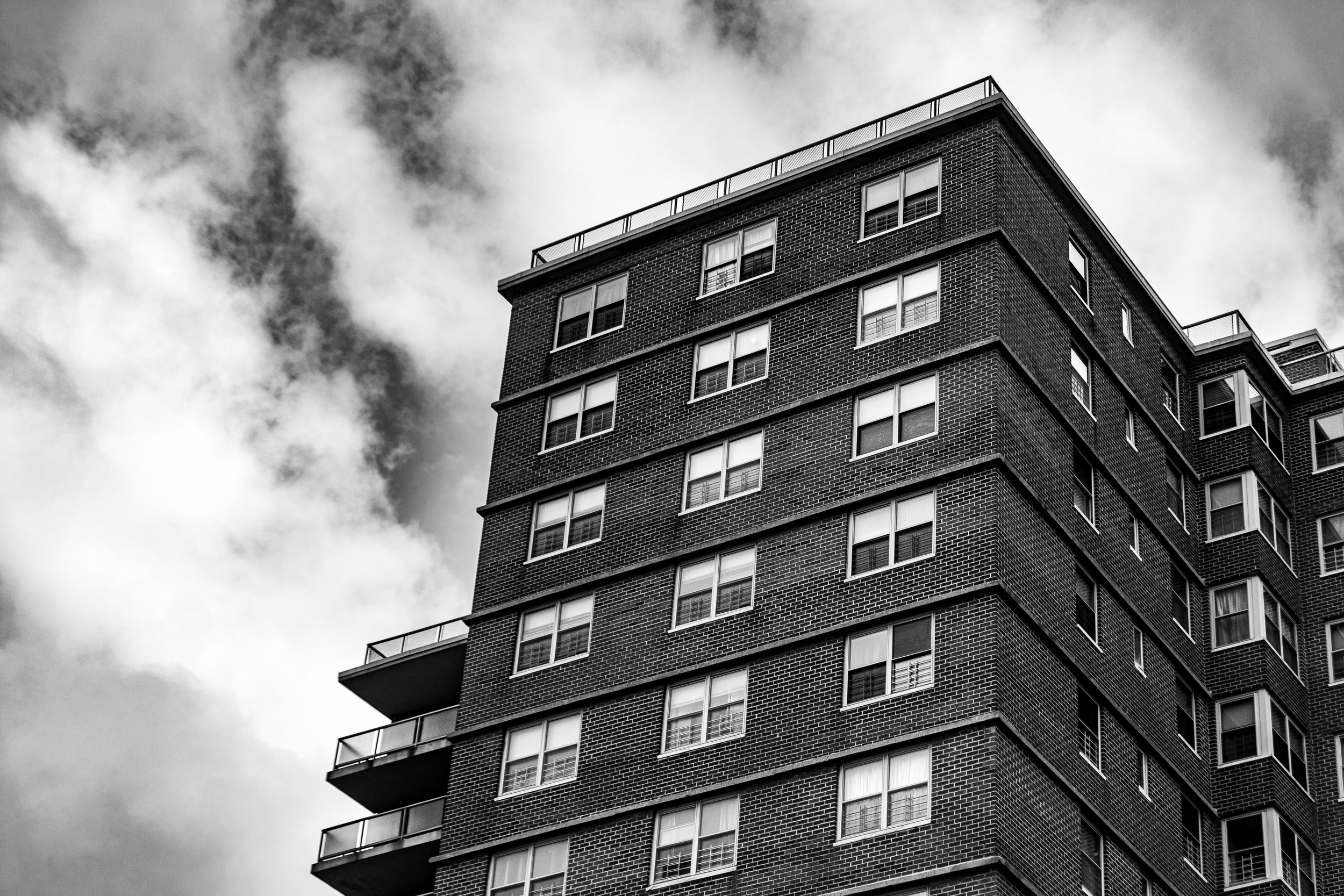
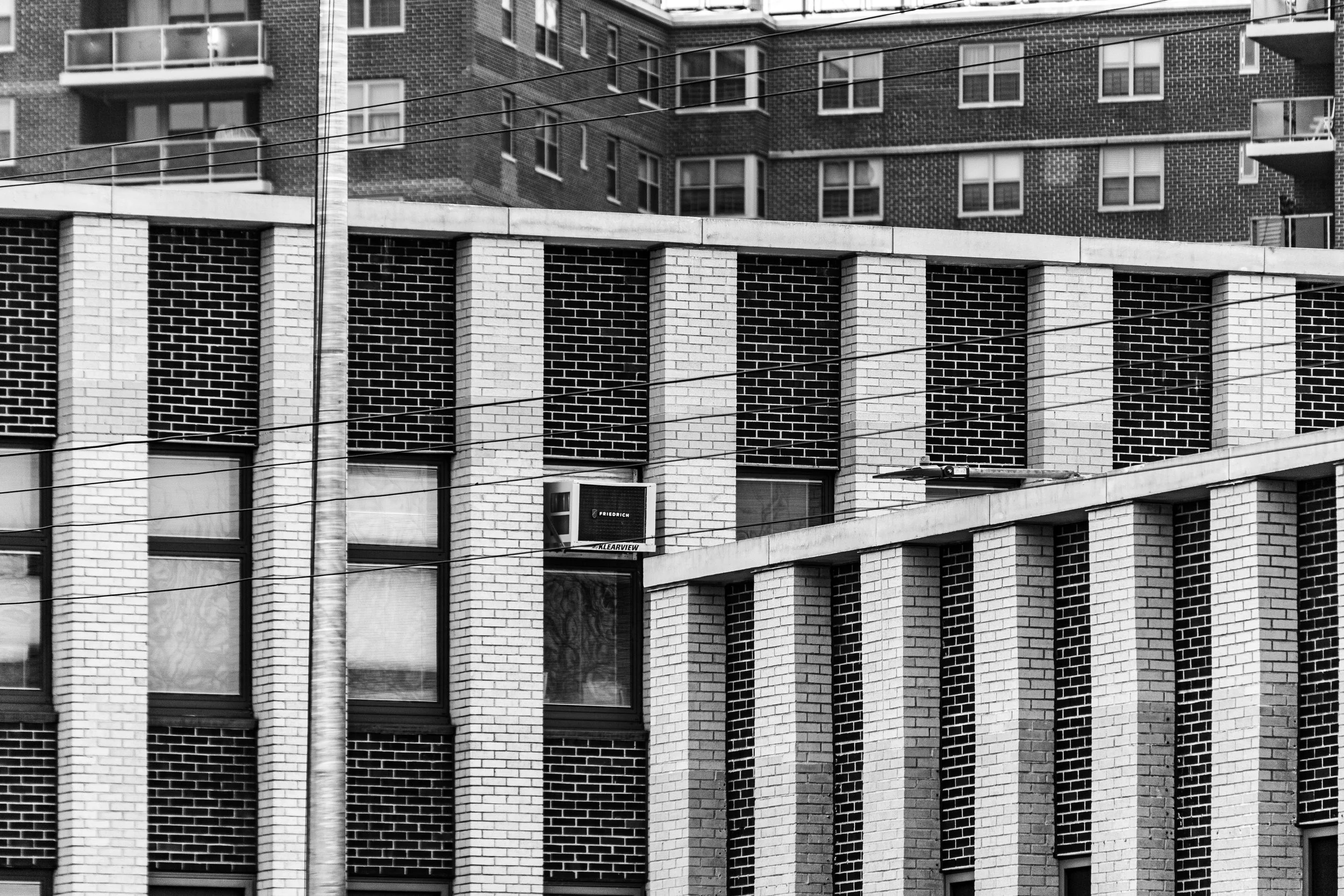
Construction of Rochdale Village began in 1961, designed by the architectural firm Springsteen & Goldhammer and developed by the United Housing Foundation in partnership with the Amalgamated Clothing Workers Union. The project, financed under New York State’s Mitchell–Lama Housing Program, comprised 20 sixteen-story towers arranged around a central green mall, with parking courts, shopping areas, schools, and playgrounds integrated into the design.
At its dedication in 1963, Rochdale Village was hailed as a “city within a city,” providing 5,860 cooperative apartments for more than 20,000 residents. The design incorporated modern amenities—elevators, garbage disposals, laundry rooms, and balconies—within a landscape of trees, lawns, and pedestrian pathways. Its power plant made it energy self-sufficient, and its internal schools, library, and shopping center embodied the ideal of a complete, walkable community.
Crucially, Rochdale Village was conceived as an experiment in racial integration, opening its doors to both Black and white families during the height of the Civil Rights Movement. This policy drew national attention in an era when many housing developments, public and private, remained effectively segregated. Early residents included educators, postal workers, nurses, and civil servants—families seeking upward mobility and community stability.
Late 20th Century: Trials, Transitions, and Resilience
By the 1970s, Rochdale faced challenges reflective of broader urban struggles. Economic downturns, rising crime rates, and disinvestment in South Jamaica strained the community. Many original white residents left for the suburbs, while middle-class Black families from other parts of New York and the South moved in, reshaping Rochdale into a predominantly African American cooperative by the late 1970s.
Despite these demographic shifts, Rochdale’s foundational cooperative spirit endured. Residents formed strong tenant associations and block committees, maintaining the grounds and advocating for improved city services. Local churches, youth centers, and cultural organizations—such as the Rochdale Village Community Center, Springfield Gardens United Methodist Church, and Rochdale Village Branch Library—emerged as pillars of social cohesion.
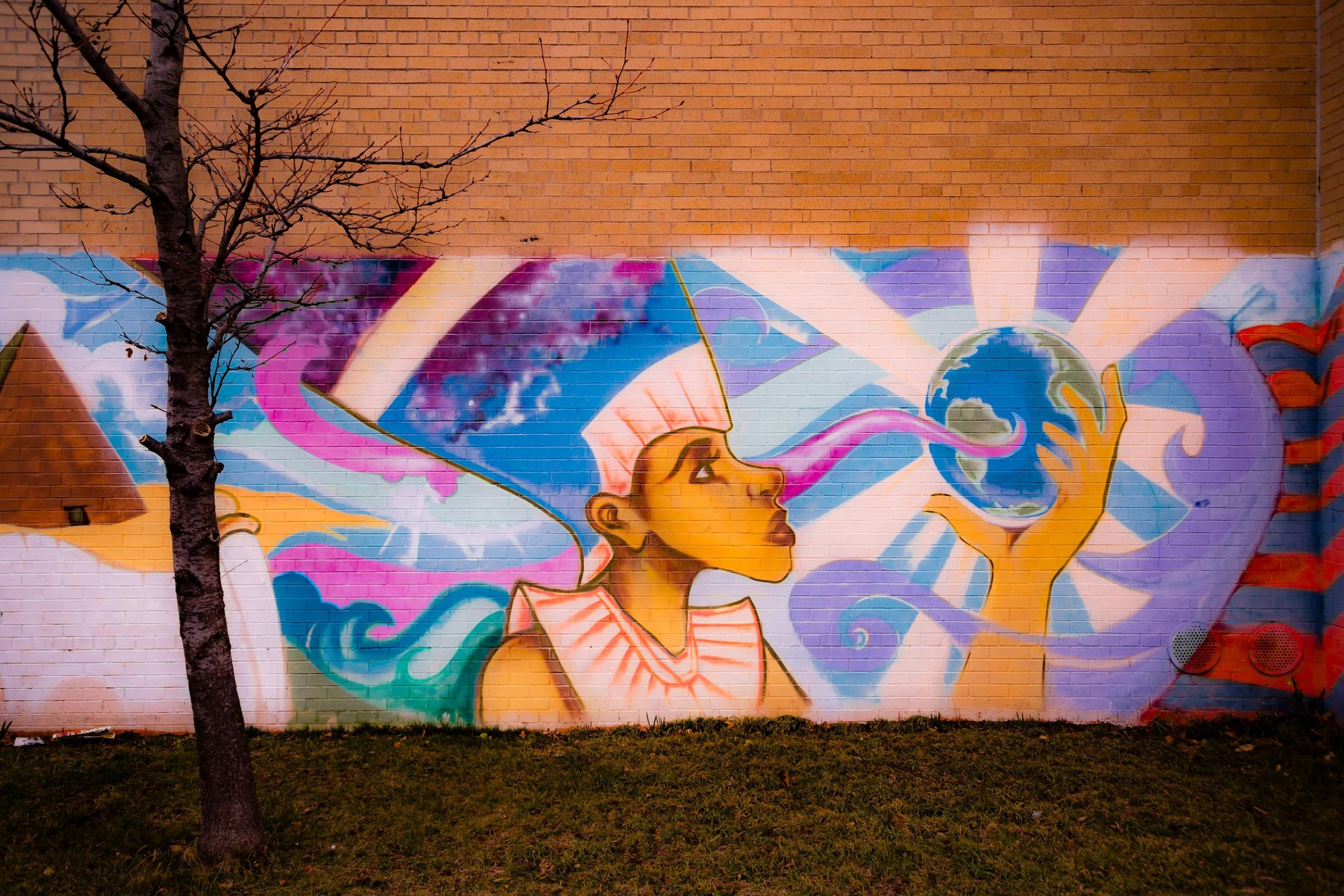
Through the 1980s and 1990s, Rochdale weathered fiscal crises and neighborhood stigmas, yet retained its core of working- and middle-class homeowners committed to the co-op’s success. Civic pride found new expression in cultural events, music programs, and senior activities, while nearby Roy Wilkins Park became a site for concerts, athletic leagues, and community festivals celebrating the area’s Black heritage and unity.
Rochdale Photographic Video
21st Century: Renewal and Community Continuity
Today, Rochdale stands as a testament to endurance and renewal. Its cooperative model remains strong, governed by an elected Board of Directors and guided by the principles of shared ownership that defined its founding. The housing complex continues to provide affordable apartments to thousands of residents, many of them multi-generational families whose parents or grandparents were original cooperators.
Extensive modernization projects have revitalized the property: new landscaping, playgrounds, energy-efficient systems, and a refurbished shopping center have brought new life to the mid-century infrastructure. Rochdale’s tree-lined malls, dotted with sculptures and benches, remain gathering places for children and elders alike.
Demographically, Rochdale is now one of New York City’s most stable middle-class African American communities, enriched by growing populations of Caribbean and African immigrants. The cooperative’s democratic governance continues to inspire admiration among urban planners and housing advocates, who view Rochdale as one of the rare large-scale housing developments to remain both solvent and self-directed for six decades.
Rochdale Photo Gallery
Spirit and Legacy
Rochdale’s legacy transcends architecture—it is a living symbol of collective endeavor and the belief that communities can govern themselves with fairness and purpose. Its founders’ vision of shared ownership, racial integration, and human dignity remains relevant today, echoing through its well-tended lawns and its active civic institutions.
New York City
Use this custom Google map to explore where every neighborhood in all five boroughs of New York City is located.
The Five Boroughs
One of New York City’s unique qualities is its organization in to 5 boroughs: Manhattan, Brooklyn, Queens, The Bronx, and Staten Island. These boroughs are part pragmatic administrative districts, and part vestiges of the region’s past. Each borough is an entire county in New York State - in fact, Brooklyn is, officially, Kings County, while Staten Island is, officially Richmond County. But that’s not the whole story …
Initially, New York City was located on the southern tip of Manhattan (now the Financial District) that was once the Dutch colony of New Amsterdam. Across the East River, another city was rising: Brooklyn. In time, the city planners realized that unification between the rapidly rising cities would create commercial and industrial opportunities - through streamlined administration of the region.
So powerful was the pull of unification between New York and Brooklyn that three more counties were pulled into the unification: The Bronx, Queens, and Staten Island. And on January 1, 1898, the City of New York unified two cities and three counties into one Greater City of New York - containing the five boroughs we know today.
But because each borough developed differently and distinctly until unification, their neighborhoods likewise uniquely developed. Today, there are nearly 390 neighborhoods, each with their own histories, cultures, cuisines, and personalities - and each with residents who are fiercely proud of their corner of The Big Apple.


