GLENDALE
Queens
Geographic Setting
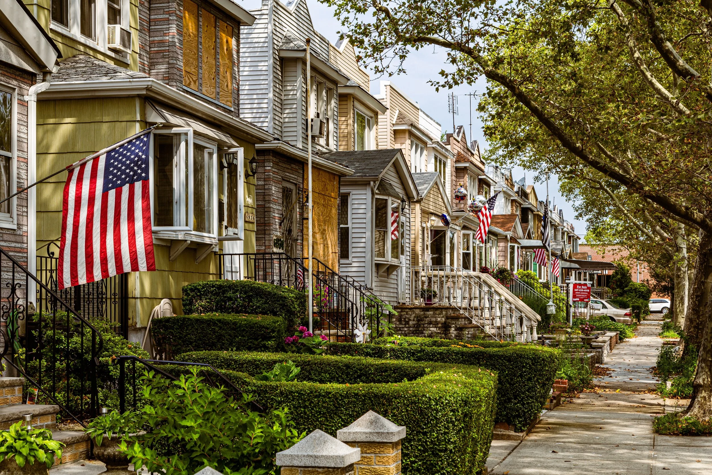
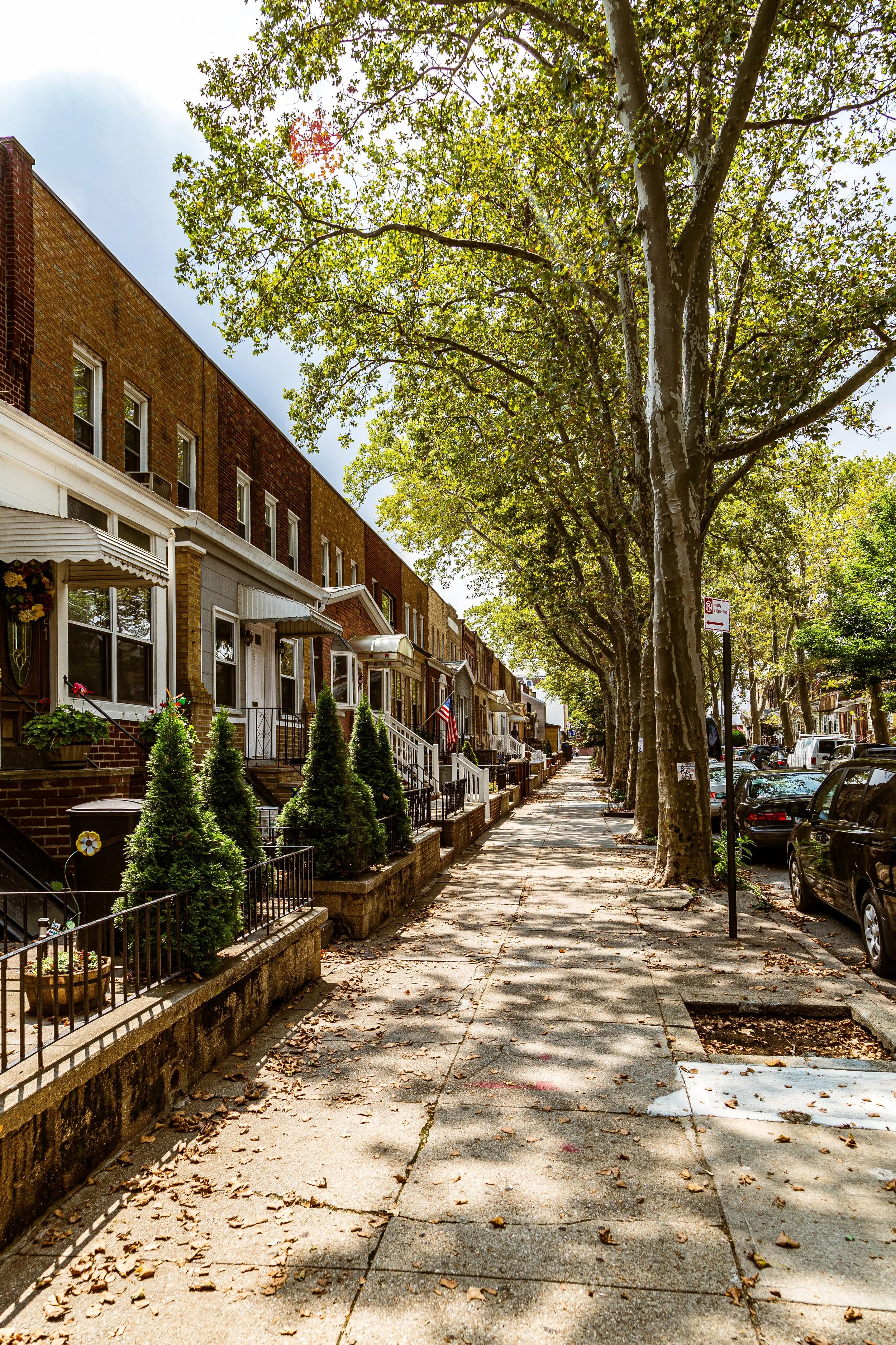
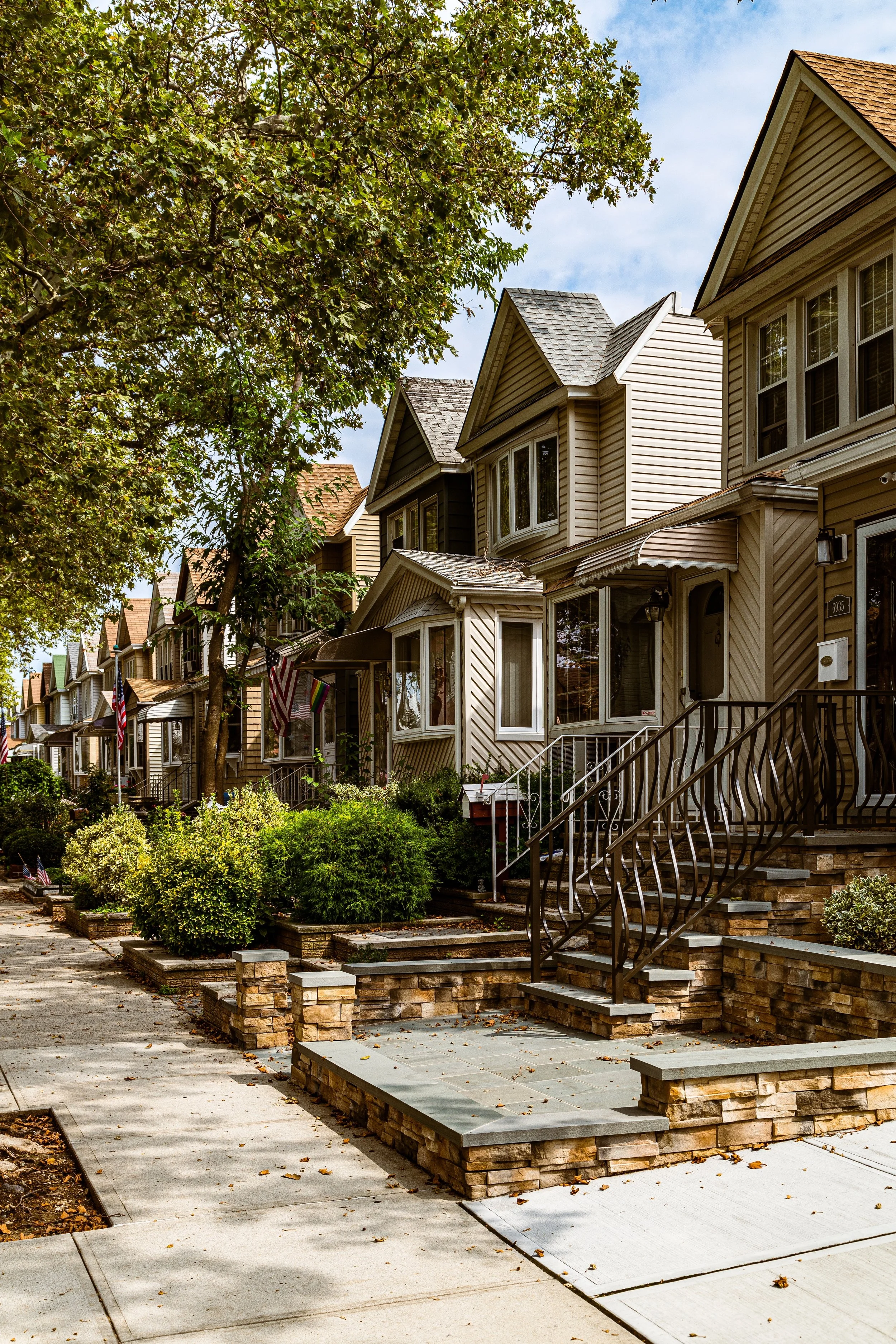
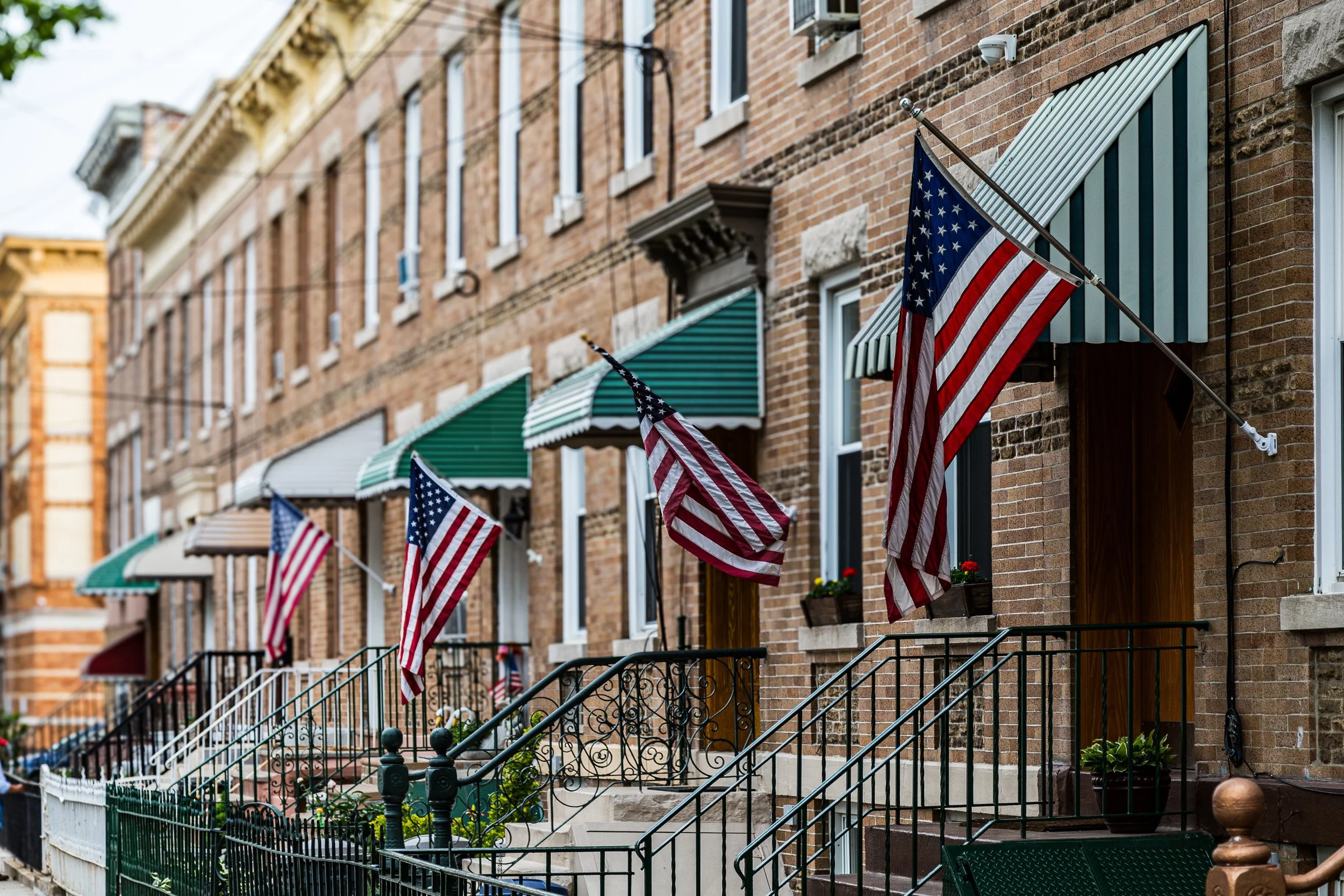
Bounded by Woodhaven Boulevard to the east, Forest Park and the Brooklyn borough line to the south and southwest, and the freight rail corridors and Fresh Pond Road to the west and north, Glendale sits at the southwestern edge of Queens—a sturdy, self-contained neighborhood defined by industry, architecture, and remarkable continuity. Tucked between Ridgewood, Forest Hills, and Woodhaven, it occupies a long, undulating basin that once held glacial ponds and farmland, now transformed into a mosaic of quiet residential streets, light manufacturing zones, and parkland fringes.
The neighborhood’s terrain, sloping gently upward from the rail yards toward Forest Park, gives Glendale a sense of enclosure—an almost village-like quality within the vastness of New York City. Its major arteries, Myrtle Avenue, Cooper Avenue, and Central Avenue, form commercial spines lined with bakeries, taverns, and family-run stores, while the side streets are composed of early-20th-century rowhouses, brick two-family homes, and semi-detached residences. Industrial buildings along the rail lines testify to the neighborhood’s manufacturing heritage, while the southern horizon opens into the forested ridges of Forest Park, one of Queens’ great green sanctuaries.
Etymology and Origins
The name “Glendale” was coined in 1869 by developer George C. Schott, who purchased farmland in the area and established one of Queens’ first planned suburban enclaves. The term—literally meaning “valley of glens” or “wooded valley”—reflected the area’s topography, a low-lying tract bordered by the high ground of Ridgewood and the Forest Park uplands. Before development, Glendale was part of the colonial Town of Newtown and consisted primarily of meadows, woods, and a few scattered farms owned by families such as the Van Wycks and Suydams.
In the mid-19th century, the construction of the South Side Railroad (later part of the Long Island Rail Road) and the Fresh Pond freight yards spurred gradual settlement. Early residents were largely German and Eastern European immigrants who worked in nearby factories and breweries, including the sprawling Ridgewood Brewery complex and later the Atlas Terminal—an industrial hub that would dominate Glendale’s economy for much of the 20th century.
The Neighborhood
Late 19th–Early 20th Century: From Farmland to Industrial Village
By the late 1800s, Glendale had evolved from rural farmland into a semi-industrial village. Brickworks, tanneries, and breweries operated alongside small farms, taking advantage of the rail lines that connected the area to Brooklyn and Long Island. The neighborhood’s first churches and schools were established during this period, reflecting its growing permanence.
The opening of Forest Park in 1895, a massive public landscape designed under the influence of Frederick Law Olmsted’s park planning, brought a new dimension to Glendale’s identity. The park’s wooded trails, horse paths, and golf course offered respite from the industrial sprawl and remain one of the neighborhood’s defining assets.
Housing development accelerated after the turn of the century. Between 1900 and 1930, waves of German, Polish, and Italian immigrants settled in the area, building rows of brick homes with modest front gardens and stoops—many of which remain intact today. The grid that emerged during this period, centered around Myrtle Avenue and Cooper Avenue, still defines Glendale’s urban structure.
Mid-20th Century: Stability and Working-Class Strength
The mid-20th century marked Glendale’s maturation as a working-class stronghold. Its population consisted largely of blue-collar families employed in manufacturing, printing, and food production. The Atlas Terminal (opened 1922) became a major industrial employer, housing warehouses, textile plants, and packaging facilities. Small factories and auto shops lined the rail corridors along Fresh Pond Road, giving Glendale a hybrid identity—part residential enclave, part production zone.
The neighborhood’s housing stock, built solidly of brick, fared better than the wood-frame homes in nearby districts, and Glendale maintained a reputation for orderliness, safety, and self-reliance. Civic organizations, veterans’ halls, and parish societies—particularly St. Pancras Roman Catholic Church (est. 1908)—anchored social life. Local bakeries and beer halls reflected the area’s enduring Germanic roots well into the 1950s.
Although the construction of the Long Island Expressway and Jackie Robinson Parkway in the mid-century period improved regional connectivity, Glendale itself remained insulated from large-scale redevelopment. Its relative isolation from subway lines preserved its low-density character while limiting overgrowth, ensuring the neighborhood retained its small-town pace within the city.
Glendale Photographic Video
Late 20th Century: Adaptation and Renewal
By the 1970s and 1980s, as factories began to close and manufacturing jobs declined citywide, Glendale underwent a quiet transformation. Industrial spaces such as the Atlas Terminal and nearby warehouses were gradually repurposed for storage, logistics, and light manufacturing. The neighborhood’s residential stability, however, endured: families who had lived there for generations were joined by newcomers—Polish, Lithuanian, Irish, and later Latin American and Eastern European immigrants—who valued its affordability, safety, and community spirit.
Local schools such as P.S. 91Q (Ridgewood Avenue School) and I.S. 119 continued to serve as neighborhood anchors, while small businesses on Myrtle Avenue and Cooper Avenue retained a distinctly local flavor. In 1998, Atlas Park, a commercial redevelopment of the old industrial terminal, was announced. Completed in 2006 as The Shops at Atlas Park, it reimagined Glendale’s industrial past as a landscaped, open-air retail destination—symbolic of the neighborhood’s ability to reinvent itself while preserving its form.
21st Century: Quiet Resilience and Local Pride
In the 21st century, Glendale remains one of Queens’ most quietly cohesive neighborhoods—a place defined not by spectacle but by endurance. Its population is diverse yet deeply rooted, with many multigenerational families living alongside new arrivals from South America, Eastern Europe, and South Asia. Though not directly served by the subway, Glendale enjoys convenient bus and rail access, and its relative seclusion has become part of its charm.
The Shops at Atlas Park have become a focal point for community gatherings, while local institutions like St. John Cemetery—the final resting place of several New York notables, including mob figures and politicians—add historical depth to the landscape. The proximity of Forest Park continues to shape daily life, offering hiking, cycling, and golf against a backdrop of oak and hickory woods that feel far removed from Manhattan’s bustle.
Environmental initiatives in recent years have aimed to reduce flooding and improve drainage in the neighborhood’s low-lying western sections. At the same time, civic groups such as the Glendale Property Owners Association and the Juniper Park Civic Association remain active in maintaining zoning protections, historic character, and community safety.
Glendale Photo Gallery
Spirit and Legacy
Glendale’s spirit is one of steadiness and self-reliance. Born from farmland, matured through industry, and sustained by working-class pride, it has weathered the city’s transformations without losing its core identity. The neighborhood’s quiet streets, brick homes, and family-run businesses evoke a sense of continuity rare in modern New York.
New York City
Use this custom Google map to explore where every neighborhood in all five boroughs of New York City is located.
The Five Boroughs
One of New York City’s unique qualities is its organization in to 5 boroughs: Manhattan, Brooklyn, Queens, The Bronx, and Staten Island. These boroughs are part pragmatic administrative districts, and part vestiges of the region’s past. Each borough is an entire county in New York State - in fact, Brooklyn is, officially, Kings County, while Staten Island is, officially Richmond County. But that’s not the whole story …
Initially, New York City was located on the southern tip of Manhattan (now the Financial District) that was once the Dutch colony of New Amsterdam. Across the East River, another city was rising: Brooklyn. In time, the city planners realized that unification between the rapidly rising cities would create commercial and industrial opportunities - through streamlined administration of the region.
So powerful was the pull of unification between New York and Brooklyn that three more counties were pulled into the unification: The Bronx, Queens, and Staten Island. And on January 1, 1898, the City of New York unified two cities and three counties into one Greater City of New York - containing the five boroughs we know today.
But because each borough developed differently and distinctly until unification, their neighborhoods likewise uniquely developed. Today, there are nearly 390 neighborhoods, each with their own histories, cultures, cuisines, and personalities - and each with residents who are fiercely proud of their corner of The Big Apple.


