
SOUTH WILLIAMSBURG
Brooklyn
Geographic Setting
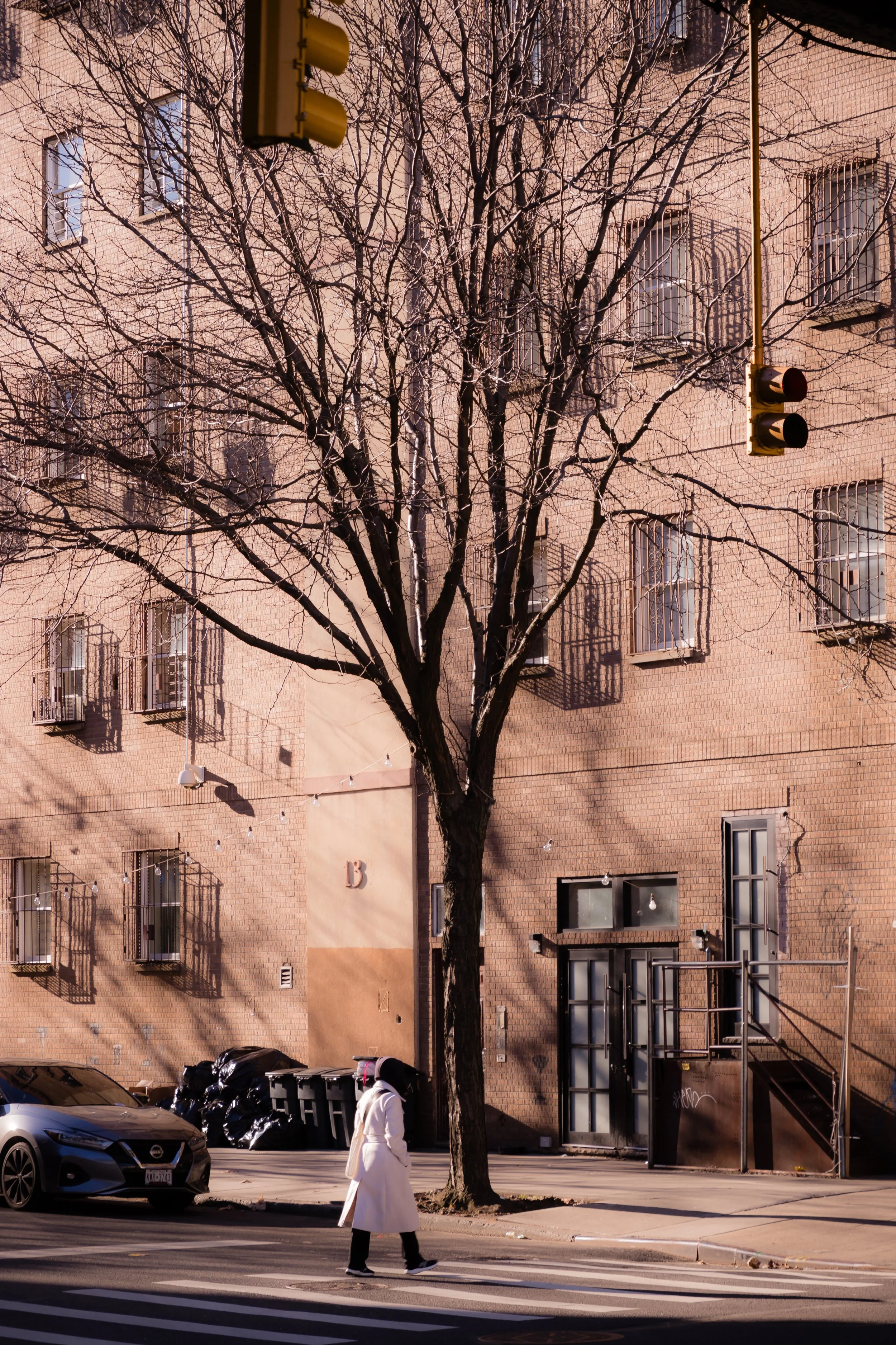
Bounded by Division Street to the north, Broadway to the northeast, Flushing Avenue to the south, and Kent Avenue along the East River to the west, South Williamsburg forms one of the most historically layered and culturally charged neighborhoods in New York City. Wedged between the industrial waterfront and the elevated tracks of the J/M/Z lines, it sits at the crossroads of Williamsburg’s working-class past, Hasidic present, and creative resurgence—a district whose identity has been shaped, erased, and redefined with each wave of Brooklyn’s evolution.
The neighborhood’s geography is both compressed and dynamic. Kent Avenue, once lined with factories and warehouses, now mixes glass towers with converted lofts and waterfront parks. Moving eastward, the terrain rises toward Bedford Avenue and Lee Avenue, where tightly knit Hasidic communities dominate the streetscape: modest brick rowhouses, yeshivas, and kosher bakeries animate an urban village atmosphere. To the south, along Flushing Avenue, the industrial edge blends into Bushwick’s warehouses and art studios, while Broadway remains the neighborhood’s eastern spine—busy, noisy, and vital, its elevated trains tracing a visible boundary between the old industrial zone and the broader fabric of Brooklyn.
Etymology and Origins
The name Williamsburg originates from Jonathan Williams, a U.S. Army engineer who surveyed this portion of Brooklyn’s East River shoreline in the 1790s. The settlement that followed—originally known as Williamsburgh—grew as a ferry-linked suburb for merchants and artisans commuting to Manhattan. The “South” distinction emerged organically as the neighborhood expanded in the 19th century, distinguishing the older industrial section near Division Avenue and the Navy Yard from the residential quarters to the north.
Before colonial settlement, the area formed part of the ancestral homeland of the Canarsie and Lenape peoples, whose trails and fishing grounds followed the East River’s tidal marshes. By the 18th century, Dutch and English farmers cultivated the fertile lowlands between what are now Flushing Avenue and Kent Avenue, while small shipyards and mills operated along the waterfront.
The completion of the Williamsburg Bridge (1903) and the industrial buildout of the Brooklyn Navy Yard to the south transformed this quiet waterfront into one of New York’s densest working-class enclaves—a place defined by immigration, factory labor, and the constant thrum of the elevated train.
The Neighborhood
19th Century: Industry and Immigration
The mid-to-late 19th century saw South Williamsburg emerge as an industrial powerhouse and immigrant stronghold. Factories, breweries, sugar refineries, and shipyards flourished along the waterfront—among them the Domino Sugar Refinery (opened 1882), which for over a century would dominate both the skyline and the local economy. Along Kent Avenue, warehouses stored lumber, coffee, and molasses arriving from global ports, while inland streets filled with tenement housing built for the thousands of German, Irish, Polish, and Italian workers employed nearby.
The area’s industrial might was matched by its cultural density. Churches such as Most Holy Trinity (1841) and Our Lady of Mount Carmel (1887) rose amid crowded blocks, serving as both spiritual and social anchors. By the 1890s, South Williamsburg had also become a major center of Eastern European Jewish immigration—its narrow streets echoing with Yiddish signs, pushcarts, and tenement courtyards that teemed with daily life.
The construction of the Williamsburg Bridge accelerated these changes, bringing a new influx of Jewish families from the Lower East Side seeking affordable housing across the river. By 1910, South Williamsburg was one of the most densely populated districts in New York, its waterfront a symbol of industrial modernity and its inner streets alive with immigrant ambition.
Early–Mid 20th Century: Hasidic Renewal and Urban Decline
The early 20th century was a period of both community growth and physical decline. As manufacturing boomed, housing conditions worsened; overcrowded tenements and inadequate sanitation led reformers to label parts of South Williamsburg among Brooklyn’s poorest. The area’s working-class residents—still largely Jewish, Italian, and Eastern European—endured the Great Depression through small trade, garment work, and the informal economy.
After World War II, the neighborhood underwent a profound demographic transformation. Thousands of Hasidic Jews, many of them Holocaust survivors from Hungary, Galicia, and Romania, resettled in South Williamsburg, founding what would become one of the largest ultra-Orthodox communities in the United States. Centered along Lee Avenue, this Hasidic enclave—dominated by the Satmar sect, led by Rabbi Joel Teitelbaum—revitalized abandoned housing and built yeshivas, mikvahs, and synagogues throughout the 1950s and 1960s.
At the same time, Puerto Rican and later Dominican migrants moved into the area’s southern and western sections, particularly near Flushing Avenue, as white flight and deindustrialization reshaped the city. Factories closed, unemployment rose, and by the 1970s, much of South Williamsburg suffered from neglect—vacant lots, fires, and poverty became common. Yet even amid decline, the neighborhood’s tightly knit Hasidic community maintained order and stability through mutual aid, religious institutions, and dense social networks.
South Williamsburg Video Coming Soon
Late 20th Century: Resilience and Division
Through the 1980s–1990s, South Williamsburg embodied the contradictions of late 20th-century Brooklyn: deep poverty adjacent to revival. The Hasidic community continued to expand, with large families crowding into aging housing stock while political influence grew through local civic organizations and voting blocs. Meanwhile, Latino and Black residents—many concentrated near Flushing Avenue and Marcy Avenue—organized around housing rights and social justice, giving rise to community groups such as Los Sures (Spanish for “The Southsiders”), founded in 1972 to combat landlord neglect and displacement.
The name Los Sures became synonymous with both resilience and resistance, as local activists fought to preserve affordable housing and cultural identity in the face of municipal disinvestment. Throughout these decades, South Williamsburg remained a study in contrasts: Hasidic stability on one side of Division Avenue, Latino activism and creativity on the other, both coexisting in uneasy proximity yet bound by shared geography and urban struggle.
21st Century: Transformation and Tension
The early 21st century brought rapid and unprecedented change. The 2005 Williamsburg–Greenpoint waterfront rezoning opened vast tracts of the East River shoreline—including portions of Kent Avenue—to residential redevelopment. Former factories became luxury condominiums, artists’ lofts, and design studios, attracting new waves of young professionals and creatives. The Domino Sugar Refinery redevelopment, launched in the 2010s, transformed a century-old industrial site into a mixed-use complex of glass towers and parkland, emblematic of the neighborhood’s gentrifying waterfront.
Yet inland, South Williamsburg’s traditional communities remain intact and distinct. Along Lee Avenue, Yiddish shop signs, kosher supermarkets, and yeshivas preserve the texture of Hasidic life, while the Broadway corridor retains its multicultural pulse—bodegas beside boutique cafés, churches beside synagogues. The contrast between the waterfront’s new skyline and the dense, insular streets east of Kent Avenue is striking: few places in New York capture the city’s extremes of wealth, faith, and culture more vividly.
Community tensions—over housing, zoning, and public space—have accompanied these changes, but so too has a sense of continuity. Organizations such as Southside United HDFC (Los Sures) continue to advocate for long-term residents, while parks like Domino Park and Grand Ferry Park reconnect the public to the East River, restoring a landscape once closed by industry.
South Williamsburg Photo Gallery
Spirit and Legacy
The spirit of South Williamsburg lies in its contrasts and continuities—a neighborhood that has absorbed every wave of New York’s history without ever losing its core identity as a place of work, refuge, and faith. It remains at once sacred and secular, industrial and domestic, insular and global.
New York City
Use this custom Google map to explore where every neighborhood in all five boroughs of New York City is located.
The Five Boroughs
One of New York City’s unique qualities is its organization in to 5 boroughs: Manhattan, Brooklyn, Queens, The Bronx, and Staten Island. These boroughs are part pragmatic administrative districts, and part vestiges of the region’s past. Each borough is an entire county in New York State - in fact, Brooklyn is, officially, Kings County, while Staten Island is, officially Richmond County. But that’s not the whole story …
Initially, New York City was located on the southern tip of Manhattan (now the Financial District) that was once the Dutch colony of New Amsterdam. Across the East River, another city was rising: Brooklyn. In time, the city planners realized that unification between the rapidly rising cities would create commercial and industrial opportunities - through streamlined administration of the region.
So powerful was the pull of unification between New York and Brooklyn that three more counties were pulled into the unification: The Bronx, Queens, and Staten Island. And on January 1, 1898, the City of New York unified two cities and three counties into one Greater City of New York - containing the five boroughs we know today.
But because each borough developed differently and distinctly until unification, their neighborhoods likewise uniquely developed. Today, there are nearly 390 neighborhoods, each with their own histories, cultures, cuisines, and personalities - and each with residents who are fiercely proud of their corner of The Big Apple.


