
WASHINGTON HEIGHTS
Manhattan
Geographic Setting
Bounded by West 155th Street to the south and West 181st Street to the north, and stretching from the Hudson River eastward to the Harlem River, Washington Heights crowns the northernmost highlands of Manhattan—a district of dramatic topography, sweeping views, and layered history. Rising on schist ridges nearly 250 feet above sea level, the neighborhood occupies the city’s broadest and most elevated plateau. To the west, Riverside Drive and Fort Washington Park descend steeply to the Hudson, while to the east, winding streets drop toward the Harlem River and the High Bridge viaduct.
Within these boundaries unfolds a landscape of contrasts: leafy residential terraces and limestone apartment houses; early 20th-century boulevards lined with Art Deco façades; and public spaces rich with Revolutionary memory. The grid flexes and adapts here—avenues curve with the terrain, and stone stairways knit together the elevations. Along Broadway, the neighborhood’s commercial spine, the cadence of languages and music mirrors Washington Heights’ defining identity: a living mosaic of generations of immigrants who have called these northern heights home.
Etymology and Origins
Washington Heights takes its name from Fort Washington, the Revolutionary War stronghold established in 1776 on the area’s highest hill to defend the Hudson River corridor. The fort was captured by the British that November after a fierce battle, forcing General George Washington’s troops to retreat across the river to New Jersey. For decades afterward, the site’s rugged hills and commanding views lent the area a patriotic mystique, remembered as the northern sentinel of the young republic.
Through the 19th century, the region was sparsely settled farmland punctuated by country estates such as Carmansville, Audubon Park, and Jumel Terrace. The Morris-Jumel Mansion (1765)—Manhattan’s oldest surviving house and George Washington’s temporary headquarters—remains a tangible link to these origins, its white columns rising over Jumel Terrace like a sentinel of the colonial past.
The Neighborhood
19th Century: From Countryside to City Frontier
Until the late 1800s, Washington Heights was rural and remote, accessible primarily by the Kingsbridge Road (now Broadway) and the Hudson River Railroad. Wealthy New Yorkers built summer estates atop its bluffs, drawn by cool air and panoramic views. The extension of the 9th Avenue Elevated Railway to 155th Street in 1879, and the construction of the Polo Grounds and Harlem River bridges, gradually connected the area to the city’s urban core.
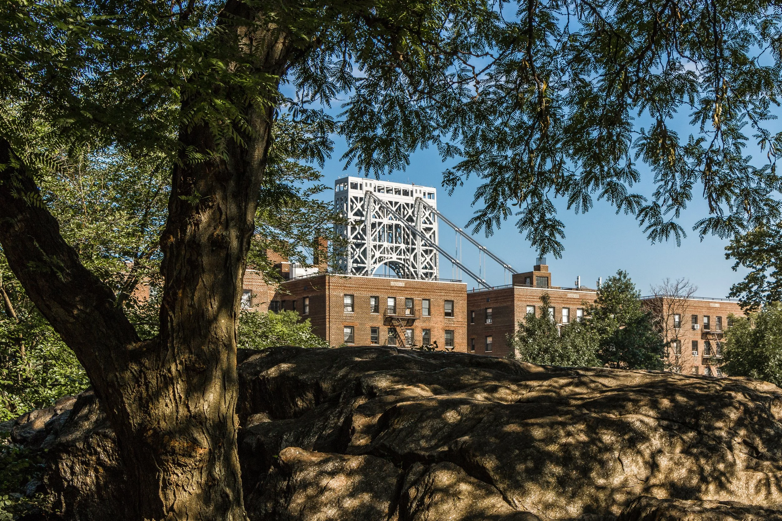
Urbanization accelerated in the 1890s, when street grading and new roads carved through the hills. The opening of the George Washington Bridge (1931) would later crown this evolution, but even before that, real estate developers promoted the Heights as “Manhattan’s suburban summit.” The grid north of 155th Street filled with early apartment buildings, while institutions such as Yeshiva University (founded 1928) established a lasting academic and cultural presence.
By the turn of the century, the Heights had begun to transition from estate landscape to residential district—a transformation that would define its 20th-century story.
Early 20th Century: Apartment Palaces and Immigrant Life
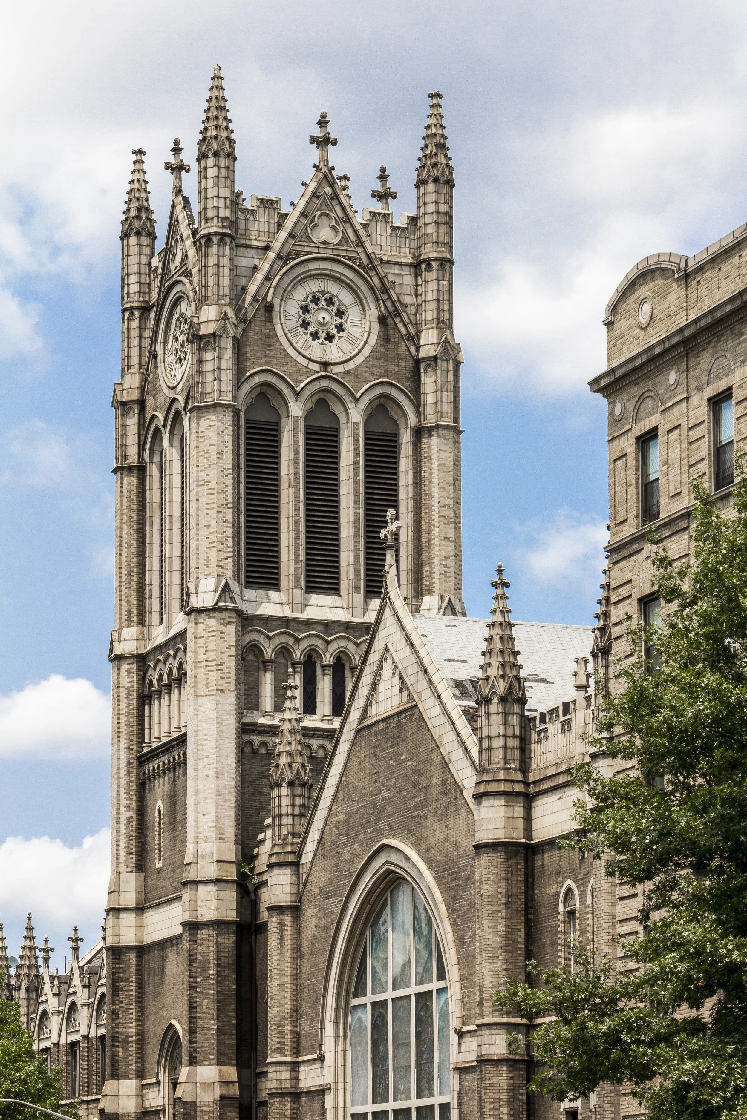
Between 1900 and 1935, Washington Heights emerged as one of Manhattan’s most desirable new neighborhoods. The completion of the Broadway IRT subway (1904–1908) linked the area directly to downtown, spurring rapid construction of six-story apartment houses along Fort Washington Avenue, Wadsworth Avenue, and Audubon Avenue. Architects such as George Pelham and Herbert O. J. Gude created elegant Beaux-Arts and Renaissance Revival buildings adorned with marble lobbies, courtyards, and decorative cornices.
Middle-class families—many German, Irish, and Jewish—settled here, drawn by spacious layouts and open air. By the 1930s, new Art Deco structures rose along Bennett Avenue, 180th Street, and Fort Washington Avenue, their geometric motifs and sunburst friezes reflecting the optimism of the age. Commercial life centered on Broadway and St. Nicholas Avenue, where theaters, bakeries, and delicatessens flourished.
Landmarks of the period include the Fort Tryon Park, designed by Frederick Law Olmsted Jr. and opened in 1935, and The Cloisters, the Metropolitan Museum’s medieval branch built with Rockefeller patronage. Together they established the neighborhood’s western edge as one of Manhattan’s most magnificent parklands, with sweeping vistas of the Palisades and Hudson.
Washington Heights Photographic Tour
Mid–Late 20th Century: Upheaval, Immigration, and Resilience
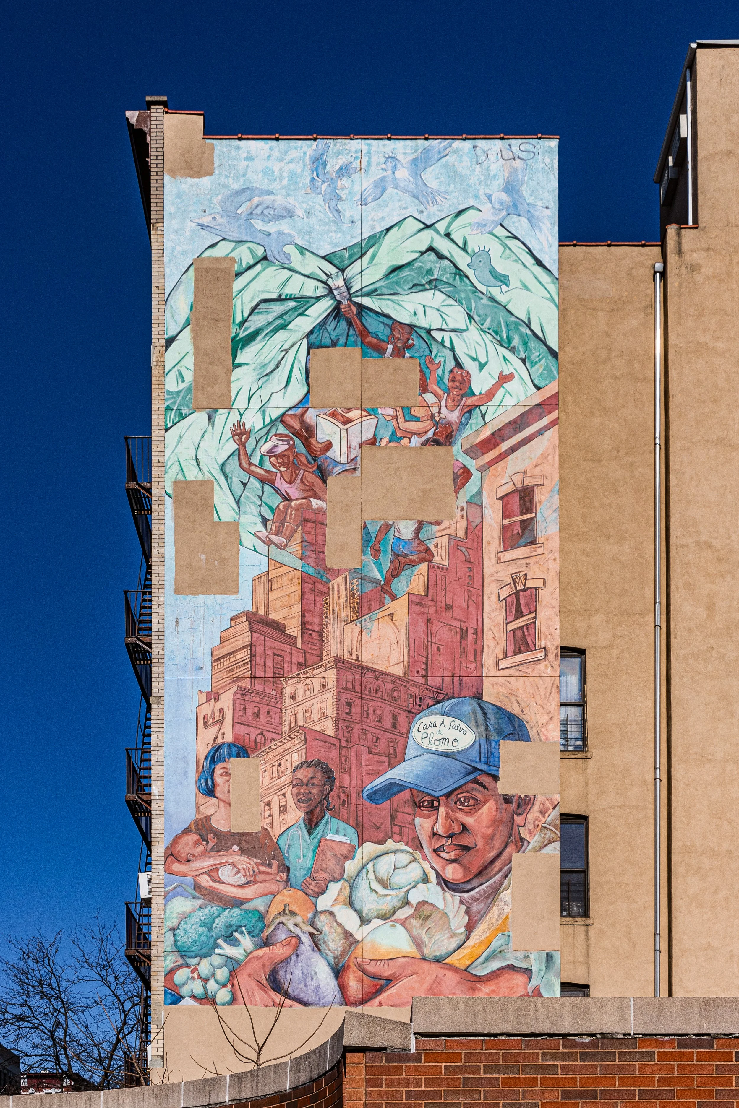
After World War II, demographic shifts transformed Washington Heights. Many Jewish and European families moved to the suburbs, replaced by successive waves of immigrants—first Puerto Rican and Cuban, then Dominican and other Caribbean communities beginning in the 1960s. By the 1980s, Washington Heights had become the largest Dominican neighborhood in the United States, its streets alive with Spanish-language signage, merengue music, and a thriving network of bodegas, salons, and social clubs.
The era was not without hardship. The neighborhood faced economic decline, drug violence, and disinvestment during the 1970s–1990s. Yet community solidarity remained fierce. Cultural institutions like the United Palace Theatre (built 1930 as Loew’s 175th Street, later restored as a spiritual and performing arts center) became beacons of endurance. The Highbridge Park Preservation Alliance and neighborhood associations fought for cleaner streets, safer parks, and better housing conditions.
Amid adversity, the Heights forged a unique identity: a Dominican heart within a New York body, where resilience itself became culture. Festivals like the Dominican Day Parade and local baseball leagues celebrated a shared heritage of migration, ambition, and pride.
21st Century: Renaissance on the Heights
In the 21st century, Washington Heights has entered a new era of stability and renewal. Investment in housing, infrastructure, and open space—coupled with the enduring strength of its community—has revived its streetscape without erasing its character. Restorations of Fort Tryon Park, J. Hood Wright Park, and the High Bridge (reopened 2015) have reconnected residents to the neighborhood’s remarkable geography.
New cafés, bookstores, and small theaters have emerged along Dyckman Street and Broadway, while long-time Dominican businesses continue to anchor the area’s cultural continuity. Historic preservation efforts protect the district’s Art Deco and Beaux-Arts buildings, while new residential developments along the riverfront reflect sensitive adaptation rather than wholesale replacement.
Today, Washington Heights remains one of New York’s most dynamic multicultural enclaves—a blend of old and new, of community activism and upward mobility. Its hills still echo with the layered voices of history: colonial defenders, immigrant dreamers, and a modern generation redefining what it means to belong to the city.
Washington Heights Photo Gallery
Spirit and Legacy
Washington Heights is, above all, a story of continuity through change. From Revolutionary battleground to immigrant stronghold, from tranquil parks to bustling streets, it has embodied the resilience that defines New York itself. The neighborhood’s landscape—terraced streets, stone stairways, and skyline views—mirrors its people: elevated, enduring, and ever in motion.
New York City
Use this custom Google map to explore where every neighborhood in all five boroughs of New York City is located.
The Five Boroughs
One of New York City’s unique qualities is its organization in to 5 boroughs: Manhattan, Brooklyn, Queens, The Bronx, and Staten Island. These boroughs are part pragmatic administrative districts, and part vestiges of the region’s past. Each borough is an entire county in New York State - in fact, Brooklyn is, officially, Kings County, while Staten Island is, officially Richmond County. But that’s not the whole story …
Initially, New York City was located on the southern tip of Manhattan (now the Financial District) that was once the Dutch colony of New Amsterdam. Across the East River, another city was rising: Brooklyn. In time, the city planners realized that unification between the rapidly rising cities would create commercial and industrial opportunities - through streamlined administration of the region.
So powerful was the pull of unification between New York and Brooklyn that three more counties were pulled into the unification: The Bronx, Queens, and Staten Island. And on January 1, 1898, the City of New York unified two cities and three counties into one Greater City of New York - containing the five boroughs we know today.
But because each borough developed differently and distinctly until unification, their neighborhoods likewise uniquely developed. Today, there are nearly 390 neighborhoods, each with their own histories, cultures, cuisines, and personalities - and each with residents who are fiercely proud of their corner of The Big Apple.


