FLUSHING HEIGHTS
Queens
Geographic Setting
Bounded by 73rd Avenue to the south, 164th Street to the west, the Long Island Expressway (I-495) to the north, and Utopia Parkway to the east, Flushing Heights occupies a quiet, residential plateau in central Queens—a transitional zone between Flushing, Fresh Meadows, and Hillcrest. Situated on gently rising terrain south of downtown Flushing, the neighborhood is defined by leafy streets, postwar homes, and its proximity to major arteries that connect eastern Queens to the rest of New York City. The area’s modest elevation gives it its name: “Heights,” referring to both its slightly higher topography and its role as a serene counterpart to the bustling commercial core of Flushing just to the north.
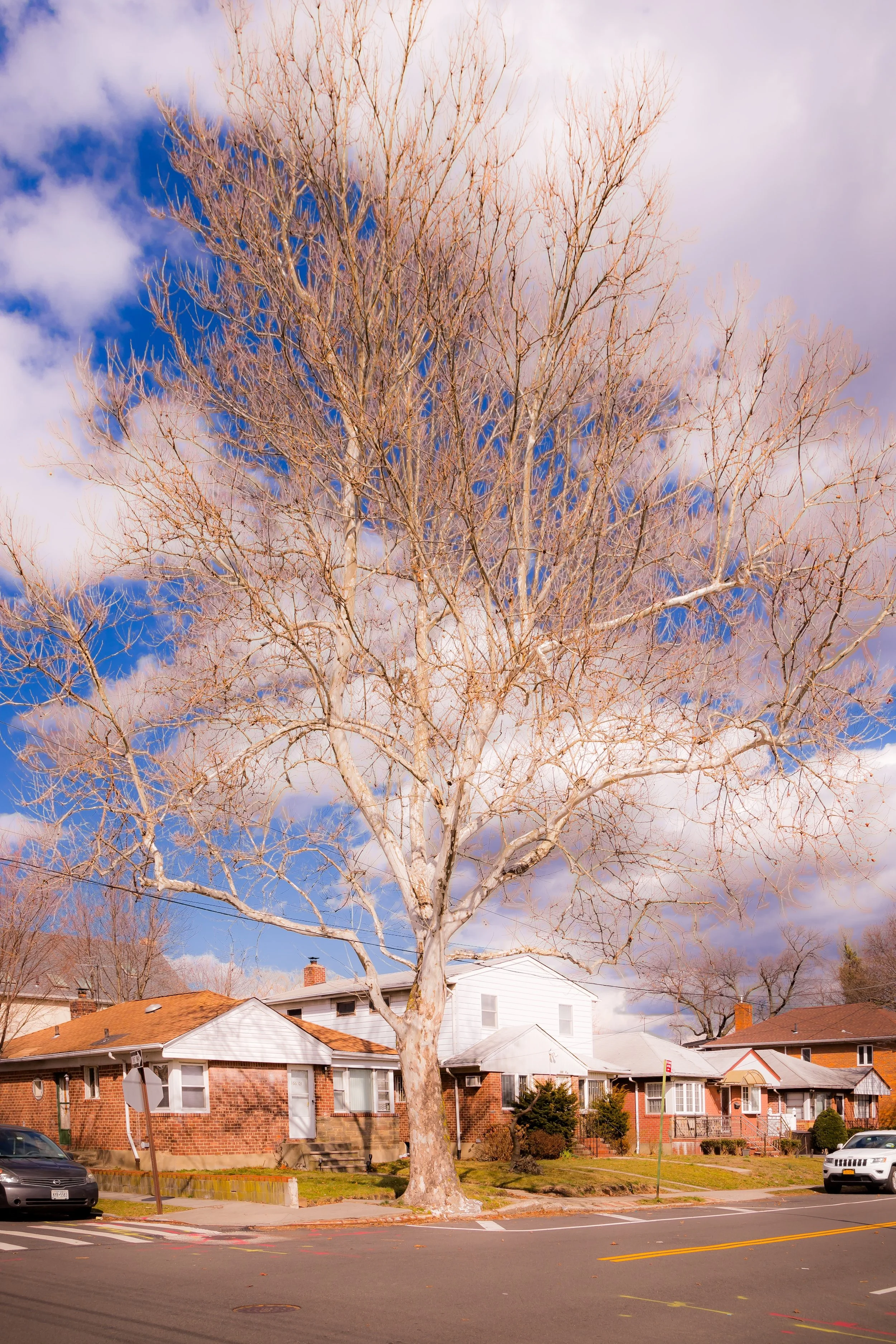
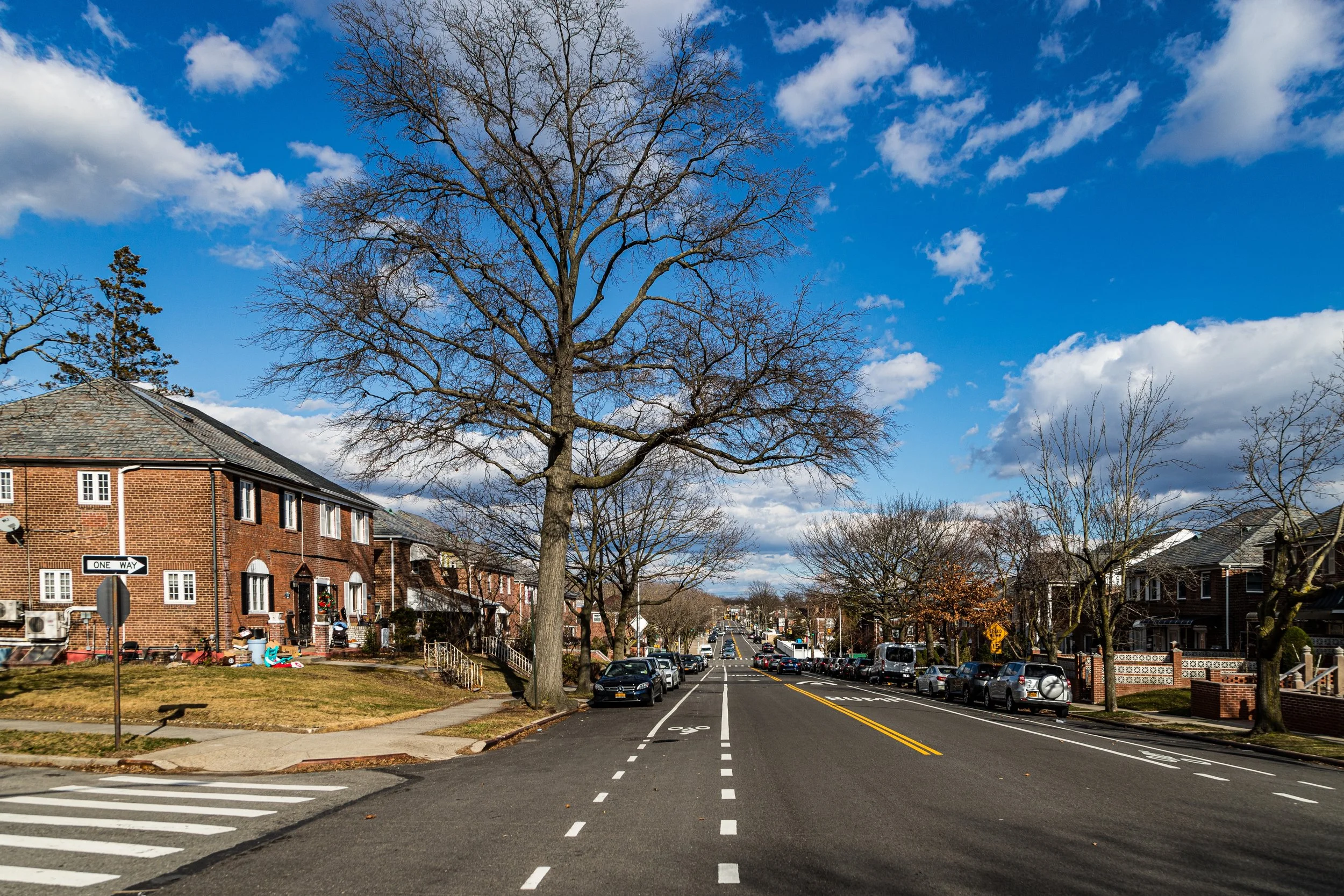
The neighborhood’s primary thoroughfares—Kissena Boulevard, 164th Street, and Utopia Parkway—carry a steady hum of local life, lined with schools, parks, and small businesses. The interior blocks, particularly along 75th Avenue, 76th Road, and 77th Avenue, are residential and tree-canopied, characterized by brick Tudor rowhouses, single-family colonials, and small garden apartment complexes built during the mid-20th century. The Long Island Expressway, which runs along the neighborhood’s northern edge, provides quick vehicular access to both Midtown Manhattan and Long Island, while bus lines on 164th Street and Kissena Boulevard link residents to the E, F, and 7 subway lines. To the south, St. John’s University in neighboring Hillcrest adds an academic pulse to the area, while to the north, Flushing Meadows–Corona Park remains only a short drive away.
Etymology and Origins
The name “Flushing Heights” is a 20th-century creation, coined by developers and city planners during the post-war suburban expansion of Queens. While the area had long been part of the greater Town of Flushing, it remained largely rural and agricultural well into the early 1900s, composed of small farms and open fields lying along the old colonial roadways of Kissena Boulevard and Utopia Parkway.
The “Heights” designation reflected the trend among developers in the 1930s–1950s to brand new housing tracts with aspirational, pastoral names—evoking elevation, refinement, and a sense of escape from the urban congestion of Manhattan and western Queens. The neighborhood’s gentle rise above downtown Flushing, coupled with its low density and greenery, made the term apt. Early advertisements for the area in the 1940s and 1950s described it as “a suburban garden within city limits,” highlighting its accessibility via the newly constructed Long Island Expressway and its proximity to emerging shopping and educational centers.
The Neighborhood
Early 20th Century: Farmland to Suburb
Before World War II, Flushing Heights was part of a swath of semi-rural land dotted with nurseries, dairies, and truck farms. The Kissena Park Nursery to the north and the Queensboro Farm Museum (precursor to today’s Queens County Farm) reflected the area’s deep agricultural roots. Modest housing began to appear in the 1920s along 164th Street and 73rd Avenue, but large-scale development was limited until after the war.
The construction of the Grand Central Parkway (1936) and Long Island Expressway (completed through Queens in the 1950s) transformed accessibility, setting the stage for a new wave of suburbanization. Developers purchased former farmland and subdivided it into neat grids of detached homes, duplexes, and small apartment buildings. These new residential tracts catered to returning veterans and middle-income families, many of whom were leaving denser parts of Brooklyn and the Bronx.
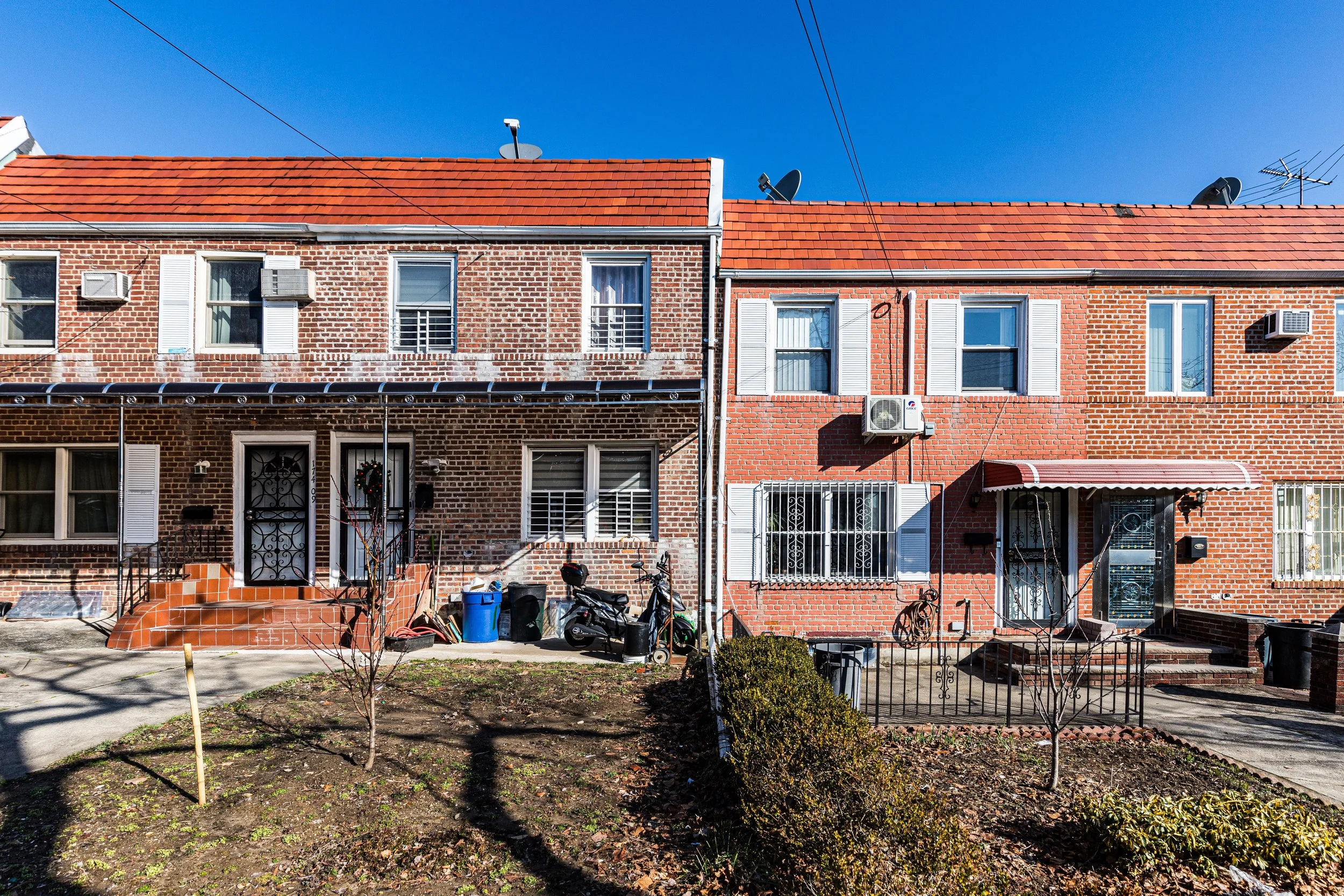
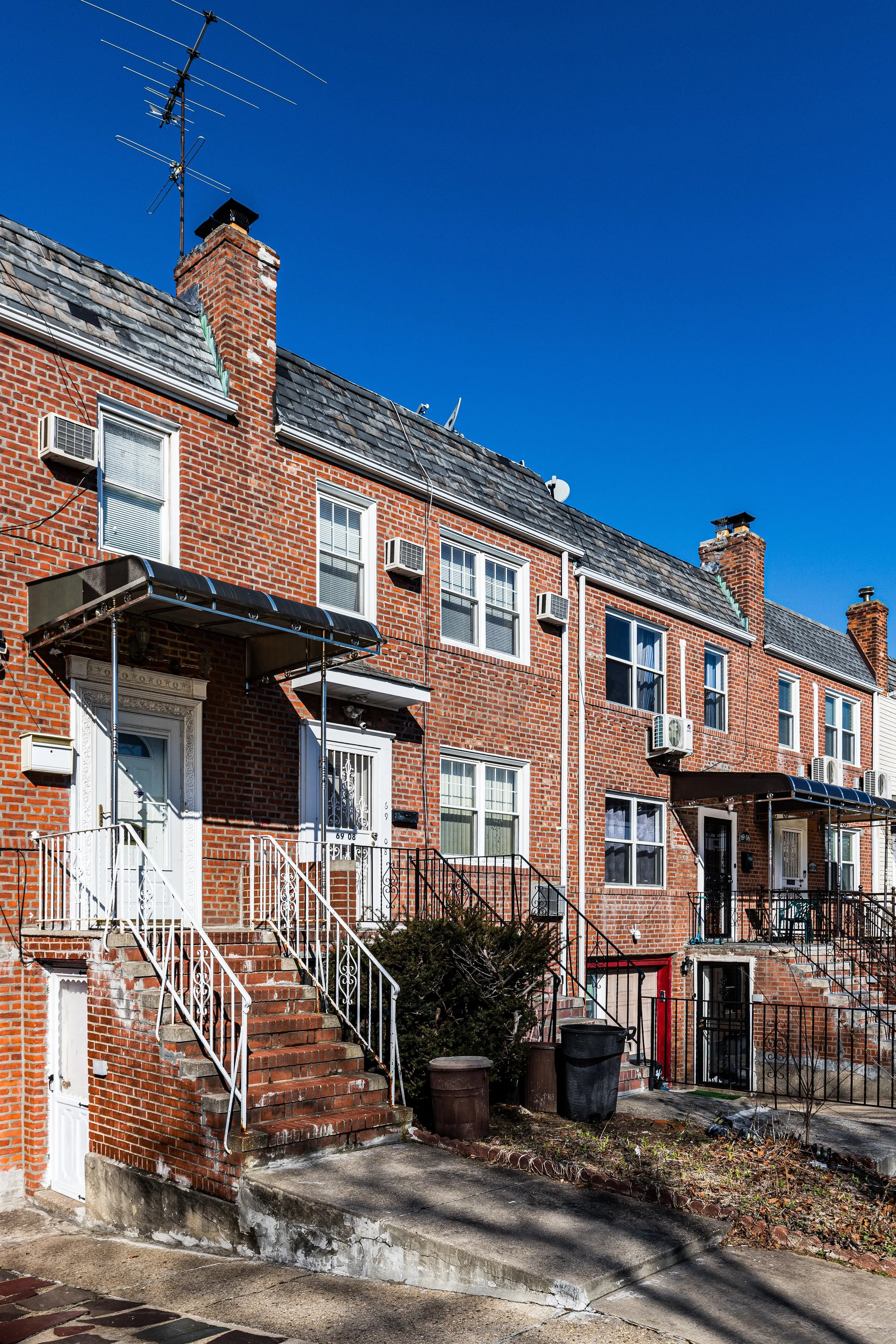
The architectural character of this era endures: red-brick Tudors with slate roofs, Cape Cods with picture windows, and split-levels with generous driveways and lawns. Yards and small gardens—rare in much of New York City—became defining features, creating the sense of suburban calm that remains Flushing Heights’ hallmark.
Mid-20th Century: Community Stability and Civic Life
By the 1950s and 1960s, Flushing Heights had matured into a stable, middle-class neighborhood, its identity shaped by family life, civic engagement, and proximity to education. The neighborhood’s schools—P.S. 154, J.H.S. 216 (George J. Ryan), and Francis Lewis High School—became pillars of the community, serving children from both Flushing Heights and adjoining Fresh Meadows. Houses of worship such as Holy Family Roman Catholic Church, Flushing Heights Reformed Church, and nearby synagogues anchored the social landscape.
Small commercial strips developed along Kissena Boulevard and 164th Street, featuring family-run groceries, bakeries, and diners. Residents recall a time when children rode bicycles to Kissena Park, and summer block parties were a local tradition. The presence of St. John’s University just to the south brought a steady flow of students and faculty into neighborhood shops and rental apartments, while the Long Island Expressway allowed quick commutes for professionals working in Midtown Manhattan or Nassau County.
Throughout the postwar decades, Flushing Heights managed to balance convenience with calm—a residential enclave buffered by infrastructure but largely untouched by large-scale commercial or industrial growth.
Flushing Heights Photographic Video
Late 20th Century: Demographic Shifts and Suburban Continuity
By the 1970s and 1980s, demographic changes across Queens began to reshape Flushing Heights. As longtime Italian-, Irish-, and Jewish-American families moved eastward into Nassau County, new immigrant communities—particularly Korean-American, Chinese-American, South Asian, and Caribbean families—settled in the area, attracted by its good schools, safe streets, and suburban character. This diversity deepened through the 1990s and 2000s, making Flushing Heights part of the multicultural mosaic that defines modern Queens.
Despite these shifts, the neighborhood retained its essential residential personality. The Long Island Expressway corridor occasionally brought proposals for redevelopment, but community associations successfully preserved the low-rise zoning and family-home character. The arrival of Asian supermarkets, halal butchers, and Latin American restaurants along Kissena Boulevard reflected the neighborhood’s evolving palate while preserving its small-business ethos.
Local parks—Kissena Corridor Park, Underhill Playground, and the southern edges of Kissena Park—remained vital community spaces, balancing urban density with open green relief. Meanwhile, improvements to Queens College and St. John’s University solidified the district’s reputation as an educational hub within reach of Manhattan’s core.
21st Century: Quiet Diversity and Steady Renewal
In the 21st century, Flushing Heights continues to exemplify the quieter side of Queens—an urban-suburban hybrid that thrives on stability and gradual change. Many of the midcentury homes have been renovated, yet their scale remains human and consistent with the neighborhood’s original planning. The area’s demographic profile now mirrors Queens at large: a harmonious mix of long-time residents and newcomers from around the world.
The community’s modest commercial zones serve daily life—supermarkets, bakeries, tutoring centers, and family-run restaurants—rather than nightlife or tourism. Public spaces have been revitalized through city initiatives, and neighborhood schools consistently rank among Queens’ most respected. With its easy access to highways, buses, and parks, Flushing Heights appeals to professionals and families seeking balance between urban connectivity and suburban peace.
Environmental and infrastructure improvements, such as flood-resistant landscaping and upgraded street drainage, reflect the city’s broader adaptation to climate challenges. Yet the neighborhood’s defining experience remains timeless: children playing in driveways, the hum of lawnmowers on summer evenings, and the sight of the Manhattan skyline faintly visible beyond the expressway.
Flushing Heights Photo Gallery
Spirit and Legacy
Flushing Heights’ spirit lies in its equilibrium—where the city gives way to suburb, and history meets quiet endurance. From farmland to postwar suburb to global neighborhood, it has evolved gently, reflecting the steady rhythms of Queens’ middle-class life. Its modest homes, shaded blocks, and diverse families embody the ideal of a lived-in, livable city.
New York City
Use this custom Google map to explore where every neighborhood in all five boroughs of New York City is located.
The Five Boroughs
One of New York City’s unique qualities is its organization in to 5 boroughs: Manhattan, Brooklyn, Queens, The Bronx, and Staten Island. These boroughs are part pragmatic administrative districts, and part vestiges of the region’s past. Each borough is an entire county in New York State - in fact, Brooklyn is, officially, Kings County, while Staten Island is, officially Richmond County. But that’s not the whole story …
Initially, New York City was located on the southern tip of Manhattan (now the Financial District) that was once the Dutch colony of New Amsterdam. Across the East River, another city was rising: Brooklyn. In time, the city planners realized that unification between the rapidly rising cities would create commercial and industrial opportunities - through streamlined administration of the region.
So powerful was the pull of unification between New York and Brooklyn that three more counties were pulled into the unification: The Bronx, Queens, and Staten Island. And on January 1, 1898, the City of New York unified two cities and three counties into one Greater City of New York - containing the five boroughs we know today.
But because each borough developed differently and distinctly until unification, their neighborhoods likewise uniquely developed. Today, there are nearly 390 neighborhoods, each with their own histories, cultures, cuisines, and personalities - and each with residents who are fiercely proud of their corner of The Big Apple.


