PARK OF EDGEWATER
The Bronx
Geographic Setting
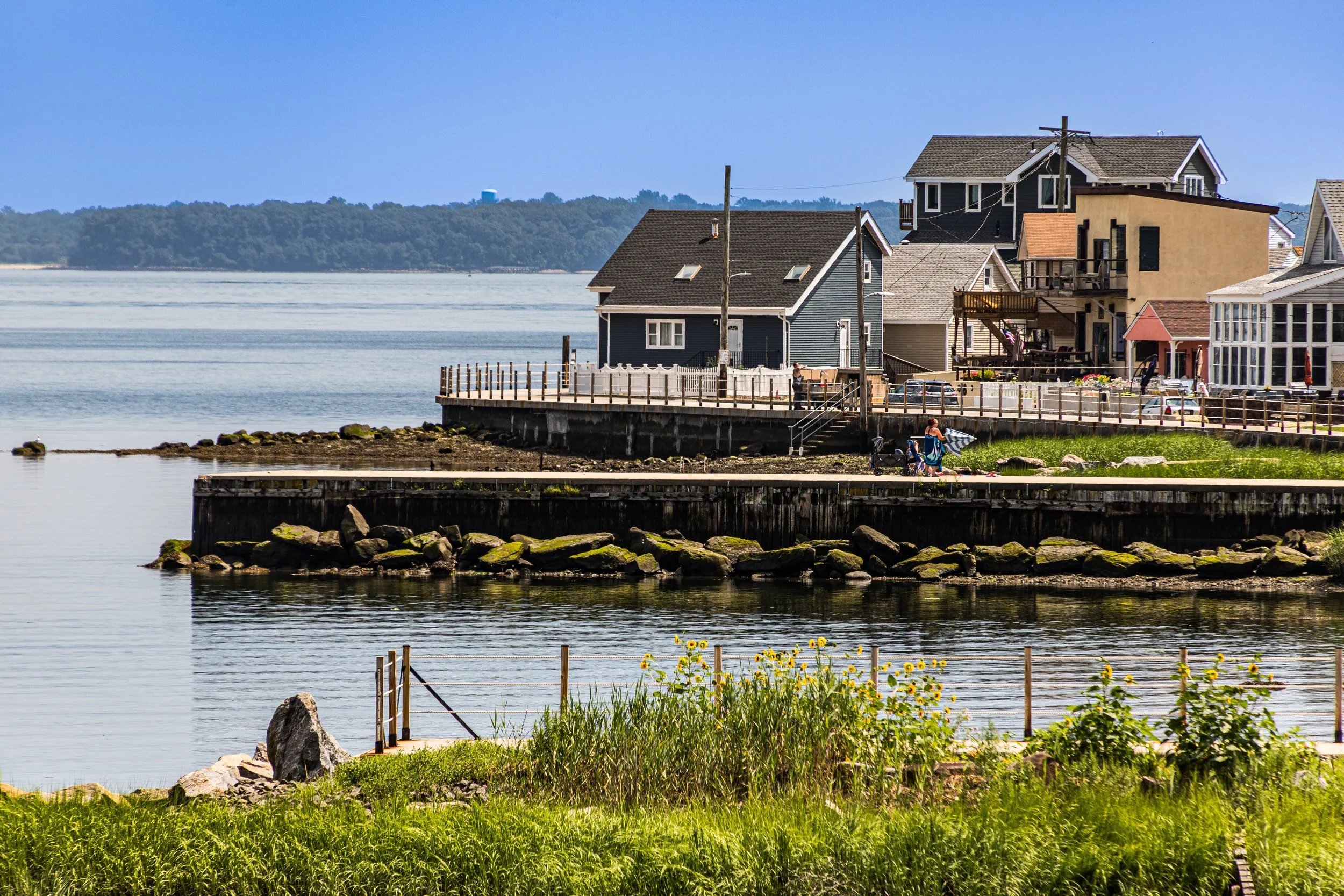
Bounded by the Throgs Neck Expressway to the south and west, Weir Creek to the north, and Eastchester Bay to the east, Park of Edgewater—often locally shortened to Edgewater Park—occupies a tranquil peninsula at the southeastern edge of the Bronx. Nestled between Throgs Neck and Country Club, it is one of New York City’s rare waterfront enclaves that retains the feel of a self-contained seaside village. Its narrow lanes, low-slung homes, and panoramic views of Long Island Sound evoke a small-town atmosphere that feels far removed from the city grid just beyond the expressway.
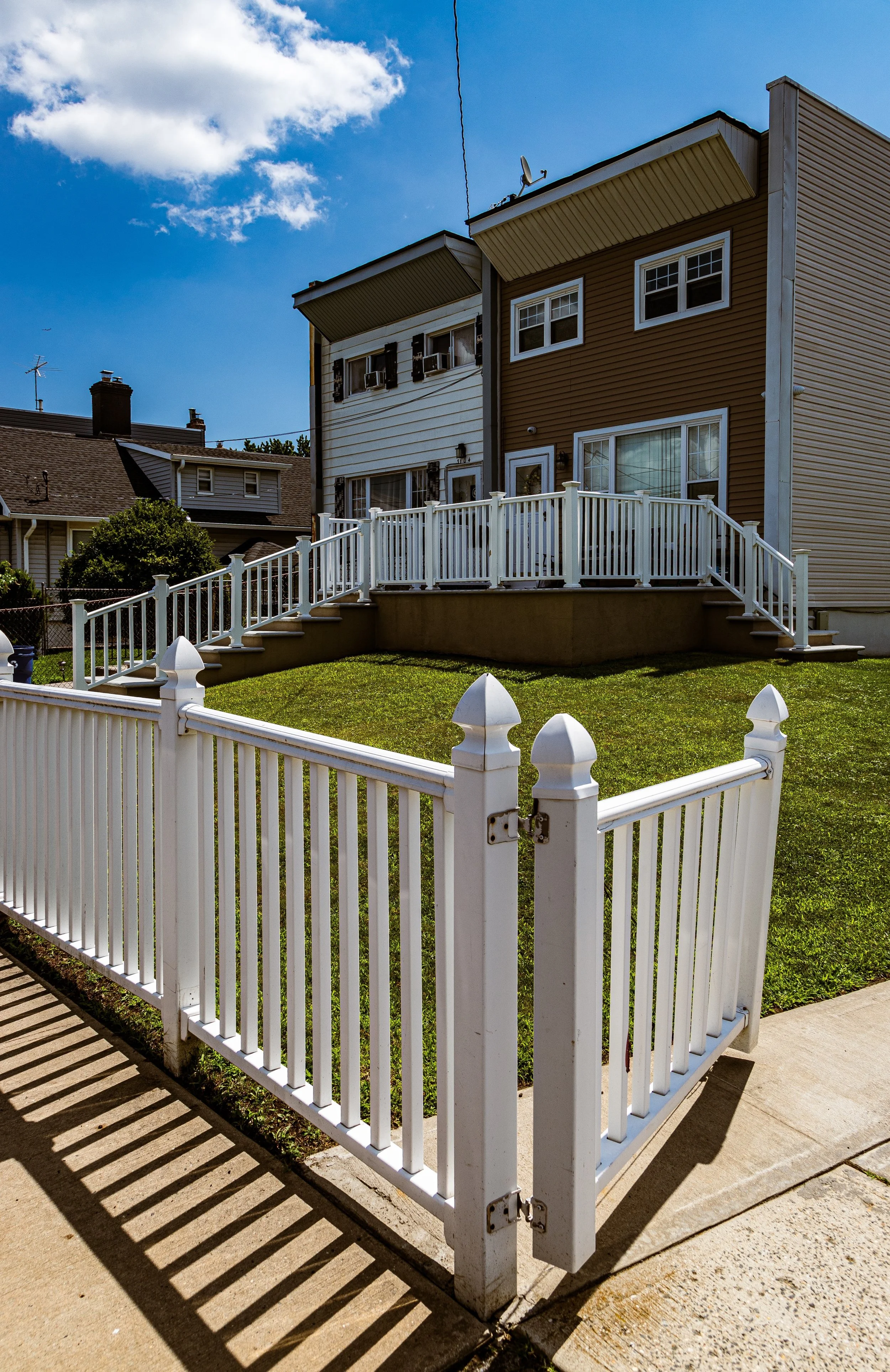
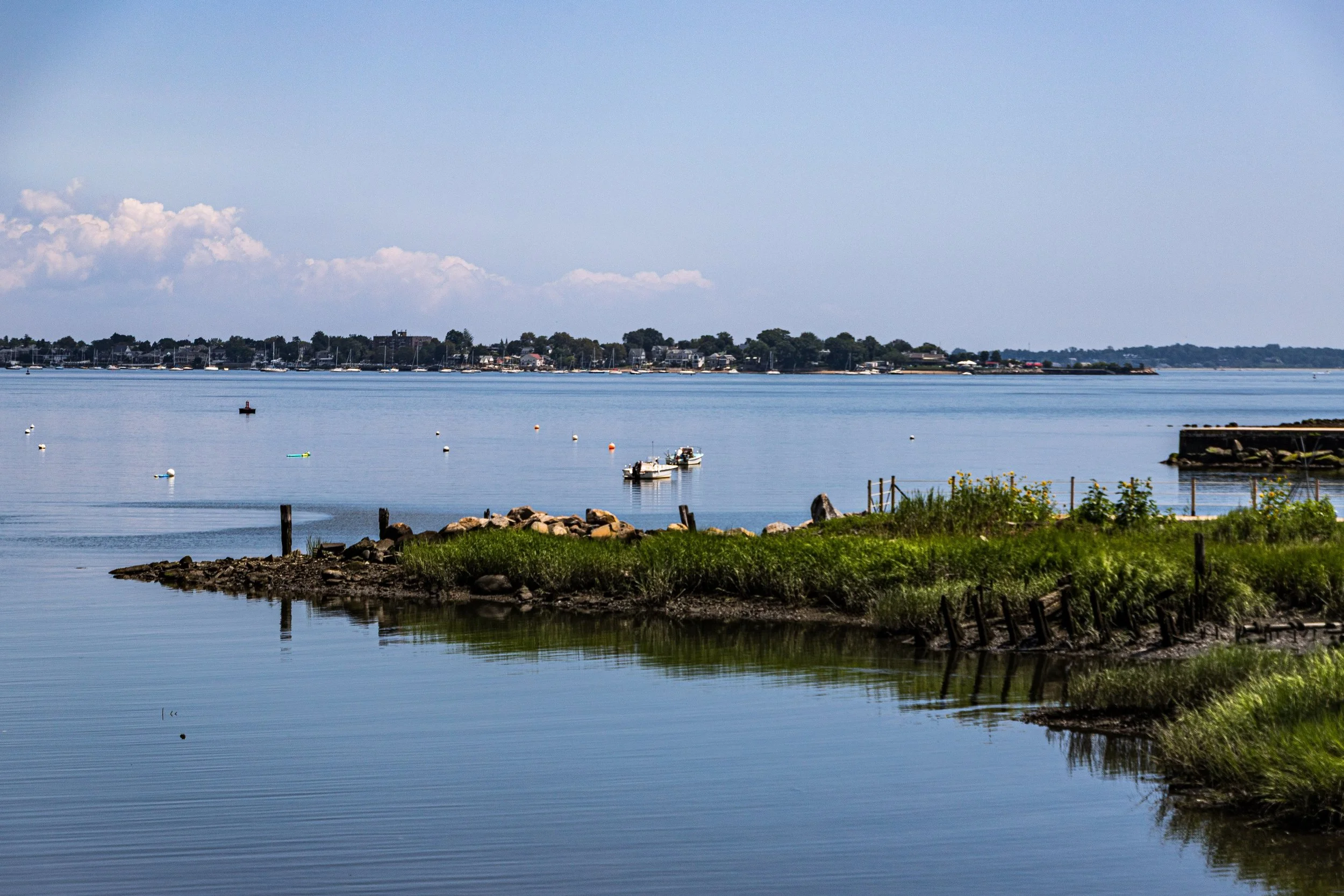
The neighborhood’s geography is both defining and protective: to the east, Eastchester Bay opens toward the Sound, dotted with small boats and piers; to the north, Weir Creek separates the community from Pelham Bay Park; and to the west, the Throgs Neck Expressway forms a hard urban boundary, shielding its quiet waterfront streets from the bustle beyond. Within those borders lies a distinctive built landscape—rows of bungalows, cottages, and co-ops, many with waterfront porches or private docks. The neighborhood’s internal roads—Edgewater Drive, Revere Avenue, Hutchinson River Parkway East, and Reed Place—meander gently toward the shore, where lawns meet the seawall and wooden stairways descend to the beach.
With its close-knit layout, private beach, and views of City Island and Whitestone Bridge, Park of Edgewater stands as one of the Bronx’s most unique residential microcosms: part maritime hamlet, part cooperative community, and wholly defined by its relationship to the water.
Etymology
The name “Edgewater” is both literal and evocative. It dates to the late 19th century, when developers sought to market this coastal tract as a suburban retreat “at the water’s edge.” The term park—then synonymous with “planned community” rather than public green space—was added to emphasize its landscaped grounds, communal layout, and exclusivity. “Park of Edgewater,” as the original title appears on early property deeds, reflected a turn-of-the-century aesthetic ideal: a garden suburb by the sea.
The name has endured, outlasting shifting ownerships and civic boundaries. Today, “Edgewater Park” remains the commonly used name among residents, though the full “Park of Edgewater” still appears in historic and legal contexts—a reminder of the neighborhood’s planned origins.
The Neighborhood
Origins through the 19th Century
Before its development, the land now known as Park of Edgewater formed part of the Marshall family estate, a coastal farm characterized by salt meadows, marshland, and tidal creeks. During the colonial era, it served as part of the agricultural hinterland of Westchester County, with limited settlement due to its isolation and marshy terrain. By the mid-19th century, as the industrial city expanded northward, the property drew interest from investors envisioning seaside resorts and suburban retreats along the Bronx’s eastern shore.
The late 1800s saw the transformation of this shoreline from rural landscape to leisure district. Wealthier New Yorkers began establishing summer colonies throughout the northeastern Bronx—at City Island, Throgs Neck, and Country Club—drawn by fresh breezes and proximity to Long Island Sound. In this context, the area that would become Edgewater Park was subdivided into a series of small plots marketed to middle-class families seeking affordable summer cottages. Early maps show the tract labeled “Edgewater Park Company,” with narrow lanes, communal beaches, and modest wooden bungalows—a pattern still visible today.
Early 20th Century: Cooperative Seaside Village
The early 1900s cemented Park of Edgewater’s unique identity. By 1910, the Edgewater Park Property Owners Cooperative had been formally established, one of the earliest resident-owned housing cooperatives in the city. The cooperative model allowed families—many of them Irish-American and Italian-American working- and middle-class New Yorkers—to purchase shares granting them rights to individual homes and communal land. This cooperative spirit fostered an unusually tight-knit community, blending urban practicality with rural self-sufficiency.
Architecturally, the neighborhood retained its seaside vernacular: bungalows, shingled cottages, and later brick rowhouses, built close together along winding private roads. The community installed its own water, sewer, and maintenance systems and maintained private beaches, playgrounds, and docks. The Edgewater Park Volunteer Fire Department, founded mid-century, became both a civic anchor and social hub, emblematic of the neighborhood’s independence.
While the Bronx-Whitestone Bridge (1939) and Throgs Neck Bridge (1961) reshaped the region’s transportation network, bringing highways and traffic near the neighborhood’s western boundary, Edgewater Park itself remained deliberately insulated—a self-managed enclave behind its gates, defined by personal ties rather than city bureaucracy.
Park of Edgewater Video Coming Soon
Mid–Late 20th Century: Resilience and Identity
The postwar decades reinforced Park of Edgewater’s distinctiveness. As much of the Bronx underwent waves of urban renewal and demographic change, Edgewater Park’s cooperative ownership model and limited access preserved its stability. Generations of families passed homes down through inheritances; many residents served as firefighters, police officers, or city workers. Annual community events—parades, picnics, and the Edgewater Park Field Day—became traditions binding the neighborhood across generations.
Yet this insularity also produced tension. During the 1970s–1980s, controversies arose over housing access and allegations of discriminatory practices within the co-op’s ownership structure. Legal challenges and city oversight gradually opened the cooperative to greater inclusivity, aligning it with modern housing laws while preserving its communal governance. Despite broader turmoil in the Bronx during the late 20th century, Edgewater Park remained almost entirely intact—its small scale, resident maintenance, and waterfront setting protecting it from the fires and disinvestment that devastated inland neighborhoods.
By the 1990s, the area’s charm and relative affordability drew a new generation of families from diverse backgrounds, blending long-established Irish and Italian residents with newcomers from across the Bronx and beyond.
21st Century: A Bronx Enclave on the Water
In the 21st century, Park of Edgewater has retained its singular character: a cooperative seaside village within New York City limits. The neighborhood’s homes—many now winterized and renovated—range from century-old cottages to new constructions designed to withstand coastal storms. Hurricane Sandy (2012) underscored both the community’s vulnerability and resilience; residents organized cleanup efforts, rebuilt seawalls, and strengthened flood defenses with city and FEMA support.
Today, Edgewater Park is home to a diverse mix of Irish-American, Italian-American, Puerto Rican, and South Asian families, united by their shared investment in the community’s maintenance and traditions. The Edgewater Park Property Owners Cooperative, still operational, oversees infrastructure, sanitation, and beach access, maintaining a measure of autonomy unusual in New York City neighborhoods.
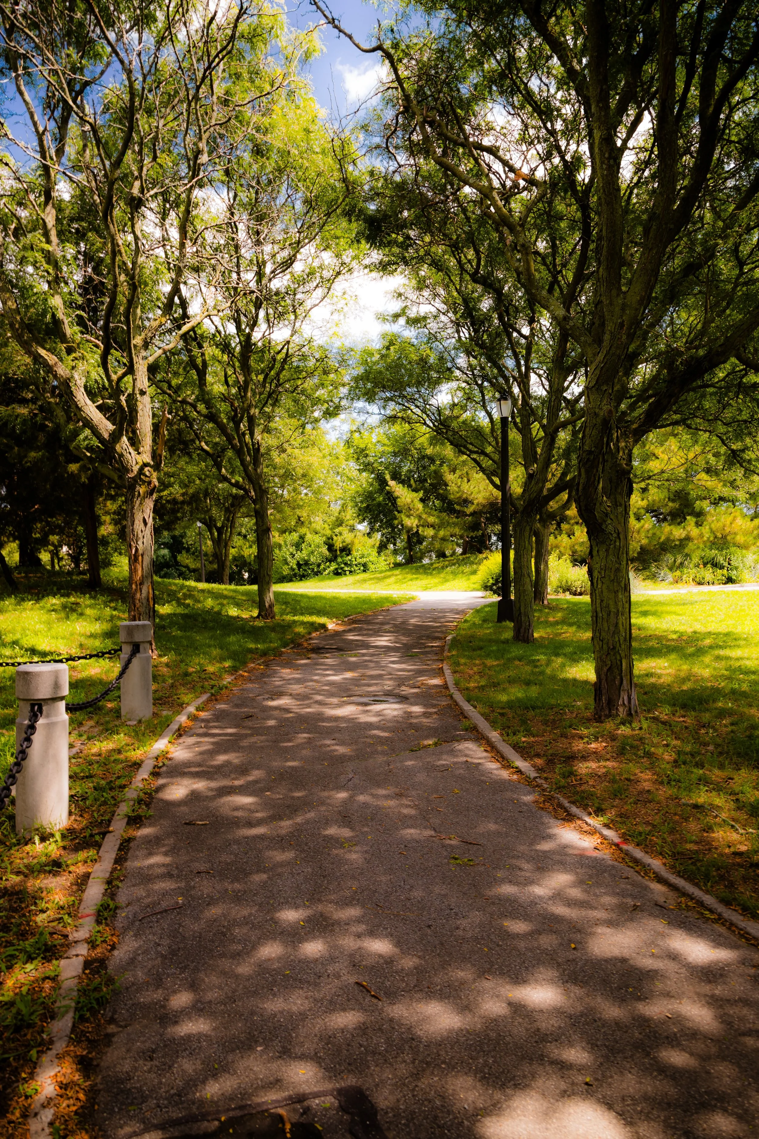
The area’s sense of neighborliness remains palpable—children ride bikes along narrow lanes, families gather on porches at sunset, and the sound of waves lapping against the seawall mingles with the distant hum of expressway traffic. The waterfront—long the neighborhood’s soul—continues to define its rhythm, from fishing at dawn to summer gatherings by the bay.
Park of Edgewater Photo Gallery
Spirit and Legacy
The spirit of Park of Edgewater lies in its steadfast commitment to community and place. It is a living relic of early 20th-century cooperative idealism, adapted for a modern, diverse city. Its wooden cottages, private lanes, and maritime horizon preserve a piece of Bronx history that feels almost pastoral—a neighborhood built not by developers but by its own residents.
New York City
Use this custom Google map to explore where every neighborhood in all five boroughs of New York City is located.
The Five Boroughs
One of New York City’s unique qualities is its organization in to 5 boroughs: Manhattan, Brooklyn, Queens, The Bronx, and Staten Island. These boroughs are part pragmatic administrative districts, and part vestiges of the region’s past. Each borough is an entire county in New York State - in fact, Brooklyn is, officially, Kings County, while Staten Island is, officially Richmond County. But that’s not the whole story …
Initially, New York City was located on the southern tip of Manhattan (now the Financial District) that was once the Dutch colony of New Amsterdam. Across the East River, another city was rising: Brooklyn. In time, the city planners realized that unification between the rapidly rising cities would create commercial and industrial opportunities - through streamlined administration of the region.
So powerful was the pull of unification between New York and Brooklyn that three more counties were pulled into the unification: The Bronx, Queens, and Staten Island. And on January 1, 1898, the City of New York unified two cities and three counties into one Greater City of New York - containing the five boroughs we know today.
But because each borough developed differently and distinctly until unification, their neighborhoods likewise uniquely developed. Today, there are nearly 390 neighborhoods, each with their own histories, cultures, cuisines, and personalities - and each with residents who are fiercely proud of their corner of The Big Apple.


