REMSEN VILLAGE
Brooklyn
Geographic Setting
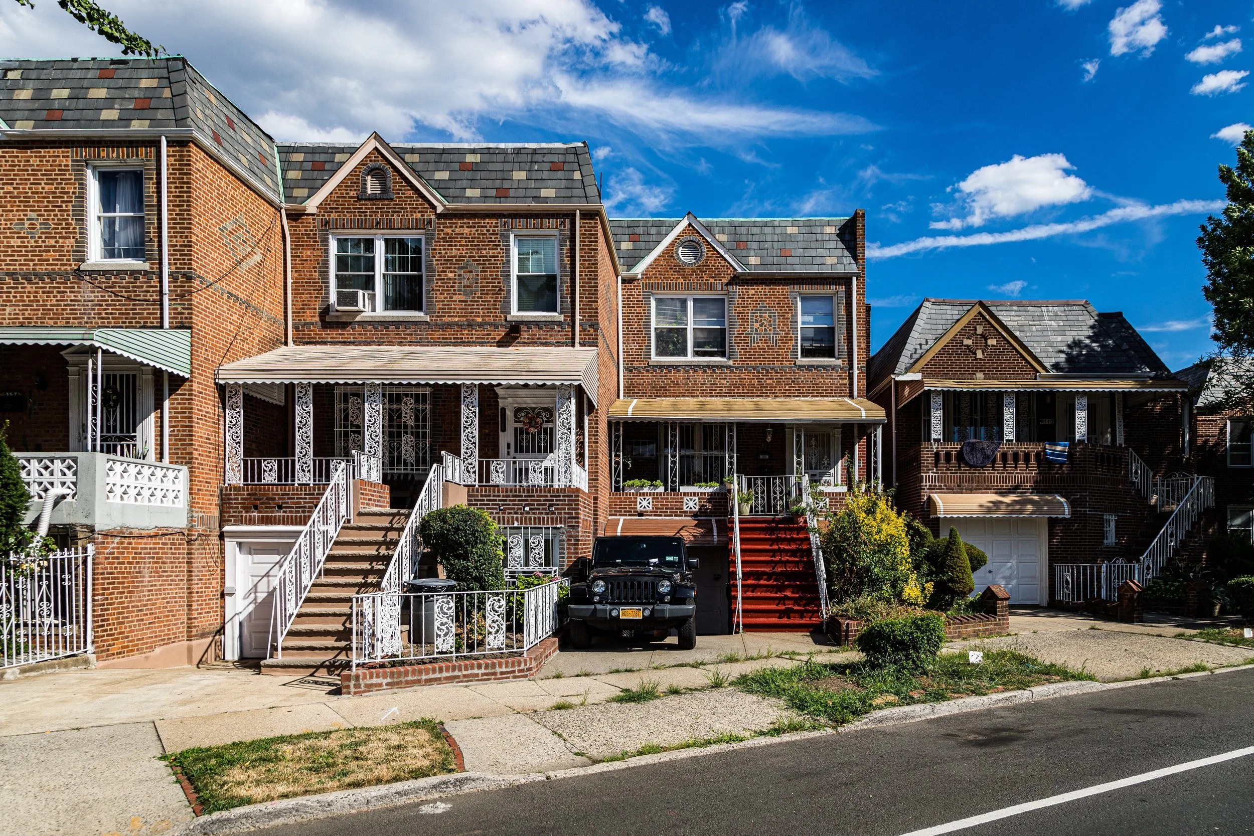
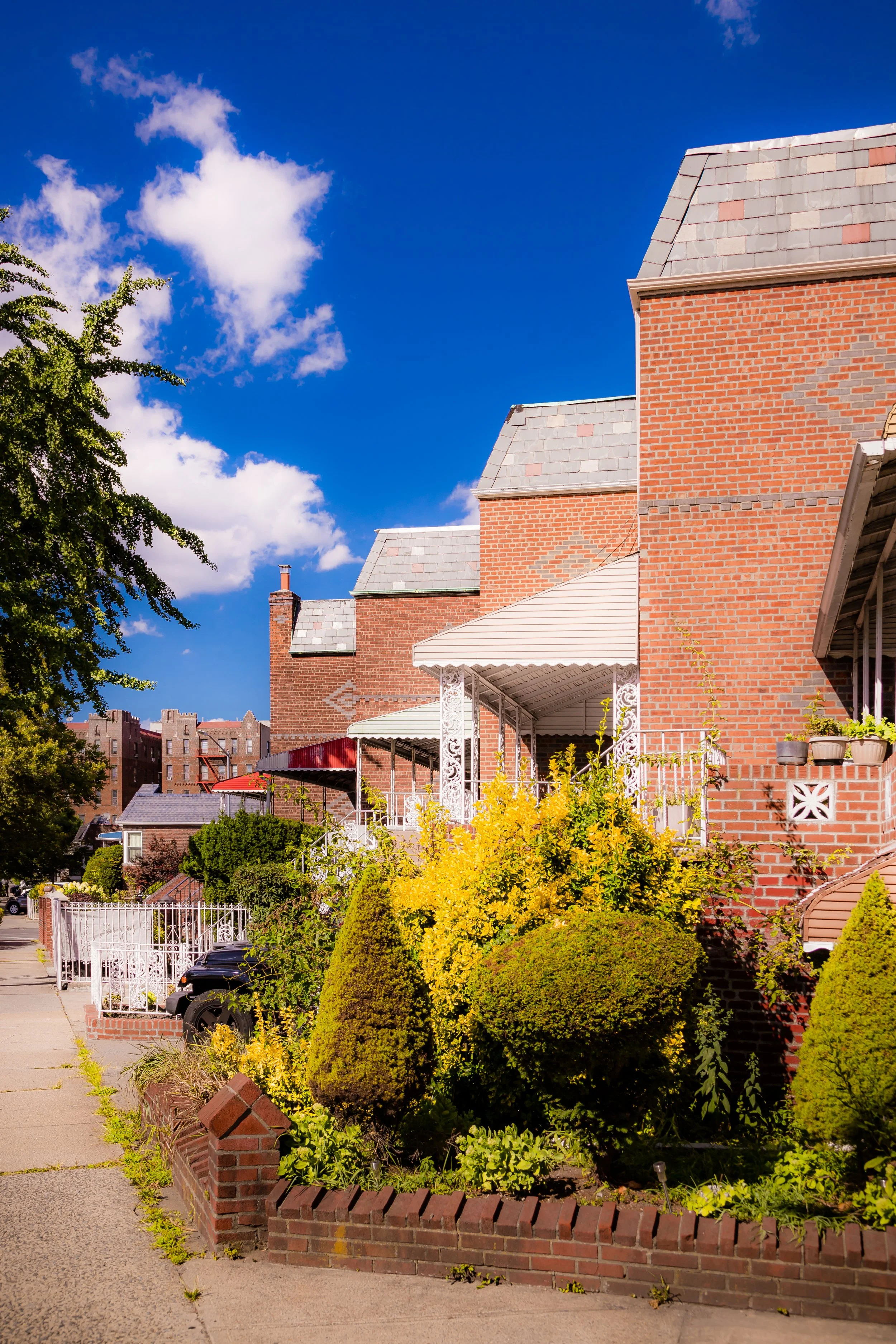
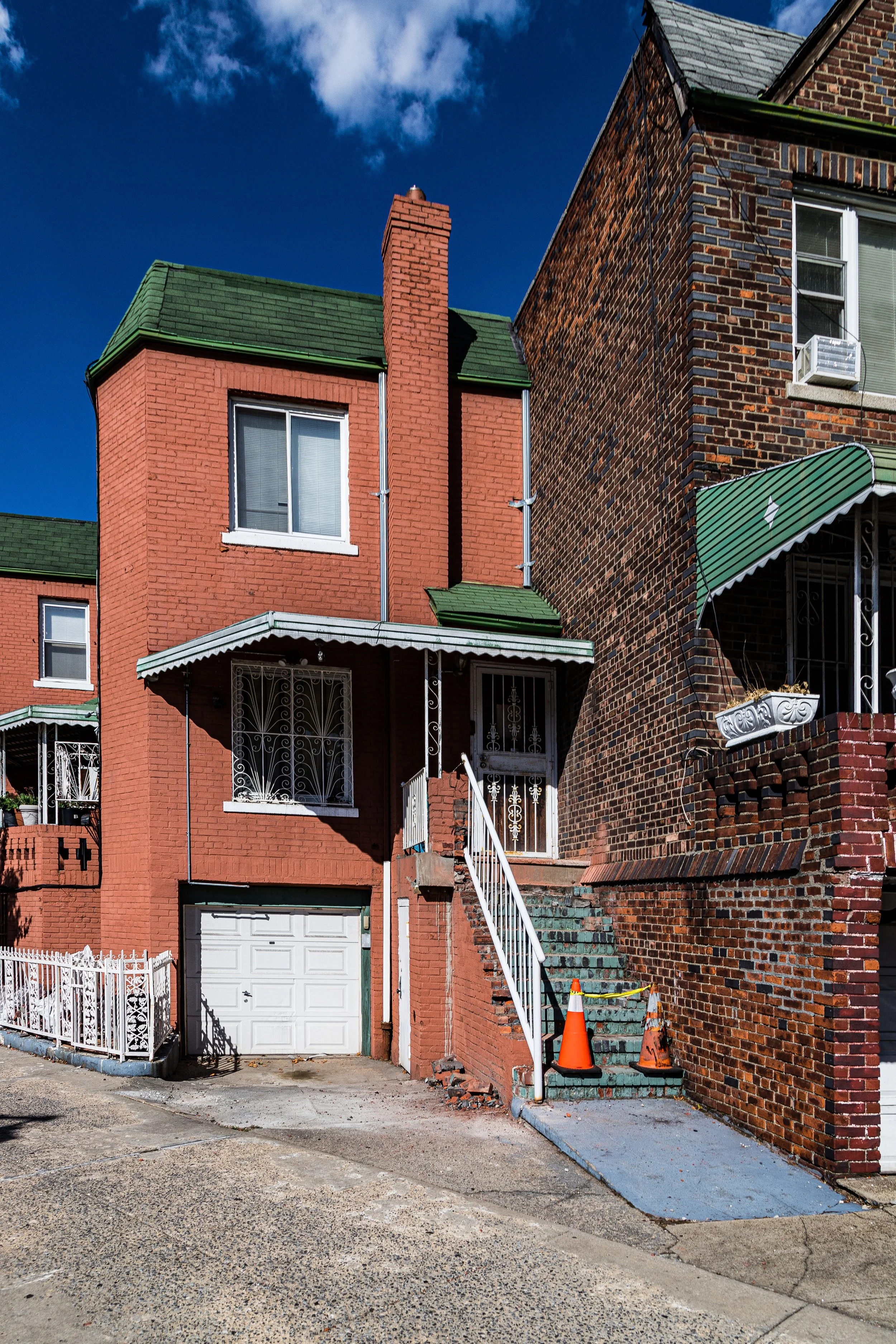
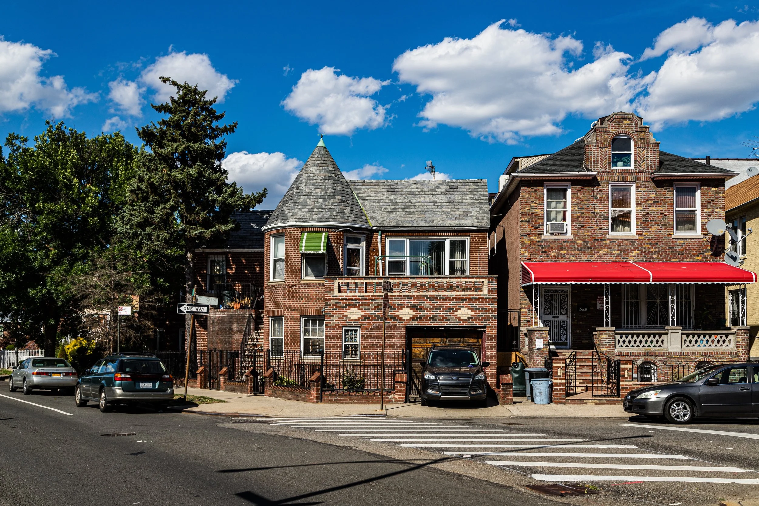
Bounded by Rockaway Parkway to the northeast, the Long Island Rail Road (Bay Ridge Branch) to the southeast, Ralph Avenue to the west, and Kings Highway to the northwest, Remsen Village lies within the southeastern reaches of central Brooklyn—an often-overlooked but distinct enclave between Canarsie, East Flatbush, and Flatlands. Its modest size belies a strong sense of neighborhood identity, rooted in mid-20th-century residential development and defined by its quiet streets, postwar brick homes, and open sky.
The area’s topography is characteristically flat, a remnant of the tidal plain that once extended toward Jamaica Bay. Its residential core centers on Avenue B, Avenue D, and East 83rd through East 89th Streets, where blocks of tidy rowhouses, garden-style apartments, and semi-detached homes form an orderly grid. Major arteries such as Ralph Avenue and Rockaway Parkway connect Remsen Village to Canarsie Pier, Marine Park, and the broader city, while Kings Highway provides a commercial edge lined with shops and schools. The neighborhood is largely residential in tone—low-rise, tree-lined, and quieter than its busier neighbors—its stillness punctuated by the rumble of freight trains along the LIRR corridor that defines its southeastern boundary.
Etymology and Origins
Remsen Village takes its name from the Remsen family, Dutch settlers whose agricultural holdings once extended across this part of Brooklyn in the 17th and 18th centuries. The Remsens were among the early landowners of Flatlands and Flatbush, their name preserved not only in this neighborhood but in Remsen Avenue, which runs north–south through central Brooklyn.
For much of its early history, the area remained part of the rural Town of Flatlands, an expanse of farms, meadows, and marshes stretching toward Canarsie Bay. The flat, fertile soil supported generations of Dutch and later English farmers, who cultivated hay, corn, and vegetables. Well into the 19th century, this landscape remained pastoral—an open quilt of fields, barns, and windmills separated by wooden fences and sandy lanes.
It was not until the 20th century, particularly after the Second World War, that the area took on its present identity as Remsen Village. The neighborhood’s name appeared in real estate advertisements and community planning documents of the 1950s and 1960s, when developers began constructing large tracts of brick rowhouses and semi-detached homes on the last remaining open land between Ralph Avenue and Rockaway Parkway.
The Neighborhood
Mid–20th Century: A Planned Postwar Enclave
Remsen Village emerged during the postwar housing boom that transformed Brooklyn’s southeastern periphery from farmland to suburban-style neighborhoods. Developers, working in tandem with the city’s housing authorities, marketed the area as an affordable, modern community for working- and middle-class families—many of whom were veterans or first-time homeowners seeking space and stability after years of wartime austerity.
The neighborhood’s design reflected the optimism of its era. Houses were built primarily of red and yellow brick, set back behind small front yards with driveways or stoops. The grid plan—bounded by major thoroughfares but internally quiet—created a sense of order and safety. Schools such as P.S. 268 Emma Lazarus and nearby Canarsie High School anchored civic life, while local playgrounds and small parks offered recreational space for children.
By the late 1950s, Remsen Village was home to a mix of Jewish, Italian, and Irish families, many of whom worked in the city’s public sector or small businesses. The neighborhood’s proximity to Kings Highway’s commercial district ensured access to shops, groceries, and transit, while its distance from industrial centers preserved a distinctly residential character.
Late 20th Century: Transition and Resilience
The 1970s–1980s brought demographic and economic change across Brooklyn, and Remsen Village was no exception. As older families moved outward to Staten Island and Long Island, new arrivals—African American and Caribbean households from East Flatbush, Crown Heights, and Jamaica, Queens—reshaped the neighborhood’s cultural identity. While some blocks experienced disinvestment during the fiscal crisis years, Remsen Village retained a degree of stability unusual for outer Brooklyn at the time, due in part to high rates of homeownership and strong local institutions.
Churches and block associations became anchors of community life. Congregations such as St. Paul’s Community Church and God’s Battalion of Prayer played central roles in maintaining social cohesion. Civic groups worked with the city to improve sanitation, lighting, and housing maintenance, while new small businesses—Caribbean bakeries, barbershops, and corner groceries—replaced older storefronts along Ralph Avenue and Rockaway Parkway.
By the 1990s, despite the broader urban challenges of crime and economic decline, Remsen Village remained a close-knit neighborhood, defined by its neat streets and shared investment in property and family life. Many residents viewed it as a quieter alternative to East Flatbush or Brownsville—a pocket of calm buffered by the rail line and the wide avenues that enclosed it.
Remsen Village Video Coming Soon
21st Century: A Quiet Community Amid Urban Change
In the 21st century, Remsen Village continues to embody a modest but enduring vision of Brooklyn living. The neighborhood remains largely residential, characterized by brick townhouses, small apartment houses, and postwar detached homes that have aged gracefully amid tree-lined streets. Generational continuity is a hallmark: many current residents are the children or grandchildren of those who first moved here in the 1950s and 1960s.
Its population today is predominantly Caribbean-American, with strong representation from Jamaican, Trinidadian, Haitian, and Guyanese communities, alongside growing Latino and South Asian presences. This cultural diversity finds expression in local businesses—roti and jerk chicken shops alongside bodegas and beauty salons—and in neighborhood events celebrating Caribbean heritage.
Remsen Village has also benefited from citywide investment in infrastructure and housing. Renovations of schools, improved transit connections along Rockaway Parkway, and environmental upgrades along the LIRR corridor have reinforced the area’s stability. Nearby green spaces such as Canarsie Park and Paerdegat Basin Parklands offer recreational escapes, linking the community to the broader environmental revival of southern Brooklyn.
While the real estate market has grown more competitive, Remsen Village retains its affordability relative to surrounding districts, attracting a new generation of homeowners seeking both space and a strong sense of community. The neighborhood’s low-rise skyline, quiet streets, and family-oriented atmosphere remain its defining traits.
Remsen Village Photo Gallery
Spirit and Legacy
The spirit of Remsen Village is one of stability, community, and quiet endurance. It is not a neighborhood of grand architecture or dramatic reinvention, but of steady lives lived in modest homes—an echo of the postwar promise that shaped so much of mid-century Brooklyn. Its legacy lies in its continuity: families maintaining gardens, block associations caring for trees and sidewalks, and neighbors greeting one another along Ralph Avenue as they have for decades.
New York City
Use this custom Google map to explore where every neighborhood in all five boroughs of New York City is located.
The Five Boroughs
One of New York City’s unique qualities is its organization in to 5 boroughs: Manhattan, Brooklyn, Queens, The Bronx, and Staten Island. These boroughs are part pragmatic administrative districts, and part vestiges of the region’s past. Each borough is an entire county in New York State - in fact, Brooklyn is, officially, Kings County, while Staten Island is, officially Richmond County. But that’s not the whole story …
Initially, New York City was located on the southern tip of Manhattan (now the Financial District) that was once the Dutch colony of New Amsterdam. Across the East River, another city was rising: Brooklyn. In time, the city planners realized that unification between the rapidly rising cities would create commercial and industrial opportunities - through streamlined administration of the region.
So powerful was the pull of unification between New York and Brooklyn that three more counties were pulled into the unification: The Bronx, Queens, and Staten Island. And on January 1, 1898, the City of New York unified two cities and three counties into one Greater City of New York - containing the five boroughs we know today.
But because each borough developed differently and distinctly until unification, their neighborhoods likewise uniquely developed. Today, there are nearly 390 neighborhoods, each with their own histories, cultures, cuisines, and personalities - and each with residents who are fiercely proud of their corner of The Big Apple.


