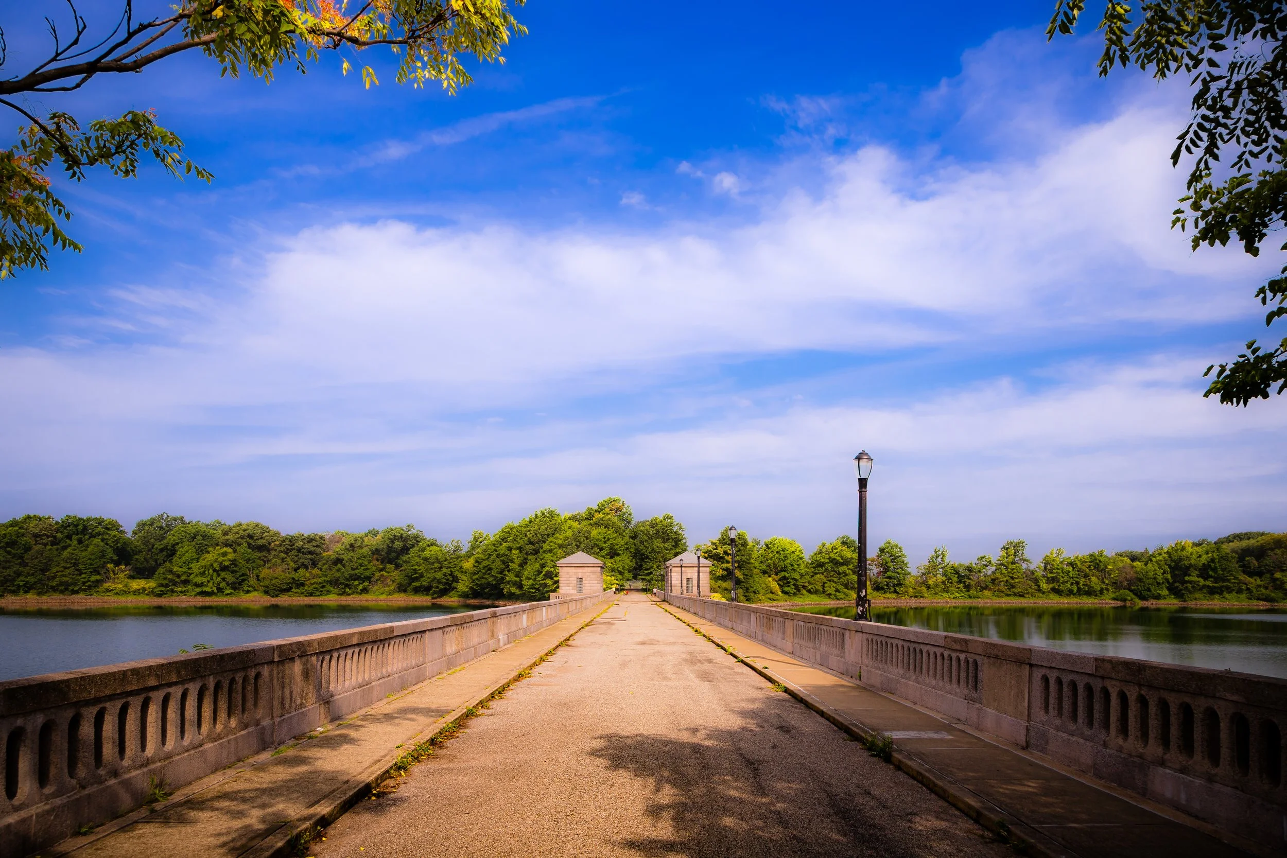
SILVER LAKE
Staten Island
Geographic Setting
Bounded by Quintard Street to the west, Hylan Boulevard to the northwest, McClean Avenue to the north, Lily Pond Avenue to the northeast, and the Lower New York Bay to the southeast, South Beach stretches along one of Staten Island’s most storied shorelines. Situated just south of Fort Wadsworth and east of Midland Beach, this waterfront neighborhood occupies a sweeping crescent of sand and sea where the Atlantic first greets the city. The landscape descends gently from the uplands of Arrochar and Dongan Hills toward the boardwalk, the Franklin D. Roosevelt Promenade, and the broad beach that gives the community its name.
The geography of South Beach is inseparable from its identity: a neighborhood defined by its relationship with the shore. Its streets—McClean, Sand Lane, Father Capodanno Boulevard—lead directly to the water’s edge, where the sounds of surf and gulls mingle with the steady hum of traffic from nearby Lily Pond Avenue. Despite the transformations of time, the open horizon of Lower Bay still frames the neighborhood’s spirit—a reminder that, here, Staten Island meets both the ocean and its own history.
Etymology
The name South Beach dates to the late 19th century, derived from its position as the southern counterpart to the once-famous North Beach resort in Queens. The term succinctly captured the neighborhood’s defining feature: a long, sunlit shoreline on Staten Island’s southeastern edge. Over the decades, “South Beach” became synonymous not only with geography but with recreation, nostalgia, and the rhythms of New York’s summer life.
In the city’s collective memory, South Beach conjures images of laughter, boardwalk lights, and the scent of salt and fried dough. Its name has endured through eras of prosperity and decline, carrying with it a promise of leisure and renewal by the sea.
The Neighborhood
Origins through the 19th Century
Before it became a resort, South Beach was a quiet stretch of coastal farmland and marshes dotted with small fishing cottages and summer homes. In the early 1800s, Staten Island’s eastern shore remained largely rural, its sandy soil supporting limited agriculture and its inlets providing access for oystermen and boat builders. The arrival of regular ferry service to Staten Island in the mid-19th century brought new visitors to its beaches, and by the 1870s, South Beach had begun its transformation into a bustling seaside destination.
Entrepreneurs quickly recognized the area’s potential. Wooden bathhouses, dance pavilions, and seaside hotels sprang up along the shoreline, catering to city dwellers eager for ocean air. The completion of the Staten Island Railway (1860) and connecting trolley lines made travel from St. George to South Beach quick and affordable. The neighborhood’s broad, accessible sands and shallow surf made it especially popular with families.
By the 1880s, South Beach was being heralded as the “Coney Island of Staten Island.” The South Beach Amusement Park—complete with carousel, roller coaster, and theater—became a magnet for visitors from across the region. Elegant hotels such as the Staten Island Pavilion and numerous boarding houses filled the waterfront, while small cottages and bungalows extended inland. The beach became the borough’s social center in summer, where music, fireworks, and laughter carried across the waves.
Early 20th Century: The Golden Era of Recreation
The early 20th century marked the height of South Beach’s popularity as a resort. The expansion of the South Beach Boardwalk, the rise of amusement piers, and the development of Sand Lane as a bustling commercial strip transformed the area into a thriving seaside district. Ferries from Manhattan and Brooklyn arrived daily, carrying thousands eager to escape the city’s heat.
For much of the first half of the century, South Beach embodied Staten Island’s summer spirit. The South Beach Amusement Park offered rides and games that rivaled those of Coney Island, while open-air dance halls hosted big bands and vaudeville performers. Bathers in striped suits crowded the surf, and vendors sold lemonade and ice cream along the boardwalk. The South Beach Trolley Terminal became one of the borough’s busiest hubs.
The neighborhood’s residential population grew alongside its resort economy. Modest bungalows and two-story homes appeared inland, occupied by families who had once visited only seasonally. Churches, schools, and small businesses lent the area permanence. Yet even at its peak, South Beach retained an air of impermanence—its wooden structures vulnerable to storms and fire, its economy tied to the changing tides of leisure.

Silver Lake Video Coming Soon
Mid–Late 20th Century: Decline and Reinvention
The mid-20th century brought both natural and economic upheaval to South Beach. The rise of automobile travel after World War II shifted New York’s vacation patterns, as families began seeking destinations beyond the city. Ferries to South Beach ceased operations, and the amusement park fell into decline. Fires in the 1940s and 1950s destroyed much of the boardwalk’s original attractions, and by the 1960s, the once-famous resort had faded into memory.
Urban renewal and infrastructure projects reshaped the landscape. The construction of the Verrazzano-Narrows Bridge (1964) and the Staten Island Expressway to the north improved access but also severed the area from its quieter upland neighbors. Many of the neighborhood’s old wooden cottages were replaced with low-rise apartment buildings or left vacant. The community’s demographics changed as working-class families from Brooklyn and Manhattan sought affordable housing near the water.
Yet amid these changes, the spirit of South Beach never disappeared. In the 1970s and 1980s, local and state initiatives began restoring the shoreline. The creation of the Franklin D. Roosevelt Boardwalk and Beach, completed in 1935 under the Works Progress Administration and later expanded, provided a durable, modern promenade that reconnected residents to the sea. Parks, playgrounds, and fishing piers replaced the old amusement rides, giving the neighborhood a new civic identity rooted in recreation and open space rather than tourism.
The beachfront’s renewal coincided with environmental restoration efforts aimed at combating pollution in Lower Bay. The result was a cleaner, more accessible shoreline that redefined South Beach not as a resort for outsiders, but as a beloved public space for Staten Islanders themselves.
21st Century: Resilience by the Sea
In the 21st century, South Beach has evolved into a vibrant and resilient coastal community. Its proximity to the Verrazzano Bridge, Hylan Boulevard, and Father Capodanno Boulevard makes it both accessible and well-connected, while its beach and boardwalk remain among Staten Island’s most iconic landmarks. The Franklin D. Roosevelt Boardwalk—stretching nearly two miles from Fort Wadsworth to Midland Beach—serves as a recreational artery for walkers, cyclists, and families, offering unparalleled views of the harbor and Atlantic horizon.
Residentially, the neighborhood reflects Staten Island’s characteristic blend of old and new. Renovated early 20th-century homes stand beside modern townhouses and condominiums. Immigrant families from Eastern Europe, South Asia, and Latin America have brought new vitality, opening cafés, markets, and restaurants that add to the neighborhood’s cultural diversity.
The memory of Hurricane Sandy (2012) remains deeply felt. The storm’s surge inundated much of South Beach, damaging homes and reshaping the shoreline. In its aftermath, extensive rebuilding and coastal resilience projects were launched, including dune restoration, seawall planning, and infrastructure upgrades. These efforts have not only repaired the neighborhood’s physical landscape but reaffirmed its enduring connection to the water—a bond forged through centuries of adaptation.
Today, South Beach stands as a microcosm of Staten Island itself: a place of history and renewal, where families picnic along the promenade, anglers cast lines from the pier, and the echoes of old amusements linger in the laughter of children at play.
Silver Lake Photo Gallery
Spirit and Legacy
The spirit of South Beach is inseparable from the sea. It is a neighborhood born of the tide, defined by cycles of rise, fall, and resurgence. From its days as a glittering seaside resort to its rebirth as a modern shoreline community, it has remained a place where water and memory converge.
Its legacy endures in the rhythm of the waves against the boardwalk, in the old photos of carousel lights and dance halls, and in the steadfast pride of residents who call this stretch of coast home. South Beach is not just a neighborhood—it is Staten Island’s front porch to the Atlantic, a place where the city meets the shore and history meets the present.
New York City
Use this custom Google map to explore where every neighborhood in all five boroughs of New York City is located.
The Five Boroughs
One of New York City’s unique qualities is its organization in to 5 boroughs: Manhattan, Brooklyn, Queens, The Bronx, and Staten Island. These boroughs are part pragmatic administrative districts, and part vestiges of the region’s past. Each borough is an entire county in New York State - in fact, Brooklyn is, officially, Kings County, while Staten Island is, officially Richmond County. But that’s not the whole story …
Initially, New York City was located on the southern tip of Manhattan (now the Financial District) that was once the Dutch colony of New Amsterdam. Across the East River, another city was rising: Brooklyn. In time, the city planners realized that unification between the rapidly rising cities would create commercial and industrial opportunities - through streamlined administration of the region.
So powerful was the pull of unification between New York and Brooklyn that three more counties were pulled into the unification: The Bronx, Queens, and Staten Island. And on January 1, 1898, the City of New York unified two cities and three counties into one Greater City of New York - containing the five boroughs we know today.
But because each borough developed differently and distinctly until unification, their neighborhoods likewise uniquely developed. Today, there are nearly 390 neighborhoods, each with their own histories, cultures, cuisines, and personalities - and each with residents who are fiercely proud of their corner of The Big Apple.


