BAYCHESTER
The Bronx
Geographic Setting
Bounded by the New England Thruway (I-95) to the east, East Gun Hill Road to the southwest, Boston Road to the northwest, and East 222nd Street to the northeast, Baychester—known locally as “The Valley”—occupies a low-lying section of the northeastern Bronx, tucked between Edenwald, Wakefield, and Co-op City. Though often overshadowed by its larger neighbors, Baychester possesses a distinctive landscape and identity, shaped by its geography, its housing evolution, and a deep sense of community continuity.
The nickname “The Valley” is as much a topographical description as a cultural one: the area’s gentle dip between Boston Road and the New England Thruway forms a natural basin that historically collected runoff from surrounding highlands. Within this quiet depression, tree-lined residential blocks, schools, and small apartment clusters form a patchwork of early-to-mid-20th-century development. Boston Road, the neighborhood’s oldest artery, provides commercial life and transit connection, while Gun Hill Road and East 222nd Street define its southern and northern edges. The Valley’s modest elevation and proximity to major transportation routes give it a peculiar duality—simultaneously removed from, yet deeply connected to, the pulse of the Bronx.
Etymology
The name “Baychester” first appeared in the early 20th century, likely derived from the merging of two evocative terms: “Bay,” referring to the Bronx’s proximity to the Eastchester Bay inlet to the southeast, and “Chester,” referencing the colonial-era Town of Eastchester from which much of the northeastern Bronx once drew its name. Though today Baychester is landlocked, the name reflects its original geographic and historic lineage—an aspirational identity tied to both nature and heritage.
The neighborhood’s local nickname, “The Valley,” emerged later, used colloquially by residents to describe the area’s distinctive terrain and the sense of closeness it fosters. Generations of Bronxites have invoked “The Valley” with familiarity and pride—a term that signifies not only topography, but belonging.
The Neighborhood
Origins
Before development, the land that would become Baychester was farmland and marsh, part of the estate holdings of Eastchester and later incorporated into the City of New York during the Bronx’s late-19th-century consolidation. Its earliest roads—Boston Post Road (now Boston Road) and Gun Hill Road—were colonial routes, connecting early settlements from Manhattan to the New England colonies. The area remained largely rural through the 1800s, dotted with family farms, truck gardens, and small estates.
The advent of the New York, Westchester & Boston Railway (NYW&B) in the early 1900s and the extension of the IRT subway lines through the Bronx spurred land speculation and gradual urbanization. By the 1920s, real estate developers began subdividing the area into residential lots marketed to working- and middle-class families seeking affordable homes with easy access to Manhattan. Advertisements for “Baychester Homes” promised “country air within city limits.”
Early–Mid 20th Century: From Fields to Family Homes
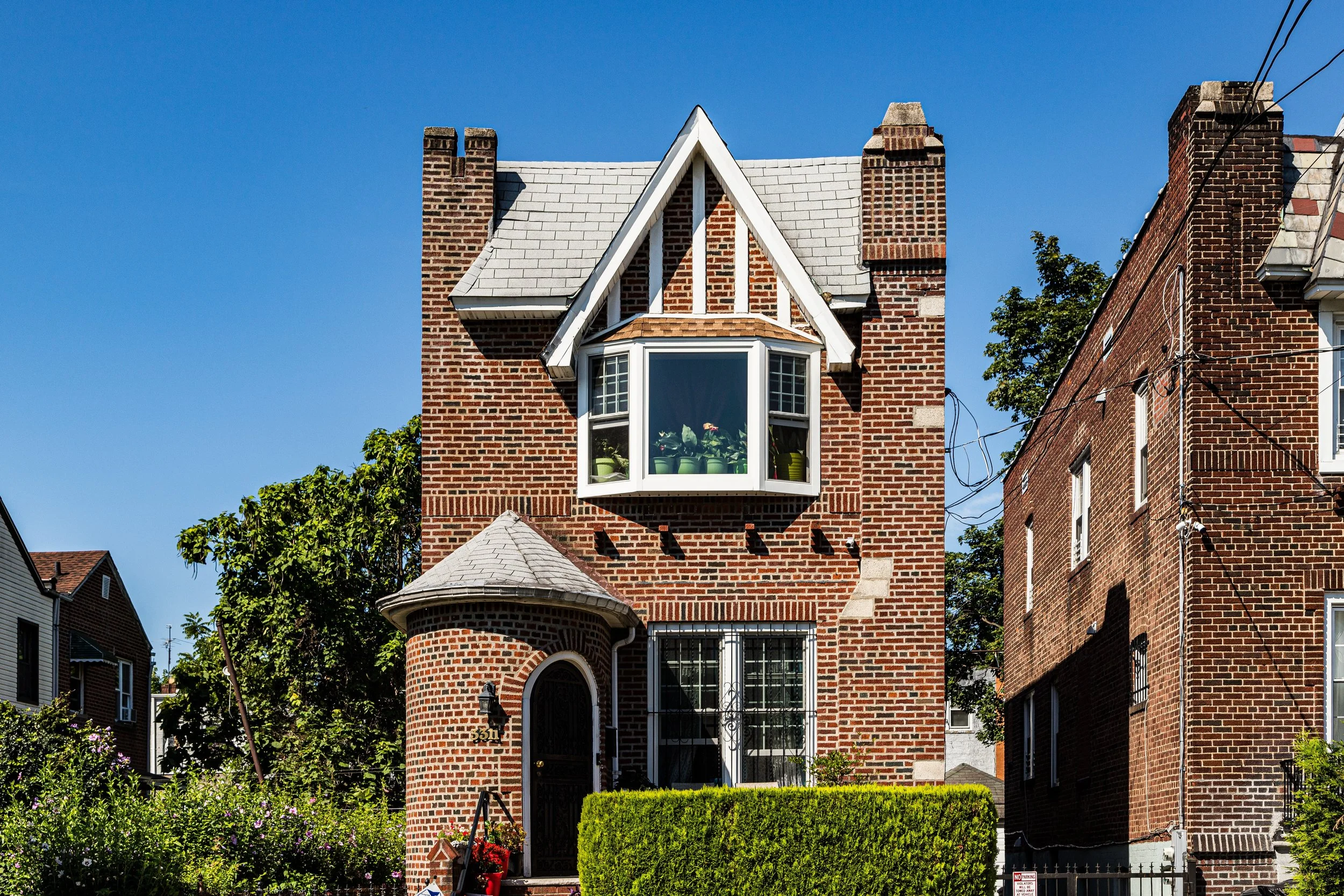
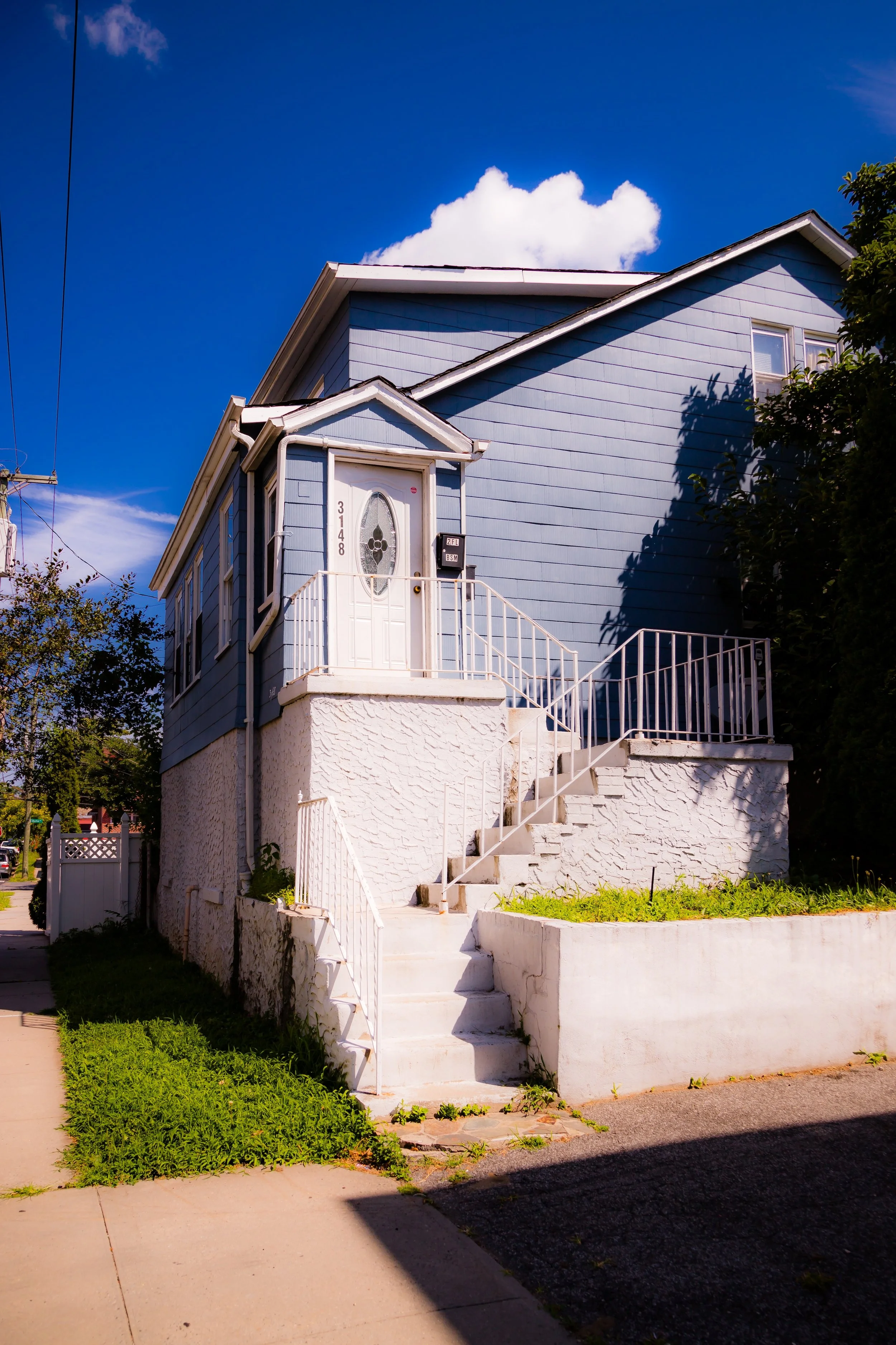
The transformation of Baychester unfolded rapidly between 1920 and 1940. Modest one- and two-family homes, many in Tudor and Colonial Revival styles, began to line newly cut streets between Boston Road and Eastchester Road. These developments catered to families leaving crowded South Bronx tenements for quieter, greener surroundings. Builders emphasized space, gardens, and proximity to transit, reinforcing the area’s suburban appeal.
In the 1930s and 1940s, infrastructure projects reshaped the local landscape. The construction of the New England Thruway created the neighborhood’s eastern boundary while linking it to the region’s expanding highway network. Boston Road became the principal commercial spine, hosting bakeries, hardware stores, and corner groceries that still characterize the corridor today. Gun Hill Road, running along the southern edge, provided access to Montefiore Hospital and the IRT 5 train, cementing Baychester’s role as a conveniently located residential enclave.
The neighborhood’s social fabric during this era was predominantly European-American, including Italian, Irish, and Jewish families who built churches, synagogues, and civic organizations that sustained local cohesion. Streets like Schieffelin Avenue and Seymour Avenue were lined with well-kept houses, stoops, and driveways—a reflection of the working-class aspiration to homeownership and permanence.
Baychester Video Coming Soon
Mid–Late 20th Century: The Valley’s Transition and Community Strength
The postwar decades brought change and challenge. As the Bronx’s demographics shifted through the 1960s and 1970s, Baychester—like much of the borough—underwent a period of racial and economic transformation. African-American and Caribbean families, many arriving from Harlem or Brooklyn, began purchasing homes from outgoing residents, bringing new traditions and energy. Despite broader urban disinvestment that scarred parts of the South Bronx, The Valley remained resilient.
Its housing stock, dominated by owner-occupied single-family homes, insulated it from the fires and abandonment that afflicted denser districts. Community organizations, including block associations and church groups, played crucial roles in maintaining stability. The area’s residents took pride in their homes and lawns, fostering a culture of self-reliance and collective care. Churches like Grace Episcopal Church on Gun Hill Road and Our Lady of the Assumption on East 223rd Street became central pillars of civic life.
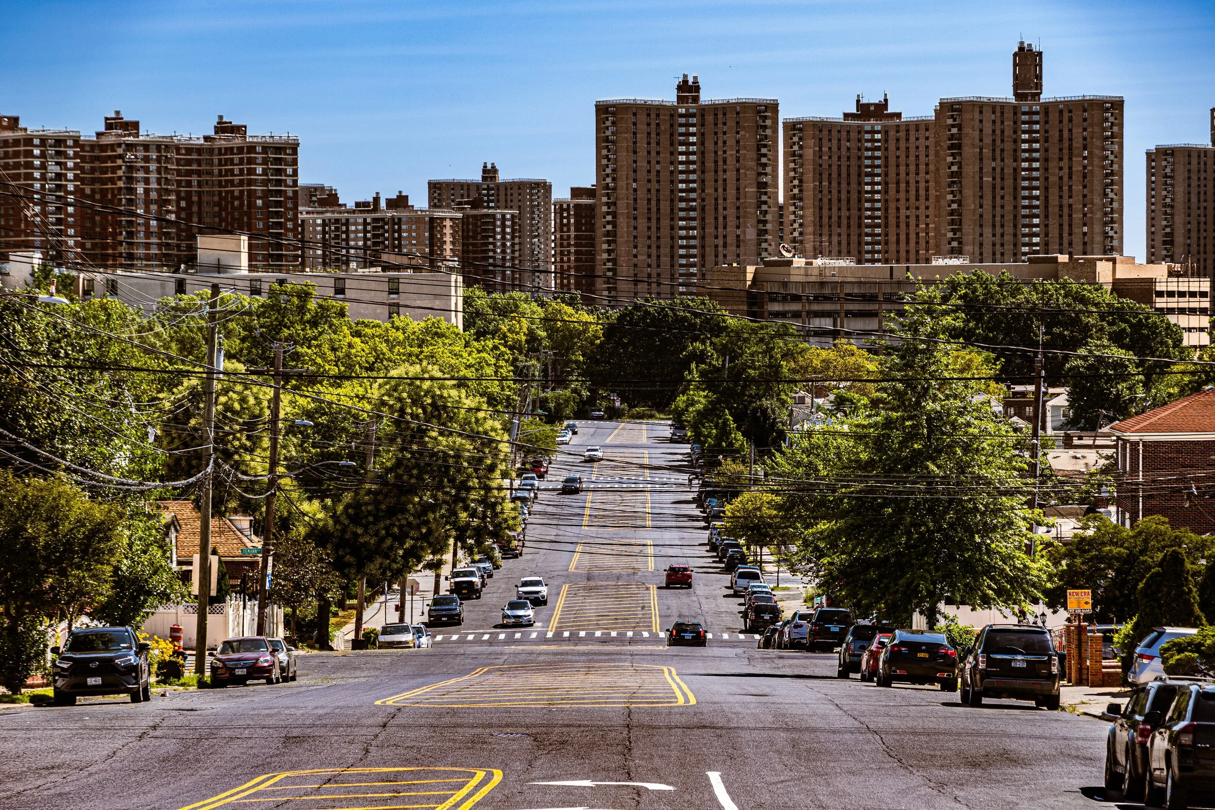
The construction of Co-op City to the east in the late 1960s introduced a massive new neighbor, reshaping local commerce and transportation patterns. While Baychester’s small scale contrasted sharply with Co-op City’s high-rise sprawl, the two areas shared economic ties: many Valley residents found employment or services in the new complex while maintaining the intimacy of their low-rise blocks.
By the 1980s and 1990s, the neighborhood had stabilized as a predominantly Black and Caribbean-American middle-class community, proud of its quiet streets and strong homeownership rates. Festivals, school events, and civic meetings reinforced a sense of neighborhood continuity that endured across generations.
21st Century: Continuity, Renewal, and Identity
In the 21st century, Baychester—especially The Valley—retains its distinct identity as one of the Bronx’s most stable and community-oriented residential enclaves. The neighborhood’s population remains diverse yet deeply rooted, with families of Caribbean, West African, Hispanic, and African-American heritage preserving the area’s long tradition of homeownership.
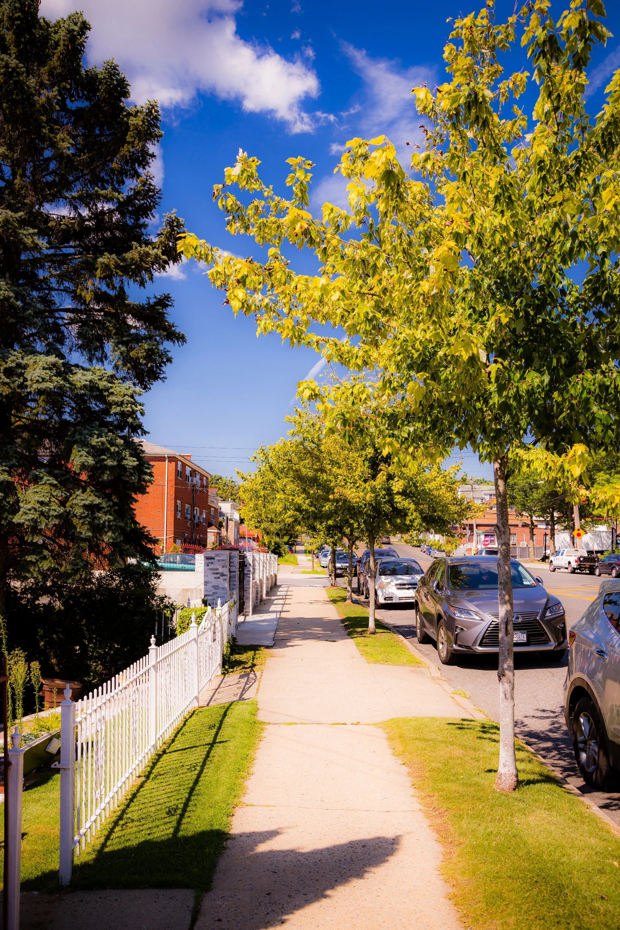
Boston Road remains the neighborhood’s primary artery, lined with long-standing small businesses, beauty salons, restaurants, and local services. The New England Thruway continues to define its eastern boundary, while Gun Hill Road connects the area to major shopping and transit hubs. Despite the proximity of large-scale developments like Co-op City, The Valley has resisted large apartment construction, retaining its low-density, suburban character—one of the Bronx’s most cohesive landscapes of detached homes and quiet streets.
New generations of residents have strengthened community institutions and improved neighborhood infrastructure through advocacy and civic engagement. Programs promoting youth mentorship, local entrepreneurship, and property restoration reflect The Valley’s commitment to its future while honoring its past.
Baychester Photo Gallery
Spirit and Legacy
The spirit of Baychester—The Valley lies in its grounded pride and enduring calm. It is a neighborhood that tells the Bronx’s story not through upheaval, but through perseverance. Here, front yards and porches, tree-lined sidewalks, and community churches speak louder than monuments. The Valley’s identity rests not in spectacle, but in the unbroken thread of people who have kept faith in their neighborhood across generations.
New York City
Use this custom Google map to explore where every neighborhood in all five boroughs of New York City is located.
The Five Boroughs
One of New York City’s unique qualities is its organization in to 5 boroughs: Manhattan, Brooklyn, Queens, The Bronx, and Staten Island. These boroughs are part pragmatic administrative districts, and part vestiges of the region’s past. Each borough is an entire county in New York State - in fact, Brooklyn is, officially, Kings County, while Staten Island is, officially Richmond County. But that’s not the whole story …
Initially, New York City was located on the southern tip of Manhattan (now the Financial District) that was once the Dutch colony of New Amsterdam. Across the East River, another city was rising: Brooklyn. In time, the city planners realized that unification between the rapidly rising cities would create commercial and industrial opportunities - through streamlined administration of the region.
So powerful was the pull of unification between New York and Brooklyn that three more counties were pulled into the unification: The Bronx, Queens, and Staten Island. And on January 1, 1898, the City of New York unified two cities and three counties into one Greater City of New York - containing the five boroughs we know today.
But because each borough developed differently and distinctly until unification, their neighborhoods likewise uniquely developed. Today, there are nearly 390 neighborhoods, each with their own histories, cultures, cuisines, and personalities - and each with residents who are fiercely proud of their corner of The Big Apple.


