PAERDEGAT
Brooklyn
Geographic Setting
Bounded by Avenue J to the north, Seaview Avenue and Paerdegat Basin to the south, and East 80th Street to the east, Paerdegat—sometimes referred to as Paerdegat Basin or Paerdegat Section—is a quiet, low-lying residential enclave in southern Brooklyn, nestled between Canarsie, Bergen Beach, and Flatlands. Its geography is defined above all by water: the long tidal inlet of Paerdegat Basin, a finger of Jamaica Bay that winds inland nearly a mile, shaping the area’s marshy southern edge and giving the neighborhood both its name and its enduring sense of place.
The landscape of Paerdegat is broad and horizontal—an expanse of tree-lined streets, low brick houses, and small lawns descending gently toward the water. The community’s main arteries, Ralph Avenue, Seaview Avenue, and East 80th Street, connect it northward to Flatlands and eastward to Canarsie, while the southern reaches open into wetlands and the Paerdegat Basin Parklands, a reclaimed estuarine habitat restored in the early 21st century. The combination of proximity to nature and suburban-style housing gives Paerdegat an atmosphere both urban and maritime—a pocket of calm at the city’s southeastern edge.
Etymology and Origins
The name Paerdegat (pronounced PAIR-duh-gat) comes from the Dutch colonial period and translates roughly to “horse gate” or “horse creek” (paardegat). The term first appeared in 17th-century maps describing the narrow, winding tidal channel that empties into Jamaica Bay, used by early Dutch settlers and Native Lenape for fishing, milling, and coastal transport.
During the 1600s–1700s, the area formed part of the Town of Flatlands, one of the original six towns of Kings County. The Dutch reclaimed and farmed its fertile but marshy soil, draining salt meadows for hay and crops. Families such as the Lott, Schenck, and Wyckoff clans—names still found on Brooklyn’s oldest streets—owned large tracts of land here, raising livestock and cultivating the rich tidal flats along Paerdegat Creek. For nearly three centuries, the creek and its surrounding fields remained rural, dotted with farmhouses, barns, and cart paths leading toward Flatbush and Jamaica Bay.
The Neighborhood
19th Century: Rural Persistence and the First Roads
Throughout the 1800s, Paerdegat remained among Brooklyn’s most pastoral districts. Its isolation from early rail and trolley lines, combined with the prevalence of marsh and bay, discouraged large-scale development. Flatbush Avenue, laid out in the early 19th century as a route from downtown Brooklyn to the Marine Parkway, was the nearest major artery; smaller roads like Mill Lane and Avenue J connected the inland farms to mills and markets.
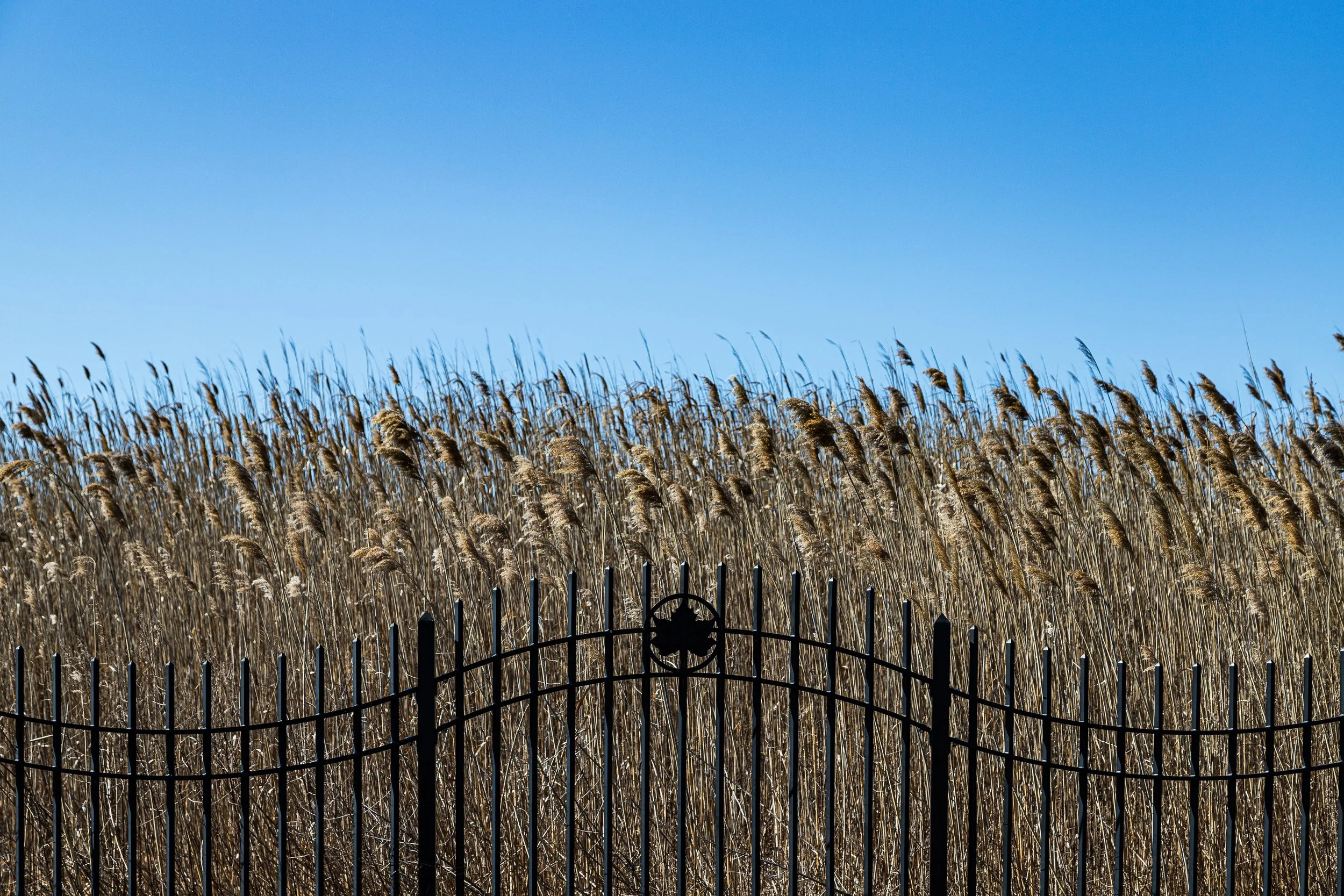
The construction of Paerdegat Basin, as it exists today, began as part of a larger 19th-century plan to dredge and extend Jamaica Bay for navigation. Although the vision of a deepwater shipping canal connecting Flatbush to the Atlantic never materialized, the Basin’s artificial widening around 1910 permanently altered the local landscape—turning what had been a natural tidal creek into a broad inlet bordered by wetlands and reeds.
Early–Mid 20th Century: From Marshland to Residential District
The transformation of Paerdegat from farmland to suburb began slowly after World War I and accelerated after World War II. As nearby Flatlands and Canarsie developed, real estate companies subdivided parcels north of Seaview Avenue and east of Ralph Avenue for housing. Drainage projects in the 1930s–1950s, part of citywide reclamation efforts led by Robert Moses, made the area habitable by filling wetlands and extending the street grid southward toward the basin.
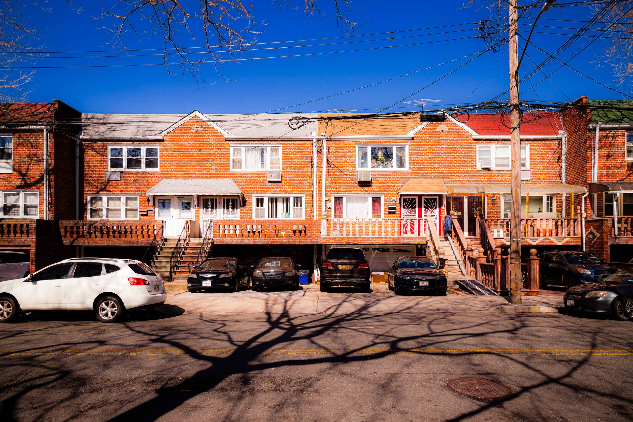
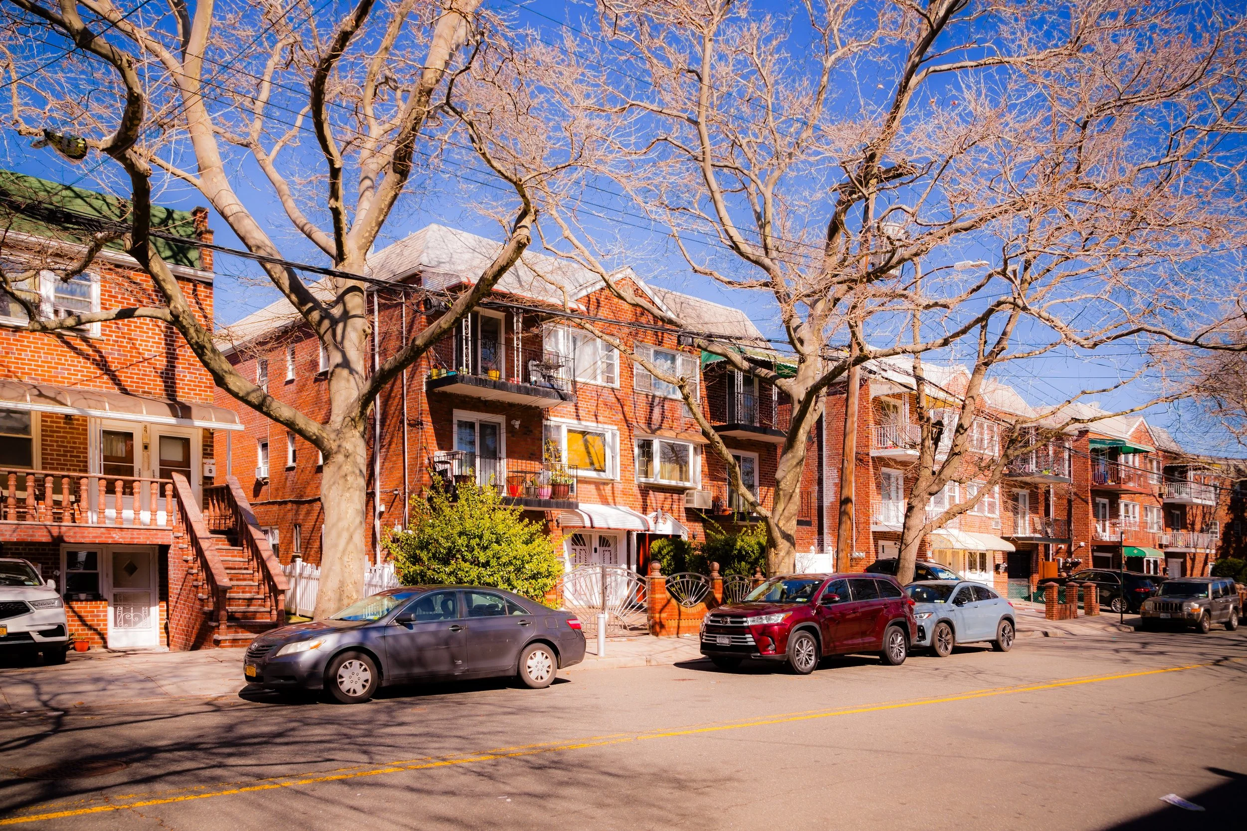
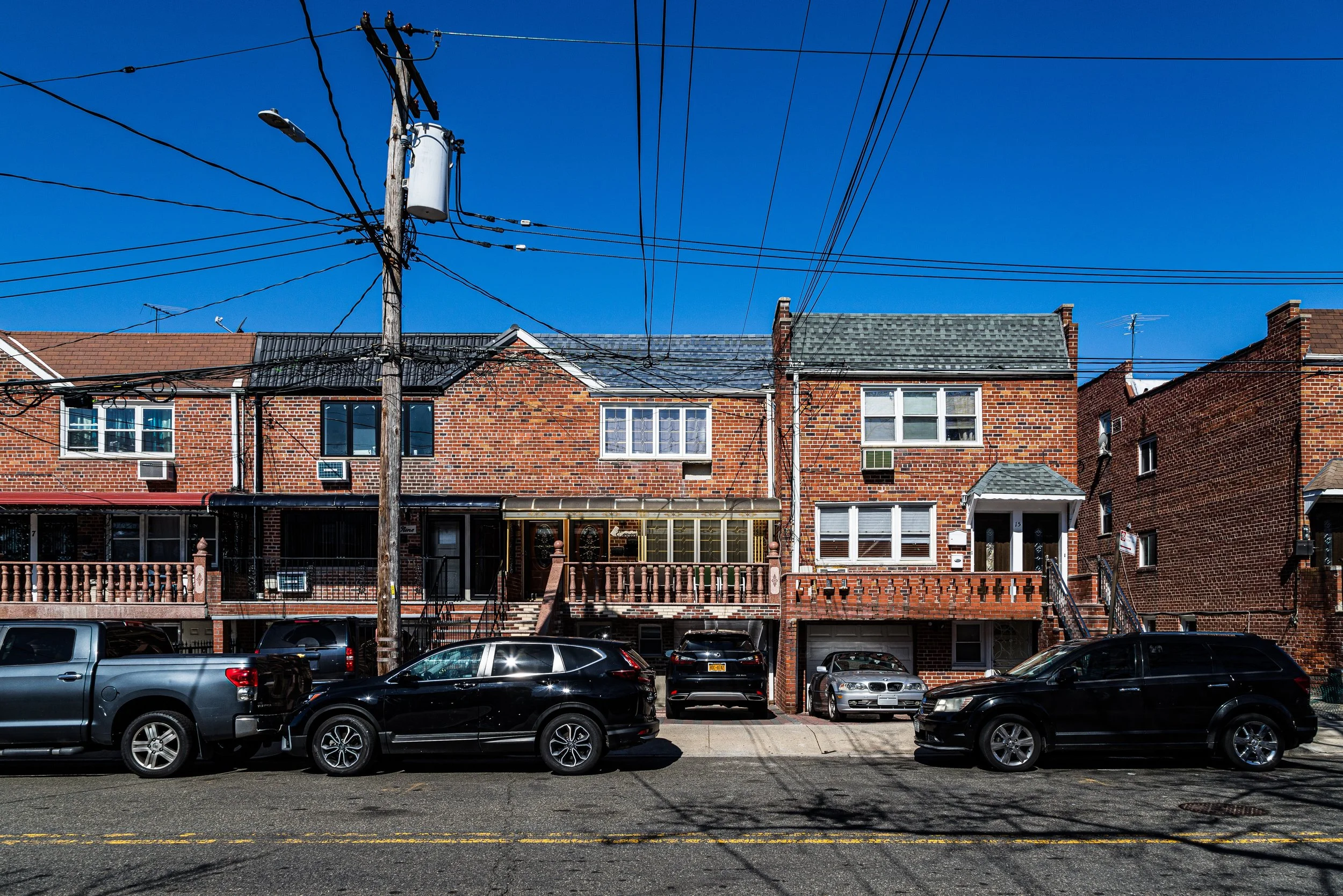
By the 1950s–1960s, Paerdegat had emerged as a small but distinct neighborhood of detached one- and two-family brick homes, with driveways, front lawns, and tree-lined sidewalks that echoed the postwar suburban ideal. Many early residents were Jewish and Italian middle-class families relocating from Crown Heights, Brownsville, or East New York, drawn by new construction and the promise of space. Public School 276 (The Louis Marshall School) and local churches and synagogues anchored community life.
The surrounding natural environment remained integral. From many backyards, residents could see the open water of Paerdegat Basin—its marshes a haven for herons and egrets, its tides a reminder of the area’s coastal fragility.
Paerdegat Photographic Video
Late 20th Century: Stability and Environmental Reckoning
Through the 1970s–1990s, Paerdegat maintained relative stability even as nearby neighborhoods faced economic decline. Its single-family homes and cohesive layout fostered a strong sense of ownership and neighborliness. The population became increasingly African American and Caribbean, with new homeowners arriving from Flatbush, Crown Heights, and the wider Caribbean diaspora. Churches and civic associations replaced the older fraternal lodges as centers of community life.
However, the area’s defining waterway—Paerdegat Basin—posed persistent environmental challenges. For decades, the basin served as a combined sewer overflow site, where heavy rains caused untreated wastewater to enter the creek. The once-clear tidal waters turned brackish and polluted, prompting local activism for cleanup and restoration.
In response, the Paerdegat Basin Combined Sewer Overflow Facility, completed in 2011 by the New York City Department of Environmental Protection, became one of the city’s largest environmental infrastructure projects. Alongside it, the Paerdegat Basin Parklands restored over 190 acres of salt marsh, meadows, and shoreline trails—reclaiming the basin’s ecological heritage and reconnecting residents to the water that had long defined their neighborhood.
21st Century: Renewal by the Water’s Edge
In the 21st century, Paerdegat stands as one of southern Brooklyn’s most stable, green, and quietly diverse neighborhoods. Its streets—East 80th through East 76th, Foster Avenue, Avenue K, and Seaview Avenue—remain lined with well-kept homes, many owned by second- or third-generation families. The area’s strong civic organizations, such as the Paerdegat Civic Association, advocate for environmental stewardship, flood resilience, and the maintenance of the new parklands.
The community’s demographics today reflect Brooklyn’s broader multicultural blend: Caribbean, Jewish, African American, and South Asian residents share a sense of pride in the neighborhood’s calm and safety. Local schools, including P.S. 233 Langston Hughes, and nearby shopping corridors along Ralph Avenue and Avenue N, reinforce the area’s self-sufficient character.
The restored Paerdegat Basin Parklands now provide walking trails, birdwatching areas, and glimpses of the wetlands’ natural rhythms. The skyline is low, the streets are quiet, and the sound of rustling reeds and distant gulls recalls the area’s origins as a Dutch creekside meadow.
Paerdegat Photo Gallery
Spirit and Legacy
The spirit of Paerdegat is one of enduring calm and ecological renewal—a neighborhood that has balanced the ambitions of urban growth with a respect for its natural foundation. From Dutch farmland to postwar suburb, from environmental neglect to restoration, Paerdegat’s story mirrors the evolution of Brooklyn itself: reclamation, resilience, and rediscovery.
New York City
Use this custom Google map to explore where every neighborhood in all five boroughs of New York City is located.
The Five Boroughs
One of New York City’s unique qualities is its organization in to 5 boroughs: Manhattan, Brooklyn, Queens, The Bronx, and Staten Island. These boroughs are part pragmatic administrative districts, and part vestiges of the region’s past. Each borough is an entire county in New York State - in fact, Brooklyn is, officially, Kings County, while Staten Island is, officially Richmond County. But that’s not the whole story …
Initially, New York City was located on the southern tip of Manhattan (now the Financial District) that was once the Dutch colony of New Amsterdam. Across the East River, another city was rising: Brooklyn. In time, the city planners realized that unification between the rapidly rising cities would create commercial and industrial opportunities - through streamlined administration of the region.
So powerful was the pull of unification between New York and Brooklyn that three more counties were pulled into the unification: The Bronx, Queens, and Staten Island. And on January 1, 1898, the City of New York unified two cities and three counties into one Greater City of New York - containing the five boroughs we know today.
But because each borough developed differently and distinctly until unification, their neighborhoods likewise uniquely developed. Today, there are nearly 390 neighborhoods, each with their own histories, cultures, cuisines, and personalities - and each with residents who are fiercely proud of their corner of The Big Apple.


