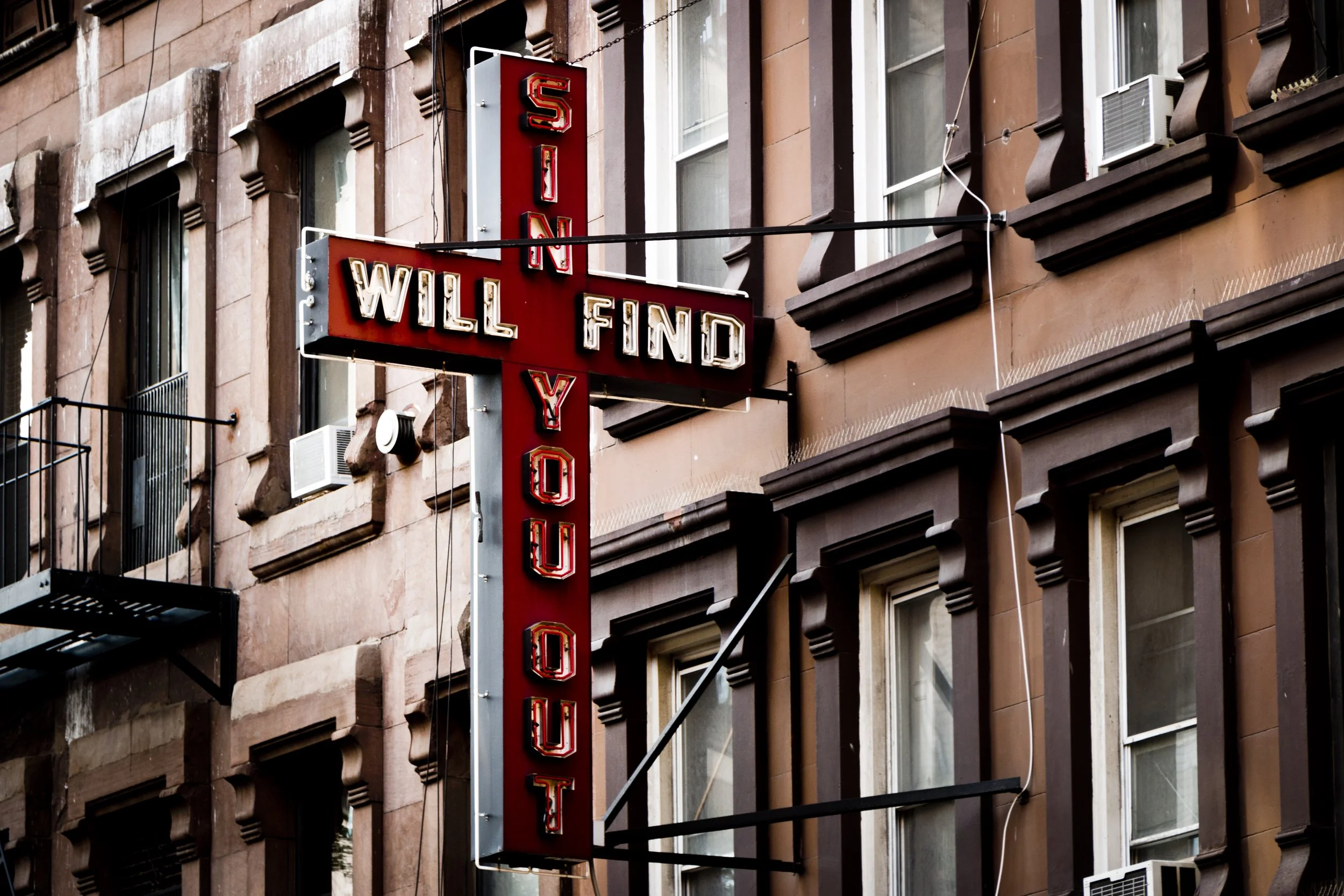
HELL’S KITCHEN (CLINTON)
Manhattan
Geographic Setting
Stretching from West 40th Street to West 59th Street, between Eighth Avenue and the Hudson River, Hell’s Kitchen—also known by the more recent civic designation Clinton—occupies a critical swath of Manhattan’s West Side, directly adjacent to the Theater District, Midtown, and the Hudson Yards waterfront. The neighborhood unfolds in a layered topography of tenements, walk-ups, brownstones, and high-rise towers, where narrow side streets lead westward to piers and parkland along the Hudson River Greenway.
Major thoroughfares structure its life: Ninth Avenue, the traditional commercial spine, still pulses with restaurants and bars; Tenth and Eleventh Avenues carry the heavier traffic of trucks and crosstown buses; and West 57th Street forms the northern portal to Midtown’s skyscrapers. To the west, the Hudson River Park and Pier 84 offer recreation and waterfront access once unthinkable in the district’s industrial past. The skyline reveals the neighborhood’s dual identity—old redbrick rowhouses in the foreground, with the glass towers of Midtown and Hudson Yards rising behind them like modern sentinels.
Etymology and Origins
The name “Hell’s Kitchen” has uncertain origins but unmistakable grit. The most common explanation traces it to the 1850s, when police officers used the phrase to describe the area’s notorious slums and gang activity. A story attributes the name to a policeman observing a riot near West 39th Street, remarking, “This place is hell itself,” to which his partner allegedly replied, “Hell’s got a mild climate—this is Hell’s Kitchen.”
The alternate name “Clinton”, adopted officially in the mid-20th century for planning and redevelopment purposes, honors DeWitt Clinton, the early 19th-century New York governor and Erie Canal visionary. While “Clinton” appears on zoning maps and community board designations, “Hell’s Kitchen” endures in popular usage—its toughness turned into a badge of authenticity.
The Neighborhood
19th Century: Docks, Tenements, and Grit
In the mid-1800s, Hell’s Kitchen was a landscape of slaughterhouses, factories, and rail yards serving the Hudson River piers. Immigrants—first Irish, later German and Italian—crowded into hastily built tenements that lined Tenth Avenue, dubbed “Death Avenue” for the frequent collisions between freight trains and pedestrians. The nearby Hudson River Railroad and New York Central freight lines made the neighborhood both vital and perilous.
By the 1870s and 1880s, it had become one of the city’s most notorious working-class quarters, home to dock laborers, brewery workers, and longshoremen who toiled under harsh conditions. Gangs such as the Gophers and Hudson Dusters ruled the alleys, and reformers like Jacob Riis photographed the area to expose its overcrowded, unsanitary housing. Yet within this hardship, strong communal networks flourished—anchored by parishes such as Holy Cross Church (West 42nd Street, founded 1852) and St. Clement’s Episcopal (founded 1830), which provided charity and stability amid poverty.
Early–Mid 20th Century: The Neighborhood Industrial Heart
The early 1900s brought both modernization and upheaval. The construction of Pennsylvania Station (1910), the West Side rail yards, and the New York Times Building (1904) to the east drew thousands of workers. Ninth Avenue’s elevated railway, later dismantled, connected residents to downtown jobs. Hell’s Kitchen became synonymous with blue-collar New York—Irish longshoremen, Italian masons, and German brewers defined its social fabric.
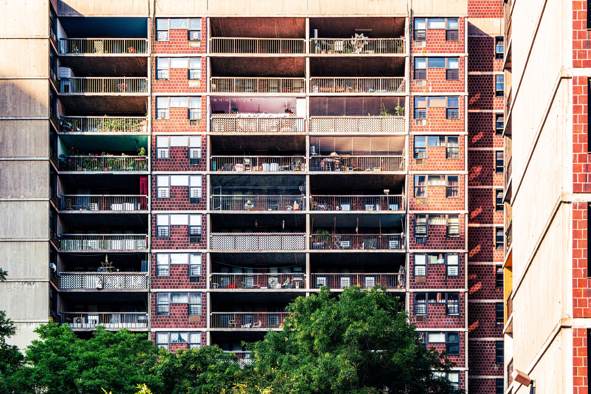
During Prohibition, its speakeasies thrived, and its reputation for toughness deepened. The 1930s–1950s saw public housing projects like the Elliot-Chelsea Houses and Harborview Terrace rise alongside tenements, as city planners sought to replace blight with modern design. DeWitt Clinton Park (opened 1905)—one of the first municipal parks named for the governor—offered the neighborhood’s children open space, while PS 111 and Sacred Heart School reinforced civic identity.
By midcentury, however, Hell’s Kitchen’s industrial backbone began to erode. The decline of the shipping industry, containerization, and the closing of many Hudson River piers in the 1960s and 1970s left the community economically strained. Yet even as jobs disappeared, residents—many second- and third-generation families—remained fiercely loyal to their neighborhood.
Hell’s Kitchen (Clinton) Photographic Tour
Late 20th Century: Resistance and Reinvention
The 1970s and 1980s marked a period of struggle and transformation. Hell’s Kitchen became a flashpoint of urban change—threatened by redevelopment plans tied to Lincoln Center to the north and the West Side Highway Project to the west. Residents, through groups such as the Clinton Planning Council, organized to prevent wholesale displacement, achieving zoning protections that preserved low-rise housing along Ninth and Tenth Avenues.
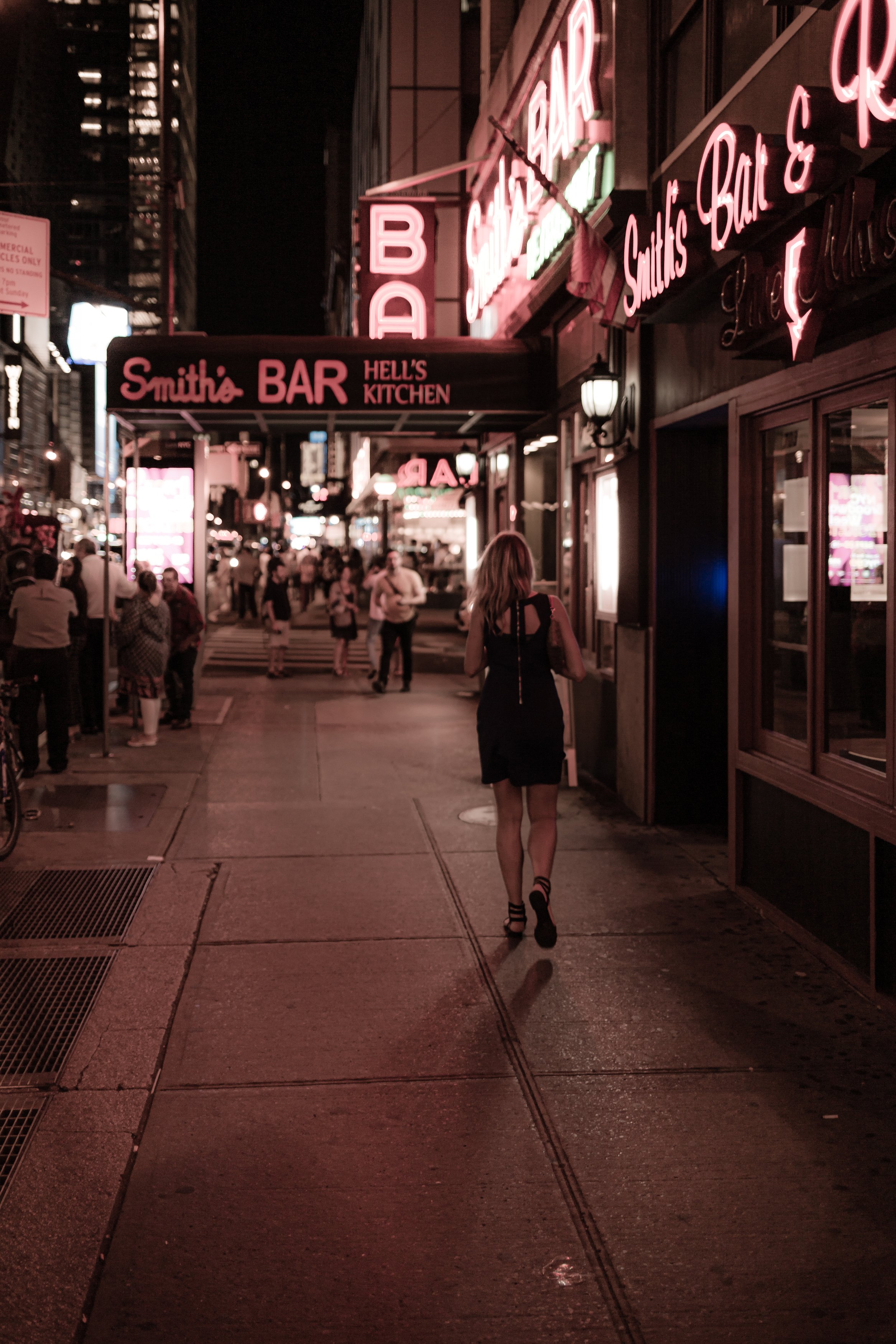
At the same time, the neighborhood’s affordability drew artists, actors, and stagehands from the nearby Theater District. Small off-Broadway venues like Theatre Row (West 42nd Street) and INTAR Theatre took root, transforming the district’s reputation from dangerous to creative. By the 1990s, Hell’s Kitchen had become a patchwork—longtime Irish and Puerto Rican families living beside newcomers from the performing arts and LGBTQ+ communities who found here a rare mix of authenticity and accessibility.
21st Century: Between History and Skyline
The 21st century has brought both revival and reckoning. Redevelopment of the Hudson Yards to the southwest and luxury towers along Eleventh Avenue have dramatically altered the skyline. Yet much of Hell’s Kitchen’s core retains its scale and spirit: four- and five-story walk-ups, family-owned delis, and the dense restaurant scene that earned Ninth Avenue its moniker as “Restaurant Row.”
The Clinton/Hell’s Kitchen Land Use Plan (1999) succeeded in balancing preservation with growth, steering high-rise development toward the avenues while protecting midblock residential character. The result is a neighborhood that now encompasses everything from subsidized artist housing to penthouse condos overlooking the river. Cultural anchors such as the Irish Arts Center, the Intrepid Sea, Air & Space Museum, and DeWitt Clinton Park celebrate both heritage and renewal.
Diversity defines the modern neighborhood: a mix of Irish, Latin American, West Indian, Asian, and creative professionals coexisting in one of Manhattan’s most varied social tapestries. Despite rising rents, Hell’s Kitchen remains a home for the ambitious and the artistic—the beating, bohemian heart of the West Side.
Hell’s Kitchen (Clinton) Photo Gallery
Spirit and Legacy
Hell’s Kitchen’s essence lies in contradiction: a place once feared, now sought after; once industrial, now creative; once marginalized, now central. It has weathered the city’s booms and busts with resilience born of working-class pride. The tension between grit and glamour remains visible in every block, from the old brick walk-ups along 46th Street to the gleaming towers on Tenth Avenue.
New York City
Use this custom Google map to explore where every neighborhood in all five boroughs of New York City is located.
The Five Boroughs
One of New York City’s unique qualities is its organization in to 5 boroughs: Manhattan, Brooklyn, Queens, The Bronx, and Staten Island. These boroughs are part pragmatic administrative districts, and part vestiges of the region’s past. Each borough is an entire county in New York State - in fact, Brooklyn is, officially, Kings County, while Staten Island is, officially Richmond County. But that’s not the whole story …
Initially, New York City was located on the southern tip of Manhattan (now the Financial District) that was once the Dutch colony of New Amsterdam. Across the East River, another city was rising: Brooklyn. In time, the city planners realized that unification between the rapidly rising cities would create commercial and industrial opportunities - through streamlined administration of the region.
So powerful was the pull of unification between New York and Brooklyn that three more counties were pulled into the unification: The Bronx, Queens, and Staten Island. And on January 1, 1898, the City of New York unified two cities and three counties into one Greater City of New York - containing the five boroughs we know today.
But because each borough developed differently and distinctly until unification, their neighborhoods likewise uniquely developed. Today, there are nearly 390 neighborhoods, each with their own histories, cultures, cuisines, and personalities - and each with residents who are fiercely proud of their corner of The Big Apple.


