LINDENWOOD
Queens
Geographic Setting
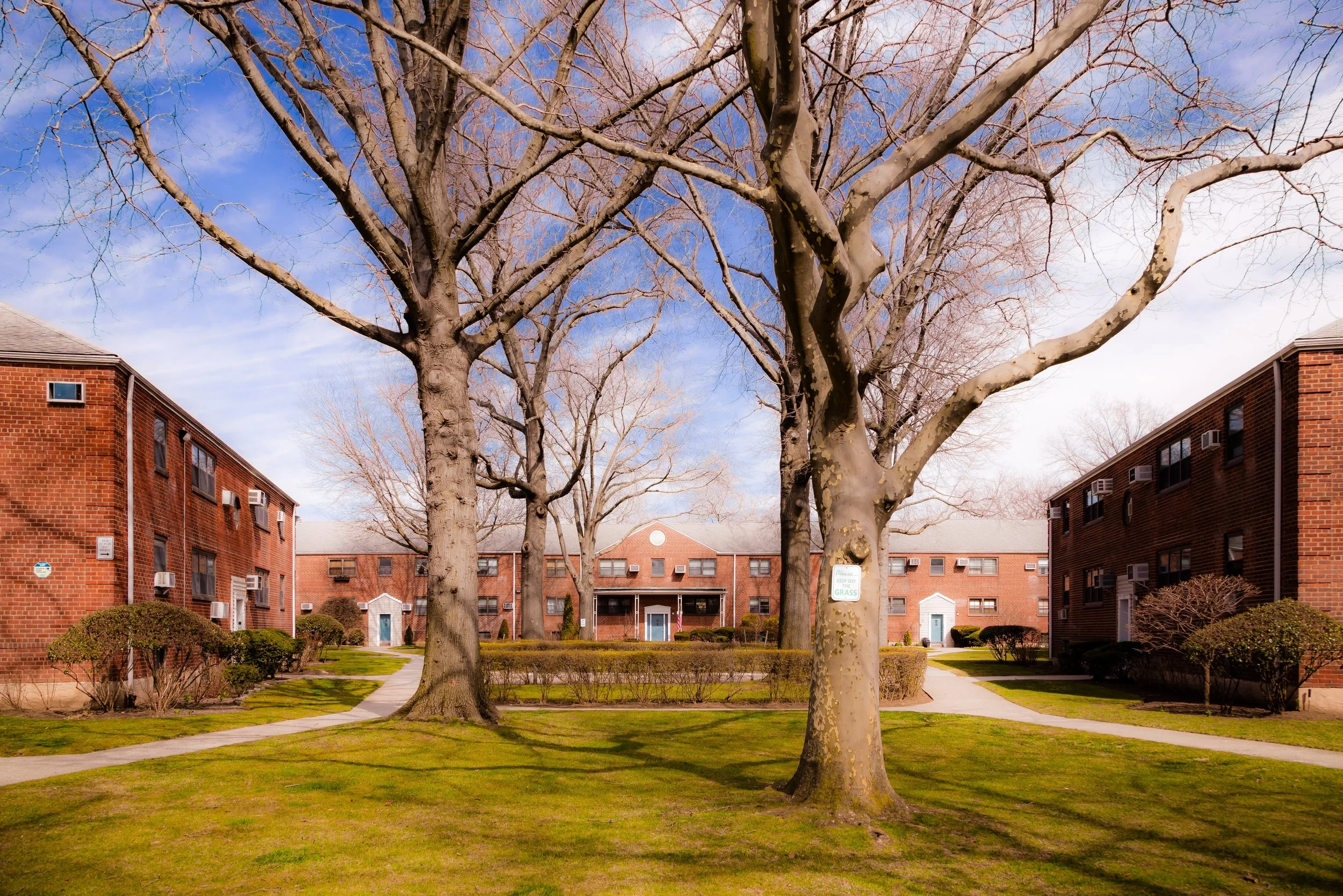
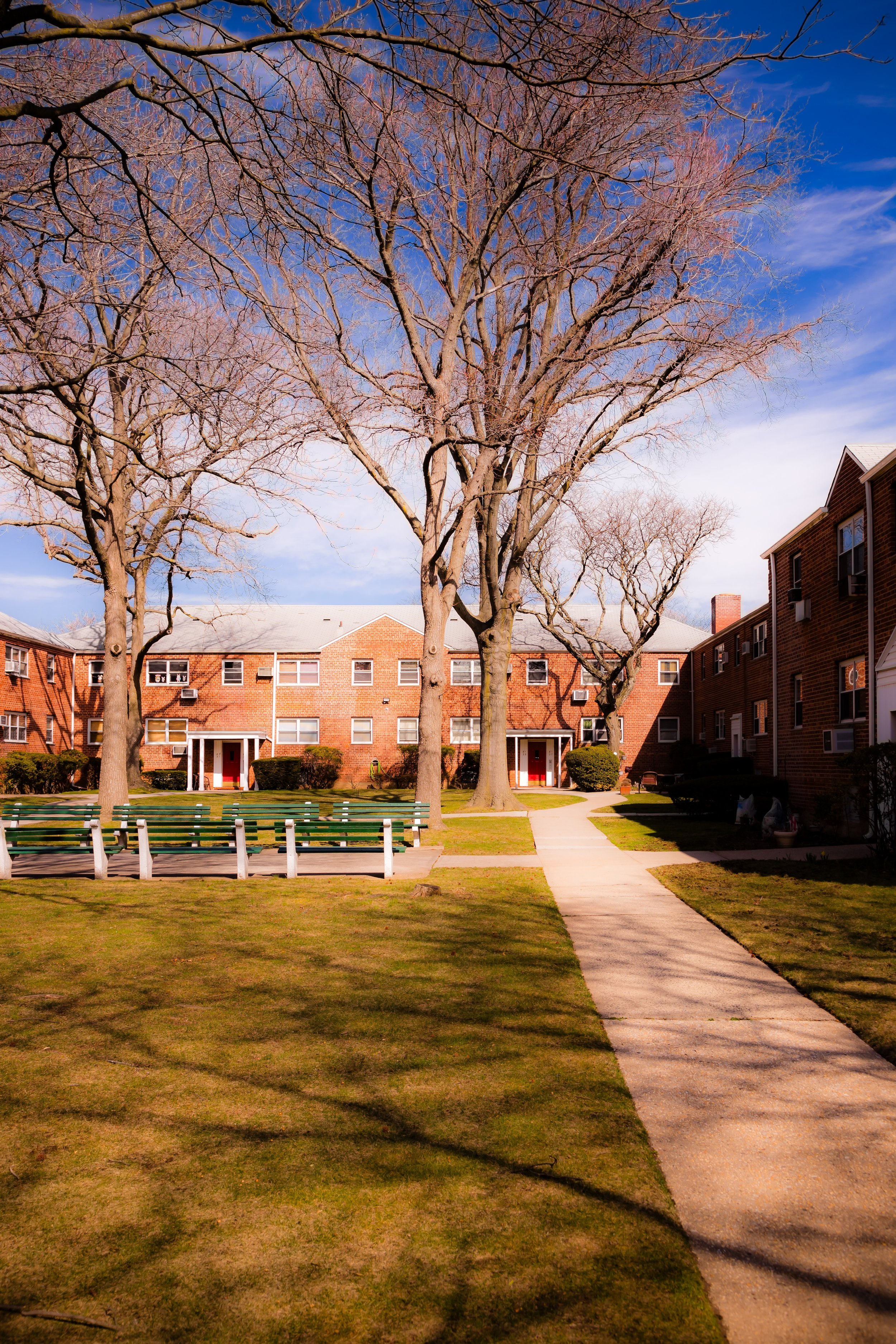
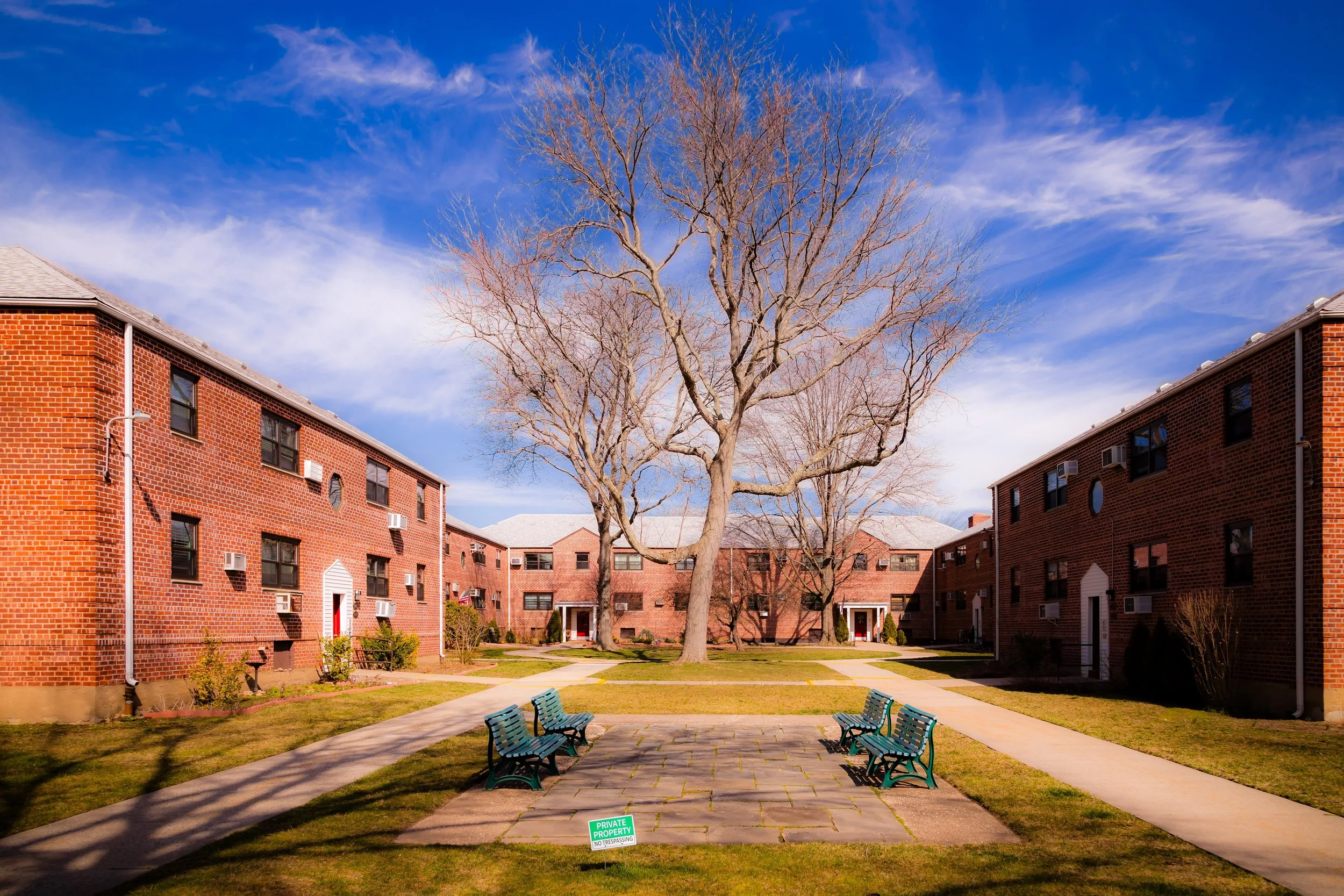
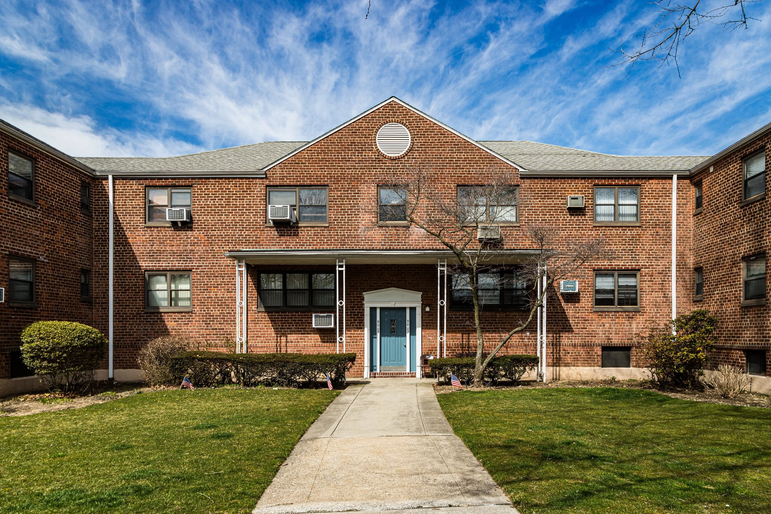
Bounded by Linden Boulevard to the north, Conduit Avenue to the northwest, the Belt Parkway to the southeast, and the Brooklyn border to the west, Lindenwood occupies a low-lying tract in the southwestern corner of Queens—a postwar residential community that blends orderly urban planning with a distinctly suburban calm. Situated between Howard Beach and Ozone Park, and just north of Jamaica Bay, Lindenwood is one of the borough’s most carefully designed mid-20th-century developments: a network of curving streets, modernist apartment houses, and tidy garden-style homes arranged around landscaped courtyards and shopping plazas.
The neighborhood’s terrain, once part of the vast Jamaica Bay marshes, was reclaimed through extensive landfilling projects in the early 20th century. Today, the grid of 80th Street, 153rd Avenue, and 157th Avenue forms its core, while the Belt Parkway and Conduit Avenue mark its outer limits, connecting Lindenwood to Brooklyn, JFK Airport, and the broader New York metropolitan area. Its residential architecture—red-brick co-ops, modest two-story homes, and low-rise condominiums—reflects the optimism of the 1950s and 1960s, when this portion of Queens was envisioned as the borough’s newest suburban frontier. Tree-lined medians, playgrounds, and walkable commercial strips create a sense of spatial openness rare within the city’s five boroughs.
Etymology and Origins
The name “Lindenwood” combines Linden Boulevard, the major arterial road along its northern edge, with a nod to the neighborhood’s park-like landscaping and newly planted linden trees that once lined its streets. The name was chosen in the 1950s by developers seeking to evoke both continuity with nearby Linden Boulevard and a suburban imagery of greenery and tranquility.
Before its development, the land now comprising Lindenwood was a mixture of tidal marshes, landfill, and former creeks connected to Jamaica Bay. For much of the 19th and early 20th centuries, the area belonged to the town of Jamaica, forming part of a sparsely populated region known as Spring Creek—a landscape of fishing shacks, small farms, and wetlands that marked the boundary between Brooklyn and Queens. The transformation of this terrain into habitable land began in the 1930s, when Robert Moses initiated massive filling operations across Jamaica Bay to create new parkland and parkway corridors, including the Belt Parkway (opened 1940).
However, large-scale residential construction did not begin until after World War II, when returning veterans and the city’s growing middle class created an urgent demand for new housing. By the mid-1950s, developers saw potential in the reclaimed lands between Ozone Park and Howard Beach—a region soon marketed as the “modern edge of Queens.”
The Neighborhood
Mid-20th Century: Planned Suburbia in the City
Lindenwood’s defining chapter began in 1956, when the Lindenwood Development Corporation, led by Benjamin Braunstein and Samuel Rosoff, launched an ambitious plan to create a self-contained residential community on 400 acres of filled land south of Linden Boulevard. Their vision combined elements of suburban design—curving roads, landscaped lots, and off-street parking—with the urban efficiency of cooperative apartment living.
The resulting development featured red-brick co-op buildings, garden-style apartments, and semi-detached single-family homes, all arranged within generous green courtyards. The architectural vocabulary was modern yet modest: flat roofs, picture windows, and minimalist ornamentation reflecting the postwar aesthetic of functionality and sunlight. Amenities such as playgrounds, schools, and local shopping centers were integrated from the start, following the “neighborhood unit” concept championed by planners of the era.
By the early 1960s, Lindenwood had attracted thousands of middle-income families—teachers, police officers, city workers, and returning veterans—many of whom relocated from Brooklyn neighborhoods such as East New York and Brownsville. The Lindenwood Shopping Center, Lindenwood Co-ops, and the Charles Park corridor provided focal points for daily life, while the area’s broad avenues offered easy access to the rest of Queens and Brooklyn. Advertisements of the time promoted Lindenwood as “a new community by the bay—where families grow in sunshine and space.”
Late 20th Century: Community Maturity and Continuity
By the 1970s, Lindenwood had settled into its mature identity as a stable, predominantly middle-class enclave. Unlike nearby industrial zones or denser urban neighborhoods, Lindenwood’s low-rise character and cooperative ownership structure helped insulate it from major economic or social upheavals. The neighborhood’s co-op boards and civic associations maintained high property standards, and local schools such as P.S. 232 (Lindenwood School) became neighborhood anchors.
Lindenwood’s population diversified steadily through the late 20th century, welcoming Italian-American, Jewish-American, and later Caribbean-American and Hispanic families who found the area’s safety, affordability, and suburban character appealing. Proximity to Howard Beach, Broad Channel, and the Rockaways reinforced its connection to Queens’ southern coastal identity.
The neighborhood’s civic life centered on its tight-knit institutions—the Lindenwood Alliance, the South Queens Civic Association, and local churches and synagogues—which organized block cleanups, tree plantings, and community fairs. Residents often described Lindenwood as a “city within a city”—a place where children could play outside safely and neighbors knew one another by name.
During the city’s fiscal crises of the 1970s and early 1980s, Lindenwood avoided the urban decay that afflicted many parts of New York. Its self-contained layout, strong community participation, and accessible location near the Belt Parkway and Cross Bay Boulevard sustained property values and continuity.
Lindenwood Video Coming Soon
21st Century: Stability, Diversity, and Quiet Resilience
In the 21st century, Lindenwood remains one of Queens’ most quietly stable neighborhoods. The original co-op developments—such as the Lindenwood Village, Lindenwood Gardens, and Lindenwood Towers—continue to be well-maintained, with many second- and third-generation residents still living in the same buildings. The tree-lined streets and manicured lawns still evoke the midcentury suburban ideal imagined by the neighborhood’s founders.
The community today reflects Queens’ broader demographic richness, with Italian-, Jewish-, Caribbean-, Russian-, and South Asian-American families sharing the same blocks. Lindenwood Shopping Center has evolved into a local hub featuring grocery stores, cafés, and small businesses that cater to a wide spectrum of residents. Meanwhile, nearby Charles Memorial Park, part of the Gateway National Recreation Area, connects the community to Jamaica Bay’s ecological landscape, offering running paths, birdwatching areas, and waterfront views.
Lindenwood’s sense of self-reliance remains strong. The Lindenwood Alliance continues to advocate for infrastructure maintenance, flood resilience, and green initiatives, while residents take pride in maintaining clean streets and landscaped medians. Despite being surrounded by major roadways, Lindenwood’s interior blocks remain peaceful, protected by their planned separation from through-traffic—a legacy of the community’s midcentury design principles..
Lindenwood Photo Gallery
Spirit and Legacy
Lindenwood’s legacy lies in its success as a planned postwar community that endured, evolving without losing its core values of safety, stability, and neighborhood pride. Conceived as a model of suburban living within city boundaries, it continues to embody that paradox gracefully: urban in geography, suburban in spirit.
New York City
Use this custom Google map to explore where every neighborhood in all five boroughs of New York City is located.
The Five Boroughs
One of New York City’s unique qualities is its organization in to 5 boroughs: Manhattan, Brooklyn, Queens, The Bronx, and Staten Island. These boroughs are part pragmatic administrative districts, and part vestiges of the region’s past. Each borough is an entire county in New York State - in fact, Brooklyn is, officially, Kings County, while Staten Island is, officially Richmond County. But that’s not the whole story …
Initially, New York City was located on the southern tip of Manhattan (now the Financial District) that was once the Dutch colony of New Amsterdam. Across the East River, another city was rising: Brooklyn. In time, the city planners realized that unification between the rapidly rising cities would create commercial and industrial opportunities - through streamlined administration of the region.
So powerful was the pull of unification between New York and Brooklyn that three more counties were pulled into the unification: The Bronx, Queens, and Staten Island. And on January 1, 1898, the City of New York unified two cities and three counties into one Greater City of New York - containing the five boroughs we know today.
But because each borough developed differently and distinctly until unification, their neighborhoods likewise uniquely developed. Today, there are nearly 390 neighborhoods, each with their own histories, cultures, cuisines, and personalities - and each with residents who are fiercely proud of their corner of The Big Apple.


