
RIVERDALE
The Bronx
Geographic Setting
Bounded by West 254th Street to the north, the Henry Hudson Parkway to the east, West 232nd Street to the south, and the Hudson River to the west, Riverdale occupies the northwestern crown of the Bronx—a landscape of steep bluffs, winding roads, and commanding river vistas that has long been synonymous with elegance, greenery, and quiet affluence. Perched high above the Hudson, the neighborhood unfolds along a series of terraces descending toward the river, its streets shaded by century-old oaks and elms.
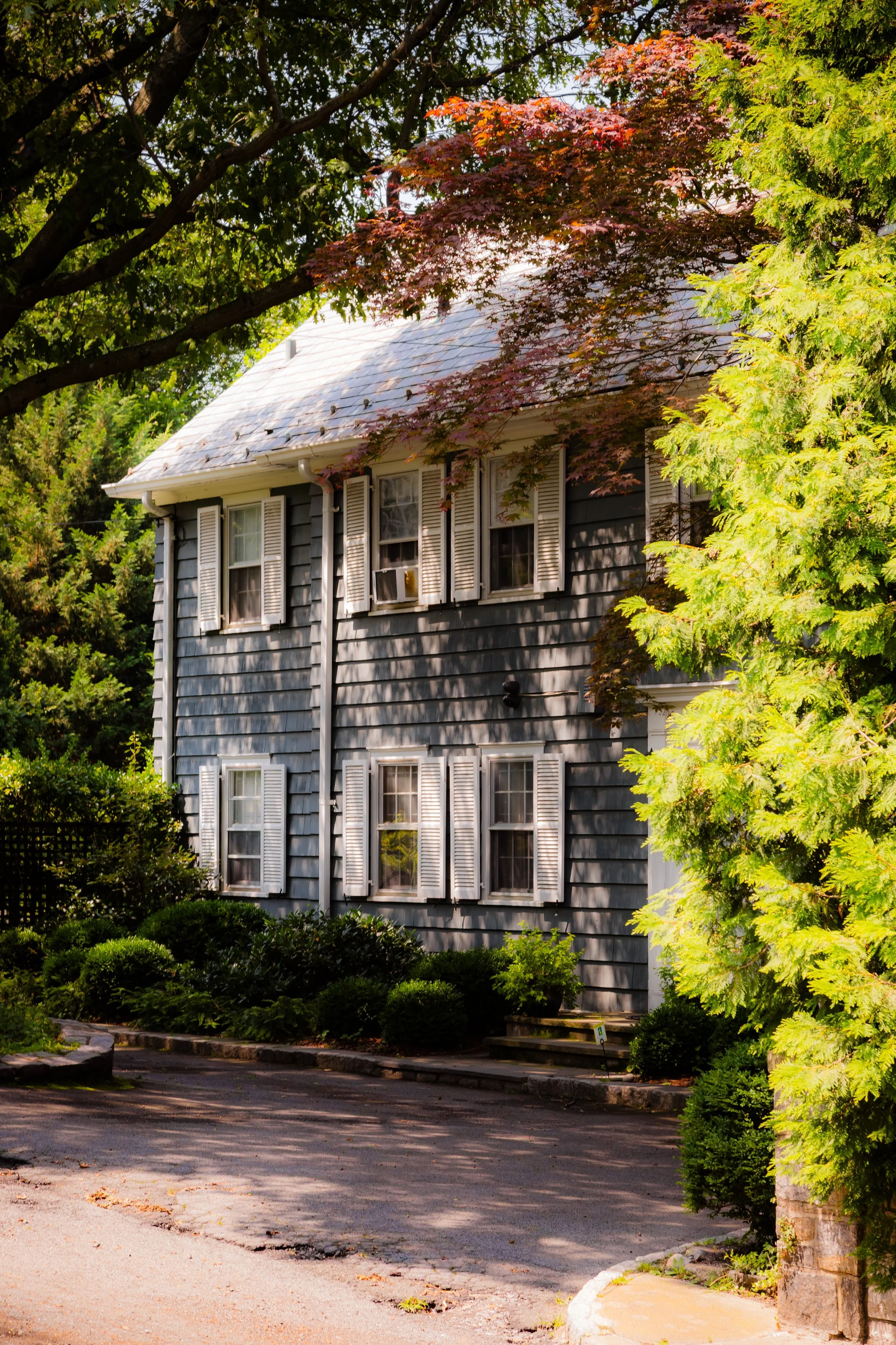
From the Henry Hudson Parkway westward, Riverdale feels almost suburban: stone walls enclose Tudor and Georgian mansions, low-rise cooperatives nestle among gardens, and private schools and houses of worship dot its hillsides. To the north lies the College of Mount Saint Vincent, overlooking the Palisades, while Wave Hill, a 28-acre estate turned public garden and cultural center, commands one of the city’s most spectacular views of the Hudson River and the cliffs of New Jersey. Independence Avenue, Palisade Avenue, and Fieldston Road meander through this verdant terrain, intersecting with smaller lanes that preserve the area’s pastoral rhythm.
Despite its reputation for serenity, Riverdale is intricately linked to the city’s flow: the Spuyten Duyvil Metro-North Station offers direct access to Manhattan, while the Henry Hudson Parkway and Broadway connect the neighborhood to Kingsbridge and the wider Bronx. It is a place where the urban and the sylvan converge—a hillside refuge that feels at once part of New York City and apart from it.
Etymology
The name “Riverdale” reflects both geography and romantic vision. The term emerged in the mid-19th century, when wealthy New Yorkers built summer estates along the Hudson River and dubbed the district “the dale by the river.” It was first recorded in the 1840s, likely as a deliberate echo of the era’s pastoral ideal—an American Eden of rolling lawns and river views.
The name encapsulated the neighborhood’s essence from its inception: a place shaped by its proximity to the Hudson, and by a longing for natural beauty within reach of the city’s energy.
The Neighborhood
Origins through the 19th Century
Before its transformation into a country retreat, the land that became Riverdale was part of the Philipse Manor estate, later divided among local farmers after the American Revolution. The area remained sparsely populated until the Hudson River Railroad (1850) opened service between Manhattan and Albany, passing along the riverfront below the bluffs. This new accessibility transformed Riverdale overnight.
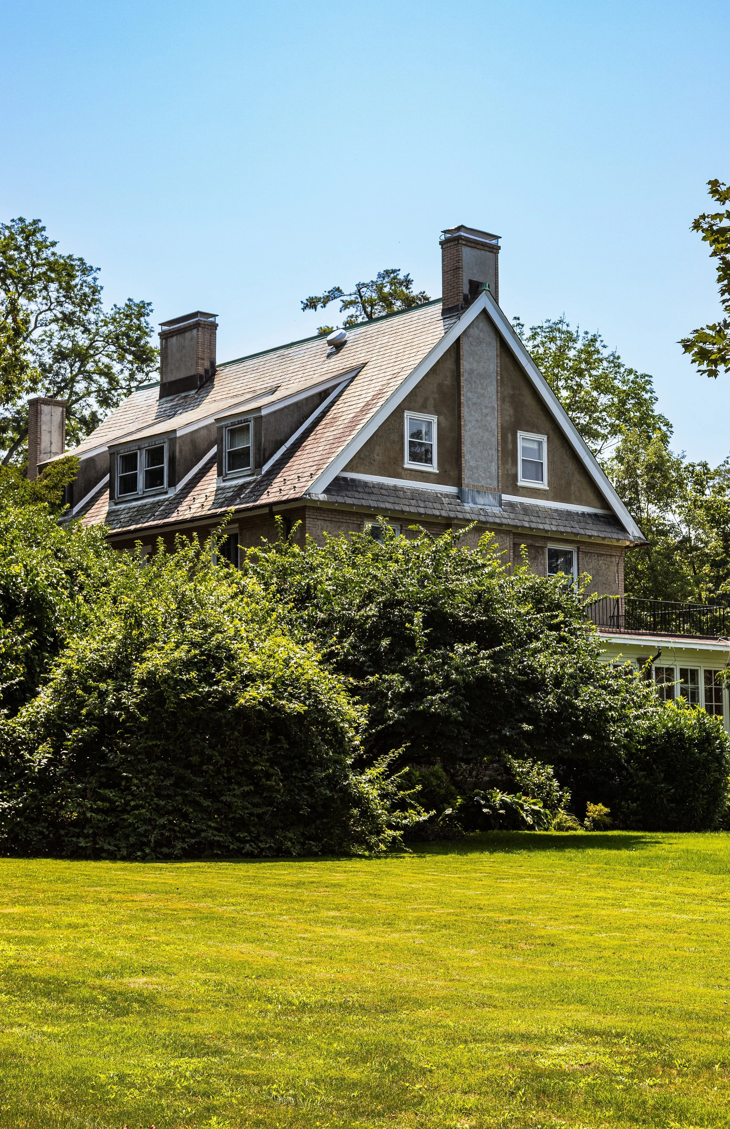
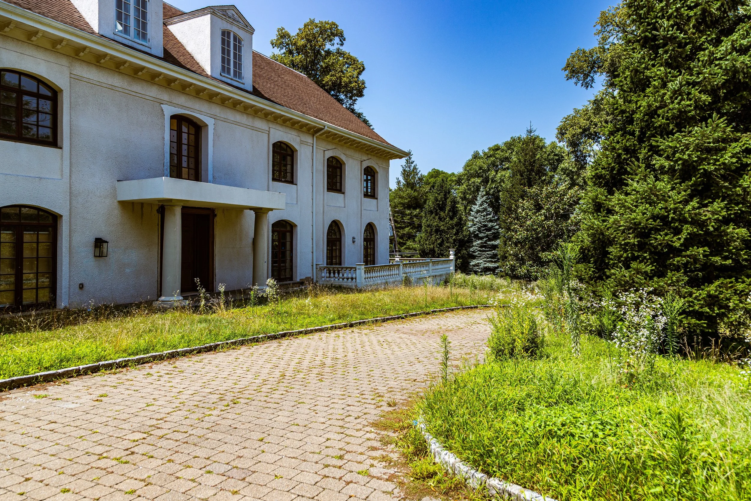
By the 1850s and 1860s, the city’s merchant and professional elite began establishing grand summer residences here, seeking refuge from the crowded streets of Manhattan. Among them was William Appleton, who built the famed Villa Belden, and Moses Hicks Grinnell, whose estate helped define the early Riverdale colony. These mansions—often built in Italianate, Gothic Revival, and Second Empire styles—crowned the ridges overlooking the Hudson, with sweeping lawns sloping toward the river and carriage drives winding through groves of oak and chestnut.
Riverdale quickly gained a reputation as a genteel enclave, its residents connected by both wealth and a shared appreciation for landscape. The completion of the Spuyten Duyvil Railroad Station cemented its status as a commuter suburb decades before the concept became common, allowing daily travel to lower Manhattan in under an hour.
Early 20th Century: Suburban Ideals and Institutional Anchors
As New York City consolidated and expanded northward, Riverdale evolved from an estate district into a planned suburban community. The Henry Hudson Parkway, conceived in the 1920s and completed in the 1930s, both defined and preserved the area—channeling traffic along its eastern boundary while protecting its western slopes from dense development.
In these years, new residential forms appeared: Tudor-style houses, Colonial Revivals, and prewar co-operative apartment buildings, blending suburban and urban sensibilities. Civic landmarks like the Riverdale Presbyterian Church and Seton Park anchored communal life, while prestigious institutions—the Ethical Culture Fieldston School (est. 1928), Horace Mann School (1887), and Riverdale Country School (1907)—established the neighborhood as a center of progressive education.
Cultural and philanthropic families, including the Schiff, Lehman, and Loeb dynasties, made Riverdale their home, fostering a climate of civic engagement and intellectual life. The construction of the College of Mount Saint Vincent (1847) and Manhattan College (moved to Riverdale in 1922) added to the district’s institutional gravitas.
During this period, Wave Hill, the former estate of financier George Perkins, became an informal social and artistic hub, hosting figures such as Mark Twain, Teddy Roosevelt, and conductor Arturo Toscanini—all drawn to the serenity of the Hudson vistas.
Riverdale Video Coming Soon
Mid–Late 20th Century: Preservation and Prestige
Through the postwar decades, Riverdale remained a bastion of stability amid the Bronx’s sweeping transformations. Its combination of zoning restrictions, geographic isolation, and high property values insulated it from the disinvestment that afflicted many southern neighborhoods. The community, historically Jewish, Irish, and Italian-American, expanded in the mid-20th century to include African-American and Latino professionals, maintaining its tradition of upward mobility and inclusion through education.
The 1950s–1970s saw the rise of modernist apartment towers along the Parkway and Palisade Avenue—Skyview-on-the-Hudson, Whitehall, and Hudson Towers—designed to offer panoramic views while preserving open space. At the same time, preservationists began organizing to protect Riverdale’s historic architecture and natural landscape. The Riverdale Historic District, designated in 1990, enshrined many of the 19th-century estates and early 20th-century homes that defined the area’s original character.
As the South Bronx burned in the 1970s, Riverdale became a symbol of continuity—a community that held fast to civic order and neighborhood identity. Residents formed associations to maintain parks, monitor development, and support local schools. Its reputation as the “green crown of the Bronx” became both a badge of pride and a promise of permanence.
21st Century: Green Living and Civic Renewal
In the 21st century, Riverdale continues to embody a distinctive blend of urban access and suburban calm. Its leafy streets and river views have attracted new generations of professionals, academics, and artists. While property values have soared, the community remains rooted in its long-standing ethos of civic responsibility and environmental stewardship.
The Wave Hill Public Garden and Cultural Center, now operated by the city, has become a centerpiece of Bronx cultural life, hosting exhibitions, concerts, and horticultural programs. Seton Park, Riverdale Park, and the nearby Spuyten Duyvil Shorefront provide green space for recreation, while the Bronx Greenway project has reconnected portions of the neighborhood to its waterfront.
Riverdale’s diversity has deepened in recent decades, with Jewish, Latino, Asian, African-American, and Caribbean residents all contributing to the neighborhood’s dynamic civic culture. The community’s schools, synagogues, and churches remain vital institutions, fostering a sense of continuity that transcends change.
Efforts to preserve the natural bluffline and prevent overdevelopment continue, balancing modernization with the historic principle that has guided Riverdale since its founding: the harmony between architecture and landscape.
Riverdale Photo Gallery
Spirit and Legacy
The spirit of Riverdale lies in its union of elevation—literal and figurative. It is a neighborhood born from vision and sustained by care, a place where wooded hills and human aspiration meet above the Hudson. Its streets still echo the 19th-century dream of a life of beauty and thoughtfulness at the city’s edge, and its enduring greenery reminds residents of what New York, at its best, can be: cultivated, communal, and quietly grand.
New York City
Use this custom Google map to explore where every neighborhood in all five boroughs of New York City is located.
The Five Boroughs
One of New York City’s unique qualities is its organization in to 5 boroughs: Manhattan, Brooklyn, Queens, The Bronx, and Staten Island. These boroughs are part pragmatic administrative districts, and part vestiges of the region’s past. Each borough is an entire county in New York State - in fact, Brooklyn is, officially, Kings County, while Staten Island is, officially Richmond County. But that’s not the whole story …
Initially, New York City was located on the southern tip of Manhattan (now the Financial District) that was once the Dutch colony of New Amsterdam. Across the East River, another city was rising: Brooklyn. In time, the city planners realized that unification between the rapidly rising cities would create commercial and industrial opportunities - through streamlined administration of the region.
So powerful was the pull of unification between New York and Brooklyn that three more counties were pulled into the unification: The Bronx, Queens, and Staten Island. And on January 1, 1898, the City of New York unified two cities and three counties into one Greater City of New York - containing the five boroughs we know today.
But because each borough developed differently and distinctly until unification, their neighborhoods likewise uniquely developed. Today, there are nearly 390 neighborhoods, each with their own histories, cultures, cuisines, and personalities - and each with residents who are fiercely proud of their corner of The Big Apple.


