BEDFORD PARK
The Bronx
Geographic Setting
Bounded by East 198th Street to the southwest, the Grand Concourse to the northwest, Mosholu Parkway to the northeast, and Webster Avenue to the southeast, Bedford Park lies near the heart of the Bronx’s northern uplands—a neighborhood of shaded streets, prewar apartment houses, and quiet intellectual energy. Nestled between the vast green corridors of Bronx Park and Van Cortlandt Park, the district forms a natural and cultural crossroads: suburban in its calm, urban in its density, and distinguished by its proximity to some of the borough’s greatest educational and architectural landmarks.
Mosholu Parkway, lined with mature trees and pedestrian promenades, defines Bedford Park’s northern border and links it seamlessly to surrounding parklands. The Grand Concourse, once known as the “Park Avenue of the Bronx,” marks its western edge with graceful Art Deco façades and apartment buildings that recall an era of civic grandeur. To the southeast, Webster Avenue carries a more industrial rhythm, while interior streets—Bedford Park Boulevard, Villa Avenue, and Valentine Avenue—wind through a neighborhood that balances historic charm with lived-in familiarity. Its small businesses, delis, and Dominican cafés mix with stately co-ops and academic institutions, producing a microcosm of Bronx history and cosmopolitanism.
Etymology
The name “Bedford Park” was chosen in the 1870s by real estate developers who sought to evoke English gentility and suburban refinement. It likely drew inspiration from Bedford Park, London, one of the world’s first garden suburbs, which embodied ideals of green space, architecture, and domestic tranquility. By attaching the same name to a tract of Bronx farmland north of Fordham, the developers hoped to attract middle-class families seeking rural peace within commuting distance of Manhattan.
The name’s endurance speaks to the developers’ success: even as the neighborhood urbanized, “Bedford Park” continued to signify leafy calm and intellectual aspiration—a “park within the city” that balanced nature with the order of planned streets.
The Neighborhood
Origins
Before urbanization, the land that became Bedford Park was part of the Manor of Fordham, a colonial-era estate owned by John Archer and later by the Valentine and Webster families, whose names remain etched into local streets. Through the 19th century, the area’s rolling hills and proximity to the newly constructed New York and Harlem Railroad (now the Metro-North Harlem Line) made it attractive for country estates and farms.
The transformation began after the annexation of the western Bronx into New York City in 1874, when developers such as Loring Andrews and Benjamin Briggs subdivided farmland north of Fordham Road into residential plots. Their intention was to create a commuter suburb for professionals working in Manhattan—a tranquil enclave reached by horsecar and rail. They named the development “Bedford Park,” laid out curving roads, and advertised its healthful air and proximity to the new Bronx Park, whose zoo and botanical garden were then being planned.
By the 1890s, the extension of the Third Avenue Elevated Line and the opening of the Bedford Park Station (now on the Metro-North Harlem Line) anchored the community’s identity as an accessible but self-contained residential haven.
Early 20th Century: A Garden Suburb in the City
The early 1900s marked Bedford Park’s transformation from a suburban development to an urban neighborhood, though it retained its distinctive greenery and architectural grace. The construction of the Grand Concourse (1909) on the neighborhood’s western edge—modeled on Parisian boulevards—ushered in a new wave of elegant Art Nouveau and Art Deco apartment houses, built for the city’s rising middle class.
At the same time, the New York Botanical Garden (founded 1891) and Bronx Zoo (opened 1899) flourished within nearby Bronx Park, transforming the area into an educational and cultural hub. The Academy of Mount St. Ursula, one of the Bronx’s oldest Catholic schools, and later the Bronx High School of Science (founded 1938), added to Bedford Park’s reputation as a center of learning. The presence of Lehman College (formerly Hunter College’s Bronx campus, opened 1931) further deepened this academic atmosphere, making the neighborhood a magnet for educators, students, and professionals.
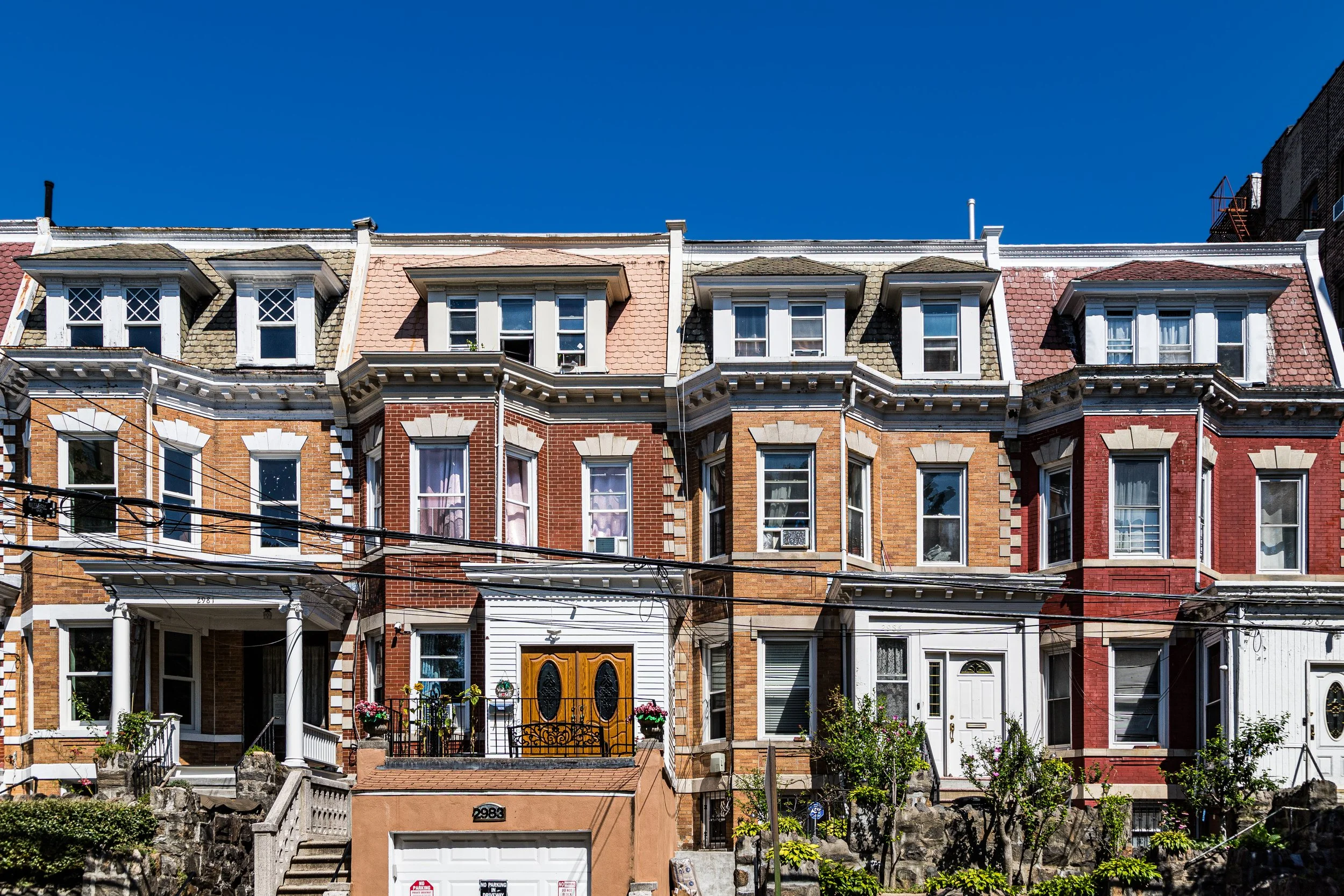
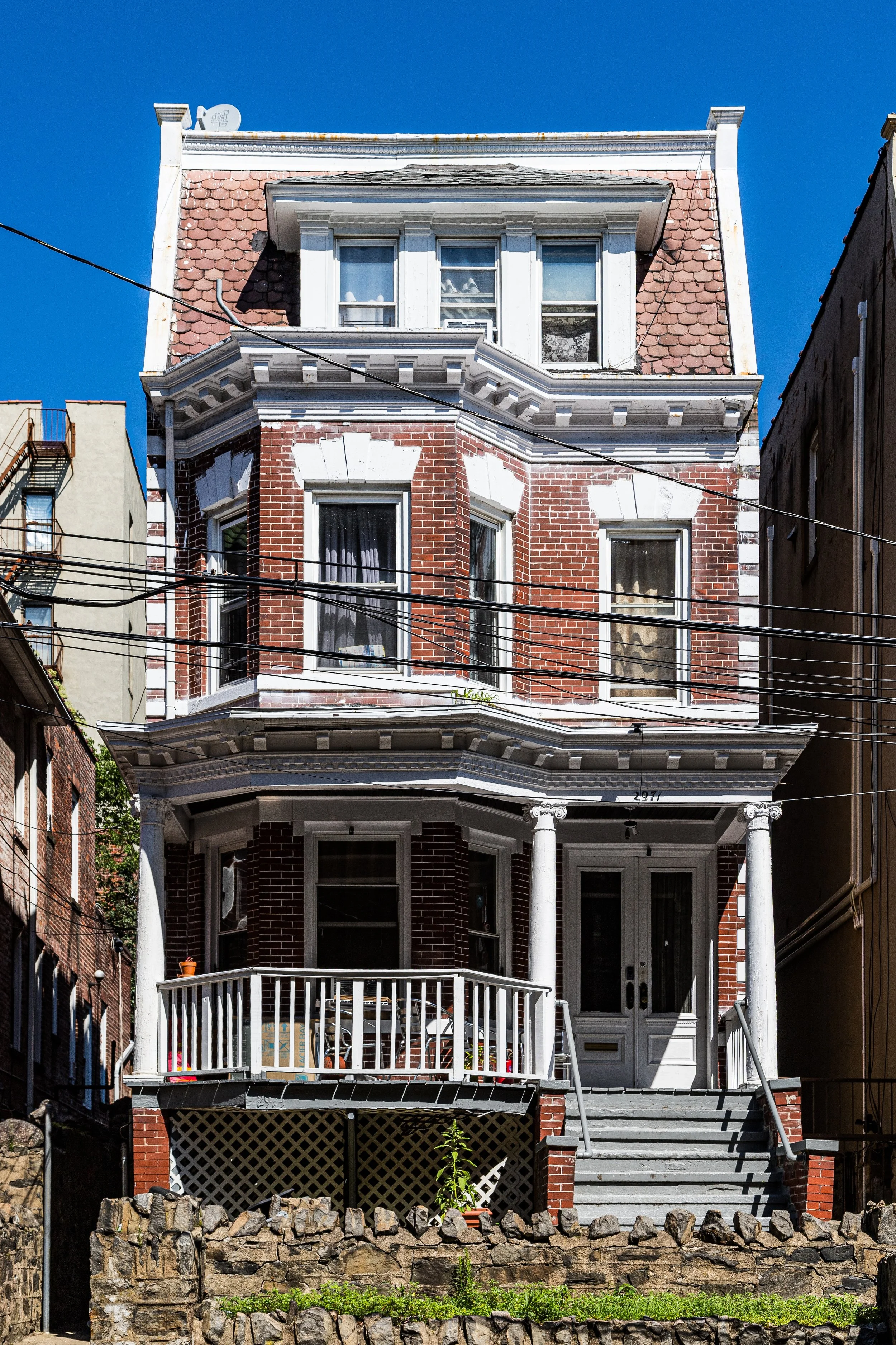
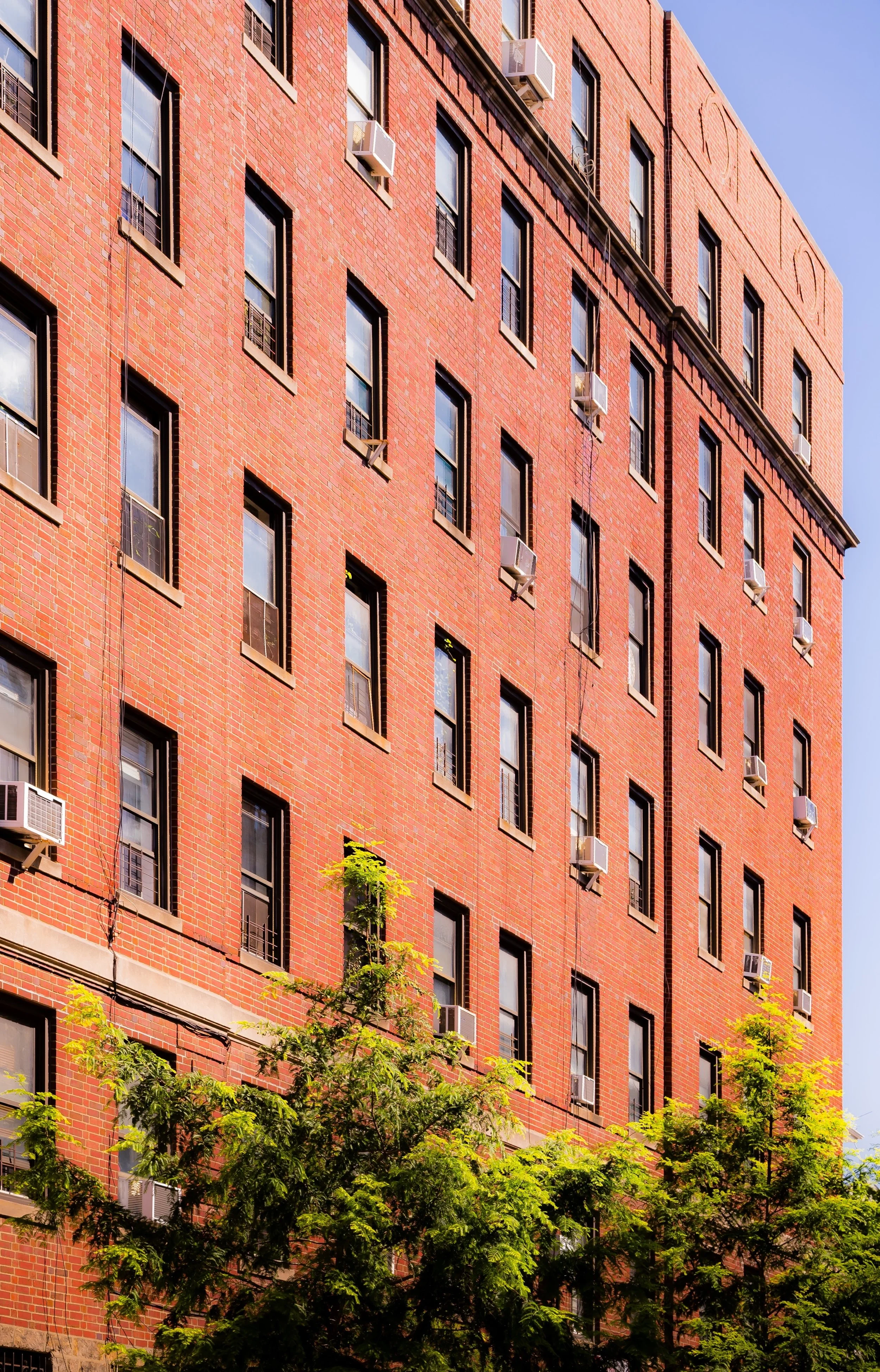
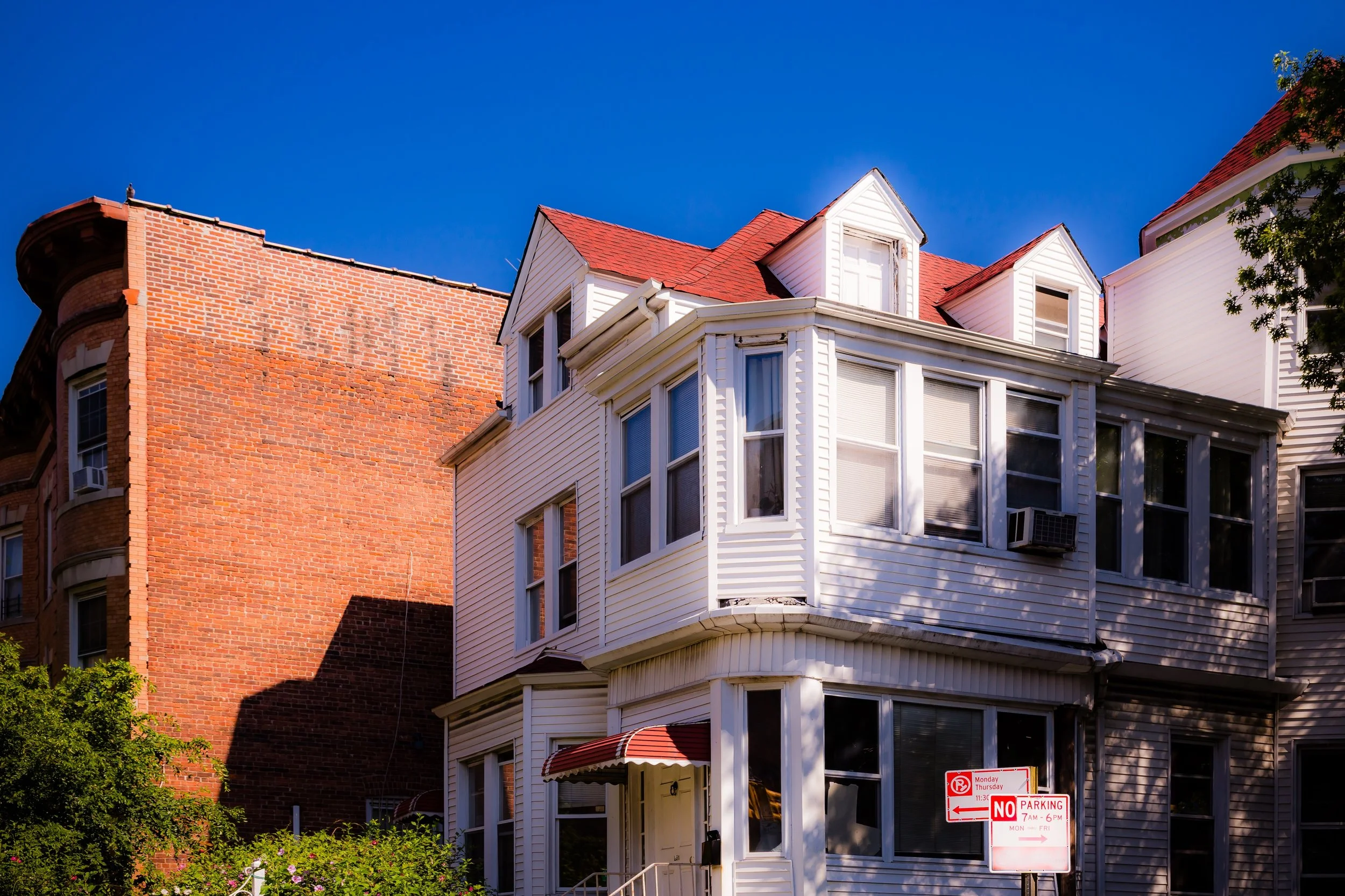
During this period, Bedford Park’s housing stock diversified. Tree-lined avenues such as Villa Avenue, Bedford Park Boulevard, and Decatur Avenue filled with prewar brick apartment buildings—many with decorative lobbies and courtyards. Smaller attached homes, built between 1910 and 1930, maintained the area’s residential intimacy, while corner stores and bakeries anchored street life.
Bedford Park Video Coming Soon
Mid-20th Century: Continuity and Cultural Confluence
By the 1940s and 1950s, Bedford Park had settled into its identity as a middle-class enclave, home to a mix of Jewish, Irish, and Italian families. The neighborhood’s architecture—graceful, cohesive, and human-scaled—embodied the civic optimism of the Bronx’s golden age. Residents commuted to Manhattan by subway or Metro-North, attended performances at the nearby Loew’s Paradise Theater on the Grand Concourse, and gathered in local institutions like Our Lady of Refuge Church (established 1933) and the Bedford Park Congregational Church.
The postwar years brought subtle demographic shifts as Puerto Rican and Dominican families arrived, joining earlier generations in what became a mosaic of ethnic and cultural identities. While parts of the Bronx suffered urban decline during the 1970s, Bedford Park—bolstered by its institutions, transit access, and relatively stable housing stock—remained resilient. Its proximity to Lehman College and the New York Botanical Garden helped sustain community pride and a sense of place.
The neighborhood’s elevated vantage—just above the lowlands of Fordham—earned it the enduring moniker “The Park on the Hill.” Even as the city’s fortunes fluctuated, Bedford Park retained its leafy calm, its tree canopy thick enough to muffle the sounds of Webster Avenue traffic and the rumble of the 4 and D trains.
Late 20th–21st Century: Renewal and Resilience
In the 1980s and 1990s, Bedford Park became a model of Bronx renewal. Community groups and homeowners fought successfully to preserve the area’s prewar architecture and improve quality of life. The Bedford Mosholu Community Association, founded in 1975, played a crucial role in promoting safety, cleanliness, and civic engagement, while new generations of residents—many of Dominican, Bangladeshi, or West African descent—added to the area’s rich multicultural fabric.
By the 21st century, Bedford Park had emerged as one of the Bronx’s most desirable neighborhoods for families and students alike. Its proximity to Lehman College, the Botanical Garden, and Fordham University has given it a steady academic presence, while Bedford Park Boulevard and Webster Avenue have reasserted themselves as thriving local corridors of commerce and culture. Cafés, bodegas, bookstores, and eateries representing cuisines from the Caribbean to South Asia enliven its corners.
Architecturally, the neighborhood remains remarkably intact. The grand apartment houses along the Grand Concourse, the prewar buildings of Mosholu Parkway, and the compact blocks near Decatur Avenue together create one of the Bronx’s most cohesive historic landscapes. The combination of greenery, accessibility, and architectural integrity continues to draw new residents who see in Bedford Park a microcosm of the Bronx’s broader story—diverse, adaptive, and enduring.
Bedford Park Photo Gallery
Spirit and Legacy
The spirit of Bedford Park lies in its balance of the urban and the pastoral, the intellectual and the everyday. It has long been a place where teachers, students, and working families live side by side, framed by parks and libraries, cathedrals and corner cafés. The hum of the subway fades beneath the rustle of leaves on Mosholu Parkway, and the grandeur of the Grand Concourse gives way to quiet stoops and gardens—a harmony that has defined the neighborhood for more than a century.
New York City
Use this custom Google map to explore where every neighborhood in all five boroughs of New York City is located.
The Five Boroughs
One of New York City’s unique qualities is its organization in to 5 boroughs: Manhattan, Brooklyn, Queens, The Bronx, and Staten Island. These boroughs are part pragmatic administrative districts, and part vestiges of the region’s past. Each borough is an entire county in New York State - in fact, Brooklyn is, officially, Kings County, while Staten Island is, officially Richmond County. But that’s not the whole story …
Initially, New York City was located on the southern tip of Manhattan (now the Financial District) that was once the Dutch colony of New Amsterdam. Across the East River, another city was rising: Brooklyn. In time, the city planners realized that unification between the rapidly rising cities would create commercial and industrial opportunities - through streamlined administration of the region.
So powerful was the pull of unification between New York and Brooklyn that three more counties were pulled into the unification: The Bronx, Queens, and Staten Island. And on January 1, 1898, the City of New York unified two cities and three counties into one Greater City of New York - containing the five boroughs we know today.
But because each borough developed differently and distinctly until unification, their neighborhoods likewise uniquely developed. Today, there are nearly 390 neighborhoods, each with their own histories, cultures, cuisines, and personalities - and each with residents who are fiercely proud of their corner of The Big Apple.


