WINGATE
Brooklyn
Geographic Setting
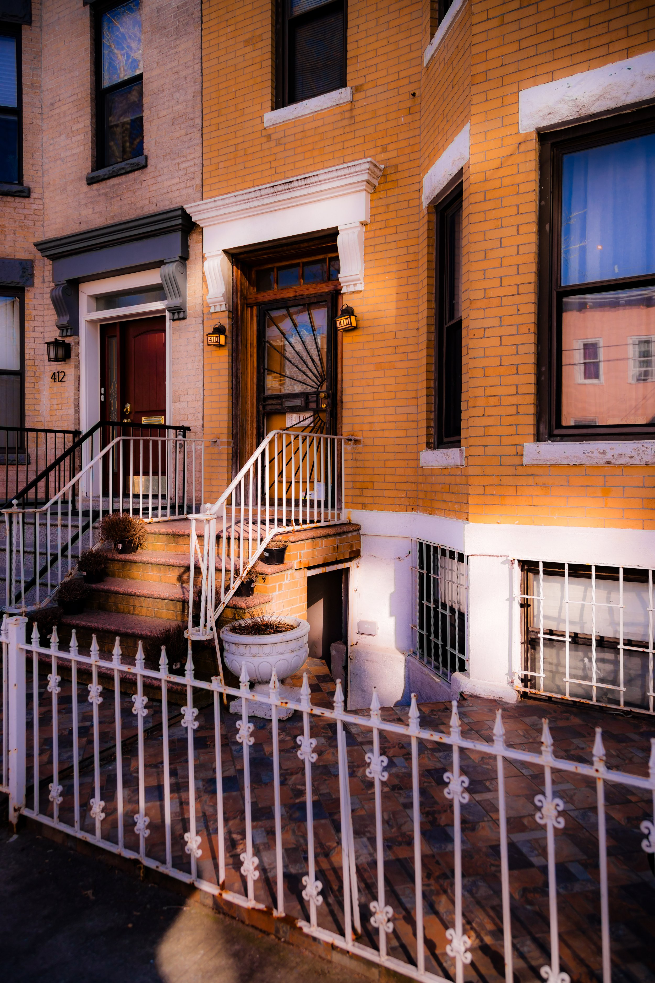
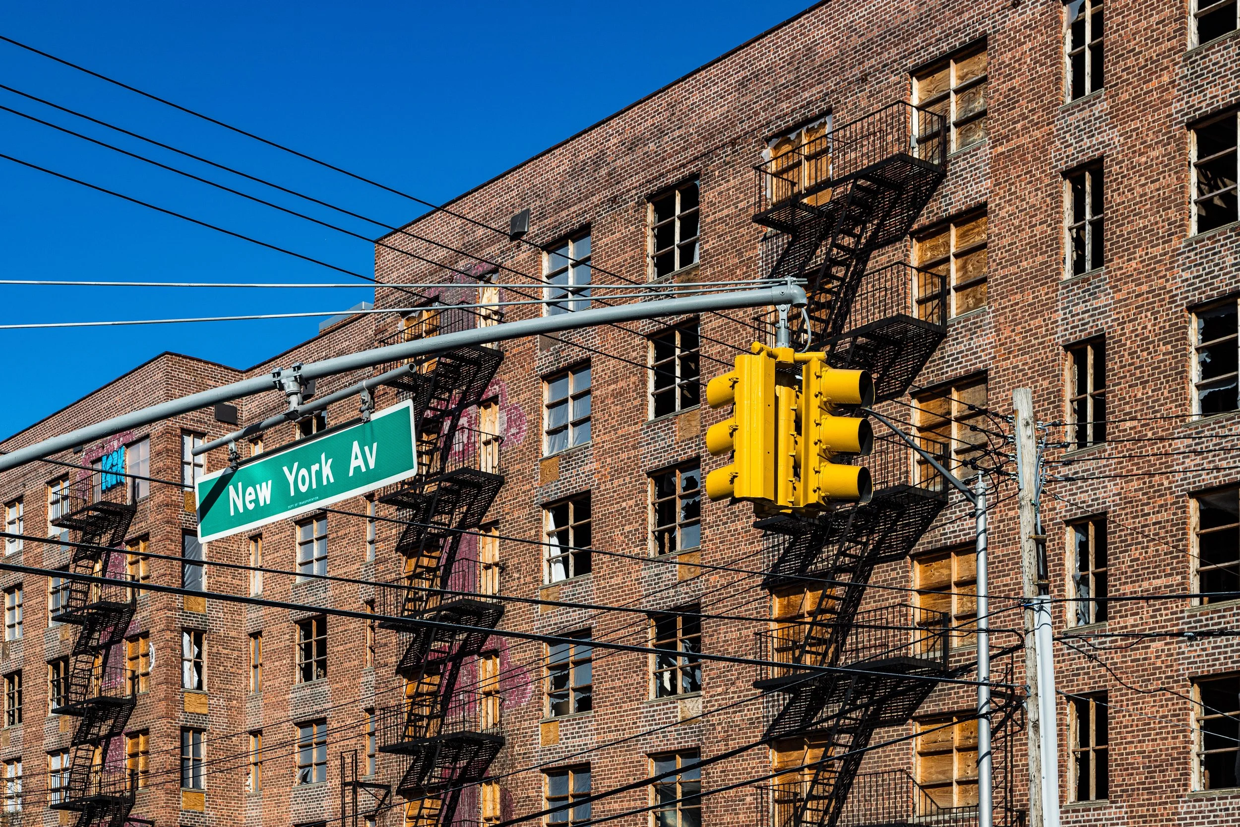
Bounded by New York Avenue to the west, Troy Avenue to the east, Clarkson Avenue to the south, and Empire Boulevard to the north, Wingate occupies a compact rectangle in central Brooklyn, just east of Prospect-Lefferts Gardens and north of East Flatbush. Though small in size, the neighborhood sits at a dynamic crossroads between the Victorian grid of northern Flatbush and the institutional corridor of Kings County Hospital Center and SUNY Downstate Medical Center. Low-rise apartment buildings, postwar brick complexes, and tree-lined residential streets dominate the landscape, with Winthrop Street, Schenectady Avenue, and Midwood Street threading through as its quiet interior arteries. To the north, Empire Boulevard marks the gateway toward Crown Heights, while to the south, Clarkson Avenue transitions toward the hospital campus and the broader Flatbush plain.
Etymology and Origins
The neighborhood’s name derives from Wingate Park, a local athletic field established in the early 20th century and named for George Wood Wingate (1840–1928), a prominent educator and marksman who served as president of the National Rifle Association and was instrumental in developing New York’s public school athletic programs. The name “Wingate” came to define not only the park itself but the adjoining residential section that grew around it during the mid-20th century. Before this, the land was part of the Flatbush township, once a patchwork of Dutch farms and later suburban parcels subdivided in the late 1800s as Brooklyn expanded southward.
The Neighborhood
19th Century: From Farmland to the City’s Edge
In the mid-1800s, the area that would become Wingate lay on the rural periphery of Flatbush, characterized by open fields, market gardens, and small wood-frame farmhouses connected by dirt lanes such as old Winthrop and Midwood Roads. The consolidation of Brooklyn into Greater New York in 1898 and the subsequent extension of trolley and subway service catalyzed development across central Brooklyn. Large tracts of farmland were subdivided into rectangular blocks, forming the street grid still visible today. By the early 1900s, builders began erecting modest two- and three-story apartment houses to serve working-class and middle-income families who sought proximity to transit and employment in nearby commercial districts.
Early–Mid 20th Century: Urban Growth and Civic Institutions
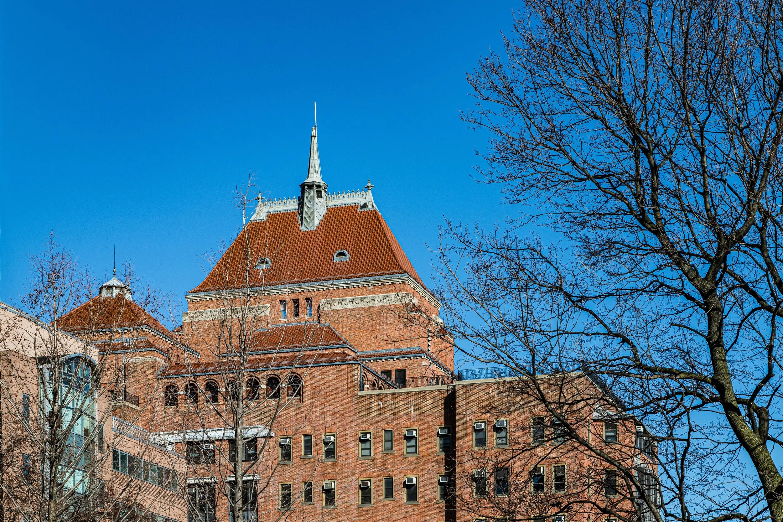
During the 1920s–1950s, Wingate developed a distinct urban identity defined by its proximity to key civic and medical institutions. The establishment of Kings County Hospital Center (originally a 19th-century almshouse) and Downstate Medical Center to the south brought an influx of health professionals and support workers. The neighborhood’s housing stock—solidly brick, practical, and community-oriented—reflected this working professional base. In 1941, the city created Wingate Field (now Wingate Park) as part of a WPA-era recreation initiative, anchoring the community with a multi-sport facility that remains a focal point for local athletics and public events. Schools such as Wingate High School (opened 1955, now repurposed for specialized academies) further cemented the area’s name in Brooklyn’s educational geography.
Wingate Photographic Video
Late 20th Century: Transition and Resilience
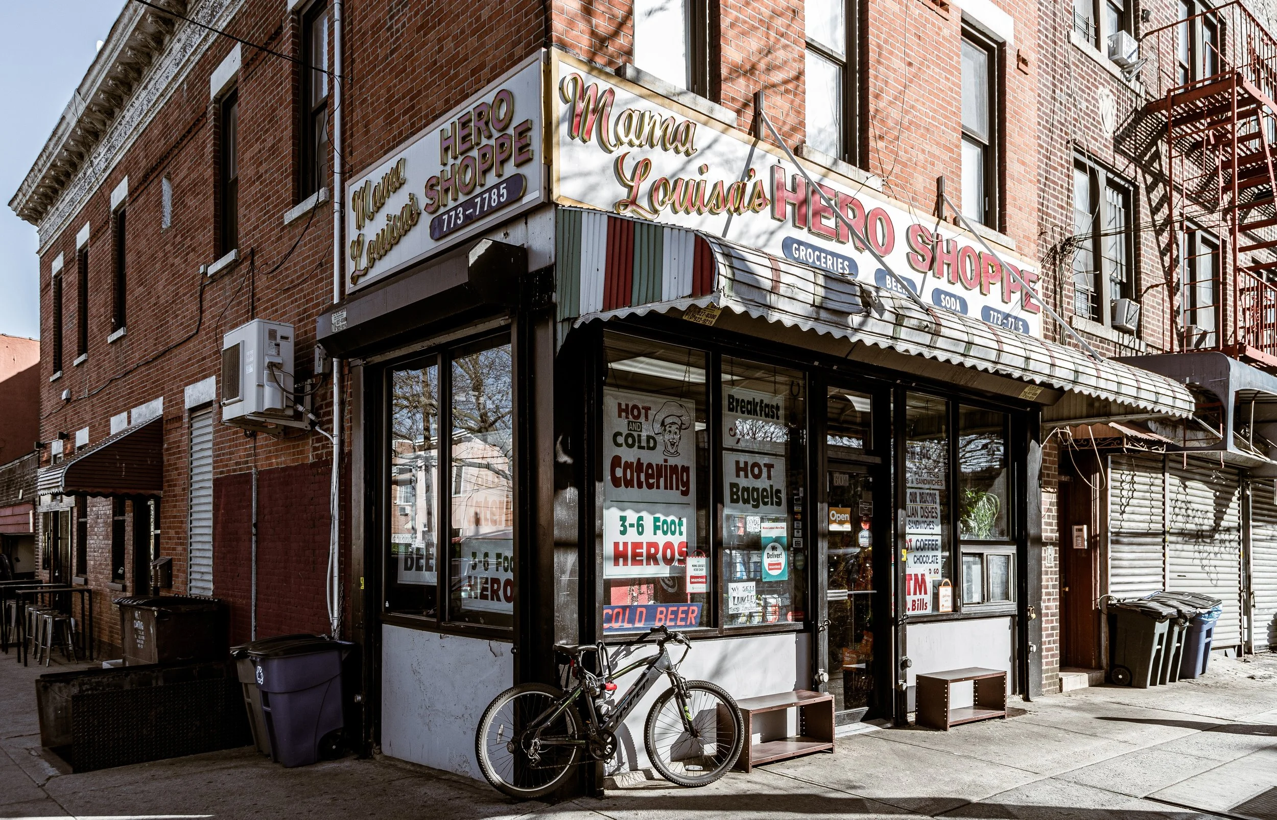
By the 1960s and 1970s, Wingate, like much of central Brooklyn, experienced demographic shifts as African American and Caribbean families moved in from Crown Heights and Bedford-Stuyvesant. Though population changes and urban disinvestment affected housing and public services citywide, the neighborhood maintained a resilient community identity rooted in church networks, school pride, and neighborhood associations. The presence of major medical centers continued to sustain local employment, while the park’s athletic programs—especially summer concerts and track meets—kept Wingate a known name beyond its small geographic footprint.
21st Century: Renewal and Identity
In the 2000s and 2010s, Wingate began to benefit from broader reinvestment in central Brooklyn. The Wingate Park Summer Concert Series, hosted by the city and community sponsors, drew crowds from across the borough, celebrating the area’s Caribbean-American heritage with reggae, calypso, and R&B performances. Incremental real estate improvements followed, as longtime homeowners renovated properties and new residents arrived seeking more affordable housing within reach of Prospect Park, Crown Heights, and Flatbush. The neighborhood remains primarily residential, characterized by tight-knit blocks, cultural diversity, and strong institutional anchors.
Wingate Photo Gallery
Spirit and Legacy
Wingate stands as a testament to Brooklyn’s middle landscape—neither historic brownstone district nor high-rise frontier, but a cohesive neighborhood defined by endurance, community, and quiet pride. Its namesake park remains its heart, symbolizing both recreation and remembrance: the green field named for a 19th-century reformer now serving as a gathering place for 21st-century Brooklyn’s vibrant, multicultural life.
New York City
Use this custom Google map to explore where every neighborhood in all five boroughs of New York City is located.
The Five Boroughs
One of New York City’s unique qualities is its organization in to 5 boroughs: Manhattan, Brooklyn, Queens, The Bronx, and Staten Island. These boroughs are part pragmatic administrative districts, and part vestiges of the region’s past. Each borough is an entire county in New York State - in fact, Brooklyn is, officially, Kings County, while Staten Island is, officially Richmond County. But that’s not the whole story …
Initially, New York City was located on the southern tip of Manhattan (now the Financial District) that was once the Dutch colony of New Amsterdam. Across the East River, another city was rising: Brooklyn. In time, the city planners realized that unification between the rapidly rising cities would create commercial and industrial opportunities - through streamlined administration of the region.
So powerful was the pull of unification between New York and Brooklyn that three more counties were pulled into the unification: The Bronx, Queens, and Staten Island. And on January 1, 1898, the City of New York unified two cities and three counties into one Greater City of New York - containing the five boroughs we know today.
But because each borough developed differently and distinctly until unification, their neighborhoods likewise uniquely developed. Today, there are nearly 390 neighborhoods, each with their own histories, cultures, cuisines, and personalities - and each with residents who are fiercely proud of their corner of The Big Apple.


