LOCUST POINT
The Bronx
Geographic Setting
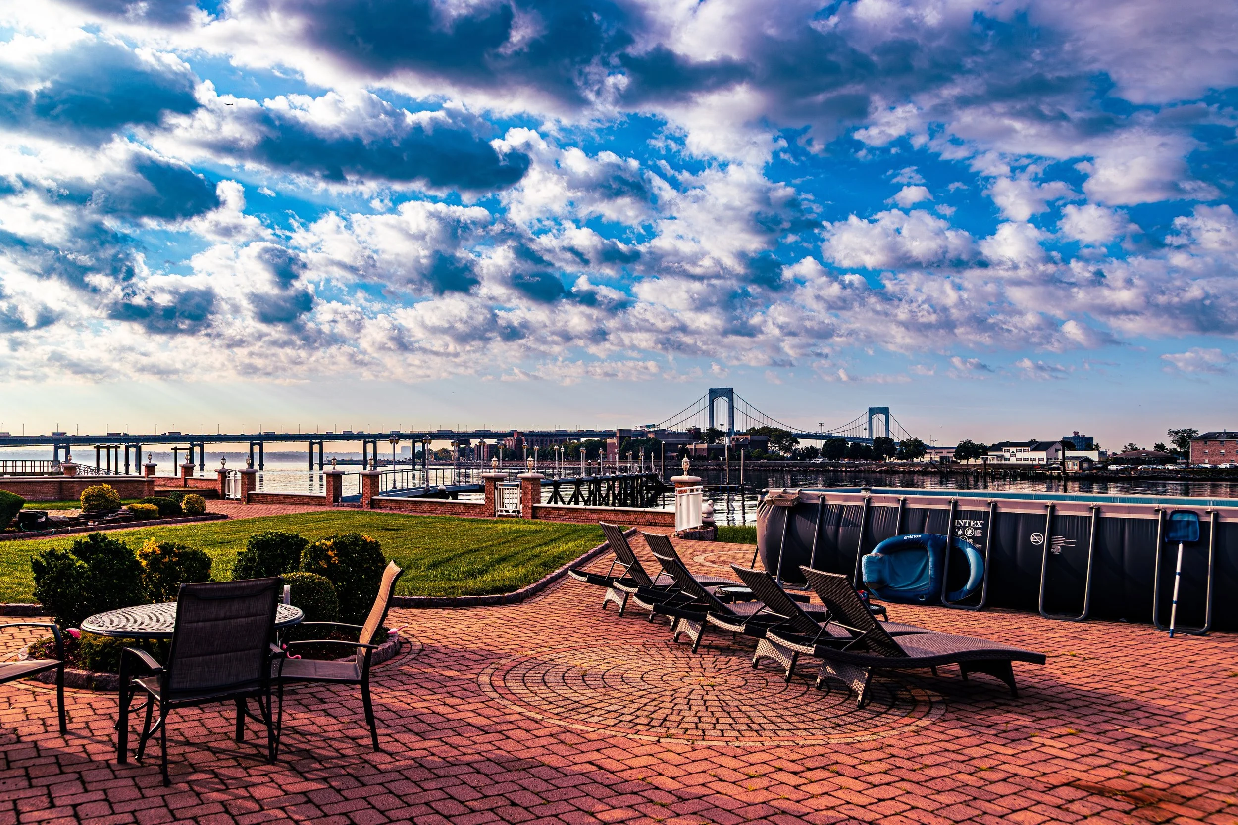
Bounded by Harding Avenue and the Throgs Neck Bridge approach to the north, the East River to the south and east, and Hammond Creek to the west, Locust Point occupies one of the Bronx’s most secluded and maritime corners—a small, tight-knit waterfront community at the southeastern tip of the borough. It lies on a narrow peninsula that juts into the confluence of the East River and Long Island Sound, just east of Throgs Neck, with views that stretch across the water to Queens and Manhasset Bay.
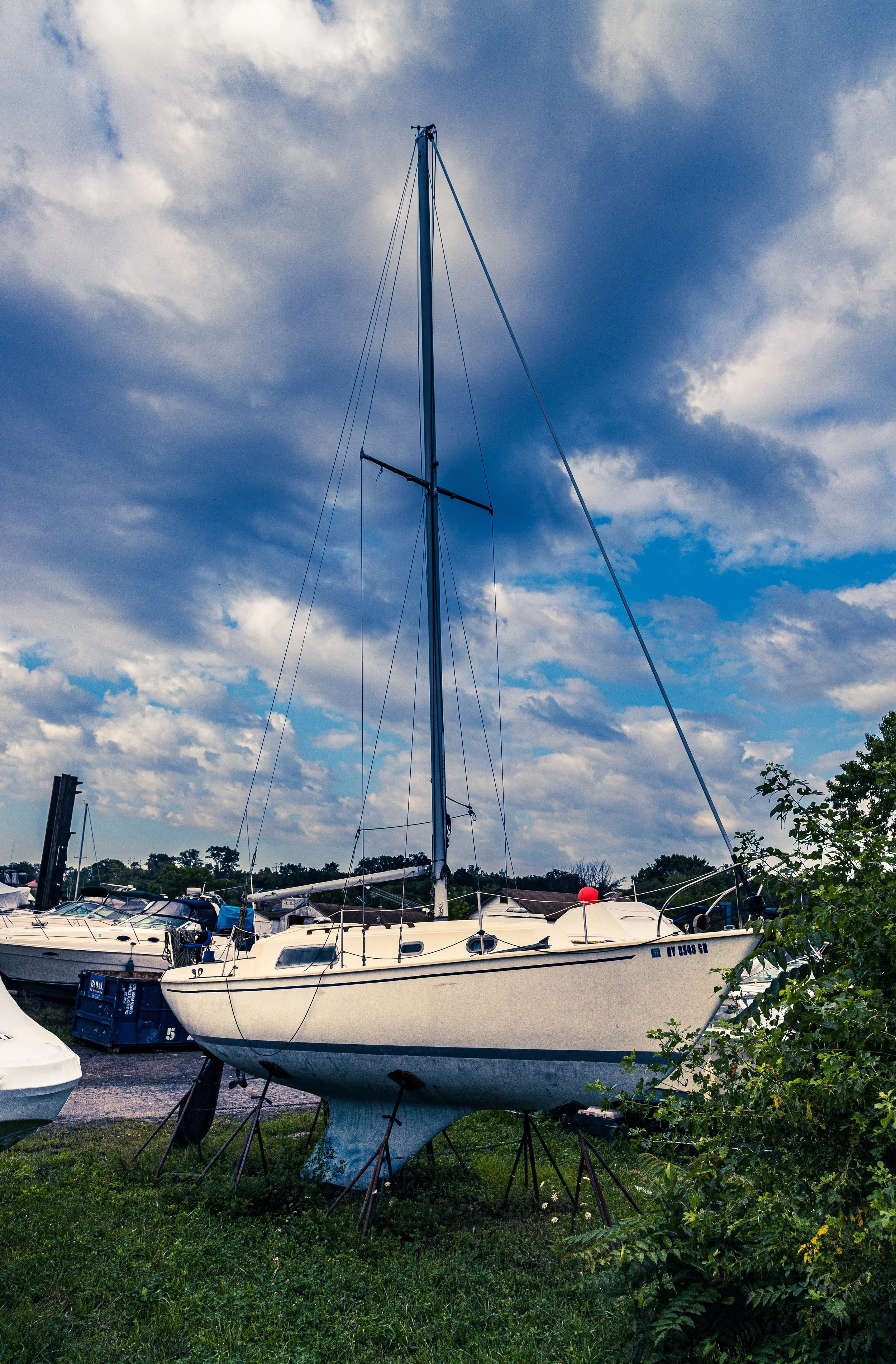
The neighborhood’s geography defines its character: low-lying and surrounded by salt air, it blends quiet residential streets with docks, marinas, and bungalows perched near the shore. Locust Point Drive and Pennyfield Avenue wind through its compact grid, terminating in cul-de-sacs that end in seawalls or small inlets. The Locust Point Yacht Club, founded in the early 20th century, serves as a local landmark and gathering place, while small private beaches and waterfront parks offer residents a rare sense of coastal intimacy within New York City’s bounds.
Though it sits only minutes from the Throgs Neck Expressway, Locust Point feels worlds apart—its isolation, greenery, and water views lending it an almost village-like serenity amid the Bronx’s urban density.
Etymology
The name “Locust Point” likely originates from the black locust trees that once dotted the peninsula’s shoreline in the 18th and 19th centuries. These hardy, fast-growing trees—common throughout the Northeast—were valued for their rot-resistant wood and were often planted near farms and docks to provide both shade and durable timber for shipbuilding.
By the late 19th century, the area’s name was well established in local maps and land deeds, describing both the promontory itself and the small maritime hamlet that began to grow there. Over time, “Locust Point” came to embody both the physical geography of a wooded river’s edge and the enduring image of a self-contained coastal community at the city’s edge.
The Neighborhood
Origins through the 19th Century
Before development, Locust Point was part of the rural Town of Westchester, characterized by tidal marshes, meadows, and woodlots. During the 18th century, its strategic position near the East River made it a site of minor Revolutionary War skirmishes and troop movements, though it remained sparsely populated. The peninsula’s isolation and fertile soil attracted a handful of farmers and fishermen who built homesteads along what would become Pennyfield Avenue, cultivating small crops and harvesting shellfish from the surrounding waters.
By the mid–19th century, as industrialization and shipping expanded throughout New York Harbor, the area gained significance as a maritime outpost. Shipbuilding, oystering, and ferry services flourished along the Bronx’s southern waterfront, and Locust Point became known for its small boatyards and wharves. Wealthier families from Manhattan and Morrisania occasionally built summer cottages here, drawn by the cooling breezes and unobstructed water views.
However, the community remained small and relatively insular—linked to the rest of the Bronx by narrow country lanes and served primarily by boat. It retained this semi-rural character well into the early 20th century, even as nearby Throgs Neck began to urbanize.
Early 20th Century: Maritime Life and the Formation of a Community
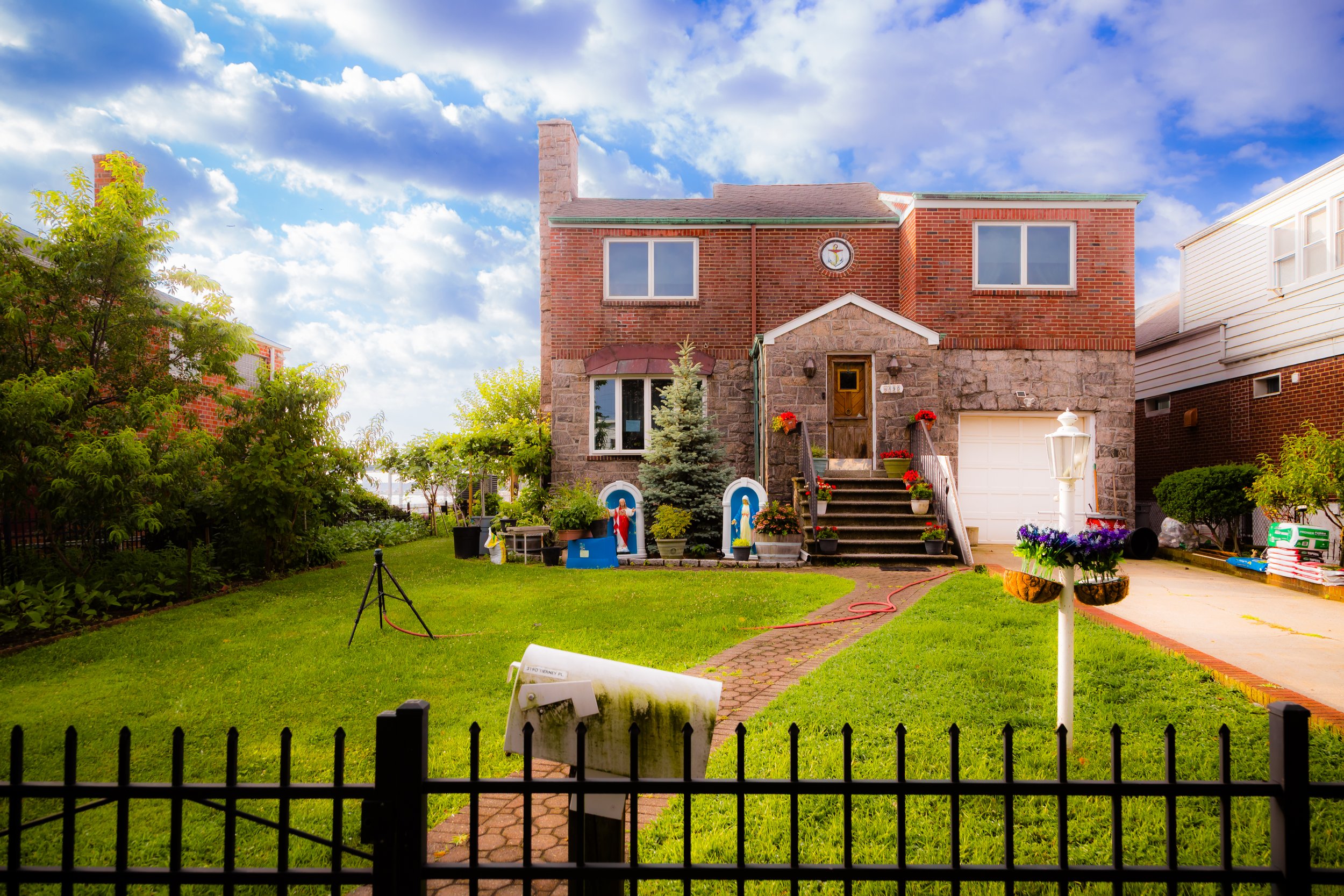
Locust Point’s modern identity coalesced during the 1920s and 1930s, when the land was subdivided for residential use and small bungalows began replacing the older farms. The neighborhood’s location—far removed from the city’s main transportation arteries—attracted working-class families seeking affordable waterfront living. Many residents were Irish, Italian, and German immigrants, some employed as dockworkers, seamen, or craftsmen connected to the maritime trades that lined the East River.
Community institutions grew organically. The founding of the Locust Point Yacht Club (circa 1932) provided both recreation and social structure, becoming the peninsula’s de facto civic heart. Residents organized block associations to advocate for infrastructure improvements—street paving, flood control, and sewer installation—which the city was slow to deliver due to the area’s small size and relative isolation.
The neighborhood’s compact geography fostered a sense of kinship: neighbors knew each other by name, children played along the seawalls, and families fished from the same docks for generations. The surrounding water both defined and defended the community, creating a natural boundary that kept it insulated from the Bronx’s rapid mid-century urban growth.
Locust Point Video Coming Soon
Mid–Late 20th Century: The Bridge and the Battles for Preservation
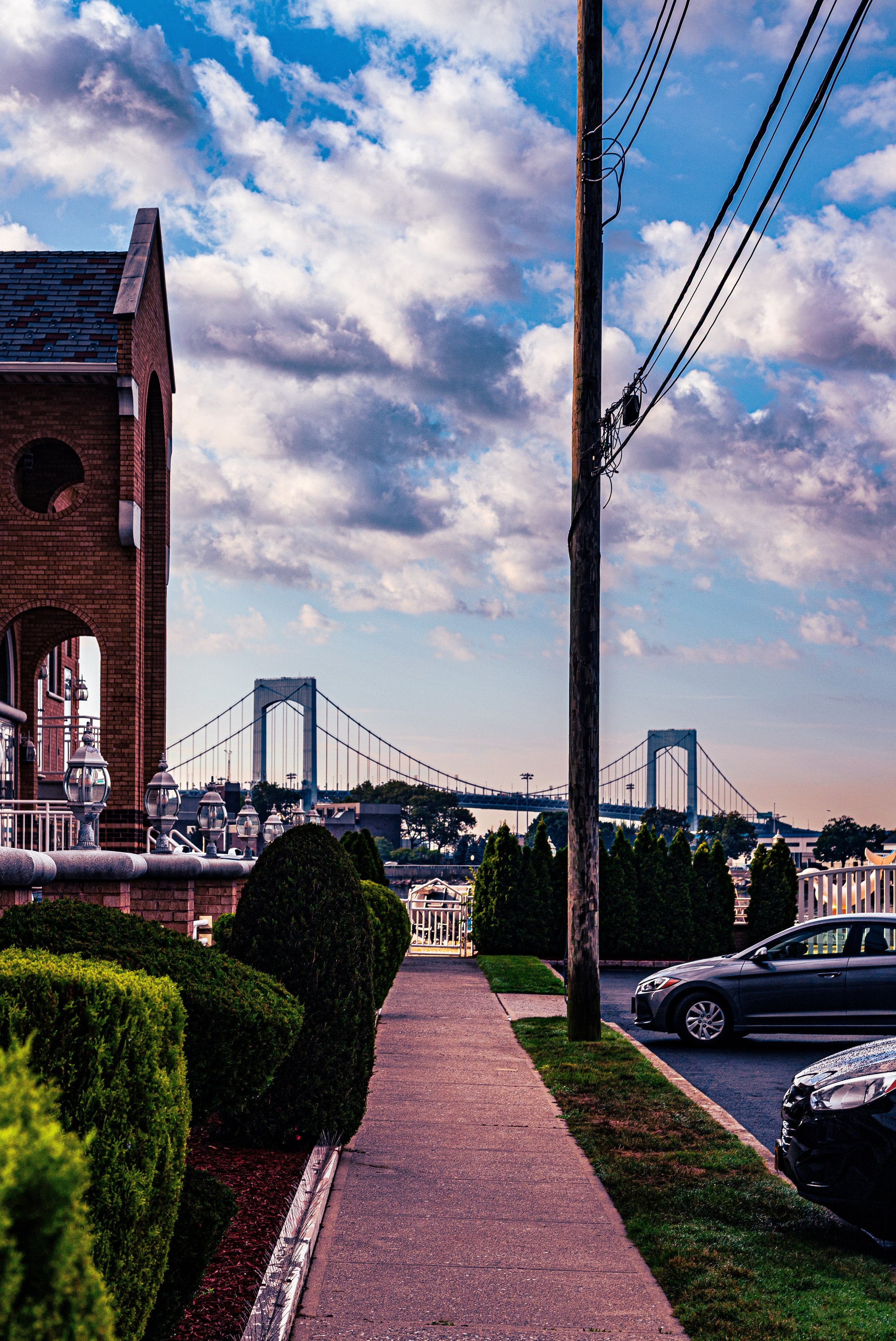
The most dramatic change came with the construction of the Throgs Neck Bridge (1957–1961). The bridge’s northern approach sliced through the mainland just above Locust Point, altering the landscape and cutting the neighborhood off from some of its former connections to Throgs Neck and Ferry Point. While the bridge brought noise and traffic nearby, it also gave the area improved access to Queens and Long Island, subtly shifting its relationship to the wider city.
During the 1960s–1980s, Locust Point remained one of the Bronx’s most stable waterfront enclaves, even as other parts of the borough suffered from arson, disinvestment, and economic decline. Its small scale, high homeownership, and close-knit culture insulated it from the city’s broader crises. The Locust Point Civic Association, formed during this period, became a powerful voice in defending the neighborhood from overdevelopment and industrial encroachment.
Environmental and zoning battles were common: residents successfully opposed several proposals for waste transfer stations, large-scale marina conversions, and heavy trucking routes that would have threatened the community’s tranquility and shoreline ecology. In the face of rising sea levels and occasional flooding, they also lobbied for improved seawalls and drainage infrastructure.
By the 1990s, Locust Point had become a case study in community-driven preservation—a working-class neighborhood maintaining its maritime roots in a rapidly transforming city.
21st Century: Waterfront Stewardship and Tight-Knit Continuity
Today, Locust Point endures as one of the Bronx’s most distinctive and self-contained communities—a pocket of small homes, gardens, and docks surrounded by water and sky. Many of its houses are still one- and two-story bungalows, though new construction and renovations have introduced more modern designs. The Locust Point Yacht Club remains the social hub, hosting seasonal events, boat parades, and community fundraisers.
The neighborhood’s population reflects both continuity and quiet diversity: descendants of the area’s early Irish and Italian families live alongside newcomers from the Caribbean, Latin America, and South Asia, all drawn by the rare chance to live near the water within city limits. Locust Point’s residents remain deeply involved in local stewardship efforts—cleaning the shoreline, maintaining public access points, and monitoring the health of Hammond Creek and nearby wetlands.
Though technically within the urban grid, the community retains a semi-rural charm: no large apartment houses, no through-traffic, and an enduring sense of seclusion. When the tide is low, herons and egrets wade among the reeds; when it’s high, boats glide across the shimmering channel toward Long Island Sound.
Locust Point Photo Gallery
Spirit and Legacy
The spirit of Locust Point lies in its steadfast relationship with the sea. Shaped by isolation, sustained by kinship, and bound by water, it represents a rare kind of New York neighborhood—one where generations have measured time not by streetcars or subways but by tides and sunsets.
New York City
Use this custom Google map to explore where every neighborhood in all five boroughs of New York City is located.
The Five Boroughs
One of New York City’s unique qualities is its organization in to 5 boroughs: Manhattan, Brooklyn, Queens, The Bronx, and Staten Island. These boroughs are part pragmatic administrative districts, and part vestiges of the region’s past. Each borough is an entire county in New York State - in fact, Brooklyn is, officially, Kings County, while Staten Island is, officially Richmond County. But that’s not the whole story …
Initially, New York City was located on the southern tip of Manhattan (now the Financial District) that was once the Dutch colony of New Amsterdam. Across the East River, another city was rising: Brooklyn. In time, the city planners realized that unification between the rapidly rising cities would create commercial and industrial opportunities - through streamlined administration of the region.
So powerful was the pull of unification between New York and Brooklyn that three more counties were pulled into the unification: The Bronx, Queens, and Staten Island. And on January 1, 1898, the City of New York unified two cities and three counties into one Greater City of New York - containing the five boroughs we know today.
But because each borough developed differently and distinctly until unification, their neighborhoods likewise uniquely developed. Today, there are nearly 390 neighborhoods, each with their own histories, cultures, cuisines, and personalities - and each with residents who are fiercely proud of their corner of The Big Apple.


